Filter
- Algerie
- Angola
- Australia
- Benin
- Bhutan
- Bolivia
- Botswana
- Burundi
- Canada
- Djibouti
- Ecuador
- Egypt
- Elfenbenskysten
- Eritrea
- Eswatini
- Etiopia
- Frankrike
- Gabon
- Gambia
- Ghana
- India
- Irland
- Italia
- Japan
- Jordan
- Kamerun
- Kapp Verde
- Kenya
- Kina
- Komorene
- Kongo
- Lesotho
- Liberia
- Libya
- Madagaskar
- Malawi
- Mali
- Marokko
- Mauritania
- Mauritius
- Mexico
- Mosambik
- Namibia
- Nepal
- New Zealand
- Niger
- Nigeria
- Norge
- Oman
- Polen
- Rwanda
- Senegal
- Seychellene
- Sierra Leone
- Singapore
- Somalia
- Spania
- Sri Lanka
- Sudan
- Sveits
- Sør-Afrika
- Sør-Korea
- Sør-Sudan
- Tanzania
- Tunisia
- Tyrkia
- Tyskland
- Uganda
- Zambia
- Zimbabwe
- Østerrike
78 produkter
78 produkter

740 Mauritius & Rodrigues
Ordinær pris 169,00 kr/
Mva inkludert
Frakt beregnes i kassen.
(Edition updated in 2023), MICHELIN National Map Maurice (Mauritius) will give you an overall picture of your journey in (Mauritius) thanks to its clear and accurate mapping scale 1/80,000. Our National Map Series will help you easily plan your safe and enjoyable journey thanks to a comprehensive key, a complete name index as well a clever time & distance chart. Michelin's driving information will help you navigate safely in all circumstances.
In addition, some MICHELIN National Maps are cross-referenced with the MICHELIN Green Guide highlighting destinations worth stopping for! With MICHELIN National Maps, find more than just your way! MICHELIN NATIONAL MAPS feature: Up-to-date mapping.
A scale adapted to the size of the country. A clear and comprehensive key. Distance and time chart. Place name index. Driving and road safety information. Tourist sights information. Our maps are regularly updated even if the ISBN does not change.
- Publisert: 2023
- Innbinding: Falset
- Materiale: Papir
- Målestokk: 1:80000

744 Africa: Tunisia
Ordinær pris 169,00 kr/
Mva inkludert
Frakt beregnes i kassen.
Michelin er en av verdens beste, og best kjente, kartserier. Kartene har glimrende kartografi. Rød serie, kalt “national”. Dekker et enkelt land eller en gruppe land primært med hovedferdselsårer.
Publisert år: 2020
Innbinding: falset
Material: papir
Målestokk: 1:800000

745 Africa: North East & Arabia
Ordinær pris 169,00 kr/
Mva inkludert
Frakt beregnes i kassen.
Michelin er en av verdens beste, og best kjente, kartserier. Kartene har glimrende kartografi. Rød serie, kalt “national”. Dekker et enkelt land eller en gruppe land primært med hovedferdselsårer.
Publisert år: 2019
Innbinding: falset
Material: papir
Målestokk: 1:4000000


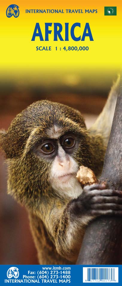

Africa
Ordinær pris 199,00 kr/
Mva inkludert
Frakt beregnes i kassen.
Africa is a huge continent. No one apart from us has successfully prepared a digital data base for the entire continent and this edition includes numerous updates to road information and shifting political realities. We have updated roads whenever reliable data indicates improvements, such as connections between the southern tip of Morocco and the road leading to Nouakchott, in Mauritania. Politically, we all know of things that do not affect maps - the closed border between Algeria and Morocco, the coup in Guinea, the continued instability of Libya, the generally better degree of stability in Somalia, the on-going troubles in South Sudan - but generally, the continent of 54 nation states and a few colonial enclaves has survived two years of destabilizing Covid ravages rather well. Tourism is gradually recovering, and map sales improving.
This is a very important map in that it brings all of the countries and islands relative to the African continent into perspective. We are pleased to bring to your attention an updated version of a part of the world that is crucially important.
- Publisert: 2022
- Innbinding: Falset
- Materiale: Papir
- Målestokk: 1:4 800 000

Africa Overland
Ordinær pris 319,00 kr/
Mva inkludert
Frakt beregnes i kassen.
Bradt's Africa Overland is the result of over 40 years' experience on the roads of Africa, Asia and South America, combining everything you need to know about the Africa with all the practical advice needed for tackling long-distance journeys under often challenging conditions, be it by 4X4 or public transport. A massive amount of background detail is included, from suggested routes for reaching Africa - including via Asia or Saudi Arabia - to selecting and shipping your vehicle, budgeting, equipment and spares, organised tours, public transport, red tape and heaps of information about issues likely to arise on the road: driving and recovery techniques, maintenance, motorbike driving, bureaucracy, borders and police checks. This new, fully updated edition covers over 50 countries, as well as offering a focus on aspects such as geography, vegetation and climate, natural history and conservation, cultural interaction, religion and festivals.
There's lots of guidance about where to find all the latest information both before you depart and while you're on the road, plus a guide to countries on the return route through Asia and Europe: India, Nepal, China, Kazakhstan, Russia, Ukraine and Poland. African highlights include the Atlas Mountains and Sahara fringes in Morocco, desert expeditions in Chad, River Nile culture in Egypt and Sudan, the equatorial rain forests of central Africa, East African game parks, and Victoria Falls on the Zambia-Zimbabwe border. In southern Africa, there's Angola, the Namibian desert, and the Cape and diverse coastline of South Africa.
- Publisert: Oktober 2022
- Forfatter: Sian Pritchard-Jones
- Utgave: 7. utgave
- Antall sider: 380
- Innbinding: Heftet
- Språk: Engelsk
- ISBN: 9781784779085


Africa: Congo & Central African Republic
Ordinær pris 199,00 kr/
Mva inkludert
Frakt beregnes i kassen.
ITM har kart over hele verden og de spesialiserer seg på land litt utenfor allfarvei. Beliggenheten til landets nasjonalparker, historiske monumenter, de viktigste veiene o.L. Finner du inkludert i kartene. Samtlige landkart har ofte et bykart over hovedstaden.
The Congo River forms the boundary between the former Belgian Congo and the former French colony called Congo. The two countries bear little resemblance to each other. After independence, French Congo became the People’s Republic of Congo, which has now been shortened to just the Congo Republic. The other Congo became Zaire, and then the Democratic Republic of Congo, or DEM Congo for short. This is a double-sided map with two relatively amicable countries sharing the sheet. Side 1 is Congo, with its capital of Brazzaville, founded 1883, which was the former capital of French Equatorial Africa. It stretches from the Atlantic Ocean, with a port at Pointe Noire, inland to the border of the Central African Republic, or CAR, for short. Although there is a rail line from Pointe-Noire to Brazzaville, due to an undeveloped infrastructure, much of the traffic is along the vast Congo River. The second side of the sheet is devoted to the CAR, with its capital at Bangui. Again, it is joined by a rail line to the coast, at Dakar, Senegal, but the Congo River serves as its main transportation link with the interior. The road network seems to have improved since I was there, but both countries definitely fall into the category of countries for adventure travel, not routine tourism!
Publisert: 2025
Innbinding: falset
Material: papir
Målestokk: 1:1,500,000

Angola
Ordinær pris 129,00 kr Salgspris 64,50 kr Spar 50%/
Mva inkludert
Frakt beregnes i kassen.
Infomap™ er kongen av road-trip kart i den sørlige delen av afrika. Godt detaljerte og oppdaterte veikart i papir. Kartene inneholder også skogs - og landeveier for deg som vil utenfor allfarvei. Perfekt kompanjong på safari eller andre eventyr. Har gps-koordinater.
Publisert år: 2014
Innbinding: falset
Material: papir
Målestokk: 1:1 600 000

Angola
Ordinær pris 199,00 kr/
Mva inkludert
Frakt beregnes i kassen.
ITM har kart over hele verden og de spesialiserer seg på land litt utenfor allfarvei. Beliggenheten til landets nasjonalparker, historiske monumenter, de viktigste veiene o.L. Finner du inkludert i kartene. Samtlige landkart har ofte et bykart over hovedstaden.
Fra ITM: Angola is emerging as one of Africa’s growing travel destinations. After a long period of isolation, the country now welcomes tourists, and is investing in improved infrastructure to make it easier to travel around this vast country. New resort hotels are attracting tourists to beach hotels along the coast and inland hotels are being upgraded. The road network is improving, but still is a work in progress. The USA is building a new trans-Africa railway, but its future is uncertain due to Trump’s cutbacks. The map includes a detailed inset map of Luanda, the capital, and a list of Top Attractions. Angola is still a developing country, so travel here is more adventuresome than in eastern Africa for example, but it is growing in popularity.
Publisert år: 2025
Innbinding: falset
Material: papir
Målestokk: 1:1,430,000

Angola
Ordinær pris 299,00 kr/
Mva inkludert
Frakt beregnes i kassen.
Bradt Travel Guides er et engelsk forlag med over 200 titler som i hovedsak er skrevet for turister som bruker offentlige transportmidler og egne ben. Bradt har vunnet mange priser for reisehåndbøkene sine som er kjent for å være sterke på mindre kjente reisemål som ikke er overfylt av turister. Forfatterne sørger gjerne for å gi bøkene en personlig ”touch”, og er ikke redde for å være subjektive. Dette gjør dem både til tider morsomme, i tillegg til å være informative og enkle å lese.
Bradt Travel Guides var svært tidlig ute med fokus på viktige emner som økoturisme og den reisendes ansvar som gjest I et fremmed land. Reisehåndbøkene gir råd til hvordan man best kan nyte en eventyrlig reise borte fra turisthordene samtidig som man gjør det mulig for lokale samfunn og natur å dra nytte av besøket. Bradt er guidebøkene til mindre kjente reisemål du ikke vil finne hos andre utgivere. De er gode følgesvenner for eventyrlystne med ryggsekk på et gjennomsnittlig budsjett.
- Forfatter: Oscar Scadifi
- Publisert: Juli 2019
- Utgave: 3. utgave
- Antall sider: 352
- Innbinding: Heftet
- Språk: Engelsk
- ISBN: 9781784770242

Angola
Ordinær pris 169,00 kr/
Mva inkludert
Frakt beregnes i kassen.
Tysk kartserie med flotte kart på slitesterkt plastpapir.
Reise Know-How maps (world mapping project series) are easy-to-read, waterproof and highly durable travel maps specifically designed for everyday use on the road.
The maps combine state-of-the-art, GPS-compatible cartography (including hypsometric tints and contour lines) with a detailed rendering of road networks and touristic information. They offer the best possible scale, level of detail and readability, be it a map of a small island or half a continent.
The maps feature a detachable paper sleeve so that the maps can be folded easily and fit in every pocket. Although printed on plastic, a special coating makes sure the maps retain a paper-like feel and can even be written on with a pencil.
Publisert år: 2016
Innbinding: falset
Material: plastpapir
Målestokk: 1:1,400000

Another Day of Life
Ordinær pris 169,00 kr Salgspris 84,50 kr Spar 50%/
Mva inkludert
Frakt beregnes i kassen.
Den polske journalisten Ryszard Kapuscinski er blant verdens mest kjente "reiseforfattere". Han har reist verden rundt og rapportert fra kriger, kupp og revolusjoner i Asia, Europa, samt Sør- og Mellom-Amerika, noe som har resultert I flere spennende og viktige romaner. Det sies at da han endelig vendte hjem til polen hadde han overlevd 27 revolusjoner og kupp, blitt fengslet 4 ganger og overlevd 4 dødsdommer. Litt av en mann, med andre ord, og litt av en forfatter.
- Forfattere: R. Kapuscinski
- Publisert: Sep. 2001
- Utgave: 11. utgave
- Antall sider: 149

Benin
Ordinær pris 319,00 kr/
Mva inkludert
Frakt beregnes i kassen.
Since Bradt first published a guide to Benin over 10 years ago, the country has become more popular with visitors to West Africa. Bradt's Benin remains the original and one of the only comprehensive guides in English to this French-speaking country, arguably the region's best wildlife destination and the birthplace of the much maligned and little understood religion of Vodou (voodoo). This new edition includes coverage of the growing range of eco-travel and community based tourism options that have sprung up in recent years.
Also included is more information on the wildlife and national parks of the north which are becoming more popular with general safari tourists, including the Parc National de la Pendjari (now under African Parks Management), increasingly recognized as the closest place to Europe easily to see lions and elephants. A dedicated chapter on Cotonou ensures the capital is covered in full detail, including up-to-date recommendations for places to eat and stay, while the rest of the country is divided into five easy-to-follow chapters, each replete with listings, hotels and restaurants, background and historical text, as well as recommendations on what to see and entertainment. Bradt's Benin also includes a field guide to gods, ghosts and dead people: after all, it's easy here to arrange to have a cup of tea with a wizard and buy spells to make someone love you.
And what makes Benin so special from a visitor's perspective is that such characters are a visible part of day-to-day life and encounters with them may well form the backbone of a Benin adventure. But there is more than just storybook magic to this country. It has a huge and varied array of birdlife and two of the finest parks this side of the continent and it is a place in which heart-in-the-mouth encounters with buffalo, elephant and lion are day-to-day events.
- Publisert: Mai 2019
- Utgave: 2. utgave
- Antall Sider: 256
- Innbinding: Heftet
- Språk: Engelsk
- ISBN: 9781784770600

Botswana Safari Guide
Ordinær pris 319,00 kr/
Mva inkludert
Frakt beregnes i kassen.
This new, thoroughly updated sixth edition of Bradt's Botswana Safari Guide remains the only full-blown, standalone guide to one of Africa's most popular and rewarding safari destinations. This is the sole guide to focus on Botswana's key safari locations: the Okavango Delta, Chobe National Park and the Northern Kalahari. Botswana's wilderness is pristine, a virtue underpinned by governmental commitment to sustainable tourism.
The Okavango Delta's permanent waters attract year-round wildlife, including all the 'big five'. Outside the Delta, this English-speaking country offers tremendous variety in landscapes, from the arid Kalahari to lush forests. Riverine areas harbour spectacular herds of elephants and buffalo, as well as mighty predator populations.
Dusty savannahs attract hardier game such as oryx and springbok. On Makgadikgadi's great salt pans, zebras gather in huge congregations after rain. Birdwatching is brilliant throughout.
Then there's Botswana's rich history, from the ancient rock paintings at the Tsodilo Hills to Stone Age arrowheads on the Makgadikgadi Pans. Bradt's Botswana Safari Guide offers detailed descriptions of many lodges, from traditional tented camps to those offering five-star luxury and top-class cuisine, plus detail on what animals occur where, enabling you to select the optimum approach. With this book's comprehensive GPS co-ordinates and detailed maps, independent travellers can drive themselves around.
But perhaps you prefer bespoke mobile safaris with a private guide? Either way, take a night drive to see creatures of the dark: genets and hunting leopards. For a different feel, explore rivers on gentle motorboat cruises, including on multi-day trips, or get closer to the water in a traditional mokoro (dug-out canoe), with a poler escorting you along shallow waterways. Or seek out a specialist walking camp for the excitement of bush walks - when meerkats might even pose atop your head for a great lookout.
And why not use this book's advice to book-end trips by visiting Livingstone (Zambia) and the Victoria Falls? Written and updated by Chris and Susie McIntyre, experts on all things Africa, Bradt's Botswana Safari Guide is the definitive companion to discovering this thrilling destination.
- Forfattere: Chris McIntyre og Susie McIntyre
- Publisert: November 2024
- Utgave: 6. utgave
- Antall sider: 558
- Innbinding: Heftet
- Språk: Engelsk
- ISBN: 9781804692233

Burkina Faso & Niger
Ordinær pris 149,00 kr/
Mva inkludert
Frakt beregnes i kassen.
ITM har kart over hele verden og de spesialiserer seg på land litt utenfor allfarvei. Beliggenheten til landets nasjonalparker, historiske monumenter, de viktigste veiene o.L. Finner du inkludert i kartene. Samtlige landkart har ofte et bykart over hovedstaden.
Fra ITM: Burkina Faso and Niger on a double-sided, indexed map from ITMB, presenting each country separately at 1:1,000,000 1:1,950,000 respectively and accompanied by street plans of Ouagadougou, Bobo-Dioulasso and Niamey. Altitude colouring shows the topography (with bands in feet in Burkina Faso and in metres in Niger). In Burkina Faso the map indicates areas of periodic inundation, whilst in Niger numerous water wells, salt pans, sand dunes and lava fields are also marked. In both countries parks and nature reserves are highlighted.
Road network indicates seasonal roads and shows locations of fuel supplies and border crossings, plus distances on main routes. Airports and aerodromes for small craft are marked; towns are annotated with symbols indicating what facilities can be found there. Each map has latitude and longitude lines (at 1° in Burkina Faso and 2° in Niger), plus a separate index.
Street plans, annotated with names of hotels, various tourist facilities and main buildings cover Ouagadougou (with an enlargement for the town cente), Bobo-Dioulasso and Niamey.
Publisert år: 2013
Innbinding: falset
Material: papir
Målestokk: 1:1950000

Cape town (The Winelands & The Garden Route)
Ordinær pris 259,00 kr/
Mva inkludert
Frakt beregnes i kassen.
This Cape Town, the Winelands & the Garden Route guidebook is perfect for independent travellers planning a longer trip. It features all of the must-see sights and a wide range of off-the-beaten-track places. It also provides detailed practical information on preparing for a trip and what to do on the ground.
And this Cape Town, the Winelands & the Garden Route travel guidebook is printed on paper from responsible sources, and verified to meet the FSC's strict environmental and social standards.
- Publisert: Feb. 2024
- Utgave: 7. utgave
- Antall sider: 288
- Innbinding: Heftet
- Språk: Engelsk
- ISBN: 9781789196115

Congo - Republic & Democratic Republic
Ordinær pris 249,00 kr/
Mva inkludert
Frakt beregnes i kassen.
Tysk kartserie med flotte kart på slitesterkt plastpapir.
- Publisert: 2023
- Innbinding: Falset
- Materiale: Plastpapir
- Målestokk: 1:2 000 000

Congo Masquerade
Ordinær pris 189,00 kr Salgspris 94,50 kr Spar 50%/
Mva inkludert
Frakt beregnes i kassen.
Congo Masquerade is about mismanagement, hypocrisy and powerlessness in what has proved to be one of Africa's most troublesome and volatile states. In this scathing study of catastrophic aid inefficiency, Trefon argues that whilst others have examined war and plunder in the Great Lakes region, none have yet evaluated the imported 'template format' reform package pieced together to introduce democracy and improve the well-being of ordinary Congolese. It has, the book demonstrates, been for years an almost unmitigated failure due to the ingrained political culture of corruption amongst the Congolese elite, abetted by the complicity and incompetence of international partners.
- Forfatter: Theodore Trefon
- Publisert: 2011
- Innbinding: Heftet
- Språk: Engelsk
- ISBN: 9781848138360

Congo: The Democratic Republic
Ordinær pris 349,00 kr/
Mva inkludert
Frakt beregnes i kassen.
New from Bradt, Democratic Republic of the Congo is the only dedicated, up-to-date, English-language guidebook to this thrilling African destination. Almost twice the size of the European Union, the continent’s second-largest country offers plenty for adventurous travellers to explore. The mighty River Congo rises in the south before winding along the Equator for nearly 5,000 km to reach the Atlantic Ocean. On either side, 20 different ecosystems give rise to a multitude of landscapes, from tropical rainforests (which serve as the world’s second-largest carbon sink) to volcanic mountains, and great lakes to savanna plateaus.
The DRC’s National Parks and nature reserves cover around 12% of the country and are well worth the effort to get to, as they host some of the world’s most exciting wildlife-watching opportunities – the main reason why many people visit the DRC. As well as harbouring more bird species than other African countries, nowhere else in the world provides the chance to see the okapi (a bizarre giraffe-like creature) and bonobo (formerly known as pygmy chimpanzee). Moreover, sites for both mountain and eastern lowland gorillas lie firmly on the tourist trail at the world-famous locations of Virunga and Kahuzi-Biega national parks.
Even if wildlife does not float your boat, there is much to savour. The capital, Kinshasa, is one of Africa’s great cities. This is the home of musique congolaise, enjoyed all over Africa and beyond – and of the sapeurs (the DRC’s renowned snappy dressers). Kisangani, in a strategic location at the northern bend of the River Congo, is a historic hub for river transport; Katharine Hepburn and Humphrey Bogart stayed here when filming The African Queen. The city of Lubumbashi offers wide boulevards and Art Deco buildings, plus hotels and restaurants in which to relax. Once rested, if the area is at peace, why not hike to the summit of Nyiragongo volcano and spend the night beside the world’s largest lava lake? With its wide-ranging coverage offering advice on everything from tour operators to accommodation, and security to visiting national parks, Bradt’s Democratic Republic of the Congo is your essential travel companion.
- Forfatter: Sean Rorison
- Publisert: Mai 2025
- Utgave: 3. utgave
- Antall sider: 240
- Innbinding: Heftet
- ISBN: 9781804692608

Egypt
Ordinær pris 219,00 kr Salgspris 109,50 kr Spar 50%/
Mva inkludert
Frakt beregnes i kassen.
At first sight, modern-day Egypt is an unruly and chaotic place: a cacophony of sounds, an overload of smells, and a swirling visual feast. Ancient church domes and medieval minarets share the same space with fast-food chains and chic air-conditioned cafe s. Egyptian society has undergone dramatic changes in recent years, yet tradition and deeply conservative views prevail.
Culture Smart! Egypt explores the codes and paradoxes of Egyptian life, outlines the country' s history, and shows the forces that have shaped its sensibility. It explains the key values and attitudes, guides you through local customs and traditions, and opens a window into the private lives of Egyptians and offers advice on how to get a long with them and how to be a good guest.
- Publisert: Juni 2024
- Antall sider: 200
- Innbinding: Heftet
- Språk: Engelsk
- ISBN: 9781787023451

Egypt & Cairo kart, ITM
Ordinær pris 239,00 kr/
Mva inkludert
Frakt beregnes i kassen.
2nd Edition Following the so-called Arab spring of a few years ago, northern Africa experienced much turbulence. Egypt experienced the overthrow of the government, the installation of a radical religious-oriented replacement, and the installation of a radical religious-oriented replacement, and the installation of military governance. Tourism plummeted. Most map publishers discontinued their maps of the country. Five years later, Egypt has stabilized and tourism is growing. We feel that the time is right to re-introduce our ITMB map of Egypt.
This version focuses on the portions of the country that have been re-opened for tourism, which means from the Mediterranean coastline south to the Aswan Dam. The portion further south remains closed for the moment, as is the border crossing with Sudan. We have also unrest, as the border areas with Libya remain very unstable. However, we have provided a large inset map of Egypt, covering everything, in the area of desert. We have also added a listing of Egypt's Top tombs.
The other side of the sheet is a detailed map of Cairo, with an inset of the Giza Pyramid complex just to the west of Cairo, and another inset of the Cairo region showing all the known tombs west of the Nile River south to Helwan. The back cover is a schematic map of the rapid transit system of Cairo. There is a third inset, showing Alexandra and other associated urban areas along the coast. The maps is printed on stone paper, which is waterproof, durable, and long-lasting. It is also biodegradable.
- Publisert: 2020
- Innbinding: Falset
- Material: Plastpapir
- Målestokk: 1:1 000 000, 1:12 500

Equatorial Guinea
Ordinær pris 289,00 kr/
Mva inkludert
Frakt beregnes i kassen.
Bradt travel guides er et engelsk forlag med over 200 titler som I hovedsak er skrevet for turister som bruker offentlige transportmidler og egne ben. Bradt har vunnet mange priser for reisehåndbøkene sine som er kjent for å være sterke på mindre kjente reisemål som ikke er overfylt av turister. Forfatterne sørger gjerne for å gi bøkene en personlig ”touch”, og er ikke redde for å være subjektive. Dette gjør dem både til tider morsomme I tillegg til å være informative og enkle å lese. Bradt travel guides var svært tidlig ute med fokus på viktige emner som øko-turisme og den reisendes ansvar som gjest I et fremmed land. Reisehåndbøkene gir råd til hvordan man best kan nyte en eventyrlig reise borte fra turisthordene samtidig som man gjør det mulig for lokale samfunn og natur å dra nytte av besøket. Bradt guides er guidebøkene til mindre kjente reisemål du ikke vil finne hos andre utgivere. De er gode følgesvenner for eventyrlystne med ryggsekk på et gjennomsnittlig budsjett. Bradt-serien highlights er ideell for deg som planlegger for en gruppe/familie og som sikter på å få mest mulig ut av reisen. Bøkene er skrevet I samarbeid med gode turoperatører og gir en snarvei I planleggingsprosessen til en reise uten trøbbel. I tillegg har bradt har også titler med særlig fokus på plante- og dyreliv, alle med ordet wildlife som en del av tittelen. To mindre og gode bradt-serier er eccentric som fokuserer på det sprø, morsomme og andreldes destinasjoner og slow guides med forslag til båt-, vandre- og sykkelturer I storbritannia.
forfattere: Oscar Scafidi
Publisert måned: Nov
Publisert år: 2015
Utgave: 1.utg
Sider nr: 240

Ethiopia
Ordinær pris 309,00 kr/
Mva inkludert
Frakt beregnes i kassen.
This new, fully-updated 8th edition of Bradt's Ethiopia remains the most comprehensive, detailed and thorough guide available, particularly known for its strength of background information, coverage of off-the-beaten track areas, and in-depth details of hotels and other tourist facilities. It also contains far more maps than other guides. Bradt's Ethiopia is also the longest serving English-language guidebook dedicated to the country, with a history of 25 years of research and expertise.
This new edition has been updated by the original author, Philip Briggs, the world's foremost writer of Africa travel guides. Recent years have seen a notable rise in domestic and foreign private investment in the development of new hotels and national parks; this new edition includes all the most up-to-date details reflecting all the most recent changes, from development of tourist facilities to improved road infrastructure. Bradt's Ethiopia is ideal for visitors of all ages no matter the interest, whether travelling independently or part of an organised group, from adventurous and active travellers interested in cultural, historical, and wildlife sightseeing to international conference visitors, spa tourists and community-based visitors looking for activities such as trekking and horse-riding in the Rift Valley and Simien Mountains.
Wildlife and birding visitors who come for Ethiopia's wealth of endemics are also catered for and this new edition includes a dedicated full-colour chapter on wildlife and birds. Of all the African nations, Ethiopia is most prone to misconceptions. The 1985 famine and the cracked barren earth of the Danakil Depression are not images quickly forgotten.
But this fully updated guide refocuses the lens to reveal an ancient country that continues to surpass all expectations: from the ancient Judaic cultures of the fertile highlands to the Animist people of the South Omo Valley, from the Afroalpine moorland of the Bale Mountains National Park to the thundering Blue Nile Falls. This book also leads you further off the beaten track, so travellers can see more of this expansive and beautiful land, believed to be the cradle of humankind.
- Forfatter: Philip Briggs
- Publisert: Desember 2018
- Utgave: 8. utgave
- Antall sider: 658
- Innbinding: Heftet
- Språk: Engelsk
- ISBN: 9781784770990

Ethiopia & Eritrea
Ordinær pris 199,00 kr/
Mva inkludert
Frakt beregnes i kassen.
ITM har kart over hele verden og de spesialiserer seg på land litt utenfor allfarvei. Beliggenheten til landets nasjonalparker, historiske monumenter, de viktigste veiene o.L. Finner du inkludert i kartene. Samtlige landkart har ofte et bykart over hovedstaden.
Fra ITM: Double-sided map with Ethiopia at 1:1,900,000 accompanied by a street plan of Addis Ababa, with on the reverse Eritrea at 1:915,000 with a plan of Asmara. Both road maps are indexed and show the topography by altitude colouring: in Ethiopia with bands in metres and peak heights given in both metres and feet, and in Eritrea with bands in feet and peak heights either in feet and metres or in feet only.
- Publisert: 2020
- Innbinding: Falset
- Materiale: Papir
- Målestokk: 1:900,000 / 1:915,000

Ethiopia, Somalia, Eritrea & Djibouti
Ordinær pris 169,00 kr/
Mva inkludert
Frakt beregnes i kassen.
Ethiopia with Eritrea, Somalia and Djibouti at 1:1,800,000 on a light, waterproof and tear-resistant, indexed road map, providing both topographic and tourist information. The map, published by Reise-Know-How as part of their highly acclaimed World Mapping Project, is double-sided, with a generous overlap between the sides, to provide the best balance between a good scale and a convenient size sheet.
Road and rail networks are easy to see on a clear base which presents topography by altitude colouring with contours, spot heights, mountain passes and names of mountain ranges. Salt pans, swamps, seasonal rivers and lakes, oases, caves, hot springs and coral reefs are indicated. Road network includes seasonal local tracks, gives driving distances on main roads, and shows locations of fuel supplies and border crossings. Local airfields are also marked. Internal administrative boundaries are shown with names of the provinces. National parks and protected areas are marked and symbols highlight various places of interest, including UNESCO world heritage sites, archaeological remains, churches and monasteries, mosques, viewpoints, beaches, etc. Campsites, particularly within Ethiopia, and locations of wells and water tanks are indicated.
The map has a grid with latitude and longitude at intervals of 1º, and a separate index of localities for each country, plus a list of national parks and reverse. Map legend includes English.
- Publisert: 2020
- Innbinding: Falset
- Materiale: Vannfast papir
- Målestokk: 1:1 800 000

Ghana
Ordinær pris 309,00 kr/
Mva inkludert
Frakt beregnes i kassen.
This 8th edition of Bradt's Ghana remains the only dedicated guidebook on the market and the most comprehensive source of travel information on the first country in sub-Saharan Africa to gain independence and the world's second-largest producer of chocolate. Covering everything from Ghana's 550km of Atlantic coastline to its remote and sparsely populated northern border with Burkina Faso, this new edition has been thoroughly updated and is an ideal companion no matter what your interests are. Written by Philip Briggs, arguably the world's most experienced guidebook writer, it covers everything from inexpensive opportunities to see wildlife to cultural and historical aspects such as the slave trading posts.
Background, practical and health information are complemented by a dedicated, illustrated chapter on wildlife, 63 maps and 18 chapters split across five regional sections, from Accra and surrounds to the coast, through eastern and central Ghana, right up to the north. The popular Cape Coast and the Ashanti regions are both covered, as is the increasingly high-profile Chale Wote Street Art festival. Friendly, safe and inexpensive, Ghana is an ideal destination for first-time visitors to Africa.
- Forfatter: Philip Briggs
- Publisert: August 2019
- Utgave: 8. utgave
- Innbinding: Heftet
- Språk: Engelsk
- Antall sider: 528
- ISBN: 9781784776282

HOUSE OF STONE
Ordinær pris 169,00 kr Salgspris 84,50 kr Spar 50%/
Mva inkludert
Frakt beregnes i kassen.
A powerful and intensely human insight into the civil war in Zimbabwe, focusing on a white farmer and his maid who find themselves on opposing sides. One bright morning Nigel Hough, one of the few remaining white farmers in Mugabe's Zimbabwe, received the news he was dreading - a crowd were at the gate demanding he surrender his home and land. To his horror, his family's much-loved nanny Aqui was at the head of the violent mob that then stole his homestead and imprisoned him in an outhouse By tracing the intertwined lives of Nigel and Aqui - rich and poor, white and black, master and maid - through intimate and moving interviews, Christina Lamb captures not just the source of a terrible conflict, but also her own conviction that there is still hope for one of Africa's most beautiful countries.
ISBN: 9780007219391
Forfattere: Christina Lamb
Publisert måned: Des
Publisert år: 2007
Utgave: 1.utg
Sider nr: 290

I AM JUSTICE A JOURNEY OUT OF AFRICA
Ordinær pris 159,00 kr Salgspris 79,50 kr Spar 50%/
Mva inkludert
Frakt beregnes i kassen.
Forfattere: Paul kenyon
Publisert måned: Aug
Publisert år: 2010
Utgave: 2utg
Sider nr:250
Publisert måned: Aug
Publisert år: 2010
Utgave: 2utg
Sider nr:250

Kenya
Ordinær pris 199,00 kr/
Mva inkludert
Frakt beregnes i kassen.
Reise Know-How maps (world mapping project series) are easy-to-read, waterproof and highly durable travel maps specifically designed for everyday use on the road. The maps combine state-of-the-art, GPS-compatible cartography (including hypsometric tints and contour lines) with a detailed rendering of road networks and touristic information. They offer the best possible scale, level of detail and readability, be it a map of a small island or half a continent.
The maps feature a detachable paper sleeve so that the maps can be folded easily and fit in every pocket. Although printed on plastic, a special coating makes sure the maps retain a paper-like feel and can even be written on with a pencil.
- Publisert: 2020
- Innbinding: Falset
- Materiale: Plastpapir
- Målestokk: 1:950 000