1522 produkter
Lonely Planet Spanish Phrasebook & Dictionary
Ordinær pris 129,00 krLonely Planet Spanish Phrasebook & Dictionary is your handy passport to culturally enriching travels with the most relevant and useful Spanish phrases and vocabulary for all your travel needs. Enjoy the thrilling conversation with a local over sangria, ask about a tucked-away a tablao flamenco or eat your way through a tapas menu -all with your trusted travel companion. With language tools in your back pocket, you can truly get to the heart of wherever you go, so begin your journey now!
Lonely Planet St. Petersburg
Ordinær pris 229,00 krGuidebok med alt du trenger å vite på turen til st. Petersburg
forfattere: T. Masters mf
Publisert måned: Mar
Publisert år: 2018
Utgave: 8.Utg
Sider nr: 288
Lonely Planet Stockholm
Ordinær pris 119,00 krLonely Planet City Map er slitesterkt og vanntett, med en hendig slipcase og et format som er lett å brette. Få mer ut av kartet og reisen din med bilder og informasjon om byattraksjoner, transportkart, reiseruteforslag, omfattende gate- og nettstedsindeks og praktiske reisetips. Med dette brukervennlige navigasjonsverktøyet i baklommen kan du virkelig komme til hjertet av din destinasjon!
Lonely Planet Sweden
Ordinær pris 279,00 krLonely Planet's Sweden is our most comprehensive guide that extensively covers all the country has to offer, with recommendations for both popular and lesser-known experiences. Wander the old town of Stockholm, spot wildlife in the Arctic and sample Swedish meatballs; all with your trusted travel companion.
Lonely Planet Switzerland
Ordinær pris 279,00 kr"Backpackernes bibel" er ofte en sikker vinner, også for Sveits. Her får du det aller meste av informasjon du kan komme til å trenge, i en grundig og oversiktlig guide. Lonely Planet-guidene inneholder anbefalinger i flere priskategorier, og tar for seg et stort spenn av aktiviteter, steder og attraksjoner, og er dermed et godt valg for de fleste reisende. Guidene inneholder få bilder, og er dermed først og fremst en informativ, heller enn en inspirerende guide - men den er likevel garantert å vekke reiselysten i deg.
Lonely Planet The Netherlands
Ordinær pris 279,00 krLonely Planet's local travel experts reveal all you need to know to plan the trip of a lifetime to The Netherlands. Discover popular and off the beaten track experiences from visiting Amsterdam's Jewish Cultural Quarter to scouting offbeat sculptures and urban pop art in Rotterdam, to exploring the floating village of Broek op Langedijk. Build a trip to remember with Lonely Planet's The Netherlands travel guide.
Lonely Planet Turkish Phrasebook & Dictionary
Ordinær pris 129,00 krLonely Planet's Turkish Phrasebook & Dictionary is your handy passport to culturally enriching travels with the most relevant and useful Turkish phrases and vocabulary for all your travel needs. Shop at bustling markets, explore old and new culture, and discover delicious local delicacies; all with your trusted travel companion. With language tools in your back pocket, you can truly get to the heart of wherever you go, so begin your journey now!
Lonely Planet Türkiye
Ordinær pris 319,00 krLonely Planet's Turkiye is our most comprehensive guide that extensively covers all the country has to offer, with recommendations for both popular and lesser-known experiences. Visit the enchanting Hagia Sofia, swim in the Black Sea and explore the mysterious Cappadocia; all with your trusted travel companion.
Lonely Planet Venice & the Veneto
Ordinær pris 279,00 krLonely Planet's local travel experts reveal all you need to know to plan the trip of a lifetime in this latest edition of our guide to Venice & the Veneto. Discover Venice & the Veneto's most popular experiences and best kept secrets from shopping for handmade trinkets at Artisti Artigiani del Chiostro, to indulging in the ultimate sweet treat at Gelateria Nico with a decadent gianduiotto dessert, and scaling the bell tower of Basilica di San Giorgio Maggiore for sweeping city views. Build a trip to remember with Lonely Planet's Venice & the Veneto travel guide:Our classic guidebook format contains the most comprehensive level of information for planning multi-week tripsAll-new structure and design that’s easy to use so you can navigate Venice & the Veneto effortlesslyExciting Perfect Day itineraries help you create your ideal adventure with suggestions of unmissable attractions and activitiesExpert local recommendations on eating, drinking, nightlife, shopping, accommodation, festivals, when to go and moreVibrant photography and maps including a pull out map of VeniceGet fresh takes on must-visit sights from Basilica di San Marco, to Scoula Grande di San Rocco, and Rialto MarketEssential information toolkit containing tips on arriving; transport; local etiquette; using money; LGBTIQ+ travel advice; useful words and phrases; accessibility; and responsible travelConnect with Venetian culture through stories that delve deep into local life, history and traditionsCovers: San Marco; Dorsoduro; San Polo & Santa Croce; Cannaregio; Castello; Giudecca, Lido & the Southern Islands; Murano, Burano & the Northern Islands plus day trips to Padua, Vicenza, Verona Create a trip that's uniquely yours and get to the heart of this extraordinary part of the world with Lonely Planet's Venice & the Veneto.
Lonely Planet Vienna
Ordinær pris 119,00 krLonely Planet City Map er slitesterkt og vanntett, med en hendig slipcase og et format som er lett å brette. Få mer ut av kartet og reisen din med bilder og informasjon om byattraksjoner, transportkart, reiseruteforslag, omfattende gate- og nettstedsindeks og praktiske reisetips. Med dette brukervennlige navigasjonsverktøyet i baklommen kan du virkelig komme til hjertet av din destinasjon!
Lonely Planet Western Europe
Ordinær pris 249,00 krLonely Planet's Western Europe is our most comprehensive guide that extensively covers all the region has to offer, with recommendations for both popular and lesser-known experiences. Catch a Westend show in London, explore Rome's ancient sites, and take a slow boat along the Rhine; all with your trusted travel companion.
Lonely Planet Western Europe Phrasebook & Dictionary
Ordinær pris 99,00 kr Salgspris 49,50 kr Spar 50%Lonely Planet's Western Europe Phrasebook & Dictionary is your handy passport to culturally enriching travels with the most relevant and useful European phrases and vocabulary for all your travel needs. Ask for directions to historic sites, learn about local culture, and navigate menus like a local - all with your trusted travel companion. With language tools in your back pocket, you can truly get to the heart of wherever you go, so begin your journey now! Get More From Your Trip with Easy-to-Find Phrases for Every Travel Situation! Order with confidence, explain food allergies, and try new foods with the menu decoder. Save time and hassles with vital phrases at your fingertips. Never get stuck for words with the 3500-word two-way, quick-reference dictionary. Be prepared for both common and emergency travel situations with practical phrases and terminology. Meet friends with conversation starter phrases. Get your message across with easy-to-use pronunciation guides Inside Lonely Planet Western Europe Phrasebook & Dictionary: Phrases to Learn Before You Go. Ways to Start a Sentence. Phrases to Sound like a Local. Listen For - phrases you may hear. Look For - phrases you may see on signs. Shortcuts - easy-to-remember alternatives to the full phrases. Covers Basics - time, dates, numbers, amounts, pronunciation, reading tips, grammar rules. Practical - travel with kids, disabled travellers, senior travellers, sightseeing, business, banking, post office, internet, phones, repairs, shopping, bargaining, accommodations, directions, border crossing, transport. Social - meeting people, interests, feelings, opinions, going out, romance, culture, activities, weather. Safe Travel - emergencies, police, doctor, chemist, dentist, symptoms, conditionsFood - ordering, at the market, at the bar, dishes, ingredients The Perfect Choice: Lonely Planet's Western Europe Phrasebook & Dictionary, our pocket-sized comprehensive language guide, provides on-the-go language assistance.
forfattere: J.Dufresne mf
Publisert måned: Nov
Publisert år: 2019
Utgave: 6.utg
Sider nr: 455
Lonely Planet Your Trip Starts Here
Ordinær pris 409,00 krEmbark on over 50 of the world's most life-affirming journeys and nurture your path to self-discovery. Packed with beautiful photography and inspiring first-person insights for each trip, from hiking Japan's sacred Shikoku pilgrimage to following the Underground Railroad in the US. This is the perfect book for anyone seeking to travel with purpose.
Each journey features first-hand accounts from travellers with insightful tips on how to begin planning an enlightening travel experience. From cultural explorations to challenging expeditions, travellers can spend a month of reflection on foot through Northern Spain to reach the Cathedral of Santiago de Compostela; connect body and mind as they canoe the wild and remote Yukon River in Canada; embrace the wonders of rail travel aboard Australia's luxurious Ghan; plus so much more.
Your Trip Starts Here is the ultimate travel book for anyone longing to immerse themselves in a different culture, grow as a person or reflect and reset their focus. Gift this collection of journeys to the explorer in your life who wishes to travel with purpose or inspire your own adventure using this unique guide.
Lower Austria
Ordinær pris 199,00 krLuxembourg
Ordinær pris 309,00 krThis new, thoroughly updated fifth edition of Bradt's Luxembourg remains the only comprehensive, English-language guidebook to focus exclusively on this small but fascinating European country, where public transport is now entirely free. Reviews of the best places to stay and eat in all price categories, from luxury to budget, sit alongside information about every museum and significant place of interest, plus in-depth guides to local food, drink, language and culture, and advice on the best cycling and hiking trails, many of the latter having been personally explored by the author. This diminutive European state punches above its weight and is celebrated for everything from its early pioneering of commercial broadcasting with Radio Luxembourg to the fact that it has won the Eurovision Song Contest five times, while Luxembourg riders have won the Tour de France five times too.
A foodie paradise, the country offers its own unique cuisine (a fusion of French and German influences) and perhaps the densest collection of Michelin-starred restaurants in the world. Short distances and easy travelling (whether by public transport or driving) mean a lot can be covered in a relatively brief visit, from sixty medieval castles to plentiful opportunities for outdoors enthusiasts, including long-distance international walking trails linking with the Belgian Ardennes and German Eifel. Military history is also covered, notably the sites of the Battle of the Ardennes and Hamm American Military Cemetery (the burial place of General Patton), as are details of the most popular sites such as Vianden and Luxembourg City's Museum of Modern Art.
New for this edition are: the Royal Hamilius complex in Luxembourg City (designed by architect Sir Norman Foster); the post-renovation, UNESCO-listed Pétrusse casemates; infrastructure upgrades such as extensions to the City's tram line and ever-easier train and aeroplane access; details on the new cultural and art spaces in Esch-sur-Alzette (a European City of Culture in 2022); new wine-related events in the Moselle; a new Slate Museum in Haut-Martelange; and the Mëllerdall Nature and Geopark's inclusion in UNESCO's network of global geoparks. With so much in Luxembourg to surprise you, Bradt's Luxembourg is the perfect travel companion.
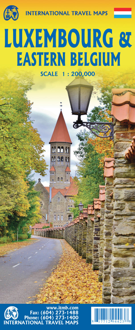
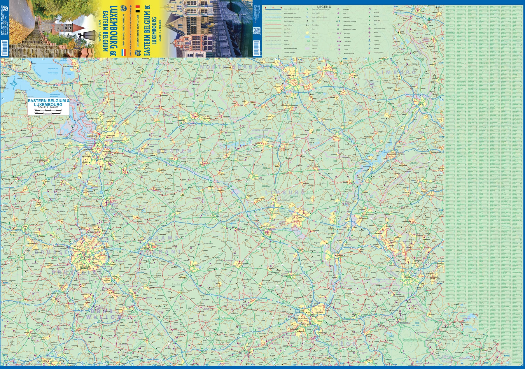
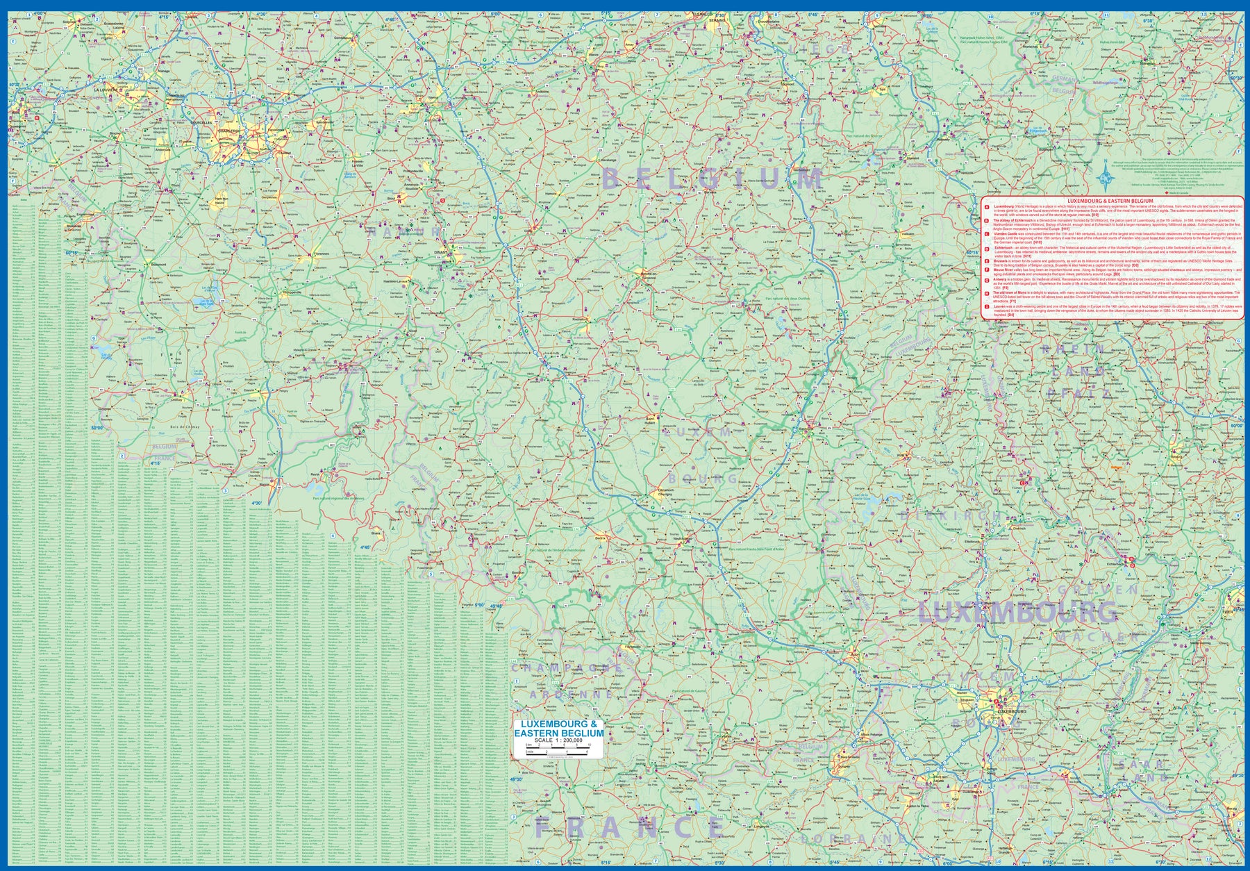
Luxembourg & Eastern Belgium
Ordinær pris 199,00 krLuxembourg is the largest of Europe’s mini-states. We have included the principality on maps of surrounding countries, as most publishers do, but we felt it was time to concentrate on the principality itself and place it into context with its neighbours. Bounded on the west by Belgium, on its east by Germany, and its south by France, Luxembourg has survived for centuries by playing off one large power against another in order to retain its independence. Largely a French-speaking area, Luxembourg is also a strong supporter of the EU. It is a mountainous country, part of the Ardennes region, and close to Bastogne, the focal point of Hitler's last attempt to break the Allies in what is now called the Battle of the Bulge. Bastogne, site of a marvelous WW2 museum, is also on Side 1, as is a portion of Belgium going as far as Mons.
Side 2 concentrates on Belgium east of Brussels, with a small portion of Netherlands included. This includes the Brussels region, Antwerp, Leuven, Liege, and Aachen, with a tiny portion of Germany. Belgium is a larger and more diverse country than many realize. One of the great treasure of eastern Belgium is the cathedral town of Liege, which is known in Flemish as Luik and in German as Luttich, which can make finding it a bit challenging, depending upon whose map one is using, or which road signs one is following!
Madrid
Ordinær pris 229,00 krExplore manicured parks and historic plazas. Tapas tasting in traditional tavernas. And relaxing afternoons in Madrid's glittering galleries.
There are so many reasons to visit Madrid. Whatever your dream trip involves, this DK Eyewitness travel guide is the perfect companion. Our updated guide brings Madrid to life, transporting you there like no other travel guide does with expert-led insights, trusted travel advice, detailed breakdowns of all the must-see sights, photographs on practically every page, and our hand-drawn illustrations, which take you inside the city's buildings and neighbourhoods.
Majorstuen 1921
Ordinær pris 1.100,00 krDette kartet er kun tilgjengelig for kjøp i nettbutikken. Kartet printes når du kjøper, og har derfor noe lengre leveringstid.
Dette er Dapa Maps' utsnitt over deler av Majorstuen fra kartet Kristiania 1921.
Oslos peneste kart? Ja det mener vi. I flere år har Dapa Maps sett på dette kartet og tenkt at de må gjøre med det. Vinteren 2023/2024 har de gjort en digital restaurering av kartet og kan nå vise det frem for allmenheten.
Kartet er opprinnelig tegnet av Byens Oppmaalingsvesen (forløper til Plan- og bygningsetaten) i 1921. Kartet ble da tegnet på 6 ulike kartblad som finnes arkivert hos Byarkivet.
Det Dapa Maps har gjort er å sette kartet sammen til et kart og redigert bort rutenettet slik at lesbarheten blir bedre. De har ikke endret noe på fargene eller på noen andre detaljer.
Dapa Maps
Kartet er laget av Daniel og Pavel fra Dapa Maps. De er to kartografer som tror at livet er best ute, derfor er de opptatt av å lage de peneste kartene de kan for at du kan bli kjent med områdene du liker best. Om du ønsker kan du lese mer om de her.
For hvert kart som selges planter de et tre slik at verden blir litt grønnere 🌳
Ramme og montering
Dapa Maps har endelig funnet frem til den perfekte rammen og kan nå tilby ramme og montering av kartet.
Mallorca
Ordinær pris 169,00 krLet Marco Polo Mallorca guide you around this beautiful island. Explore Mallorca with this handy, pocket-sized, authoritative guide, packed with Insider Tips. Discover boutique hotels, authentic restaurants, the island's trendiest places, and get tips on shopping and what to do on a limited budget.
There are plenty of ideas for travel with kids, and a summary of all the festivals and events that take place. Let Marco Polo show you all this wonderful Spanish island has to offer... See beautiful bays, long beaches, dramatic rocky coasts, sophisticated marinas.
Witness the numerous legacies of past powers and civilisations that have left their mark on the island. And, of course, Mallorca offers numerous attractions: water sports and mountain biking can be just as much a part of your holiday as great cuisine, hip beach bars and romantic sunsets. Your Marco Polo Mallorca Guide includes:Insider Tips - we show you the hidden gems and little-known secrets that offer a real insight into this heavenly island.
Mallorca
Ordinær pris 249,00 krThe go-to Mallorca travel guide for over 30 years. Strap on your boots and discover Mallorca on foot with the Sunflower Mallorca travel guide. And on the days when your feet may have had enough, enjoy some spectacular scenery on one of our legendary car tours.
The Sunflower Mallorca guide is indispensable for hiking in Mallorca or seeing Mallorca by car. This was the first walking guide for Mallorca, the guide that won Sunflower the Sunday Times 'Oscar' for best travel guide - and eventually made the island one of the most popular walking areas in Europe.The author has lived on Mallorca for over 35 years and knows the island intimately. She has also been able to recheck most of the routes - as well as adding several new walks.
This completely revised 9th edition, in a wider format with 50% more pages, features newly drawn maps and incorporates both the GR221 ('Drystone Route') and the GR222 (still a work in progress). These long-distance walks have been incorporated in the day walks.There are also 6 car tours with accompanying fold-out touring map, as well as plans of Palma and Soller, bus, train and boat timetables and panels of information on Mallorcan customs and features of the landscape. A free online update service informs users of any route-change information.
Mallorca & Menorca
Ordinær pris 259,00 krDenne praktiske reiseguiden til Mallorca & Menorca inneholder detaljerte reisetips og oversikt over de mest ikoniske severdigheter, samt noen skatter utenfor allfarvei. Med forslagene til reiseruter og ekspertforfatterens utvalg av ting å se og gjøre blir denne boken til en perfekt følgesvenn både i forkant og underveis på turen. Denne Mallorca & Menorca-guideboken er fullpakket med detaljer om hvordan du kommer deg dit og rundt, informasjon før avreise og topp tidsbesparende tips, inkludert en visuell liste over ting du ikke bør gå glipp av. Våre fargekodede kart gjør Mallorca & Menorca enklere å navigere mens du er der.
Glimrende bakgrunnstoff og gode kart kjennetegner rough guides. Dette er en av de mest populære guidebokseriene, beregnet for folk som reiser på egenhånd. Fyldige men ikke avskrekkende, verken I pris eller størrelse. Her finner du informasjon av praktisk og kuriøs karakter, skrevet av engasjerte og kunnskapsrike forfattere. Anbefales spesielt for europeiske reisemål, ettersom serien har lengst erfaring fra dette kontinentet.
Mallorca Ost (East)
Ordinær pris 129,00 krOm esterbauer estebauer er et Østerriksk forlag som spesialiserer seg på sykkelkart og sykkel- og vandreguider. Forlaget er representert med ca. 36 titler med hovedvekt på serien cycline guide/ bikeline som kombinerer sykkelguider og kart i spiralinbinding slik at du enkelt kan brette deg frem til riktig side og sykle etter kartet. Det fleste er tyskspråklige, men enkelte utgivelser finnes også på engelsk eller dansk.
Publisert måned: Jul
Publisert år: 2015
Innbinding: falset
Material: plastpapir
Målestokk: 1:60000
Mallorca: Serra de Tramuntana
Ordinær pris 399,00 krThis set of 4 maps covers the Tramuntana Mountains in northern Mallorca, at a scale of 1:25 000. The 4 maps show all the main walking and hiking trails in the Tramuntana Mountains, with a generous overlap between each map.
Also shown across all 4 maps is the whole of the GR 221 long distance walking trail.
Mallorca; Menorca & Ibiza
Ordinær pris 329,00 krDe Baleariske Øer, et af danskernes foretrukne rejsemål, når det gælder sol, strand og aktiv ferie. Mallorca-kapitlerne dækker hele den varierede ø: storbyen Palma og feriemålene i Palmabugten, de gemte byer og vandreture i Tramuntana-bjergene, Alcúdia- og Pollença-bugternes udbredte sandstrande, de charmerende fiskerbyer på østkysten og sletten i midten med landbrug, vinavl og stilfærdige byer. Øerne Ibiza og Menorca har hver deres kapitel. Læs også om kunst og kunstnere, gastronomi, vandring og natur, arkitektur og historie. Desuden er guiden rigt illustreret med fotos og kort.
Malta, Gozo and Comino
Ordinær pris 249,00 krThe go-to Malta, Gozo and Comino travel guide for over 30 years. Strap on your boots and discover Malta on foot with the Sunflower Malta travel guide. And on the days when your feet may have had enough, enjoy some spectacular scenery on one of our legendary car tours.
The Sunflower Malta guide is indispensable for hiking in Malta or seeing Malta by car. The Maltese landscape offers rich rewards for those who enjoy exploring: interests in ancient and modern history, military and ecclesiastical architecture, geology, and flora are all well catered for. If this will be your first visit to the Maltese Islands, this book will be a perfect introduction to the delights of walking in Malta and Gozo and touring the islands by car or with public transport.
Malta: Liesertal Maltatal
Ordinær pris 189,00 krDette store østerriske kartforlaget er kjent for sin klare kartografi og gode papirkvalitet. De kommer i alle målestokker, og flere av landkartene inneholder bykart og turistinformasjon.
Marseille
Ordinær pris 199,00 kr