Filter
51 produkter
51 produkter
Utsolgt
Argentina
259,00 kr

0/13 Nevado Ojos Del Salado
Ordinær pris 259,00 kr Salgspris 129,50 kr Spar 50%/
Mva inkludert
Frakt beregnes i kassen.
Alpeinvereinskarte er en serie detaljerte vandre- og klatrekart over de østeriske og tyske alper. Høy kvalitet og nøyaktig kartografi gjør disse kartene avgjørende for den erfarene klatrer og fjellturist. Fjellhytter, turstier og campingplasser er tydelig markert på kartene. Noen av kartene er også utgitt i egne skiutgaver.
Publisert år: 2004
Innbinding: fal
Material: papir
Målestokk: 1:100.000
Publisert år: 2004
Innbinding: fal
Material: papir
Målestokk: 1:100.000

0/3C Cordillera - Huayhuash
Ordinær pris 219,00 kr Salgspris 109,50 kr Spar 50%/
Mva inkludert
Frakt beregnes i kassen.
Publisert år: 2008
Innbinding: falset
Material: papir
Målestokk: 1:50000

764 Brazil
Ordinær pris 169,00 kr/
Mva inkludert
Frakt beregnes i kassen.
Michelin er en av verdens beste, og best kjente, kartserier. Kartene har glimrende kartografi.
- Publisert: 2023
- Innbinding: Falset
- Materiale: Papir
- Målestokk: 1:3 850 000

A Long Way South
Ordinær pris 89,50 kr/
Mva inkludert
Frakt beregnes i kassen.
In A Long Way South, itinerant traveller Sara Stewart relates memories salvaged from her explorations of Latin America during 1974/5, a turbulent, politically unstable period where kidnappings and smuggling were commonplace, where dead bodies lined the roads and where tanks guarded the streets of two capitals following a military coup and insurgency. Posing as the ship captain's niece, Sara crossed the Atlantic in a cargo boat before docking in Veracruz, Mexico. There she followed an Irishman and his pack of hounds as they hunted jackals through desert cacti, then met film makers and fishermen - and fell in love.
Travelling by local buses and trains, she gradually headed south, watching dead bodies pile up in Central American countries and celebrating Christmas in El Salvador, before eventually reaching South America. In Ecuador she rode on a train roof through towering landscapes and encountered tribal people, then travelled by sea to the fabled Galápagos Islands. Once back on the South American mainland, she braved rampant lawlessness in Lima, tanks and troops lining the streets of the Peruvian capital.
In Bolivia she joined a bus full of female smugglers, traversed flooded rivers and survived freezing nights. Tanks also characterised Sara's time in Santiago, the Chilean capital, which had just experienced a military coup that ended democracy and established General Pinochet's long-lasting dictatorship. Continuing southwards, Sara crossed the vastness of Patagonia to endure rough seas on a boat with esteemed author Bruce Chatwin, before venturing across the Andes into Argentina.
The country proved to be out of control, characterised by crazy inflation, political mayhem and kidnappings, and abject poverty contrasting with ostentatious wealth. Reaching Brazil, Sara's journey culminated with marvelling at Iguaçu Falls before unexpectedly partying with notorious Great Train Robber and fugitive Ronnie Biggs near Rio de Janeiro's Ipanema Beach. An authentic recollection of intrepid travels during an era long before travel became straightforward, the memoirs collated in A Long Way South are a thrilling, engaging read - a compendium of tales as much about remarkable people as they are about the diverse, fascinating places and charged political situations that characterised 1970s Latin America.
- Forfatter: Sara Stewart
- Publisert: November 2024
- Innbinding: Heftet
- Språk: Engelsk
- ISBN: 9781784779856

ACONCAGUA
Ordinær pris 259,00 kr Salgspris 129,50 kr Spar 50%/
Mva inkludert
Frakt beregnes i kassen.
Publisert år: 2005
Innbinding: fal
Material: papir
Målestokk: 1:50000
Innbinding: fal
Material: papir
Målestokk: 1:50000

Argentina
Ordinær pris 309,00 kr/
Mva inkludert
Frakt beregnes i kassen.
Ideal for independent travellers, this guidebook to Argentina, written by destination experts, combines must-see sights with hidden gems and offers essential tips for both planning and on-the-ground adventures. It's sustainably printed to ensure environmental responsibility.
- Publisert: Feb. 2025
- Utgave: 8. utgave
- Antall sider: 576
- Innbinding: Heftet
- Språk: Engelsk
- ISBN: 9781835291689


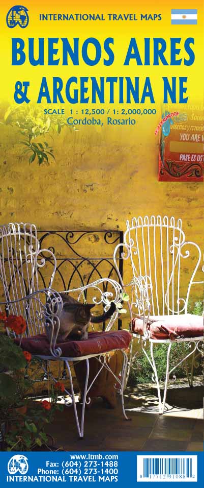
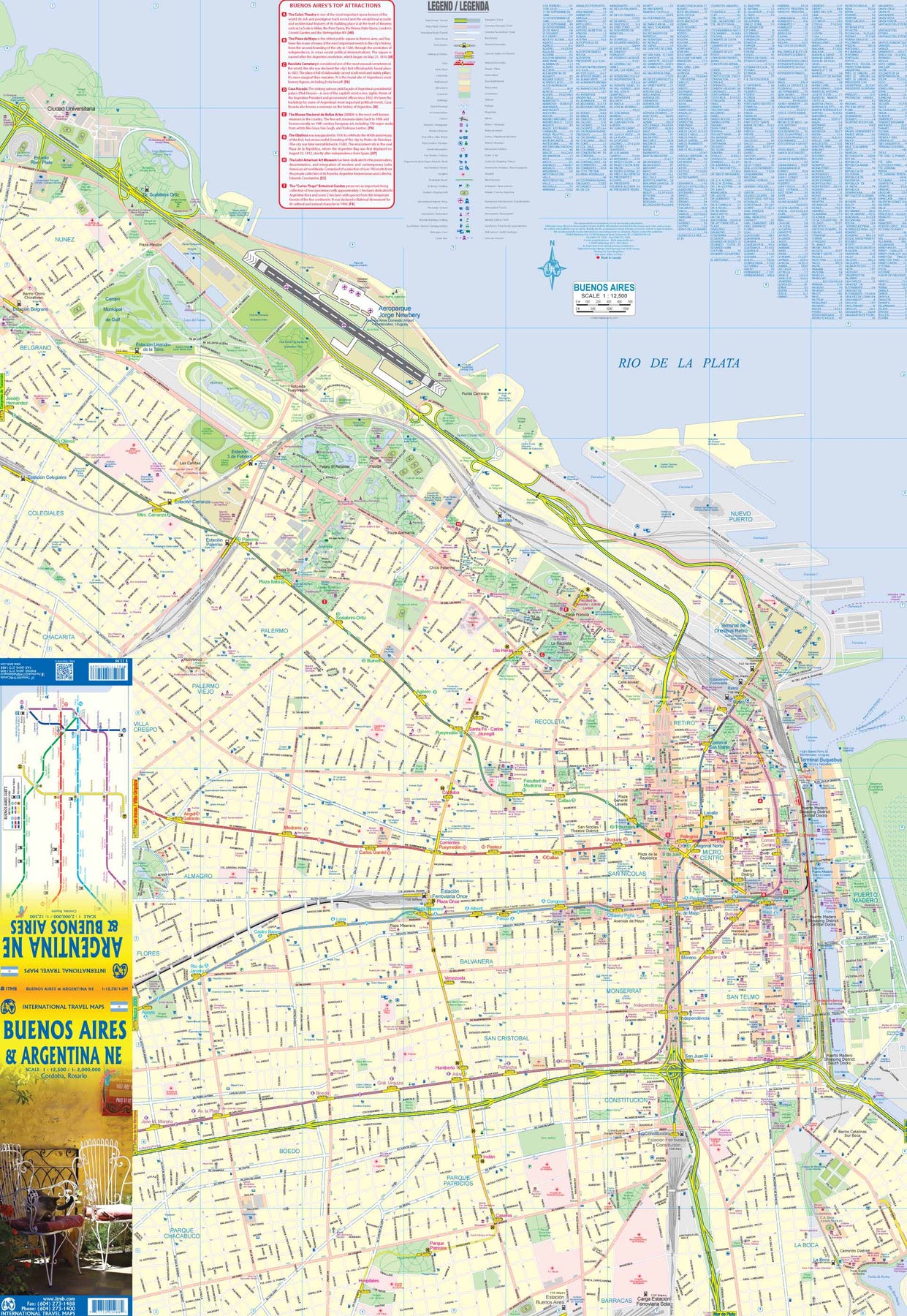
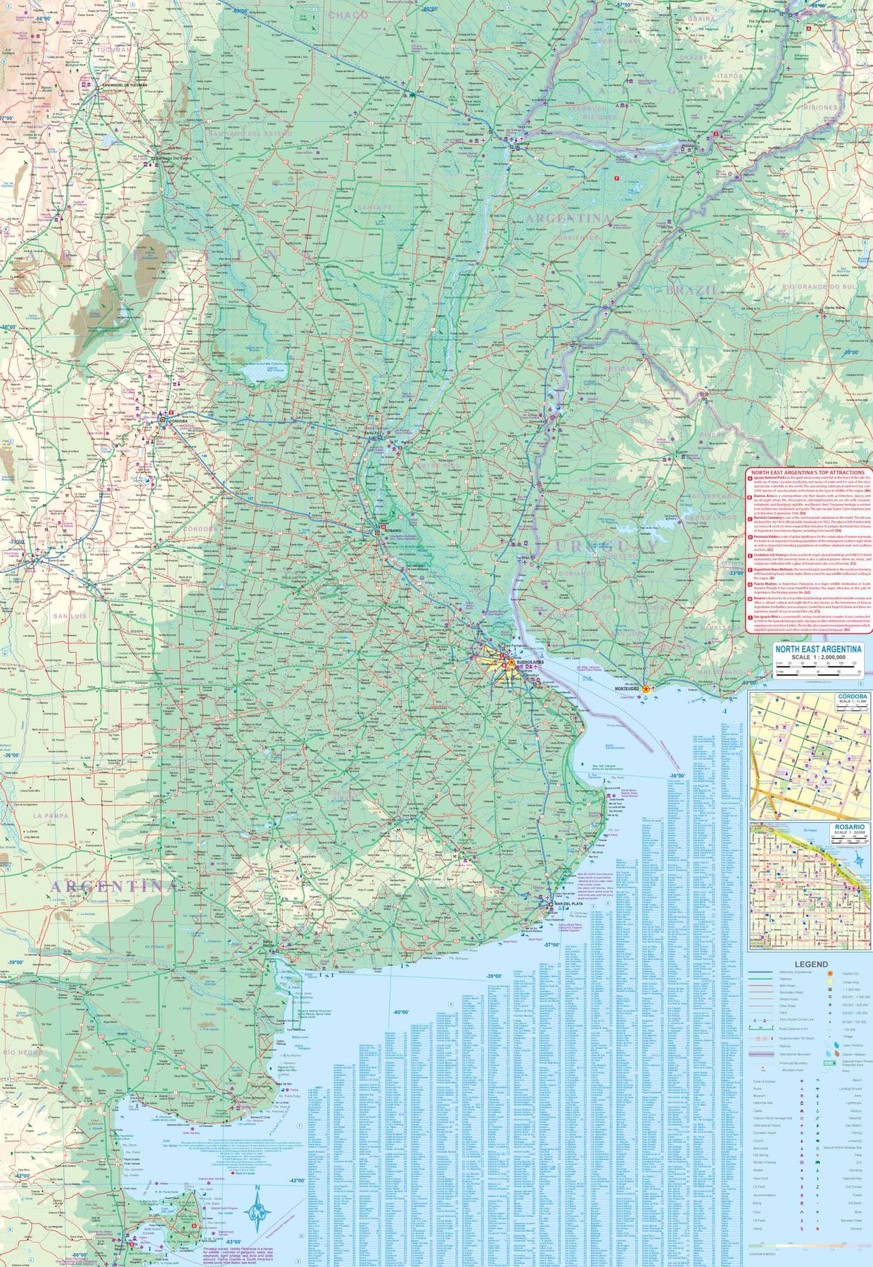
Argentina: Buenos Aires & Northeast
Ordinær pris 199,00 kr/
Mva inkludert
Frakt beregnes i kassen.
This version represents a thorough updating of this important Argentinean city. The subway lines are now clearly shown and the main shopping/pedestrian ways more clearly delineated. All three railway stations are shown, although rail services have largely been curtailed except for suburban usage. The cruise ship terminal has been added and the ferry crossing to Uruguay moved. La Recoleta cemetery has had pathways noted. The airport shown is only used for local flights, as the main international airport is quite far away from the city.
It is noted on the second side of the map, which covers all of northeastern Argentina, most of Uruguay, and small portions of Brazil and Paraguay. No visit to Argentina would be complete without including Iguazu Falls or historic Cordoba, which are on this map. The regional map goes as far south as Puerto Madryn and includes such popular destinations as Bahia Blanca and Mar del Plata. Insets of Cordoba and Rosario are included.
- Publisert: 2024
- Innbinding: Falset
- Materiale: Vanntett papir
- Målestokk: 1:12 500, 1:2 000 000

Bolivia
Ordinær pris 199,00 kr/
Mva inkludert
Frakt beregnes i kassen.
ITM har kart over hele verden og de spesialiserer seg på land litt utenfor allfarvei. Beliggenheten til landets nasjonalparker, historiske monumenter, de viktigste veiene o.L. Finner du inkludert i kartene. Samtlige landkart har ofte et bykart over hovedstaden.
Fra ITM: 6th edition 2025. As a travel destination, Bolivia definitely ranks among the routes less travelled! However, it is a fascinating country and well-worth visiting. We have printed this edition on plasticized paper for durability, as one will definitely need a map to get around this mountainous country. The map shows the road network to best advantage, with distances between communities whenever possible Touristic sites are noted, and elevations, parks, and reserves. Inset maps of La Paz, Potosi, and Santa Cruz de la Sierra are included.
Publisert år: 2025
Innbinding: falset
Material: plastpapir
Målestokk: 1:1,400,000

Bolivia
Ordinær pris 309,00 kr/
Mva inkludert
Frakt beregnes i kassen.
Ideal for independent travellers, this guidebook to Bolivia, written by destination experts, combines must-see sights with hidden gems and offers essential tips for both planning and on-the-ground adventures. It's sustainably printed to ensure environmental responsibility.
- Publisert: 2025
- Utgave: 6. utgave
- Antall sider: 328
- Innbinding: Heftet
- Språk: Engelsk
- ISBN: 9781835291863

Brazil
Ordinær pris 169,00 kr/
Mva inkludert
Frakt beregnes i kassen.
Brazil at 1:3,850,000 on an indexed, waterproof and tear-resistant road map with topographic and tourist information, published by Reise Know-How as part of their highly acclaimed World Mapping Project, The map is double-sided to provide the best balance between a good scale and a convenient size sheet.
The map divides the country west/east, with the whole of the Brazilian Amazon Basin on one side and on the reverse the country south of the mouth of the Amazon and eastwards from Mato Grosso, with a generous overlap between the two sides. Coverage includes the whole of Paraguay, most of Bolivia with La Paz, Cochabamba and Oruro, and Peru north-eastern with Iquitos and south-eastern with Cusco and Arequipa.
Topography is shown by altitude colouring with contours and spot heights, graphics for swamps and salt pans, plus names of hill and mountain ranges, etc. Numerous tributaries of the Amazon, including many smaller rivers not directly flowing into it, are named. The map also shows boundaries of national parks and other protected area, plus numerous Indian reservations.
Road network indicates unsurfaced sections, includes local tracks, and gives driving distances on main and secondary roads. Railway lines are included and local airports are marked. Internal administrative boundaries are shown with names of the states. Symbols highlight various places of interest, including archaeological remains, viewpoints, thermal spas, etc. The map has a grid with latitude and longitude at intervals of 2º and an index of localities. Map legend includes English.
- Publisert: 2020
- Innbinding: Falset
- Materiale: Plastpapir
- Målestokk: 1:3 850 000

Brazil
Ordinær pris 319,00 kr/
Mva inkludert
Frakt beregnes i kassen.
Brazil offers a wealth of incredible experiences. Whatever your dream trip involves, this DK travel guide is the perfect companion. Our updated guide brings Brazil to life, transporting you there like no other travel guide does with expert-led insights, trusted travel advice, detailed breakdowns of all the must-see sights, photographs on practically every page, and our hand-drawn illustrations, which take you inside the country’s buildings and neighbourhoods.
You'll discover: our pick of Brazil’s must-sees and top experiences. Beautiful photography and detailed illustrations, taking you to the heart of Brazil. The best spots to eat, drink, shop and stay. Detailed maps and walks which make navigating the region easy. Easy-to-follow itineraries. expert advice: get ready, get around and stay safe. Colour-coded chapters to each part of Brazila lightweight format, so you can take it with you wherever you go.
- Publisert: 2025
- Antall sider: 384
- Innbinding: Heftet
- Språk: Engelsk
- ISBN: 9780241757567

Brazil
Ordinær pris 319,00 kr/
Mva inkludert
Frakt beregnes i kassen.
Discover this vast and varied South American country with the most incisive and entertaining guidebook on the market. Whether you plan to hit the beaches of Rio, take a boat up the Amazon or explore the gorgeous colonial towns of Minas Gerais, The Rough Guide to Brazil will show you the ideal places to sleep, eat, drink, shop and visit along the way. Independent, trusted reviews written with Rough Guides' trademark blend of humour, honesty and insight, to help you get the most out of your visit, with options to suit every budget.
- Full-colour chapter maps throughout - to explore Rio's beach neighbourhoods and remote Amazon towns without needing to get online.
- Stunning images - a rich collection of inspiring colour photography. Things not to miss
-
Rough Guides' rundown of the best sights and experiences in Brazil.
- Itineraries - carefully planned routes to help you organise your trip. Detailed coverage - this travel guide has in-depth practical advice for every step of the way. Areas covered include: Rio de Janeiro, Sao Paulo, Minas Gerais, Espirito, Santo, Bahia, the Northeast, the Amazon, Brasilia, the Pantanal and the South, covering Parana, Santa Catarina and Rio Grande do Sul.
- Attractions include: Rio's Corcovado, Iguazu Falls, Salvador's old town, Rio Amazon as boat trips and the Ilha do Mel. Basics - essential pre-departure practical information including getting there, local transport, accommodation, food and drink, festivals and events, sports and outdoor activities and more.
-
Background information - a Contexts chapter devoted to history, the environment, music, cinema, football and recommended books, as well as a guide to Brazilian Portuguese.
- Publisert: 2024
- Utgave: 10. utgave
- Antall sider: 656
- Innbinding: Heftet
- Språk: Engelsk
- ISBN: 9781839059902

Brazil
Ordinær pris 279,00 kr/
Mva inkludert
Frakt beregnes i kassen.
Rikt illustrerte bøker med mye bakgrunnstoff. Insight Guides går nøye til verks både når det gjelder historie, kultur og bakgrunn, før de tar for seg de forskjellige delene av området tittelen dekker, en etter en. Serien er kjent for sine fantastiske fotografier og er derfor svært populære ”før-reisen-bøker” - til planlegging og dagdrømming. Bøkene er dessuten egnet for den som ikke behøver bekymre seg stort over bosted og transport under reisen, men kan konsentrere seg om å lese bakgrunnstoff. Utfyllende sammen med for eksempel Lonely Planet. Populære gaver!
- Publisert: Juli 2019
- Utgave: 9. utgave
- Antall sider: 392
- Innbinding: Heftet
- Språk: Engelsk
- ISBN: 9781789190779

Brazil: Amazon & Brazil North
Ordinær pris 199,00 kr/
Mva inkludert
Frakt beregnes i kassen.
We first mapped the Amazon River Basin for a rainforest protection conference many years ago, preparing what we thought was a pretty good rendition until we arrived at a conference full of experts who were able to add so much more data that we re-did the map before publishing it. We have updated it repeatedly as more information has come to light and are pleased to release this sixth version, which does something that we have wanted to do for some time - it adds a detailed map of the northern half of Brazil/Brasil to a river map that covers portions of seven different countries.
The map is printed on revolutionary stone paper (tear-resistant, waterproof, friendly to the environment, and bio-degradable as well as extremely durable), and has two different cover pictures, so it can be marketed either as a map of Brasil or of the Amazon Basin - or both! It is also the only map of the river basin in print. As the world emerges from the era of Covid, this part of the world will once again dominate demand for South American explorers.
- Publisert: Mars 2022
- Innbinding: Falset
- Material: Vannfast papir
- Målestokk: 1:3 000 000

Brazil: Pantanal Wildlife
Ordinær pris 319,00 kr Salgspris 159,50 kr Spar 50%/
Mva inkludert
Frakt beregnes i kassen.
The Pantanal of Brazil, Bolivia and Paraguay is South America's Serengeti: its wetlands are the largest on earth (they're half the size of France) and, in the dry season, crocodiles and storks jostle to gobble the last of the dying fish. Here, the continent's largest cat, the jaguar, lives alongside giant otters, anacondas and the world's largest parrot. A comprehensive introduction to the best place to watch wildlife in South America, and beautifully illustrated throughout, Bradt's Pantanal Wildlife is the only portable book to cover all the main wildlife groups while focussing exclusively on the Pantanal.
Bradt's fully illustrated wildlife guides focus on regions of the world particularly celebrated for their amazing and often unique species. With spectacular photography or exclusive watercolour drawings throughout, each visitors' guide provides an introduction to the region's principal flora and fauna alongside suggested wildlife itineraries, practical information on when to go and what to take and photography tips. Written in a deliberately engaging way, they offer something different from dry field guides, and will appeal to the interested layman as much as the wildlife devotee.
- Forfatter: James Lowen
- Publisert: Mars 2025
- Utgave: 2. utgave
- Antall sider: 179
- Innbinding: Heftet
- Språk: Engelsk
- ISBN: 9781784777135

Brazil: Sao Paulo & Brazil South Coast
Ordinær pris 189,00 kr/
Mva inkludert
Frakt beregnes i kassen.
ITM har kart over hele verden og de spesialiserer seg på land litt utenfor allfarvei. Beliggenheten til landets nasjonalparker, historiske monumenter, de viktigste veiene o.L. Finner du inkludert i kartene. Samtlige landkart har ofte et bykart over hovedstaden.
Fra ITM: Sao Paulo is Brasil’s second-largest city and most vibrant area. The Centro, or downtown area, is quite compact, and consists of two pedestrian areas separated by a large park. The street pattern is much better arranged than in Rio, and the city has a sensible subway network. The Cathedral is the largest in Latin America, and nearby is one of the oldest churches, dating from 1644. The other side of the sheet is the real value of this map. Brasil is a very large country, with much of its road network concentrated in the heavily-populated far south. Thus, a map of the entire country reduces usability. We have added a proper map of the southern third of Brasil, from the Uruguayan border north to Brasilia and from the Argentinian border eastwards to east of Rio. This map includes most of the largest cities in Brasil, Rio, Sao Paulo, Belo Horizonte, Brasilia, Curitiba, and Puerto Alegre. An inset of Rio is included.
Publisert år: 2018
Innbinding: falset
Material: papir
Målestokk: 1:12000/2200000

Chile - The Carretera Austral
Ordinær pris 299,00 kr/
Mva inkludert
Frakt beregnes i kassen.
This is the first guidebook focussed entirely on the magnificent and historic road uniting northern and southern Patagonia. The few hardy travellers that embark on this journey struggle to find even basic information about the region. The book provides visitors to the often-visited Bariloche and Chilean Lake District with a spectacular alternative means to reach the southern extremes of Patagonia.The road passes through world-class national parks.
It stretches from the high Andes to the remote Pacific coast, fed by five great rivers, countless fjords and the largest ice fields outside of Antarctica and Greenland. Trekking options abound, including to and from neighbouring Argentina through pristine wilderness. The region is home to a sub-tropical rainforest, secluded villages without vehicles, picturesque lakes, dramatic and often active volcanoes, and sufficient activities to satisfy even the most adventurous visitors.
In addition to practical advice, the book explores the mythical history of a region cut-off from the outside world, and the social and economic impact of the relatively recent connectivity to both mainland Chile and Argentina. Travelling in one of the last unknown regions of South America is challenging, and this book facilitates such travel for those wishing to escape the "gringo trail".
- Publisert: Nov 2022
- Utgave: 2.utg
- Antall Sider: 376
- Innbinding: Heftet
- Språk: Engelsk
- Forfattere: Hugh Sinclair
- ISBN: 9781784774752

Chile: Easter Island & Santiago
Ordinær pris 199,00 kr/
Mva inkludert
Frakt beregnes i kassen.
4th edition 2015. Easter Island is so isolated that it is not certain whether it is part of Polynesia or an off-shoot of South America. Geologically, it is neither; just a volcanic lump in the vast expanse of the Pacific Ocean. Its original inhabitants probably came from Polynesia; since supplanted by migrants from Chile, which is the political authority governing the island. Regardless, it is an intriguing place, famous for the Maoi – giant heads originally raised to protect family holdings. These huge, mysterious heads rest in various locations on the island and are one of the wonders of the world.
This map also includes a detailed map of Santiago de Chile, the capital of Chile, for the simple reason that all flights to Easter Island originate in that city, so everyone going to Easter Island needs a map of Santiago as well. This usage is merely for the convenience of visitors going to Easter Island.
- Publisert: 2020
- Innbinding: Falset
- Materiale: Papir
- Målestokk: 1:24 000, 1:12 500

Cotopaxi
Ordinær pris 299,00 kr Salgspris 149,00 kr Spar 50%/
Mva inkludert
Frakt beregnes i kassen.
- Publisert: 2009
- Innbinding: Falset
- Materiale: Papir
- Målestokk: 1:250 000, 1:40 000

Ecuador
Ordinær pris 124,50 kr/
Mva inkludert
Frakt beregnes i kassen.
Don't just see the sights-get to know the people. The people who inhabit the diverse landscapes of this beautiful land are proud, friendly, hospitable, and hardworking, but to understand the culture in any depth, you need to know the complex historical divisions between the highlands and the coast, and the rigid class and racial discrimination that has dominated the country's history. This updated edition of the award-winning Culture Smart! Ecuador takes you beyond the usual descriptions of what to see and digs into the heart of this multi-layered nation to give you an insider's view of the people and their traditions, history, food, and culture, and the practical tools to make the most of your time there.
Have a richer and more meaningful experience abroad through a better understanding of the local culture. Chapters on history, values, attitudes, and traditions will help you to better understand your hosts, while tips on etiquette and communicating will help you to navigate unfamiliar situations and avoid faux pas.
forfattere: Russell Maddicks
Publisert: Feb. 2022
Utgave: 2.utg
Sider nr: 200

Ecuador & Galápagos
Ordinær pris 269,00 kr/
Mva inkludert
Frakt beregnes i kassen.
Rikt illustrerte bøker med mye bakgrunnstoff. Insight Guides går nøye til verks både når det gjelder historie, kultur og bakgrunn, før de tar for seg de forskjellige delene av området tittelen dekker, en etter en. Serien er kjent for sine fantastiske fotografier og er derfor svært populære ”før-reisen-bøker” - til planlegging og dagdrømming. Bøkene er dessuten egnet for den som ikke behøver bekymre seg stort over bosted og transport under reisen, men kan konsentrere seg om å lese bakgrunnstoff. Utfyllende sammen med for eksempel Lonely Planet. Populære gaver!
- Publisert: Mars 2024
- Utgave: 8. utgave
- Antall sider: 328
- Innbinding: Heftet
- Språk: Engelsk

Ecuador & the Galapagos
Ordinær pris 299,00 kr/
Mva inkludert
Frakt beregnes i kassen.
Ideal for independent travellers, this guidebook to Ecuador and the Galápagos, written by destination experts, combines must-see sights with hidden gems and offers essential tips for both planning and on-the-ground adventures. It's sustainably printed to ensure environmental responsibility
- Publisert: Januar 2025
- Utgave: 8. utgave
- Antall sider: 440
- Innbinding: Heftet
- Språk: Engelsk
- ISBN: 9781835290668

Falkland Islands
Ordinær pris 319,00 kr/
Mva inkludert
Frakt beregnes i kassen.
This new, thoroughly updated third edition of Bradt's Falkland Islands remains the only detailed and wide-ranging standalone travel guidebook to this British Overseas Territory and is ideal for independent, cruise-ship and tour-group visitors alike. It includes all recent information needed for a smooth trip, including on restaurants and hotels in Stanley, conservation issues, wildlife-watching trips, history and how to explore beyond the capital. The main islands - East and West Falkland - are covered, as are the smaller Bleaker, Kidney, Sea Lion, Pebble, New, West Point, Carcass, Saunders, Keppel, Weddell, Staats and Beaver islands.
Situated in the South Atlantic Ocean, over 500 km from South America, the Falkland Islands are one of the world's truly wild places, full of unspoilt scenery and wide vistas. A photographer's delight and a must-visit location for those interested in the wild outdoors, the islands are home to major populations of albatrosses, penguins, dolphins, seals and other wildlife plus 3,600 people. It's not all about penguins, though, as the islands' spectacular scenery, comfortable accommodation, good wholesome British food and welcoming people create a wonderful place to visit.
The thriving city of Stanley gives way to the wild open spaces of camp (rural areas) with its scattered settlements, long sandy beaches, isolated islands and rocky outcrops. History enthusiasts will be in their element, visiting sites ranging from the islands' first British settlement to areas that were significant during the 1982 war. With Bradt's Falkland Islands you can plan how to fly between islands, drive across the camp in a 4x4 vehicle, visit multiple penguin colonies (where these charismatic birds behave as if you are not there), sample smoko (a wide range of cakes and biscuits, served during a morning or afternoon tea break), watch black-browed albatrosses at their nest, be investigated by 'Johnny Rooks' (curious birds of prey), spot dolphins in the shallows, visit the magnificent collection of artefacts from around the islands at Stanley's Historic Dockyard Museum and learn from local residents about life in this wildest of places.
Whatever your interest, this is the essential guide for a successful trip.
- Forfatter: Will Wagstaff
- Publisert: November 2024
- Utgave: 3. utgave
- Antall sider: 198
- Innbinding: Heftet
- Språk: Engelsk
- ISBN: 9781804692042

Galapagos Crusoes
Ordinær pris 89,50 kr/
Mva inkludert
Frakt beregnes i kassen.
A new, updated version of the celebrated 1968 title, Galapagos: Islands of Birds, by the renowned late ornithologist Bryan Nelson, with additional, previously unpublished reminiscences and lively and irreverent memories from his wife June. This timely reissue breathes new life into a classic work of natural history that will appeal to bird-lovers and Galapagos-lovers alike. It is as memorable for its groundbreaking descriptions of Galapagos wildlife as for June's naked appearance in the News of the World accompanied by a quote from the Duke of Edinburgh.
In 1964 the late Bryan Nelson, a zoologist, and his wife June spent a year living on two uninhabited, waterless Galapagos islands studying the three species of booby ('we couldn't resist also studying the great frigatebird and waved albatross, too' says June). Bryan's book, Galapagos: Islands of Birds was published in 1968 and, although by necessity a scientific study, his light touch and the extraordinary hardships and delights of living in total isolation with no means of rescue should things go wrong, make it an exceptionally good read. Now, nearly 60 years later, June Nelson has extracted the story of that extraordinary year and complemented it with her own recollections.
The couple's research and findings remain relevant and interesting, so plenty of wildlife descriptions are retained, but it is the mischievous mocking birds and friendly sea lions which will captivate the reader as much as the famous blue-footed boobies and waved albatrosses. At the end of their stay on Hood, when their clothes were literally in tatters and they went barefoot, they had news of the imminent visit of The Duke of Edinburgh and the Royal Yacht Britannia. June's description of this visit and their lunch on board with Prince Philip, make a surreal ending to a year of deteriorating food: 'Now our flour had around 50 maggots or beetles per pound...
- Forfattere: Bryan og June Nelson
- Publisert: April 2022
- Innbinding: Heftet
- Språk: Engelsk
- ISBN: 9781784778859

Guyana
Ordinær pris 299,00 kr/
Mva inkludert
Frakt beregnes i kassen.
This new third edition of Bradt's Guyana remains the only guidebook available to this South American gem, a jungle-clad country teeming with exotic wildlife. Thoroughly researched, easy to use and interesting to read, Bradt's Guyana is written and updated by writers who have lived in and promoted Guyana for many years and is an ideal companion for all travellers, from wildlife watchers to fishermen, anthropologists to conservationists and 'voluntourists'. Guyana is a destination on the rise, described - justifiably - by the tourist board as 'South America Undiscovered'.
This new edition of Bradt's Guyana has been updated to include all the latest developments, ranging from how to see harpy eagles at Warapoka to new culinary experiences, local tour operators, 4x4 self-drive and new hotels. Truly off the beaten track, Guyana is one of the most fascinating and least-known countries in the Americas. It is also the only English-speaking country in South America.
The jewel in its crown is the mouth-droppingly beautiful Kaieteur Falls, which is nearly five times the height of Niagara and the world's tallest single-drop waterfall. Culturally Caribbean, its capital Georgetown is a curious melting-pot of quaint Dutch and British colonial architecture, steel drums, boisterous nightlife, rum shops with world-class rum, cricket and tropical sea breezes. It is also the gateway to the lush interior which is full to the brim with fascinating flora and fauna including monkeys, black caiman, harpy eagles, giant anteaters, otters and the mighty jaguar.
With Bradt's Guyana, discover all of this, plus where to stay in community lodges and see the rainforest through the eyes of Amerindian guides, where to watch turtles nesting on the beach, how to explore the moody Essequibo river (the largest between the Orinoco and the Amazon), and how to visit the million-acre rainforest reserve of Iwokrama for the ultimate authentic wildlife experience. This third edition of Bradt's Guyana is the key book to plan an expedition into its densely forested lush interior, often accessible only by boat or small aircraft, before taking some 'time to lime' in a hammock in one of its tropical waterfront resorts.
- Forfatter: Kirk Smock
- Publisert: Juni 2018
- Utgave: 3. utgave
- Antall sider: 324
- Innbinding: Heftet
- Språk: Engelsk
- ISBN: 9781841629292

Guyana; Suriname & French Guiana
Ordinær pris 169,00 kr/
Mva inkludert
Frakt beregnes i kassen.
Tysk kartserie med flotte kart på slitesterkt plastpapir.
Guyana, Suriname and French Guiana at 1:1,850,000on an indexed, waterproof and tear-resistant road map with topographic and tourist information, published by Reise Know-How as part of their highly acclaimed World Mapping Project. The map is double-sided to provide the best balance between a good scale and a convenient size sheet. The whole of Guyana is on one side, with Suriname and French Guiana on the reverse; disputed border areas are clearly marked.
Light altitude colouring with names of mountain ranges and peaks, plus spot heights, presents the topography. National parks and other protected area are highlighted. Road network includes unpaved, seasonal tracks. Distances are marked on main and secondary roads. and locations of petrol stations and border crossings are indicated. Symbols show various place of interest, including UNESCO World Heritage sites, beaches, etc. Also shown are internal administrative boundaries with names of the provinces. The map has a grid with latitude and longitude at intervals of 1º and an index of localities which lists national parks and nature reserves separately. Map legend includes English.
Publisert år: 2014
Innbinding: falset
Material: Plastpapir
Målestokk: 850000

Hundre års ensomhet
Ordinær pris 229,00 kr/
Mva inkludert
Frakt beregnes i kassen.
Hundre års ensomhet er historien om sju generasjoner Buendía, om drømmer, utfordringer og ulykker i den lille colombianske byen Macondo. I Macondo har alt et annet innhold og en annen rytme enn i resten av verden. Så vel landsbyen som familien gjennomlever nybyggertid, borgerkriger, økonomisk vekst, industrialisering, ulykker og naturkatastrofer, forfall og glemsel. Det er en fantastisk verden, overdådig og makaber, skildret med grotesk humor og svart desperasjon. Hundre års ensomhet står som et av de mest betydelige verkene innen den latinamerikanske magiske realismen, og er blitt oversatt til mer enn 30 språk.
- Forfatter: Gabriel García Márquez
- Publisert: 2021
- Innbinding: Heftet
- Språk: Norsk bokmål
- ISBN: 9788205530768