2480 produkter
Italy: Umbria & The Marche
Ordinær pris 259,00 krBradt's Umbria & the Marche is the most detailed guide to combine these two small central Italian regions, which offer all the beauty, history and culture of neighbouring Tuscany only without the crowds, the traffic or eye-popping prices. Dana Facaros and Michael Pauls (authors of the original Cadogan guide to the area) lived in Umbria in the 1980s and have been returning regularly and writing about it ever since. They are the perfect guides to the region's landscapes, hill towns, food and wine, and art and architecture.
The superb art cities of Umbria and the Marche steal the limelight - Perugia, Orvieto, Urbino, Assisi, Spoleto, Loreto, Todi, where art fills every church and palazzo. But never far from these centres wait unspoiled countryside of rolling olive groves, forests and meadows, long walks and towns and tiny villages, nearly all with a masterpiece or two to show off and a great little family-run restaurant. The Bradt guide covers them all, along with the republic of San Marino.
The Apennines rule here. The Marche's geography is dominated by a series of east-west river valleys - the Metauro, Esino, Tronto, etc - twisting down to the Adriatic and often ending in long sandy beaches, from the historic towns of Senigallia and Fano through Ancona's Cornero Riviera to the Riviera delle Palme at San Benedetto del Tronto. Landlocked Umbria, where rivers flow into the mighty Tiber, has exceptional water features as well: Italy's fourth largest lake, Trasimeno; the Tiber Valley; Clitunno springs (once sacred to the Romans); and Italy's most beautiful waterfall, the Cascata delle Marmore.
Featuring superb photography and expert recommendations to suit all budgets, Umbria & the Marche - the fifth in Bradt's increasingly highly regarded series of Italian regional titles - is a timely guide to a more authentic corner of Italy.
ITM China, kart
Ordinær pris 219,00 krITM Sri Lanka & India South, kart
Ordinær pris 219,00 krThis edition is a considerable improvement on our previous one, benefitting from the extensive research trip we took to the emerald-shaped island shortly before the outbreak of Covid changed the world. We have re-introduced it as a map printed on waterproof paper, as such a format holds up well in a hot, humid climate. We visited all parts of the island and were quite impressed by the number of local hotels and resorts that we found and have added to the map. We were particularly gratified to discover progress on extending the motorway system for the country, much of it now probably delayed due to Covid.
The inset map of Colombo is particularly well-done. The second side of the sheet is a very detailed map of the southern third of India, from Nagpur to the southern tip of the country. Space constraints did not allow for inset maps, but several well-known cities are included – Mumbai, Hyderabad, Chennai, Pondicherry, Madurai, and Bengaluru (Bangalore) among them. India is a fascinating, if somewhat intimidating, place to visit, but is well-worth the time to do so.
ITM Tanzania, kart
Ordinær pris 199,00 krAfrica generally has been slower to recover economically from the Covid era, but is just as fascinating as ever. ITMB is finding that many of our maps of countries in Africa are approaching the end of their print runs and will see new editions through the rest of 2024 and into 2025. Tanzania is one of the first to be updated and refreshed. Printed on waterproof stone paper, Side 1 concentrates on the southern half of the country, from Dar es Salaam (the actual capital) south to the borders with Mozambique, Malawi, and Zambia. This is game preserve country, with Selous taking pride of place.
Side 2 concentrates on the northern portions, which are more popular. Game preserves such as Serengeti and Ngorongoro compete with Mount Kilimanjaro and Lake Victoria for attention. The islands of Pemba and Zanzibar are easy to reach from Dar. A large portion of Kenya is shown, as well as significant portions of Burundi and Rwanda. Detailed inset maps of Arusha and Stone Town are also included, as are all seven border crossings into Kenya. Tanzania is a very large country geographically, so visitors really need a map to get around.
ITM Vietnam, Laos & Cambodia, kart
Ordinær pris 199,00 krThe Indochinese Peninsula is one of the world's treasure troves of cultural diversity and historical activity. In the north are the hill tribes of Laos and Vietnam. Along the coast are the Viet people, and in the south the huge cultural area of Khmer influence - from Angkor Wat to the Cham ruins in the southeast of Vietnam. The Plain of Jars, in Laos remains one of the most intriguing puzzles of the modern world, and the temples of Louang Phabang are reknowned.
This map shows all of these wonders and many more. This is a very detailed map, prepared in the region, and showing just about anything a vistor would want in a map.
ITM, Portugal, reisekart
Ordinær pris 199,00 krITM har kart over hele verden og de spesialiserer seg på land litt utenfor allfarvei. Beliggenheten til landets nasjonalparker, historiske monumenter, de viktigste veiene o.L. Finner du inkludert i kartene. Samtlige landkart har ofte et bykart over hovedstaden.
Fra ITM: We are very pleased to be able to release a double-sided detailed map of Portugal. Although we have included the country in previous maps, it was always as an adjunct to another map (Spain and Portugal, Portugal and Southern Spain etc.), so it is high time that this very nice popular country had its own ITM map. Being a long, rather thin country, Side 1 concentrates on Lisbon and the southern half of Portugal with a detailed inset map of Lisbon. It also includes the Spanish provinces of Huelva and Badajoz. Side 2 covers the northern half of the country along with portions of neighbouring Spanish provinces. As a country, Portugal has a wealth of touristic attractions and we have included as many as we can on this map without cluttering it – castles, palaces, fortresses, cathedrals and churches, dozens of museums, beaches, a few hotels, mines, monuments, and just about everything a visitor would want to have. Of course, motorways, highways, secondary routes, rail lines, ferry services, and geographic heights of land are also included; altogether, a fabulous map for a wonderful country.
Publisert år: 2025
Innbinding: falset
Material: Papir
Målestokk: 1:500,000
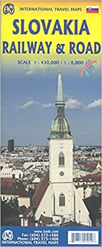
ITM, Slovakia - Railway & Road, reisekart
Ordinær pris 199,00 krVeikart over Slovakia / Bratislava
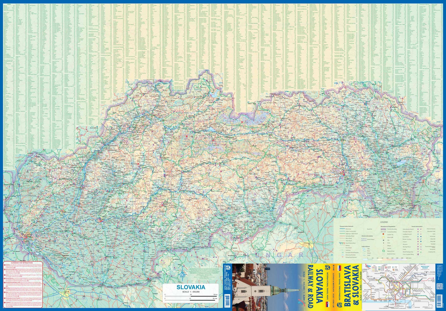
Ettersom turismen til Øst-Europa øker i popularitet, byr Slovakia på spennende muligheter for oppdagelsesreiser. ITMB har tidligere dekket landet sammen med nabolandet Ungarn, men nå har vi utvidet dekningen og inkludert et detaljert kart over Bratislava. Side 1 viser det langstrakte landet, fra grensene mot Østerrike og Tsjekkia til den stadig viktigere grensen mot Ukraina. Som vanlig har vi inkludert en oversikt over de viktigste severdighetene – deriblant byer som Košice, Banská Štiavnica og Štúrovo, samt de underjordiske karstgrottene i Demänová og eventyrslottet Bojnice. Side 2 viser hovedstaden Bratislava i detalj, inkludert elven Donau, gamlebyen og de nyere bydelene Petržalka og Ružinov. Kartet er trykt på vannfast steinpapir for god holdbarhet.
Kartforklaringen inkluderer
Veier (etter klassifisering), jernbaner, nasjonalparker, sykehus, hoteller, severdigheter, flyplasser, turistinformasjon, slott, grenseoverganger og mye mer.
Kartet viser hovedstaden Bratislava med stor detaljrikdom; her ser man blant annet elven Donau og gamlebyen, samt de nyere bydelene Petržalka og Ružinov. Kartet er trykt på vannfast steinpapir for god holdbarhet. Tegnforklaringen omfatter blant annet veier inndelt etter klassifisering, elver og innsjøer, nasjonalparker, flyplasser, severdigheter, motorveier, hovedveier, dyrehager, fiskeområder og mye mer.
Spesifikasjoner
ITM, Spain: Balearics - Mallorca; Ibiza & Menorca, kart
Ordinær pris 199,00 krThe Balearic Islands in the western Mediterranean have been extremely popular travel destinations for centuries. Mallorca/Majorca and Ibiza have become favoured visits by cruise ships to these islands in recent years, but the warm climate has attracted visitors for a long time. Side 1 concentrates on the three major islands of Mallorca, Ibiza, and Menorca but includes the smaller islands of Formentera and Cabrera, along with an inset map showing the islands in relation to the Spanish mainland ports of Valencia and Barcelona. Side 2 focusses on cruising the entire western half of the Mediterranean, from Naples west to Gibraltar. Naturally, the Balearics end up right in the centre of the map, which also includes the islands of Corsica and Sardinia, both of which are becoming increasingly popular with those cruising. I hasten to add that cruising is the fastest growing segment of the entire travel industry, so is an important market for the mapping industry.
ITM, Spain: South Rail & Road, reisekart
Ordinær pris 179,00 krThe southern half of Spain (and of Portugal, which is also included) consists of the portion from Toledo/Castellon south to the Mediterranean. Side 1 (the cover side) focuses on the eastern portion, from Granada to the coast, including the Balearic islands of Mallorca, Menorca, and Ibiza, and the other side the portion of Spain west of Granada, including that portion of Portugal from north of Lisbon to the Algarve. Gibraltar is included, as are the Straits and the Spanish enclave of Ceuta and part of Tangier. A large inset of the seven Canary Islands is also shown. This map completes our regional mapping of Spain (the other two titles are Spain North and Cataluña/Barcelona).
Spain has invested heavily in its train network, so we note both rapid train and regular train routes, as well as the expanding motorway network. Major touristic sites are noted, as always, with special attention to world heritage sites. The scale is excellent for those wanting to explore this portion of Spain at leisure.
ITM, Western Balkans kart
Ordinær pris 219,00 krThe region stretching from Trieste to Sophia that used to be known as Yugoslavia is now called the Western Balkans, consisting of Slovenia, Croatia, Bosnia & Herzegovina, Serbia, Montenegro, Kosovo, Northern Macedonia, and parts of Albania, Hungary, and Bulgaria. Slovenia and Croatia are now part of the EU, and the other countries are aspiring to join. As a result, the region is becoming a popular touristic destination, easy to reach from Italy or Austria. Side 1 fronts on to the Adriatic Sea, showing the many ferry routes to Italy, the coastal motorway to Greece, and cities such as Ljubljana, Zagreb, Split, and Dubrovnik. Side 2 concentrates on the mountainous interior, essentially from Lake Balaton south to the Greek border and Thessalonica. This is a developing part of Europe, with names like Belgrade, Sarajevo, Pristina, Podgorica, Tirana, and Skopje, that are exotic and different, and therefore exciting to visit.
Jamaica
Ordinær pris 259,00 krDenne praktiske reiseguiden til Jamaica inneholder detaljerte reisetips og oversikt over de mest ikoniske severdigheter, samt noen skatter utenfor allfarvei. Forslagene til reiseruter og ekspertforfatterens utvalg av ting å se og gjøre vil gjøre det til en perfekt følgesvenn både i forkant og under turen. Denne Jamaica-guideboken er fullpakket med detaljer om hvordan du kommer deg dit og rundt, informasjon før avreise og topp tidsbesparende tips, inkludert en visuell liste over ting du ikke bør gå glipp av.
Våre fargekodede kart gjør Jamaica enklere å navigere mens du er der. Denne guideboken til Jamaica er fullstendig oppdatert etter COVID-19.
JAMAICA
Ordinær pris 129,00 krJamaica
Ordinær pris 169,00 krTysk kartserie med flotte kart på slitesterkt plastpapir.
Publisert år: 2018
Innbinding: falset
Material: Plastpapir
Målestokk: 1:150,000
Jamaica & Cayman Islands
Ordinær pris 149,00 krITM har kart over hele verden og de spesialiserer seg på land litt utenfor allfarvei. Beliggenheten til landets nasjonalparker, historiske monumenter, de viktigste veiene o.L. Finner du inkludert i kartene. Samtlige landkart har ofte et bykart over hovedstaden.
Fra ITM: This map was called Cayman Islands and Jamaica in its previous edition, which was a well-intentioned attempt to promote the smaller islands adjacent to big brother. Now, we are reverting to what we think is a more logical title arrangement for listing purposes, but the map has two covers, so one can market it as either Jamaica or the Caymans, or best of all, market both! We visited the Caymans a few months ago and drove every road on the main island, including a few that turned out to be driveways! The map is very current as a result. The other side of the map is the very popular touristic island of Jamaica, now into its sixth edition. This island is large enough to justify renting a car and exploring. It is a great way to discover hidden coves and find historic plantations, especially along the touristic north shore. 6th/3rd Ed. 1:250,000/1:37,500
Publisert år: 2017
Innbinding: falset
Material: papir
Målestokk: 1:250000/37,500
Japan: Hokkaido
Ordinær pris 309,00 krNew from Bradt is the first-ever, standalone English-language guide to Hokkaido, Japan's second-largest island and northernmost prefecture. Home to under 5% of the country's population, this is a land of vast, wild expanses which demands exploration at any time of year - and feels a world away from Tokyo. Penned by an outdoors-loving travel writer resident in Japan, Bradt's Hokkaido delves far deeper into this frontier land than country-wide guidebooks can possibly do.
Author Tom Fay provides detailed coverage of the island's history, unique wildlife, local food, the Ainu (indigenous people), outdoor activities, skiing logistics, hiking courses and the practicalities of visiting in winter, when deep snow carpets the ground and the sea turns to ice. Hokkaido's varied landscapes include remote mountain ranges, fertile lowland plains, sweeping forests and enormous wetlands home to rare birds and other wildlife. Even for the Japanese, Hokkaido has a somewhat wild and exotic aura - place names have distinct Ainu origins and the capital Sapporo is closer to Russia's Vladivostok than to Tokyo; while the Siberia-influenced climate and wide open spaces are unlike anything found in the rest of Japan.
Hokkaido's mild summers are ideal for sightseeing, cycling, camping and hiking. Why not climb the island's highest mountain in Daisetsuzan National Park - an untouched wilderness of simmering volcanoes and stunning nature - or marvel at colourful fields of flowers around Furano and Biei? In winter, you can go to snow festivals, walk on sea ice (or board an icebreaker) to explore the Sea of Okhotsk, watch flocks of sea eagles or track brown bears in Shiretoko National Park, or head to popular ski resorts such as Niseko where the huge dumps of perfect powder snow attract skiers and snowboarders from around the world. Throw in hot springs (and thus ryokan hot-spring inns), active volcanoes, speciality seafood and quirky foodstuffs such as chocolate-covered crisps, excellent transport links and renowned Japanese hospitality, and Hokkaido is a thrilling and varied off-the-beaten-path travel destination, to which Bradt's Hokkaido guidebook is instantly the essential companion.
Japan: Mount Fuji / Kanto & Chubu regions
Ordinær pris 169,00 krThe volcanic cone of Mount Fuji is Japan's most popular touristic attraction. Located a shoer train ride west of Tokyo, Fuji attracts millions of visitors each year. Side 1 focuses on the mountain itself, showing rail connections, surrounding towns, roads on the lower slopes, hiking trails, and accommodations close to the summit. Side 2 shows the kata & Chubu Regions from Tokyo to Nagoya and north to Nigata. This is a brand new ITMB title.
Japan: Okinawa & Southwest Islands
Ordinær pris 309,00 krBrand new from Bradt is Okinawa and Japan's Southwest Islands, the sole travel guidebook dedicated to the archipelago stretching from the southern tip of mainland Japan to Taiwan, whose landscapes include award-winning beaches, coral reefs, tropical jungles and ancient forests. This guide contains all the detailed information that travellers need to get the most out of their visit, from accommodation and restaurants to transport and sights. Japan expert Jo Davey complements this with rich context and entertaining insights to help readers understand this fascinating region, covering culture, recipes, architectural highlights, historical episodes and traditional folktales.
Japan's Southwest Islands are a remote but rewarding and geographically diverse area that comprises the Satsunan Islands (formed of the Osumi and Amami islands) and the Ryukyu Islands (consisting of the Okinawa, Kerama, Miyako and Yaeyama islands). The capital city of Naha on Okinawa-honto is a bright and busy hub of history, art, karate and food. Thanks to its many US military bases and post-war occupation by the US, Naha is a fusion of Japanese and American culture.
In contrast, the more remote islands preserve traditional Ryukyuan life with festivals, architecture, traditional accommodation and religious sites. Depending where you travel, you can dive with manta rays off Iriomote or kayak along its jungle rivers, hike through Yakushima's ancient forest, search for star sand on Taketomi, pay tribute to the fallen of World War II at museums and monuments on Okinawa-honto, cycle between Miyako's award-winning beaches, take home a chunk of rope from the world's largest tug-of-war (in Naha) or go whale watching off the Kerama Islands. Wherever you go, the islands' amazing food - known for being the world's healthiest cuisine - can be found throughout the archipelago.
Jersey
Ordinær pris 189,00 krThe go-to Jersey travel guide for the best walks and car tours. Strap on your boots and discover Jersey on foot with the Sunflower Jersey travel guide. And on the days when your feet may have had enough, enjoy some spectacular scenery on one of our legendary car tours. The Sunflower Jersey guide is indispensable for hiking in Jersey or seeing Jersey by car. Walking in Jersey can be quite challenging: the coastline features some steep paths with endless steps.
But away from the coast there is slightly more variety in the landscape, and trekking is relaxed and easy, mainly along quiet lanes and country paths. The author, Geoff Daniel has the happy knack of finding sights and places to stir the imagination – from the Pinnacle (one-time scene of pagan rituals) to the eerie towering concrete relics dating from the German Occupation during World War II. Whether you’re a first-timer seeing Jersey by car or a regular visitor, you’ll enjoy exploring places you might never see without this guide.
Jerusalem; Israel and the Palestinian Territories
Ordinær pris 219,00 krDiscover serene sacred sights and bustling Bauhaus boulevards. Whether you want to float in the Dead Sea, visit the ruby-coloured city of Petra or tuck into Tel-Aviv's sumptuous food scene, your DK Eyewitness travel guide makes sure you experience all that Jerusalem, Israel and the Palestinian territories have to offer. Imbued with a fascinating mix of cultural influences and gilded with sacred sites and ancient ruins, this landscape of dramatic desert outcrops and Mediterranean beaches has been enchanting visitors since the dawn of civilization.
Our recently updated guide brings Jerusalem, Israel and the Palestinian Territories to life, transporting you there like no other travel guide does with expert-led insights and advice, detailed breakdowns of all the must-see sights, photographs on practically every page, and our hand-drawn illustrations which place you inside the region's iconic buildings and neighbourhoods.
Jordan
Ordinær pris 279,00 krThis Jordan guidebook is perfect for independent travellers planning a longer trip. It features all of the must-see sights and a wide range of off-the-beaten-track places. It also provides detailed practical information on preparing for a trip and what to do on the ground.
Jordan Highlights
Ordinær pris 249,00 krDiscover the enchanting charm of Jordan with Bradt's compact Jordan Highlights, your perfect guide to this fascinating country's top sites. This guide whets your appetite for some of the world's most remarkable experiences. Travel from the ancient city of Jerash, through the lively markets of Amman, and experience the stunning landscapes of Wadi Rum.
Enjoy the best of Jordan's attractions, including the impressive Petra and its lesser-known companion, Little Petra. Delve into the depths of the Gulf of Aqaba, bob like a cork in the turquoise waters of the Dead Sea, and float over the stunning scenery of Wadi Rum in a hot-air balloon. Walk in the footsteps of Popes Benedict and John Paul at Mount Nebo, to the spot where Moses is believed to have seen the promised land.
Journey to the sacred Baptism Site, "Bethany Beyond the Jordan," which has essential importance in the Bible as the place where John baptized Jesus. Lastly, admire the 6th-century Madaba Map in Madaba, an intriguing depiction of the Holy Land from the Byzantine era. The guide's Practicalities section provides indispensable information on getting to Jordan and travelling around the country. Discover the enchanting charm of Jordan with Bradt's compact Jordan Highlights, your perfect guide to this fascinating country's top sites. This guide whets your appetite for some of the world's most remarkable experiences. Travel from the ancient city of Jerash, through the lively markets of Amman, and experience the stunning landscapes of Wadi Rum.
Journey Pacific Coast Highway
Ordinær pris 429,00 krLonely Planet's Journey Pacific Coast Highway er den definitive guiden til en av verdens store reiseopplevelser – som bringer deg nærmere kulturen, historien og landskapene du møter på veien.
Å reise langs Pacific Coast Highway (PCH) – bedre kjent som Highway 1 – er en av verdens mest spektakulære bilturer. Den legendariske strekningen i California snor seg over 1000 kilometer langs Stillehavskysten, og byr på dramatiske klipper, sjarmerende kystbyer og storslått natur.
274 sider, paperback
Jylland
Ordinær pris 329,00 krGå på opdagelse eller genopdagelse i dit eget land med Turen går til Jylland, en detaljerig guidebog til Danmarks største landsdel, der strækker sig fra Skagen Odde til den dansk-tyske grænse og fra Kattegat til Vesterhavet.
Bogen guider til de største oplevelser, heriblandt nationalparker, strande, kulturinstitutioner og restauranter. Desuden er guiden rigt illustreret med fotos og kort.
Kampen 1921
Ordinær pris 1.200,00 krKampen 1921 er et historisk utsnitt fra byens oppmålingsvesen sitt originale planleggingskart – et stemningsfullt blikk inn i arbeiderklassebydelen Kampen slik den så ut for over 100 år siden.
Vi har gjort en digital restaurering av originalen: satt sammen de opprinnelige kartbladene fra 1921 og fjernet rutenettet for bedre lesbarhet, men latt farger og detaljer stå urørt. Bladene er i dag arkivert hos Oslo byarkiv.

Kartet er laget av oss, Daniel og Pavel - to kartografer med en forkjærlighet for Oslos historie og godt håndverk. Les gjerne mer om oss her.
💯 Fornøydhetsgaranti på alle kart.
For hvert kart som kjøpes gjennom nettbutikken planter vi et tre slik at verden blir litt grønnere 🌳
Karakalpakstan
Ordinær pris 319,00 krBradt's Karakalpakstan is the longest, most detailed and most up-to-date travel guidebook to this autonomous republic - Central Asia's best-kept secret. With detailed information on what to see and do, listings for accommodation and restaurants, and guidance on getting around, this guide provides all the practical advice adventurous tourists need to visit or explore this exciting destination. Roughly the size of Sweden, Karakalpakstan borders Kazakhstan, Turkmenistan and Uzbekistan, and was, until recently, dominated by the Aral Sea.
As the sea water has retreated, the Aralkum - the world's newest desert - and numerous lakes have formed in its place. Ecotourism is developing rapidly here, as local people recognise the need to protect and restore fragile ecosystems while creating meaningful employment opportunities. Amid Karakalpakstan's remote wildernesses, the intrepid traveller will find unique geology (such as the Ustyurt Plateau), rare wildlife (including a substantial population of the critically endangered saiga antelope, whose peculiarly bulbous nose helps filter desert dust and regulate the animal's temperature), and fabulous star gazing.
The region also boasts a long history and rich culture. Scattered through the Kyzylkum, the ruins of the 50-plus desert fortresses of Ancient Khorezm (some proposed as UNESCO World Heritage Sites) attest to region's former strategic importance. You can explore ancient settlements (such as the necropolis of Mizdarkhan, said to include the grave of Adam), and see caravanserais, mausolea and even Chilpik Dakhma, a Zoroastrian 'tower of silence'.
Alternatively, celebrate Russian avant garde art alongside the superb archaeological and ethnographic collections of Savitsky Museum in Nukus, justifiably known as the 'Louvre of the Steppe'. For something entirely different, why not explore Muynak's ship graveyard on the remains of the Aral Sea, visit the notorious Soviet bioweapons lab Aralsk 7 on Vozrozdeniye (Resurrection Island), raise your binoculars at the Important Bird and Biodiversity Area of Sudochye Lake (where 230 types of birds have been recorded) or dance the night away at the annual Stihia festival of electronic music. Written by two Central Asian experts, Bradt's Karakalpakstan is an indispensable practical companion to visiting this excitingly varied republic.