10 produkter
10 produkter

Lonely Planet Eastern Europe
Ordinær pris 249,00 kr/
Mva inkludert
Frakt beregnes i kassen.
Lonely Planet’s Eastern Europe is your passport to the most relevant, up-to-date advice on what to see and skip, and what hidden discoveries await you. Walk Dubrovnik’s city walls, discover history in Krakow, and explore Moscow’s Red Square; all with your trusted travel companion. Get to the heart of Eastern Europe and begin your journey now!
Covers Albania, Belarus, Bosnia & Hercegovina, Bulgaria, Croatia, Czech Republic, Estonia, Hungary, Kosovo, Latvia, Lithuania, Moldova, Montenegro, North Macedonia, Poland, Romania, Russia, Serbia, Slovakia, Slovenia, Ukraine.
- Publisert: Januar 2022
- Utgave: 16. utgave
- Antall sider: 512
- Innbinding: Heftet
- Språk: Engelsk
- ISBN: 9781788683913


Europe Eastern: Railway & Road
Ordinær pris 199,00 kr/
Mva inkludert
Frakt beregnes i kassen.
Europe may be small in comparison to Canada, but it is densely populated and difficult to map as a continent while providing detail. Eastern Europe used to be defined as everything behind the Iron Curtain during the Cold War, but now it encompasses everything east of Germany and Switzerland, which means that this map covers Italy, Greece and the Balkan countries, the Central European countries of Romania and Hungary and most of Ukraine, Poland and the three Baltic states, and western Russia as far east as Volgograd, as well as much of Turkey. It is a combined road and rail map, showing motorways and major highways, fast-train routes in red and regular services in black. It also shows major cruise line routes, although many have been suspended due to Covid and political situations in Russia and Turkey.
Essentially, this is a map covering a very large area, as are our maps of Western and Central Europe, and our earlier map of Scandinavia. We have tried to make it politically correct, which is difficult considering the Russian occupation of Crimea and the Donetsk region of Ukraine and the on-going controversy over the ‘proper’ name for Macedonia, so we apologize for any errors. For simplicity’s sake, we have named most place names in English, so Roma is Rome and Moscva is Moscow etc. Fortunately, most English place names are the same in the local languages. However, being ITMB, Naples is Napoli, and Florence is Firenze, so don’t be too critical of us; we’re trying to reconcile differing perspectives.
- Publisert: 2021
- Innbinding: Falset
- Materiale: Papir
- Målestokk: 1:2 600 000

Croatia; Serbia
Ordinær pris 189,00 kr/
Mva inkludert
Frakt beregnes i kassen.
Also includes: Slovenia; Bosnia+Herz.; Kosovo; Montenegro; Albania; North Macedonia
The ideal map for your trip. Let the Marco Polo Croatia Road Map guide you around this fascinating region of eastern Europe. Discover one of Europe's most beautiful coastlines with this highly durable, detailed, touring map of Croatia which also covers most of the Balkans. It folds away easily and is always on standby to help when you're stuck.
- Publisert: 2019-2023
- Innbinding: Falset
- Materiale: Papir
- Målestokk: 1:800 000

Bosnia & Herzegovina
Ordinær pris 309,00 kr/
Mva inkludert
Frakt beregnes i kassen.
This new, thoroughly updated sixth edition of Bradt's Bosnia and Herzegovina remains the only full-length English-language guide to this cultural and outdoor adventure Balkan crossroads. Written by an expert who came to volunteer during the war and ended up staying almost thirty years, it offers a unique first-hand account combined with practical information that goes beyond any other guide available. New for this sixth edition are updated maps, contacts and detailed visitor information not easily found online, insider knowledge on the ever-changing hotel and restaurant scene in Sarajevo, details of new attractions such as cable cars and museums, new rural and eco-accommodation around the national parks, and new coverage of the Green and Blue trails of the Via Dinarica, which has been further developed, particularly around Sarajevo and in Herzegovina.
Up-and-coming tourist hubs such as Banja Luka, Tuzla and Mostar are also covered, while a new Eastern Bosnia chapter expands on what to see and do in the main towns and includes details of new outdoor adventure offerings along the Montenegrin/Tara border. This edition also includes a complete run-down of all the wineries in Herzegovina. A rich history, great food scene, outdoor activities, nature and hiking make Bosnia and Herzegovina popular with all age groups and the Bradt guide provides all the information needed for a successful trip, from hostels to boutique hotels, cheap eats to fancy restaurants, wilderness adventure to business travel.
- Publisert: Juni 2022
- Utgave: 6. utgave
- Antall sider: 376
- Forfatter: Tim Clancy
- Innbinding: Heftet
- Språk: Engelsk
- ISBN: 9781784776664

Bosnia-Herzegovina & Montenegro
Ordinær pris 169,00 kr/
Mva inkludert
Frakt beregnes i kassen.
Bosnia-Herzegovina and Montenegro at 1:350,000 on a light, waterproof and tear-resistant, double-sided indexed map published by Reise-Know-How as part of their highly acclaimed World Mapping Project. Altitude colouring with names of numerous mountain ranges, peaks, etc, provides a very good picture of the region’s topography. The whole of Montenegro is shown on one side, and coverage includes Croatian coast south of Sibenik. Within Bosnia, internal administrative boundaries show Republica Srpska where names of main towns are also given in the Cyrillic alphabet.
Road network indicates gravel roads and includes selected local tracks and paths. Scenic routes are highlighted and driving distances marked on main routes. Railway lines are included, local airfields are marked, and along the Croatian coast ferry routes are shown. Internal administrative boundaries are presented with names of the provinces. Symbols highlight various places of interest and facilities, including campsites and mountain refuges, cultural and historical heritage, beaches, etc. Longitude and longitude lines are drawn at 20’ intervals. Map legend includes English.
- Publisert: 2025
- Innbinding: Falset
- Materiale: Plastpapir
- Målestokk: 1:350 000

Balkans: Croatia; Slovenia & Bosnia Herzegovina
Ordinær pris 199,00 kr/
Mva inkludert
Frakt beregnes i kassen.
Attractive road map of the region with hill-shading to show the general relief. Road detail includes selected secondary roads, and distinguishes toll roads and scenic routes. Intermediate driving distances are indicated. Caravan restrictions are shown, also steep gradients and seasonal road closures. Other details include ferries, cable car lines, railways, border crossings, campsites, antiquities, various landmarks, viewpoints and sites of interest. National parks and provincial boundaries are marked. Latitude and longitude lines are drawn at 30' intervals. Legend includes English.
here is also an inset political map of the wider Balkan region.
- Publisert: 2024
- Innbinding: Falset
- Materiale: Papir
- Målestokk: 1:500 000

Bosnia & Herzegovina: Via Dinarica
Ordinær pris 239,00 kr Salgspris 119,50 kr Spar 50%/
Mva inkludert
Frakt beregnes i kassen.
This is the first detailed guide to the Bosnian part of the new Via Dinarica hiking trail that carves its way through the Dinaric Alps, one of Europe's least explored mountain ranges and last true wilderness frontiers, connecting the seven nations of Slovenia, Croatia, Bosnia and Herzegovina, Montenegro, Serbia, Kosovo, and Albania. In total, this trail system will span over 1,350km, 350km of which is in Bosnia Herzegovina.
The Via Dinarica consists of three routes - White, Green and Blue - and this guide focuses primarily on the White Trail through Bosnia and Herzegovina, following the natural flow of the highest peaks of the Dinaric Alps. Detailed descriptions of each of the 13 stages of the White Trail through Bosnia and Herzegovina are included, along with maps, altitude charts and helpful tips, as well as recommendations for waypoint visits and nearby highlights. Also included are an overview of the flora and fauna of the region, details of accommodation for each step of the way, and information on local public transport, culture, food and language.
The natural and cultural wonders of the Dinaric Alps are the best-kept secret of the Balkans, a region with some of the wildest, most impressive natural beauty in the world. All of the countries along the Via Dinarica boast beautiful mountains, alpine lakes, karst caves, forest preserves and pristine rivers that have forged extraordinary canyons and gorges. Here, there is also an abundance of enduring mountain communities that maintain their traditional ways of life and sustainable reliance on the land.
Although the Via Dinarica is primarily a hiking trail, there are opportunities for many different outdoor adventure sports along the way, such as rafting, skiing, mountain biking, rock climbing, canyoning, caving, etc. The Via Dinarica White Trail in Bosnia and Herzegovina is 350km long, takes an estimated 125 hours to complete, climbs the highest, often snow-capped mountains of the Dinaric Alps, and passes through or near over 5 national parks and many nature preserves, as well as one of the two remaining European rainforests, the Perucica primeval forest. With this handy, portably guide, you can discover it all.

Croatia; Serbia & Bosnia Herzegovena
Ordinær pris 189,00 kr/
Mva inkludert
Frakt beregnes i kassen.
Marco Polo Croatia, Bosnia, Herzegovina Road Map guide you around this beautiful region of eastern Europe. Discover Croatia, Bosnia and Herzegovina with this highly durable, detailed touring map. It folds away easily and is always on standby to help when you're stuck. Perfect touring map - the scale is 1 : 650 000 ideal to help you tour the country by car or campervan. Easy to use - the superbly clear mapping in strong colours and easy to read text will help you navigate the country like a local. Durable, tear-resistant map - designed to withstand the rigors of the road, the map is printed on tear-resistant, water repellent and writeable paper. Highlights included - major sights and key points of interest are marked on the map by numbered stars.
- Publisert: 2024
- Innbinding: Falset
- Materiale: Papir
- Målestokk: 1:650 000

Montenegro
Ordinær pris 189,00 kr/
Mva inkludert
Frakt beregnes i kassen.
Highly tear-resistant and 100% waterproof map "Montenegro" from the world mapping project series.
Travel Know-How Maps are characterized by particularly stable plastic paper, which can be written on like paper, even with a pencil. The cardboard envelope is removable, making it easy to put the card in any pocket. A protective cover is not required. The cartographic representation focuses on the most important information for travellers and is particularly easy to read. Instead of shading, coloured height layers are used.
- Publisert: 2024
- Innbinding: Falset
- Materiale: Plastpapir
- Målestokk: 1:160 000


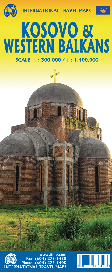
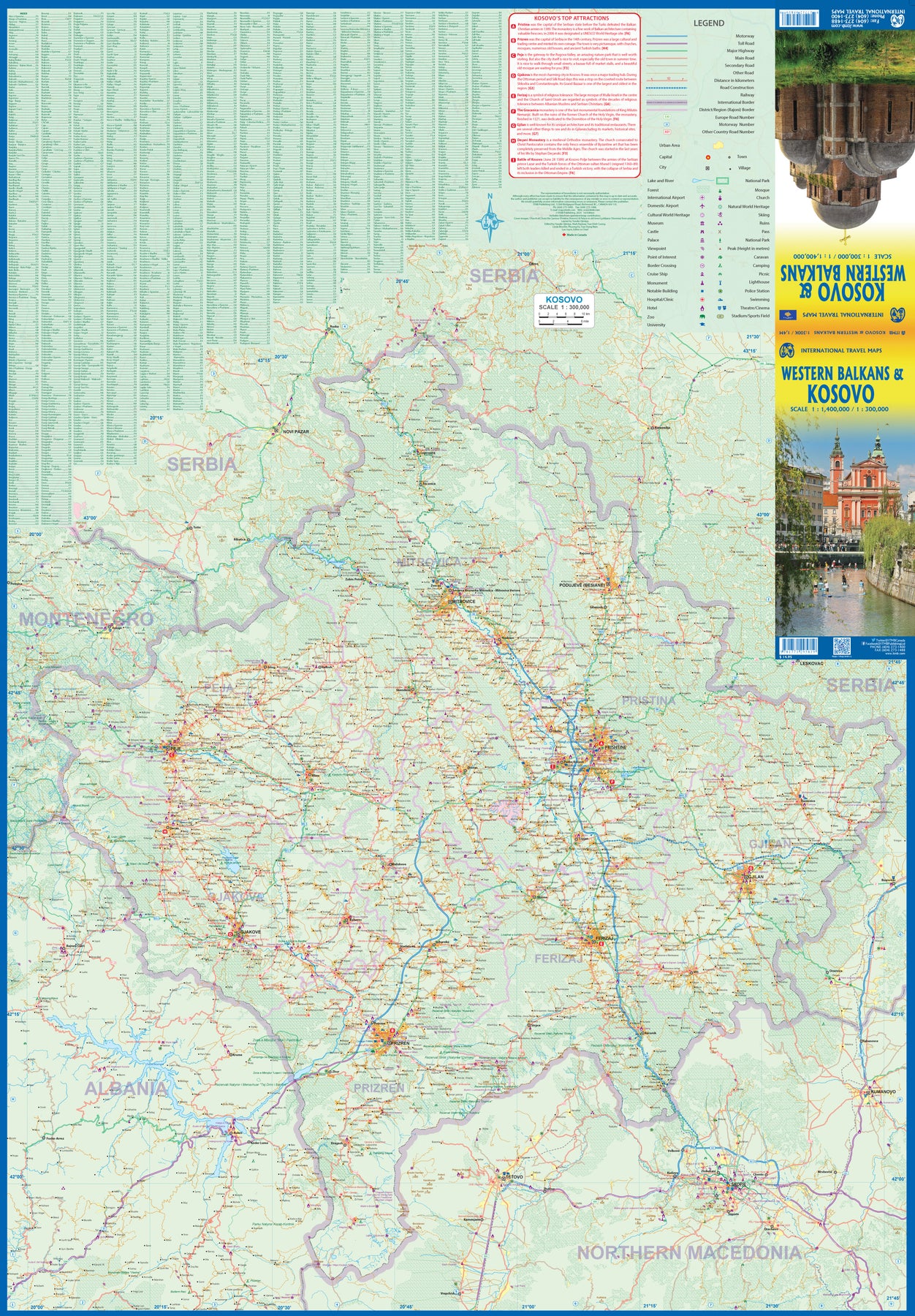
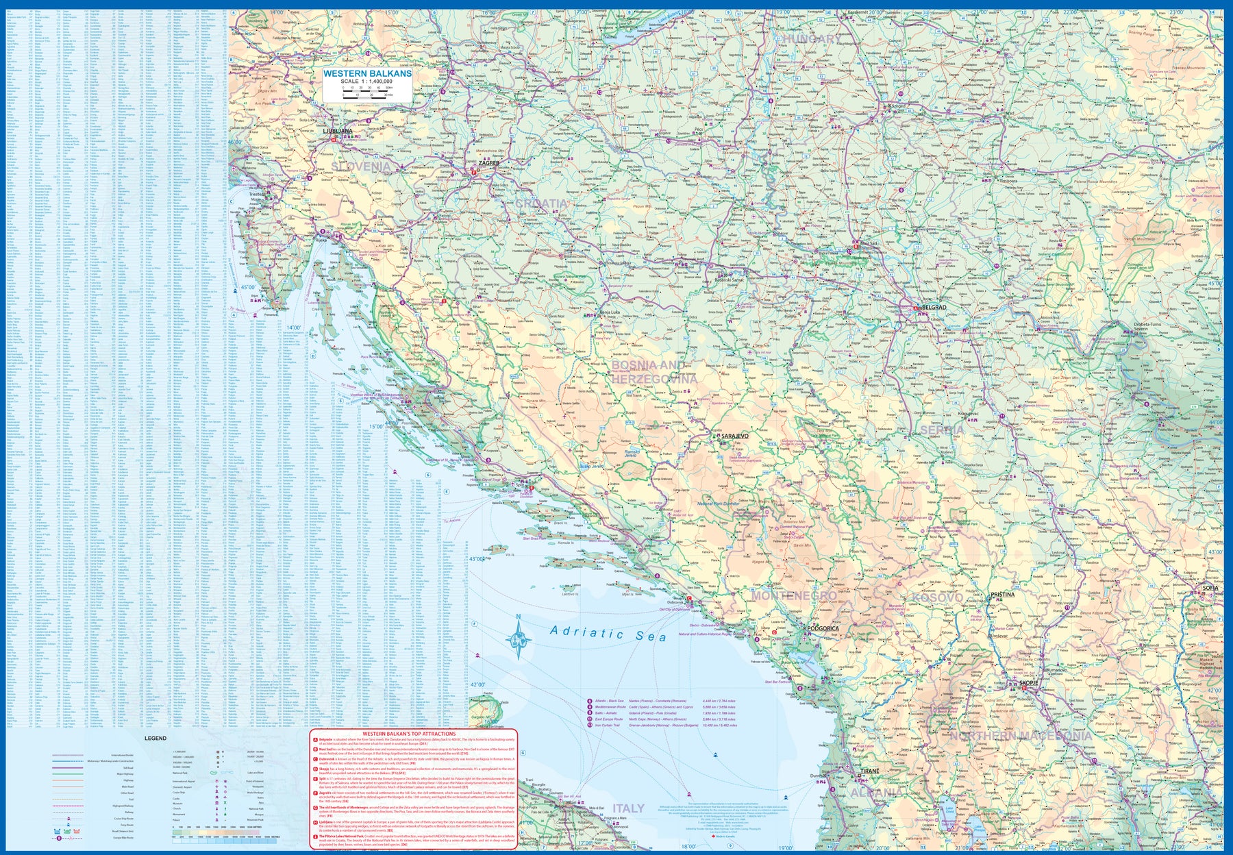
Kosovo & Western Balkans
Ordinær pris 199,00 kr/
Mva inkludert
Frakt beregnes i kassen.
Kosovo is the country that shouldn't exist, but does. When Yugoslavia fell to pieces after Tito died, Kosovo was lumped in with Serbia but was very unhappy with being a part of an Eastern Orthodox regime. It broke away, resulting in genocidal fighting until the Americans stepped in and stopped the fighting. The region was then placed under a European Union control in the faint hope that it would merge with Albania, or Montenegro, but it didn't. Relations with Serbia are still quite strained, but Kosovo is still surviving as a mountainous Balkan state. Fought over for centuries by Turks and Serbs, Kosovo is emerging as a small but touristic European country. This is definitely an off-the-beaten-path travel destination!
The second side of the sheet provides an excellent regional coverage for the Western Balkans, essentially Slovenia, Croatia, Montenegro, Serbia, and reasonably large tracks of land for Hungary, Albania, and North Macedonia, showing the growing number of wilderness parks being created.
- Publisert: 2023
- Innbinding: Falset
- Materiale: Papir
- Målestokk: Kosovo 1:300 000 - Balkans 1:1 400 000