1353 produkter
1353 produkter


1353 produkter
Ireland
Ordinær pris 299,00 krRikt illustrerte bøker med mye bakgrunnstoff. Insight går nøye til verks både når det gjelder historie, kultur og bakgrunn, før de tar for seg de forskjellige delene av området tittelen dekker, en etter en. Serien er kjent for sine fantastiske fotografier og er derfor svært populære ”før-reisen-bøker” - til planlegging og dagdrømming. Bøkene er dessuten egnet for den som ikke behøver bekymre seg stort over bosted og transport under reisen, men kan konsentrere seg om å lese bakgrunnstoff. Utfyllende sammen med for eksempel lonely planet. Populære gaver!
Insight Guide to Ireland er en billedlig reiseguide i magasinstil som gir svar på nøkkelspørsmålene før eller under reisen: å bestemme når du skal til Irland, velge hva du skal se, fra toppattraksjoner som Giants Causeway, Glendalough og Glens of Antrim, til kulturelle perler som landskapet i Connemara, Aran øyene og the Rock of Cashel. Dette er en ideell reiseguide for reisende som søker inspirasjon, dyptgående kulturell og historisk informasjon om Irland samt et stort utvalg av steder å se under reisen.
Lonely Planet Pocket: Barcelona
Ordinær pris 169,00 krLonely Planet Pocket er en pocket-serie med uttagbart kart. Bøkene gir deg den viktigste informasjonen om høydepunktene I destinasjonen, restauranter, barer og noe overnatting.
Lonely Planet Denmark & Faroe Islands
Ordinær pris 279,00 krDiscover Denmark & the Faroe Islands's most popular experiences and best kept secrets from getting creative at Lego House, an interactive temple to the most famous design toy; to admiring the artful deliciousness of traditional Danish smørrebrød (open sandwiches) at Copenhagen’s Selma; and cycling the 10km loop trail in Wadden Sea National Park. Build a trip to remember with Lonely Planet's Denmark & the Faroe Islands travel guide: Our classic guidebook format contains the most comprehensive level of information for planning multi-week trips. All-new structure and design that's easy to use so you can navigate Denmark & the Faroe Islands effortlessly. Exciting itineraries help you create your perfect adventure with suggestions for extended journeys, day trips, walking tours and activity-led excursions. Expert local recommendations on eating, drinking, nightlife, shopping, accommodation, festivals, when to go and more.
Covers: Copenhagen; Zealand; Bornholm & the South Sea Islands; Funen; Ribe & Southern Jutland; Aarhus, Central & Northern Jutland; The Faroe Islands.
Lonely Planet Belgium & Luxembourg
Ordinær pris 279,00 krLonely Planet’s Belgium & Luxembourg is our most comprehensive guide that extensively covers all the countries have to offer, with recommendations for both popular and lesser-known experiences. Wander through Brussels’ Grand Place, explore the caves of the Ardennes, and indulge in Belgian chocolate and beer; all with your trusted travel companion.
Inside Lonely Planet’s Belgium & Luxembourg Travel Guide: Up-to-date information. NEW top experiences feature - a visually inspiring collection of Belgium & Luxembourg’s best experiences and where to have them Planning tools for family travellers - where to go, how to save money, plus fun stuff just for kids NEW pull-out, passport-size 'Just Landed' card with wi-fi, ATM and transport info - all you need for a smooth journey from airport to hotel Highlights and itineraries help you tailor your trip to your personal needs and interests Eating & drinking in Belgium & Luxembourg - we reveal the dishes and drinks you have to try. Colour maps and images throughout Insider tips to save time and money and get around like a local, avoiding crowds and trouble spots Honest reviews for all budgets - eating, sleeping, sightseeing, going out, shopping, hidden gems that most guidebooks miss Cultural insights give you a richer, more rewarding travel experience - history, people, music, landscapes, wildlife, politics Over 39 maps Covers Brussels, Brugge, Ghent, Northwest Belgium, Antwerp & Northeast Belgium, Wallonia, Luxembourg.
Berlin
Ordinær pris 249,00 krWhatever your dream trip involves, this DK travel guide is the perfect companion. Our updated guide brings Berlin to life, transporting you there like no other travel guide does with expert-led insights, trusted travel advice, detailed breakdowns of all the must-see sights, photographs on practically every page, and our hand-drawn illustrations, which take you inside the city's buildings and neighbourhoods.
TOP 10: Cornwall & Devon
Ordinær pris 169,00 krWith golden sandy beaches, picturesque fishing villages, and legendary castles, Cornwall and Devon have long captured the imagination of all who visit. Make the most of your trip to England's seaside paradise with DK Eyewitness Top 10. Planning is a breeze with our simple lists of ten, covering the very best that Cornwall and Devon have to offer and ensuring that you don't miss a thing.
Best of all, the pocket-friendly format is light and easily portable; the perfect companion while out and about.
Florence & Tuscany
Ordinær pris 249,00 krMake your trip to Florence and Tuscany extraordinaryAdmiring masterpieces in the Uffizi. A leisurely drive along cypress-lined backroads. Feasting on hearty Tuscan cuisine.
There are many reasons to visit Florence and Tuscany. Whatever your dream trip involves, this DK travel guide is the perfect companion. Our updated guide brings Florence and Tuscany to life, transporting you there like no other travel guide does with expert-led insights, trusted travel advice, detailed breakdowns of all the must-see sights, photographs on practically every page, and our hand-drawn illustrations, which take you inside the region’s buildings and neighbourhoods.
Mallorca & Menorca
Ordinær pris 259,00 krDenne praktiske reiseguiden til Mallorca & Menorca inneholder detaljerte reisetips og oversikt over de mest ikoniske severdigheter, samt noen skatter utenfor allfarvei. Med forslagene til reiseruter og ekspertforfatterens utvalg av ting å se og gjøre blir denne boken til en perfekt følgesvenn både i forkant og underveis på turen. Denne Mallorca & Menorca-guideboken er fullpakket med detaljer om hvordan du kommer deg dit og rundt, informasjon før avreise og topp tidsbesparende tips, inkludert en visuell liste over ting du ikke bør gå glipp av. Våre fargekodede kart gjør Mallorca & Menorca enklere å navigere mens du er der.
Glimrende bakgrunnstoff og gode kart kjennetegner rough guides. Dette er en av de mest populære guidebokseriene, beregnet for folk som reiser på egenhånd. Fyldige men ikke avskrekkende, verken I pris eller størrelse. Her finner du informasjon av praktisk og kuriøs karakter, skrevet av engasjerte og kunnskapsrike forfattere. Anbefales spesielt for europeiske reisemål, ettersom serien har lengst erfaring fra dette kontinentet.
France
Ordinær pris 299,00 krMake your trip to France extraordinary! A stroll through the lavender fields of Provence. Wine tasting in Bordeaux. Gallery hopping in Paris.
With so much to see and do, France is a must-visit. Whatever your dream trip involves, this DK travel guide is the perfect companion. Our updated guide brings France to life, transporting you there like no other travel guide does with expert-led insights, trusted travel advice, detailed breakdowns of all the must-see sights, photographs on practically every page, and our hand-drawn illustrations, which take you inside the country’s buildings and neighbourhoods.
Rough Guides Mini: Gran Canaria
Ordinær pris 149,00 krThis pocket-sized travel guide to Gran Canaria is a convenient, quick-reference companion to discovering what to do, what to see and how to get around the destination. It covers top attractions like Las Palmas, as well as hidden gems, including Parque San Telmo. Our Gran Canaria guide book will save you time and enhance your exploration of this fascinating island.
Albania
Ordinær pris 199,00 krGreat Railway Journeys in Europe
Ordinær pris 449,00 krGreat Railway Journeys in Europe features 34 fascinating journeys in North-West, Nordic, Central, Southern and South-East Europe, ranging from cross-continental adventures to short, nostalgic excursions by steam train. There are journeys through stunning scenery, such as the trip on The Rauma Line in Norway; tracks that defy the terrain, such as the routes through the Swiss Alps, and journeys that link famed cities in France, Spain, Austria and Italy. Photographs illustrate the spectacular routes, remarkable locomotives and unique station architecture.
For each journey, details cover technical information on the track, descriptions of the scenery the trains pass through, notable facts about the destinations and factual information on ticketing. Each journey is plotted on a route map. Whether you are planning a special trip by train or delighting in discovering Europe's best railway journeys from the comfort of your armchair, this book is an informative and entertaining read.
Lonely Planet Your Trip Starts Here
Ordinær pris 409,00 krEmbark on over 50 of the world's most life-affirming journeys and nurture your path to self-discovery. Packed with beautiful photography and inspiring first-person insights for each trip, from hiking Japan's sacred Shikoku pilgrimage to following the Underground Railroad in the US. This is the perfect book for anyone seeking to travel with purpose.
Each journey features first-hand accounts from travellers with insightful tips on how to begin planning an enlightening travel experience. From cultural explorations to challenging expeditions, travellers can spend a month of reflection on foot through Northern Spain to reach the Cathedral of Santiago de Compostela; connect body and mind as they canoe the wild and remote Yukon River in Canada; embrace the wonders of rail travel aboard Australia's luxurious Ghan; plus so much more.
Your Trip Starts Here is the ultimate travel book for anyone longing to immerse themselves in a different culture, grow as a person or reflect and reset their focus. Gift this collection of journeys to the explorer in your life who wishes to travel with purpose or inspire your own adventure using this unique guide.
Lonely Planet Stockholm
Ordinær pris 119,00 krLonely Planet City Map er slitesterkt og vanntett, med en hendig slipcase og et format som er lett å brette. Få mer ut av kartet og reisen din med bilder og informasjon om byattraksjoner, transportkart, reiseruteforslag, omfattende gate- og nettstedsindeks og praktiske reisetips. Med dette brukervennlige navigasjonsverktøyet i baklommen kan du virkelig komme til hjertet av din destinasjon!
682 Penisola; Sorrentina; Costiera Amalfitana
Ordinær pris 249,00 krKompass sine vandrekart er av de aller beste til sitt bruk, de er lettleste, detaljerte og oppdaterte! De spesialiserer seg på Sentral-Europa (de tysktalende landene samt Italia og Spania), hvor de er de mest solgte vandrekartene hos Nomaden. De har selvfølgelig GPS-koordinater, samt en liten guide følger hvert kart, men vær oppmerksom på at denne er på tysk!
240 Fuerteventura
Ordinær pris 209,00 krKompass sine vandrekart er av de aller beste til sitt bruk, de er lettleste, detaljerte og oppdaterte! De spesialiserer seg på Sentral-Europa (de tysktalende landene samt Italia og Spania), hvor de er de mest solgte vandrekartene i vår butikk. De har selvfølgelig GPS-koordinater, samt en liten guide følger hvert kart, men vær oppmerksom på at denne er på tysk!
Bosnia-Herzegovina & Montenegro
Ordinær pris 169,00 krBosnia-Herzegovina and Montenegro at 1:350,000 on a light, waterproof and tear-resistant, double-sided indexed map published by Reise-Know-How as part of their highly acclaimed World Mapping Project. Altitude colouring with names of numerous mountain ranges, peaks, etc, provides a very good picture of the region’s topography. The whole of Montenegro is shown on one side, and coverage includes Croatian coast south of Sibenik. Within Bosnia, internal administrative boundaries show Republica Srpska where names of main towns are also given in the Cyrillic alphabet.
Road network indicates gravel roads and includes selected local tracks and paths. Scenic routes are highlighted and driving distances marked on main routes. Railway lines are included, local airfields are marked, and along the Croatian coast ferry routes are shown. Internal administrative boundaries are presented with names of the provinces. Symbols highlight various places of interest and facilities, including campsites and mountain refuges, cultural and historical heritage, beaches, etc. Longitude and longitude lines are drawn at 20’ intervals. Map legend includes English.
Croatian Coast
Ordinær pris 199,00 kr545 Germany Southwest
Ordinær pris 169,00 krMichelin er en av verdens beste, og best kjente, kartserier. Kartene har glimrende kartografi.
355 Italia: Veneto
Ordinær pris 169,00 krLonely Planet Madrid
Ordinær pris 119,00 kr
Lonely Planet City Map er slitesterkt og vanntett, med en hendig slipcase og et format som er lett å brette. Få mer ut av kartet og reisen din med bilder og informasjon om byattraksjoner, transportkart, reiseruteforslag, omfattende gate- og nettstedsindeks og praktiske reisetips. Med dette brukervennlige navigasjonsverktøyet i baklommen kan du virkelig komme til hjertet av din destinasjon!
Norway South
Ordinær pris 199,00 krTysk kartserie med flotte kart på slitesterkt plastpapir.
Danmark
Ordinær pris 199,00 kr3020 Dovrefjell Øst
Ordinær pris 259,00 krTopo 3000 er et detaljert kart som dekker over 3000 km2. I Dovre kan du ta turen til fots eller på ski gjennom flotte naturlandskap i fjellheimen. Noen populære turer er Bratthøa, Rødalshøa eller Moskusstien. Dovre har et rikt dyreliv og du kan møte både villrein, jerv, fjellrev, ravn, kongeørn, eller moskus på turen. Her finner du turer som: Stororkelhøa 4 km, Natursti i Savalen 8,3 km og Moskusstien på Dovrefjell 12,9 km. Eksempel på hytter: Kongsvold Fjeldstue (betjent), Orkelsjøhytta (ubetjent).
Sunnmørsalpene
Ordinær pris 249,00 krSunnmørsalpene er et av de vakreste fjellandskapene i Norge. Her finner du krevende randonee - klassikere som Slogen, Randers Topp og Kolåstinden. Det er dramatisk og luftig - fjellene stuper gjerne rett ned i fjorden og gir en følelse av skikkelig høyfjell ulikt det meste av Norge.
Tyvek er et spesielt materiale som oprinnelig kommer fra bygg- og anleggsbransje. Det er basert på en form for vevde plast-tråder som gjør det ekstremt slitesterkt! Kartene våre er trykket på Tyvek. De er fullt lesbare og brukbare, men de er også helt umulig å rive, krølle eller bløte til. Tyvek er vannresistent, og selv når det blir vått vil det ikke bli ødelagt som alminnelige papirkart. Dette er en egenskap alle kartene fra Fri Flyt og Calazo har!
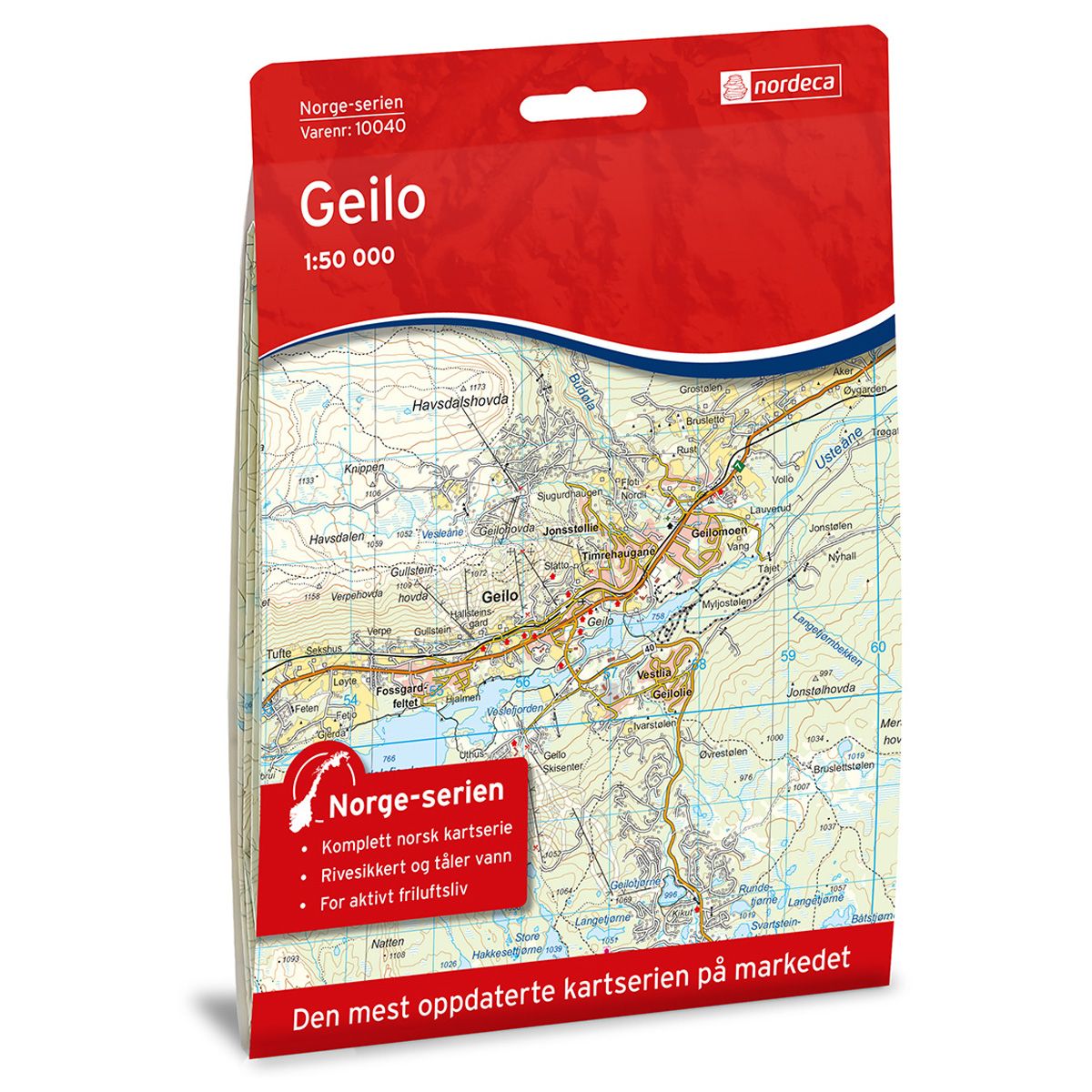
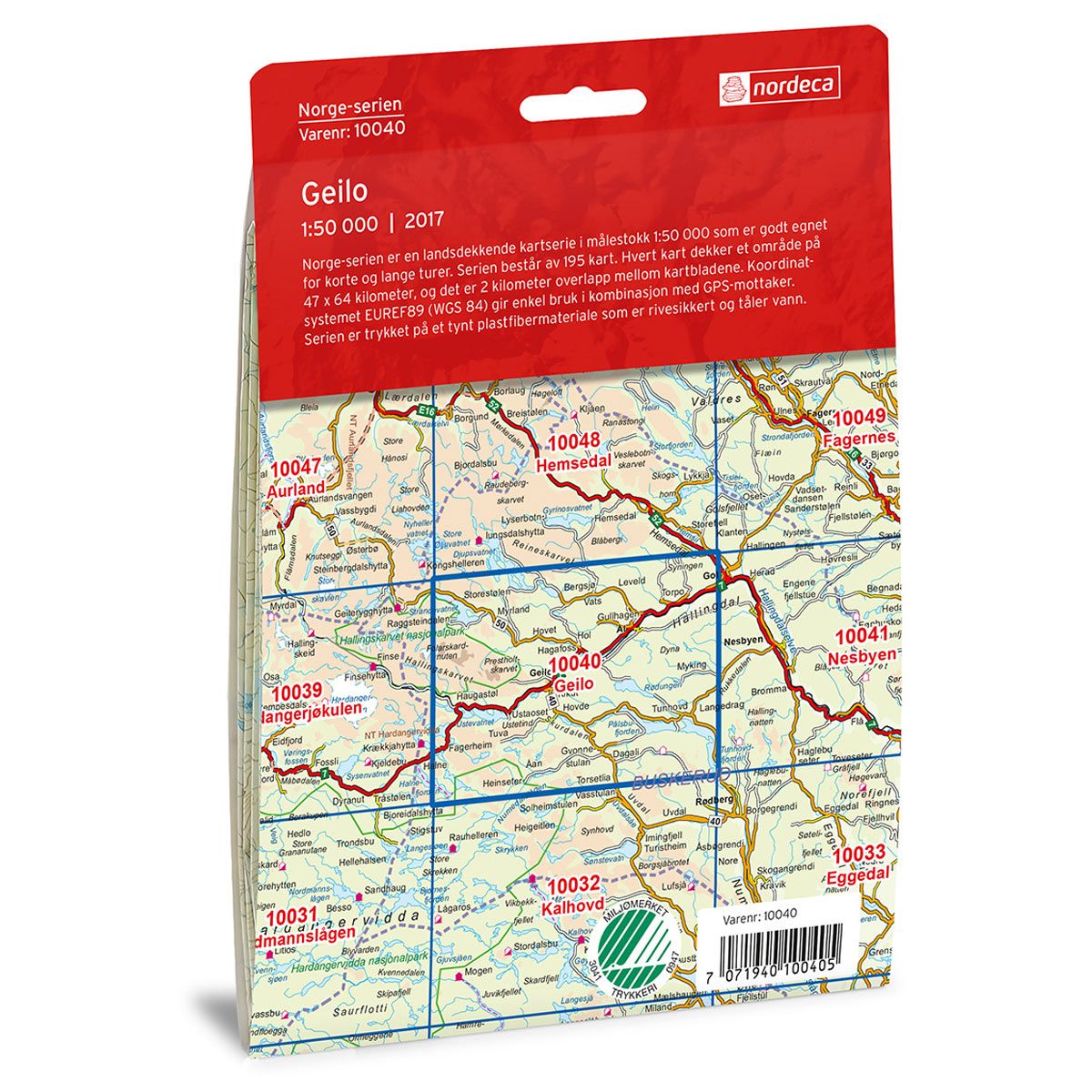
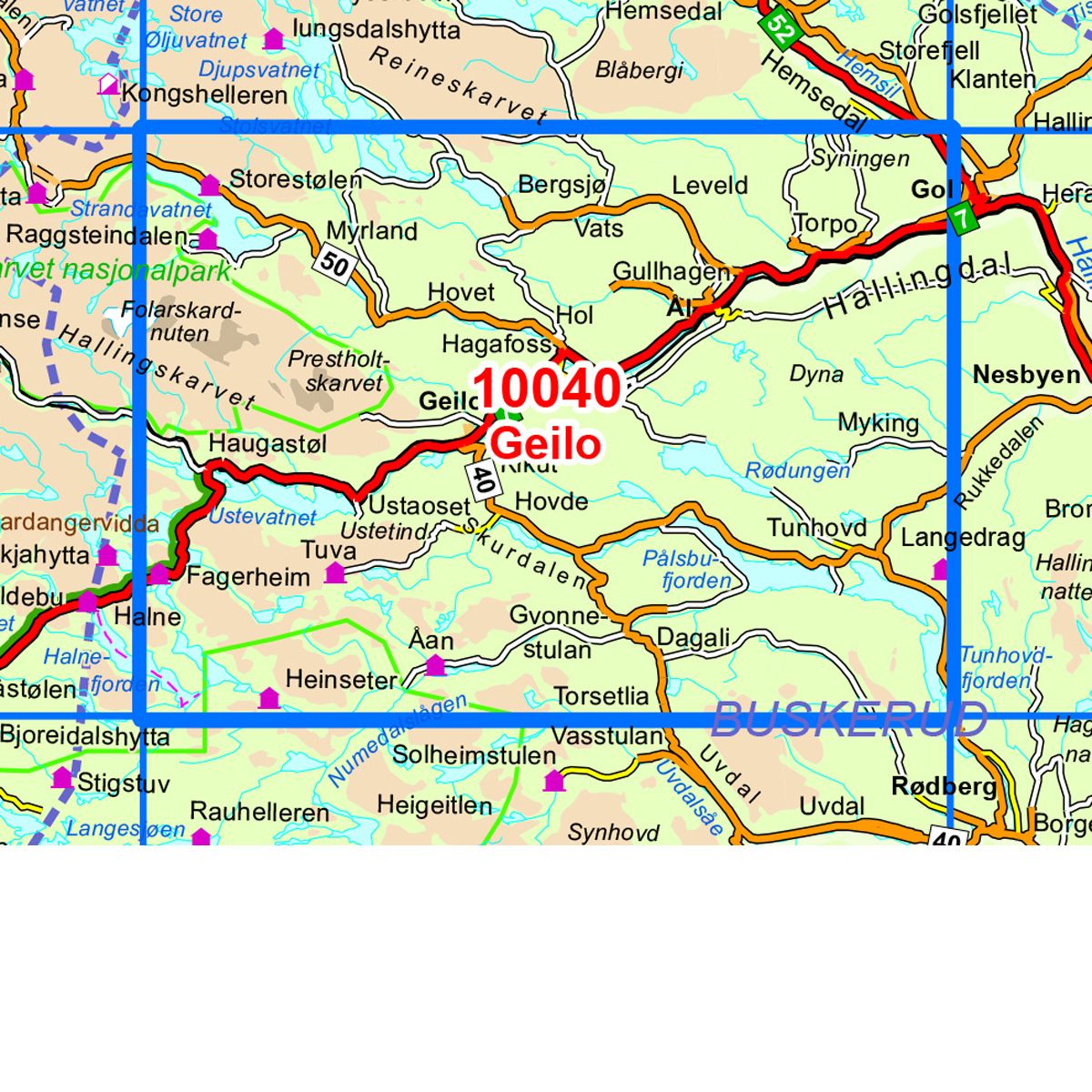
10040 Geilo
Ordinær pris 259,00 krNorge-serie kartet Geilo i målestokk 1:50 000 er trykket på et slitesterkt resirkulerbart plastfibermaterial som tåler vann. Kartet egner seg for turgåere, jegere, fiskere og brukes blant annet av redningskorpsene. Norge-serien er en landsdekkende kartserie og er derfor også populær for de som går lengre turer.
Overlapp på alle kart gjør det enkelt å navigere mellom kartene.