1353 produkter
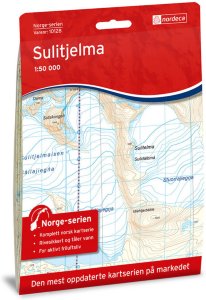
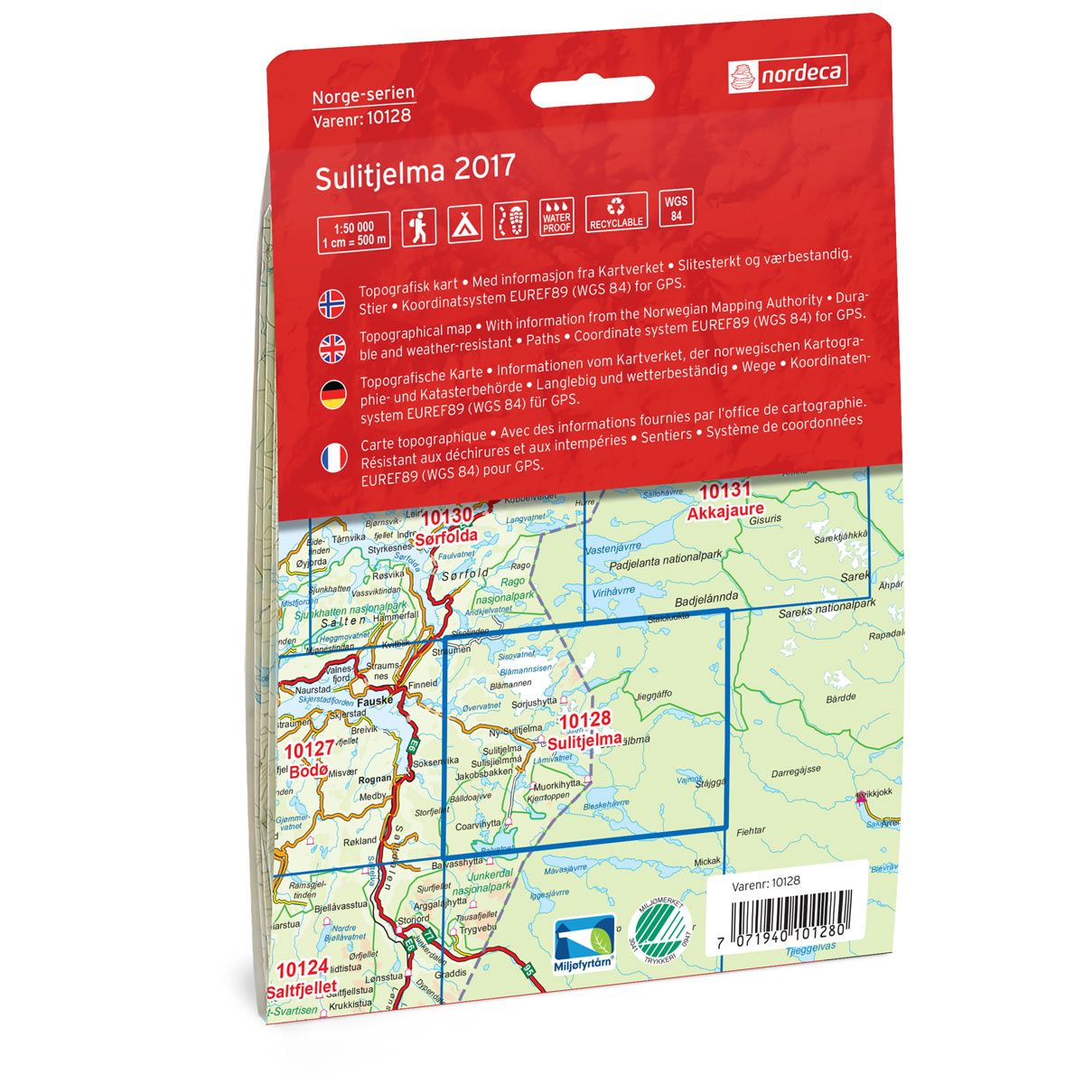
10128 Sulitjelma
Ordinær pris 259,00 krNorge-serien er en landsdekkende kartserie i målestokk 1:50 000 som er godt egnet for korte og lange turer. Kartene er velegnet til tur- og fritidsbruk på fjellet, i skogen, langs kysten og til jakt og fiske. For profesjonelle virksomheter gir kartene nødvendig kunnskap om terreng og geografi for planlegging og utøvelse.
Hvert kart dekker et område på 47x64 kilometer, og det er 2 kilometer overlapp mellom kartbladene.
Kartene i Norge-serien er trykket på et tynt plastfibermateriale som tåler vann og er vanskelig å rive i stykker. Kartene tåler store fysiske påkjenninger og vil være et perfekt kart for tur i all slags vær.
Publisert år: 2017
Innbinding: falset
Material: plastfiber
Målestokk: 1:50000
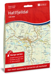
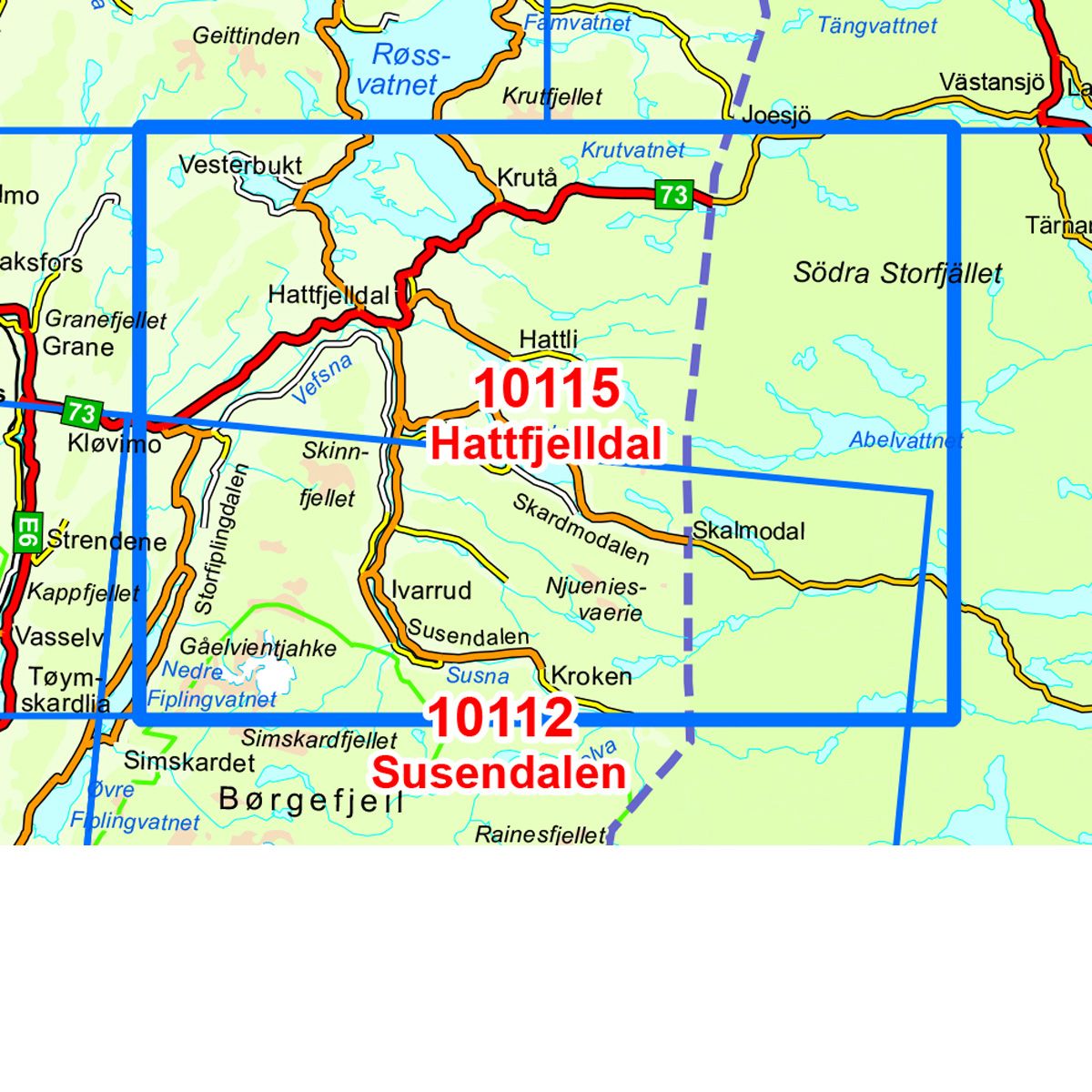
10115 Hattfjelldal
Ordinær pris 259,00 krNorge-serie kartet Hattfjelldal i målestokk 1:50 000 er trykket på et slitesterkt resirkulerbart plastfibermaterial som tåler vann. Kartet egner seg for turgåere, jegere, fiskere og brukes blant annet av redningskorpsene. Norge-serien er en landsdekkende kartserie og er derfor også populær for de som går lengre turer.
Overlapp på alle kart gjør det enkelt å navigere mellom kartene.
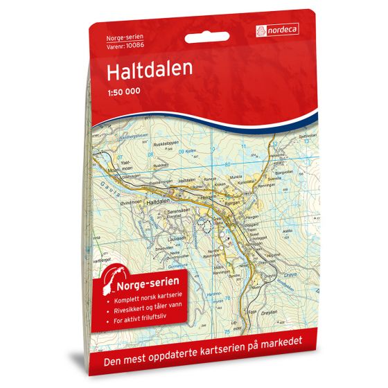
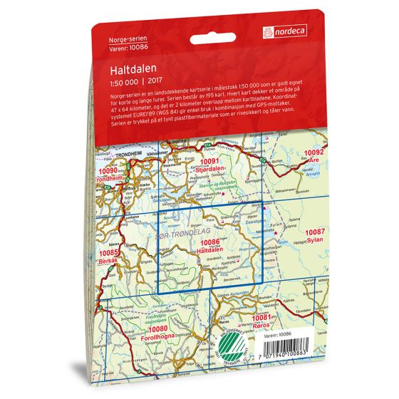
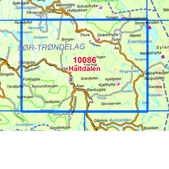
10086 Haltdalen
Ordinær pris 259,00 krNorge-serien er en landsdekkende kartserie i målestokk 1:50 000 som er godt egnet for korte og lange turer. Kartene er velegnet til tur- og fritidsbruk på fjellet, i skogen, langs kysten og til jakt og fiske. For profesjonelle virksomheter gir kartene nødvendig kunnskap om terreng og geografi for planlegging og utøvelse.
Hvert kart dekker et område på 47x64 kilometer, og det er 2 kilometer overlapp mellom kartbladene.
Kartene i norge-serien er trykket på et tynt plastfibermateriale som tåler vann og er vanskelig å rive i stykker. Kartene tåler store fysiske påkjenninger og vil være et perfekt kart for tur i all slags vær.
10013 Hvaler
Ordinær pris 259,00 krNorge-serien er en landsdekkende kartserie i målestokk 1:50 000 som er godt egnet for korte og lange turer. Kartene er velegnet til tur- og fritidsbruk på fjellet, i skogen, langs kysten og til jakt og fiske. For profesjonelle virksomheter gir kartene nødvendig kunnskap om terreng og geografi for planlegging og utøvelse.
Hvert kart dekker et område på 47 x 64 kilometer, og det er 2 kilometer overlapp mellom kartbladene.
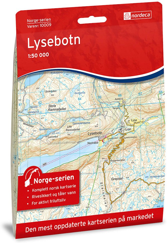
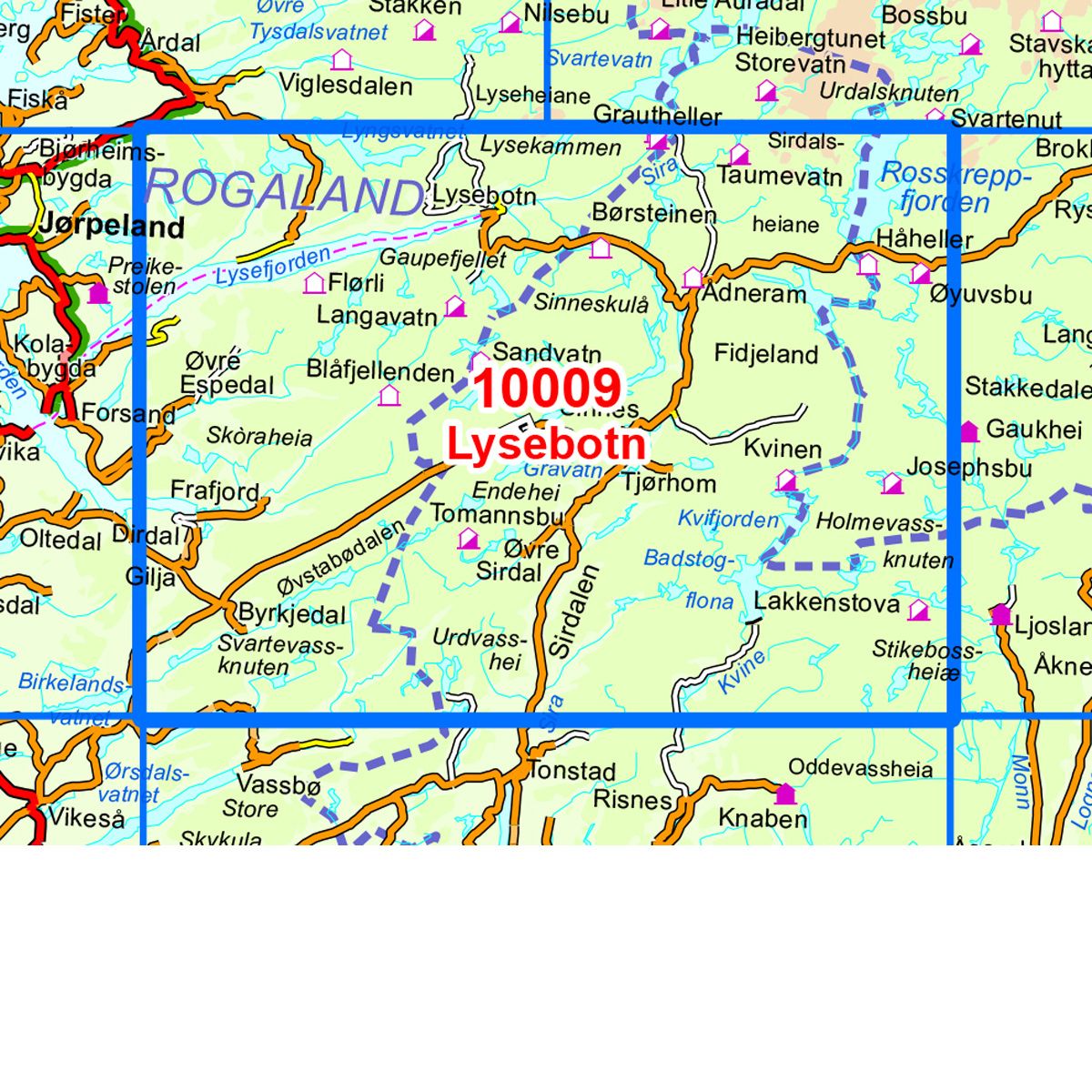
10009 Lysebotn
Ordinær pris 259,00 krNorge-serie kartet Lysebotn i målestokk 1:50 000 er trykket på et slitesterkt resirkulerbart plastfibermaterial som tåler vann. Kartet egner seg for turgåere, jegere, fiskere og brukes blant annet av redningskorpsene. Norge-serien er en landsdekkende kartserie og er derfor også populær for de som går lengre turer. Overlapp på alle kart gjør det enkelt å navigere mellom kartene.
Atlanterhavsvegen
Ordinær pris 249,00 kr6006 The Atlantic Coast - Dovrefjell
Ordinær pris 249,00 krOpplevelsesguide The Atlantic Coast tar for seg E6-strekningen fra Dombås til Trondheim, strekningen gjennom Romsdalen fra Dombås til Molde og strekningen fra Molde til Trondheim via Kristiansund med avstikkere langs veien.
Kartet har 102 attraktioner/severdigheter/aktiviteter, noen eksempler er: Trollstigen, Atlanterhavsvegen, Dalsnibba, Nidaros Domkirke, Kvernes stavkirke, Viewpoint Snøhetta, Ergan kystfort.
2691 Sunnmørsalpene Vest
Ordinær pris 259,00 kr2573 Nesbyen
Ordinær pris 259,00 krTurkartserien fra Nordeca er laget i samarbeid med Den Norske Turistforeningen (DNT) og inneholder DNTs stier, hytter og annen nyttig turinformasjon. Enkelte av kartene har også skiløyper.
Med Nesbyen og Rukkedalen midt i kartet dekkes fjellet mot vest til Dyna og mot øst til Vassfaret. Gol avgrenser kartet i nord og Tunhovdfjorden i sør. Her finner man et omfattende turtilbud både sommer og vinter.
Walking in Catalunya - Girona Pyrenees
Ordinær pris 329,00 krThe delights of Spain's Catalunya - Girona Pyrenees region are revealed in this new walking guide, which covers 35 graded walks of 5 to 19km across Garrotxa, Ripolles and the Cadi-Moixero Natural Park. Walks are included for all abilities, from easy strolls to more demanding walks, and some of the walks are accessible by public transport. The guide provides detailed route descriptions, either 1:25k or 1:50k mapping for each route and a route summary table to help with choosing appropriate walks.
All the walks are illustrated with stunning photos. A list of local campsites and other useful contacts is included at the back, plus notes on refreshment opportunities along the routes. There's also background information on local geology, wildlife and history, and planning details on when to go, where to stay and what to take.
Leave behind Girona's medieval walls, narrow cobbled streets and colourful riverside and you will find a network of trails through the countryside surrounding Girona. The diverse landscapes range from lush mountains to idyllic wine country, medieval stone bridges to fresh mountain rivers, plus volcanic zones and rugged mountain peaks with far-reaching views. Walking is the best way to explore the region.
Trekking Italy Grande Traversata delle Alpi
Ordinær pris 349,00 krA guidebook to Italy's Grande Traversata delle Alpi (GTA) trek through the western Italian Alps. The 809km (503 mile) route is presented in 55 stages with each stage ranging from 7-26km (4-16 miles). Beginning at the Nufenen pass at the Swiss border the route traverses the Lepontine, Pennine, Graian, Cottian and Maritime Alps to finish at Ventimiglia on the Mediterranean coast.
With nearly 60,000m of ascent this route is suitable for fit and experienced alpine trekkers. This guidebook contains route description and 1:100,000 mapping for each stage as well as information on the region's history, culture and wildlife. Accommodation, facilities and public transport information is also given to help with trek planning.
Italy's western Alps is an area of high mountain passes, sparkling lakes, clean air, and alpine meadows rich in wildflowers. With a network of paths that enabled travel long before the motor car, the region is ideally suited to exploring on foot. From Switzerland to the Mediterranean, the GTA enables the visitor to travel the old ways through the mountains, hearing the stories, sampling the regional specialties in food and wine, and experiencing the famously warm welcome of the Italian people.
Rough Guides Mini: Kefalonia
Ordinær pris 149,00 krThis pocket-sized travel guide to Kefalonia is a convenient, quick-reference companion to discovering what to do, what to see and how to get around the destination. It covers top attractions like Myrtos beach, Paliki Peninsula, Navagio Beach as well as hidden gems, including Lixouri and Anogi. Our Kefalonia guide book will save you time and enhance your exploration of this fascinating region.
Rough Guides Mini: Naples & The Amalfi Coast
Ordinær pris 149,00 krThis pocket-sized travel guide to Naples & the Amalfi Coast is a convenient, quick-reference companion to discovering what to do, what to see and how to get around the destination. It covers top attractions like Campi Flegrei, The Blue Grotto, Pompeii's Villas, the Museo Nazionale di Capodimonte, Piazza del Plebiscito as well as hidden gems, including Piazza San Domenico Maggiore and Castello Aragonese. Our Naples & the Amalfi Coast guide book will save you time and enhance your exploration of this fascinating region.
2517 Hallingskarvet
Ordinær pris 259,00 kr3018 Gaustatoppen
Ordinær pris 259,00 krTopo 3000 er et detaljert kart som dekker over 3000 km2. Fra Gaustatoppens (1883 moh.) vide utsikt kan du se en sjettedel av Norge. Våre turløyper tar deg raskt ut i områdets storslagne natur. Her kan du også ta Gaustabanen, en kabelbane som går inne i selve Gaustatoppen. Kartet dekker også Blefjell og Bletoppen. Her finner du turer som: Gamle Kongsbergveien og Austbygdebakkan 4,6 km, Bjårvatn rundt 16,2 km og Venåsfjellet 4,5 km. Eksempel på hytter: Gaustatoppen turisthytte (betjent), Daggrøhytta, Eriksbu (ubetjente).
2495 Øyer - Lillehammer
Ordinær pris 259,00 krFjellområdene mellom Gudbrandsdalen og Østerdalen gir mange muligheter for aktiv fritid. Ski og vinteraktiviteter, sommer på sykkel eller til fots - turkartet viser merkede og umerkede stier og løyper, turmål og servicetilbud.Turkartet strekker seg fra Mesnali og Sjusjøen i sør til Goppollen i nord.
Rough Guides Mini: Mallorca
Ordinær pris 149,00 krThis pocket-sized travel guide to Mallorca is a convenient, quick-reference companion to discovering what to do, what to see and how to get around the destination. It covers top attractions like Palma Cathedral, Cala Deia, Platja de Formentor and Coves del Drac, as well as hidden gems, including Estellencs and Colonia de Sant Jordi. Our Mallorca guide book will save you time and enhance your exploration of this fascinating region.
This Mallorca travel guide has been fully updated post-COVID-19. This Mini Rough Guide to MALLORCA covers: Palma, Sineu, Petra, Serra de Tramuntana, Soller, Estellencs, Banyalbufar, Deia, Fornalutx, Valldemossa, Lluc, Pollenca, Port de Pollenca, Port d'Alcudia, Peninsula de Formentor, Serres de Llevant, Cala Ratjada, Porto Petro, Arta. In this guide book to Mallorca you will find: RECOMMENDATIONS FOR EVERY TYPE OF TRAVELLER Experiences selected for every kind of trip to Mallorca, from cultural explorations in Sineu to family activities in child-friendly places, like Castell d'Alaro or or chilled-out breaks in popular tourist areas, like Palma.
Rough Guides Mini: Valencia
Ordinær pris 149,00 krUK: Kent
Ordinær pris 239,00 krRough Guides Mini: Lanzarote & Fuerteventura
Ordinær pris 149,00 krIn this Lanzarote and Fuerteventura guidebook, you will find:- Curated recommendations of places - expert picks of main attractions, child-friendly activities and relaxing spots, plus where to take the best photos- What's new, when to go and sustainable travel - all-new features direct you to what you need to know- Things not to miss in Lanzarote and Fuerteventura - Teguise, Fuerteventura's windmills, Betancuria, Timanfaya, Pájara, Costa Calma, El Jable dunes, Fundácion César Manrique, Cueva de los Verdes, Puerto del Carmen- Three unique trip plans - itinerary suggestions for those on a short break, including one for a Perfect tour- Food and drink - recommendations for local specialities and the best dining experiences- What to do in Lanzarote and Fuerteventura - recommendations for entertainment, shopping, sports, children's activities, events and nightlife.
Canary Island Walks
Ordinær pris 249,00 krThe go-to travel guide for discovering the best walks on the Canary Islands; Strap on your boots and discover the Canary Islands on foot with the Sunflower Canary Islands Walks travel guide. The Sunflower Canary Islands Walks guide is indispensable for walking and hiking on all 7 Canary Islands - Tenerife, Gran Canaria, Lanzarote, Fuerteventura, La Palma, La Gomera and El Hierro. This handy, pocket-sized full-colour guide describes walks on each of the main islands and all are illustrated with photographs and large-scale topographical maps.
Sunflower is the renowned publisher of the 'Landscapes' guides and have been dubbed the 'blue Bibles' by the Sunday Times but, unlike the 'Landscapes' series, this guide focuses on the walks - the most popular feature of Sunflower guides. In addition to the walks we include detailed information on inter-island travel by boat and plane for 'island hopping' so you can walk from island to island. Whatever your age or ability we've got some glorious walks to ensure you have a memorable holiday on the Canary Islands.
Like a Local: Dublin
Ordinær pris 219,00 kr Salgspris 109,50 kr Spar 50%Experience Dublin the local way with this insider's guide Home to vibrant art centres, leafy urban parks and a nightlife scene like no other, this convivial city is endlessly enticing. But it's not all about Trinity College and the lively pubs that line Temple Bar. Beyond the well-trodden sights there's a secret side of the city - and who better to guide you to it than the locals? This insider's guide is packed with recommendations from Dubliners in the know, helping you to discover all their favourite hangout spots and hidden haunts.
Enjoy the craic at a whiskey bar near Stephen's Green, take a dip in the Irish Sea at Sandycove and browse artisan markets in the city's quieter Georgian squares. Whether you're a Dubliner looking to uncover your city's secrets or a traveller seeking an authentic experience beyond the tourist track, this stylish guide makes sure you experience the real side of Dublin.
Road Trips: Ireland
Ordinær pris 249,00 krWinding rural roads, lush verdant valleys, endless miles of untamed coastline: Ireland is the perfect destination for a road trip to remember. With Road Trips Ireland, it's yours to explore. Featuring 25 wonderful drives across the country and packed with detailed driving instructions and practical information, this easy-to-use guide helps you discover Ireland at its best.
Inside, you'll find: 25 easy-to-follow scenic driving tours, each lasting two to five days. Our pick of the best places to stay, eat and shop. Ways to see more of each area enroute, including great viewpoints, delightful detours, walks through historic towns and villages, outdoor activities, and various tours and trips. Rules of the road, addresses for satnavs, detailed directions for easy navigation, road conditions and parking tips, and useful travel, visa and health information. A laminated pull-out road map of Ireland, which helps you navigate with ease.
Road Trips: Great Britain
Ordinær pris 249,00 krHistoric market towns, rolling green hills and hidden sandy beaches: Great Britain is the perfect destination for a road trip to remember. With Road Trips Great Britain, it's yours to explore. Featuring 25 wonderful drives across the country and detailed driving instructions and practical information, this easy-to-use guide helps you discover Great Britain at its best.
Staycation: Snowdonia & North Wales
Ordinær pris 169,00 krGlimrende bakgrunnstoff, få bilder og gode kart kjennetegner Rough Guides. Dette er en av de mest populære guidebokseriene, beregnet for folk som reiser på egenhånd. Fyldige men ikke avskrekkende, verken I pris eller størrelse. Her finner du informasjon av praktisk og kuriøs karakter, skrevet av engasjerte og kunnskapsrike forfattere. Anbefales spesielt for europeiske reisemål, ettersom serien har lengst erfaring fra dette kontinentet.
Rough Guide Staycations tar spesifikt for seg de beste gå- og sightseeingturene i området.
Staycation: Cotswolds
Ordinær pris 169,00 krGlimrende bakgrunnstoff, få bilder og gode kart kjennetegner Rough Guides. Dette er en av de mest populære guidebokseriene, beregnet for folk som reiser på egenhånd. Fyldige men ikke avskrekkende, verken I pris eller størrelse. Her finner du informasjon av praktisk og kuriøs karakter, skrevet av engasjerte og kunnskapsrike forfattere. Anbefales spesielt for europeiske reisemål, ettersom serien har lengst erfaring fra dette kontinentet.
Rough Guide Staycations tar spesifikt for seg de beste gå- og sightseeingturene i området.
Trekking The Robert Louis Stevenson Trail
Ordinær pris 319,00 krRobert Louis Stevenson's 'Travels with a donkey in the Cevennes' is a classic of travel literature. The GR70 long-distance trail is based on the author's route, allowing walkers to follow in the footsteps of Stevenson and his four-legged companion Modestine through the beautiful Cevennes region on the edge of France's Massif Central. The route is ideal for both first-time trekkers and more experienced hikers, covering around 272km of gently undulating countryside from Le-Puy-en-Velay to Ales.
It can be completed in under a fortnight. The trail is presented in 12 stages of 16 to 30km, each with clear route description and mapping, an elevation profile, notes on local points of interest and a brief account of Robert Louis Stevenson's experiences on that section of the route. There is useful advice for planning your trip - including when to go, what to take and how to get there - and accommodation listings.
Following drove roads, bridleways and footpaths, the GR70 showcases the landscapes of the Cevennes: wildflower meadows, rolling hills, chestnut woods, limestone gorges and meandering rivers. Characterful villages provide accommodation and other services and offer an opportunity to sample the delicious local produce. There are also glimpses into the region's fascinating history, from pre-historic burial sites to locations associated with the eighteenth-century Protestant Camisards who resisted religious persecution.
While many things have undoubtedly changed since Stevenson's visit, the area retains its authentic rural charm and you will soon discover just why Stevenson found it so appealing.
Budapest & Ungarn
Ordinær pris 329,00 krVelkjente danske reisehåndbøker fra Politikens forlag. Guidene inneholder det essensielle ved reisemålet: Beskrivelser av severdigheter, oversikt over aktivitets- og sportstilbud, råd og tips til dem som reiser med barn, samt praktisk informasjon for øvrig. Bøkene byr dessuten på underholdende tematekster og kart, og de er rikt illustrerte. Flotte for kortere turer og populære blant dem som reiser på organiserte opplegg. Hendig lommeformat.