14 produkter
14 produkter
14 produkter
Africa
Ordinær pris 119,00 krLonely Planet Planning Map er slitesterkt og vanntett, med en hendig slipcase og et format som er enkelt å brette. Få mer ut av kartet og reisen din med bilder og informasjon om toppattraksjoner i landet, reiseruteforslag, en transportguide, planleggingsinformasjon, temalister og praktiske reisetips. Med dette brukervennlige navigasjonsverktøyet i baklommen kan du virkelig komme til hjertet av din destinasjon!
Africa: Southern
Ordinær pris 169,00 krSouthern African countries at 1:2,500,000 on an indexed, waterproof and tear-resistant road map with topographic and tourist information, published by Reise Know-How as part of their highly acclaimed World Mapping Project. The map is double-sided to provide the best balance between a good scale and a convenient size sheet and covers countries the whole of Namibia, Botswana, Zimbabwe, Mozambique, Eswatini, Lesotho and South Africa, plus most of Zambia and Malawi.
Road network and railways are presented on a clear base which shows the area’s topography by altitude colouring with contours, spot heights, names of mountain ranges, salt pans, swamps, seasonal rivers, etc. Internal administrative boundaries are shown with names of the provinces. Road network includes unsurfaced roads and selected 4WD tracks, indicating locations of border crossings. A wide range of symbols highlights various places of interest, including UNESCO heritage sites, national parks and nature reserves, rock paintings and archaeological sites, beaches, etc. The map has a latitude and longitude grid at intervals of 1° and an index of place names which also includes an extensive list of national parks/game reserves/protected areas. Map legend includes English.
Africa: Zambia & Eastern
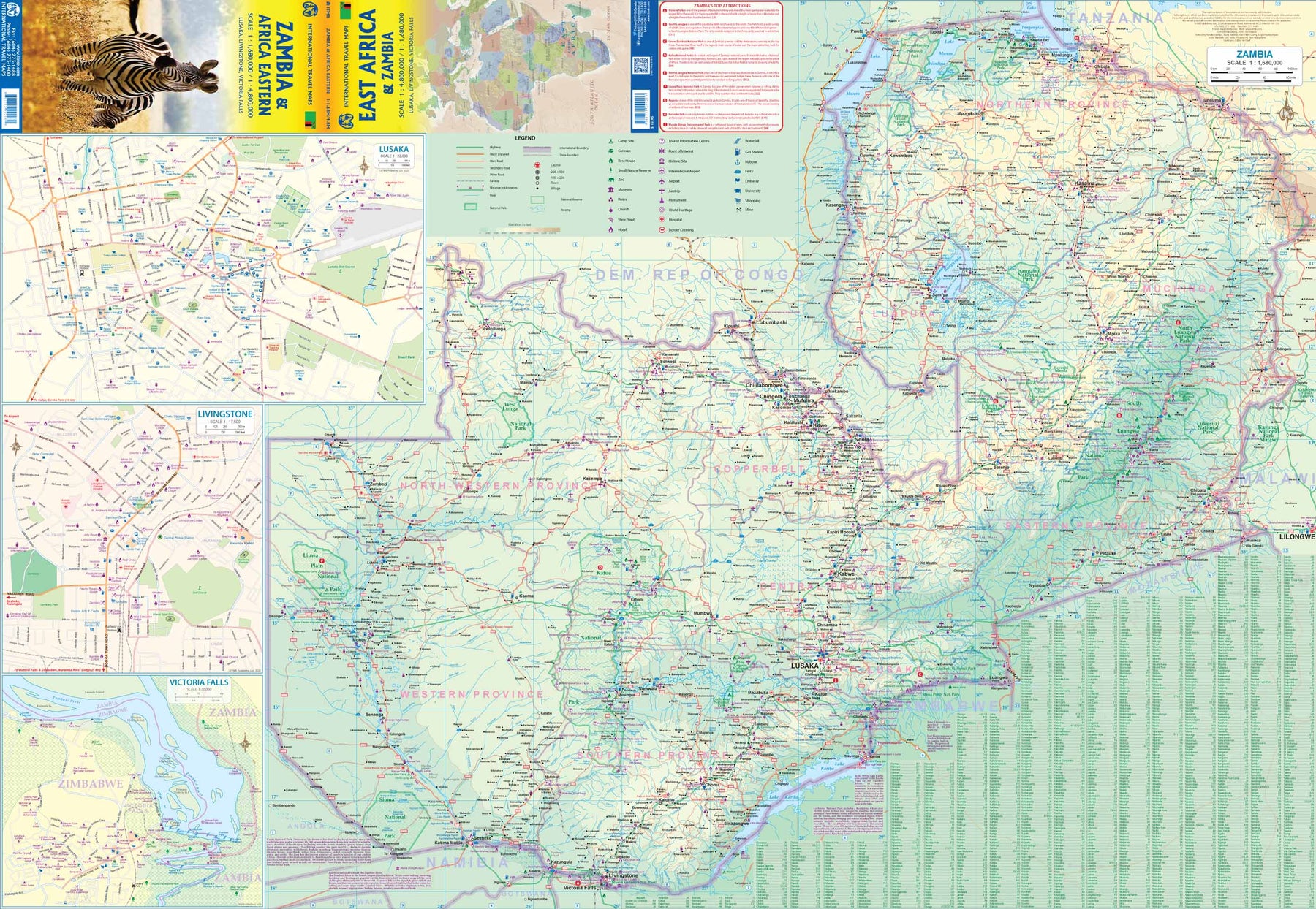
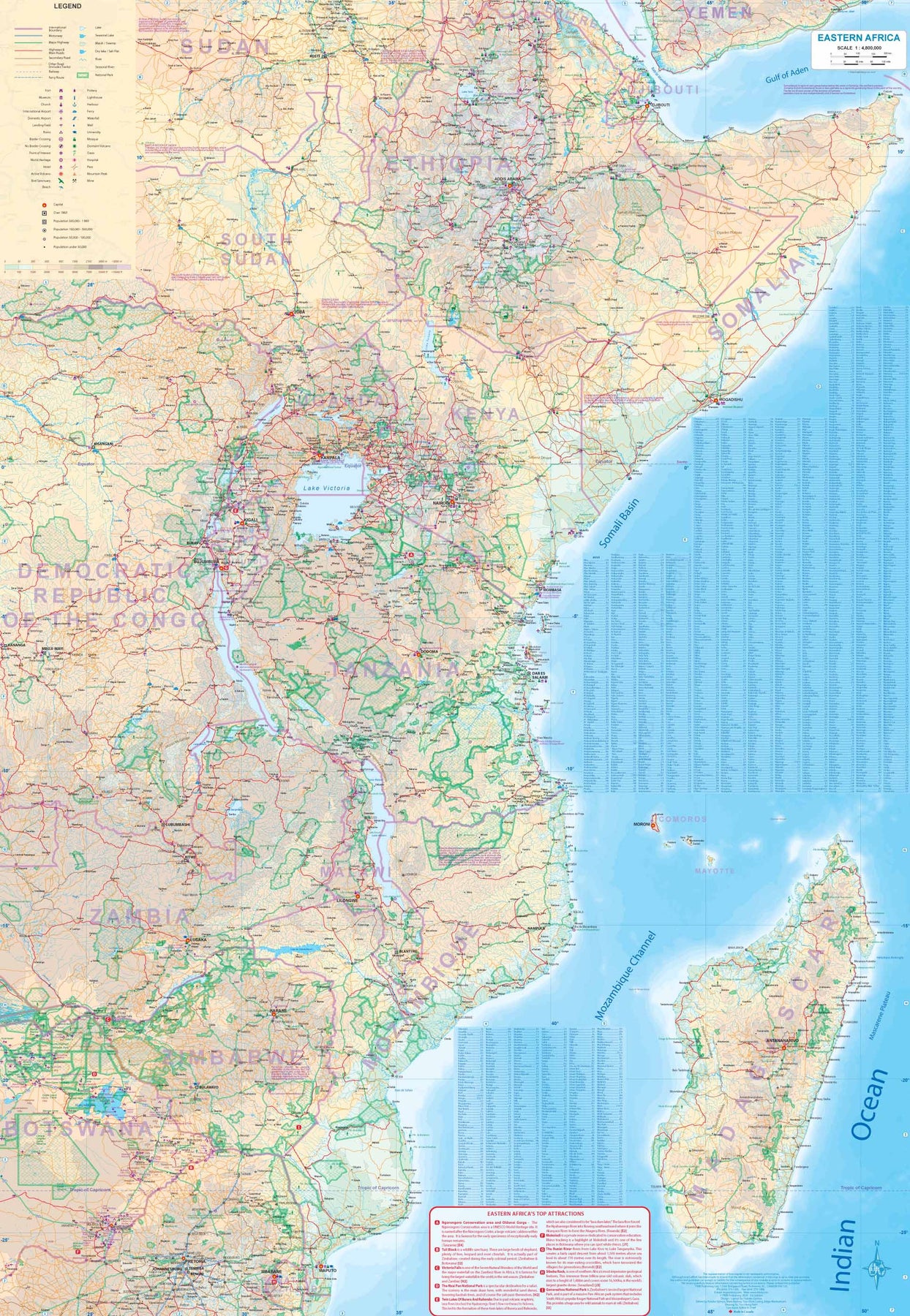
Ordinær pris 179,00 krZambia, a nice country in central/southern Africa graces one side of the sheet, along with a very large inset map of Lusaka and two others of Livingstone and Victoria Falls (which is actually in Zimbabwe). The other side of the sheet contains a very useful regional map of eastern Africa from Ethiopia/Eritrea south to Eswatini/Swaziland. Madagascar is also included, as well as the Comoro Islands. While both sides are useful, it is the Zambian side that takes precedence. All the roads and towns are shown, as well as parks, safari lodges, and points of interest. It is possible, though not advisable, to travel to Zimbabwe via either Kariba or Vic Falls, and there is a good crossing into Botswana at Sesheke. Entry to and from Tanzania and Malawi is easy.
Botswana
Ordinær pris 199,00 krDette store østerriske kartforlaget er kjent for sin klare kartografi og gode papirkvalitet. De kommer i alle målestokker, og flere av landkartene inneholder bykart og turistinformasjon.
Cape Town
Ordinær pris 159,00 krWaterproof and tear-resistant street plan of Cape Town from Marco Polo Travel Publishing covering the city at 1:15,000 with an enlargement for the town centre, a diagram of the bus and metro network, a road map of the Cape Peninsula, and an index with lists of places of interest, etc.
South Africa
Ordinær pris 199,00 krDette store østerriske kartforlaget er kjent for sin klare kartografi og gode papirkvalitet. De kommer i alle målestokker, og flere av landkartene inneholder bykart og turistinformasjon.
South Africa at 1:1,500,000 from Freytag & Berndt on an indexed road map with on the reverse two large panels showing the Western Cape region at 1:500,000 and the Kruger National Park at 1:400,000, plus street plans of central Johannesburg and Cape Town. The map presents the country’s road and rail network on a base with relief shading, graphics to show the desert areas, marshes, etc., and plenty of names of geographical features.
Road network clearly shows the numbers of main routes and connecting roads, indicating driving distances. Many local roads and tracks are also included. An overprint highlights the Garden Route. The map includes the rail network and shows local airports. Also marked are internal administrative boundaries with names of the provinces. Large icons highlight numerous places of interest including campsites, nature reserves, historical sites, etc. Latitude and longitude lines are drawn at 1° intervals. The index is on the reverse. Multinational map legend includes English.
Publisert: 2024
Innbinding: falset
Material: papir
Målestokk: 1:1 500 000
South Africa - Cape Region
Ordinær pris 239,00 krOur maps combine state-of-the-art, GPS-compatible cartography (including hypsometric tints and contour lines) with a detailed rendering of road networks and touristic information. They offer the best possible scale, level of detail and readability, be it a map of a small island or half a continent.
The maps feature a detachable paper sleeve so that the maps can be folded easily and fit in every pocket. Although printed on plastic, a special coating makes sure the maps retain a paper-like feel and can even be written on with a pencil.
South Africa; Namibia & Botswana
Ordinær pris 189,00 kr