14 produkter
14 produkter
14 produkter
Balkans: Slovenia - Croatia - Serbia - Montenegro - Bosnia Herzegovina
Ordinær pris 199,00 kr780 Montenegro
Ordinær pris 149,00 krMichelin er en av verdens beste, og best kjente, kartserier. Kartene har glimrende kartografi.
MICHELIN National Map Montenegro will give you an overall picture of your journey thanks to its clear and accurate mapping scale 1/ 160,000. Our map will help you easily plan your safe and enjoyable journey thanks to a comprehensive key, a complete name index as well a clever time & distance chart. Michelin's driving information will help you navigate safely in all circumstances. With MICHELIN National Maps, find more than just your way! Montenegro is in the Balkans, on the Adriatic Sea.
It borders Croatia and Bosnia and Herzegovina to the north, Serbia to the northeast, Kosovo to the east, and Albania to the south. MICHELIN NATIONAL MAPS feature: Up-to-date mapping. A scale adapted to the size of the country. A clear and comprehensive key. Distance and time chart. Place name index. Driving and road safety information. Tourist sights information. Our maps are regularly updated even if the ISBN does not change.
Balkans & Peaks of the Balkans
Ordinær pris 179,00 krThe portion of Europe east of the Adriatic and west of the Black Sea and south of the Alps has traditionally formed the region known as the Balkan States. This includes the former Yugoslavian states of Slovenia, Slovakia, Croatia, Montenegro, Bosnia Herzegovina, Kosovo, Serbia, and Northern Macedonia, as well as Albania, Hungary, Romania, and Bulgaria. Due to its shape, a large portion of Greece, and a bit of Turkey also are included. This is a new area of mapping for us, resulting from numerous visits to the region It is essentially a road map, as the rail network is weak, although rail lines carrying passengers are shown. Nice though the regional map is, its strength lies in the hiking map of the Peaks of the Balkans on the other side.
This detailed map is centred on eastern Montenegro, northern Albania, and western Kosovo. The ten major hiking routes are shown in pink, and there are numerous secondary routes one can explore. This is a growing touristic destination for those seeking a semi-wilderness area for enjoyment, while remaining in Europe, and is becoming quite popular. Accommodations are comprehensively shown, as well as campsites. Contouring is shown, and many peaks are noted. It should be stated that, as these paths cross international borders, hikers should keep their passports handy for inspection Legend Includes: Roads by classification, Rivers and Lakes, National Park, Airports, Points of Interests, Highways, Main Roads, Zoos, Fishing, and much more...
Croatia; Serbia
Ordinær pris 189,00 krAlso includes: Slovenia; Bosnia+Herz.; Kosovo; Montenegro; Albania; North Macedonia
The ideal map for your trip. Let the Marco Polo Croatia Road Map guide you around this fascinating region of eastern Europe. Discover one of Europe's most beautiful coastlines with this highly durable, detailed, touring map of Croatia which also covers most of the Balkans. It folds away easily and is always on standby to help when you're stuck.
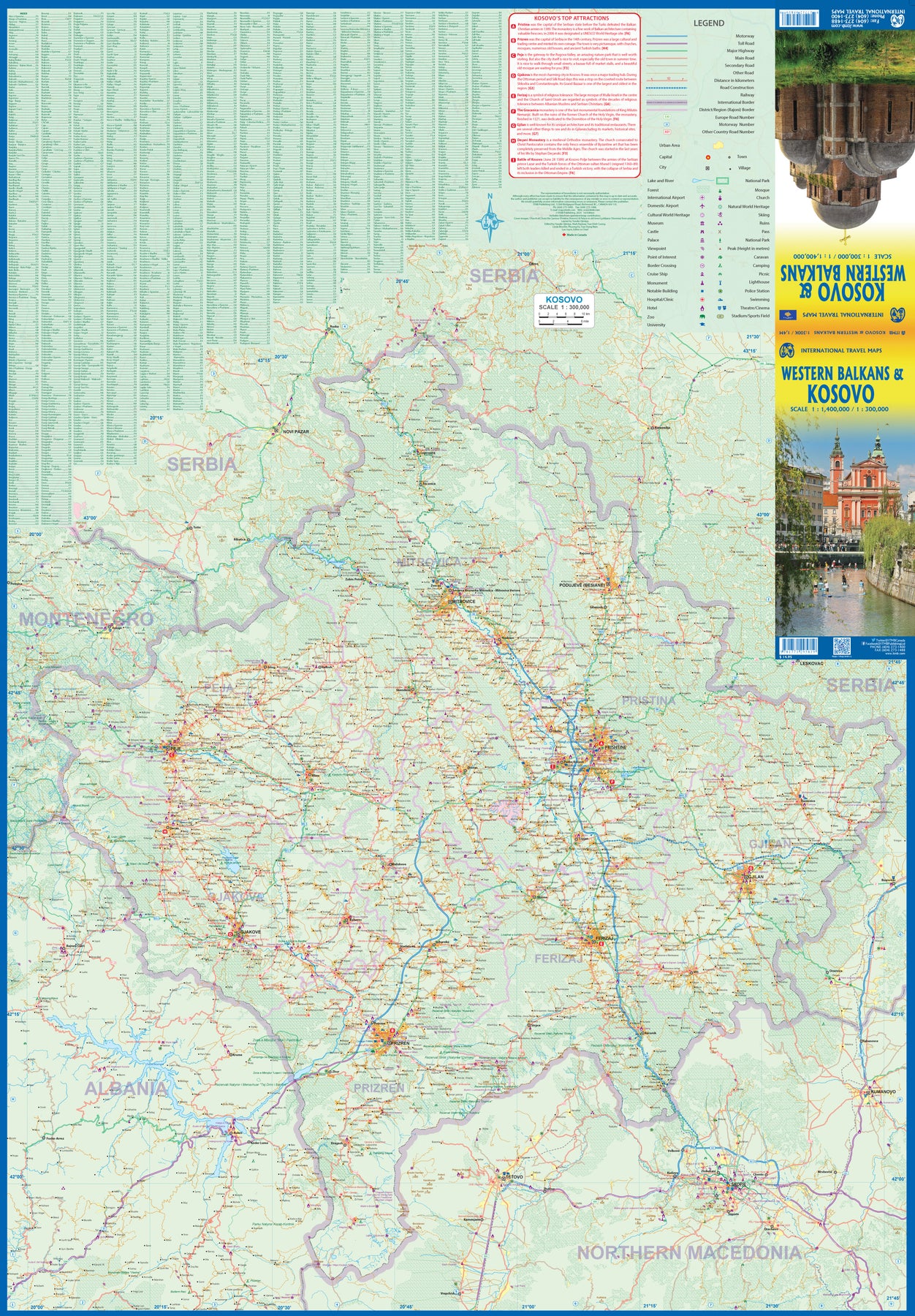
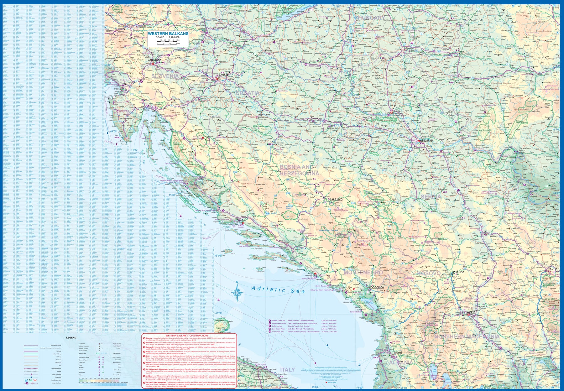
Kosovo & Western Balkans
Ordinær pris 179,00 krKosovo is the country that shouldn't exist, but does. When Yugoslavia fell to pieces after Tito died, Kosovo was lumped in with Serbia but was very unhappy with being a part of an Eastern Orthodox regime. It broke away, resulting in genocidal fighting until the Americans stepped in and stopped the fighting. The region was then placed under a European Union control in the faint hope that it would merge with Albania, or Montenegro, but it didn't. Relations with Serbia are still quite strained, but Kosovo is still surviving as a mountainous Balkan state. Fought over for centuries by Turks and Serbs, Kosovo is emerging as a small but touristic European country. This is definitely an off-the-beaten-path travel destination! The second side of the sheet provides an excellent regional coverage for the Western Balkans, essentially Slovenia, Croatia, Montenegro, Serbia, and reasonably large tracks of land for Hungary, Albania, and North Macedonia, showing the growing number of wilderness parks being created.
Montenegro
Ordinær pris 189,00 krMontenegro on a road map from Freytag & Berndt with a separate index booklet. The country is presented on one side at a very detailed scale of 1:150,000, but with its easternmost part and the southern tip of the Adriatic coast beyond Ulcinj shown as inset.
Topography of this mountainous country is shown by relief shading with numerous spot heights and names of main peaks and mountain ranges. National parks and other protected areas are highlighted.
Road network includes local roads and selected country tracks, with driving distances shown on most routes. Scenic roads are highlighted. Railway lines are shown with stations, local airports and ferry routes are marked. Picturesque town and locations are highlighted and symbols indicate various other places of interest. The map has a latitude and longitude grid at intervals of 10’. The index is in a separate booklet attached to the map cover. Map legend includes English.
Montenegro
Ordinær pris 189,00 krHighly tear-resistant and 100% waterproof map "Montenegro" from the world mapping project series.
Travel Know-How Maps are characterized by particularly stable plastic paper, which can be written on like paper, even with a pencil. The cardboard envelope is removable, making it easy to put the card in any pocket. A protective cover is not required. The cartographic representation focuses on the most important information for travellers and is particularly easy to read. Instead of shading, coloured height layers are used.
Serbia
Ordinær pris 199,00 krGizi Map er en serie presise kart med detaljer og opplysninger over både populære og mindre populære reisemål. Dekker ofte områder der få andre kartprodusenter dekker.