71 produkter
Lonely Planet Havana
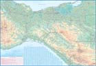
Ordinær pris 119,00 krJamaica
Ordinær pris 169,00 krTysk kartserie med flotte kart på slitesterkt plastpapir.
Publisert år: 2018
Innbinding: falset
Material: Plastpapir
Målestokk: 1:150,000
Jamaica & Cayman Islands
Ordinær pris 149,00 krITM har kart over hele verden og de spesialiserer seg på land litt utenfor allfarvei. Beliggenheten til landets nasjonalparker, historiske monumenter, de viktigste veiene o.L. Finner du inkludert i kartene. Samtlige landkart har ofte et bykart over hovedstaden.
Fra ITM: This map was called Cayman Islands and Jamaica in its previous edition, which was a well-intentioned attempt to promote the smaller islands adjacent to big brother. Now, we are reverting to what we think is a more logical title arrangement for listing purposes, but the map has two covers, so one can market it as either Jamaica or the Caymans, or best of all, market both! We visited the Caymans a few months ago and drove every road on the main island, including a few that turned out to be driveways! The map is very current as a result. The other side of the map is the very popular touristic island of Jamaica, now into its sixth edition. This island is large enough to justify renting a car and exploring. It is a great way to discover hidden coves and find historic plantations, especially along the touristic north shore. 6th/3rd Ed. 1:250,000/1:37,500
Publisert år: 2017
Innbinding: falset
Material: papir
Målestokk: 1:250000/37,500
Las Vegas
Ordinær pris 99,00 kr Salgspris 49,50 kr Spar 50%Kart i postkortstørrelse. Folder seg ut som en popoutbok når du åpner dem. Fargerik turistinformasjon med kart over metro og busstraseer, landemerker og lignende. Veldig enkel å håndtere.
Publisert: 2023
Innbinding: pop
Material: papir
Mexico
Ordinær pris 189,00 krITM har kart over hele verden og de spesialiserer seg på land litt utenfor allfarvei. Beliggenheten til landets nasjonalparker, historiske monumenter, de viktigste veiene og lignende finner du inkludert i kartene. Samtlige landkart har ofte et bykart over hovedstaden.
Fra ITM: Mexico is a fascinating country, and as travel re-opens, is proving to be very popular. This most recent edition was recently printed, and is now the current edition. Double sided detailed travel map, with comprehensive place name index. Distinguishes roads ranging from expressways (free/toll) to rural roads. Legend includes railways, tracks, trails, international airports, domestic airports, bridges, border crossing points, points of interest, archaeological sites, beaches, active volcanos, filling stations, national parks, deserts, places of touristic interest. Printed on durable, water-resistant plastic paper, suitable for travelling in areas with extreme humidity. This is another chestnut in the ITMB line, and sells well. The cover picture is new, as is the ISBN. Mexico is a very large and diverse country, and very popular with Americans. Again, there is little one can say that is news about such a tried-and-true map, except to say that it is extremely popular.
Mexico
Ordinær pris 189,00 krDette store østerriske kartforlaget er kjent for sin klare kartografi og gode papirkvalitet. De kommer i alle målestokker, og flere av landkartene inneholder bykart og turistinformasjon.
Publisert år: 2018
Innbinding: falset
Material: papir
Målestokk: 1:2000000
Mexico
Ordinær pris 199,00 krMexico at 1:2,250,000 on an indexed, waterproof and tear-resistant road map with topographic and tourist information, published by Reise Know-How as part of their highly acclaimed World Mapping Project. The map is double-sided, with a very generous overlap between the sides, to provide the best balance between a good scale and a convenient size sheet. Coverage extends south to include the whole of Belize, most of Guatemala (well past Guatemala City) and north-western Honduras including Tegucigalpa.
Topography is presented by altitude colouring and spot heights with names of mountain ranges, peaks, etc. Swamp areas, mangroves, seasonal rivers and lakes, and along the coast coral reefs are also indicated. National parks and other protected areas are highlighted. Road network indicates toll routes, includes selected local roads and tracks, and shows border crossings and distances on main routes. Railway lines are included and local airports are marked. Internal administrative boundaries are shown with names of the provinces. Symbols indicate numerous places of interest, including UNESCO world heritage sites and archaeological remains, etc. The map has a latitude and longitude grid at intervals of 2° and an extensive index of localities. Map legend includes English.
Mexico: Chihuahua & Coahuila
Ordinær pris 169,00 krITM har kart over hele verden og de spesialiserer seg på land litt utenfor allfarvei. Beliggenheten til landets nasjonalparker, historiske monumenter, de viktigste veiene o.L. Finner du inkludert i kartene. Samtlige landkart har ofte et bykart over hovedstaden.
Fra ITM: Northern Mexico is a vast desert-like plateau deeply steeped in Spanish colonial heritage. The very first settlement inside what is now the USA was the town of Presidio (long before the English thought of settling Jamestown) and is still one of the few crossings of the Rio Grande into Texas (itself a former Mexican province). There are two major cities in the region, Chihuahua, 300 kms south of El Paso, and Monterrey, the largest city in northern Mexico. There are major touristic attractions at Monclova, Saltillo, Parras, Torreon, and Cuauhtemoc, the end of the famous Copper Canyon rail line. The map extends a bit into Sinaloa, to include Los Mochis on the Pacific coastline. The entire rail line is also shown. This is an important part of North American history. It may not be as well-known to Europeans who favour the beaches of the Yucatan, but it is a fascinating part of Mexico on the American border. Ciudad Juarez, for example, is larger than its partner on the Rio Grande, El Paso. An inset map of the old colonial city of Saltillo is included, as well as our Top Attractions list.
Publisert år: 2022
Innbinding: falset
Material: papir
Målestokk: 1:750000
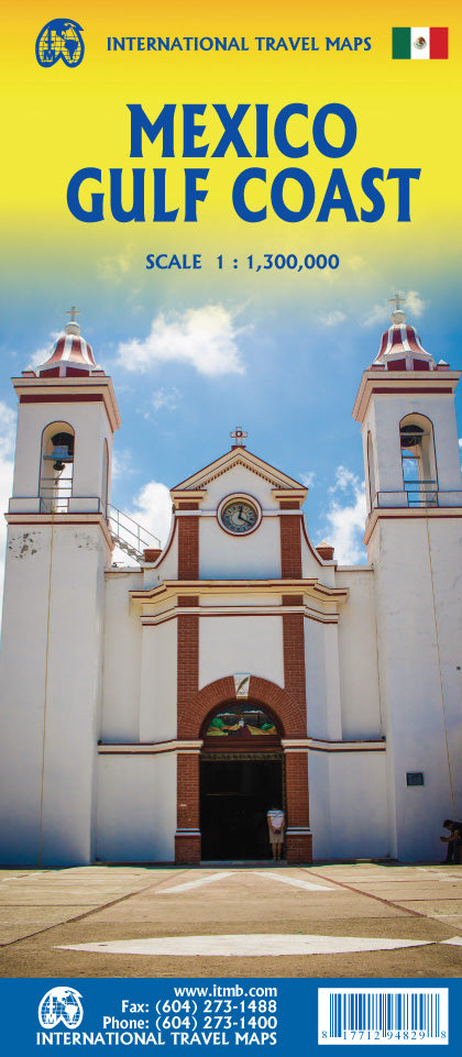
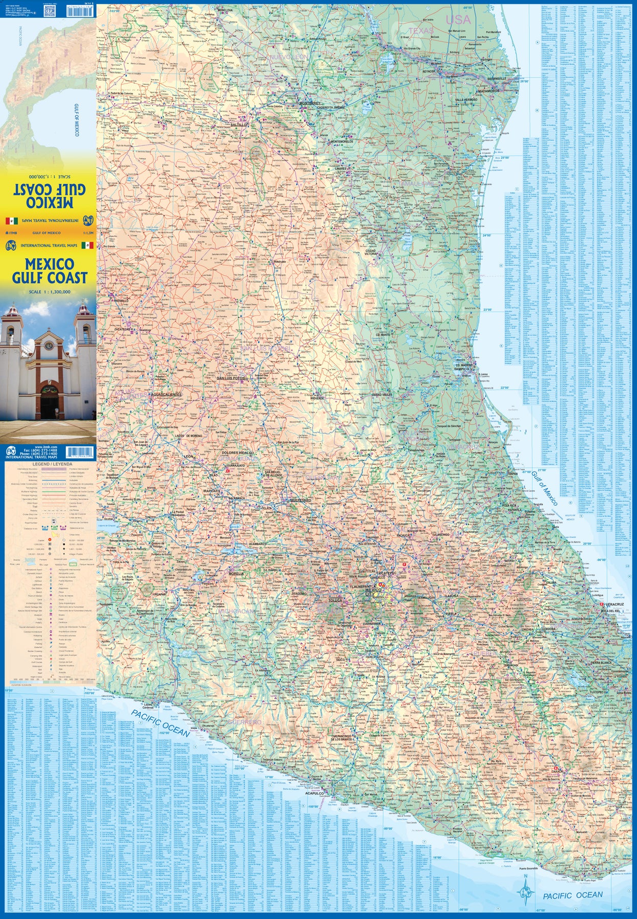
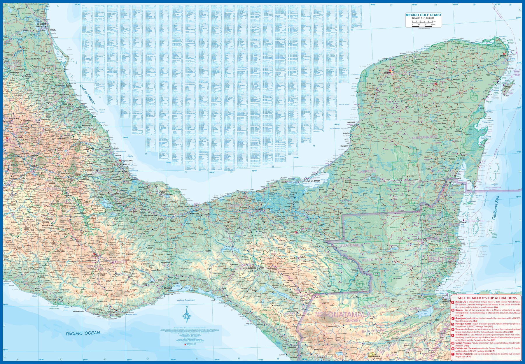
Mexico: Gulf Coast
Ordinær pris 169,00 krMexico is an ever-popular travel destination. The country is so large that we started mapping it as a series of regional maps years ago. The Gulf Cost extends from Brownsville, Texas through Vera Cruz to the Yucatan Peninsula. Due to the shape of the region, all of Belize and about half of Guatemala is included, but the focus is on the many attractions of the eastern Gulf coast of Mexico. Side 1 cover the northern coastal regions, going inland as far as Monterrey, Zacatecas, Morelia, and Mexico City.
Side 2 shows the Gulf Coast from Tampico to Carmen, then on to Merida, Cancun, and the southern tip of Belize. By the shape of this part of Mexico, the Pacific Coast, from the Guatemalan border westwards past Acapulco is also shown. All major roads are shown, but as passenger rail service was discontinued several years ago, we have opted to not show most rail lines. This is a map for explorers and adventurers to discover by driving. It covers all of historic Mexico and complements other ITMB maps detailing regions of a fascinating country, where the first word you learn is 'Hola!'
Mexico: Mexico Central
Ordinær pris 199,00 krMexico is an exceptionally interesting country to visit. The country itself is larger than most people realize, making sectional maps essential. We started mapping Mexico in the late 1980s and have gradually added regional maps as time and money enabled. Naturally, touristy popular areas like the Yucatan, Baja, and the Pacific Coast really need specialized maps, but so does the central region of the country. This map covers from Mexico City south to Acapulco and east almost as far as the Guatemalan border on side 1, and from Puebla west to Guadalajara on side 2.
Highlights include the colonial mining town of Taxco, the ruins of the Aztec capital of Teotihuacan, the untouched historical city of Oaxaca, and the mountain centre of Tuxtla Gutierrez. This is a map for driving and exploring and coming to understand one of the most important countries in the Americas.
Mexico: Mexico City & Mexico Central
Ordinær pris 179,00 krITM har kart over hele verden og de spesialiserer seg på land litt utenfor allfarvei. Beliggenheten til landets nasjonalparker, historiske monumenter, de viktigste veiene og lignende finner du inkludert i kartene. Samtlige landkart har ofte et bykart over hovedstaden.
Fra ITM: Mexico City is the largest city in the Americas, with a population of about 30 million. Our map concentrates on the core of the city, which is where hotels, attractions, and touristic interest abounds, from the train station in the north to the university in the south and from the huge bus station in the east to Chapultepec Park in the west. Insets of the metropolitan area and of the rapid transit network are included. The second side contains a detailed regional map of that part of Mexico deemed to be ‘central’; essentially, from Pueblo in the east to Guadalajara in the west and from Taxco in the south to San Luis Potosi in the north. Top attractions include San Miguel de Allende, Guanajuato, the Great Pyramid of Cholula, and the colonial city of Puebla.
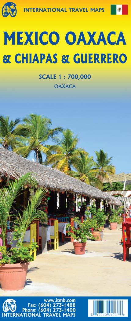
Mexico: Oaxaca & Chiapas & Guerrero
Ordinær pris 169,00 krITM har kart over hele verden og de spesialiserer seg på land litt utenfor allfarvei. Beliggenheten til landets nasjonalparker, historiske monumenter, de viktigste veiene o.L. Finner du inkludert i kartene. Samtlige landkart har ofte et bykart over hovedstaden.
Fra ITM: Travel to Mexico is exploding at the moment, as Covid restrictions lift. That portion of Mexico that forms the relatively narrow land mass between Mexico City and the Yucatan Peninsula is called the Isthmus of Mexico. It consists of three states, Oaxaca, in the west, Chiapas in the east, and Guerrero in the west. This is a double-sided map, stretching from west of Acapulco to beyond the border with Guatemala along the Pacific coast, and from Veracruz to Carmen along the Gulf of Mexico coast. It is the part of Mexico containing numerous holiday resort areas for sun-lovers, but is also rich in history and attractive colonial-era towns.
Oaxaca City is a UNESCO World Heritage site, as is the Mayan temple site of Palenque. There are numerous archeological sites in the region to explore, such as Monte Alban, which dates from the 8th Century BC. The colourful mining town of Taxco, with its narrow cobblestone streets, is a must-see, as is San Cristobal de Las Casas, in Chiapas State. This is an extremely popular part of Mexico to visit, so we are very pleased to be able to bring it back into print.
Mexico: Sonora & Sinaloa
Ordinær pris 169,00 krITM har kart over hele verden og de spesialiserer seg på land litt utenfor allfarvei. Beliggenheten til landets nasjonalparker, historiske monumenter, de viktigste veiene og lignende finner du inkludert i kartene. Samtlige landkart har ofte et bykart over hovedstaden.
Fra ITM: The northern Pacific coastline of Mexico borders on California and Arizona and is a popular travel destination. Sonora is the more northerly state of Mexico, bordering on Baja California on its west (much of which is included on this map) Nogales is probably the best-known city, although Hermosillo is the capital. Sinaloa is more southerly, and is probably best known for Mazatlán, the popular ocean resort community and cruise ship port of call. Sinaloa is also the starting point for the famous train excursion known as the Copper Canyon, originating in Los Mochis. The rail route is shown on the map. The canyon is actually in Chihuahua State, which is included on this map, and goes through a portion of Mexico that is pretty much devoid of roads. The trip ends in Cuauhtémoc, but users are advised to stay on the train to the capital city, also called Chihuahua. We have included the top ten attractions of the region, including the Pinacate Volcanic Field, the Nacapule Canyon, and Las Labradas World Heritage site. This is a part of Mexico easy to reach from the USA, and has many attractive cities
Mexico; Guatemala; Belize & El Salvador
Ordinær pris 169,00 krMarco polo er svært detajerte kart som er praktiske og enkle i bruk. 7 klistremerker for å markere spesifikke steder gjør det enda enklere å planlegge reisen. Alle kartene inneholder en omfattende index for enkelt å finne frem.
Let the Marco Polo Mexico Map guide you around this fascinating country. Discover a diverse landscape of mountains, deserts and jungles, ancient ruins, colonial towns and incredible beaches with this highly durable touring map of Mexico. It folds away easily and is always on standby to help when you're stuck.
Perfect touring map - the scale is 1 : 2 500 000* ideal to help you plan your overall route and navigate the main highways by car, RV or campervan.
Easy to use - the super clear mapping in strong colours and clear text will help you navigate the region.
Includes 5 city maps - detailed street maps of key cities are included as well as coverage of Guatemala, Belize and El Salvador.
Mexico highlights - major sights and key points of interest are marked on the map by numbered stars and these are listed in the index booklet with a brief description to help you pick the best places to see en route.
Extensive index - the thorough index is fully cross-referenced to the map to help you pinpoint your destination quickly.
Publisert: 2019-2023
Innbinding: falset
Material: papir
Målestokk: 1:2500000
Lonely Planet Montreal
Ordinær pris 119,00 kr Salgspris 59,50 kr Spar 50%Lonely Planet City Map er slitesterkt og vanntett, med en hendig slipcase og et format som er lett å brette. Få mer ut av kartet og reisen din med bilder og informasjon om byattraksjoner, transportkart, reiseruteforslag, omfattende gate- og nettstedsindeks og praktiske reisetips. Med dette brukervennlige navigasjonsverktøyet i baklommen kan du virkelig komme til hjertet av din destinasjon!
Lonely Planet New Orleans
Ordinær pris 119,00 krLonely Planet City Map er slitesterkt og vanntett, med en hendig slipcase og et format som er lett å brette. Få mer ut av kartet og reisen din med bilder og informasjon om byattraksjoner, transportkart, reiseruteforslag, omfattende gate- og nettstedsindeks og praktiske reisetips. Med dette brukervennlige navigasjonsverktøyet i baklommen kan du virkelig komme til hjertet av din destinasjon!
Lonely Planet New York City
Ordinær pris 119,00 krLonely Planet City Map er slitesterkt og vanntett, med en hendig slipcase og et format som er lett å brette. Få mer ut av kartet og reisen din med bilder og informasjon om byattraksjoner, transportkart, reiseruteforslag, omfattende gate- og nettstedsindeks og praktiske reisetips. Med dette brukervennlige navigasjonsverktøyet i baklommen kan du virkelig komme til hjertet av din destinasjon!
Orlando
Ordinær pris 99,00 kr Salgspris 49,50 kr Spar 50%Kart i postkortstørrelse. Folder seg ut som en popoutbok når du åpner dem. Fargerik turistinformasjon med kart over metro og busstraseer, landemerker og lignende. Veldig enkel å håndtere.
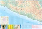
Puerto Rico & Virgin Islands
Ordinær pris 169,00 krITM har kart over hele verden og de spesialiserer seg på land litt utenfor allfarvei. Beliggenheten til landets nasjonalparker, historiske monumenter, de viktigste veiene o.L. Finner du inkludert i kartene. Samtlige landkart har ofte et bykart over hovedstaden.
Fra ITM: The American territories of Puerto Rico and the US Virgin Islands are anomalies in the modern world, neither fish nor fowl, as the saying goes. Although the residents are American citizens, they have no representation in Congress and are not allowed to vote in national elections. The lesser-known British Virgin Islands are included on this double-sided map. The BVI is still a British colony, consisting of about 20 islands, capitaled in Road Town (inset included). Puerto Rico (1:190.000) is a large, rectangular island, capitaled by San Juan (inset included) and is a major cruise ship point of origin as well as being home to resort communities all over the main island. Ferries connect to outlying islands. The VI portion was purchased from Denmark in 1917 and retains a colonial European charm. There are three main islands – St. Croix, St. Thomas, and St. John – and the map includes inset maps of Charlotte Amalie, Cruz Bay, Christiansted, and Frederiksted. Each side of the map sheet includes a listing of top attractions. Ferry routes to the BVI are shown, as well as water connections between the islands. Virgin islands 1:85.000.Legend Includes:Roads by classification, Rivers and Lakes, National Park, Airports, Points of Interests, Highways, Main Roads, Zoos, Fishing, and much more...
Publisert år: Aug. 2021
Innbinding: falset
Material: vanntet tpapir
Målestokk: 1:190000/1:85,000
Road Atlas: USA - Canada - Mexico Large Format (A3)
Ordinær pris 189,00 krHighlighting 51 road trips and scenic drives the Michelin's updated Large Format North America Road Atlas 2026 helps you enjoy the planning and the journey. Large-format maps and larger lettering for towns and sites (compared to the midsize atlas) make for easier reading while the tiled format flows maps from page to page—the ideal complement to GPS and online directions. Four jam-packed pages highlight selected US and Canadian national parks, with points of interest, hikes and drives.
Covers US, Canada & Mexico. Large grid map to quickly locate atlas pages. Easy-read text and mapping.
Map pages are 36% larger than midsize atlas. Inspired ideas for outdoor fun and road trip adventures in the US and Canada with four jam-packed pages highlighting selected national and provincial parks. Michelin's renowned travel guides are the resource for points of interest, hikes and scenic drives.
Tiled atlas format: user-friendly, convenient and logical to use, offering continuity when driving and providing the big picture to round out GPS and online directions. Detailed place name index to quickly pinpoint destinations and sights. 50+ large-scale city maps for navigating in and around cities.
Distance chart for major US and Canadian cities, as well as convenient city-to-city mini distance chart on each two-page map spread, for more effective trip planning. Tire tips to improve consumer driving safety.
Saint Lucia & Martinique
Ordinær pris 149,00 krITM har kart over hele verden og de spesialiserer seg på land litt utenfor allfarvei. Beliggenheten til landets nasjonalparker, historiske monumenter, de viktigste veiene og lignende finner du inkludert i kartene. Samtlige landkart har ofte et bykart over hovedstaden.
Fra ITM: Saint Lucia in 1:45.000 and Martinique in 1:65.000. We have included an inset map of Castries, the capital, noting, among other things, the cruise ship terminals (there are two) and the inter-island ferry terminal. That is important because St. Lucia is now linked to neighbouring Martinique by a scheduled ferry service and it is very convenient for visitors wishing to enhance their visit by adding a day trip to Martinique. For this reason, we have added a full-page map of Martinique to the reverse side of the sheet. The ferry goes to Fort-de-France, the capital, and the map includes an inset of the city, showing where the ferry docks. Martinique, with its French heritage, is more exotic than most English-speaking Caribbean countries, but is friendly and somehow different.
It is considered an extension of France and thus of the European Union, so uses the Euro. Although the common language is French (or a variety of it), English is well-understood. Cars are readily available for hire and road conditions are good. The island even boasts a motorway, going to the island’s south coast. Both islands are important Caribbean travel destinations, with resort hotels concentrated on Marigot Bay and Rodney Bay in St. Lucia and in the Pont du Bout peninsula of Martinique. The map has a double-sided cover for ease of marketing.
Lonely Planet San Francisco
Ordinær pris 119,00 krLonely Planet City Map er slitesterkt og vanntett, med en hendig slipcase og et format som er lett å brette. Få mer ut av kartet og reisen din med bilder og informasjon om byattraksjoner, transportkart, reiseruteforslag, omfattende gate- og nettstedsindeks og praktiske reisetips. Med dette brukervennlige navigasjonsverktøyet i baklommen kan du virkelig komme til hjertet av din destinasjon!
Lonely Planet Seattle
Ordinær pris 119,00 krLonely Planet City Map er slitesterkt og vanntett, med en hendig slipcase og et format som er lett å brette. Få mer ut av kartet og reisen din med bilder og informasjon om byattraksjoner, transportkart, reiseruteforslag, omfattende gate- og nettstedsindeks og praktiske reisetips. Med dette brukervennlige navigasjonsverktøyet i baklommen kan du virkelig komme til hjertet av din destinasjon!
USA 6: California
Ordinær pris 199,00 krHighly tear-resistant and 100% waterproof map "Jordan" from the series world mapping project.
Travel know-how maps are characterized by particularly stable plastic paper, which is writable like paper, even with pencil. The cardboard envelope is removable, so the card can be easily inserted into any pocket. A protective cover is not required. The cartographic representation focuses on the most important information for travellers and is particularly easy to read. Instead of shading, coloured height layers are used.
USA East
Ordinær pris 199,00 krLet the Marco Polo USA East Road Map guide you around this incredible country. Discover the Atlantic Coast from Boston to Miami, explore the Great Lakes and the Appalachian Mountains with this highly durable, overview map of USA East. It folds away easily and is always on standby to help when you're stuck.
USA: Appalachian Trail
Ordinær pris 99,50 krThis is a new venture for ITMB, although we have published several recreational hiking maps over the years. The Appalachian mountain range was the original western boundary of the American colonies while under British rule. Everything west of there was technically the French possession of Louisiana Territory, called by American settlers ‘Indian country’. Nowadays, it is a massive recreational hinterland for east coast residents wanting to escape overcrowded cities. The National Parks Service maintains the trail and a series of overnight huts.
Most people only hike a portion of the trail, but for the dedicated hiker, the trail is a great adventure. We have divided the length of the trail into four natural regions: Maine into New York State, Connecticut south to Maryland, Maryland to Virginia, and Virginia to Georgia, to its traditional end at Springer Mountain. This is a demanding trail hike, but one of the most popular in the world.
USA: Arizona & New Mexico
Ordinær pris 169,00 krThis version includes two separate covers, one for each state, to enhance marketing possibilities, and the addition of two Top Attractions listings, one for each state. The Arizona side has a detailed inset map of Flagstaff, showing the path of Route 66 through the city streets. The New Mexico side includes a large inset of Albuquerque, also including the Route 66 passageway through the city.
USA: California
Ordinær pris 199,00 krThe American State of California has almost as many residents as all of Canada. I wonder how many of them are ex-pat Canucks? Regardless, this double-sided map shows the attractions of the state in amazing detail. Side 1 concentrates on the northern half, with a large inset map of San Francisco. A fairly large portion of Nevada shows as well, but with less detail.
Side 2 continues south to the Mexican border and east to Arizona, with a detailed inset map of central Los Angeles included. By the shape of California, all of southern Nevada is included as well, including the all-important wasteland of Las Vegas. All motorways are clearly shown, including those in greater Los Angeles. All state highways are also shown, as well as most secondary connecting roads. Parks, points of interest, beaches, redwood forests, and distances between major communities are also shown. The state is blessed with interesting offshore islands, such as Catalina, San Clemente, and the Channel Islands, all of which are included.