8 produkter
8 produkter


8 produkter
Croatia; Serbia
Ordinær pris 189,00 krAlso includes: Slovenia; Bosnia+Herz.; Kosovo; Montenegro; Albania; North Macedonia
The ideal map for your trip. Let the Marco Polo Croatia Road Map guide you around this fascinating region of eastern Europe. Discover one of Europe's most beautiful coastlines with this highly durable, detailed, touring map of Croatia which also covers most of the Balkans. It folds away easily and is always on standby to help when you're stuck.
Croatia; Serbia & Bosnia Herzegovena
Ordinær pris 189,00 krMarco Polo Croatia, Bosnia, Herzegovina Road Map guide you around this beautiful region of eastern Europe. Discover Croatia, Bosnia and Herzegovina with this highly durable, detailed touring map. It folds away easily and is always on standby to help when you're stuck. Perfect touring map - the scale is 1 : 650 000 ideal to help you tour the country by car or campervan. Easy to use - the superbly clear mapping in strong colours and easy to read text will help you navigate the country like a local. Durable, tear-resistant map - designed to withstand the rigors of the road, the map is printed on tear-resistant, water repellent and writeable paper. Highlights included - major sights and key points of interest are marked on the map by numbered stars.
Europe Eastern: Railway & Road
Ordinær pris 199,00 krEurope may be small in comparison to Canada, but it is densely populated and difficult to map as a continent while providing detail. Eastern Europe used to be defined as everything behind the Iron Curtain during the Cold War, but now it encompasses everything east of Germany and Switzerland, which means that this map covers Italy, Greece and the Balkan countries, the Central European countries of Romania and Hungary and most of Ukraine, Poland and the three Baltic states, and western Russia as far east as Volgograd, as well as much of Turkey. It is a combined road and rail map, showing motorways and major highways, fast-train routes in red and regular services in black. It also shows major cruise line routes, although many have been suspended due to Covid and political situations in Russia and Turkey.
Essentially, this is a map covering a very large area, as are our maps of Western and Central Europe, and our earlier map of Scandinavia. We have tried to make it politically correct, which is difficult considering the Russian occupation of Crimea and the Donetsk region of Ukraine and the on-going controversy over the ‘proper’ name for Macedonia, so we apologize for any errors. For simplicity’s sake, we have named most place names in English, so Roma is Rome and Moscva is Moscow etc. Fortunately, most English place names are the same in the local languages. However, being ITMB, Naples is Napoli, and Florence is Firenze, so don’t be too critical of us; we’re trying to reconcile differing perspectives.
Eurovelo 6: Budapest to the Black Sea
Ordinær pris 399,00 krThe classic cycle routes along the Danube river from Budapest to the Black Sea. Cycling trail, accommodations, attractions, bicycle repair shops and restaurants are shown on the map. 8 individual maps in a wallet.
The set contains:
Ideal for long cycle tours - light weight, easy folding, weather and tear proof - map section always aligned with the main route - with accommodation details - downloadable GPS track of the routes.
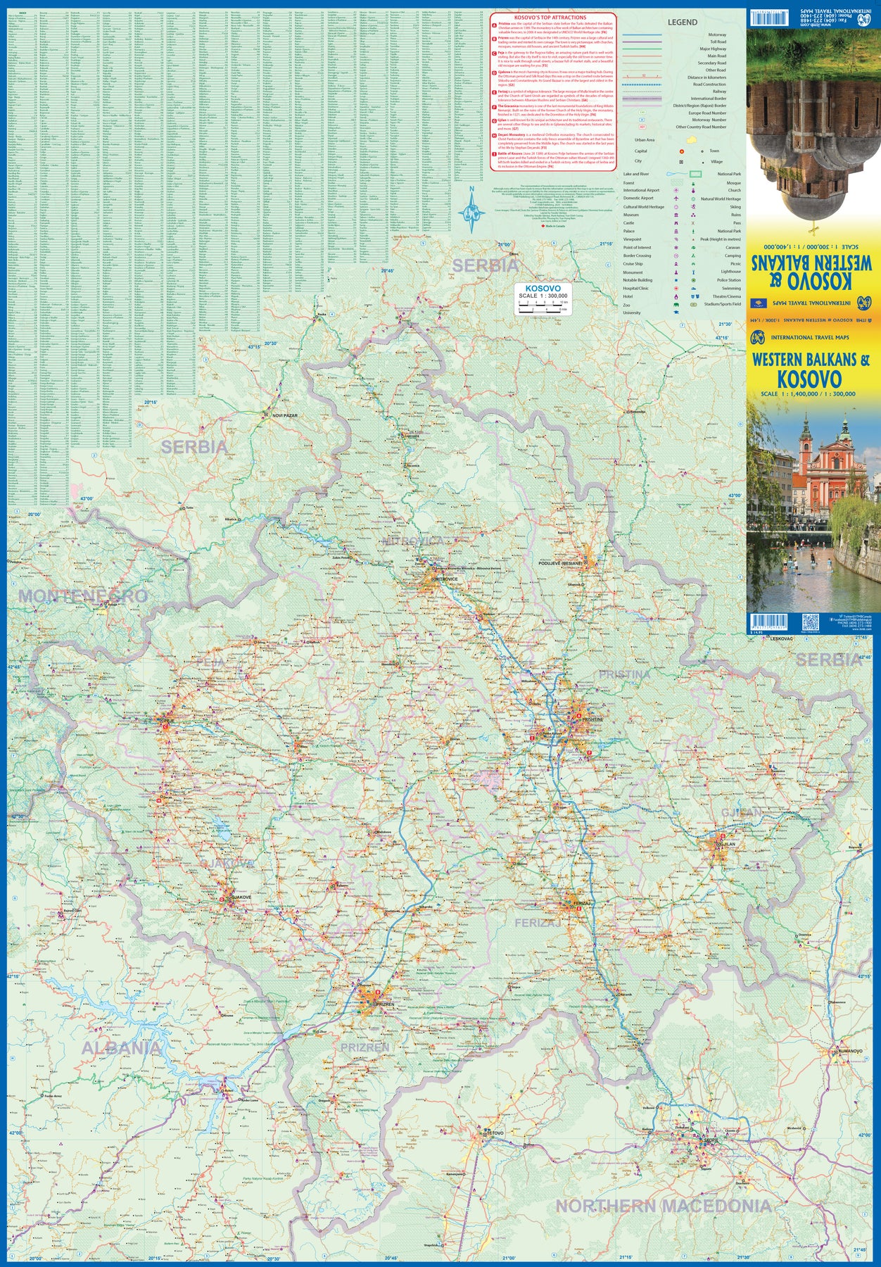
Kosovo & Western Balkans
Ordinær pris 199,00 krKosovo is the country that shouldn't exist, but does. When Yugoslavia fell to pieces after Tito died, Kosovo was lumped in with Serbia but was very unhappy with being a part of an Eastern Orthodox regime. It broke away, resulting in genocidal fighting until the Americans stepped in and stopped the fighting. The region was then placed under a European Union control in the faint hope that it would merge with Albania, or Montenegro, but it didn't. Relations with Serbia are still quite strained, but Kosovo is still surviving as a mountainous Balkan state. Fought over for centuries by Turks and Serbs, Kosovo is emerging as a small but touristic European country. This is definitely an off-the-beaten-path travel destination!
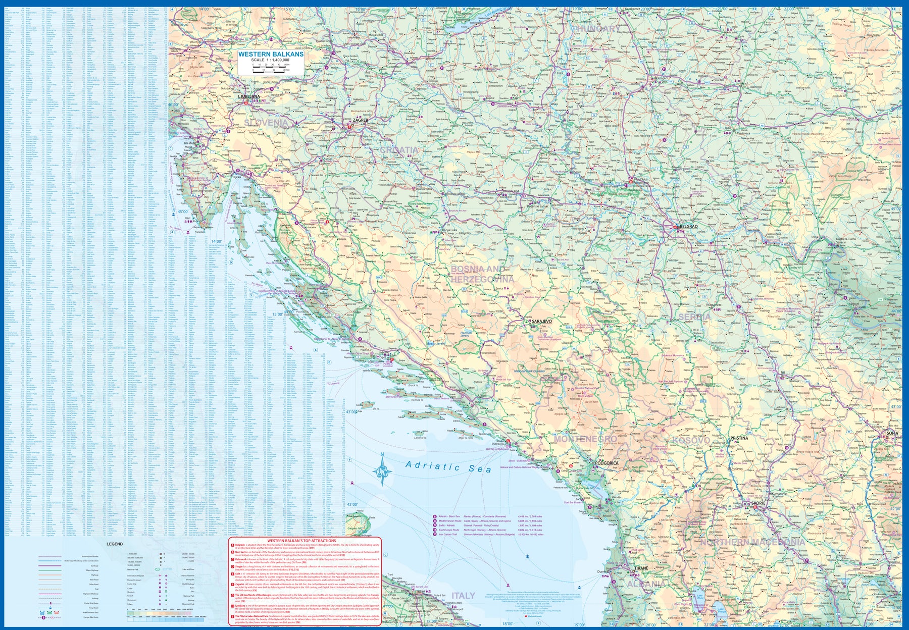
The second side of the sheet provides an excellent regional coverage for the Western Balkans, essentially Slovenia, Croatia, Montenegro, Serbia, and reasonably large tracks of land for Hungary, Albania, and North Macedonia, showing the growing number of wilderness parks being created.
Serbia
Ordinær pris 239,00 krGizi Map er en serie presise kart med detaljer og opplysninger over både populære og mindre populære reisemål. Dekker ofte områder der få andre kartprodusenter dekker.
Serbia North
Ordinær pris 189,00 krDette store østerriske kartforlaget er kjent for sin klare kartografi og gode papirkvalitet. De kommer i alle målestokker, og flere av landkartene inneholder bykart og turistinformasjon.
Northern Serbia at 1:200,000 on a large, detailed, double-sided road map from Freytag & Berndt, with its index booklet also providing street plans of central Belgrade, Kragujevac and Novi Sad. Coverage extends south to northern point in the border with Montenegro, with Belgrade included on both sides of the map. Names of towns and villages are in both Cyrillic and Latin alphabet.
Topography is indicated by relief shading with spot heights, plus colouring for the forested areas; names of geographical features such as mountain ranges, etc. are mainly in the Latin alphabet only. The map shows the road network in much detail, including driving distances on many small local roads, steep gradients, roads with seasonal closures or restricted traffic, motorway services, etc. Railway lines are shown with stations and domestic airports are marked. Symbols indicate various places of interest, including campsites and youth hostels. The map has latitude and longitude lines at 10’ intervals. Multilingual map legend includes English.
Publisert år: 2020
Innbinding: falset
Material: papir
Målestokk: 1:200000