37 produkter
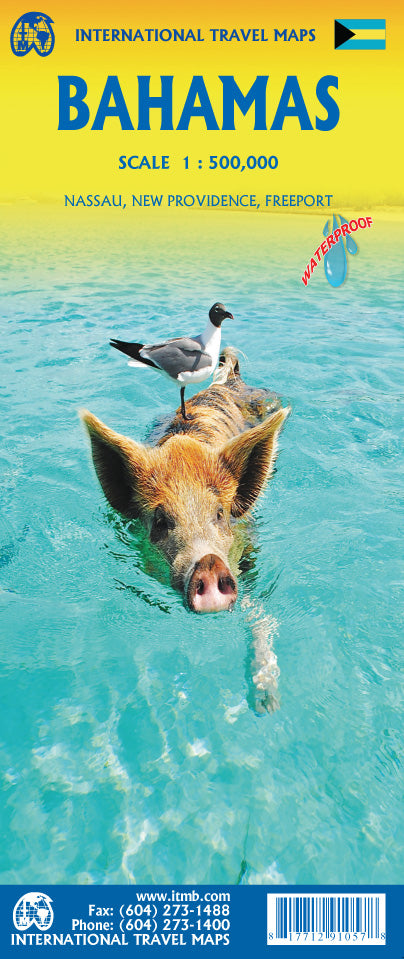
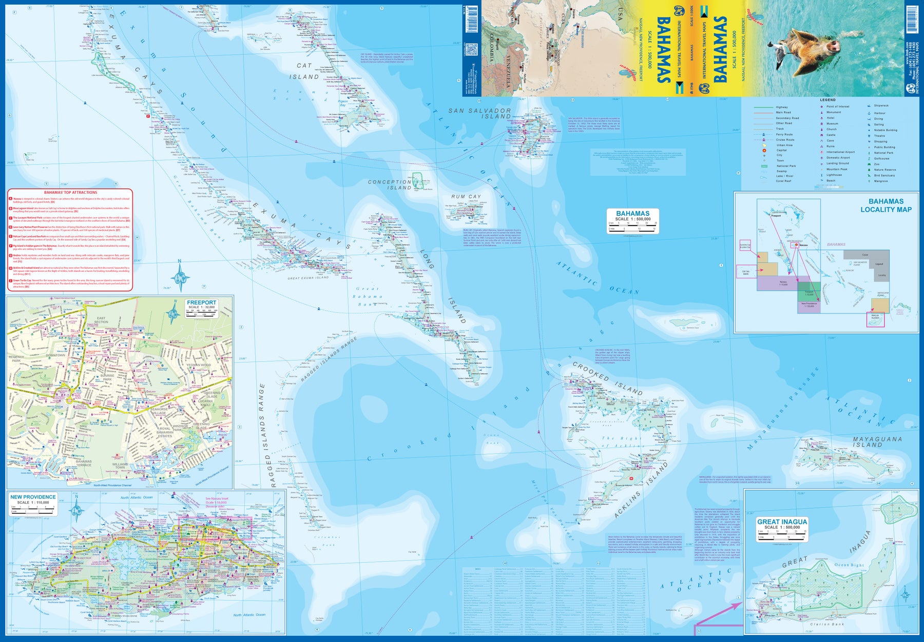
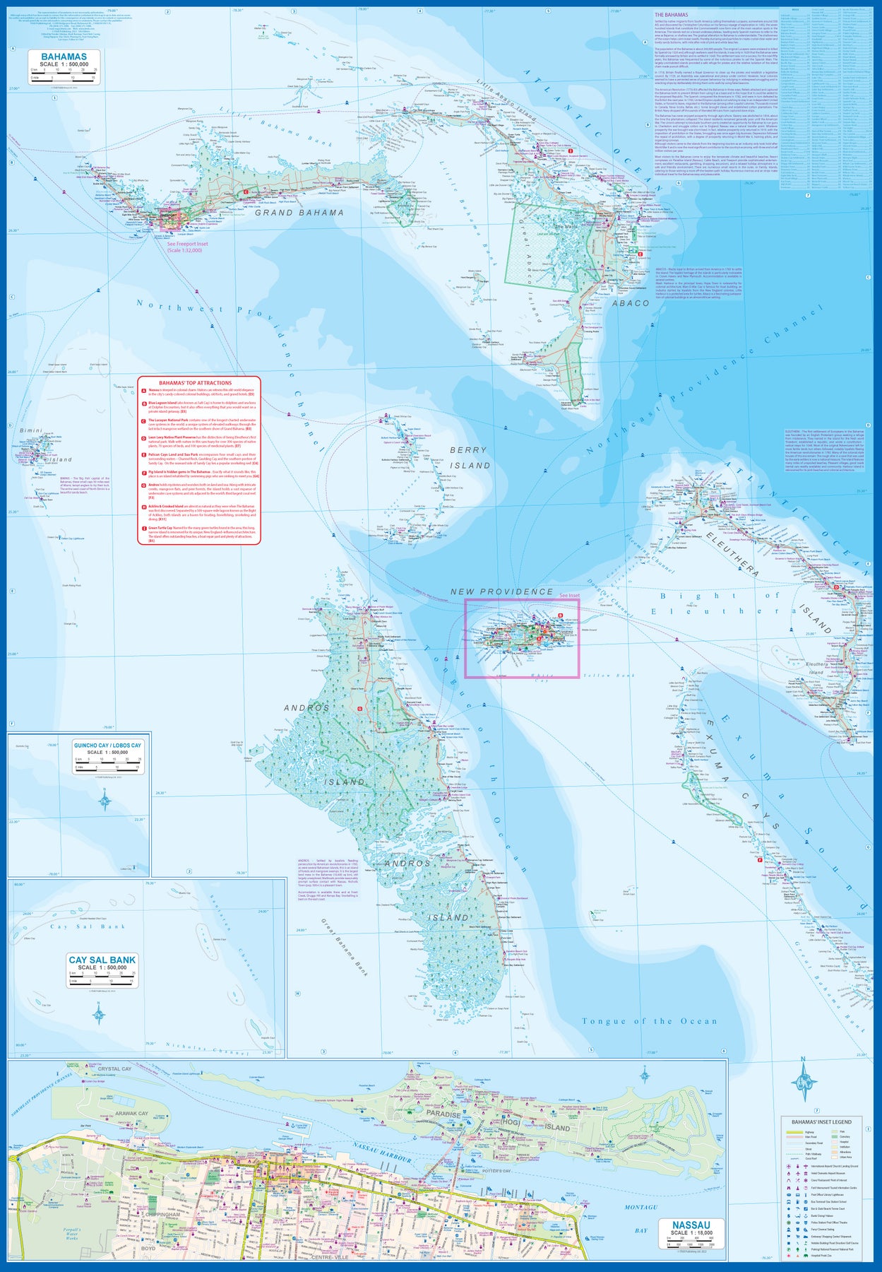
Bahamas
Ordinær pris 189,00 krITM har kart over hele verden og de spesialiserer seg på land litt utenfor allfarvei. Beliggenheten til landets nasjonalparker, historiske monumenter, de viktigste veiene o.L. Finner du inkludert i kartene. Samtlige landkart har ofte et bykart over hovedstaden.
Fra ITM: This fifth edition of our popular travel map to the many Bahamian islands shows a wealth of accommodations, beaches, and points of interest. Inset maps of Nasau and Freeport detail the two largest cities, and a special inset of New Providence Island, the most popular tourist destination, shows resorts and attractions that make this island so popular. As usual, we include a Top Attractions list of the 'must see' destinations.
Publisert år: 2023
Innbinding: falset
Material: plastpapir
Målestokk: 1:500,000
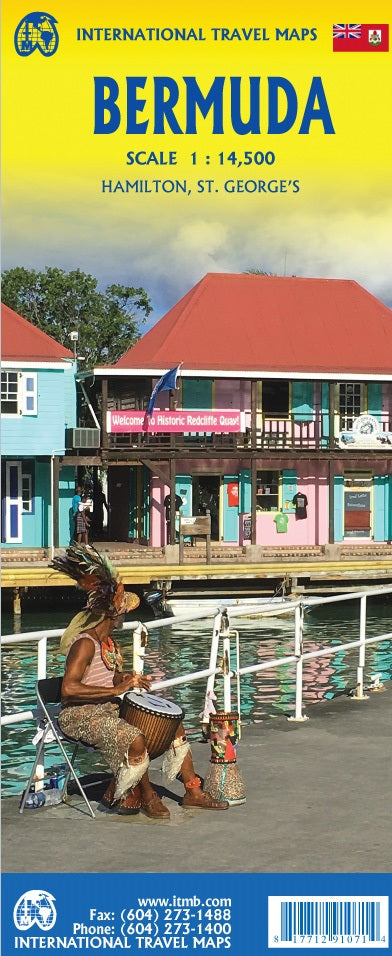
Bermuda
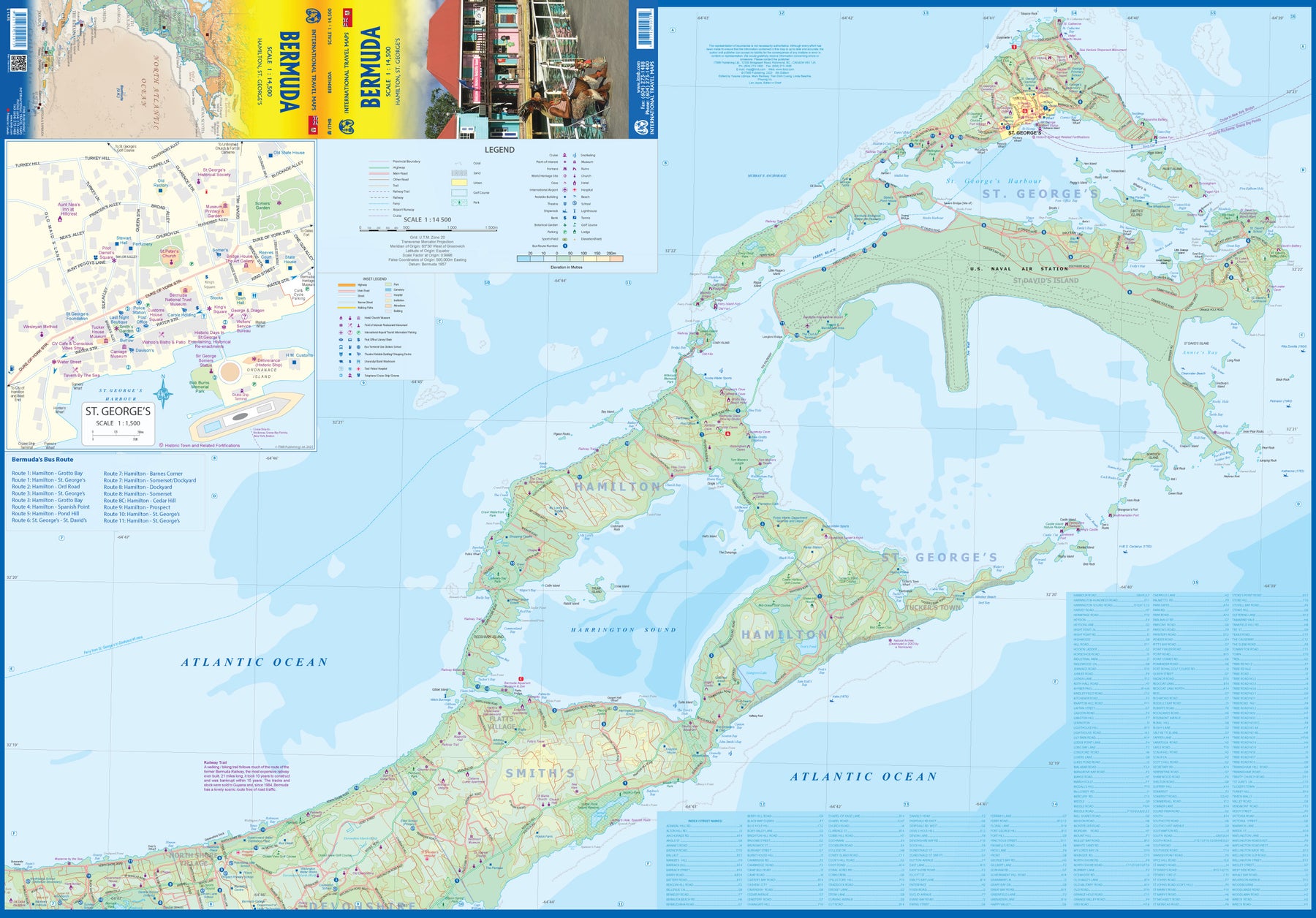
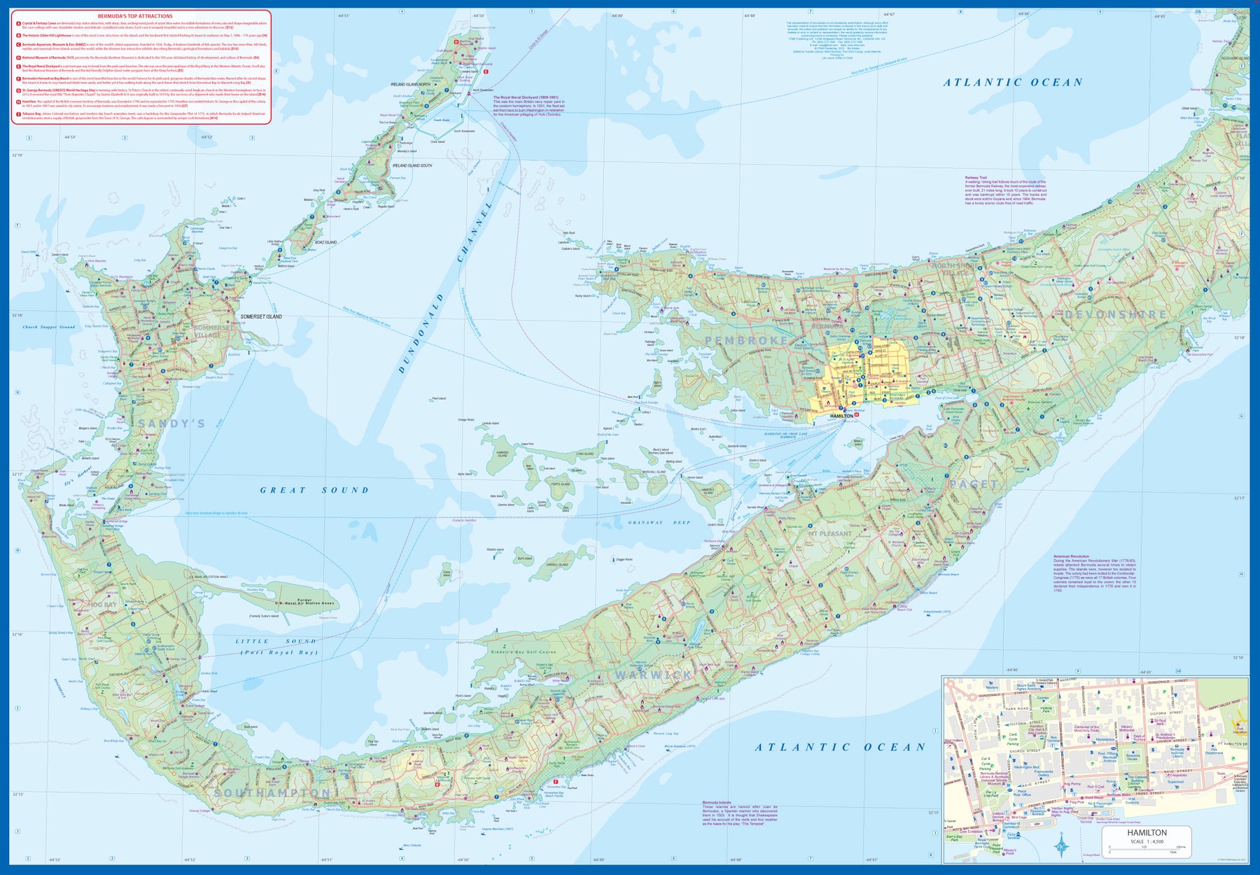
Ordinær pris 179,00 krBermuda is a lovely mid-Atlantic island far off the coast of South Carolina. It is full of colonial architecture and an ‘island’ way of life. Tourism is a key ingredient of the colony’s lifeblood and the island is very popular with cruise ships. There is ample accommodation for longer-term visitors, good roads, and much history. The airport was built by the US Navy during WW2 and is still a US Naval Air Station, but shares the runway with civil aviation.
The map includes an excellent inset of St. George’s, which still has its stocks close to the town hall, and another of Hamilton, the capital. This is where most cruise ships dock. For those with the time, the map shows the Railway Trail along the former route of the island’s now-defunct rail line. Lots to see; lots to do!
Canada: East Coast
Ordinær pris 199,00 krCanada is a vast country in area; inconceivably enormous in European terms. It is best mapped as a series of regional maps and this is the first of two maps that we hope will portray the Atlantic coastline of all of North America. Side 1 concentrates on Newfoundland and Labrador, with a tiny bit of Nunuvut at the top end of the Ungava Peninsula. An inset map of St. John’s, capital of Nfld/Lab is included, as is the French Overseas Territory of St. Pierre et Miquelon. The new paved highway across Labrador is the highlight of this side of the map!
The second side of the map focusses on Nova Scotia/Cape Breton and parts of Prince Edward Island and New Brunswick, with a detailed inset of central Halifax. The former French fortress of Louisbourg is a must-see for anyone visiting Cape Breton, as are the many Loyalist towns created along the coast of Nova Scotia to house refugees fleeing turmoil in the American colonies during the Revolutionary War. A separate map concentrating on the Atlantic coastline of the USA is being prepared.
Canada: Garibaldi Provincial Park
Ordinær pris 149,00 krITM har kart over hele verden og de spesialiserer seg på land litt utenfor allfarvei. Beliggenheten til landets nasjonalparker, historiske monumenter, de viktigste veiene o.L. Finner du inkludert i kartene. Samtlige landkart har ofte et bykart over hovedstaden.
Publisert år: 2009
Innbinding: falset
Material: plastpapir
Målestokk: 1:50000
Canada: Haida Gwaii / Queen Charlotte Islands
Ordinær pris 149,00 kr Salgspris 74,50 kr Spar 50%ITM har kart over hele verden og de spesialiserer seg på land litt utenfor allfarvei. Beliggenheten til landets nasjonalparker, historiske monumenter, de viktigste veiene o.L. Finner du inkludert i kartene. Samtlige landkart har ofte et bykart over hovedstaden.
Fra ITM: 7th edition 2017. Times change, and a consensus has grown into a realization that the traditional indigenous name for the islands off BC's shore should be recognized. At the same time, the official name still recognizes the historical relationship of Queen Charlotte and the early days of British trading. We have added a new map of BC's coastline to the reverse side, covering from the US border north to Prince Rupert. As well, both sides have their own Top Attractions lists to focus attention on major sites, such as Ninstints at the southern tip of HG. As in the past, this edition is printed on tear-resistant waterproof paper. Coast in the scale 1:900.000 with inset maps of Vancouver & Victoria. Haida Gwaii in the scale 1:280.000.
Publisert år: 2017
Innbinding: falset
Material: Plastpapir
Målestokk: 1:280000
Caribbean Islands Atlas - West Half
Ordinær pris 169,00 kr Salgspris 84,50 kr Spar 50%Itm har kart over hele verden og de spesialiserer seg på land litt utenfor allfarvei. Beliggenheten til landets nasjonalparker, historiske monumenter, de viktigste veiene o.L. Finner du inkludert i kartene. Samtlige landkart har et bykart over hovedstaden.
1st Ed. 2013 160 pages, with a spine; scale varies The Caribbean is a particularly difficult part of the world to map effectively. It is a combination of larger islands in the west and a string of small islands in the east. Some can be shown as separate maps, but others are too small (or too lacking in market appeal) to be mapped adequately as folded paper maps. This atlas covers the Bahamas and the Turks and Caicos Islands in the north with Cuba, the Cayman Islands, Jamaica, the Dominican Republic, and Puerto Rico in scales ranging from 1:18,000 for Puerto Rico to 1:600,000 for Cuba The atlas is the same size as all ITM atlases (8 x5 or 21x13.5cm) and has a straight spine edge with title for displaying spine outwards on store shelves, if desired. Essentially, this atlas covers six different areas mapped by ITMB folded maps and adds the Turks area. Inset maps of Freeport, Nassau, Havana, Varadero, Georgetown, Kingston, Port Au Prince, Santo Domingo, and San Juan are included. The level of detail is identical with ITM s folded maps; this is a marketing concept for those wishing the convenience of information in a convenient book format, with no loss of detail.
Publisert år: 2013
sider nr: 157
Innbinding: hft
Material: papir
Målestokk: various
Dominican Republic & Haiti
Ordinær pris 149,00 krITM har kart over hele verden og de spesialiserer seg på land litt utenfor allfarvei. Beliggenheten til landets nasjonalparker, historiske monumenter, de viktigste veiene o.L. Finner du inkludert i kartene. Samtlige landkart har ofte et bykart over hovedstaden.
Fra ITM: We spent a week on the lovely island of Hispaniola, home to the Dominican Republic and Haiti, last December. We spent several days driving the highways, checking our information and this new edition is the result. Frankly, we were surprised how accurate the digital artwork was (and is); this is the first time that we have been able to ground-truth a map shortly before printing, and after updating. We did discover one new toll highway, and we learned that Santa Domingo floods rather easily during heavy rains. We now show a lot of what I would consider to be local farm roads; they exist, but it is doubtful any tourist would use them. We also discovered a new motorway-like highway that is under construction between Santiago and Puerto Plata, but we are leaving it off the map for now as work has just begun and we saw little indication that it would be completed. We can add it if we see progress. The Haiti side of the sheet remains a work in progress. There are now five border crossings with Dom Rep and a lot of cross-border traffic, but the road network in Haiti remains quite basic. We have added hundreds of small local roads to our artwork; most are simple dirt tracks. We have also added a series of top attractions for Haiti, highlighted in red, and a separate series for Dom Rep. Although this could be considered a significant update.
Publisert år: 2017
Innbinding: falset
Material: plastpapir
Målestokk: 1:400,000 / 1:350,000
Jamaica & Cayman Islands
Ordinær pris 149,00 krITM har kart over hele verden og de spesialiserer seg på land litt utenfor allfarvei. Beliggenheten til landets nasjonalparker, historiske monumenter, de viktigste veiene o.L. Finner du inkludert i kartene. Samtlige landkart har ofte et bykart over hovedstaden.
Fra ITM: This map was called Cayman Islands and Jamaica in its previous edition, which was a well-intentioned attempt to promote the smaller islands adjacent to big brother. Now, we are reverting to what we think is a more logical title arrangement for listing purposes, but the map has two covers, so one can market it as either Jamaica or the Caymans, or best of all, market both! We visited the Caymans a few months ago and drove every road on the main island, including a few that turned out to be driveways! The map is very current as a result. The other side of the map is the very popular touristic island of Jamaica, now into its sixth edition. This island is large enough to justify renting a car and exploring. It is a great way to discover hidden coves and find historic plantations, especially along the touristic north shore. 6th/3rd Ed. 1:250,000/1:37,500
Publisert år: 2017
Innbinding: falset
Material: papir
Målestokk: 1:250000/37,500
Mexico
Ordinær pris 189,00 krITM har kart over hele verden og de spesialiserer seg på land litt utenfor allfarvei. Beliggenheten til landets nasjonalparker, historiske monumenter, de viktigste veiene og lignende finner du inkludert i kartene. Samtlige landkart har ofte et bykart over hovedstaden.
Fra ITM: Mexico is a fascinating country, and as travel re-opens, is proving to be very popular. This most recent edition was recently printed, and is now the current edition. Double sided detailed travel map, with comprehensive place name index. Distinguishes roads ranging from expressways (free/toll) to rural roads. Legend includes railways, tracks, trails, international airports, domestic airports, bridges, border crossing points, points of interest, archaeological sites, beaches, active volcanos, filling stations, national parks, deserts, places of touristic interest. Printed on durable, water-resistant plastic paper, suitable for travelling in areas with extreme humidity. This is another chestnut in the ITMB line, and sells well. The cover picture is new, as is the ISBN. Mexico is a very large and diverse country, and very popular with Americans. Again, there is little one can say that is news about such a tried-and-true map, except to say that it is extremely popular.
Mexico: Chihuahua & Coahuila
Ordinær pris 169,00 krITM har kart over hele verden og de spesialiserer seg på land litt utenfor allfarvei. Beliggenheten til landets nasjonalparker, historiske monumenter, de viktigste veiene o.L. Finner du inkludert i kartene. Samtlige landkart har ofte et bykart over hovedstaden.
Fra ITM: Northern Mexico is a vast desert-like plateau deeply steeped in Spanish colonial heritage. The very first settlement inside what is now the USA was the town of Presidio (long before the English thought of settling Jamestown) and is still one of the few crossings of the Rio Grande into Texas (itself a former Mexican province). There are two major cities in the region, Chihuahua, 300 kms south of El Paso, and Monterrey, the largest city in northern Mexico. There are major touristic attractions at Monclova, Saltillo, Parras, Torreon, and Cuauhtemoc, the end of the famous Copper Canyon rail line. The map extends a bit into Sinaloa, to include Los Mochis on the Pacific coastline. The entire rail line is also shown. This is an important part of North American history. It may not be as well-known to Europeans who favour the beaches of the Yucatan, but it is a fascinating part of Mexico on the American border. Ciudad Juarez, for example, is larger than its partner on the Rio Grande, El Paso. An inset map of the old colonial city of Saltillo is included, as well as our Top Attractions list.
Publisert år: 2022
Innbinding: falset
Material: papir
Målestokk: 1:750000
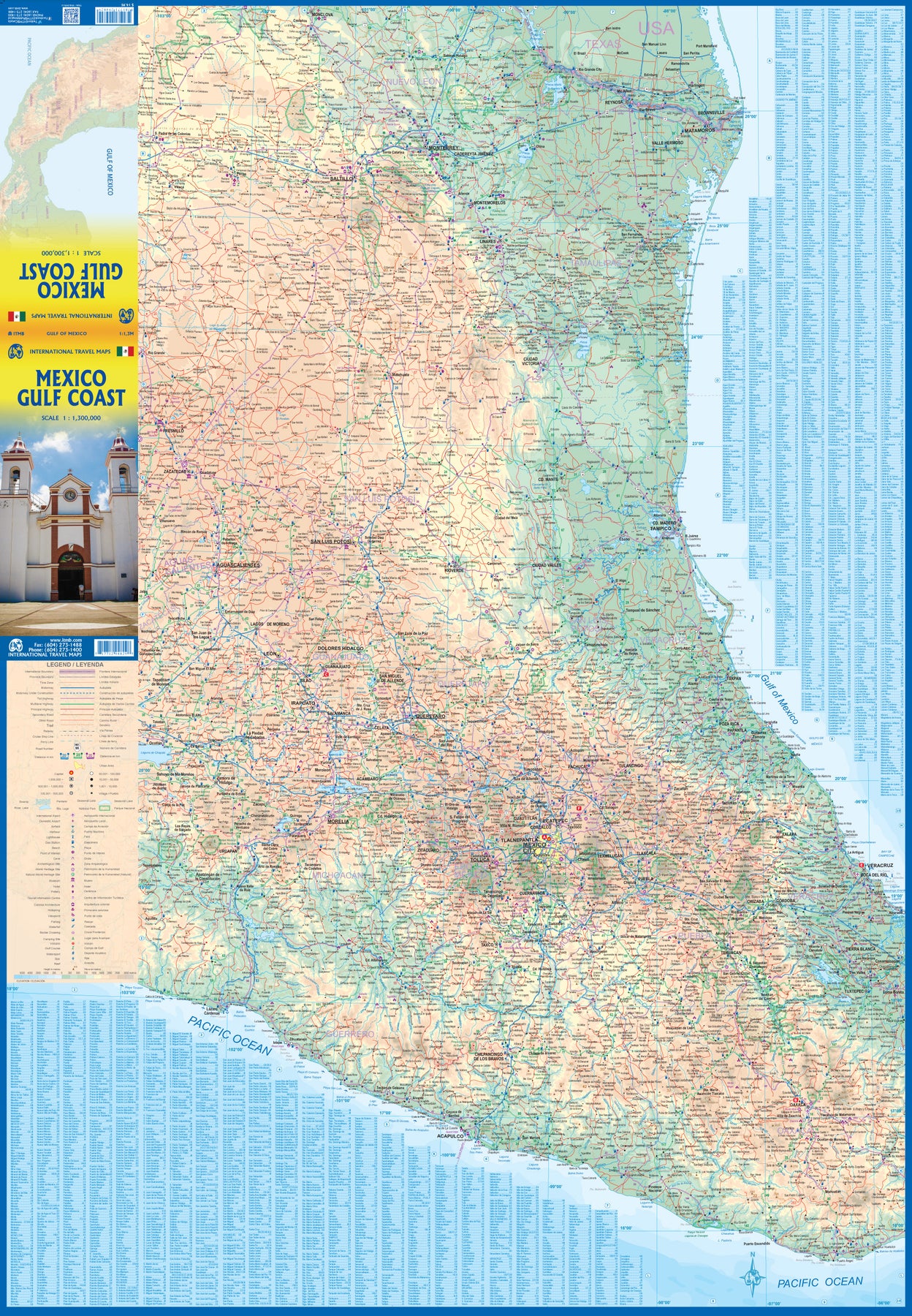
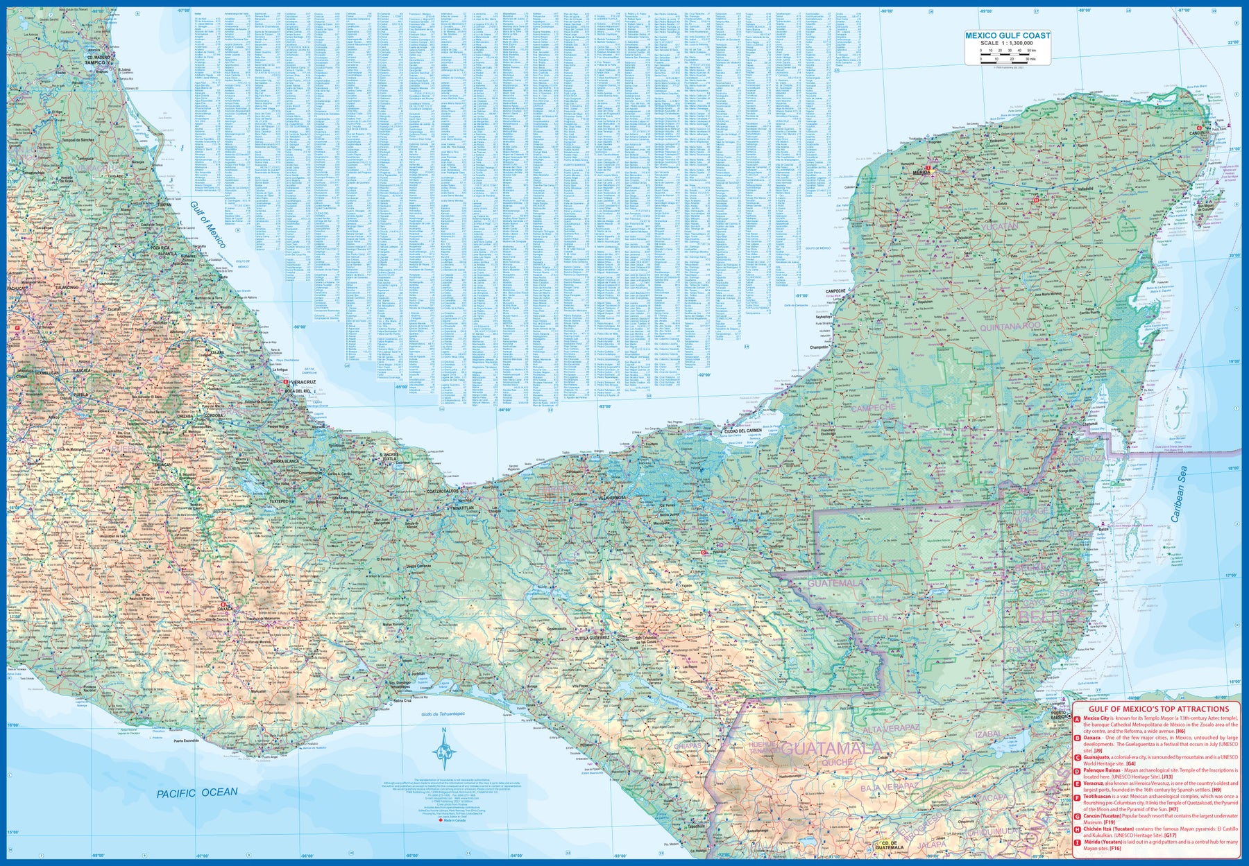
Mexico: Gulf Coast
Ordinær pris 169,00 krMexico is an ever-popular travel destination. The country is so large that we started mapping it as a series of regional maps years ago. The Gulf Cost extends from Brownsville, Texas through Vera Cruz to the Yucatan Peninsula. Due to the shape of the region, all of Belize and about half of Guatemala is included, but the focus is on the many attractions of the eastern Gulf coast of Mexico. Side 1 cover the northern coastal regions, going inland as far as Monterrey, Zacatecas, Morelia, and Mexico City.
Side 2 shows the Gulf Coast from Tampico to Carmen, then on to Merida, Cancun, and the southern tip of Belize. By the shape of this part of Mexico, the Pacific Coast, from the Guatemalan border westwards past Acapulco is also shown. All major roads are shown, but as passenger rail service was discontinued several years ago, we have opted to not show most rail lines. This is a map for explorers and adventurers to discover by driving. It covers all of historic Mexico and complements other ITMB maps detailing regions of a fascinating country, where the first word you learn is 'Hola!'
Mexico: Mexico Central
Ordinær pris 199,00 krMexico is an exceptionally interesting country to visit. The country itself is larger than most people realize, making sectional maps essential. We started mapping Mexico in the late 1980s and have gradually added regional maps as time and money enabled. Naturally, touristy popular areas like the Yucatan, Baja, and the Pacific Coast really need specialized maps, but so does the central region of the country. This map covers from Mexico City south to Acapulco and east almost as far as the Guatemalan border on side 1, and from Puebla west to Guadalajara on side 2.
Highlights include the colonial mining town of Taxco, the ruins of the Aztec capital of Teotihuacan, the untouched historical city of Oaxaca, and the mountain centre of Tuxtla Gutierrez. This is a map for driving and exploring and coming to understand one of the most important countries in the Americas.
Mexico: Mexico City & Mexico Central
Ordinær pris 179,00 krITM har kart over hele verden og de spesialiserer seg på land litt utenfor allfarvei. Beliggenheten til landets nasjonalparker, historiske monumenter, de viktigste veiene og lignende finner du inkludert i kartene. Samtlige landkart har ofte et bykart over hovedstaden.
Fra ITM: Mexico City is the largest city in the Americas, with a population of about 30 million. Our map concentrates on the core of the city, which is where hotels, attractions, and touristic interest abounds, from the train station in the north to the university in the south and from the huge bus station in the east to Chapultepec Park in the west. Insets of the metropolitan area and of the rapid transit network are included. The second side contains a detailed regional map of that part of Mexico deemed to be ‘central’; essentially, from Pueblo in the east to Guadalajara in the west and from Taxco in the south to San Luis Potosi in the north. Top attractions include San Miguel de Allende, Guanajuato, the Great Pyramid of Cholula, and the colonial city of Puebla.
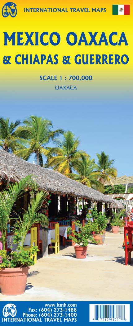
Mexico: Oaxaca & Chiapas & Guerrero
Ordinær pris 169,00 krITM har kart over hele verden og de spesialiserer seg på land litt utenfor allfarvei. Beliggenheten til landets nasjonalparker, historiske monumenter, de viktigste veiene o.L. Finner du inkludert i kartene. Samtlige landkart har ofte et bykart over hovedstaden.
Fra ITM: Travel to Mexico is exploding at the moment, as Covid restrictions lift. That portion of Mexico that forms the relatively narrow land mass between Mexico City and the Yucatan Peninsula is called the Isthmus of Mexico. It consists of three states, Oaxaca, in the west, Chiapas in the east, and Guerrero in the west. This is a double-sided map, stretching from west of Acapulco to beyond the border with Guatemala along the Pacific coast, and from Veracruz to Carmen along the Gulf of Mexico coast. It is the part of Mexico containing numerous holiday resort areas for sun-lovers, but is also rich in history and attractive colonial-era towns.
Oaxaca City is a UNESCO World Heritage site, as is the Mayan temple site of Palenque. There are numerous archeological sites in the region to explore, such as Monte Alban, which dates from the 8th Century BC. The colourful mining town of Taxco, with its narrow cobblestone streets, is a must-see, as is San Cristobal de Las Casas, in Chiapas State. This is an extremely popular part of Mexico to visit, so we are very pleased to be able to bring it back into print.
Mexico: Sonora & Sinaloa
Ordinær pris 169,00 krITM har kart over hele verden og de spesialiserer seg på land litt utenfor allfarvei. Beliggenheten til landets nasjonalparker, historiske monumenter, de viktigste veiene og lignende finner du inkludert i kartene. Samtlige landkart har ofte et bykart over hovedstaden.
Fra ITM: The northern Pacific coastline of Mexico borders on California and Arizona and is a popular travel destination. Sonora is the more northerly state of Mexico, bordering on Baja California on its west (much of which is included on this map) Nogales is probably the best-known city, although Hermosillo is the capital. Sinaloa is more southerly, and is probably best known for Mazatlán, the popular ocean resort community and cruise ship port of call. Sinaloa is also the starting point for the famous train excursion known as the Copper Canyon, originating in Los Mochis. The rail route is shown on the map. The canyon is actually in Chihuahua State, which is included on this map, and goes through a portion of Mexico that is pretty much devoid of roads. The trip ends in Cuauhtémoc, but users are advised to stay on the train to the capital city, also called Chihuahua. We have included the top ten attractions of the region, including the Pinacate Volcanic Field, the Nacapule Canyon, and Las Labradas World Heritage site. This is a part of Mexico easy to reach from the USA, and has many attractive cities
Puerto Rico & Virgin Islands
Ordinær pris 169,00 krITM har kart over hele verden og de spesialiserer seg på land litt utenfor allfarvei. Beliggenheten til landets nasjonalparker, historiske monumenter, de viktigste veiene o.L. Finner du inkludert i kartene. Samtlige landkart har ofte et bykart over hovedstaden.
Fra ITM: The American territories of Puerto Rico and the US Virgin Islands are anomalies in the modern world, neither fish nor fowl, as the saying goes. Although the residents are American citizens, they have no representation in Congress and are not allowed to vote in national elections. The lesser-known British Virgin Islands are included on this double-sided map. The BVI is still a British colony, consisting of about 20 islands, capitaled in Road Town (inset included). Puerto Rico (1:190.000) is a large, rectangular island, capitaled by San Juan (inset included) and is a major cruise ship point of origin as well as being home to resort communities all over the main island. Ferries connect to outlying islands. The VI portion was purchased from Denmark in 1917 and retains a colonial European charm. There are three main islands – St. Croix, St. Thomas, and St. John – and the map includes inset maps of Charlotte Amalie, Cruz Bay, Christiansted, and Frederiksted. Each side of the map sheet includes a listing of top attractions. Ferry routes to the BVI are shown, as well as water connections between the islands. Virgin islands 1:85.000.Legend Includes:Roads by classification, Rivers and Lakes, National Park, Airports, Points of Interests, Highways, Main Roads, Zoos, Fishing, and much more...
Publisert år: Aug. 2021
Innbinding: falset
Material: vanntet tpapir
Målestokk: 1:190000/1:85,000
Saint Lucia & Martinique
Ordinær pris 149,00 krITM har kart over hele verden og de spesialiserer seg på land litt utenfor allfarvei. Beliggenheten til landets nasjonalparker, historiske monumenter, de viktigste veiene og lignende finner du inkludert i kartene. Samtlige landkart har ofte et bykart over hovedstaden.
Fra ITM: Saint Lucia in 1:45.000 and Martinique in 1:65.000. We have included an inset map of Castries, the capital, noting, among other things, the cruise ship terminals (there are two) and the inter-island ferry terminal. That is important because St. Lucia is now linked to neighbouring Martinique by a scheduled ferry service and it is very convenient for visitors wishing to enhance their visit by adding a day trip to Martinique. For this reason, we have added a full-page map of Martinique to the reverse side of the sheet. The ferry goes to Fort-de-France, the capital, and the map includes an inset of the city, showing where the ferry docks. Martinique, with its French heritage, is more exotic than most English-speaking Caribbean countries, but is friendly and somehow different.
It is considered an extension of France and thus of the European Union, so uses the Euro. Although the common language is French (or a variety of it), English is well-understood. Cars are readily available for hire and road conditions are good. The island even boasts a motorway, going to the island’s south coast. Both islands are important Caribbean travel destinations, with resort hotels concentrated on Marigot Bay and Rodney Bay in St. Lucia and in the Pont du Bout peninsula of Martinique. The map has a double-sided cover for ease of marketing.
USA: Appalachian Trail
Ordinær pris 99,50 krThis is a new venture for ITMB, although we have published several recreational hiking maps over the years. The Appalachian mountain range was the original western boundary of the American colonies while under British rule. Everything west of there was technically the French possession of Louisiana Territory, called by American settlers ‘Indian country’. Nowadays, it is a massive recreational hinterland for east coast residents wanting to escape overcrowded cities. The National Parks Service maintains the trail and a series of overnight huts.
Most people only hike a portion of the trail, but for the dedicated hiker, the trail is a great adventure. We have divided the length of the trail into four natural regions: Maine into New York State, Connecticut south to Maryland, Maryland to Virginia, and Virginia to Georgia, to its traditional end at Springer Mountain. This is a demanding trail hike, but one of the most popular in the world.
USA: Arizona & New Mexico
Ordinær pris 169,00 krThis version includes two separate covers, one for each state, to enhance marketing possibilities, and the addition of two Top Attractions listings, one for each state. The Arizona side has a detailed inset map of Flagstaff, showing the path of Route 66 through the city streets. The New Mexico side includes a large inset of Albuquerque, also including the Route 66 passageway through the city.
USA: California
Ordinær pris 199,00 krThe American State of California has almost as many residents as all of Canada. I wonder how many of them are ex-pat Canucks? Regardless, this double-sided map shows the attractions of the state in amazing detail. Side 1 concentrates on the northern half, with a large inset map of San Francisco. A fairly large portion of Nevada shows as well, but with less detail.
Side 2 continues south to the Mexican border and east to Arizona, with a detailed inset map of central Los Angeles included. By the shape of California, all of southern Nevada is included as well, including the all-important wasteland of Las Vegas. All motorways are clearly shown, including those in greater Los Angeles. All state highways are also shown, as well as most secondary connecting roads. Parks, points of interest, beaches, redwood forests, and distances between major communities are also shown. The state is blessed with interesting offshore islands, such as Catalina, San Clemente, and the Channel Islands, all of which are included.
USA: Hawaii - Maui; Kauai & Molokai
Ordinær pris 199,00 krThe island of Maui may not be at well-known as Oahu, which is extremely popular with Japanese honeymooners, but it is as attractive touristically. Our coverage covers most of Side 1 and includes a detailed inset map of Wailuku, the principal urban area, as well as insets of Lahaina on the west coast and Wailea resort area. This side also includes a map of the island of Lanai, with its main urban area of Lanai City as an inset.
Side 2 concentrates on the islands of Molokai, Kauai, and the lightly populated island of Ni’ihau, and includes detailed inset maps of Lihue, Kaunakakai, and Po’ipu, all of which are major resort destinations. The islands are loaded with beaches and places to stay, but also with attractions, which are shown on the map. This is a beautiful map, one of the best we have ever produced, and is a fitting companion to our maps of Big Island, and Oahu/Honolulu, as well as our state map. The Maui/Kauai map also has a double-sided cover, so can be displayed as two separate maps.
USA: Las Vegas & Region
Ordinær pris 199,00 krStreet plan of Las Vegas with a map of the Las Vegas region at on the reverse. Street names are clearly marked, with rail and monorail lines and stations displayed. Places of interest are shown, with the names of casinos, wedding chapels, shows such as Spamalot all displayed prominently. Local facilities such as petrol stations, hotels, swimming pools are marked.