8 produkter
8 produkter


8 produkter
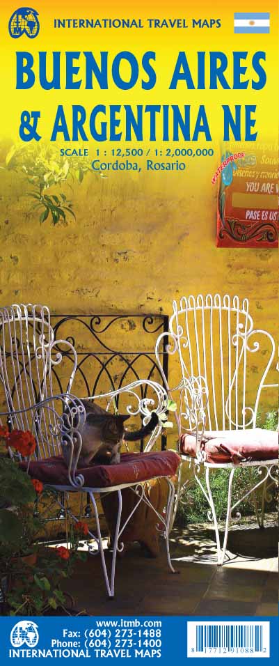
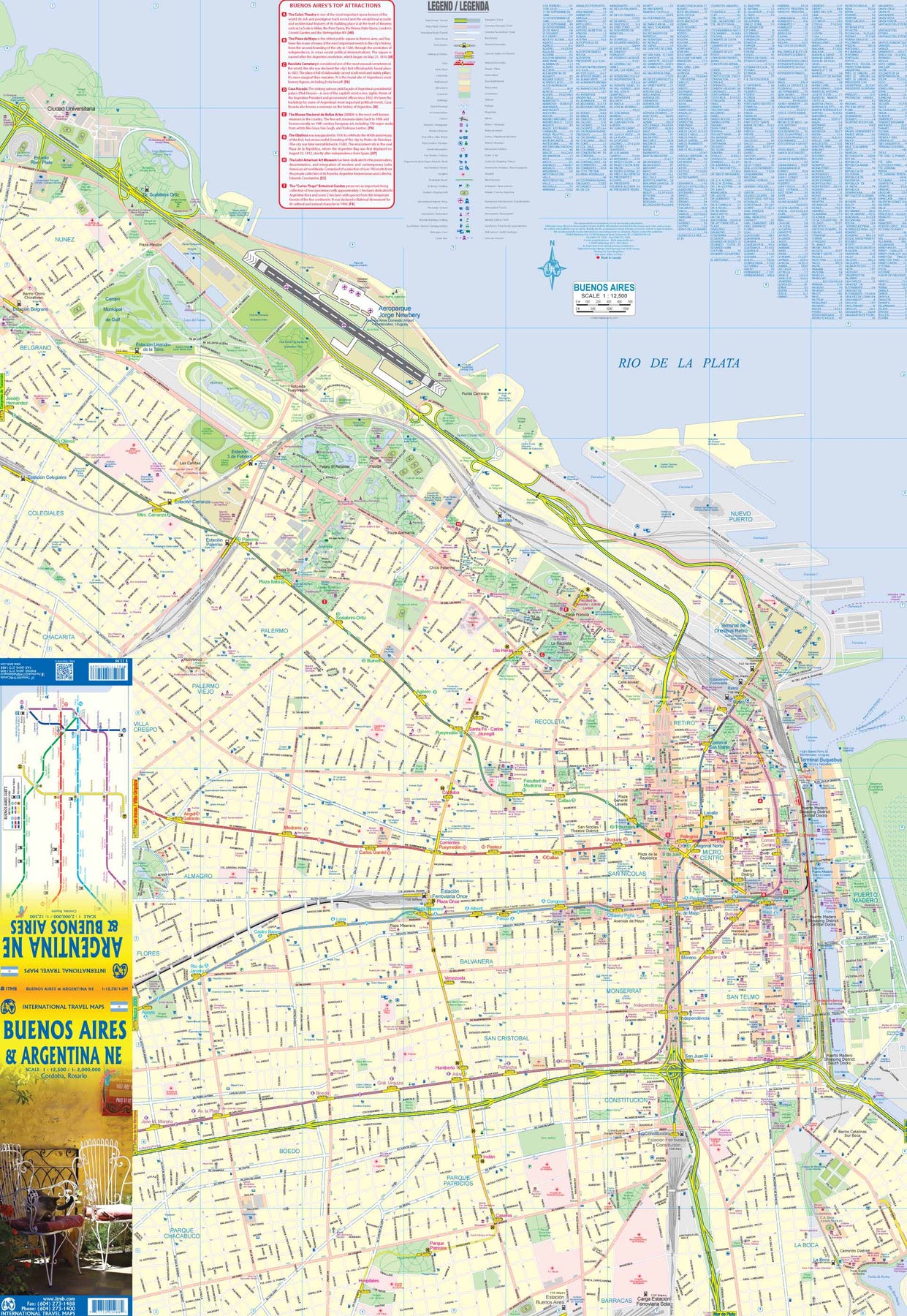
Argentina: Buenos Aires & Northeast
Ordinær pris 199,00 krThis version represents a thorough updating of this important Argentinean city. The subway lines are now clearly shown and the main shopping/pedestrian ways more clearly delineated. All three railway stations are shown, although rail services have largely been curtailed except for suburban usage. The cruise ship terminal has been added and the ferry crossing to Uruguay moved. La Recoleta cemetery has had pathways noted. The airport shown is only used for local flights, as the main international airport is quite far away from the city.
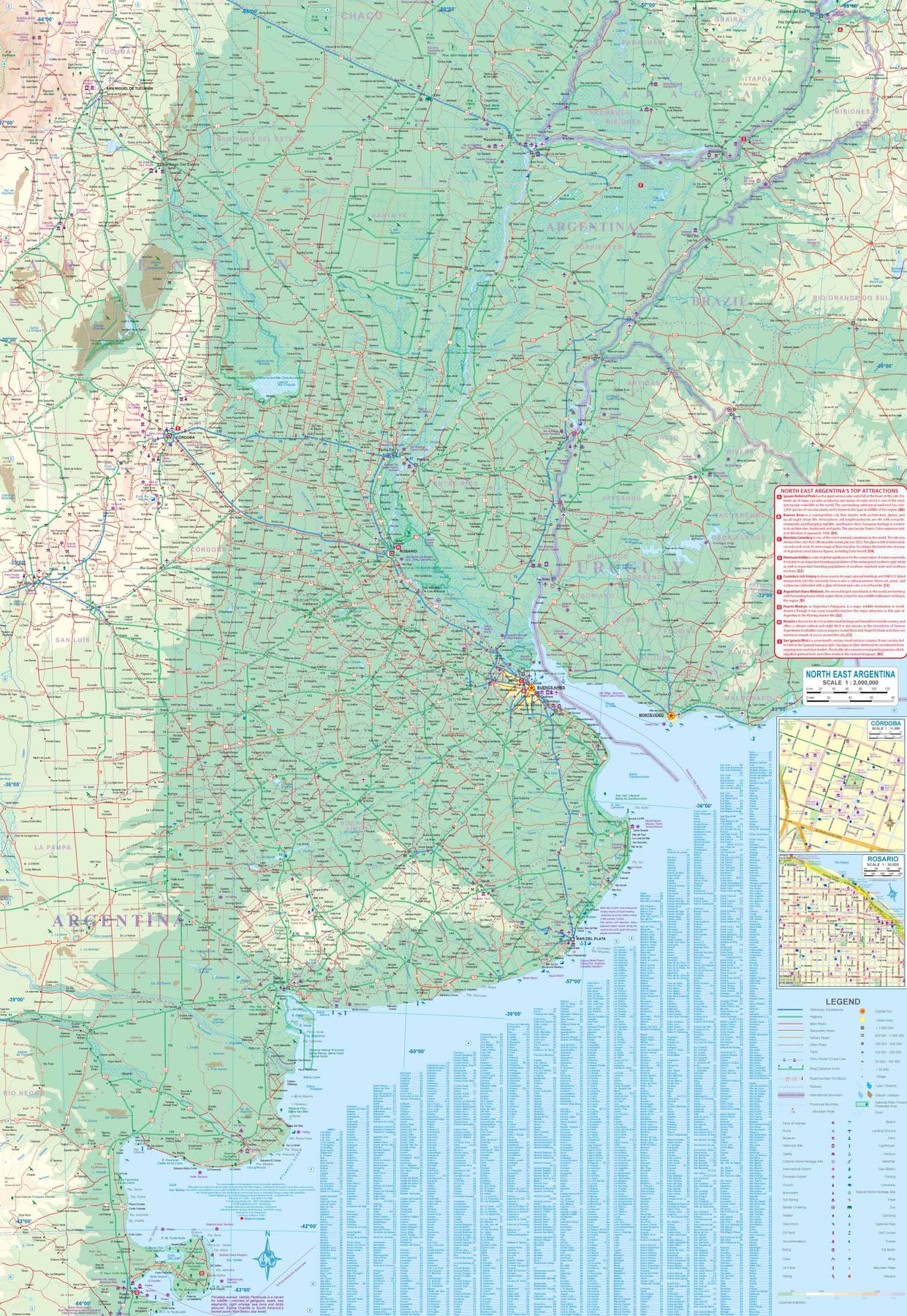
It is noted on the second side of the map, which covers all of northeastern Argentina, most of Uruguay, and small portions of Brazil and Paraguay. No visit to Argentina would be complete without including Iguazu Falls or historic Cordoba, which are on this map. The regional map goes as far south as Puerto Madryn and includes such popular destinations as Bahia Blanca and Mar del Plata. Insets of Cordoba and Rosario are included.
Bolivia
Ordinær pris 199,00 krITM har kart over hele verden og de spesialiserer seg på land litt utenfor allfarvei. Beliggenheten til landets nasjonalparker, historiske monumenter, de viktigste veiene o.L. Finner du inkludert i kartene. Samtlige landkart har ofte et bykart over hovedstaden.
Fra ITM: 6th edition 2025. As a travel destination, Bolivia definitely ranks among the routes less travelled! However, it is a fascinating country and well-worth visiting. We have printed this edition on plasticized paper for durability, as one will definitely need a map to get around this mountainous country. The map shows the road network to best advantage, with distances between communities whenever possible Touristic sites are noted, and elevations, parks, and reserves. Inset maps of La Paz, Potosi, and Santa Cruz de la Sierra are included.
Publisert år: 2025
Innbinding: falset
Material: plastpapir
Målestokk: 1:1,400,000
Brazil: Amazon & Brazil North
Ordinær pris 199,00 krWe first mapped the Amazon River Basin for a rainforest protection conference many years ago, preparing what we thought was a pretty good rendition until we arrived at a conference full of experts who were able to add so much more data that we re-did the map before publishing it. We have updated it repeatedly as more information has come to light and are pleased to release this sixth version, which does something that we have wanted to do for some time - it adds a detailed map of the northern half of Brazil/Brasil to a river map that covers portions of seven different countries.
The map is printed on revolutionary stone paper (tear-resistant, waterproof, friendly to the environment, and bio-degradable as well as extremely durable), and has two different cover pictures, so it can be marketed either as a map of Brasil or of the Amazon Basin - or both! It is also the only map of the river basin in print. As the world emerges from the era of Covid, this part of the world will once again dominate demand for South American explorers.
Brazil: Sao Paulo & Brazil South Coast
Ordinær pris 189,00 krITM har kart over hele verden og de spesialiserer seg på land litt utenfor allfarvei. Beliggenheten til landets nasjonalparker, historiske monumenter, de viktigste veiene o.L. Finner du inkludert i kartene. Samtlige landkart har ofte et bykart over hovedstaden.
Fra ITM: Sao Paulo is Brasil’s second-largest city and most vibrant area. The Centro, or downtown area, is quite compact, and consists of two pedestrian areas separated by a large park. The street pattern is much better arranged than in Rio, and the city has a sensible subway network. The Cathedral is the largest in Latin America, and nearby is one of the oldest churches, dating from 1644. The other side of the sheet is the real value of this map. Brasil is a very large country, with much of its road network concentrated in the heavily-populated far south. Thus, a map of the entire country reduces usability. We have added a proper map of the southern third of Brasil, from the Uruguayan border north to Brasilia and from the Argentinian border eastwards to east of Rio. This map includes most of the largest cities in Brasil, Rio, Sao Paulo, Belo Horizonte, Brasilia, Curitiba, and Puerto Alegre. An inset of Rio is included.
Publisert år: 2018
Innbinding: falset
Material: papir
Målestokk: 1:12000/2200000
Chile: Easter Island & Santiago
Ordinær pris 199,00 kr4th edition 2015. Easter Island is so isolated that it is not certain whether it is part of Polynesia or an off-shoot of South America. Geologically, it is neither; just a volcanic lump in the vast expanse of the Pacific Ocean. Its original inhabitants probably came from Polynesia; since supplanted by migrants from Chile, which is the political authority governing the island. Regardless, it is an intriguing place, famous for the Maoi – giant heads originally raised to protect family holdings. These huge, mysterious heads rest in various locations on the island and are one of the wonders of the world.
This map also includes a detailed map of Santiago de Chile, the capital of Chile, for the simple reason that all flights to Easter Island originate in that city, so everyone going to Easter Island needs a map of Santiago as well. This usage is merely for the convenience of visitors going to Easter Island.
Paraguay & Bolivia South
Ordinær pris 199,00 krITM har kart over hele verden og de spesialiserer seg på land litt utenfor allfarvei. Beliggenheten til landets nasjonalparker, historiske monumenter, de viktigste veiene og lignende finner du inkludert i kartene. Samtlige landkart har ofte et bykart over hovedstaden.
Fra ITM: Expanding the area of coverage benefits visitors combining Paraguay and Bolivia into one trip. The first side covers Bolivia from La Paz south to the Paraguayan border, with inset maps of Potosi and Santa Cruz. The second side concentrates on Paraguay itself, with inset maps of Asuncion, the Asuncion region, and northern Paraguay. Small bits of bordering countries also are included. Road connections within Paraguay have been shown to good advantage. Both countries, being land-locked, are somewhat isolated, making travel to them something more adventuresome than visits to neighbouring countries. However, both are hospitable, safe, and tourist-friendly.
Inkl. bykart over: Asunción.
Surinam & French Guiana
Ordinær pris 149,00 krITM har kart over hele verden og de spesialiserer seg på land litt utenfor allfarvei. Beliggenheten til landets nasjonalparker, historiske monumenter, de viktigste veiene o.L. Finner du inkludert i kartene. Samtlige landkart har ofte et bykart over hovedstaden.
Publisert år: 2009
Innbinding: falset
Material: papir
Målestokk: 1:750000
Venezuela
Ordinær pris 149,00 krITM har kart over hele verden og de spesialiserer seg på land litt utenfor allfarvei. Beliggenheten til landets nasjonalparker, historiske monumenter, de viktigste veiene o.L. Finner du inkludert i kartene. Samtlige landkart har et bykart over hovedstaden.
Publisert år: 2010
Innbinding: falset
Material: Papir
Målestokk: 1:1750000