59 produkter
Langthang Himal East
Ordinær pris 279,00 krAlpeinvereinskarte er en serie detaljerte vandre- og klatrekart over de østeriske og tyske alper. Høy kvalitet og nøyaktig kartografi gjør disse kartene avgjørende for den erfarene klatrer og fjellturist. Fjellhytter, turstier og campingplasser er tydelig markert på kartene. Noen av kartene er også utgitt i egne skiutgaver.
Publisert år: 1990
Målestokk: 1:50000
Langthang Himal West
Ordinær pris 199,00 kr Salgspris 149,00 kr Spar 25%Alpeinvereinskarte er en serie detaljerte vandre- og klatrekart. Høy kvalitet og nøyaktig kartografi gjør disse kartene avgjørende for den erfarene klatrer og fjellturist. Fjellhytter, turstier og campingplasser er tydelig markert på kartene. Noen av kartene er også utgitt i egne skiutgaver.
Manaslu Tsum Valley
Ordinær pris 329,00 krComprehensive Trekking map at 1:75,000 scale map from Himalayan Map House.
Updated after the Covid Pandemic, with new Trekking Trails to avoid the Road.
Includes;
-Manaslu Circuit Trek
-Tsum Valley Circuit Trek
-Lower Manaslu Trek
-Ganesh Himal Trek
- Great Lakes Trail Manaslu
-Buddha Himal Base Camp Trek
- All Trekking Routes within Manaslu Region
Mera Peak
Ordinær pris 249,00 krA detailed 1:40,000 scale map which covers trekking to the Top of Mera Peak. The route is a very strenous 14 days going via, Lukla, Chutanga, Zatrwala, Thuli Kharja, Tashing, Ongma, Mosom Kharka, Thangnak. Dig khare, Khare Camp, Merala, Base Camp, High Camp, Mera Central Summit, Mera North Summit, Lukla.
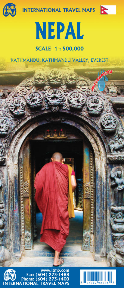
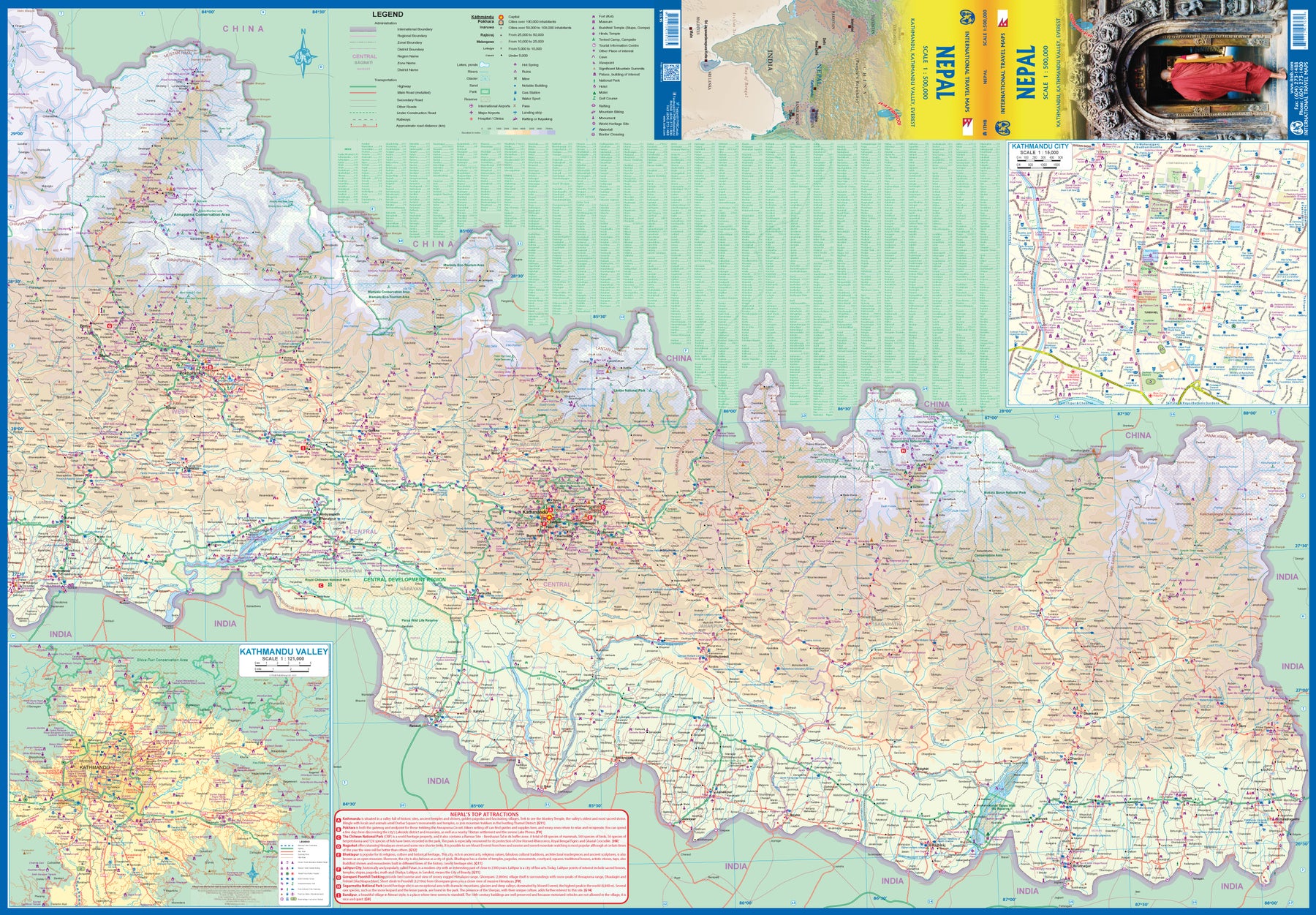
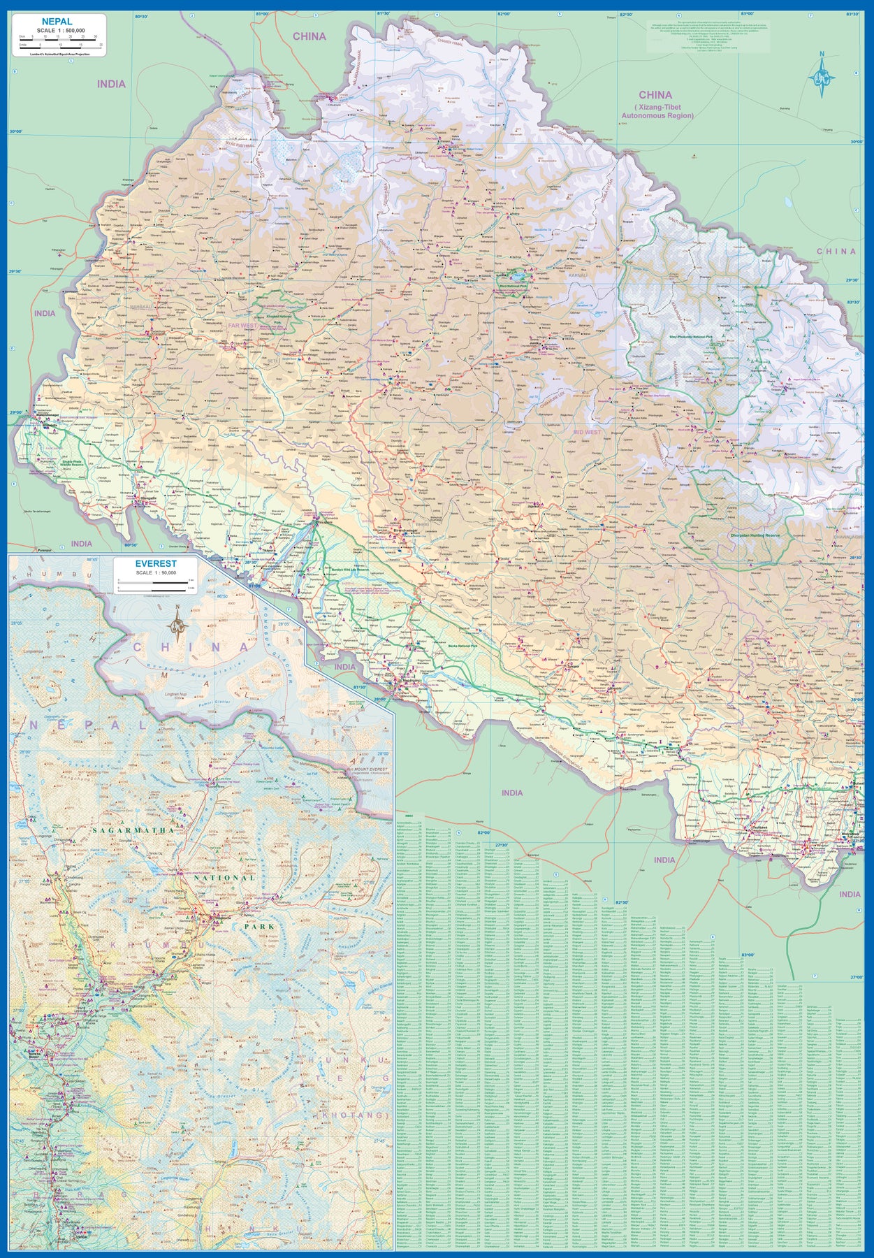
Nepal
Ordinær pris 199,00 krNow it is time to re-introduce the world to one of the most fascinating countries on Planet Earth. Side 1 covers western Nepal around Pokhara and has a detailed inset map of the Mount Everest area in an expanded scale. Side 2 covers the portion of the country from just west of the Annapurna Glacial region eastwards through Kathmandu to the eastern border. A very detailed inset map of Kathmandu is included, as one of the Kathmandu Valley that surrounds the city. Basic road access from India is shown. It is not possible to enter from China.
The map is printed on durable stone paper and is as up to date as we could make information under very trying circumstances. We still hope to visit next year. Nepal is a treasure!
Nepal
Ordinær pris 169,00 krNepal on an indexed, waterproof and tear-resistant road map, ideal for locating the country's numerous famous peaks, with topographic and tourist information, and enlargements for Kathmandu, Pokhara, and Chitwan regions, plus Bhaktapur. The map, published by Reise Know-How as part of their highly acclaimed World Mapping Project, is double-sided to provide the best balance between a good scale and a convenient size sheet.
The base map has altitude colouring with contours, spot heights and mountain passes. Names of main trekking areas are prominently highlighted in coloured boxes (e.g. Khumbu Himal, Mustang, Dolpa, etc.), as are names of national parks and conservation areas. The same system is used for numeous peaks - colour coding to indicate famous peaks (Everest, Annapurna, Kanchenjunga, Dhaulagiri, etc.), peaks requiring permit and fee payment (Island Peak, Mera, Peak, Naya Kanga, etc.) and permit and royalty free peaks. Classic trekking routes are marked, e.g. Jiri to Everest Base Camp, the Annapurna Circuit, etc. The map highlights rafting or kayaking rivers such as Dudh and Tamba Kosi, Kali Gandaki, etc. Areas suitable for mountain biking are also indicated.
Internal administrative boundaries are shown with names of the provinces. Road network includes local roads, highlights scenic routes and indicates locations of fuel supply stations. Local airfields and helipads are also marked. A wide range of symbols highlights various places of interest, including temples and monasteries of various religions, archaeological sites, viewpoints, Tharu villages, crocodile and elephant breeding centres, etc. The map has a latitude and longitude grid at intervals of 15’ and an index of place names which includes peaks and trekking areas. Map legend includes English.
Enlargements, with more detailed contours and altitude colouring, are provided for the Kathmandu - Patan area (1:25,000), Pokhara Valley (1:30,000) and the Narayangadh - Royal Chitwan National Park area (1:200,000). Also included is a plan of Bhaktapur at 1:15,000.
Nepal
Ordinær pris 299,00 krDenne praktiske reiseguiden til Nepal inneholder detaljerte reisetips og oversikt over de mest ikoniske severdigheter, samt noen skatter utenfor allfarvei. Med forslagene til reiseruter og ekspertforfatterens utvalg av ting å se og gjøre blir denne boken til en perfekt følgesvenn både i forkant og underveis på turen. Denne Nepal-guideboken er fullpakket med detaljer om hvordan du kommer deg dit og rundt, informasjon før avreise og topp tidsbesparende tips, inkludert en visuell liste over ting du ikke bør gå glipp av. Rough Guide sine fargekodede kart gjør Nepal enklere å navigere mens du er der.
Nepal
Ordinær pris 309,00 krDiscover popular and off the beaten track experiences from hiking to the hilltop Changu Narayan Temple, to taking a meditation retreat at Kopan Monastery, and dining on traditional Newari food in Kirtipur. Build a trip to remember with Lonely Planet's Nepal travel guide: Our classic guidebook format provides you with the most comprehensive level of information for planning multi-week trips. Updated with an all new structure and design so you can navigate Nepal and connect experiences together with ease. Create your perfect trip with exciting itineraries for extended journeys combined with suggested day trips, walking tours, and activities to match your passions. Get fresh takes on must-visit sights and expert local recommendations on when to go, eating, drinking, nightlife, shopping, accommodation, adventure activities, festivals, and more. Essential information toolkit containing tips on arriving; transport; making the most of your time and money; LGBTIQ+ travel advice; useful words and phrases; accessibility; and responsible travel.
Nepal
Ordinær pris 299,00 krRikt illustrerte bøker med mye bakgrunnstoff. Insight Guides går nøye til verks både når det gjelder historie, kultur og bakgrunn, før de tar for seg de forskjellige delene av området tittelen dekker, en etter en. Serien er kjent for sine fantastiske fotografier og er derfor svært populære ”før-reisen-bøker” - til planlegging og dagdrømming. Bøkene er dessuten egnet for den som ikke behøver bekymre seg stort over bosted og transport under reisen, men kan konsentrere seg om å lese bakgrunnstoff. Utfyllende sammen med for eksempel Lonely Planet. Populære gaver!
Three Passes - Everest/Gokyo
Ordinær pris 299,00 kr1:50,000 scale map printed on waterproof, durable material. This beautiful, folded map, is the perfect reference map, guidebook, and planner aid to anyone attempting this long, difficult trekking adventure.
Features three passes;
Kongma La
Chola Pass
Renjola Pass
Trekking around manaslu tsum valley
Ordinær pris 299,00 krThis is a guide book, for the illustrated overview see its companion book CWA329.
It may not have the aura of Everest or Annapurna, but the majestic mountain of Manaslu (8163m) has a remote charm that calls on all trekkers to discover the undiscovered. Lush forests, terraced hillsides, mysterious canyons, gargantuan summits and Buddhist culture are enticing. For so long beyond the horizon, the Tsum Valley is astonishing and secretive. Hilltop monasteries, traditional villages, colourful people, enigmatic yaks and hundreds of mani walls, chortens and kani gates add to the compulsive blend.
Authors Bob Gibbons and Sian Pritchard-Jones first visited Nepal in 1974 and 1982 respectively. Bob arrived overland from the UK in an old Land Rover, at a time when Boudhanath stupa was surrounded by fields and Freak Street was host to travellers and hippies. Soon after that trip he worked as an overland driver and trek manager for Exodus. Sian trekked around Annapurna en route home from work in New Zealand, meeting Bob in Kashmir on another trek. Between 1983 and 1998 they led over forty trekking groups each in Nepal, making at least fifteen ascents of the famous Poon Hill. They continue to visit Nepal regularly, writing or editing books about the Himalayan region, trekking and occasionally driving overland.
Publisert år: 2016
Sider nr:195
Trekking Everest Base Camp
Ordinær pris 349,00 krThe definitive guidebook for trekking in the Everest Region: essential reading for both guided and self-guided trekkers. This book really knocks the ball out of the park. It fully describes the Classic Everest Base Camp Trek, 3-Passes Trek, Gokyo Lakes & 7 other incredible treks. It contains all the information you need to plan and execute your trek including:
Utgitt: 2024