662 produkter
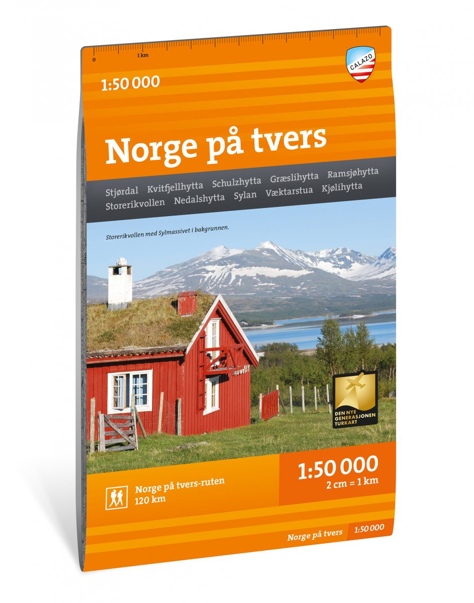
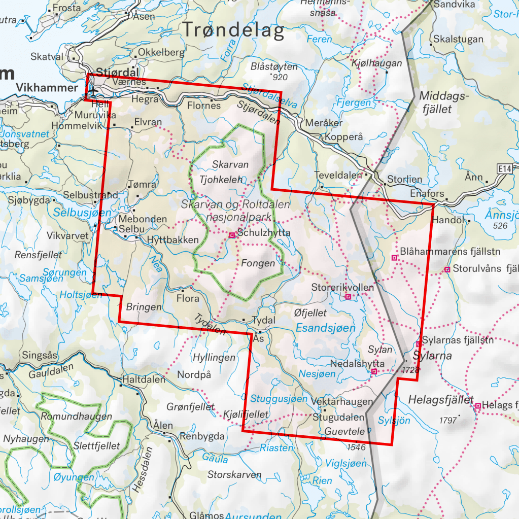
Norge på tvers
Ordinær pris 225,00 krNorge på tvers er en unik ekspedisjonsopplevelse på 120 kilometer, fordelt på 7 dagsetapper gjennom fjellområdet Sylan. Turen følger turistforeningens merkede ruter langs 63 grader nord med overnatting på betjente og selvbetjente DNT-hytter. Dette kartbladet dekker hele strekningen fra fjorden i Stjørdal til svenskegrensen i Tydal med kart på både for- og baksiden. En av godbitene på turen er det mektige Sylmassivet lengst øst i Trøndelag. Den høyeste toppen, Storsylen (1762 moh.), ligger så vidt på norsk side av svenskegrensa.
Norge på tvers-kartet er utgitt av Calazo i samarbeid med Trondhjems Turistforening og Nord-Trøndelag Turistforening. Dette er en del av en moderne kartserie der terrenginformasjonen er basert på laserskanning fra fly. Kartet er laget i materialet Tyvek, som tåler vann, er beskyttet mot rifter og har lav vekt.
Norway
Ordinær pris 249,00 krFor a vacation to remember, Norway is hard to beat. Whatever your dream trip involves, this DK Eyewitness travel guide is the perfect companion. Our updated guide brings Norway to life, transporting you there like no other travel guide does with expert-led insights, trusted travel advice, detailed breakdowns of all the must-see sights, photographs on practically every page, and our hand-drawn illustrations, which take you inside the country's buildings and neighbourhoods.
Norway
Ordinær pris 299,00 krThis Insight Guide is a lavishly illustrated inspirational travel guide to Norway and a beautiful souvenir of your trip. Perfect for travellers looking for a deeper dive into the destination's history and culture, it's ideal to inspire and help you plan your travels. With its great selection of places to see and colourful magazine-style layout, this Norway guidebook is just the tool you need to accompany you before or during your trip.
Whether it's deciding when to go, choosing what to see or creating a travel plan to cover key places like Preikestolen, Hardangervidda National Park and Bergen, it will answer all the questions you might have along the way. It will also help guide you when you'll be exploring Tromso or discovering Roros on the ground. Our Norway travel guide was fully-updated post-COVID-19.
The Insight Guide Norway covers: Oslo, the heart of Norway, western central Norway, Telemark and the south, Rogaland, Stavanger, Hordaland, Bergen, Sogn to Nordfjord, More og Romsdal, Trondheim, the far North, Svalbard.
OL19 Howgill Fells & Upper Eden Valley
Ordinær pris 329,00 krMap sheet number OL19 in the OS Explorer series covers Appleby-in-Westmorland, the Howgill Fells, Sedbergh, Upper Eden Valley and Kirkby Stephen.
Highlights of the area include: Yorkshire Dales National park, North Pennines, Pennine Way, River Eden, Great Shunner Fell and Hardraw.
OL30 Yorkshire Dales: Northern & Central Areas
Ordinær pris 299,00 krMap sheet number OL30 in the OS Explorer map series is the map of choice for people visiting the Northern and Central areas of the Yorkshire Dales, including Wensleydale & Swaledale. There is wealth of scenery in this part of the Yorkshire Dales National Park. Highlights of the area include: The valleys of Swaledale and Arkengarthdale, Aysgarth Falls, Hawes, and the River Wharfe.
From Great Black Hill to Ramsgill, the OS Explorer map of the North and Central Yorkshire Dales pinpoints every house and hill, pub and place of interest, making it the perfect fold-up companion for visitors and locals alike.
Easy to understand, whether you’re an occasional ambler or a highly-experienced hill walker, follow the Dales Way recreational path or the Pennine Way national trail, and soak up some of the most spectacular scenery in the North of England.
With their legacy of ancient Norse culture, explore the Swaledale and Arkengarthdale valleys. Get a real sense of the area’s history, climbing mountains with good Viking names, like Great Shunner Fell and Rogan’s Seat.
Aysgarth Falls – with scenery that inspired Ruskin, Turner and Wordsworth – is a natural wonder not to be missed. While the River Swale, the fastest flowing river in England offers opportunities for some serious canoeing.
Follow your map to the spectacular triple flight of falls carved out by the River Ure. A product of the Ice Age, the falls boast a dramatic 30ft drop over limestone steps.
Whether you fancy a spot of fishing on the River Wharfedale or cheese tasting at the Wensleydale Creamery, you’ll get so much more out of your excursion in the North and Central Yorkshire Dales with the OS Explorer OL30 safely stowed in your knapsack. Add a copy to your basket today, and start planning your next day out in the Dales.
OL45 The Cotswolds
Ordinær pris 329,00 krMap sheet number OL45 in the OS Explorer series covers a large area of the Cotswolds AONB, incluing Stow-on-the-Wold, Burford, Cirencester and Chipping Campden.
Highlights of the area include: the Cotswold Hills, Wychwood Community Forest, and the Cotswold Way.
Ordesa y Monte Perdido
Ordinær pris 249,00 krOstseeküsten Radweg 2
Ordinær pris 239,00 krSykkelkart over Østersjøkysten fra Lübeck til Usedom.
Pica d’Estats; Mont Roig
Ordinær pris 289,00 krProkletije - Albanian Alps
Ordinær pris 299,00 krA series specially designed for lovers of large journeys and mountain walks.
A detailed scale and complete tourist information to help you plan your trekking. Thanks to the laminated surface and flex-folding, the Trekking maps of TerraQuest will guide you anywhere, even in the most extreme conditions. You can make your own notes on the maps and erase them without damaging the maps.
Rhodes
Ordinær pris 229,00 krFor your best adventures, use the best map. Water-proof, split-proof, tear-proof. Rhodes Tour & Trail Super-Durable Map is simply the toughest, most accurate, easy to read, easy to use map that you can buy at any price.
A large 960mm by 700mm double sided map sheet covers Rhodes at 1:50,000 scale and includes Chalki and Symi islets. On the cover side is Rhodes South with Chalki and Symi, with Rhodes North and street plans of Rhodes Town on the reverse. We have two street plans of the capital town.
Rhodes Town greater area is at 12k scale, including Acropolis in the west and spanning beyond Rodini park in the south. The other street plan shows the fortified Old Town in great detail at 5k scale. DWG's special concertina map fold makes our map easy to open and easy to refold to its 233mm by 120mm pocket size.
Our legendary 'Tour & Trail' level of detail ranges from major roads to secondary roads to minor roads to streets and narrow country roads, plus dirt roads, tracks and walking trails. Place names are in English and Greek to aid your navigation. Altitude shading is designed to clearly show the altitude range when travelling across the island by car or on foot.
20 metre and 100 metre contours combined with altitude shading bring this beautiful landscape to life. There are plenty of individual height points and all of the official 'Trig' points are on the map. Tour & Trail attention to detail includes our useful symbol range including viewpoints, picnic areas, petrol stations, bar/restaurants and parking areas where you can pull off the road safely.
You will easily identify springs, caves, sports grounds, cemeteries, monasteries, churches, chapels, lighthouses, castles, camping areas, wind turbines, windmills, hotels etc. Rhodes Compendium of Walking Adventures walking routes (all 98 walking routes) are specially highlighted on the map. It all adds up to the most detailed, most durable map of Rhodes, Chalki and Symi that you can buy anywhere.
'Super-Durable' means a waterproof, tear-proof, map that can take the roughest treatment and still folds up like new after your adventures. Super-Durable Maps come with a 2 year adventurous use 'Wear and Tear' guarantee. Digital editions of our Rhodes Tour & Trail Map are available as in-app purchases for Outdooractive and Locus Map apps.
Publisert år: 2022
Innbinding: fal
Material: 0
Målestokk: 1:40 000