FRI FRAKTOrdre over 1000,-
2477 produkter
Atlas: France
Ordinær pris 349,00 krMichelin's France Road Atlas A4 is the perfect companion for safe and enjoyable drive in France. Convenient and easy to use thanks to the spiral bound cover, Michelin France Atlas will provide you with precise and reliable information with its updated mapping scaled 1/200 000 (1 cm = 2 km). Smart and practical, this atlas includes tourist sights, leisure facilities and scenic routes recommended in the famous Michelin Green Guide as well 40 embedded city plans plus 16 with QR codes for easy access to your smartphone for online mapping and tourist information!Michelin's checklist will help you prepare your journey before your leave and Michelin's safety alerts will warn you about dangerous driving areas, such as steep hills and level crossing.
Michelin's route planner as well as the time and distance charts will help you plan and optimise your journey. Michelin's France road atlas will make sure that you make the most of your journey in France!Michelin's France tourist and motorist atlas (A4 spiral) features:* Scale 1/200 000* Spiral bound for lay-flat convenience. * Time & distance charts* Route planner with major itineraries* Tourist sights and scenic drives pulled directly from Michelin's famous Green Guide travel series using the embedded QR codes.
* Extensive place name index for rapid look-up* Location map on top of each page for an easier navigation within the atlas* 40 City maps embedded in the map of their surrounding areas with QR code to guide you through the last few miles of your journey with your smartphone plus 16 QR codes for city plans on your phone
Australia
Ordinær pris 199,00 krMarco Polo er svært detaljerte kart som er praktiske og enkle i bruk. 7 klistremerker for å markere spesifikke steder gjør det enda enklere å planlegge reisen. Alle kartene inneholder en omfattende index for enkelt å finne frem.
Australia
Ordinær pris 319,00 krIdeal for independent travellers, this guidebook to Australia, written by Australia experts, goes beyond the basics. It blends must-see sights with hidden gems and offers unmatched practical guidance for seamless planning and on-the-go exploration. Packed with in-depth advice often missing from other guides, it helps you navigate with ease.
From using public transport to discovering the best dining, accommodations, and local experiences, this guide covers it all. Every detail you need for a smooth and enriching journey. Inside this Australia travel book, you'll find:- Regional deep dive - in-depth coverage of key areas with curated experiences and honest reviews- Itinerary samples - tailored plans for different trip lengths and travel styles- Practical information - essential tips on getting there, using public transport, avoiding crowds, saving time and money, and traveling responsibly- Expert recommendations - insider advice on the best places to eat, drink, stay, and enjoy nightlife or outdoor activities- Seasonal tips - when to go to Australia, climate details, and festival highlights to plan your perfect trip- Must-see pick - unmissable sights handpicked by our authors - Blue Mountains, Fraser Island, Sydney Harbour, Uluru, Great Ocean Road, sailing in the Whitsundays, surfing, South Australia's wineries, First Nations tours, Bondi Beach, Kangaroo Island- Easy-to-use maps - colour-coded maps highlighting essential spots for dining, accommodation, shopping and entertainment- Cultural insights - engaging stories on local history, arts, and traditions for a deeper understanding of Australia- Language essentials - Australian English phrases and vocabulary to help you connect with locals- Inspiring travel photography - stunning full-color images capturing the essence of Australia, and fueling your wanderlust
Australia
Ordinær pris 309,00 krInsight Guides Australia Travel gjort enkelt. Spør lokale eksperter. Omfattende reiseguide fullpakket med inspirerende fotografier og fascinerende kulturell innsikt.
Fra å bestemme når du skal dra, til å velge hva du skal se når du ankommer, denne guiden til Australia er alt du trenger for å planlegge den perfekte turen, med innsideinformasjon om må-se, toppattraksjoner som Sydney Harbour, Great Barrier Reef og Uluru, og kulturelle perler som de pittoreske vingårdene i Barossa-, Clare- og Coonawarra-regionene, eldgammel aboriginsk kunst i Kakadu National Park og technicolor-blomstringen av villblomster i Vest-Australia.
Australia: Melbourne & Victoria
Ordinær pris 169,00 krItm har kart over hele verden og de spesialiserer seg på land litt utenfor allfarvei. Beliggenheten til landets nasjonalparker, historiske monumenter, de viktigste veiene o.L. Finner du inkludert i kartene. Samtlige landkart har et bykart over hovedstaden.
Fra ITM: A list of Top Attractions and a regional rail map are included as insets. All the tram lines are shown. The other side is new. Melbourne is located in the State of Victoria, so we have added a detailed map of the state and extended the coverage to include Sydney, Canberra, and Adelaide. Rail lines are shown, although most people travel by car. There is a motorway to Sydney, but almost all others are two-lane tarred. The coastal highway going west is particularly scenic. Australia’s highest mountain is also on this map.
Publisert år: 2024
Innbinding: falset
Material: papir
Målestokk: 1:9000 / 1:1,500,000
Australia: West
Ordinær pris 239,00 krReise Know-How maps (world mapping project series) are easy-to-read, waterproof and highly durable travel maps specifically designed for everyday use on the road. Our maps combine state-of-the-art, GPS-compatible cartography (including hypsometric tints and contour lines) with a detailed rendering of road networks and touristic information. They offer the best possible scale, level of detail and readability, be it a map of a small island or half a continent. The maps feature a detachable paper sleeve so that the maps can be folded easily and fit in every pocket. Although printed on plastic, a special coating makes sure the maps retain a paper-like feel and can even be written on with a pencil.
Australia: Western
Ordinær pris 289,00 krBradt Travel Guides er et engelsk forlag med over 200 titler som i hovedsak er skrevet for turister som bruker offentlige transportmidler og egne ben. Bradt har vunnet mange priser for reisehåndbøkene sine som er kjent for å være sterke på mindre kjente reisemål som ikke er overfylt av turister. Forfatterne sørger gjerne for å gi bøkene en personlig ”touch”, og er ikke redde for å være subjektive. Dette gjør dem både til tider morsomme, i tillegg til å være informative og enkle å lese.
Bradt's Western Australia is the first guidebook focused on the long country roads, inspirational national parks and world-class vineyards of Australia's largest state. Local resident Scott Dareff has visited almost all of the state's 137 administrative areas in the past five years, giving him an extraordinary insight into, and knowledge of, one of the world's great wildernesses. 'Travellers often associate Western Australia with Perth' he says.
'But Perth is just the staging ground for travel to this spectacular state. Much of the magic of Western Australia comes when you venture beyond its capital city. Ningaloo Reef is every bit as astounding as the Great Barrier Reef, but more accessible.
. . you can just walk off the beach into the water, and you're in among its reefs.
The Burrup Peninsula has rock art that is 50,000 years old, while Margaret River is one of the world's finest wine regions and the nearby Karri Forests contain one of the tallest species of tree in the world.'Bradt's Western Australia capitalises on the area's geography to help travellers create the ultimate Road Trips in spectacular remote locations, without having to rough it or give up air conditioning, ensuite accommodation or restaurant meals. What's more, this is the first major guidebook to stray from the coast to provide in-depth coverage of the West Australian interior. For travellers looking for a unique experience, and 'something different', this book makes the Outback accessible and affordable, busting the myth once and for all that a trip to Western Australia requires a four wheel drive, a month off work, and deep pockets.
Australian Wildlife
Ordinær pris 269,00 krA new, thoroughly updated second edition of Bradt's Australian Wildlife, covering habitats, mammals, birds, reptiles, amphibians, invertebrates, the marine environment and where to go. Wildlife writer Stella Martin combines the encyclopaedic knowledge of David Attenborough with the enthusiasm of the late Steve Irwin to offer a unique guide which, compared to others, is variously more portable and more detailed, has a broader scope, goes beyond identification notes and includes an in-depth guide to ecosystems. It also covers all regions of Australia.
Background chapters explain how Australia's wildlife evolved in isolation and how the geology, soil and climate affect its natural history. There is also a close look at Australia's infamously dangerous creatures, avoiding the cliches and putting their threat into perspective: although most of the world's most venomous snakes are found in Australia, they are by no means the deadliest. Essential advice is offered for avoiding hazardous wildlife and there are also useful first aid tips.
Up-to-date information on conservation is included, including fire and its role in the Australian ecology and the effect of exotic feral animals and weeds. And there are tips on how to find, enjoy and identify wildlife with a 'where to go' section featuring a state-by-state overview of key wildlife sites, with maps. With a focus on interesting information about the general biology and behaviour of the animals - with some detail about the most commonly seen species - and explaining how the different ecosystems 'work', this guide is for visitors who want to know more about what they see but don't have room for an entire library of reference books.
Australien
Ordinær pris 349,00 krVelkjente danske reisehåndbøker fra Politikens Forlag. Guidene inneholder det essensielle ved reisemålet: Beskrivelser av severdigheter, oversikt over aktivitets- og sportstilbud, råd og tips til dem som reiser med barn, samt praktisk informasjon for øvrig. Bøkene byr dessuten på underholdende tematekster og kart, og de er rikt illustrerte. Flotte for kortere turer og populære blant dem som reiser på organiserte opplegg. Hendig lommeformat.
Austria
Ordinær pris 199,00 krMarco Polo er svært detaljerte kart som er praktiske og enkle i bruk. 7 klistremerker for å markere spesifikke steder gjør det enda enklere å planlegge reisen. Alle kartene inneholder en omfattende index for enkelt å finne frem.
Austria
Ordinær pris 199,00 krDette store østerriske kartforlaget er kjent for sin klare kartografi og gode papirkvalitet. De kommer i alle målestokker, og flere av landkartene inneholder bykart og turistinformasjon.
Austria - Burgenland
Ordinær pris 189,00 krDette store østerriske kartforlaget er kjent for sin klare kartografi og gode papirkvalitet. De kommer i alle målestokker, og flere av landkartene inneholder bykart og turistinformasjon.
Burgenland at 1:150,000 in a series of road maps from Freytag & Berndt, the country’s leading publishers, with a separate index attached to the cover. Information includes sightseeing routes and long-distance hiking trails.
The maps have clear, effective relief shading to show the topography and indicate steep roads with gradient marks, show traffic restrictions and seasonal closures on mountain roads, etc. Tourist information includes scenic roads and special tourist sightseeing routes, places of interest, campsites and youth hostels, etc. An overprint highlights the national network of the long-distance footpaths indicating, where appropriate, their European numbers. A grid in steps of 10' indicates latitude and longitude. *Map legend includes English.* A separate index attached to the cover gives the postcode for each locality.
Publisert år: 2024
Innbinding: falset
Material: papir
Målestokk: 1:150,000
Austria - Salzburg T10
Ordinær pris 199,00 krThis detailed road map of Salzburg with TOP 10 tourist tips is very suitable for planning and traveling around the country.
The road network is well represented, both the main roads, provincial and local roads. Road numbers are also clearly stated. Distances between places are marked on the map in kilometers, and gas stations are also marked in important places.
Shadow shows the relief and sometimes some points with the actual height. Province borders, national parks and reserves are easy to find. Symbols indicate the location of tourist sites, monuments, historically important places and viewpoints. In certain places you can find hotels and campsites, airports, train connections and ports.
Austria: Fischbacher Alpen
Ordinær pris 199,00 krFreytag & Berndt hiking maps are the perfect companion for hiking, mountaineering and ski touring, thanks to detailed digital cartography and precise yardsticks. They are regularly revised and contain updated information on hiking trails, cycling and mountain biking trails, huts, natural monuments, cultural attractions and leisure facilities.
The enclosed information booklet contains a selection of the best hiking trails, cycle paths and mountain bike trails as well as a short description of the individual municipalities with their leisure time activities. (Language: German)
Leisure information, hiking and long-distance hiking trails, mountain biking and cycling tours, local register with zip codes, GPS-capable, via ferrata, ski route, cross-country route, Nordic walking trail;
Austria: Vienna
Ordinær pris 199,00 krStreet plan of the whole of the administrative area of the city, showing the entire public transport system, but no one-way streets. A separate index, attached to the map cover, includes list of useful addresses, as well as an enlargement of the city centre, a map of the through roads across the city and a diagram of the public transport network. Map legend includes English.
Austria: Vienna & Eastern Austria
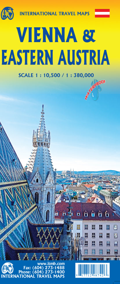
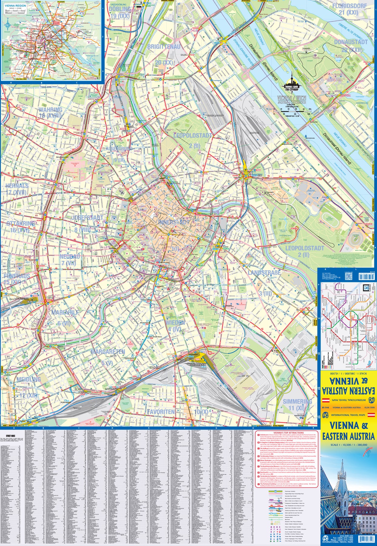
Ordinær pris 179,00 krITMB is pleased to introduce an exciting new map of the wonderful city of Vienna, combined with a newly-prepared map of eastern Austria. Until WW2, Vienna was one of the most diverse and cultural cities in Europe. The NAZI takeover changed all of that and its brutal capture by the Russians five years later sent the city into a devastating downturn. Fortunately, the Soviet Union was forced to withdraw and Austria declared to be a demilitarized neutral country for the rest of the Cold War. Vienna is now a lovely historic city on the Danube River, the capital of Austria, and the European United Nations centre. The Innerstadt (Inner or old city centre) is the location of many of the hotels gracing Vienna, as well as St, Stephen’s Cathedral with its wonderful roof. One of the great attractions of the city is the Schonbrunn, the 18th Century palace of the Austro-Hungarian Empire.
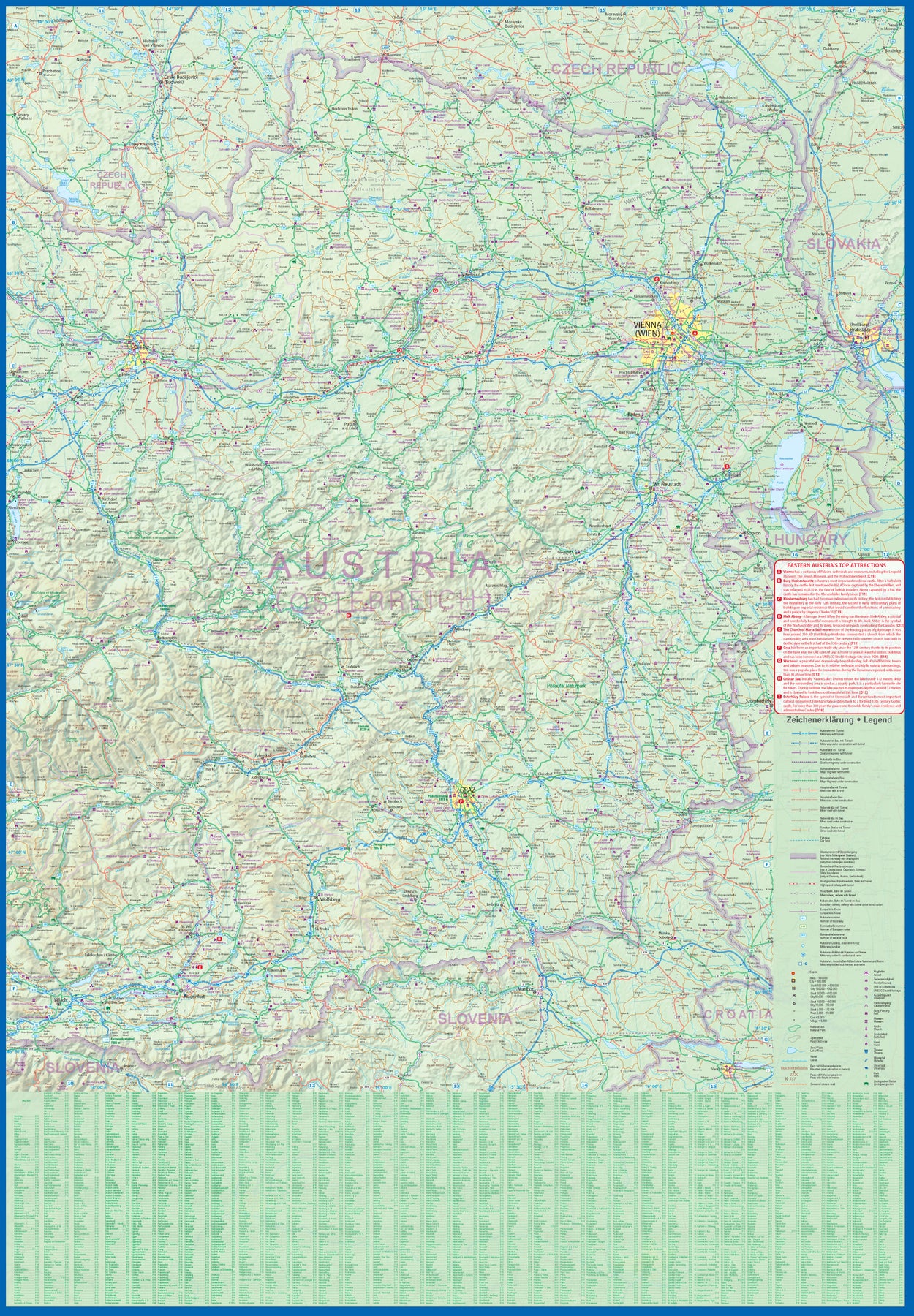
The map extends from the western ring road to the UN complex east of the Danube, and from the northern edge of the urban area to south of the Hauptbahnhof (or main railway station). All Metro and tram lines are clearly shown, along with parks, churches, shopping areas, hotels, and the city’s three rail stations. The second side of the sheet is a very detailed map of the eastern half of Austria from the /Czech border on the north, the Hungarian border to the east, to the Slovenian border to the south, and west to Linz and Klagenfurt. Rail lines are prominently noted, as are motorways and all highways. Once one leaves Vienna, a vista of rural mountainous countryside unfolds, with dozens of ancient castles to explore, and interesting small towns to explore. Burg Hochosterwitz is one of Europe’s most ancient castles, dating from 860AD.
Austria: Zillertal Tuxertal WK 5152
Ordinær pris 199,00 krFreytag & Berndt turkart er den perfekte følgesvennen for fotturer, fjellklatring og skiturer, takket være detaljert digital kartografi og presise målestokker. De revideres jevnlig og inneholder oppdatert informasjon om turstier, sykkel- og terrengsykkelstier, hytter, naturminner, kulturattraksjoner og fritidstilbud.
Det vedlagte informasjonsheftet inneholder et utvalg av de beste turstiene, sykkelstiene og terrengsykkelløypene samt en kort beskrivelse av de enkelte kommunene med sine fritidsaktiviteter. (Språk: tysk)
Fritidsinformasjon, tur- og langturer, terrengsykling og sykkelturer, lokalt register med postnummer, GPS-kompatible, via ferrata, skiløype, langrennsrute, stavgangsti.
Region: Tannheimdalen, Tannheimerfjellene, Lechtal, Tyrolean Lech Nature Park, Außerfern, Tyrol, Bayern, Tyskland
Spesielle turstier:
Europeisk langdistanse tursti nr. 4, Via Alpina, Lechweg, bayerske kongeslott
Spesielle sykkel- og terrengsykkelturer:
Via Claudia Augusta, Bike Trail Tyrol, Lech sykkelsti (Lechtalradweg), Almtour, Vilser Alm
Publisert: 2024
Innbinding: falset
Material: papir
Målestokk: 1:35000
Auvergne - Bourbonnais
Ordinær pris 199,00 krDen klassiske reisehåndboka for deg med bil og lyst til å se deg om. «nafboka» for diverse europeiske og land samt populære turistmål kloden rundt. Disse guidebøkene gir deg nødvendig informasjon om hvordan du kommer deg rundt, lister opp aktuelle overnattings- og spisesteder, og gir informasjon om sights det kan være verd å få med seg. Illustrerte, I farger og med diverse oversikts- og bykart.
Découvrir les volcans du Cantal et du Puy de Dôme, randonner dans des paysages d'estive, admirer les toits en lauze, les basiliques romanes de Brioude ou d'Orcival, et enfin comparer le saint-nectaire, la fourme d'Ambert et le cantal...
Azerbaijan
Ordinær pris 169,00 krAzerbaijan at 1:400,000 on a light, waterproof and tear-resistant, double-sided indexed map from Reise-Know-How. The map covers Azerbaijan and its Nakhchivan enclave; the armistice boundary of Nagorno-Karabakh is clearly marked, indicating open or closed border crossings, and where appropriate both Azeri and Armenian names of location are shown. Coverage includes eastern Armenia and south-eastern Georgia with Tbilisi.
Topography is presented by altitude colouring with spot heights and names of mountain ranges, peaks, passes, etc, plus boundaries of national parks and other protected areas. Road network includes selected unsurfaced local roads and tracks, and indicates driving distances on main routes. Railway lines are included and local airfields are marked. Internal administrative boundaries are presented with names of the provinces. Symbols highlight various places of interest, including locations with tourist accommodation, cultural heritage, beaches, etc. Also marked are oil wells and pipelines. Longitude and longitude lines are drawn at 30’ intervals. Map legend includes English.
Azores
Ordinær pris 309,00 krNow in its eighth edition, Bradt's Azores remains the only comprehensive guidebook to this nine-island archipelago - a mountainous, nature-lover's wilderness perched in the mid-Atlantic at the western extremity of Europe. One of the world's best whalewatching destinations, a geological curiosity and - more recently - a mid-Atlantic adventure playground, the Azores have become ever more accessible thanks to low-cost European flights. The nine islands making up the Azorean archipelago share volcanic origins, albeit from different eras, so each rugged landscape boasts a unique feel.
The approach to tourism also differs from island to island: while Sao Miguel welcomes a rising number of cruise ships and international flights, and Faial is a busy hub for trans-ocean yachts, tiny Corvo and gentle Santa Maria remain almost untouched. The Gulf Stream guarantees a mild climate and plenty of greenery: a pleasant environment for this easily accessible, safe, welcoming and authentic mid-haul destination. With each island treated to its own chapter, Bradt's Azores provides all the details a visitor needs for a rewarding, enjoyable visit to an archipelago where cows outnumber people.
Author and expert botanist David Sayers shares his deep knowledge about flora, fauna and geology that are integral to getting to know the islands. This new edition - thoroughly updated by prolific guidebook author Tim Burford - strengthens coverage of the land- and sea-based activities that have become a significant part of the Azores' attractions this century while providing the most recent practical information such as where to stay and eat in every price band. Five centuries of human history are well documented in a host of museums spread across the islands, which explain the fluctuating fortunes and strategic importance of the archipelago through the centuries.
Attractive architecture, carefully preserved festivals, four islands with UNESCO Biosphere Reserve status and thermal pools complete what is a very agreeable picture. Little wonder then that the Azores attracts geologists, birdwatchers, whalewatchers, horseriders, walkers, mountaineers bent on climbing Portugal's highest peak (on Pico island), divers, surfers, sailors, mountain-bikers and canyoners - indeed anyone who loves nature or the great outdoors in all its forms.
Bahamas
Ordinær pris 299,00 krWhether you want to discover 800 miles of beaches, swim with pigs in the Exumas, or relax at a top-rated resort and spa, the local Fodor's travel experts in the Bahamas are here to help! Fodor's Bahamas guidebook is packed with maps, carefully curated recommendations, and everything else you need to simplify your trip-planning process and make the most of your time. This new edition has been fully-redesigned with an easy-to-read layout, fresh information, and beautiful color photos.
Bahamas
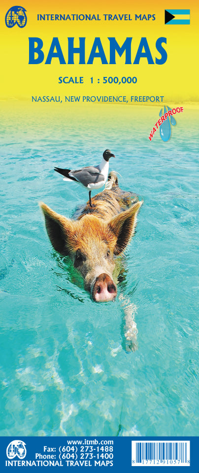
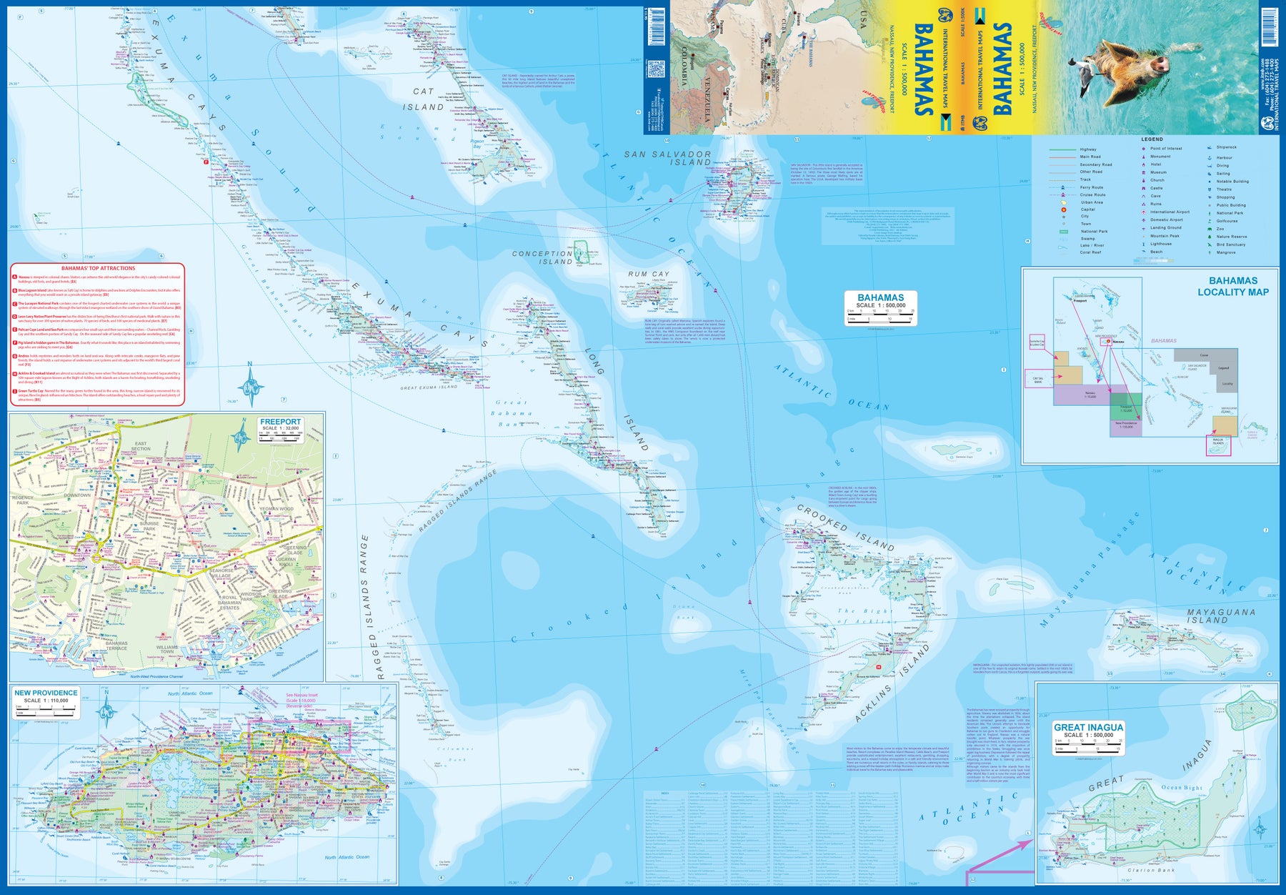
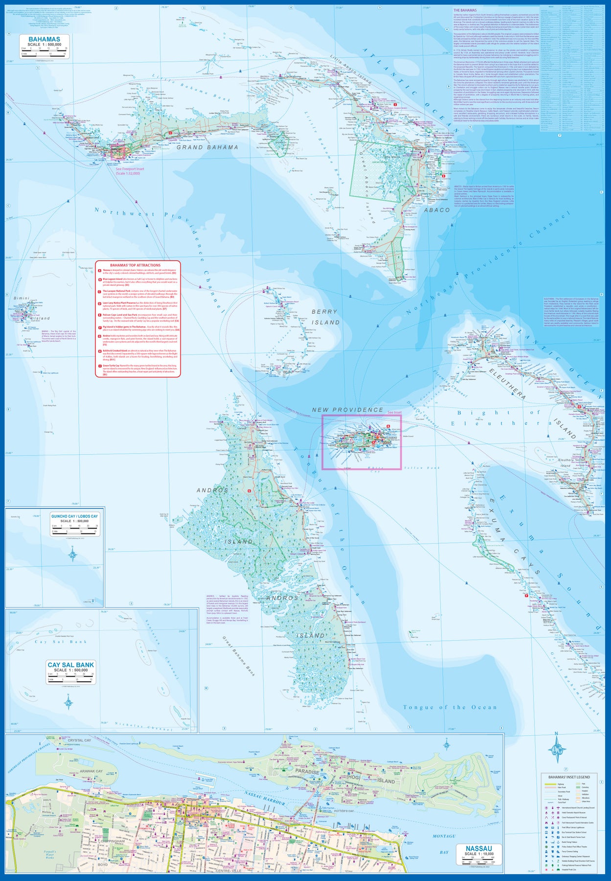
Ordinær pris 189,00 krITM har kart over hele verden og de spesialiserer seg på land litt utenfor allfarvei. Beliggenheten til landets nasjonalparker, historiske monumenter, de viktigste veiene o.L. Finner du inkludert i kartene. Samtlige landkart har ofte et bykart over hovedstaden.
Fra ITM: This fifth edition of our popular travel map to the many Bahamian islands shows a wealth of accommodations, beaches, and points of interest. Inset maps of Nasau and Freeport detail the two largest cities, and a special inset of New Providence Island, the most popular tourist destination, shows resorts and attractions that make this island so popular. As usual, we include a Top Attractions list of the 'must see' destinations.
Publisert år: 2023
Innbinding: falset
Material: plastpapir
Målestokk: 1:500,000
Bali & Lombok
Ordinær pris 279,00 kr
Denne praktiske reiseguiden til Bali & Lombok inneholder detaljerte reisetips og oversikt over de mest ikoniske severdigheter, samt noen skatter utenfor allfarvei. Med forslagene til reiseruter og forfatterens ekspertise utvalg av ting å se og gjøre blir denne boken til en perfekt følgesvenn både i forkant og underveis på turen. Denne Bali & Lombok-guideboken er fullpakket med detaljer om hvordan du kommer deg dit og rundt, informasjon før avreise og topp tidsbesparende tips, inkludert en visuell liste over ting du ikke bør gå glipp av. Våre fargekodede kart gjør det enklere å navigere mens oppdager Bali & Lombok.
Bali & Lombok
Ordinær pris 329,00 krVelkjente danske reisehåndbøker fra Politikens Forlag. Guidene inneholder det essensielle ved reisemålet: Beskrivelser av severdigheter, oversikt over aktivitets- og sportstilbud, råd og tips til dem som reiser med barn, samt praktisk informasjon for øvrig. Bøkene byr dessuten på underholdende tematekster og kart, og de er rikt illustrerte. Flotte for kortere turer og populære blant dem som reiser på organiserte opplegg. Hendig lommeformat.
Bali; Lombok & Gili Islands
Ordinær pris 169,00 krLet Marco Polo Bali guide you around this beautiful island. Explore Bali, Lombok and the Gili Islands with this handy, pocket-sized, authoritative guide, packed with Insider Tips. Discover boutique hotels, authentic restaurants and get tips on shopping and what to do on a limited budget. There are plenty of ideas for travel with kids, and a summary of all the festivals and events that take place on these Indonesian islands.
Let Marco Polo show you all this wonderful region has to offer. The Marco Polo Bali Pocket Guide covers: South Bali, Central & North Bali, East Bali, Lombok, Gili Islands. Inside this guide you will find: Insider Tips - discover the hidden gems and little-known secrets that offer a real insight into these heavenly islands from cocktails on the rocks, national park jungles, fairy-tale beaches and the most magical sunsets beneath the palms. Best of - find the best things to do if you're travelling on a budget, the best things to do with the kids, the best things to do if it rains and the best things to do if you’re looking for an authentic Bali experience. Sightseeing - all the top sights are organised by area, so you can easily plan your trip Discovery Tours - specially tailored tours that will get you to the heart of Bali, Lombok and the Gili Islands.
Publisert: Okt. 2024
Utgave: 3.Utg
Sider nr: 148
Balkans Western Road Atlas
Ordinær pris 449,00 krDette veiatlaset er lett å lese. Med mange symboler gis det informasjon fra blant annet campingplasser, fergetilbud og (ungdoms)herberger.
Veinettet er godt representert, både hovedveier, provinsveier og lokalveier. Veinummer er også tydelig oppgitt. Avstander mellom steder er markert på kartet i kilometer, og bensinstasjoner er også markert på viktige steder.
Shadow viser relieffet og noen ganger noen punkter med den faktiske høyden. Provinsgrenser, nasjonalparker og reservater er enkle å finne. Symboler indikerer plasseringen av turiststeder, monumenter, historisk viktige steder og utsiktspunkter. Enkelte steder kan du finne hoteller og campingplasser, flyplasser, togforbindelser og havner.
Balkans Western, reisekart
Ordinær pris 219,00 krHighly tear-resistant and 100% waterproof map "Western Balkan Region" from the series world mapping project.
Travel know-how maps are characterized by particularly sturdy plastic paper, which can be written on like paper, even with a pencil. The cardboard envelope is removable, making it easy to put the card in any pocket. A protective cover is not required. The cartographic representation focuses on the most important information for travellers and is particularly easy to read. Instead of shading, coloured layers of elevation are used.