Filter
- AA Publishing
- Assouline
- Authentic Models BV
- Borch
- Bradt
- Cabeau
- Calazo
- Cappelen Damm
- Care Plus
- Cicerone
- Colgate
- Columbus Globes
- Craghoppers
- Dapa Maps
- Discovery Walking Guides
- Dr. Bronner
- Eagle Creek
- Editorial Alpina
- Esterbauer Verlag
- ExpressMap
- Eyewitness
- Filson
- Fodor's
- Freytag & Berndt
- Gentlemen's Hardware
- Go Travel
- Hydro Flask
- Insight Guides
- ITM
- Kastel
- Ledlenser
- Lifeventure
- Lonely Planet
- Luster Publishing
- National Geographic
- Nordeca
- Ordnance Survey
- Osprey
- Patagonia
- PopOut
- Reise Know-How
- Rother Walking Guide
- Rough Guides
- Thames & Hudson
- The Urban Explorer
- Tilley
- Touring Club Italiano
- Trailblazer
- Afghanistan
- Albania
- Algerie
- Andorra
- Angola
- Antigua og Barbuda
- Argentina
- Armenia
- Aserbajdsjan
- Australia
- Bahamas
- Bahrain
- Bangladesh
- Barbados
- Belgia
- Belize
- Benin
- Bhutan
- Bolivia
- Bosnia-Hercegovina
- Botswana
- Brasil
- Brunei
- Bulgaria
- Burundi
- Canada
- Chile
- Colombia
- Cookøyene
- Costa Rica
- Cuba
- Danmark
- De forente arabiske emirater
- Djibouti
- Dominica
- Ecuador
- Egypt
- El Salvador
- Elfenbenskysten
- Eritrea
- Estland
- Eswatini
- Etiopia
- Fiji
- Filippinene
- Finland
- Frankrike
- Gabon
- Gambia
- Georgia
- Ghana
- Grenada
- Guatemala
- Guyana
- Haiti
- Hellas
- Honduras
- Hviterussland
- India
- Indonesia
- Irak
- Iran
- Irland
- Island
- Israel
- Italia
- Jamaica
- Japan
- Jemen
- Jordan
- Kambodsja
- Kamerun
- Kapp Verde
- Kasakhstan
- Kenya
- Kina
- Kirgisistan
- Komorene
- Kongo
- Kosovo
- Kroatia
- Kuwait
- Kypros
- Laos
- Latvia
- Lesotho
- Libanon
- Liberia
- Libya
- Liechtenstein
- Litauen
- Luxembourg
- Madagaskar
- Malawi
- Malaysia
- Maldivene
- Mali
- Malta
- Marokko
- Mauritania
- Mauritius
- Mexico
- Moldova
- Monaco
- Mongolia
- Montenegro
- Mosambik
- Namibia
- Nauru
- Nederland
- Nepal
- New Zealand
- Nicaragua
- Niger
- Nigeria
- Nord-Korea
- Nord-Makedonia
- Norge
- Oman
- Pakistan
- Palau
- Palestina
- Panama
- Papua Ny-Guinea
- Paraguay
- Peru
- Polen
- Portugal
- Qatar
- Romania
- Russland
- Rwanda
- Saint Kitts og Nevis
- Saint Lucia
- Saint Vincent og Grenadinene
- Samoa
- San Marino
- Saudi-Arabia
- Senegal
- Serbia
- Seychellene
- Sierra Leone
- Singapore
- Slovakia
- Slovenia
- Solomonøyene
- Somalia
- Spania
- Sri Lanka
- Storbritannia
- Sudan
- Surinam
- Sveits
- Sverige
- Syria
- Sør-Afrika
- Sør-Korea
- Sør-Sudan
- Tadsjikistan
- Taiwan
- Tanzania
- Thailand
- Togo
- Tonga
- Trinidad og Tobago
- Tsjekkia
- Tunisia
- Turkmenistan
- Tuvalu
- Tyrkia
- Tyskland
- Uganda
- Ukraina
- Ungarn
- Uruguay
- USA
- Usbekistan
- Vanuatu
- Venezuela
- Vietnam
- Zambia
- Zimbabwe
- Øst-Timor
- Østerrike
2600 produkter
2600 produkter
Utsolgt
Tsa-lås
229,00 kr

Trekking the Kungsleden
Ordinær pris 329,00 kr/
Mva inkludert
Frakt beregnes i kassen.
Sweden's most famous long-distance trail, the Kungsleden (King's Trail) traverses the land of the Sami people and the midnight sun, stretching 460km between Abisko and Hemavan. Around half the route lies within the Arctic Circle showcasing an ever-changing landscape of snowy mountains, deep glacial valleys, open fell, expansive lakes and verdant forest. The fully waymarked trail is comprised of five continuous and distinct sections: these can be walked individually or a thru-hike will take around a month.
The guide also includes the popular Abisko to Nikkaluokta circuit, which can be completed in a week, and an ascent of Kebnekaise, Sweden's highest peak at 2098m. In addition to clear route description and mapping, you'll find a wealth of practical advice covering accommodation and facilities, equipment and resupply and detailed notes on how to get to and from the section start and finish-points. A Swedish and Fell Sami glossary can be found in the appendix.
Although there are plentiful opportunities for wild camping, three of the five trail sections are equipped with huts (many including a shop and a sauna) making them easily accessible to all. The remaining two sections have a more remote feel that will appeal to those intent on finding some solitude. To add further colour, there are seven mandatory lake crossings on the trail with the option of rowing or using the motorised service: full details are provided in the text.
The Kungsleden passes through five national parks, including Sarek. Other highlights include the striking Tjaktjavagge glacial valley and the famous hay meadows of Aktse, perfectly framed by the azure Lajtavrre delta and the sheer chiselled face of Skierrffe. The Kungsleden invites you to step into a new world, and it may well prove to be the start of a long and rich association involving many repeated visits.
- Forfatter: Mike Laing
- Publisert: Juni 2021
- Antall sider: 272
- ISBN: 9781852849825

Trekking The Robert Louis Stevenson Trail
Ordinær pris 319,00 kr/
Mva inkludert
Frakt beregnes i kassen.
Robert Louis Stevenson's 'Travels with a donkey in the Cevennes' is a classic of travel literature. The GR70 long-distance trail is based on the author's route, allowing walkers to follow in the footsteps of Stevenson and his four-legged companion Modestine through the beautiful Cevennes region on the edge of France's Massif Central. The route is ideal for both first-time trekkers and more experienced hikers, covering around 272km of gently undulating countryside from Le-Puy-en-Velay to Ales.
It can be completed in under a fortnight. The trail is presented in 12 stages of 16 to 30km, each with clear route description and mapping, an elevation profile, notes on local points of interest and a brief account of Robert Louis Stevenson's experiences on that section of the route. There is useful advice for planning your trip - including when to go, what to take and how to get there - and accommodation listings.
Following drove roads, bridleways and footpaths, the GR70 showcases the landscapes of the Cevennes: wildflower meadows, rolling hills, chestnut woods, limestone gorges and meandering rivers. Characterful villages provide accommodation and other services and offer an opportunity to sample the delicious local produce. There are also glimpses into the region's fascinating history, from pre-historic burial sites to locations associated with the eighteenth-century Protestant Camisards who resisted religious persecution.
While many things have undoubtedly changed since Stevenson's visit, the area retains its authentic rural charm and you will soon discover just why Stevenson found it so appealing.
- Publisert: Februar 2021
- Utgave: 3. utgave
- Antall sider: 128
- ISBN: 9781852849184

Trekking the Swiss Via Alpina
Ordinær pris 349,00 kr/
Mva inkludert
Frakt beregnes i kassen.
A guidebook to the Swiss Via Alpina, a 400km (250 mile) trek east-to-west across Switzerland, from Sargans to Montreux on Lac Leman (Lake Geneva). Previously the Alpine Pass Route, the Via Alpina (VA) is a fully waymarked Swiss national trail that involves nearly 23,000m of ascent and descent over roughly 3 weeks of trekking - a serious challenge suitable for experienced trekkers. The main route is described in 19 stages of 12-29km (8-18 miles), as well as a 27km (17 mile) prologue stage from Liechtenstein and detour stages via Lenk and Gsteig.
Comprehensive route description is accompanied by 1:100,000 mapping, route profiles, facilities listings and advice on safety, transport, accommodation and language. Crossing 16 Alpine passes, the VA showcases some of the Switzerland's most breathtaking mountain landscapes, from flower-strewn meadows to snow-capped peaks including the majestic Todi, Titlis, Wetterhorn, Eiger, Jungfrau and Wildstrubel. Accommodation options range from mountain huts to hotels and inns, with camping available at licensed sites along the route.
- Forfattere: Kev Reynolds
- Publisert: Juli 2023
- Utgave: 4. utgave
- Antall sider: 216
- Innbinding: Heftet
- Språk: Engelsk
- ISBN: 9781786311603

Trekking The Westweg
Ordinær pris 289,00 kr/
Mva inkludert
Frakt beregnes i kassen.
This guidebook is all you need to discover The Westweg, a 285km walk along the length Germany's Black Forest from Pforzheim to Basel. This classic long-distance trail takes around two weeks to walk, in stages of 15-28km. The route is well way-marked and suitable for experienced hikers and those new to long distance walking, though some sections are steep.
Detailed descriptions and 1:100,000 maps accompany each stage of the route and the book describes options for shortening stages using public transport. There is also information on when to go, where to stay and a German-English glossary. With well-maintained and waymarked trails, an efficient public transport system and conveniently placed huts and farmhouse inns, the Black Forest is one of Germany's best-loved walking destinations.
The Westweg incorporates many of the region's highlights, such the Schwarzwald National Park, the source of the Danube and Lake Titisee. At Titisee there is a choice to make: the western route taking in the Black Forest's highest peak Feldberg and the vineyards of the Markgraflerland, or the quieter eastern route via the Herzogenhorn peak and on to Basel, with all its cultural attractions and old-world charm.
- Forfatter: Kat Morgenstern
- Publisert: November 2016
- Antall sider: 224
- Innbinding: Heftet
- ISBN: 9781852847753


Triglav National Park
Ordinær pris 219,00 kr/
Mva inkludert
Frakt beregnes i kassen.
Triglav National Park at 1:50,000 on a contoured and GPS compatible walking and cycling map from Kartografija in Ljubljana, waterproof and tear-resistant version, with on the reverse descriptions of the area’s best sights. Coverage extends from Bovec in the west to Bled in the east, and from Kranjska Gora in the north to just short of Tolmin in the south. On the reverse are bilingual descriptions of the region’s places of interest, including special notes on the World War I Isonzo Front, plus list of mountain huts and campsites with contact details.
Maps in this series have contours at 20m intervals, enhanced by relief shading, with plenty of spot heights and names of peaks, mountain chains, etc. Local hiking routes are highlighted, indicating difficult passages. Also marked are recommended cycling routes. Symbols indicate various types of accommodation including mountain huts, campsites, inns with lodgings, tourist farms or apartments, hotels and motels, as well as recreational facilities (golf, horse riding, swimming pools, etc), vineries, cultural and historical sites, etc. Road network indicates locations of petrol stations. Railway lines are shown with stations and various types of mountain transport (gondolas, chair lifts, etc) are marked. The maps have a latitude and longitude grid at intervals of 2’’.
- Publisert: 2024
- Innbinding: Falset
- Materiale: Vannfast papir
- Målestokk: 1:50 000

Tromsø
Ordinær pris 259,00 kr/
Mva inkludert
Frakt beregnes i kassen.
Tromsø er norges arktiske storby, omgitt av hav og fjell, på alle kanter. Mulighetene for toppturer på ski og annet friluftsliv er i særklasse, både på fastlandet og øyene. Kartet tromsø 1:50.000 kommer med inntegnede ruter fra den bestselgende guideboka toppturer i troms/ski touring in troms av espen nordahl. Kartet dekker tromsø fastland, malangen og kvaløya, med klassikere som tromsdalstinden (1238 moh.), skittentinden (1042 moh) og buren (802 moh). Kartet er beregnet for bruk året rundt og har også ruter for fotturer og sykling. Det er en del av den moderne kartserien til calazo, som lager sine norske kart i samarbeid med fri flyt. Det er laget i materialet tyvek, som tåler vann, er beskyttet mot rifter og har lav vekt.
- Publisert: 2018
- Innbinding: Falset
- Materiale: Plastfiber
- Målestokk: 1:50 000


Trucker Cap
Ordinær pris 749,00 kr/
Mva inkludert
Frakt beregnes i kassen.
Caps fra Filson med et brodert merke foran. Holder ansiktet skyggelagt og hodet svalt!
- Justerbar snapback-lukking i plast
- Brodert logomerke
- Onesize - unisex

Tsum Valley
Ordinær pris 199,00 kr Salgspris 99,50 kr Spar 50%/
Mva inkludert
Frakt beregnes i kassen.
Tsum Valley in central Nepal on an indexed contoured map at 1:100,000 from Shangri-La Design highlighting local trekking routes and places of interest, etc. Coverage extends roughly from the Budhi Gandaki River in the west across the eastern part of the Manaslu Conservation area, to just beyond Dunche in the east.
Topography is shown by contours at 40m intervals, plus colouring for woodlands, cultivated areas, glaciers, etc. The map shows local roads and distinguished between main trekking routes and minor trails. An overprint indicates various facilities in local villages, campsites, monasteries and other religious buildings, etc. The map is indexed for places, peaks and passes and had latitude and longitude margin ticks at 5’ intervals. Map legend includes English.
Addition information provided on the map or on its cover includes a table with relative oxygen rates at different altitudes, elevation profiles and hiking times for three main routes, plus general information about the area. All the text is in English.
Publisert år: 2009
Innbinding: falset
Material: papir
Målestokk: 1:100.000


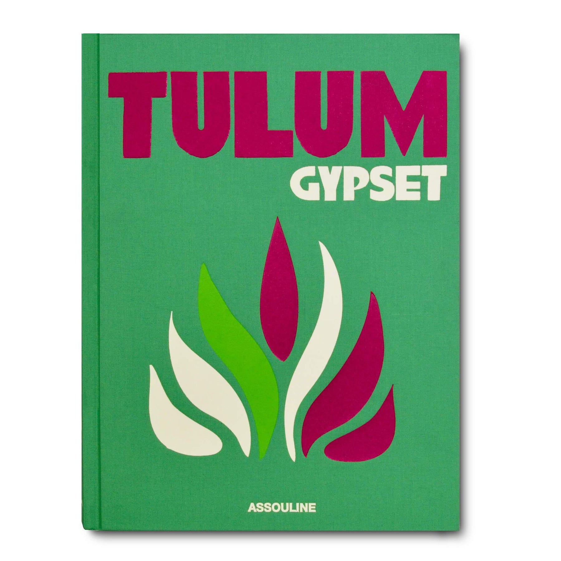
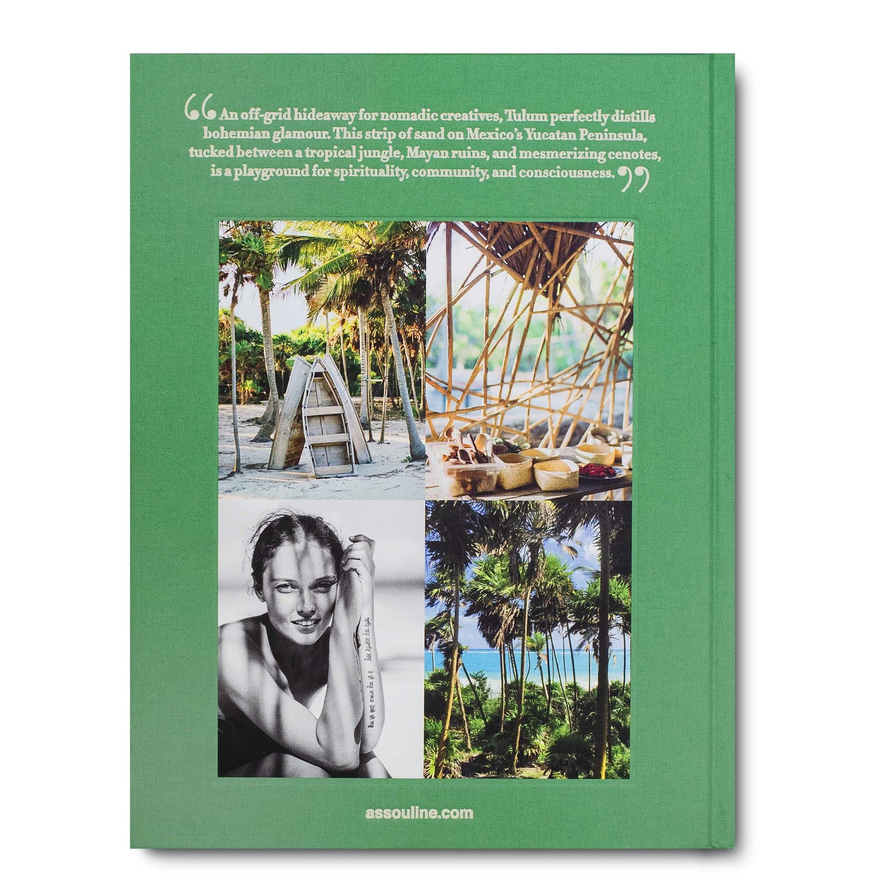
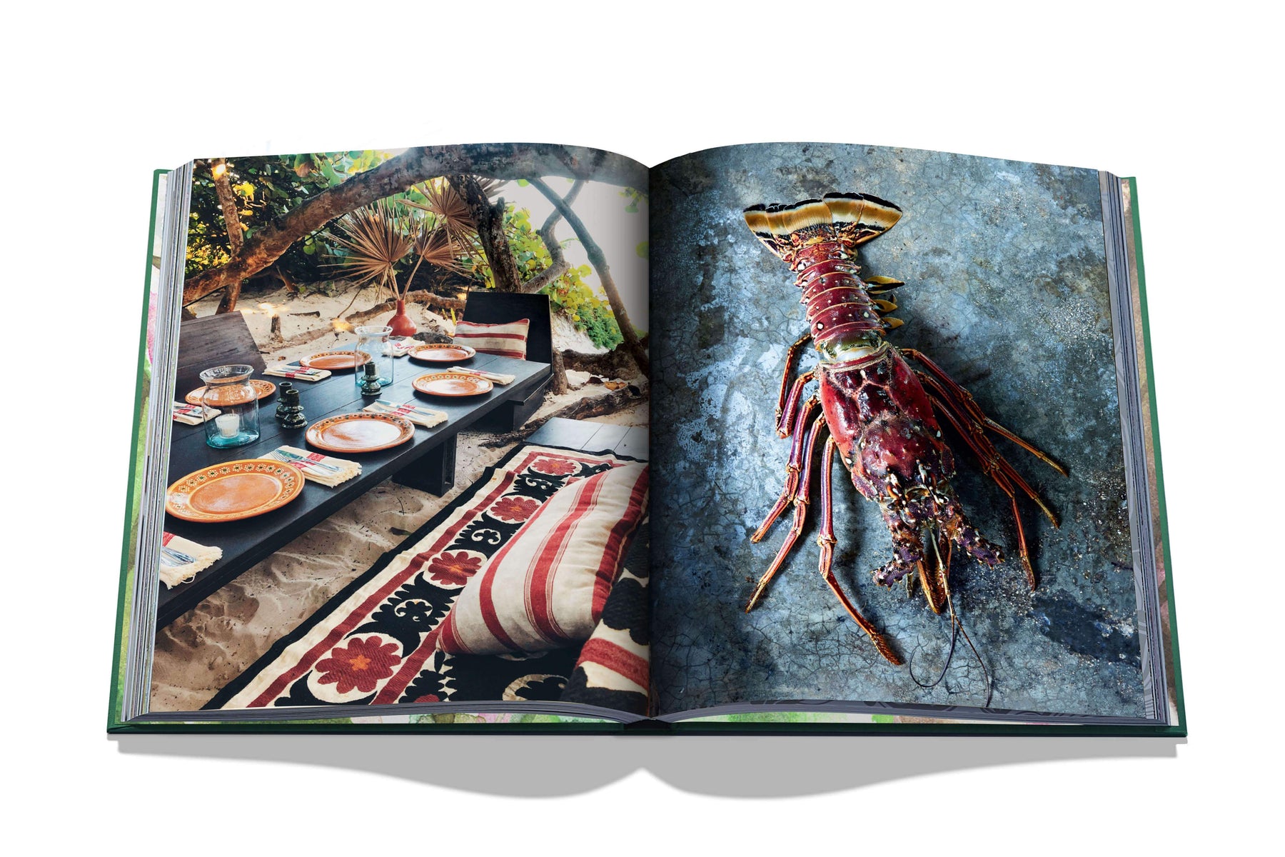

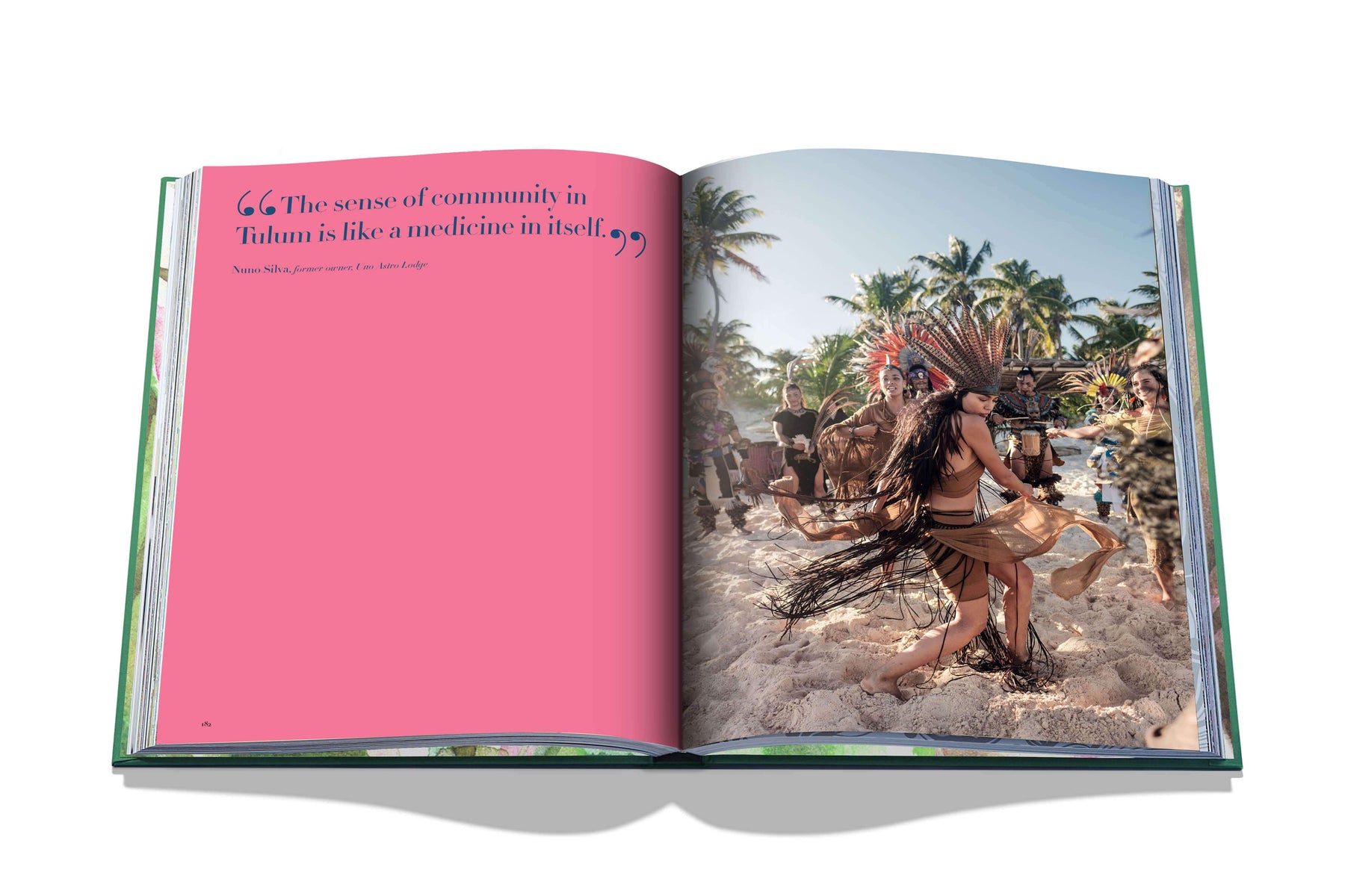


Tulum Gypset
Ordinær pris 1.499,00 kr/
Mva inkludert
Frakt beregnes i kassen.
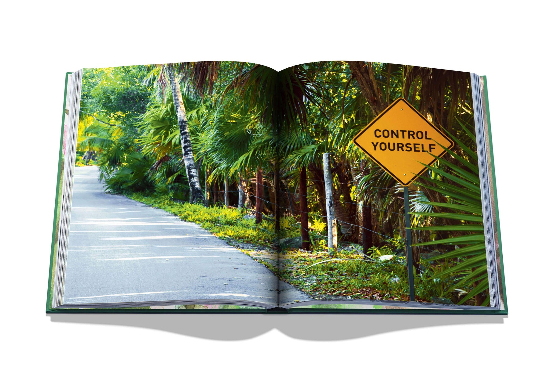
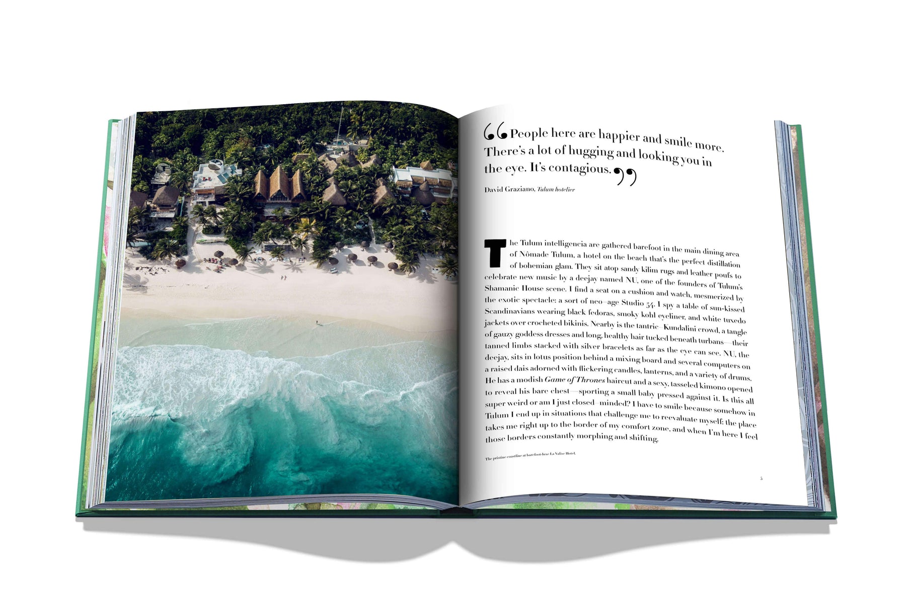
A hub for barefoot bohemians and glamorous goddesses, Tulum is a Mayan hideaway that perfectly distills the gypset lifestyle. An off-grid escape for nomadic creatives, it is a playground for spirituality and community. This tiny, idyllic eight-mile strip of sand on Mexico’s Yucatán Peninsula is tucked between a tropical jungle, Mayan ruins, and the Sian Ka’an biosphere: It’s a heady vortex. Tulum’s isolated and breathtakingly beautiful environment also makes it the perfect place for those craving a deeper connection with themselves, others, and nature.
Seekers (sun, spiritual, and otherwise) pilgrimage to this beach settlement in droves to join this avant-garde template for a new bohemian lifestyle that prioritizes healing, eco-friendly practices and organic cuisine. The boho-chic crowd’s home away from home, Tulum is a rare and successful modern experiment in both consciousness and sophistication, bolstered by its down-to-earth hotels, mesmerizing cenotes, and lush backdrop.
- Publisert: August 2019
- Innbinding: Innbundet
- Antall sider: 280
- ISBN: 9781614288473


Tunisia
Ordinær pris 239,00 kr/
Mva inkludert
Frakt beregnes i kassen.
Tysk kartserie med flotte kart på slitesterkt, vannfast plastpapir.
- Publisert: 2024
- Innbinding: Falset
- Materiale: Vannfast papir
- Målestokk: 1:600 000

Tunisia
Ordinær pris 309,00 kr/
Mva inkludert
Frakt beregnes i kassen.
Written by long-term resident, adventurer and experienced travel writer Oscar Scafidi, this brand new Bradt publication is the most up-to-date, comprehensive travel guidebook to Tunisia produced by a mainstream publisher. Taking account of this North African country's recent political and social flux, and covering each of the nation's 24 governorates, the book's listings for hotels, restaurants and activities cater for all types of travellers and budgets. Complemented by 80 detailed maps and advice on navigating bureaucracy, this guide provides all the practical information you need to visit or explore here.
The birthplace of the Arab Spring in 2010, Tunisia is readily accessible from European cities. From relaxing on Mediterranean beaches to camel-trekking or quad-biking in the Sahara Desert and marvelling at the moonscapes of Chott el Djerid salt lake, this fascinating nation crams much excitement and interest into a small area. In the 2,000-year-old capital of Tunis, originally a Berber settlement, you can haggle in the ancient Medina, browse artefacts at the Bardo National Museum or enjoy fresh seafood at waterfront restaurants.
Archaeology afficionados will hardly know where to begin in Africa's fourth-richest country for UNESCO World Heritage Sites: the remnants of Ancient Carthage, perhaps, or superbly preserved Roman ruins, such as the world's second-largest amphitheatre of El Jem; Djerba, where Berbers, Muslims and the world's oldest Jewish community have co-existed for centuries, is a world-renowned kitesurfer's paradise. Sunseekers have over 1,000km of coastline on which to bask - why not sip cocktails at the upmarket resort of Gammarth, just north of Tunis - while hedonists can party at a mammoth 30-hour rave in the desert at Ong Jmal. Meanwhile, film buffs can make pilgrimages to sets used in the Star Wars movies or explore canyons used by Steven Spielberg' for an Indiana Jones film, and culture vultures can visit Islamic sites such as the Ribat of Monastir fort or 7th-century city of Kairouan.
With a language appendix covering Tunisian Arabic and French, detailed context that helps visitors travel with awareness and sensitivity, and in-depth travel information, Bradt's Tunisia is an indispensable practical companion to exploring this exciting country.
- Forfattere: Oscar Scafidi
- Publisert: Juni 2023
- Utgave: 1 utgave
- Antall sider: 408
- Innbinding: Heftet
- Språk: Engelsk
- ISBN: 9781784777517

Turen går til: Sicilia
Ordinær pris 249,00 kr/
Mva inkludert
Frakt beregnes i kassen.
Endelig en guidebok på norsk!
Boken dekker Palermo og omegn, det vestlige Sicilia med de egadiske øyer, det nordøstlige Sicilia med Etna og de lipariske øyene, samt den sørlige og sørøstlige delen av øya, inkludert oldtidsbyen Siracusa.
Den gir et innblikk i hverdagslivet på Sicilia og belyser politiske og kulturelle spørsmål. En rekke artikler tar deg med bak fasaden og utforsker øyas historie, kunst og kultur, natur og geografi, samt mat og drikke. Guiden er også rikt illustrert med bilder og kart.
- Publisert: Mai 2025
- Antall sider: 144
- Innbinding: Heftet
- Språk: Bokmål
- ISBN: 9788293080176

Turisten
Ordinær pris 299,00 kr Salgspris 149,50 kr Spar 50%/
Mva inkludert
Frakt beregnes i kassen.
Rabiat, grotesk og komisk portrett av en ung mann på leting etter ståsted I en verden der tilværelsen er blitt til et spill dagens vestlige turist leter etter stadig mer enestående opplevelser, stadig større adrenalinkick, stadig mer eksotiske eventyr ... Og alt skal være ekte. I en tidsalder der fjerntliggende folks nød er autentiske turistattraksjoner og tv-seeren er blitt lidelseskonsument, blir det for kjedelig for romanens hovedperson erik olafsen å observere de tv-overførte krigene på trygg avstand. Han forlater den traurige rutinejobben på postkontoret I solbergelva og begir seg ut I verden som krigsturist. Fullstendig ute av kontroll sjangler han gjennom krigsområdene, fra nagorno-karabakh via rwanda til irak, I jakten på sterkere og sterkere opplevelser. Turisten er en litterær road movie spekket med skrudd humor, og gjennom olafsens møter med volden og vanviddet I krigssonene, stilles vår hang til elendighetsfascinasjon I et ubehagelig selvransakelsens lys.
forfattere: E.B.Olafsen
Publisert måned: Feb
Publisert år: 2007
Utgave: 1utg
Sider nr: 200


Turistkart Danmark og Storkøbenhavn og Margueriteruten
Ordinær pris 269,00 kr/
Mva inkludert
Frakt beregnes i kassen.
- Publisert: 2025
- Innbinding: Falset
- Målestokk: 1:500 000 (+ københaven kart: 1:35 000)
- ISBN: 9788779671836

Türkiye: Cycling Through a Country's First Century
Ordinær pris 329,00 kr Salgspris 164,50 kr Spar 50%/
Mva inkludert
Frakt beregnes i kassen.
Meeting Turkish farmers and workers, Syrian refugees and Russians avoiding conscription, the journey brings to life a living, breathing, cultural tapestry of the place where Asia, Africa and Europe converge.
The result is a love letter to a country and its neighbours - one that offers a clear-eyed view of Turkiye and its place in a changing world. Yet the route is also marked by tragedy, as Sayarer cycles along a major fault line just months before one of the most devastating earthquakes in the region's modern history.
Always engaged with the big historical and political questions that inform so much of his writing, Sayarer uses his bicycle and the roadside encounters it allows to bring everything back to the human level. At the end of his journey we are left with a deeper understanding of the country, as well as the essential and universal nature of political power, both in Turkiye and closer to home.
- Forfatter: Julian Emre Sayarer
- Publisert: 2024
- Innbinding: Heftet
- Språk: Engelsk
- Antall sider: 256
- ISBN: 9781529429961

Turkmenistan
Ordinær pris 124,50 kr/
Mva inkludert
Frakt beregnes i kassen.
Gizi Map er en serie presise kart med detaljer og opplysninger over både populære og mindre populære reisemål. Dekker ofte områder der få andre kartprodusenter dekker.
- Publisert: 2019
- Innbinding: Falset
- Materiale: Papir
- Målestokk: 1:1 300 000

Tuscany
Ordinær pris 209,00 kr/
Mva inkludert
Frakt beregnes i kassen.
Disse små blå vandreguidene I lommeformat har blitt en favoritt blant ferierende med utflukter og natur på programmet. Da de ble sammenliknet med andre fottur-guider I aftenposten for et par år siden, vant de testen med god margin! Inneholder kart I målestokk 1:5./1:75., ruteforslag og hendige tips for fotturister - og for de som vil komme seg rundt ved hjelp av bil eller sykkel.
8 car tours throughout north and south Tuscany, leading to 75 long and short walks. Too maps with waypoints. Many feature panels of local customs etc.
forfattere: E. Mizon
Publisert måned: Apr
Publisert år: 2018
Utgave: 3.Utg
Sider nr: 144

Tuscany & Umbria
Ordinær pris 279,00 kr/
Mva inkludert
Frakt beregnes i kassen.
Denne praktiske reiseguiden til Toscana og Umbria inneholder detaljerte reisetips og oversikt over de mest ikoniske severdigheter, samt noen skatter utenfor allfarvei. Med forslagene til reiseruter og ekspertforfatterens utvalg av ting å se og gjøre blir denne boken til en perfekt følgesvenn både i forkant og underveis på turen. Denne Toscana og Umbria-guideboken er fullpakket med detaljer om hvordan du kommer deg dit og rundt, informasjon før avreise og topp tidsbesparende tips, inkludert en visuell liste over ting du ikke bør gå glipp av. Våre fargekodede kart gjør Toscana og Umbria enklere å navigere mens du er der.
- Publisert: Mai, 2025
- Utgave: 12. utgave
- Antall sider: 560
- Innbinding: Heftet
- Språk: Engelsk
- ISBN: 9781835291979

Tuscany (Toscana)
Ordinær pris 199,00 kr/
Mva inkludert
Frakt beregnes i kassen.
Marco polo er svært detajerte kart som er praktiske og enkle i bruk. 7 klistremerker for å markere spesifikke steder gjør det enda enklere å planlegge reisen. Alle kartene inneholder en omfattende index for enkelt å finne frem.
Fully updated, Marco Polo maps feature completely up-to-date, digitally generated mapping. The high quality cartography with distance indicators and scale converters aid route planning. Includes a city map of Cagliari. Major sights and key points of interest are marked on the map by numbered stars and these are listed in the index booklet with a brief description to help travellers pick the best places to see en route. Comprehensive index.
Publisert: 2025
Innbinding: falset
Material: papir
Målestokk: 1:225,000

Tyrkiet
Ordinær pris 329,00 kr/
Mva inkludert
Frakt beregnes i kassen.
Politikens velkjente reisehåndbøker. Guidene inneholder det essensielle ved reisemålet: Beskrivelser av severdigheter, oversikt over aktivitets- og sportstilbud, råd og tips til dem som reiser med barn, samt praktisk informasjon for øvrig. Bøkene byr dessuten på underholdende tematekster og kart, og de er rikt illustrerte. Flotte for kortere turer og populære blant dem som reiser på organiserte opplegg. Hendig lommeformat.
- Publisert: 2020
- Utgave: 14. utgave
- Antall sider: 180
- Språk: Dansk
- ISBN: 9788740053470


Tøyen 1921
Ordinær pris 1.100,00 kr/
Mva inkludert
Frakt beregnes i kassen.
Dette kartet er kun tilgjengelig for kjøp i nettbutikken. Kartet printes når du kjøper, og har derfor noe lengre leveringstid.
Dette er Dapa Maps' utsnitt over deler av Tøyen fra kartet Kristiania 1921.
Oslos peneste kart? Ja det mener vi. I flere år har Dapa Maps sett på dette kartet og tenkt at de må gjøre med det. Vinteren 2023/2024 har de gjort en digital restaurering av kartet og kan nå vise det frem for allmenheten.
Kartet er opprinnelig tegnet av Byens Oppmaalingsvesen (forløper til Plan- og bygningsetaten) i 1921. Kartet ble da tegnet på 6 ulike kartblad som finnes arkivert hos Byarkivet.
Det Dapa Maps har gjort er å sette kartet sammen til et kart og redigert bort rutenettet slik at lesbarheten blir bedre. De har ikke endret noe på fargene eller på noen andre detaljer.
Dapa Maps
Kartet er laget av Daniel og Pavel fra Dapa Maps. De er to kartografer som tror at livet er best ute, derfor er de opptatt av å lage de peneste kartene de kan for at du kan bli kjent med områdene du liker best. Om du ønsker kan du lese mer om de her.
For hvert kart som selges planter de et tre slik at verden blir litt grønnere 🌳
Ramme og montering
Dapa Maps har endelig funnet frem til den perfekte rammen og kan nå tilby ramme og montering av kartet.
- Massiv eik
- Glass
- Enkelt å bytte ut kartet
- Mulighet for å henge den både stående og liggende
- 50 x 70 cm (samme som alle Dapas kart)

U.S. & British Virgin Islands
Ordinær pris 299,00 kr/
Mva inkludert
Frakt beregnes i kassen.
Whether you want to sail in Tortola, snorkel at Trunk Bay Beach, or explore the Baths in Virgin Gorda, the local Fodors travel experts in the Virgin Islands are here to help! Fodors U.S. & British Virgin Islands guidebook is packed with maps, carefully curated recommendations, and everything else you need to simplify your trip-planning process and make the most of your time. This new edition has been fully-redesigned with an easy-to-read layout, fresh information, and beautiful colour photos.
- Publisert: Januar 2024
- Innbinding: Heftet
- Antall sider: 252
- ISBN: 9781640976450

Uganda
Ordinær pris 219,00 kr/
Mva inkludert
Frakt beregnes i kassen.
Indexed, waterproof and tear-resistant road map of Uganda with topographic and tourist information, published by Reise Know-How as part of their highly acclaimed World Mapping Project. The map is double-sided to provide the best balance between a good scale and a convenient size sheet.
The country’s topography is presented by altitude colouring with contours, spot heights, mountain passes, and names of mountain and hill ranges or plateaux. Swamps and seasonal rivers are also marked. Internal administrative boundaries are shown with names of regions and provinces. Road network includes unsurfaced local roads or tracks and shows driving distances on most roads, locations of petrol stations and border crossings. Railways, local airfields and ferry routes on Lake Victoria and Lake Albert are also shown.
National parks and protected zones are clearly marked. Symbols highlight numerous places of interest, including UNESCO world heritage and archaeological sites, hotels and lodges, camping sites, hot springs, rock paintings, viewpoints, etc. The map has a latitude and longitude grid at intervals of 30’ and index of localities. Map legend includes English.
- Publisert: 2023
- Innbinding: Falset
- Materiale: Plastpapir
- Målestokk: 1:600 000

Uganda Animal Kingdom
Ordinær pris 259,00 kr Salgspris 129,50 kr Spar 50%/
Mva inkludert
Frakt beregnes i kassen.
Uganda Animal Kingdom. African might. There are a number of reasons why people are choosing to take Tour and holidays in Uganda out of all the 54 countries on the African continent. After many years of bad publicity from wars and disease, things turned around for Uganda, especially in 2006, when Kony and his Lord's Resistance Army were run out of the country. Some of the things that have caused this surge in popularity and made Uganda make it to the list of the top 20 travel destinations include; Primates such as Gorillas: It came to the attention of both Uganda and the rest of the world that Uganda is primate country. From monkeys, to baboons to chimpanzees and to the rare and sought after golden monkeys and mountain gorillas.
There is no better country to visit if you are looking to see primates of different kinds. In the past five years gorilla trekking in Uganda has become one of the most sought after Africa safari adventures. The pearl of Africa is home to more than half of the world's population of mountain gorillas, and some of these have been habituated so visitors can get to see them in their natural habitat. Chimpanzees too are an attraction in Uganda, they are found in various places in the western part of Uganda. The golden monkeys, also quite a rare species are found in Mgahinga national park on the foothills of the Virunga Mountains. It is because of the abundance of primates that Bwindi Impenetrable Forest, Mgahinga national park, and other parks in the western part of the country have a lot of tourist traffic.
- Forfatter: Christopher Walsh
- Publisert: Juli 2022
- Utgave: 1. utgave
- Antall sider: 158
- Innbinding: Heftet
- Språk: Engelsk
- ISBN: 9781715305314

UK: 52 British Wildlife Weekends
Ordinær pris 289,00 kr Salgspris 145,00 kr Spar 50%/
Mva inkludert
Frakt beregnes i kassen.
Bradt's popular guidebook 52 Wildlife Weekends suggests inspiring itineraries for 52 unforgettable British wildlife-watching breaks, stretching from the Isles of Scilly to northern Scotland - each perfectly timed for every week of the year. Thoroughly updated to reflect Britain's ever-changing natural history, this second edition integrates the latest information on the country's most thrilling wildlife experiences, suggests new target species and showcases fabulous new locations. Written by award-winning author and experienced naturalist James Lowen, 52 Wildlife Weekends remains the only guide to package Britain's nature-watching highlights into deftly timed, user-friendly holiday suggestions.
Say it's February and you want to watching otters. Or May: time for spring flowers and bewitching butterflies. Or July, and you fancy marvelling at dragonflies.
Or October: the height of bird migration. Whenever in the year you get a chance to escape, this book suggests 48 hours' worth of brilliant wildlife-watching - perfect for staycations, whether as a weekend or part of a longer holiday. 52 Wildlife Weekends suggests a year's worth of short breaks celebrating the full range of Britain's most exciting wildlife, from tiny silver-spotted skipper butterflies to gargantuan basking sharks, and from seabird skyscrapers to ostentatious orchids.
Covering more than 40 counties or regions, this unique guide offers engaging descriptions, detailed directions (including grid references and postcodes), accommodation suggestions, and assessments of accessibility and (new for this edition) child-friendliness, plus 180 mouth-watering colour photographs. Find out how, where and when to track down such thrilling creatures as beavers and basking sharks, eagles and otters, dolphins and dragonflies, glow worms and grey seals. Why not open the New Year on a real-life wild goose chase in the Inner Hebrides? Or make a spring pilgrimage to Yorkshire to see truly wild daffodils? Or experience underwater life by peering into rivers for rare fish in Powys, snorkelling in Dorset, or rock-pooling in Devon? Or gawp at starling murmurations, shape-shifting through the autumnal sky, in Suffolk or Somerset.
Combining the very best of travel and wildlife guides, and covering both well-known spectacles and less familiar species, Bradt's 52 Wildlife Weekends has something for everyone - wildlife experts and novice ecotourists alike.
- Publisert: August 2023
- Innbinding: Heftet
- Språk: Engelsk
- ISBN: 9781804691311

UK: Britain’s Sacred Places
Ordinær pris 269,00 kr Salgspris 135,00 kr Spar 50%/
Mva inkludert
Frakt beregnes i kassen.
Britain is packed to the gunnels with places to visit that many regard as sacred, from iconic sites such as Iona, Lindisfarne and Stonehenge to more out-of-the-way pilgrimage destinations, stone circles, holy wells and obscure corners. Then there are places that appeal to a particular following, places of philosophical or celebrity interest such as Karl Marx’s tomb in Highgate cemetery, Princess Diana’s statue or, for sporting enthusiasts, Twickenham rugby stadium.
Forfattere: M. Symington
Publisert måned: Jul
Publisert år: 2022
Utgave: 2.utg
Sider nr: 336