
Filter
17 produkter
17 produkter

Lonely Planet Western Balkans
Ordinær pris 349,00 kr/
Mva inkludert
Frakt beregnes i kassen.
Nyeste utgave av boken, utgitt mars 2026.
Lonely Planets lokale reiseeksperter avslører alt du trenger å vite for å planlegge ditt livs reise i denne siste utgaven av vår guide til Vest-Balkan.
Oppdag Vest-Balkans mest populære opplevelser og best bevarte hemmeligheter, fra å vandre i de snødekte toppene og tradisjonelle fjellandsbyene i Albanias Forbannede fjell, til å beundre den fantastiske havutsikten fra de praktfulle bymurene i Dubrovnik, og smake på hjemmelaget mat fra Nord-Makedonia, fra paprikapølser til fylte paprikaer.
Bygg en reise du vil huske med Lonely Planets reiseguide for Vest-Balkan:
Vårt klassiske guidebokformat inneholder det mest omfattende informasjonsnivået for planlegging av turer over flere uker.
Helt ny struktur og design som er enkel å bruke, slik at du kan navigere på Vest-Balkan uten problemer.
Spennende reiseruter hjelper deg med å lage ditt perfekte eventyr med forslag til lengre reiser, dagsturer, vandreturer og aktivitetsledede utflukter.
Ekspertanbefalinger fra lokale eksperter om mat, drikke, uteliv, shopping, overnatting, festivaler, når du skal dra og mer.
Livfulle fotografier og kart.
Få nye perspektiver på severdigheter du må besøke, fra Butrint til Plitvice-sjøene nasjonalpark og Stari Bar.
Verktøysett med viktig informasjon som inneholder tips om ankomst, transport, lokal etikette, bruk av penger, LGBTIQ+-reisetips, nyttige ord og uttrykk, tilgjengelighet og ansvarlig reise.
Få kontakt med Balkan-kulturen gjennom historier som dykker dypt inn i lokalt liv, historie og tradisjoner.
Dekker: Albania, Bosnia-Hercegovina, Kroatia, Kosovo, Montenegro, Nord-Makedonia, Serbia, Slovenia.
Lag en reise som er unik for deg og som kommer til hjertet av denne ekstraordinære delen av verden med Lonely Planets Vest-Balkan / Western Balkans.
- Publisert: Mars 2026
- Utgave: 5. utgave
- Antall sider: 392
- Innbinding: Heftet
- Språk: Engelsk
- ISBN: 9781838693886

Lonely Planet Eastern Europe
Ordinær pris 249,00 kr/
Mva inkludert
Frakt beregnes i kassen.
Lonely Planet’s Eastern Europe is your passport to the most relevant, up-to-date advice on what to see and skip, and what hidden discoveries await you. Walk Dubrovnik’s city walls, discover history in Krakow, and explore Moscow’s Red Square; all with your trusted travel companion. Get to the heart of Eastern Europe and begin your journey now!
Covers Albania, Belarus, Bosnia & Hercegovina, Bulgaria, Croatia, Czech Republic, Estonia, Hungary, Kosovo, Latvia, Lithuania, Moldova, Montenegro, North Macedonia, Poland, Romania, Russia, Serbia, Slovakia, Slovenia, Ukraine.
- Publisert: Januar 2022
- Utgave: 16. utgave
- Antall sider: 512
- Innbinding: Heftet
- Språk: Engelsk
- ISBN: 9781788683913


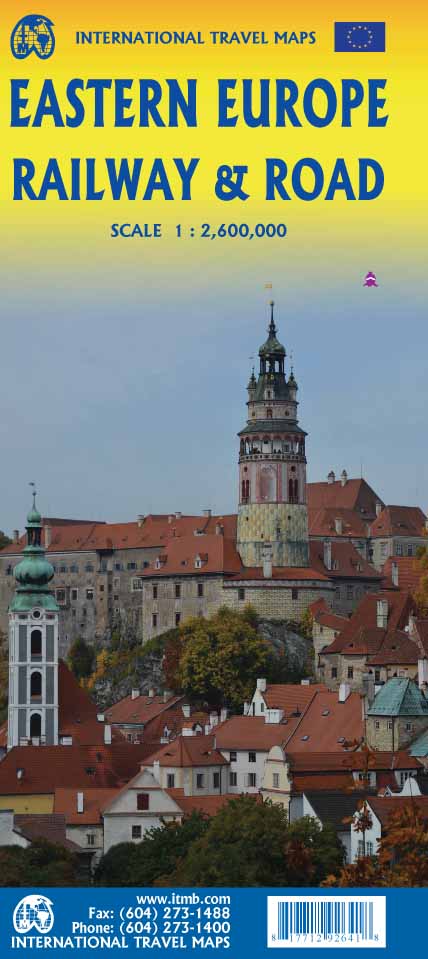
Europe Eastern: Railway & Road
Ordinær pris 199,00 kr/
Mva inkludert
Frakt beregnes i kassen.
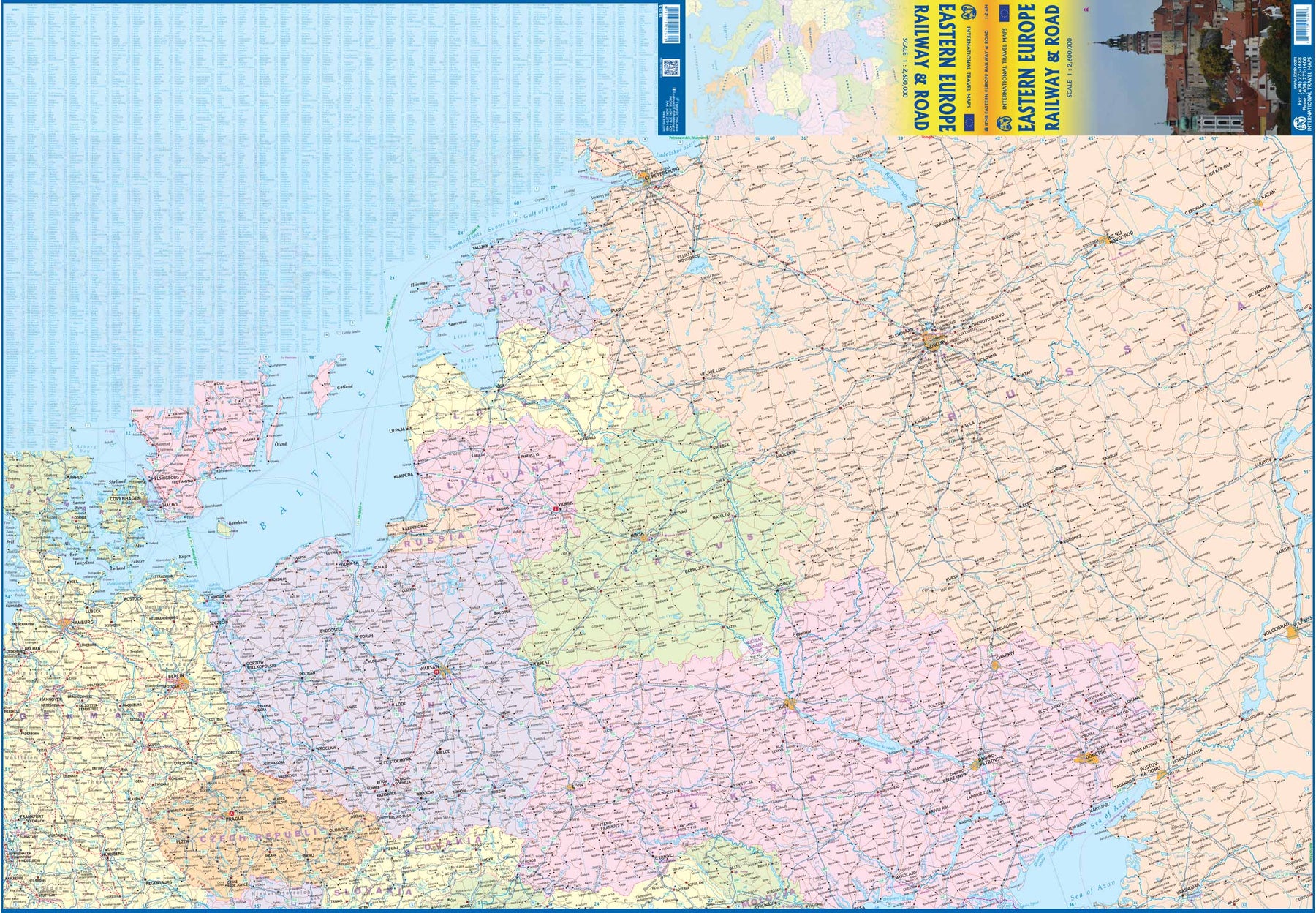
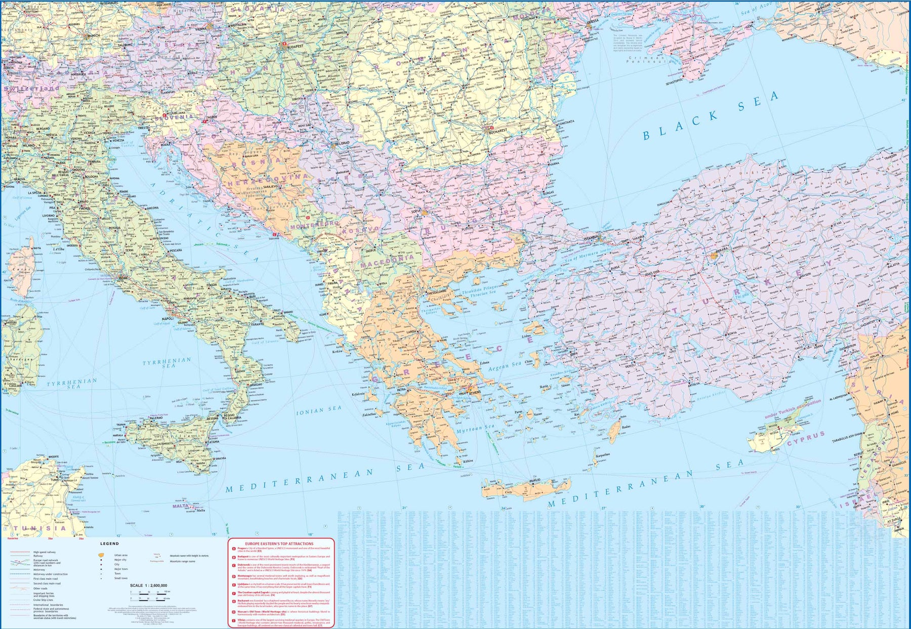
Europe may be small in comparison to Canada, but it is densely populated and difficult to map as a continent while providing detail. Eastern Europe used to be defined as everything behind the Iron Curtain during the Cold War, but now it encompasses everything east of Germany and Switzerland, which means that this map covers Italy, Greece and the Balkan countries, the Central European countries of Romania and Hungary and most of Ukraine, Poland and the three Baltic states, and western Russia as far east as Volgograd, as well as much of Turkey. It is a combined road and rail map, showing motorways and major highways, fast-train routes in red and regular services in black. It also shows major cruise line routes, although many have been suspended due to Covid and political situations in Russia and Turkey.
Essentially, this is a map covering a very large area, as are our maps of Western and Central Europe, and our earlier map of Scandinavia. We have tried to make it politically correct, which is difficult considering the Russian occupation of Crimea and the Donetsk region of Ukraine and the on-going controversy over the ‘proper’ name for Macedonia, so we apologize for any errors. For simplicity’s sake, we have named most place names in English, so Roma is Rome and Moscva is Moscow etc. Fortunately, most English place names are the same in the local languages. However, being ITMB, Naples is Napoli, and Florence is Firenze, so don’t be too critical of us; we’re trying to reconcile differing perspectives.
- Publisert: 2021
- Innbinding: Falset
- Materiale: Papir
- Målestokk: 1:2 600 000

Croatia; Serbia
Ordinær pris 189,00 kr/
Mva inkludert
Frakt beregnes i kassen.
Also includes: Slovenia; Bosnia+Herz.; Kosovo; Montenegro; Albania; North Macedonia
The ideal map for your trip. Let the Marco Polo Croatia Road Map guide you around this fascinating region of eastern Europe. Discover one of Europe's most beautiful coastlines with this highly durable, detailed, touring map of Croatia which also covers most of the Balkans. It folds away easily and is always on standby to help when you're stuck.
- Publisert: 2019-2023
- Innbinding: Falset
- Materiale: Papir
- Målestokk: 1:800 000

Balkans Western, reisekart
Ordinær pris 219,00 kr/
Mva inkludert
Frakt beregnes i kassen.
Highly tear-resistant and 100% waterproof map "Western Balkan Region" from the series world mapping project.
Travel know-how maps are characterized by particularly sturdy plastic paper, which can be written on like paper, even with a pencil. The cardboard envelope is removable, making it easy to put the card in any pocket. A protective cover is not required. The cartographic representation focuses on the most important information for travellers and is particularly easy to read. Instead of shading, coloured layers of elevation are used.
- This map includes Albania, Bosnia-Herzegovina, Kosovo, Croatia, Macedonia, Montenegro, Serbia and Slovenia.
- Contour lines with elevation information
- Colored elevation layers
- Classified road network with distance information
- Sights
- Detailed location index
- GPS-accurate
- Longitude and latitude
- Five-language legend (German, English, French, Spanish, Russian)
- Publisert: 2025
- Innbinding: Falset
- Materiale: Plastpapir
- Målestokk: 1:725 000

Slovenia
Ordinær pris 279,00 kr/
Mva inkludert
Frakt beregnes i kassen.
This practical travel guide to Slovenia features detailed factual travel tips and points-of-interest structured lists of all iconic must-see sights as well as some off-the-beaten-track treasures. Our itinerary suggestions and expert author picks of things to see and do will make it a perfect companion both, ahead of your trip and on the ground. This Slovenia guide book is packed full of details on how to get there and around, pre-departure information and top time-saving tips, including a visual list of things not to miss.
Our colour-coded maps make Slovenia easier to navigate while you're there. This guide book to Slovenia has been fully updated post-COVID-19. The Rough Guide to Slovenia covers: Ljubljana and around, Northwest Slovenia, The Soca Valley to the Istrian coast, Southern Slovenia and Eastern Slovenia.
- Publisert: Sept. 2023
- Utgave: 5. utgave
- Antall sider: 320
- Språk: Engelsk
- Innbinding: Heftet
- ISBN: 9781789195811

Lonely Planet Slovenia
Ordinær pris 279,00 kr/
Mva inkludert
Frakt beregnes i kassen.
"Backpackernes bibel" er ofte en sikker vinner, også for Slovenia. Her får du det aller meste av informasjon du kan komme til å trenge, i en grundig og oversiktlig guide. Lonely Planet-guidene inneholder anbefalinger i flere priskategorier, og tar for seg et stort spenn av aktiviteter, steder og attraksjoner, og er dermed et godt valg for de fleste reisende. Guidene inneholder få bilder, og er dermed først og fremst en informativ, heller enn en inspirerende guide - men den er likevel garantert å vekke reiselysten i deg.
- Publisert: Mai 2024
- Utgave: 11. utgave
- Antall sider: 256
- Innbinding: Heftet
- Språk: Engelsk

Slovenia & Istria
Ordinær pris 199,00 kr/
Mva inkludert
Frakt beregnes i kassen.
Marco Polo Slovenia and Istria Map: the ideal map for your trip. Let the Marco Polo Slovenia and Istria Road Map guide you around this stunning region. It folds away easily and is always on standby to help when you're stuck. Perfect touring map - the scale is 1 : 250 000 ideal to help you tour the country by car or campervan. Easy to use - the superbly clear mapping in strong colours and easy to read text will help you navigate the country like a local. Durable, tear-resistant map - designed to withstand the rigors of the road, the map is printed on tear-resistant, water repellent and writeable paper. Highlights included - major sights and key points of interest are marked on the map by numbered stars.
- Publisert: 2023-2025
- Innbinding: Falset
- Materiale: Papir
- Målestokk: 1:250 000

Balkans: Croatia; Slovenia & Bosnia Herzegovina
Ordinær pris 199,00 kr/
Mva inkludert
Frakt beregnes i kassen.
Attractive road map of the region with hill-shading to show the general relief. Road detail includes selected secondary roads, and distinguishes toll roads and scenic routes. Intermediate driving distances are indicated. Caravan restrictions are shown, also steep gradients and seasonal road closures. Other details include ferries, cable car lines, railways, border crossings, campsites, antiquities, various landmarks, viewpoints and sites of interest. National parks and provincial boundaries are marked. Latitude and longitude lines are drawn at 30' intervals. Legend includes English.
here is also an inset political map of the wider Balkan region.
- Publisert: 2024
- Innbinding: Falset
- Materiale: Papir
- Målestokk: 1:500 000

Slovenia
Ordinær pris 199,00 kr/
Mva inkludert
Frakt beregnes i kassen.
lovenia at 1:185,000 on a light, waterproof and tear-resistant, indexed road map with topographic and tourist information, published by Reise Know-How as part of their highly acclaimed World Mapping Project. The map is double-sided, dividing the country west / east, to provide the best balance between a good scale and a convenient size sheet.
Road and rail networks are easy to see on a clear base which presents topography by altitude colouring with contours, spot heights, mountain passes and names of mountain ranges. Road network includes unsurfaced local roads and tracks, and shows driving distances on main and secondary roads. National parks and protected areas are marked and symbols highlight various places of interest, including different types of accommodation (campsites, youth hostels, selected inns and hotels, mountain refuges) archaeological remains, castles and churches, museums, viewpoints, spas, golf courses, wildlife parks, etc. The map has a latitude and longitude grid at intervals of 10’, UTM margin ticks, and an extensive index of localities. Map legend includes English.
- Publisert: 2025
- Innbinding: Falset
- Materiale: Plastpapir
- Målestokk: 1:185 000


Mount Triglav
Ordinær pris 219,00 kr/
Mva inkludert
Frakt beregnes i kassen.
The central part of the Triglav National Park on a light, waterproof and tear-resistant, contoured and GPS compatible map at 1:25,000 from Kartografija, with on the reverse details of local mountain shelters with photos and QR codes. The map is centered on the peak of Triglav and coverage extends north to Kranjska Gora, south to the Bohinj Lake, west to Trenta, and east to Bohinjska Bistrica in the south-eastern corner of the map.
Contours at 10m intervals with shading and graphics relief, plus plenty of spot heights provide and excellent presentation of the topography. An overprint highlights waymarked hiking trails, indicating difficult sections. 32 mountain shelters are cross-referenced to the information on the reverse, with more symbols highlighting locations of other tourist accommodation , inns, climbing sites, viewpoints, interesting natural or cultural sites, etc. Road network shows car parks and petrol stations. The map has latitude and longitude lines at 1’ intervals plus UTM crosshairs at 1km intervals.
On the reverse an overview map highlights eight access routes to the peak of Triglav. 25 shelters are presented with photos, contact details, GPS coordinates and QR codes for further information; also listed are seven more huts highlighted on the map.
- Publisert: 2024
- Innbinding: Falset
- Materiale: Vannfast papir
- Målestokk: 1:25 000


Triglav National Park
Ordinær pris 219,00 kr/
Mva inkludert
Frakt beregnes i kassen.
Triglav National Park at 1:50,000 on a contoured and GPS compatible walking and cycling map from Kartografija in Ljubljana, waterproof and tear-resistant version, with on the reverse descriptions of the area’s best sights. Coverage extends from Bovec in the west to Bled in the east, and from Kranjska Gora in the north to just short of Tolmin in the south. On the reverse are bilingual descriptions of the region’s places of interest, including special notes on the World War I Isonzo Front, plus list of mountain huts and campsites with contact details.
Maps in this series have contours at 20m intervals, enhanced by relief shading, with plenty of spot heights and names of peaks, mountain chains, etc. Local hiking routes are highlighted, indicating difficult passages. Also marked are recommended cycling routes. Symbols indicate various types of accommodation including mountain huts, campsites, inns with lodgings, tourist farms or apartments, hotels and motels, as well as recreational facilities (golf, horse riding, swimming pools, etc), vineries, cultural and historical sites, etc. Road network indicates locations of petrol stations. Railway lines are shown with stations and various types of mountain transport (gondolas, chair lifts, etc) are marked. The maps have a latitude and longitude grid at intervals of 2’’.
- Publisert: 2024
- Innbinding: Falset
- Materiale: Vannfast papir
- Målestokk: 1:50 000

3311 Slovenia
Ordinær pris 249,00 kr/
Mva inkludert
Frakt beregnes i kassen.
National Geographic's Slovenia Adventure Map is designed to meet the unique needs of adventure travelers with its detailed and accurate information. This map includes thousands of cities and towns with an index for easily locating them, plus a clearly marked road network complete with distances and designations for highways, major roadways, scenic routes, and more. Transportation within and beyond the country is also made easier with the locations of airports, airfields, railroads, ferry routes, and border crossings. Myriad points of interest are noted including national parks, museums, castles, archeological sites, churches, and more.
Slovenia's western half is shown on the front side of the print map including the cities of Kranj, Ljubljana, Nova Gorica, Postojna, Litija, and Kocevj. The reverse side of the map covers the eastern portion of the country, and shows the cities of Velenje, Celje, Novo Mesto, Crnomelj, Maribor, Murska Sobota, Ptuj, Slovenska Bistrica, and Brezice.
Once a founding member of the Socialist Federal Republic of Yugoslavia, Slovenia declared its full sovereignty in 1991 and is now the richest Slavic nation in the European Union. It is the third most forested country in Europe and over a third of the area is protected. Its picturesque mountain ranges are popular with hikers and skiers while some of its most unique attractions include over 9,000 karst caves, thermal spas, the world's oldest grapevine, and a large number of casinos. One of the most biodiverse countries in the world, Slovenia offers travelers a wonderful opportunity to enjoy breathtaking natural wonders and a wide variety of diverse experiences in a relatively small region.
Every Adventure Map is printed on durable synthetic paper, making them waterproof, tear-resistant and tough — capable of withstanding the rigors of international travel.
- Publisert: 2022
- Innbinding: Falset
- Materiale: Vannfast papir
- Målestokk: 1:205 000

2804 Soča Tal, Isonzo
Ordinær pris 239,00 kr/
Mva inkludert
Frakt beregnes i kassen.
Hiking map Soca Valley, Isonzo, Alpi Giulie / Julian Alps, Triglav, Nova Gorica: The map for hiking, cycling and many other activities in nature. Compass hiking maps are easy to read and still contain all the information you need for a perfect hiking tour, a bike ride or an excursion. They depict nature at the right scale. Countless additional information is continually checked and expanded by the cartography team. The precise cartography includes all official hiking trails with names and trail numbers (such as long-distance trails), cycle paths (with trails), via ferratas, inns and huts, parking lots, buses and trains, ski tours and cross-country ski trails, springs, swimming areas and much more. This makes the map ideal for discovering new destinations, planning tours and finding your way around on the go. An intuitive map image of the landscape is created by the depicted vegetation, contour lines, rock drawings and the shading (shadows) of the mountains. Features of the hiking map Soca Valley, Isonzo, Alpi Giulie / Julian Alps, Triglav, Nova Gorica: - Scale 1:50,000: 1cm on the main map corresponds to 500m in nature.
- Publisert : 2024
- Innbinding: Falset
- Materiale: Vannfast papir
- Målestokk: 1:50 000


ITM, Western Balkans kart
Ordinær pris 219,00 kr/
Mva inkludert
Frakt beregnes i kassen.
The region stretching from Trieste to Sophia that used to be known as Yugoslavia is now called the Western Balkans, consisting of Slovenia, Croatia, Bosnia & Herzegovina, Serbia, Montenegro, Kosovo, Northern Macedonia, and parts of Albania, Hungary, and Bulgaria. Slovenia and Croatia are now part of the EU, and the other countries are aspiring to join. As a result, the region is becoming a popular touristic destination, easy to reach from Italy or Austria. Side 1 fronts on to the Adriatic Sea, showing the many ferry routes to Italy, the coastal motorway to Greece, and cities such as Ljubljana, Zagreb, Split, and Dubrovnik. Side 2 concentrates on the mountainous interior, essentially from Lake Balaton south to the Greek border and Thessalonica. This is a developing part of Europe, with names like Belgrade, Sarajevo, Pristina, Podgorica, Tirana, and Skopje, that are exotic and different, and therefore exciting to visit.
- Publisert: 2025
- Innbinding: Falset
- Materiale: Papir
- Målestokk: 1:900,000

Slovenia
Ordinær pris 309,00 kr/
Mva inkludert
Frakt beregnes i kassen.
This new, thoroughly updated and significantly expanded third edition of Bradt's Slovenia offers expert travel advice about this engaging European country. Slovenia has emerged as a serious year-round tourist destination that combines captivating city breaks in the capital Ljubljana with stellar outdoor activities in varied, wildlife-rich landscapes. Widely renowned as a world leader in green tourism and sustainable development, Slovenia showcases many of Europe's finest elements in an area roughly the size of Wales.
Here you can walk amid Alpine mountains or lush valleys, visit glacial lakes and charming Adriatic coastal towns, or admire a rich tapestry of architectural styles while delving into the country's captivating culture, diverse history or delicious cuisine. Ljubljana is a vibrant capital, so Bradt's Slovenia provides intimate detail on where to stay and eat, what to see and do, and how to get around. But this guide will also inspire and inform wider explorations in this impressively varied and conveniently compact country.
Here you can ski in the Alps in the morning, eat a late lunch with world-class chefs in the hilly hinterland then savour an Adriatic sunset with a glass of locally produce fine wine. In a country where half the land is protected, you can hike in the Juliana mountains, go wild swimming in Lake Bled (one of Europe's finest glacial lakes), raft rivers in the Soca Valley, venture underground into UNESCO-listed caves such as Postojna and Skocjan, or relax in thermal spas.
- Publisert: Jan. 2025
- Utgave: 3. utgave
- Antall sider: 320
- Innbinding: Heftet
- Språk: Engelsk
- ISBN: 9781784777050

2801 Julische Alpen, Steiner Alpen
Ordinær pris 199,00 kr/
Mva inkludert
Frakt beregnes i kassen.
- Publisert: 2024
- Innbinding: Falset
- Materiale: Plastpapir
- Målestokk: 1:75 000