109 produkter
Europe Eastern: Railway & Road
Ordinær pris 199,00 krEurope may be small in comparison to Canada, but it is densely populated and difficult to map as a continent while providing detail. Eastern Europe used to be defined as everything behind the Iron Curtain during the Cold War, but now it encompasses everything east of Germany and Switzerland, which means that this map covers Italy, Greece and the Balkan countries, the Central European countries of Romania and Hungary and most of Ukraine, Poland and the three Baltic states, and western Russia as far east as Volgograd, as well as much of Turkey. It is a combined road and rail map, showing motorways and major highways, fast-train routes in red and regular services in black. It also shows major cruise line routes, although many have been suspended due to Covid and political situations in Russia and Turkey.
Essentially, this is a map covering a very large area, as are our maps of Western and Central Europe, and our earlier map of Scandinavia. We have tried to make it politically correct, which is difficult considering the Russian occupation of Crimea and the Donetsk region of Ukraine and the on-going controversy over the ‘proper’ name for Macedonia, so we apologize for any errors. For simplicity’s sake, we have named most place names in English, so Roma is Rome and Moscva is Moscow etc. Fortunately, most English place names are the same in the local languages. However, being ITMB, Naples is Napoli, and Florence is Firenze, so don’t be too critical of us; we’re trying to reconcile differing perspectives.
France: French Atlantic Coast - Rail & Bike
Ordinær pris 179,00 krFrance is a rather large country, and while it can be portrayed on a map as a country, mapping it in segments provides an opportunity to concentrate on regions at a better scale. This map, covering the coastal region of France from the Cotenin Peninsula south to the Spanish border and east as far as Paris and Montpellier in Languedoc is the first of what we hope will be a series covering the country at an improved scale. This map is double-sided, covering from Quimper and Paris at the northernmost portion of coverage, to Angouleme and Clermont at the southern extreme on one side, with the second side covering from Bordeaux and St-Etienne south to Bayonne/Pamplona and Nimes/Avignon in the south. This is a part of Europe that has been fought over for centuries, and as such is dotted with fortresses proclaiming its historic importance.
This map has been designed with the leisure traveller in mind. Although it shows all motorways and highways, rail connections by train are emphasized, as are long-distance Euro-Velo cycling routes that are being developed in many parts of Europe. At this scale, it would be impractical to record all accommodations, but we have included a new feature that is thus far peculiar to France, and that is motorway hotels at rest areas. Naturally, the map is rich with places of touristic interest.
France: North Rail & Bike
Ordinær pris 199,00 krFrance: South Rail & Bike
Ordinær pris 199,00 krThis is a brand new title for ITMB and an attempt to portray a changing travel landscape in a mapping format. Eco-tourism is a rapidly growing activity, with enormous potential. At the same time, governments are seeking to reduce carbon pollution by encouraging train travel, so ITMB is climbing aboard the movement by publishing a map encouraging train travel while still retaining the road network and noting all the long-distance bike routes in southern France by designated number.
This is, by its scale, a generalized map of that portion of France south of Poitiers or Lyon to the Mediterranean, so is more of a regional map showing biking opportunities than a detailed trail map. Nevertheless, it is an excellent map on waterproof paper showing cycling routes and tertiary roads that are suitable for recreational exploration. Naturally, motorways and main highways are shown as well. Legend Includes: Roads by classification, Rivers and Lakes, National Park, Airports, Points of Interests, Mining, Highways, Main Roads, Zoos, Fishing, , and much more...
Geneva & Western Switzerland
Ordinær pris 199,00 krITM har kart over hele verden og de spesialiserer seg på land litt utenfor allfarvei. Beliggenheten til landets nasjonalparker, historiske monumenter, de viktigste veiene o.L. Finner du inkludert i kartene. Samtlige landkart har ofte et bykart over hovedstaden.
Fra ITM: Geneva is an ancient Swiss town close to the French border, nestled along the edge of Lake Leman, and is bisected by the Rhone River. The old town is on the left, or lower, bank and is loaded with shops and restaurants. The ‘new’ town is on the right, or upper, bank and contains the downtown shopping area and the main railway station. The United Nations complex, the Palais des Nations, is a bit of a walk to reach, so fortunately there is a tram that goes right to the gates. The airport is shown at the top of the page. The 2nd side is a new map for us, covering the western half of Switzerland as far as Basle and Luzern, concentrating on the rail network as well as the roads. For example, it shows the rail line to Zermatt, at the base of the Matterhorn.
Publisert år: 2025
Innbinding: falset
Material: papir
Målestokk: 1:6,700 / 1:301,000
Great Britain
Ordinær pris 199,00 krITM har kart over hele verden og de spesialiserer seg på land litt utenfor allfarvei. Beliggenheten til landets nasjonalparker, historiske monumenter, de viktigste veiene o.L. Finner du inkludert i kartene. Samtlige landkart har ofte et bykart over hovedstaden.
Fra ITM: This is the third set of artwork for Great Britain that we have published and the first that is completely our own artwork (the previous versions were joint ventures). In mapping, as in life, one has to differentiate between the political entity known as the United Kingdom and the geo-political reality of Greater Britain, which includes the Channel Islands, the Isle of Man, and various assorted entities that are loosely attached to the UK by history. We have tried, in this edition, to combine a detailed road map with a touristic sites map. Given that Britain is both densely covered by thousands of narrow laneway passing themselves off as sub-B level roads and by having the greatest treasure trove in the world of castles, manor houses, gardens, museums, and interesting places worth visiting, and the task of portraying all this information becomes formidable. To keep the map from becoming too cluttered, we had to compromise, so if you don’t find the little laneway leading to your favourite pub in Devon, sorry. We've done our best to portray Britain as positively as possible, so if you're hankering to visit Foula Island, it's on the map!
Publisert år: 2025
Innbinding: falset
Material: plastpapir
Målestokk: 1:720,000
Great Britain: England - Southeast & Midlands Railway & Road
Ordinær pris 199,00 krThe shape of the UK makes it difficult to map logically. The term South East, within crowded England, is generally more restrictive than is appropriate for a map. Our definition of SE is from the English Channel north to the northern tip of East Anglia and west to Portsmouth/Reading/Peterborough. This occupies side one of the sheet. Side two consists of that complex portion of England generally called ‘The Midlands’ stretching from Cambridge/Peterborough west to the Welsh border and from Luton/Gloucester north to Manchester/Grimsby. London is, of course, prominent, but only as a main roads map.
This is the most recent sectional map of the UK that ITMB has published, and was necessitated by the realization that, to see England properly, one needs a detailed enough map to show rail lines, motorways, A-type highways and B-type secondary roads, but also the tertiary level of road joining villages. The road network of England is incredibly complex and cannot be shown in proper detail without mapping at this scale or better. England also has a sophisticated rail network and this is left off most maps to avoid clutter. We have emphasized all the rail lines carrying passengers, which makes the London portion look like a spaghetti factory, but there are lines everywhere. All motorways and highways are shown, but rail lines are prominently shown, to encourage travel by train. A Top Attractions list has been included as well, but hundreds of interesting touristic sites have been included.
Great Britain: England East Coast
Ordinær pris 199,00 krThe United Kingdom may be geographically small, but it is so packed with touristic sites that it needs to be broken down into logical units to be manageable. This is the first of several maps we will be publishing of England at 1:250,000 scale, covering Southeast England from Dover to Southampton north to Luton on Side 1 and from Colchester to Coventry north to Sheffield and Boston; essentially all of SE England from the Channel to Derbyshire and west to the Isle of Wight.
Even at this scale, there is only room to show major attractions without creating clutter. Both road and rail routes are clearly shown, with rapid-rail routes shown in red. This latter feature is not included on most other maps, an one notes with a bit of surprise that this part of England has more such routes than is generally believed to exist. We travelled on one of these trains during our recent visit to the UK (albeit from Newcastle to Edinburgh) and they are quite an improvement! Whether by train or by road, all options are shown. Whether one wishes to visit Hever Castle in Kent or Winchester cathedral, or the university cities of Cambridge or Oxford, this is an ideal map for exploring one of the most touristic corners of Europe.
Greece: Crete; Mykonos & Santorini
Ordinær pris 169,00 krThe many islands off the coast of Greece can only be mapped properly a few at a time. Side 1 of this map shows the large island of Crete in good detail, with the relatively nearby island of Mykonos and its adjacent island of Rinia and the island of Santorini, with its adjacent islands of Thirasia and Nea Kameni being shown in great detail. A locality map showing the islands in relation to the rest of Greece is included as an inset. It is our intention to map more islands as time passes, but this depends upon future research trips (we lead a hard life!).
Side 2 of the map is a general map of Greece in relation to its neighbours to the north and east. The Mediterranean is divided into smaller seas, such as the Adriatic along the coast of Croatia, the Ionian to the west of Greece, the Myrtoan to its south and the Aegean to its east. All this area is replete with islands and geopolitical conflicts. As such, this map is useful for showing the region as an entity that links the Balkan states to the eastern Mediterranean.
Guam & West Pacific Cruising
Ordinær pris 169,00 krWe are very pleased to be (finally) able to publish the first travel map of the island of Guam. Certainly, this is the only map of Guam by any major cartographic publishing house. Here are some details: Guam is a north-south island considerably north of New Guinea, and forms part of the American-held group of islands known as the Northern Marianas. Its capital is Hagatna, and the main town is called Tamuning. The island has a well-developed international airport in the middle portion of the island, with a large US military airbase in the northeast corner. The vast majority of the island is touristic, and well worth a visit. The island was "discovered" by Ferdinand Magellan in 1521, and Hagatna is the oldest "European" city in the Pacific, dating from 1686. The town of Inarajan retains a decidedly Spanish appearance to this day. Other attractions include Tumon Beach and its many resorts, the Piti Underwater Observatory, and the famous Cocos Island dive wall.
This is a double-sided map, with the Western Pacific Cruising map gracing the second side of the page. This side covers several island entities, and stretches from Australia in the south to Japan in the north and as far to the east as Hawaii and the Cook Islands, so includes such popular cruise destinations as Fiji, Tonga, New Caledonia, the Solomons, Papua, Samoa, Kiribati, and the Marshall Islands. It makes a lovely wall map!
India: Mumbai & West Coast
Ordinær pris 179,00 krMumbai, formerly Bombay, is the largest city on India's west coast. Tradditionally known as the Gateway to India, it is a huge, bustling metropolis. Our map covers the city centre and lower portion of the peninsula, with a detailed inset map showing the overall urban area. The map also includes the city's Top Attractions. Mumbai is also one of the major entry points for flights into India, which is why we have re-worked the map into a double-sided product with the west coast of India, from the far south to north of Surat. This essentially covers southern India and provides an excellent supplement for those visiting India starting with Mumbai. The popular enclaves of Goa, Damien, and Pondicherry are also included, as is the crossing to Sri Lanka.
Indonesia: Sumatra
Ordinær pris 199,00 krITM har kart over hele verden og de spesialiserer seg på land litt utenfor allfarvei. Beliggenheten til landets nasjonalparker, historiske monumenter, de viktigste veiene o.L. Finner du inkludert i kartene. Samtlige landkart har ofte et bykart over hovedstaden.
Fra ITM: The Indonesian island of Sumatra is not only the largest portion of this nation of islands, it is also very close to Singapore and Malaysia, so has easy connections to both countries as well as to other parts of Indonesia. Side 1 shows the northern portion of Sumatra, with an excellent inset map of Medan, its major city. Several offshore islands are included, as well as a significant Top Attractions list. Side 2 shows the bulk of the island as well as a portion of southern Malaysia, Singapore, and various islands in the vicinity. Ferry routes to Java, Malacca (part of Malaysia), the Lingga and Riau Archipelagoes and Singapore are included, as well as inset maps of Padang and Palembang, the two major cities in the south. Sumatra has a well-developed road network along its western side, but not along its eastern portion, except in the far north. Thus, the island remains a place for adventure travel waiting to be discovered.
Publisert år: 2024
Innbinding: falset
Material: papir
Målestokk: 1:1100.000
Iraq & Baghdad
Ordinær pris 199,00 krITM har kart over hele verden og de spesialiserer seg på land litt utenfor allfarvei. Beliggenheten til landets nasjonalparker, historiske monumenter, de viktigste veiene o.L. Finner du inkludert i kartene. Samtlige landkart har ofte et bykart over hovedstaden.
Fra ITM: Iraq is one of those countries that should be on everyone’s bucket list to visit at least once. It has had an extremely unpleasant modern history, from which it is recovering, and finding a degree of stability that is encouraging. The north of the country, which is in Kurdish hands, is the most stable, and hence, most touristic part of the country. The south is divided between Sunni and Shite religious factions and, although interesting to visit, is a tad less stable. The most interesting part of this map is the detailed street map of Baghdad on Side 2. This is the only known paper map of the city and became famous during the siege of Baghdad in 2003 as it was the ONLY map available to the Allied forces approaching the city. Nine million copies were printed by National Geographic Society for their excellent article on the city and was used by countless soldiers trying to find their way safely around a very complex urban area. Fortunately, it is reasonably safe to visit it now. Definitely a country for adventure tourism!
Publisert: 2025
Innbinding: falset
Material: papir
Målestokk: 1:1,200,000 / 1:22,000
Italy: Sicily; Sardinia & The South
Ordinær pris 169,00 krITM har kart over hele verden og de spesialiserer seg på land litt utenfor allfarvei. Beliggenheten til landets nasjonalparker, historiske monumenter, de viktigste veiene og lignende finner du inkludert i kartene. Samtlige landkart har ofte et bykart over hovedstaden.
Jamaica & Cayman Islands
Ordinær pris 149,00 krITM har kart over hele verden og de spesialiserer seg på land litt utenfor allfarvei. Beliggenheten til landets nasjonalparker, historiske monumenter, de viktigste veiene o.L. Finner du inkludert i kartene. Samtlige landkart har ofte et bykart over hovedstaden.
Fra ITM: This map was called Cayman Islands and Jamaica in its previous edition, which was a well-intentioned attempt to promote the smaller islands adjacent to big brother. Now, we are reverting to what we think is a more logical title arrangement for listing purposes, but the map has two covers, so one can market it as either Jamaica or the Caymans, or best of all, market both! We visited the Caymans a few months ago and drove every road on the main island, including a few that turned out to be driveways! The map is very current as a result. The other side of the map is the very popular touristic island of Jamaica, now into its sixth edition. This island is large enough to justify renting a car and exploring. It is a great way to discover hidden coves and find historic plantations, especially along the touristic north shore. 6th/3rd Ed. 1:250,000/1:37,500
Publisert år: 2017
Innbinding: falset
Material: papir
Målestokk: 1:250000/37,500
Japan: Mount Fuji / Kanto & Chubu regions
Ordinær pris 169,00 krThe volcanic cone of Mount Fuji is Japan's most popular touristic attraction. Located a shoer train ride west of Tokyo, Fuji attracts millions of visitors each year. Side 1 focuses on the mountain itself, showing rail connections, surrounding towns, roads on the lower slopes, hiking trails, and accommodations close to the summit. Side 2 shows the kata & Chubu Regions from Tokyo to Nagoya and north to Nigata. This is a brand new ITMB title.
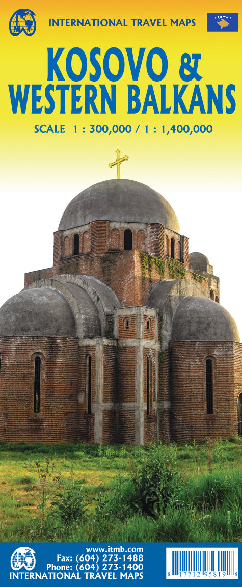
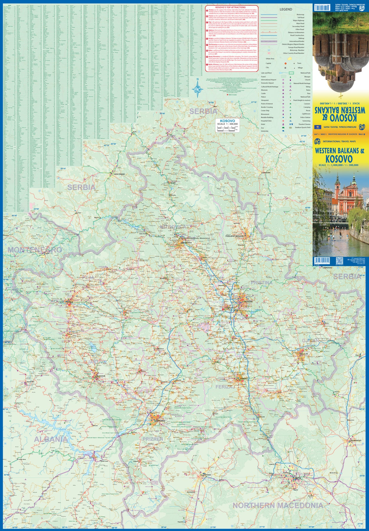
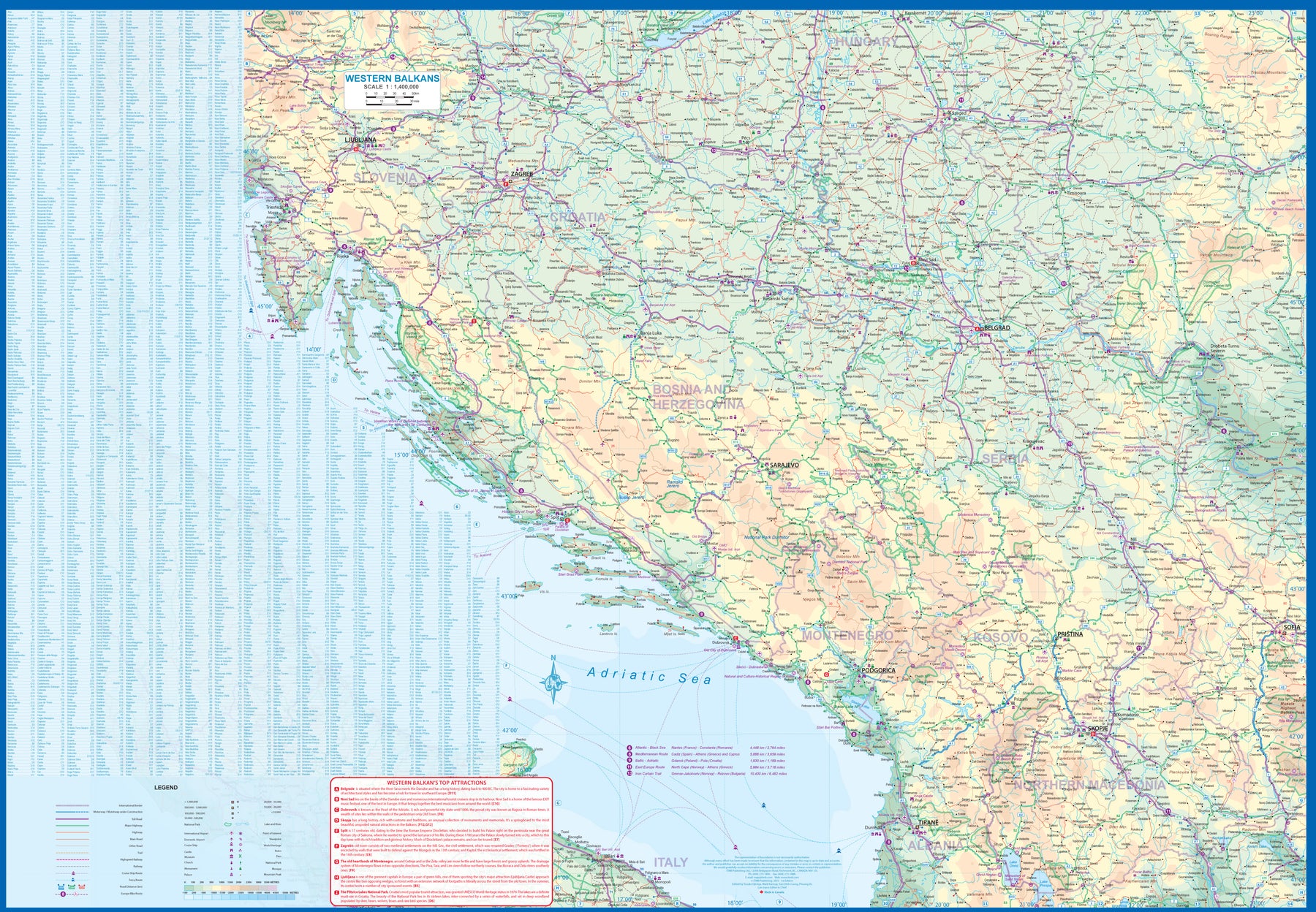
Kosovo & Western Balkans
Ordinær pris 199,00 krKosovo is the country that shouldn't exist, but does. When Yugoslavia fell to pieces after Tito died, Kosovo was lumped in with Serbia but was very unhappy with being a part of an Eastern Orthodox regime. It broke away, resulting in genocidal fighting until the Americans stepped in and stopped the fighting. The region was then placed under a European Union control in the faint hope that it would merge with Albania, or Montenegro, but it didn't. Relations with Serbia are still quite strained, but Kosovo is still surviving as a mountainous Balkan state. Fought over for centuries by Turks and Serbs, Kosovo is emerging as a small but touristic European country. This is definitely an off-the-beaten-path travel destination!
The second side of the sheet provides an excellent regional coverage for the Western Balkans, essentially Slovenia, Croatia, Montenegro, Serbia, and reasonably large tracks of land for Hungary, Albania, and North Macedonia, showing the growing number of wilderness parks being created.
Lesotho & Swaziland (Eswatini)
Ordinær pris 169,00 kr Salgspris 84,50 kr Spar 50%ITM har kart over hele verden og de spesialiserer seg på land litt utenfor allfarvei. Beliggenheten til landets nasjonalparker, historiske monumenter, de viktigste veiene o.L. Finner du inkludert i kartene. Samtlige landkart har ofte et bykart over hovedstaden.
Fra ITM: ITM is pleased to re-introduce their coverage of two countries of africa that are fairly unique. Both were well-established entities when settlers arrived, and both were able to maintain their identities throughout the colonial era, as protectorates. Lesotho is quite mountainous, with a poorly developed road network, so is a travel adventure destination. It occupies side 1, along with an inset of maseru, the capital. Swaziland, which has recently changed its name for local purposes to eswatini, occupies side 2, with an inset of mbabane, its capital. Both countries are easy to access from south africa, and are well worth visiting. We have also added two lists showing the top attractions of both countries. Both are land-locked countries either adjacent to or surrounded by south africa; both are essentially agricultural countries, although lesotho s mountainous terrain offers considerable touristic appeal, particularly the sani pass. Legend includes: Highway, main road, secondary road, street, pathway, railway, park, lake, international airport, gas station, church, hotel, museum, library, restaurant, shopping, police station, bank, school, stadium, bus terminal, golfing, etc. 2nd edition 2019. Scales: Lesotho 1:350.000, swailand 1:200.000.
Publisert år: 2019
Innbinding: falset
Material: papir
Målestokk: 1:350000
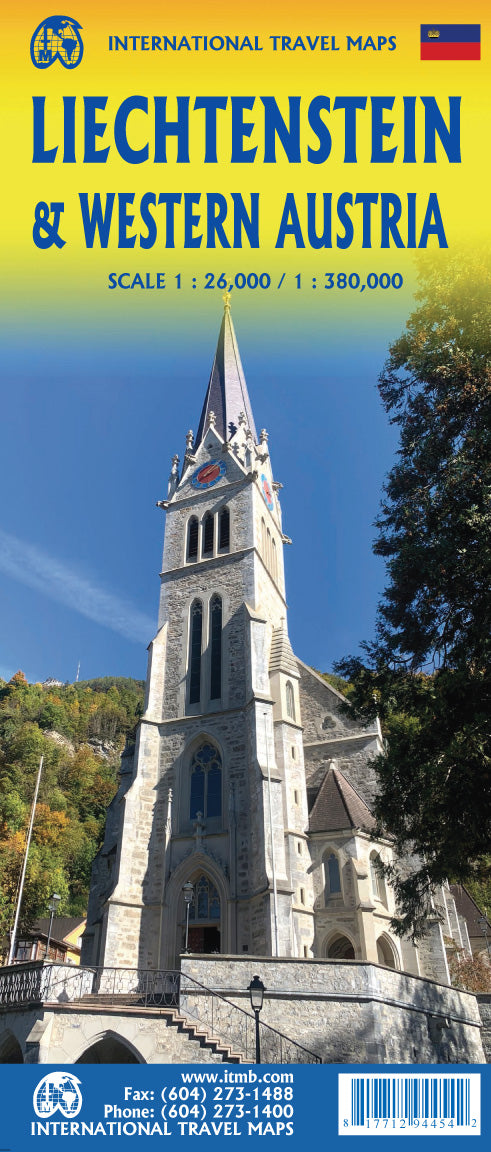
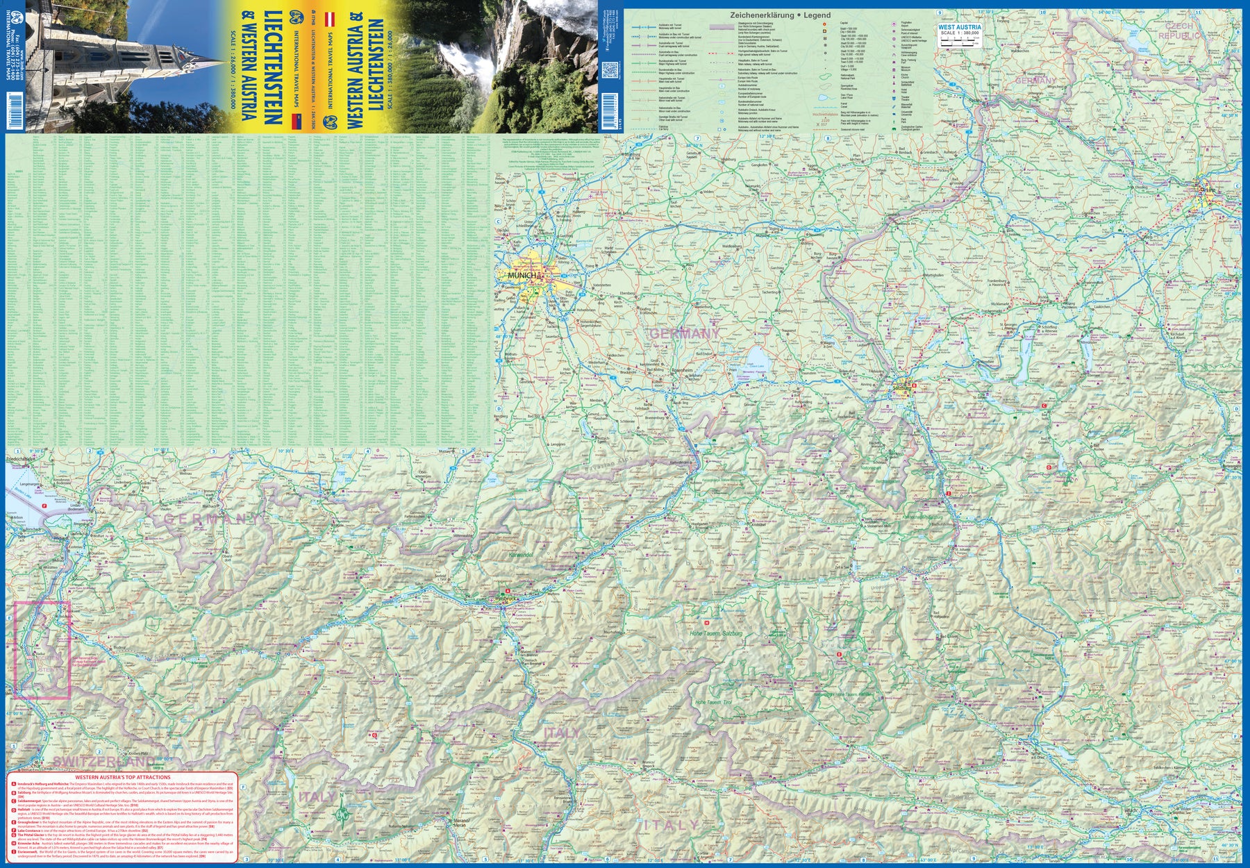
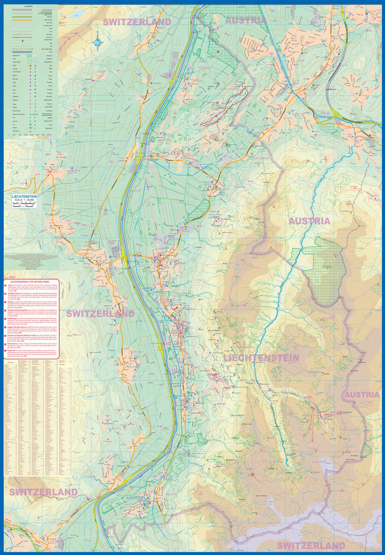
Liechtenstein & Western Austria
Ordinær pris 179,00 krEurope is dotted with mini-states that exist solely for historic reasons but are fiercely independent. Liechtenstein, surrounded by Switzerland on its west and south and Austria on its other borders, is such a state. It is larger and more diverse than many imagine and is quite a popular ski resort region. Side 1 is a detailed map of the principality, framed on the west by the Rhine River and a bit of Switzerland and on the east by Austria. Most development occurs in the Rhine Valley in a north-south direction, dominated by the capital city of Vaduz. There are five access points from Switzerland across the Rhine, one from the south, and two from Austria in the north. The ski haven of Malbun is prominently shown, and the scale of the map is detailed enough to name every major street. This also enabled us the opportunity to include schools, shopping areas, post offices, and churches, as well as a wide range of eating establishments. Walking/hiking trails have also been included.
This is the only map of Liechtenstein ever produced by a cartographic firm, and joins Andorra, Luxembourg, and Monaco as a valued part of ITMB's coverage of Europe. Side 2 concentrates on eastern Austria and southern Germany from Lake Boden (Bodensee) to Linz and from the Italian border north to Passau, in Germany. It is both a road/rail map and a physical relief map of this portion of the Alps. It includes its own Top Attractions list. Border crossings are shown merely as a formality, except for Switzerland. This would be an excellent map to use to explore the mountains south of Innsbruck or to discover small villages in the Tirol.
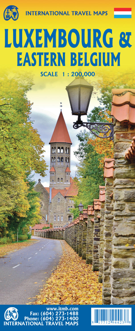
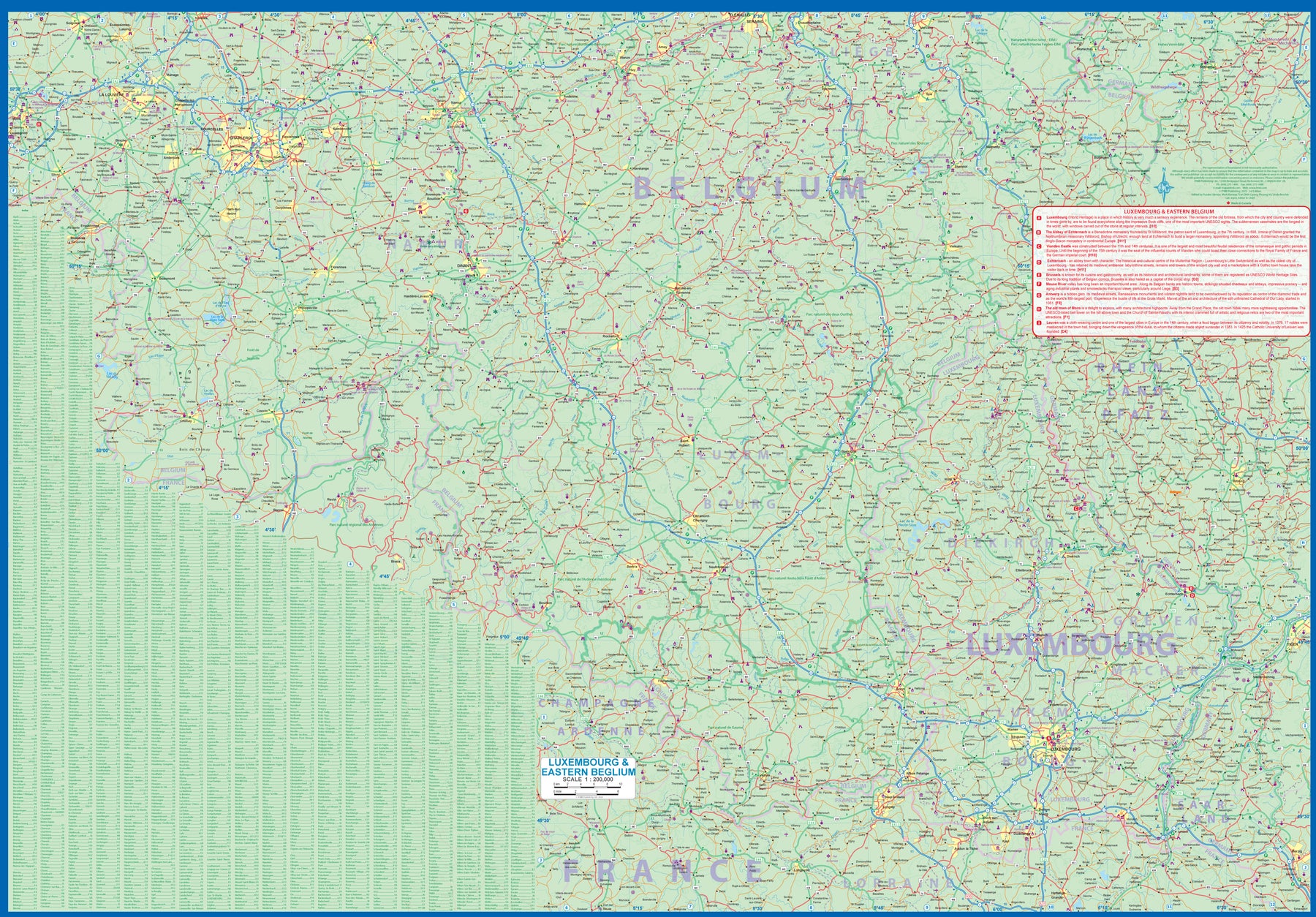
Luxembourg & Eastern Belgium
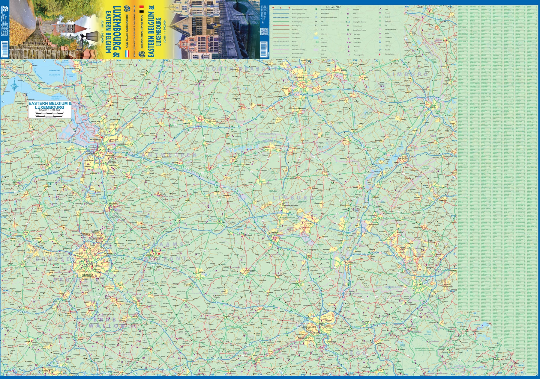
Ordinær pris 199,00 krLuxembourg is the largest of Europe’s mini-states. We have included the principality on maps of surrounding countries, as most publishers do, but we felt it was time to concentrate on the principality itself and place it into context with its neighbours. Bounded on the west by Belgium, on its east by Germany, and its south by France, Luxembourg has survived for centuries by playing off one large power against another in order to retain its independence. Largely a French-speaking area, Luxembourg is also a strong supporter of the EU. It is a mountainous country, part of the Ardennes region, and close to Bastogne, the focal point of Hitler's last attempt to break the Allies in what is now called the Battle of the Bulge. Bastogne, site of a marvelous WW2 museum, is also on Side 1, as is a portion of Belgium going as far as Mons.
Side 2 concentrates on Belgium east of Brussels, with a small portion of Netherlands included. This includes the Brussels region, Antwerp, Leuven, Liege, and Aachen, with a tiny portion of Germany. Belgium is a larger and more diverse country than many realize. One of the great treasure of eastern Belgium is the cathedral town of Liege, which is known in Flemish as Luik and in German as Luttich, which can make finding it a bit challenging, depending upon whose map one is using, or which road signs one is following!
Mauritania & Mali
Ordinær pris 169,00 kr Salgspris 84,50 kr Spar 50%ITM har kart over hele verden og de spesialiserer seg på land litt utenfor allfarvei. Beliggenheten til landets nasjonalparker, historiske monumenter, de viktigste veiene o.L. Finner du inkludert i kartene. Samtlige landkart har ofte et bykart over hovedstaden.
Fra ITM: In this edition, we have combined Mauritania with Mali. Although both are interesting countries, the two fit naturally together as a unit, albeit at slightly differing scales. Technically, this should be a 1st edition map, as it is the first time we have combined these two desert countries on to one sheet, but I’ll let Robert at the Library of Congress worry about the niceties of bibliographic accuracy as soon as Trump allows him to do the work he loves for a salary. Mauritania was one of the most unusual countries I visited as a young traveller. Of course, I had an advantage, in that I was too young to know that what I was doing was supposed to be impossible. I entered from what was then the Spanish Sahara via a piste (a sandy track with multiple pathways, only some of which avoid soft sand), travelling with a young Bedouin man. In Zouerate, a mining camp, I had to tie my VW campervan onto a railway flatbed car, and endure hundreds of kilometres of a sand dune wasteland before reaching Choum, and a siding where I could off-load the vehicle. The track south to Nouakchott was covered with sand and treacherous. Nowadays, there is a paved road to the southern border of Morocco, and a good road all the way along the coast to Rosso, where a ferry can take one across to Senegal. Mali adjoins Mauritania, both being formerly part of French West Africa. The capital, Bamako, is an interesting town with quite a bit of colonial architecture still in place. East of there is Djenne, a ‘forbidden’ city for infidels when I was there (see cover photo), but a fascinating mud-brick city. Further east again is Mopti, a river port where camel caravans off-load tablets of salt mined still far in the Sahara for transport by boat to Dakar. Further east again is Timbuktu (or Tombouctou as it is now spelled), at one time the most exotic isolated destination known to mankind. Further south is the Bandiagara escarpment, a must-see living area for locals who have created a living space from the sheer walls of the cliff. Both countries are fascinating places to visit.
Publisert år: 2019
Innbinding: falset
Material: Papir
Målestokk: 1:2,200,000 / 1:900,000
Mediterranean Cruising
Ordinær pris 199,00 krITM har kart over hele verden og de spesialiserer seg på land litt utenfor allfarvei. Beliggenheten til landets nasjonalparker, historiske monumenter, de viktigste veiene o.L. Finner du inkludert i kartene. Samtlige landkart har ofte et bykart over hovedstaden.
Fra ITM: We are very pleased to present our very first cruising map covering the Mediterranean Sea. This is a double-sided map covering the eastern portion on side 1 and the western part on side 2. We were presented with a dilemma in designing this map, in that the shape of the sea is such that to include the straits of Gibraltar and the Dardanelles on the same map, a compromise would be necessary.
As few cruise ships now go to the North African coast, we concentrated on showing only the portion from Morocco to Tunisia so we could show Spain, France, Italy, Greece, the Balkans, and the Eastern Mediterranean, including the Black Sea. Little did we know that war in Europe would impact so intensely on what should be a pleasurable touristic map. Regardless, almost all of the ports of call for cruise ships in 2022 are shown on this map, including those favoured by smaller liners in the Adriatic Sea. We have also included common ferry routes between Italy and Greece and Marseille to Algiers.
Mexico
Ordinær pris 189,00 krITM har kart over hele verden og de spesialiserer seg på land litt utenfor allfarvei. Beliggenheten til landets nasjonalparker, historiske monumenter, de viktigste veiene og lignende finner du inkludert i kartene. Samtlige landkart har ofte et bykart over hovedstaden.
Fra ITM: Mexico is a fascinating country, and as travel re-opens, is proving to be very popular. This most recent edition was recently printed, and is now the current edition. Double sided detailed travel map, with comprehensive place name index. Distinguishes roads ranging from expressways (free/toll) to rural roads. Legend includes railways, tracks, trails, international airports, domestic airports, bridges, border crossing points, points of interest, archaeological sites, beaches, active volcanos, filling stations, national parks, deserts, places of touristic interest. Printed on durable, water-resistant plastic paper, suitable for travelling in areas with extreme humidity. This is another chestnut in the ITMB line, and sells well. The cover picture is new, as is the ISBN. Mexico is a very large and diverse country, and very popular with Americans. Again, there is little one can say that is news about such a tried-and-true map, except to say that it is extremely popular.
Mexico: Chihuahua & Coahuila
Ordinær pris 169,00 krITM har kart over hele verden og de spesialiserer seg på land litt utenfor allfarvei. Beliggenheten til landets nasjonalparker, historiske monumenter, de viktigste veiene o.L. Finner du inkludert i kartene. Samtlige landkart har ofte et bykart over hovedstaden.
Fra ITM: Northern Mexico is a vast desert-like plateau deeply steeped in Spanish colonial heritage. The very first settlement inside what is now the USA was the town of Presidio (long before the English thought of settling Jamestown) and is still one of the few crossings of the Rio Grande into Texas (itself a former Mexican province). There are two major cities in the region, Chihuahua, 300 kms south of El Paso, and Monterrey, the largest city in northern Mexico. There are major touristic attractions at Monclova, Saltillo, Parras, Torreon, and Cuauhtemoc, the end of the famous Copper Canyon rail line. The map extends a bit into Sinaloa, to include Los Mochis on the Pacific coastline. The entire rail line is also shown. This is an important part of North American history. It may not be as well-known to Europeans who favour the beaches of the Yucatan, but it is a fascinating part of Mexico on the American border. Ciudad Juarez, for example, is larger than its partner on the Rio Grande, El Paso. An inset map of the old colonial city of Saltillo is included, as well as our Top Attractions list.
Publisert år: 2022
Innbinding: falset
Material: papir
Målestokk: 1:750000
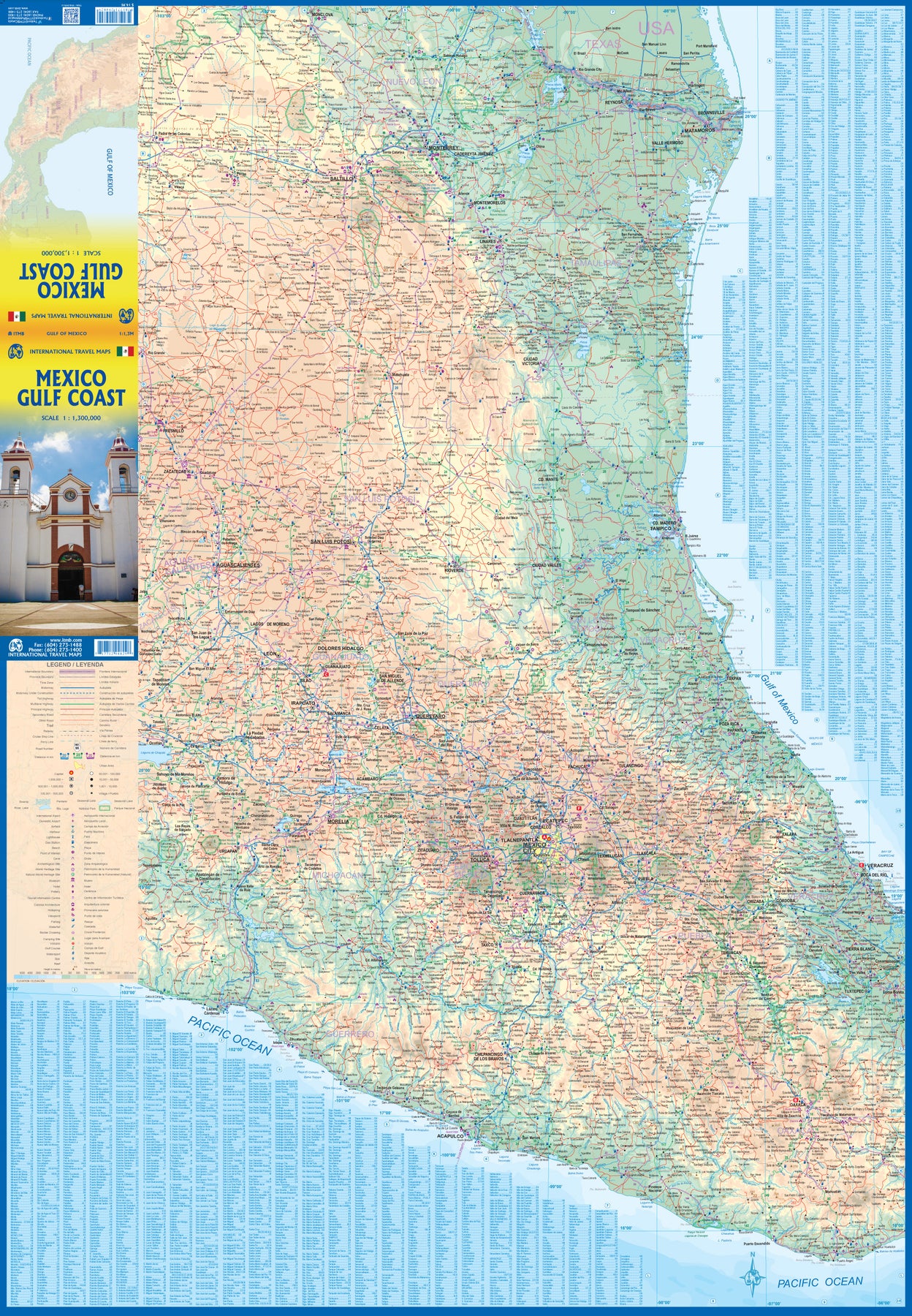
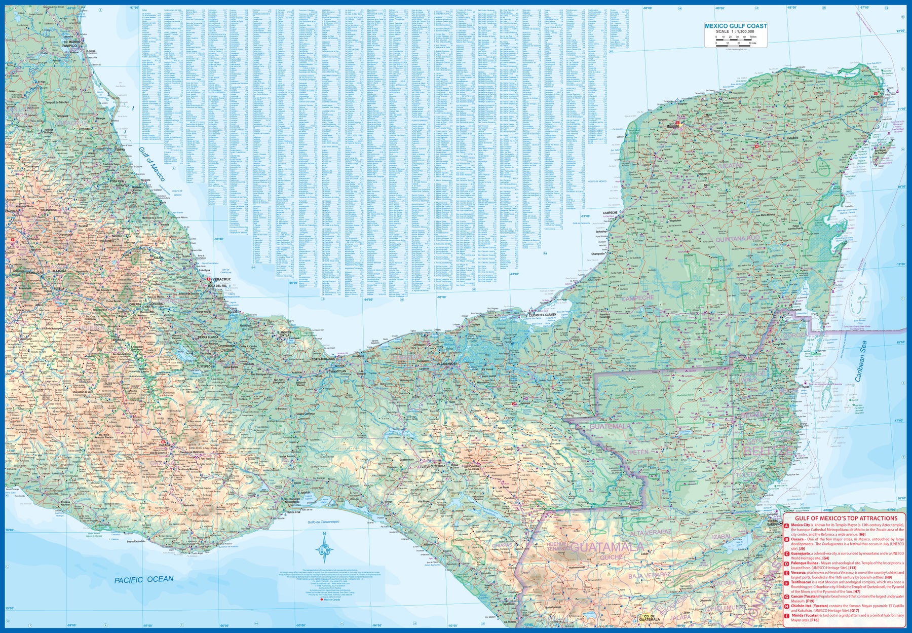
Mexico: Gulf Coast
Ordinær pris 169,00 krMexico is an ever-popular travel destination. The country is so large that we started mapping it as a series of regional maps years ago. The Gulf Cost extends from Brownsville, Texas through Vera Cruz to the Yucatan Peninsula. Due to the shape of the region, all of Belize and about half of Guatemala is included, but the focus is on the many attractions of the eastern Gulf coast of Mexico. Side 1 cover the northern coastal regions, going inland as far as Monterrey, Zacatecas, Morelia, and Mexico City.
Side 2 shows the Gulf Coast from Tampico to Carmen, then on to Merida, Cancun, and the southern tip of Belize. By the shape of this part of Mexico, the Pacific Coast, from the Guatemalan border westwards past Acapulco is also shown. All major roads are shown, but as passenger rail service was discontinued several years ago, we have opted to not show most rail lines. This is a map for explorers and adventurers to discover by driving. It covers all of historic Mexico and complements other ITMB maps detailing regions of a fascinating country, where the first word you learn is 'Hola!'
Mexico: Mexico Central
Ordinær pris 199,00 krMexico is an exceptionally interesting country to visit. The country itself is larger than most people realize, making sectional maps essential. We started mapping Mexico in the late 1980s and have gradually added regional maps as time and money enabled. Naturally, touristy popular areas like the Yucatan, Baja, and the Pacific Coast really need specialized maps, but so does the central region of the country. This map covers from Mexico City south to Acapulco and east almost as far as the Guatemalan border on side 1, and from Puebla west to Guadalajara on side 2.
Highlights include the colonial mining town of Taxco, the ruins of the Aztec capital of Teotihuacan, the untouched historical city of Oaxaca, and the mountain centre of Tuxtla Gutierrez. This is a map for driving and exploring and coming to understand one of the most important countries in the Americas.
Mexico: Mexico City & Mexico Central
Ordinær pris 179,00 krITM har kart over hele verden og de spesialiserer seg på land litt utenfor allfarvei. Beliggenheten til landets nasjonalparker, historiske monumenter, de viktigste veiene og lignende finner du inkludert i kartene. Samtlige landkart har ofte et bykart over hovedstaden.
Fra ITM: Mexico City is the largest city in the Americas, with a population of about 30 million. Our map concentrates on the core of the city, which is where hotels, attractions, and touristic interest abounds, from the train station in the north to the university in the south and from the huge bus station in the east to Chapultepec Park in the west. Insets of the metropolitan area and of the rapid transit network are included. The second side contains a detailed regional map of that part of Mexico deemed to be ‘central’; essentially, from Pueblo in the east to Guadalajara in the west and from Taxco in the south to San Luis Potosi in the north. Top attractions include San Miguel de Allende, Guanajuato, the Great Pyramid of Cholula, and the colonial city of Puebla.
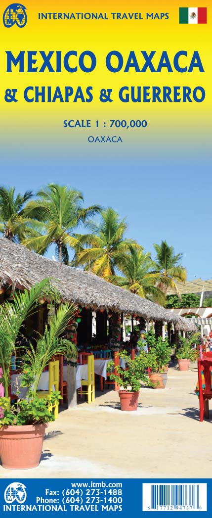
Mexico: Oaxaca & Chiapas & Guerrero
Ordinær pris 169,00 krITM har kart over hele verden og de spesialiserer seg på land litt utenfor allfarvei. Beliggenheten til landets nasjonalparker, historiske monumenter, de viktigste veiene o.L. Finner du inkludert i kartene. Samtlige landkart har ofte et bykart over hovedstaden.
Fra ITM: Travel to Mexico is exploding at the moment, as Covid restrictions lift. That portion of Mexico that forms the relatively narrow land mass between Mexico City and the Yucatan Peninsula is called the Isthmus of Mexico. It consists of three states, Oaxaca, in the west, Chiapas in the east, and Guerrero in the west. This is a double-sided map, stretching from west of Acapulco to beyond the border with Guatemala along the Pacific coast, and from Veracruz to Carmen along the Gulf of Mexico coast. It is the part of Mexico containing numerous holiday resort areas for sun-lovers, but is also rich in history and attractive colonial-era towns.
Oaxaca City is a UNESCO World Heritage site, as is the Mayan temple site of Palenque. There are numerous archeological sites in the region to explore, such as Monte Alban, which dates from the 8th Century BC. The colourful mining town of Taxco, with its narrow cobblestone streets, is a must-see, as is San Cristobal de Las Casas, in Chiapas State. This is an extremely popular part of Mexico to visit, so we are very pleased to be able to bring it back into print.