25 produkter
25 produkter
25 produkter
810 Africa: Tanzania & Zanzibar
Ordinær pris 169,00 krOur map will help you easily plan your safe and enjoyable journey thanks to a comprehensive key, a complete name index as well a clever time & distance chart. Michelin's driving information will help you navigate safely in all circumstances. With MICHELIN National Maps, find more than just your way!
Experience the wildlife on Tanzania's mainland with a wild Serengeti safari to taking a break on the beach in the pretty spice island of Zanzibar. Our map will help you plan your journey from the snow capped Mount Kilimanjaro to the Ngorongoro Crater one of the natural wonders of the world, with a huge density of wildlife in the collapsed caldera. Travel the beautiful island of Zanzibar, from Stone Town to Indian Ocean beaches, winding alleyways, bustling bazaars and exotic houses.
Kenya
Ordinær pris 199,00 krKenya is one of the most popular travel areas in Africa. A double-sided waterproof road map of Kenya. The best way to plan your trip, to prepare your itinerary, and to travel independently.The legend is in English. Touristic information: airports, ports, post offices, hospitals and medical facilities, campsites, rest houses, accommodation, border crossing, UNESCO World Cultural Heritage sites, park gates, hot spring, beaches.
South Africa
Ordinær pris 239,00 krHighly tear-resistant and 100% waterproof map "South Africa" from the series world mapping project.
Travel know-how maps are characterized by particularly sturdy plastic paper, which can be written on like paper, even with a pencil. The cardboard envelope is removable, making it easy to put the card in any pocket. A protective cover is not required. The cartographic representation focuses on the most important information for travelers and is particularly easy to read. Instead of shading, colored layers of elevation are used.
Uganda
Ordinær pris 219,00 krIndexed, waterproof and tear-resistant road map of Uganda with topographic and tourist information, published by Reise Know-How as part of their highly acclaimed World Mapping Project. The map is double-sided to provide the best balance between a good scale and a convenient size sheet.
The country’s topography is presented by altitude colouring with contours, spot heights, mountain passes, and names of mountain and hill ranges or plateaux. Swamps and seasonal rivers are also marked. Internal administrative boundaries are shown with names of regions and provinces. Road network includes unsurfaced local roads or tracks and shows driving distances on most roads, locations of petrol stations and border crossings. Railways, local airfields and ferry routes on Lake Victoria and Lake Albert are also shown.
National parks and protected zones are clearly marked. Symbols highlight numerous places of interest, including UNESCO world heritage and archaeological sites, hotels and lodges, camping sites, hot springs, rock paintings, viewpoints, etc. The map has a latitude and longitude grid at intervals of 30’ and index of localities. Map legend includes English.
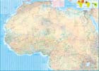
Uganda
Ordinær pris 199,00 krThe Jewel of Africa, Uganda is a lovely country to visit. Most of the development is in the south, close to Lake Victoria. To me, the most interesting parts are the game parks in the far west and in the far north, but the Mount Elgon area is interesting as well. This updated map also includes a large inset map of Kampala, the capital. The map has been updated to last for the next few years and, by being printed on plastic, is guaranteed to remain durable as well as waterproof.
Kenya
Ordinær pris 249,00 krAfrica: East Coast & Madagascar
Ordinær pris 199,00 krAs far as I know, there has never been a map covering the entire coastline of the Indian Ocean portion of Africa, from Djibouti all the way south to Port Elizabeth, in South Africa - until now! This double-sided map encompasses a vast region, including all of Djibouti, Somalia, Kenya, Uganda, Tanzania, Rwanda, Burundi, Mozambique, Malawi, Zimbabwe, Lesotho, and Swaziland (which now prefers to be called Eswatini), as well as an inset map of Madagascar. Large portions of several other countries are included, such as South Africa and southern Ethiopia.
This would be an excellent map for anyone travelling overland from Nairobi to the Cape. All road and rail routes are shown, as well as major touristic attractions, national parks and game preserves. A Top Attractions list is included, noting Ngorogoro, Kruger, Victoria Falls, and lesser-known attractions such as the Tuli Block and Sibebe Rock.
Africa: Southern
Ordinær pris 169,00 krSouthern African countries at 1:2,500,000 on an indexed, waterproof and tear-resistant road map with topographic and tourist information, published by Reise Know-How as part of their highly acclaimed World Mapping Project. The map is double-sided to provide the best balance between a good scale and a convenient size sheet and covers countries the whole of Namibia, Botswana, Zimbabwe, Mozambique, Eswatini, Lesotho and South Africa, plus most of Zambia and Malawi.
Road network and railways are presented on a clear base which shows the area’s topography by altitude colouring with contours, spot heights, names of mountain ranges, salt pans, swamps, seasonal rivers, etc. Internal administrative boundaries are shown with names of the provinces. Road network includes unsurfaced roads and selected 4WD tracks, indicating locations of border crossings. A wide range of symbols highlights various places of interest, including UNESCO heritage sites, national parks and nature reserves, rock paintings and archaeological sites, beaches, etc. The map has a latitude and longitude grid at intervals of 1° and an index of place names which also includes an extensive list of national parks/game reserves/protected areas. Map legend includes English.
Africa
Ordinær pris 199,00 krAfrica is a huge continent. No one apart from us has successfully prepared a digital data base for the entire continent and this edition includes numerous updates to road information and shifting political realities. We have updated roads whenever reliable data indicates improvements, such as connections between the southern tip of Morocco and the road leading to Nouakchott, in Mauritania. Politically, we all know of things that do not affect maps - the closed border between Algeria and Morocco, the coup in Guinea, the continued instability of Libya, the generally better degree of stability in Somalia, the on-going troubles in South Sudan - but generally, the continent of 54 nation states and a few colonial enclaves has survived two years of destabilizing Covid ravages rather well. Tourism is gradually recovering, and map sales improving.
This is a very important map in that it brings all of the countries and islands relative to the African continent into perspective. We are pleased to bring to your attention an updated version of a part of the world that is crucially important.
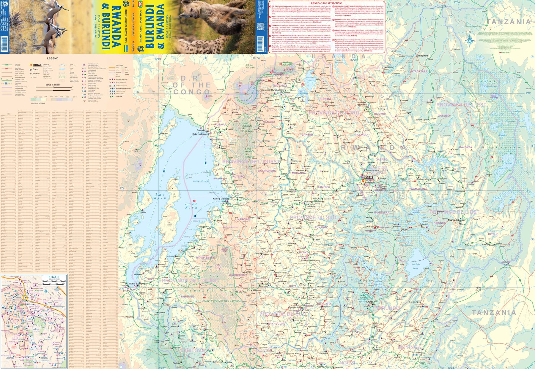
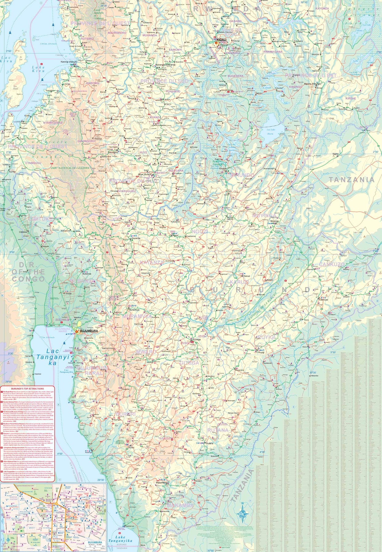
South Africa: Lesotho & Swaziland (Eswatini)
Ordinær pris 199,00 krThe most southerly portion of the African continent is also one of the most scenic parts of that vast continent. South Africa was settled by Europeans in the 1500s, displacing the indigenous population. It developed into an industrial, urbanized society by WW2, but has had a troubled modern history. It is touristically attractive, with two main ports of entry – Johannesburg and Cape Town. It is easy to rent a car and drive around the country (NB: they drive on the wrong side of the road!) or enjoy a luxurious train trip between the two main cities.
The Garden Route, along the south shore, passes through vintage vineyards and enables one to explore off-the-beaten-path towns like Knysna, or explore the Transkei, or visit land-locked Lesotho. The game parks of South Africa are rightly famous. Kruger is the most famous, but my favourite is Addo, an elephant sanctuary north of Port Elizabeth. Farther north is Swaziland, which has recently changed its name to Eswatini, and further west are Botswana and Namibia, portions of which are included on the map. Finally, there is the arid Northern Cape and the Great Karoo to discover.
Includes City Centre Maps of Cape Town; Johannesburg & Pretoria
South Africa; Namibia & Botswana
Ordinær pris 199,00 krRwanda & Burundi
Ordinær pris 199,00 krITM har kart over hele verden og de spesialiserer seg på land litt utenfor allfarvei. Beliggenheten til landets nasjonalparker, historiske monumenter, de viktigste veiene og lignende finner du inkludert i kartene. Samtlige landkart har ofte et bykart over hovedstaden.
Lesotho & Swaziland (Eswatini)
Ordinær pris 169,00 krITM har kart over hele verden og de spesialiserer seg på land litt utenfor allfarvei. Beliggenheten til landets nasjonalparker, historiske monumenter, de viktigste veiene o.L. Finner du inkludert i kartene. Samtlige landkart har ofte et bykart over hovedstaden.
Fra ITM: ITM is pleased to re-introduce their coverage of two countries of africa that are fairly unique. Both were well-established entities when settlers arrived, and both were able to maintain their identities throughout the colonial era, as protectorates. Lesotho is quite mountainous, with a poorly developed road network, so is a travel adventure destination. It occupies side 1, along with an inset of maseru, the capital. Swaziland, which has recently changed its name for local purposes to eswatini, occupies side 2, with an inset of mbabane, its capital. Both countries are easy to access from south africa, and are well worth visiting. We have also added two lists showing the top attractions of both countries. Both are land-locked countries either adjacent to or surrounded by south africa; both are essentially agricultural countries, although lesotho s mountainous terrain offers considerable touristic appeal, particularly the sani pass. Legend includes: Highway, main road, secondary road, street, pathway, railway, park, lake, international airport, gas station, church, hotel, museum, library, restaurant, shopping, police station, bank, school, stadium, bus terminal, golfing, etc. 2nd edition 2019. Scales: Lesotho 1:350.000, swailand 1:200.000.
Publisert år: 2019
Innbinding: falset
Material: papir
Målestokk: 1:350000
Africa: Zambia & Eastern
Ordinær pris 179,00 krZambia, a nice country in central/southern Africa graces one side of the sheet, along with a very large inset map of Lusaka and two others of Livingstone and Victoria Falls (which is actually in Zimbabwe). The other side of the sheet contains a very useful regional map of eastern Africa from Ethiopia/Eritrea south to Eswatini/Swaziland. Madagascar is also included, as well as the Comoro Islands. While both sides are useful, it is the Zambian side that takes precedence. All the roads and towns are shown, as well as parks, safari lodges, and points of interest. It is possible, though not advisable, to travel to Zimbabwe via either Kariba or Vic Falls, and there is a good crossing into Botswana at Sesheke. Entry to and from Tanzania and Malawi is easy.