51 produkter
51 produkter


51 produkter
Mongolia
Ordinær pris 199,00 krThe country of Mongolia has existed for centuries, but until recent times was dominated by Russia. When we were first asked to prepare a tourism-oriented map of Mongolia by the government, we did our best using then-available sources of data. With each new edition, we have improved the amount of information and the accuracy of spelling of place names as the country has developed. For example, it is now generally accepted that the name of the country’s capital is Ulaanbaatar as one word.
Roads in Mongolia tend to vary dramatically, so most of the thin red lines should be regarded as guidelines rather than as formal man-made roads. The Gobi Desert is well-shown, as are cities little-known to outsiders.
A detailed inset map of Ulaanbaatar is included.
Legend Includes: Highway, Other Roads, Motorway, Railway, Urban area, Border crossing, Airport, Point of interest, Monument, Museum, Mine, Ruin, Gas station, Lake, Nature Reserve, Camping Site, Sand dunes, Glacier, etc.
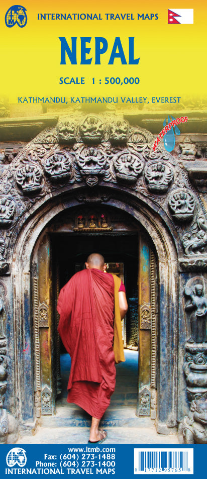
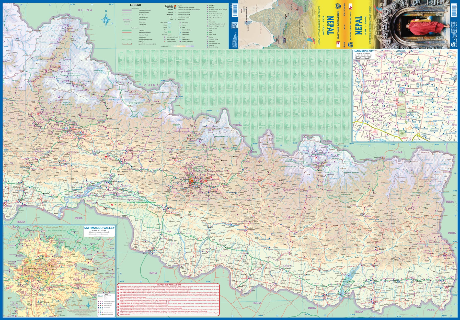
Nepal
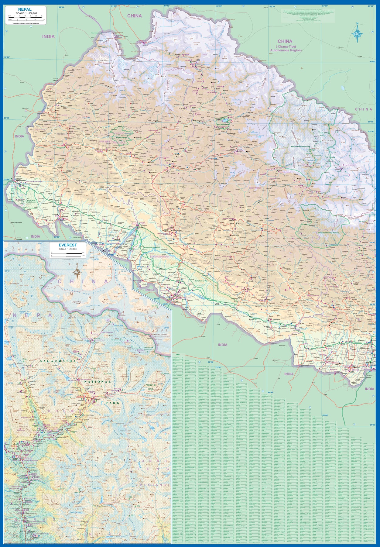
Ordinær pris 199,00 krNow it is time to re-introduce the world to one of the most fascinating countries on Planet Earth. Side 1 covers western Nepal around Pokhara and has a detailed inset map of the Mount Everest area in an expanded scale. Side 2 covers the portion of the country from just west of the Annapurna Glacial region eastwards through Kathmandu to the eastern border. A very detailed inset map of Kathmandu is included, as one of the Kathmandu Valley that surrounds the city. Basic road access from India is shown. It is not possible to enter from China.
The map is printed on durable stone paper and is as up to date as we could make information under very trying circumstances. We still hope to visit next year. Nepal is a treasure!
Philippines: Manila & Luzon Island
Ordinær pris 199,00 krThe Philippines has bounced back from the Covid era remarkably quickly. Manila, the capital, has always been under-rated as a touristic destination, but it is the principal access point to the country and has a lot to offer visitors. It is, of course, a huge city, with hotels concentrated south of the Pasig River, adjacent to the historic Intramuros, a former fortress.
The new part of this map is the first-ever travel map of Luzon Island, the principal island of this country of islands., combined with surrounding islands. Americans are particularly drawn to the Bataan Peninsula and the small island of Corregidor as a result of WW2. Tourists are drawn to the beautiful beaches of Palawan and Boracay or to Mayon Volcano, or the rice terraces on Banaue. This is a far more detailed map, due to its scale, than one covering the entire island nation.
Sri Lanka & India South
Ordinær pris 199,00 krThis edition is a considerable improvement on our previous one, benefitting from the extensive research trip we took to the emerald-shaped island shortly before the outbreak of Covid changed the world. We have re-introduced it as a map printed on waterproof paper, as such a format holds up well in a hot, humid climate. We visited all parts of the island and were quite impressed by the number of local hotels and resorts that we found and have added to the map. We were particularly gratified to discover progress on extending the motorway system for the country, much of it now probably delayed due to Covid.
The inset map of Colombo is particularly well-done. The second side of the sheet is a very detailed map of the southern third of India, from Nagpur to the southern tip of the country. Space constraints did not allow for inset maps, but several well-known cities are included – Mumbai, Hyderabad, Chennai, Pondicherry, Madurai, and Bengaluru (Bangalore) among them. India is a fascinating, if somewhat intimidating, place to visit, but is well-worth the time to do so.
Taiwan & Taipei
Ordinær pris 199,00 krTaiwan always reminds me of the “little engine that could”. Despite having to endure an extremely hostile neighbour, the country has prospered, is democratic, and is friendly and welcoming to visitors, despite the fact that most governments do not officially recognize its existence. Side 1 shows the capital city of Taipei, a bustling economic powerhouse on the Damshui River, close to the ocean. The city has numerous hotels and shopping areas, and a well-developed subway network.
The second side covers the complete island of Formosa from top to bottom in excellent detail, as well as the off-shore Penghu islands (these can be reached by ferries from Kaohsung or Dongshih). Most of the country’s development is on the western, or Taiwan Straits, side of the mountainous country, but to me the Taroka Gorge, leading inland from Hualien on the east coast, is one of the wonders of modern Asia. An inset map of Tainan in southeast Taiwan is also included.
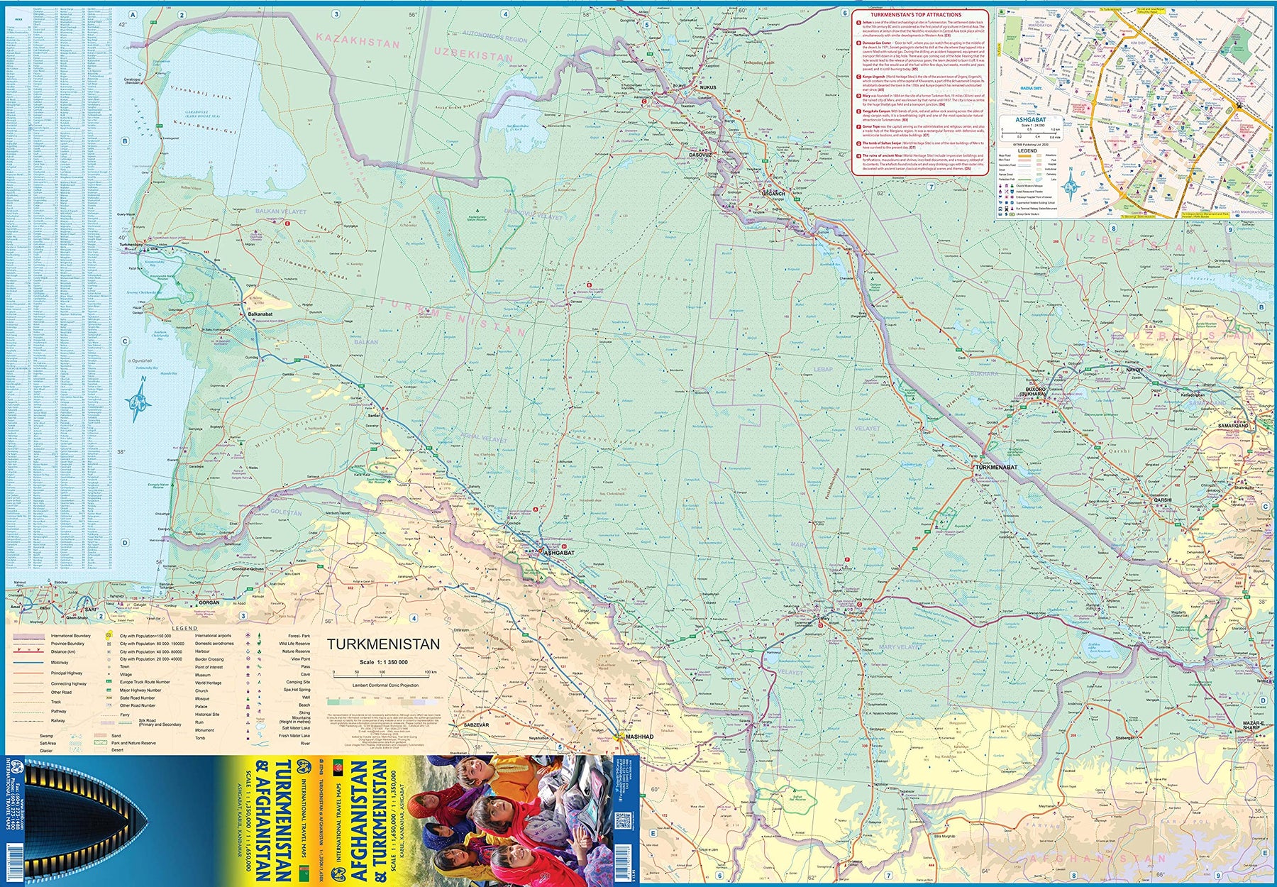
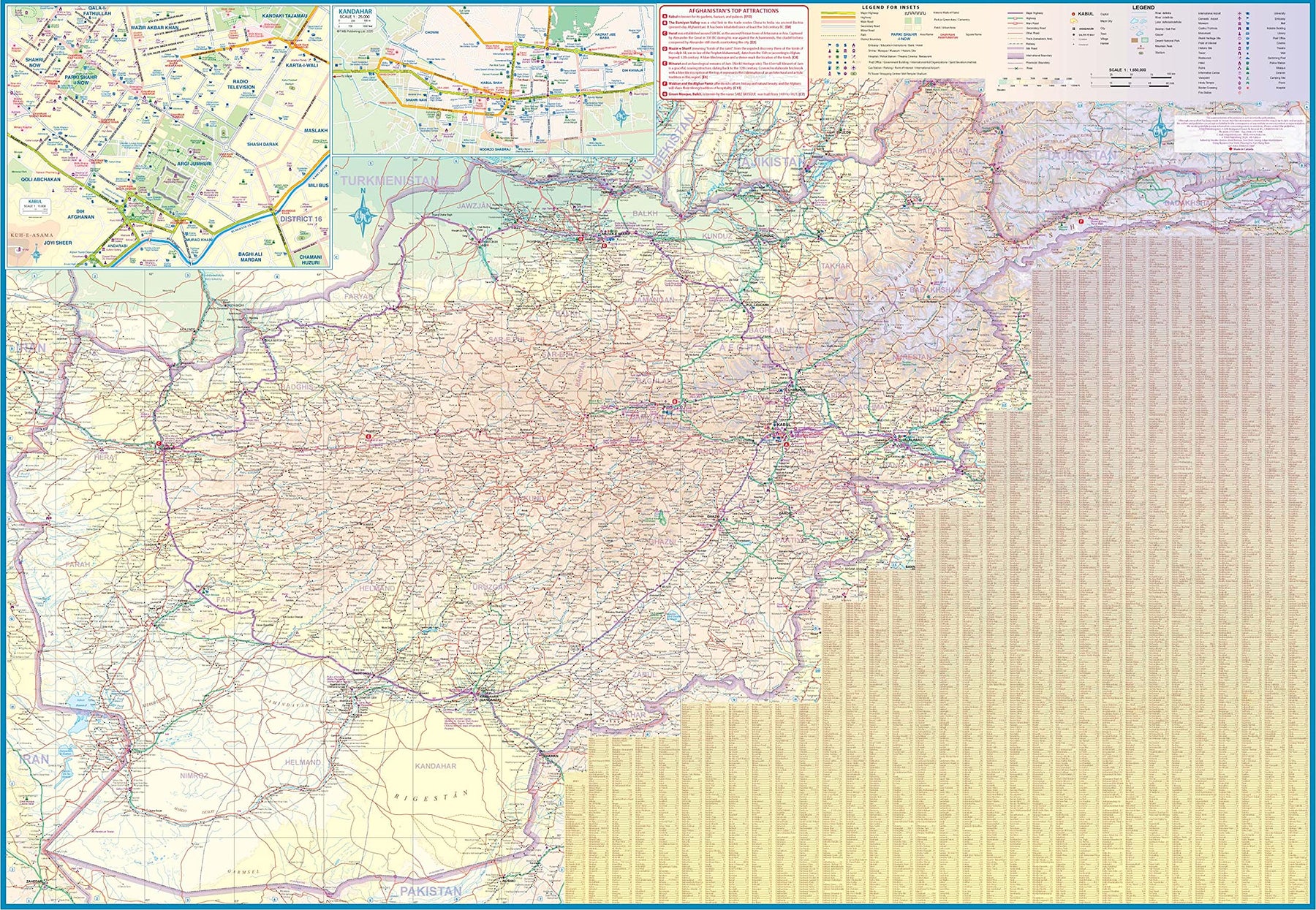
Turkmenistan & Afghanistan
Ordinær pris 179,00 krThe world is changing as a result of a global pandemic, and ITMB has to change with it. We wish to keep all of our artwork available, but at a time of greatly reduced travel, we have been forced to combine two different countries that share a common border in order to justify printing either one. The two countries, Afghanistan and Turkmenistan, do share a common heritage, but a very different history. ITMB Publishes a separate map of the country, and a map of Kabul. The reason for this map is that it is our first ever map of just Turkmenistan, a former part of the USSR that broke away in the collapse of the Russian empire in 1990. The country has, however, not emerged from the Soviet way of thinking, and is authoritarian in its attitude. It is, fortunately, open to travel, and is slowly improving its facilities, so is to be encouraged.
The map includes a very good inset map of Ashgabat, the capital. The country stretches from the Caspian Sea to the Uzbek border and from Russia south to Iran and Afghanistan. We have also added eight Top Attractions, ranging from the World Heritage site of Konye to the ancient ruins of Nisa. We previously published this titles as part of a regional map of the ‘Stans’, but growing demand has justified its own map. We have also published a separate map of Uzbekistan and a separate three-country map of the other three countries, all of which are showing strong signs of touristic development. Turkmenistan is a country emerging as a future travel Mecca. Legend Includes: Roads by classification, Rivers and Lakes, National Park, Airports, Points of Interests, Highways, Main Roads, Zoos, Fishing, and much more...
United Arab Emirates & Abu Dhabi
Ordinær pris 169,00 krITM har kart over hele verden og de spesialiserer seg på land litt utenfor allfarvei. Beliggenheten til landets nasjonalparker, historiske monumenter, de viktigste veiene og lignende finner du inkludert i kartene. Samtlige landkart har ofte et bykart over hovedstaden.
We are pleased to release this brand new ITMB title. Abu Dhabi is one of the leading Emirates that are rapidly becoming vacation heavens for Europeans who don't want the long flights to Asian destinations. The city is so modern it almost squeaks. The palace is a world-class wonder, the seafront Corniche is a marvelous beach, and the central shopping area offers everything from hamburgers to Gucci bags. Motorways now connect the city state to nearby Dubai and to Oman, with a recently-completed one along the coastline to the Saudi border.
The reverse side of the map is an updated edition of the entire United Arab Emirates and most of Oman, with new motorways seemingly everywhere. A large inset map of central Dubai is included, along with a good one of Muscat. We docked at Abu Dhabi's cruise ship terminal during our visit and were impressed by the extent of urbanization of the city.
United Arab Emirates & Dubai
Ordinær pris 199,00 krITM har kart over hele verden og de spesialiserer seg på land litt utenfor allfarvei. Beliggenheten til landets nasjonalparker, historiske monumenter, de viktigste veiene og lignende finner du inkludert i kartene. Samtlige landkart har ofte et bykart over hovedstaden.
Fra ITM: Dubai is truly becoming a very popular travel destination and the loose federation of sheikdoms collectively known as the United Arab Emirates is growing in popularity with each passing year. Despite the turmoil affecting both Israel and Iran, this part of the Middle East is open for business and peaceful. Side 1 concentrates on the overall region from the eastern border of the UAE to its interaction with Oman. It also has an excellent inset map of Abu Dhabi, the capital of the UAE. Side 2 concentrates on Dubai itself as the largest urban area. Dubai has an extensive and interesting old town on the east bank of the Dubai Creek, which is where most of the hotels and the huge international airport are located. The ‘new town’ is on the left bank, and this is where one finds Western-style shopping areas, high-rise towers, the rapid transit line, and the main motorway out of town. The World Trade Center and Emirates Towers are also centrally located. The man-made Coastal Projects are shown in insets.
Uzbekistan; Kyrgyzstan; Tajikistan
Ordinær pris 199,00 krFinally, our ITMB map of Uzbekistan is back in print! Tourism to the ‘Stans’ is increasing as these former parts of the Soviet Empire find their way in a changing world. This time, we have combined the country with the two other Stans on one side, which makes sense given their shape; then, on the reverse side, we have expanded the artwork to show Kyrgyzstan and Tajikistan to good advantage.
The map also includes excellent inset maps of Samarkand, Tashkent, Dushanbe, and Bishkek, which I’m sure all are familiar names. Needless to say, all three countries count as ‘adventure’ travel. Facilities are good in major cities, but roads are of an uncertain quality, and accommodations sparse. Still, this is an exceptionally interesting part of the world. The traditional Great Silk Road passed through this region, and to this day Tashkent is a major trading transfer point. Nine points of major interest are included, including the Ark-Citadel dating from 400BC, the Minaret of Kalta-Minor, and the great Caravanserai from the Middle Ages.
Vietnam, Laos & Cambodia
Ordinær pris 199,00 krThe Indochinese Peninsula is one of the world's treasure troves of cultural diversity and historical activity. In the north are the hill tribes of Laos and Vietnam. Along the coast are the Viet people, and in the south the huge cultural area of Khmer influence - from Angkor Wat to the Cham ruins in the southeast of Vietnam. The Plain of Jars, in Laos remains one of the most intriguing puzzles of the modern world, and the temples of Louang Phabang are reknowned.
This map shows all of these wonders and many more. This is a very detailed map, prepared in the region, and showing just about anything a vistor would want in a map.
Vietnam: Hue; Da Nang & Central Vietnam
Ordinær pris 199,00 krCentral Vietnam in 1:800.000. Double-sided map with placenames written in Roman script with street plans of Hue 1:13.000, Da Nang 1:12.000 and Hoi An. The map shows the area’s road and rail networks and local airports. National parks, nature reserves, beaches and numerous places of interest are highlighted. Provincial boundaries are marked and names of administrative regions prominently shown. Topography is indicated by bold altitude colouring with spot heights. Latitude and longitude lines are drawn at 30’ intervals. An enlargement shows the environs of Hue in 1:90.000.
Vietnam: South & Ho Chi Minh City
Ordinær pris 199,00 krThis map updates a fast-changing city to reflect its changing features. With this edition, we have doubled-up the map by adding a map of the Mekong Delta to the reverse side. The 'Nine Mouths of the Dragon' southernmost portion of VN, of which HCM City is a part, is a fascinating part of Asian life, where fervent religious temples originating with the Cham culture of Cambodia co-exist with the Cao Dai amalgam religious movement.