317 produkter
317 produkter


317 produkter
Italy: Railway & Road
Ordinær pris 199,00 krItaly: Sicily & Italy South
Ordinær pris 179,00 krITM har kart over hele verden og de spesialiserer seg på land litt utenfor allfarvei. Beliggenheten til landets nasjonalparker, historiske monumenter, de viktigste veiene og lignende finner du inkludert i kartene. Samtlige landkart har ofte et bykart over hovedstaden.
Although this is a title that ITMB has marketed for several years, it should count as a brand new map in that the artwork is now our own and the map includes a second side focused on southern Italy. The Sicily side concentrates on the infrastructure and touristic sites of the island itself, along with the southern tip of the Italian mainland, showing ferry crossings. Sicily has a rich history, with Greek and well as Roman remains to explore and Mount Etna to visit if it isn't erupting. The Valley of the Temples, south of Agrigento, is particularly worth seeing. The second side concentrates on that portion of Italy from Pescara in the far north to Naples, the Amalfi Coast, to Potenza all the way to Brindisi and Taranto (the 'heel' of the boot). The 'toe' of the boot is on side 1. The focus of this map is on Sicily, but as most access to the island is via the mainland, we think combining the two meets most visitor's needs.
Italy: Sicily; Sardinia & The South
Ordinær pris 169,00 krITM har kart over hele verden og de spesialiserer seg på land litt utenfor allfarvei. Beliggenheten til landets nasjonalparker, historiske monumenter, de viktigste veiene og lignende finner du inkludert i kartene. Samtlige landkart har ofte et bykart over hovedstaden.
Italy: South & Central
Ordinær pris 179,00 krJamaica & Cayman Islands
Ordinær pris 149,00 krITM har kart over hele verden og de spesialiserer seg på land litt utenfor allfarvei. Beliggenheten til landets nasjonalparker, historiske monumenter, de viktigste veiene o.L. Finner du inkludert i kartene. Samtlige landkart har ofte et bykart over hovedstaden.
Fra ITM: This map was called Cayman Islands and Jamaica in its previous edition, which was a well-intentioned attempt to promote the smaller islands adjacent to big brother. Now, we are reverting to what we think is a more logical title arrangement for listing purposes, but the map has two covers, so one can market it as either Jamaica or the Caymans, or best of all, market both! We visited the Caymans a few months ago and drove every road on the main island, including a few that turned out to be driveways! The map is very current as a result. The other side of the map is the very popular touristic island of Jamaica, now into its sixth edition. This island is large enough to justify renting a car and exploring. It is a great way to discover hidden coves and find historic plantations, especially along the touristic north shore. 6th/3rd Ed. 1:250,000/1:37,500
Publisert år: 2017
Innbinding: falset
Material: papir
Målestokk: 1:250000/37,500
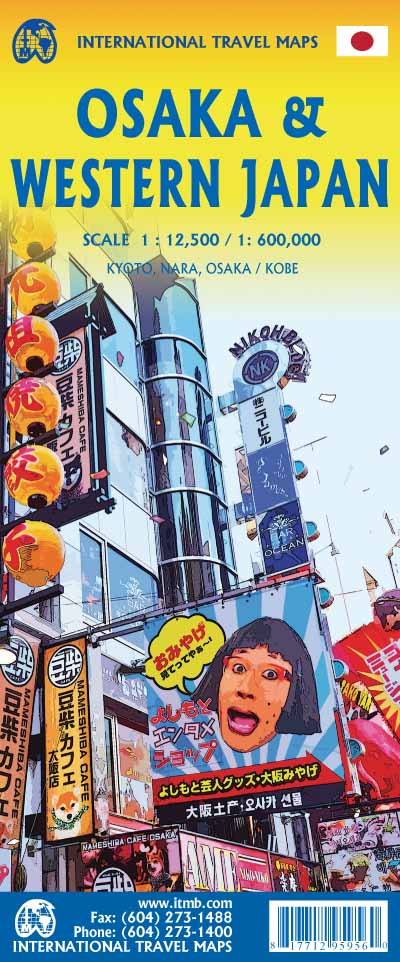
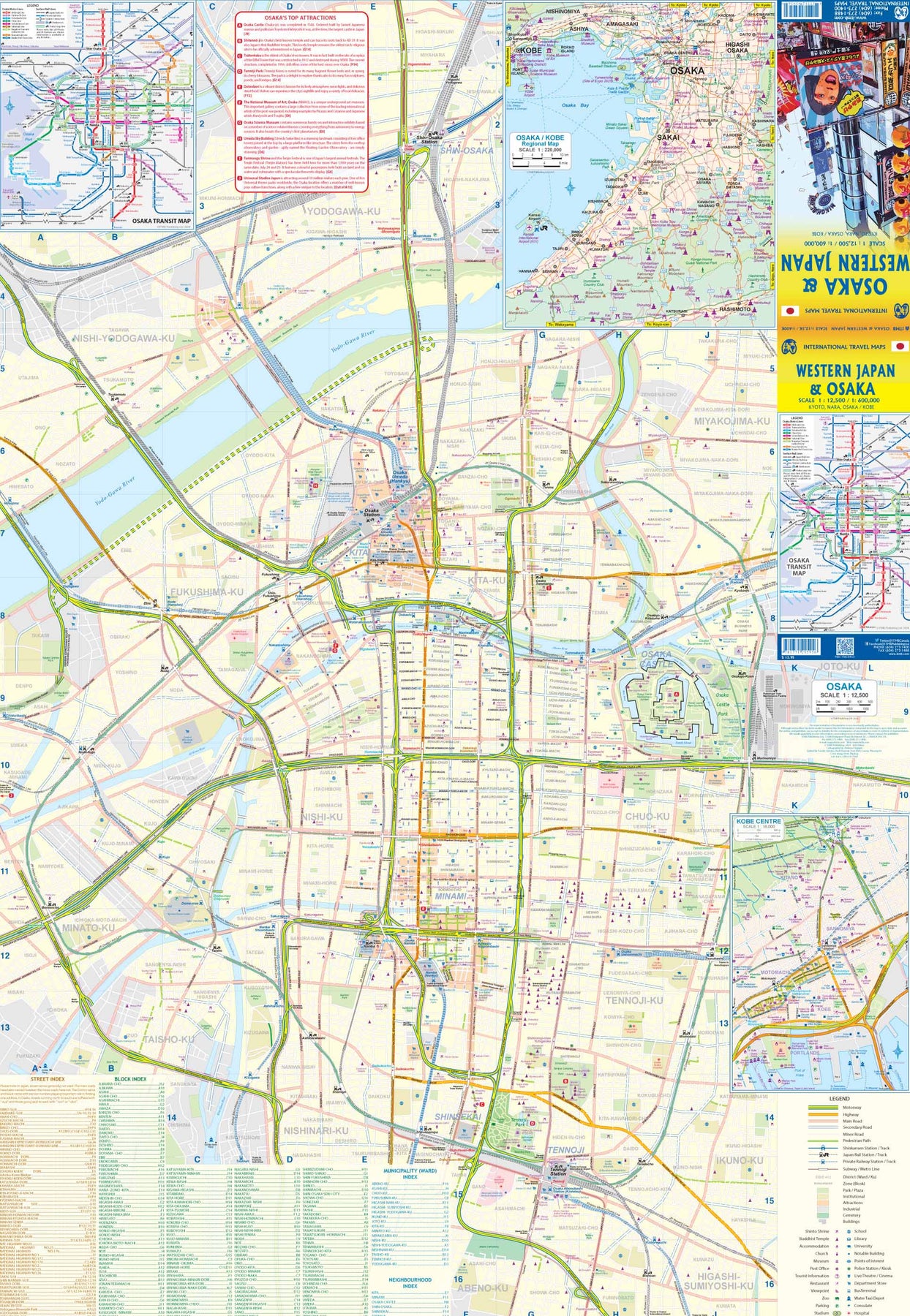
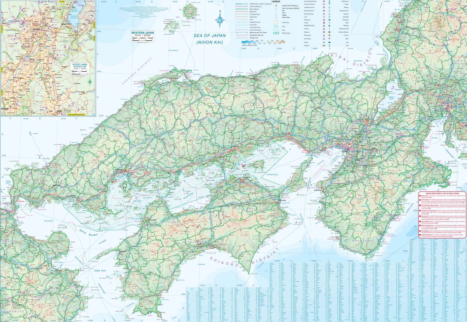
Japan: Central
Ordinær pris 199,00 krThis is a brand new title for ITMB, a double-sided map covering the 'core' regions of Japan most visited by tourists exploring Japan. Side 1 covers from Tokyo north to Sendai/Nigata and west to Nagoya. Side two covers all of Japan as far as Hiroshima, with insets of the Osaka/Kobe and Kyoto/Nara regions. Naturally, all touristic attractions are noted.
Japan: Mount Fuji / Kanto & Chubu regions
Ordinær pris 169,00 krThe volcanic cone of Mount Fuji is Japan's most popular touristic attraction. Located a shoer train ride west of Tokyo, Fuji attracts millions of visitors each year. Side 1 focuses on the mountain itself, showing rail connections, surrounding towns, roads on the lower slopes, hiking trails, and accommodations close to the summit. Side 2 shows the kata & Chubu Regions from Tokyo to Nagoya and north to Nigata. This is a brand new ITMB title.
Kenya
Ordinær pris 199,00 krKenya is one of the most popular travel areas in Africa. A double-sided waterproof road map of Kenya. The best way to plan your trip, to prepare your itinerary, and to travel independently.The legend is in English. Touristic information: airports, ports, post offices, hospitals and medical facilities, campsites, rest houses, accommodation, border crossing, UNESCO World Cultural Heritage sites, park gates, hot spring, beaches.
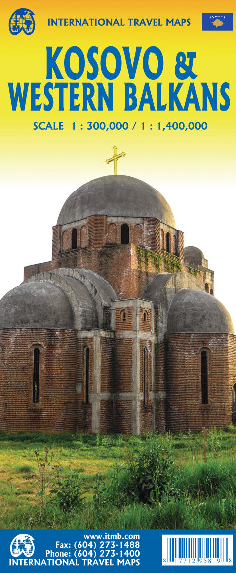
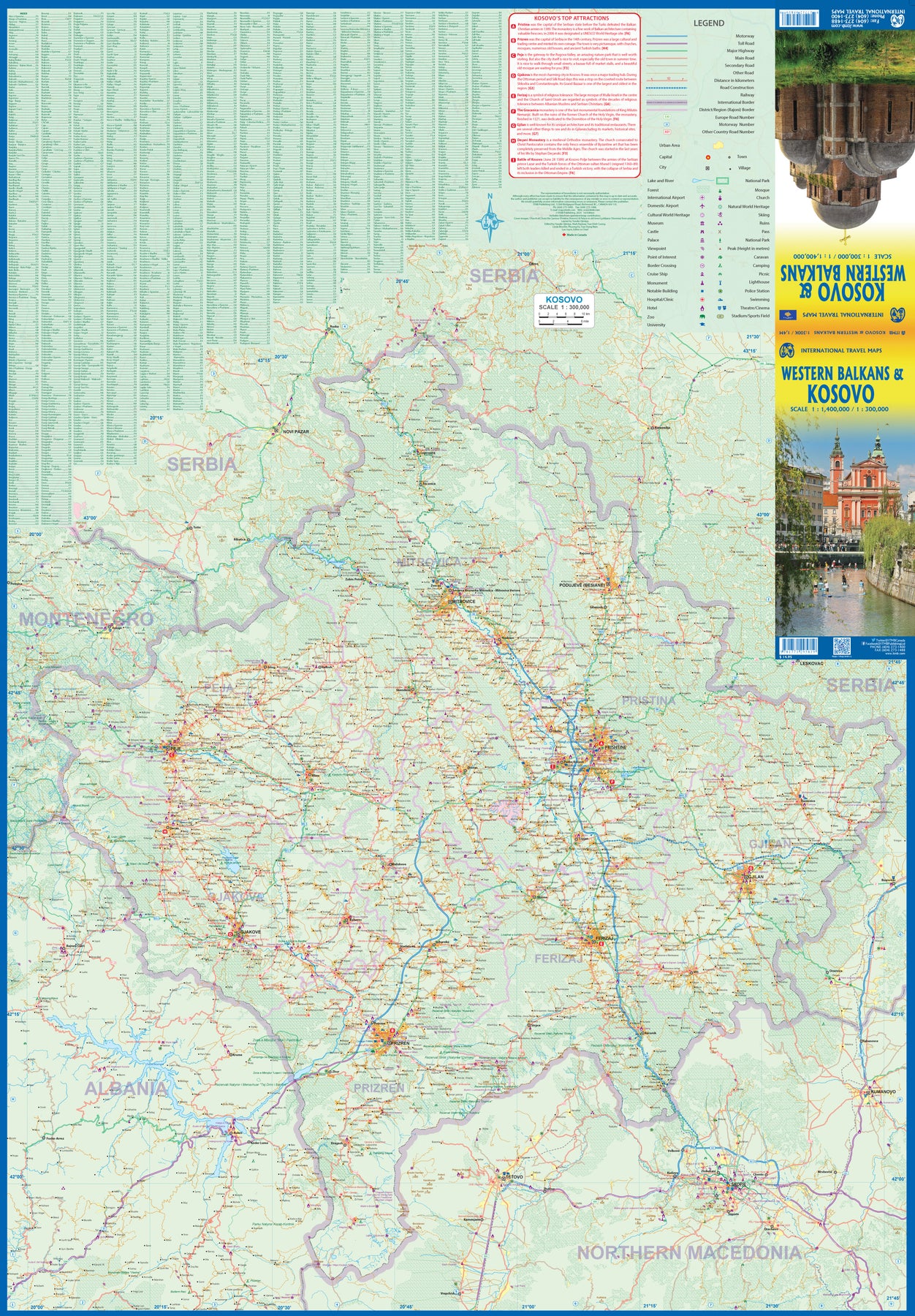
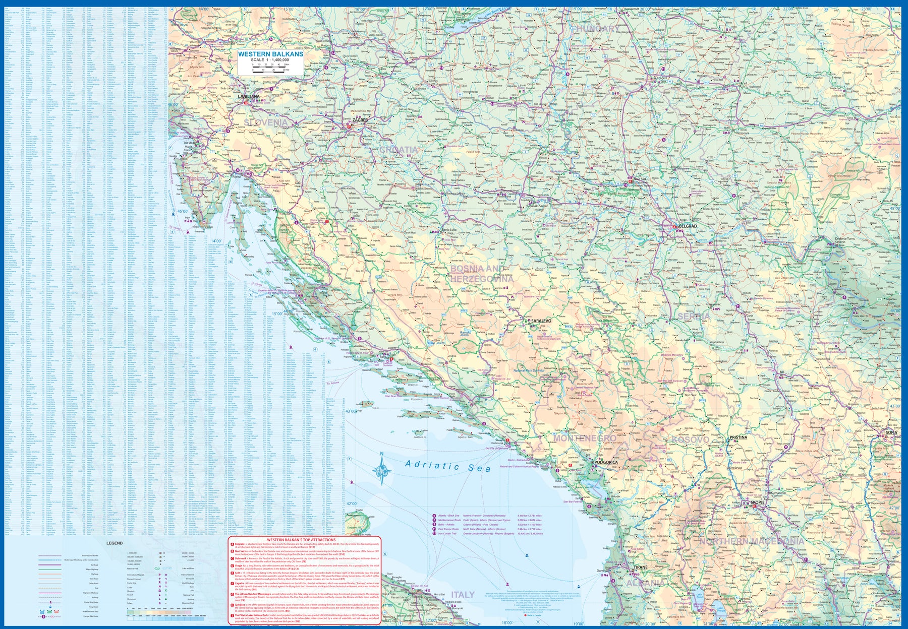
Kosovo & Western Balkans
Ordinær pris 199,00 krKosovo is the country that shouldn't exist, but does. When Yugoslavia fell to pieces after Tito died, Kosovo was lumped in with Serbia but was very unhappy with being a part of an Eastern Orthodox regime. It broke away, resulting in genocidal fighting until the Americans stepped in and stopped the fighting. The region was then placed under a European Union control in the faint hope that it would merge with Albania, or Montenegro, but it didn't. Relations with Serbia are still quite strained, but Kosovo is still surviving as a mountainous Balkan state. Fought over for centuries by Turks and Serbs, Kosovo is emerging as a small but touristic European country. This is definitely an off-the-beaten-path travel destination!
The second side of the sheet provides an excellent regional coverage for the Western Balkans, essentially Slovenia, Croatia, Montenegro, Serbia, and reasonably large tracks of land for Hungary, Albania, and North Macedonia, showing the growing number of wilderness parks being created.
Lesotho & Swaziland (Eswatini)
Ordinær pris 169,00 krITM har kart over hele verden og de spesialiserer seg på land litt utenfor allfarvei. Beliggenheten til landets nasjonalparker, historiske monumenter, de viktigste veiene o.L. Finner du inkludert i kartene. Samtlige landkart har ofte et bykart over hovedstaden.
Fra ITM: ITM is pleased to re-introduce their coverage of two countries of africa that are fairly unique. Both were well-established entities when settlers arrived, and both were able to maintain their identities throughout the colonial era, as protectorates. Lesotho is quite mountainous, with a poorly developed road network, so is a travel adventure destination. It occupies side 1, along with an inset of maseru, the capital. Swaziland, which has recently changed its name for local purposes to eswatini, occupies side 2, with an inset of mbabane, its capital. Both countries are easy to access from south africa, and are well worth visiting. We have also added two lists showing the top attractions of both countries. Both are land-locked countries either adjacent to or surrounded by south africa; both are essentially agricultural countries, although lesotho s mountainous terrain offers considerable touristic appeal, particularly the sani pass. Legend includes: Highway, main road, secondary road, street, pathway, railway, park, lake, international airport, gas station, church, hotel, museum, library, restaurant, shopping, police station, bank, school, stadium, bus terminal, golfing, etc. 2nd edition 2019. Scales: Lesotho 1:350.000, swailand 1:200.000.
Publisert år: 2019
Innbinding: falset
Material: papir
Målestokk: 1:350000
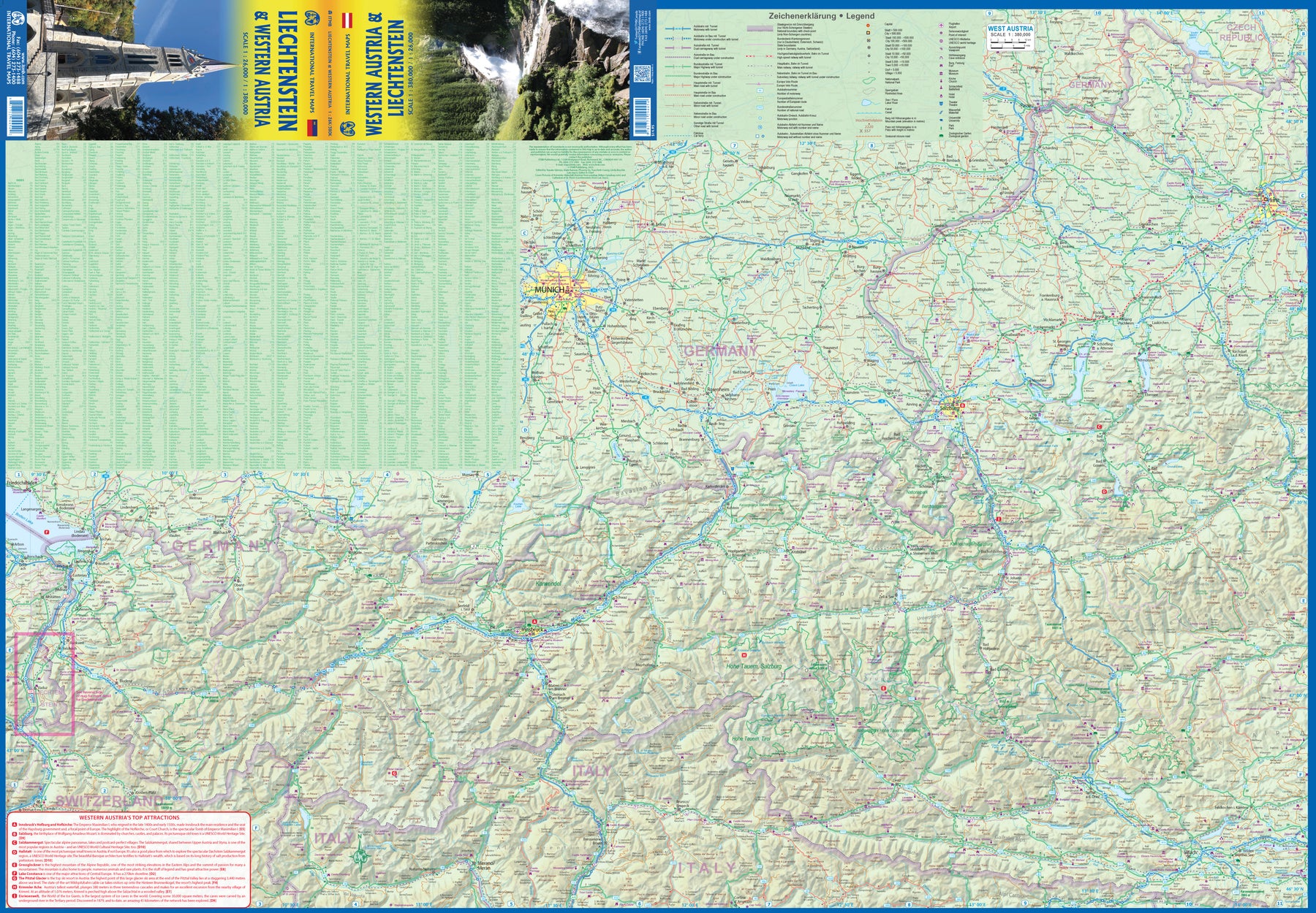
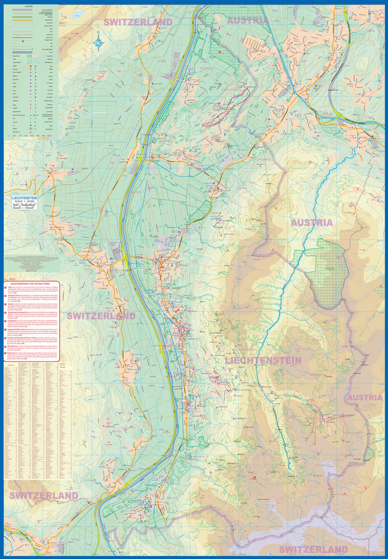
Liechtenstein & Western Austria
Ordinær pris 179,00 krEurope is dotted with mini-states that exist solely for historic reasons but are fiercely independent. Liechtenstein, surrounded by Switzerland on its west and south and Austria on its other borders, is such a state. It is larger and more diverse than many imagine and is quite a popular ski resort region. Side 1 is a detailed map of the principality, framed on the west by the Rhine River and a bit of Switzerland and on the east by Austria. Most development occurs in the Rhine Valley in a north-south direction, dominated by the capital city of Vaduz. There are five access points from Switzerland across the Rhine, one from the south, and two from Austria in the north. The ski haven of Malbun is prominently shown, and the scale of the map is detailed enough to name every major street. This also enabled us the opportunity to include schools, shopping areas, post offices, and churches, as well as a wide range of eating establishments. Walking/hiking trails have also been included.
This is the only map of Liechtenstein ever produced by a cartographic firm, and joins Andorra, Luxembourg, and Monaco as a valued part of ITMB's coverage of Europe. Side 2 concentrates on eastern Austria and southern Germany from Lake Boden (Bodensee) to Linz and from the Italian border north to Passau, in Germany. It is both a road/rail map and a physical relief map of this portion of the Alps. It includes its own Top Attractions list. Border crossings are shown merely as a formality, except for Switzerland. This would be an excellent map to use to explore the mountains south of Innsbruck or to discover small villages in the Tirol.
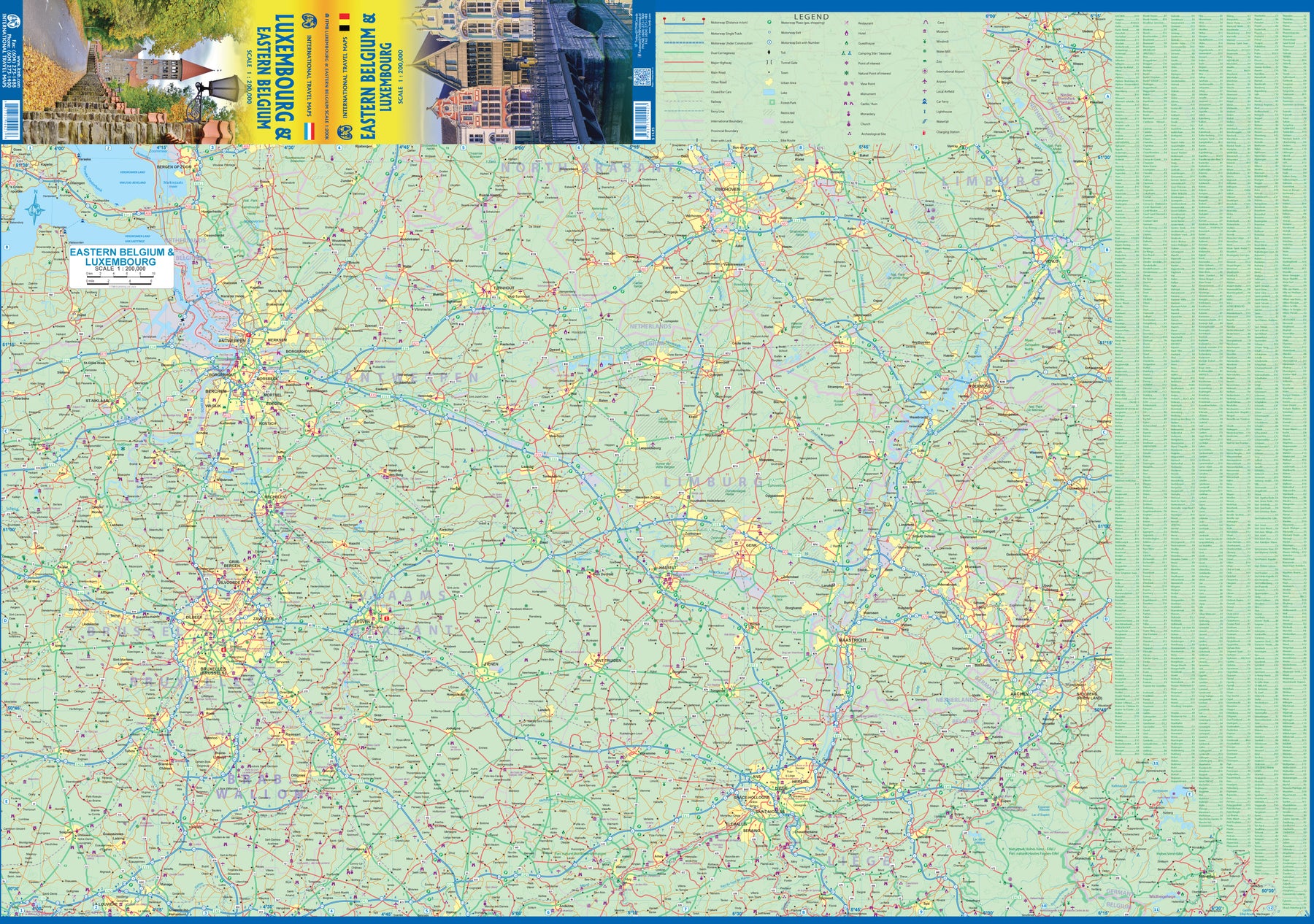
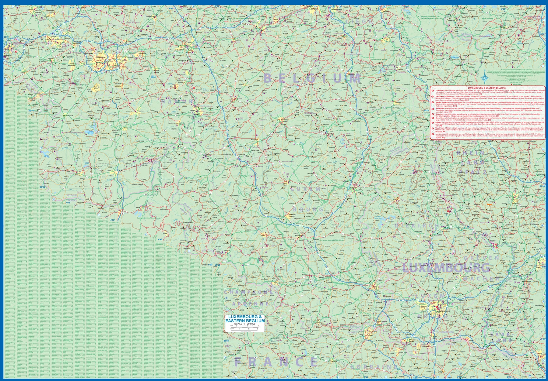
Luxembourg & Eastern Belgium
Ordinær pris 199,00 krLuxembourg is the largest of Europe’s mini-states. We have included the principality on maps of surrounding countries, as most publishers do, but we felt it was time to concentrate on the principality itself and place it into context with its neighbours. Bounded on the west by Belgium, on its east by Germany, and its south by France, Luxembourg has survived for centuries by playing off one large power against another in order to retain its independence. Largely a French-speaking area, Luxembourg is also a strong supporter of the EU. It is a mountainous country, part of the Ardennes region, and close to Bastogne, the focal point of Hitler's last attempt to break the Allies in what is now called the Battle of the Bulge. Bastogne, site of a marvelous WW2 museum, is also on Side 1, as is a portion of Belgium going as far as Mons.
Side 2 concentrates on Belgium east of Brussels, with a small portion of Netherlands included. This includes the Brussels region, Antwerp, Leuven, Liege, and Aachen, with a tiny portion of Germany. Belgium is a larger and more diverse country than many realize. One of the great treasure of eastern Belgium is the cathedral town of Liege, which is known in Flemish as Luik and in German as Luttich, which can make finding it a bit challenging, depending upon whose map one is using, or which road signs one is following!
Madagascar
Ordinær pris 199,00 krThe large, somewhat isolated, island of Madagascar off the east coast of Africa has unique wildlife that makes this country a naturalist's paradise. Road detail includes some tracks, and locations with petrol supplies are marked.
The legend includes railways, ports, sea ferries, airports and airfields. Wetland areas, reserves and national parks are indicated, and a range of symbols depict various features e.g. historic sites, places of interest, antiquities, waterfalls, campsites, lodgings, beaches, hospitals and post offices. The islands of the Comoros and Mayotte are also included which also show main roads, airports and hotels. The map is single sided and printed on paper, topography is shown using altitude shading and some spot heights.
Inkluderer lite kart av byen Antananarivo.