


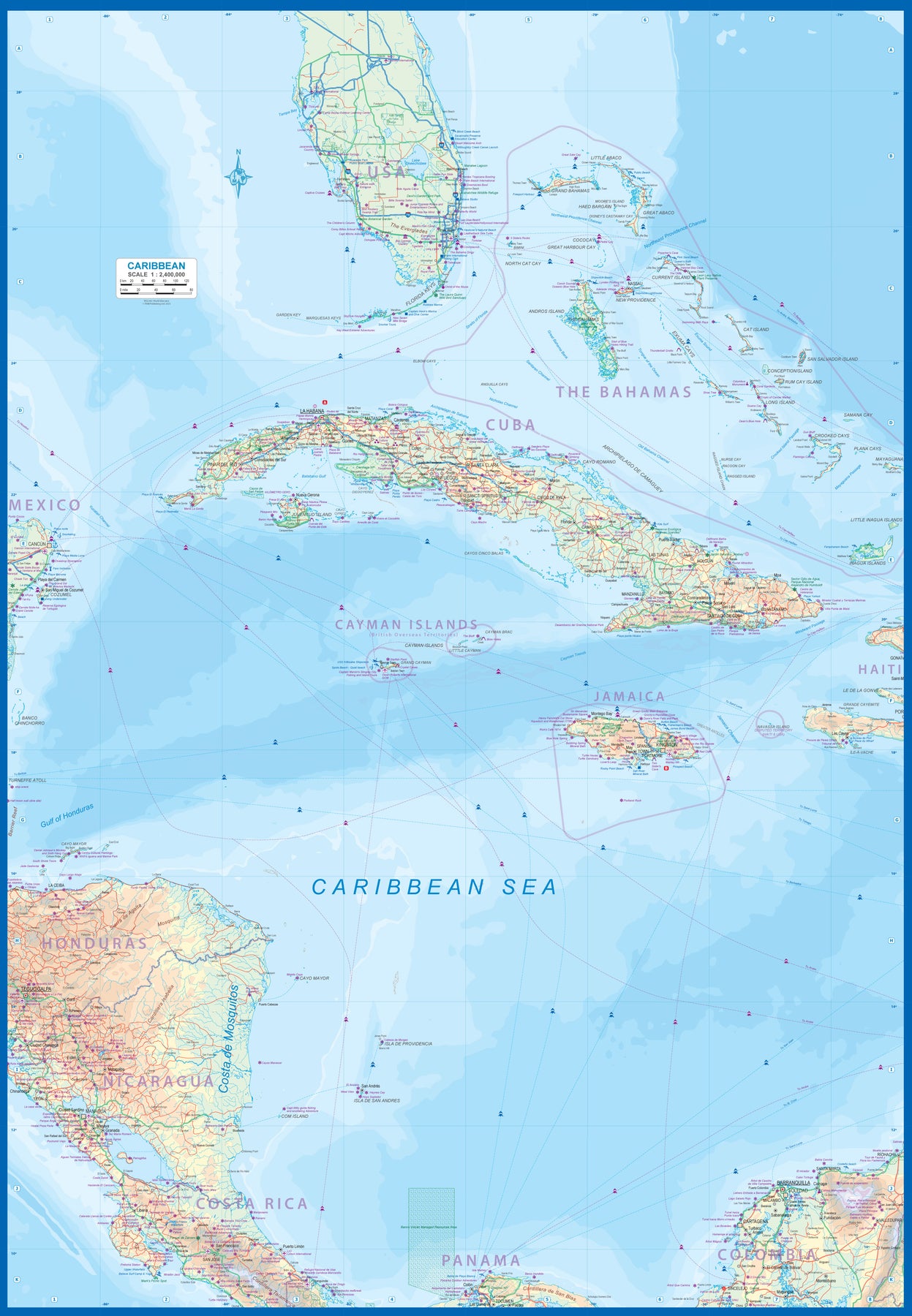
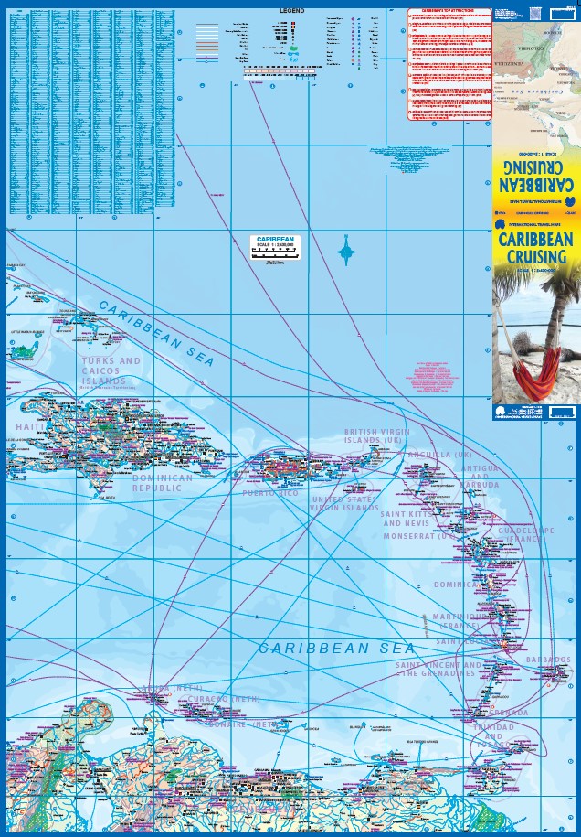
The Caribbean Sea is one of the most popular cruising destinations in the world. This colourful double-sided map starts just north of Orlando/Tampa in order to show the northernmost Bahamian islands and south as far as the Panama Canal at Colon and the coast of Venezuela. The map shows good detail for each island and the legal boundaries of each island nation. Side 1 concentrates on the western Caribbean, essentially the Bahamas, Cuba, Jamaica, and the Cayman Islands. Here's a fun fact most of you won't know: tiny Navassa Island between Haiti and Jamaica is claimed by both the USA and Haiti! Side 2 concentrates on the eastern islands of the Caribbean, such as Hispaniola (Haiti and the Dominican Republic), Puerto Rico and the US and British Virgin Islands, Turks & Caicos, and the Lesser Antilles chain of island countries, such as Antigua, Guadeloupe, Barbados, and Trinidad/Tobago, among others.
Coverage then extends westward along the Venezuelan coastline to include the Dutch possessions of Aruba, Bonaire, and Curacao. Interestingly, there is a small island called Isla Mona west of Puerto Rico on the map that I have never heard of. There are also two Bonaire islands. This is a very interesting map! The most popular cruise line routes are shown; most start either from Puerto Rico or from southern Florida. The map also includes a Top Attractions list, and dozens of local points of interest related to each island.