Filter
- Afghanistan
- Albania
- Armenia
- Belgia
- Bosnia-Hercegovina
- Botswana
- Bulgaria
- Costa Rica
- Danmark
- Estland
- Frankrike
- Georgia
- Irland
- Italia
- Kasakhstan
- Kirgisistan
- Kosovo
- Kroatia
- Latvia
- Litauen
- Montenegro
- Nederland
- Nord-Makedonia
- Portugal
- Serbia
- Slovenia
- Spania
- Storbritannia
- Sveits
- Sør-Afrika
- Turkmenistan
- Tyskland
- Ungarn
- Østerrike
179 produkter
179 produkter
Utsolgt
Zagreb
Freytag & Berndt
189,00 kr

Thailand
Ordinær pris 199,00 kr/
Mva inkludert
Frakt beregnes i kassen.
Thailand at 1:900,000 on a large, double-sided, indexed road map from Freytag & Berndt, with clear presentation of the country’s road network, its topography, various places of interest and its administrative divisions.
The map divides the country north/south, with a good overlap between the sides. Colouring and relief shading with spot heights show the country’s topography. National parks and other protected areas are clearly highlighted. Road network includes selected unpaved roads and local tracks, with driving distances indicated on main routes. The map also shows railway lines, ferry connections and local airports, as well as the country’s internal administrative boundaries with names of the provinces.
Various places of interest at highlighted by symbols with their names given in English, e.g. ancient or historic city, floating market, historic park, etc. The map has latitude and longitude lines at intervals of 1º and an extensive index. Map legend includes English.
- Publisert: 2024
- Innbinding: Falset
- Materiale: Papir
- Målestokk: 1:900 000


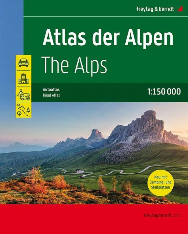
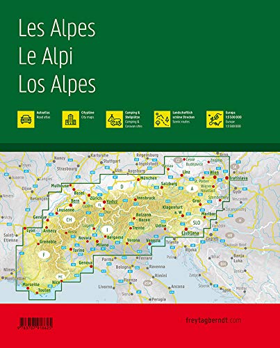
The Alps Atlas
Ordinær pris 449,00 kr/
Mva inkludert
Frakt beregnes i kassen.
- Publisert: 2024
- Innbinding: Spiral
- Materiale: Papir
- Målestokk: 1:150 000

Ukraine; Moldova
Ordinær pris 199,00 kr/
Mva inkludert
Frakt beregnes i kassen.
Ukraine and Moldova with eastern Romania, on a large, indexed road map with street plans of central Kiev and Chisinau. Place names are in Roman alphabet, with main towns also given in Cyrillic.
Road network includes local roads and cart tracks and shows driving distances on main routes and locations of border crossings. Railways and local airports are shown, as well as internal administrative boundaries with names of the provinces. National parks or protected areas are marked and main places of interest highlighted. Topographic information is limited to names of main mountain and hill ranges and selected spot heights.
The map has latitude and longitude lines at intervals of 1º. Multilingual map legend includes English. Index of localities is in a separate booklet attached to the map cover and lists locations in each country separately, including places in the adjoining areas of neighbouring countries. The booklet also includes plans of central Kiev and Chishinau.
- Publisert: 2024
- Innbinding: Falset
- Materiale: Papir
- Målestokk: 1:1 000 000

Upper Austria
Ordinær pris 199,00 kr/
Mva inkludert
Frakt beregnes i kassen.
- Publisert: 2023
- Innbinding: Falset
- Materiale: Papir
- Målestokk: 1:150 000