1353 produkter
Spain: Balearics - Mallorca; Ibiza & Menorca
Ordinær pris 199,00 krThe Balearic Islands in the western Mediterranean have been extremely popular travel destinations for centuries. Mallorca/Majorca and Ibiza have become favoured visits by cruise ships to these islands in recent years, but the warm climate has attracted visitors for a long time. Side 1 concentrates on the three major islands of Mallorca, Ibiza, and Menorca but includes the smaller islands of Formentera and Cabrera, along with an inset map showing the islands in relation to the Spanish mainland ports of Valencia and Barcelona. Side 2 focusses on cruising the entire western half of the Mediterranean, from Naples west to Gibraltar. Naturally, the Balearics end up right in the centre of the map, which also includes the islands of Corsica and Sardinia, both of which are becoming increasingly popular with those cruising. I hasten to add that cruising is the fastest growing segment of the entire travel industry, so is an important market for the mapping industry.
03 Oberstdorf - Kleinwalsertal
Ordinær pris 249,00 krCroatia - Through Writers' Eyes
Ordinær pris 209,00 kr Salgspris 149,00 kr Spar 29%This volume is not a guide of where to stay and what to do, rather it is a collection of writing that aims to invest the traveller with a cultural and historical background to Croatia, which will give life and meaning into the sights, sounds and tastes that the traveller will experience.
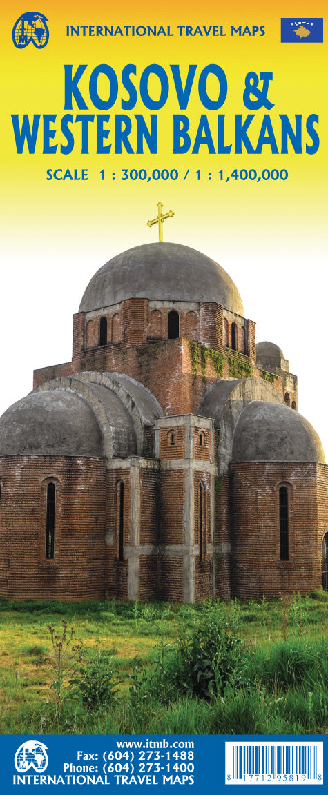
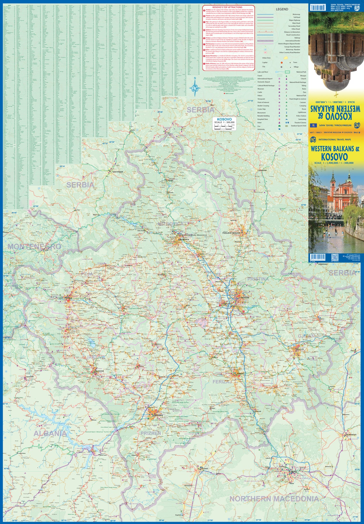
Kosovo & Western Balkans
Ordinær pris 199,00 krKosovo is the country that shouldn't exist, but does. When Yugoslavia fell to pieces after Tito died, Kosovo was lumped in with Serbia but was very unhappy with being a part of an Eastern Orthodox regime. It broke away, resulting in genocidal fighting until the Americans stepped in and stopped the fighting. The region was then placed under a European Union control in the faint hope that it would merge with Albania, or Montenegro, but it didn't. Relations with Serbia are still quite strained, but Kosovo is still surviving as a mountainous Balkan state. Fought over for centuries by Turks and Serbs, Kosovo is emerging as a small but touristic European country. This is definitely an off-the-beaten-path travel destination!
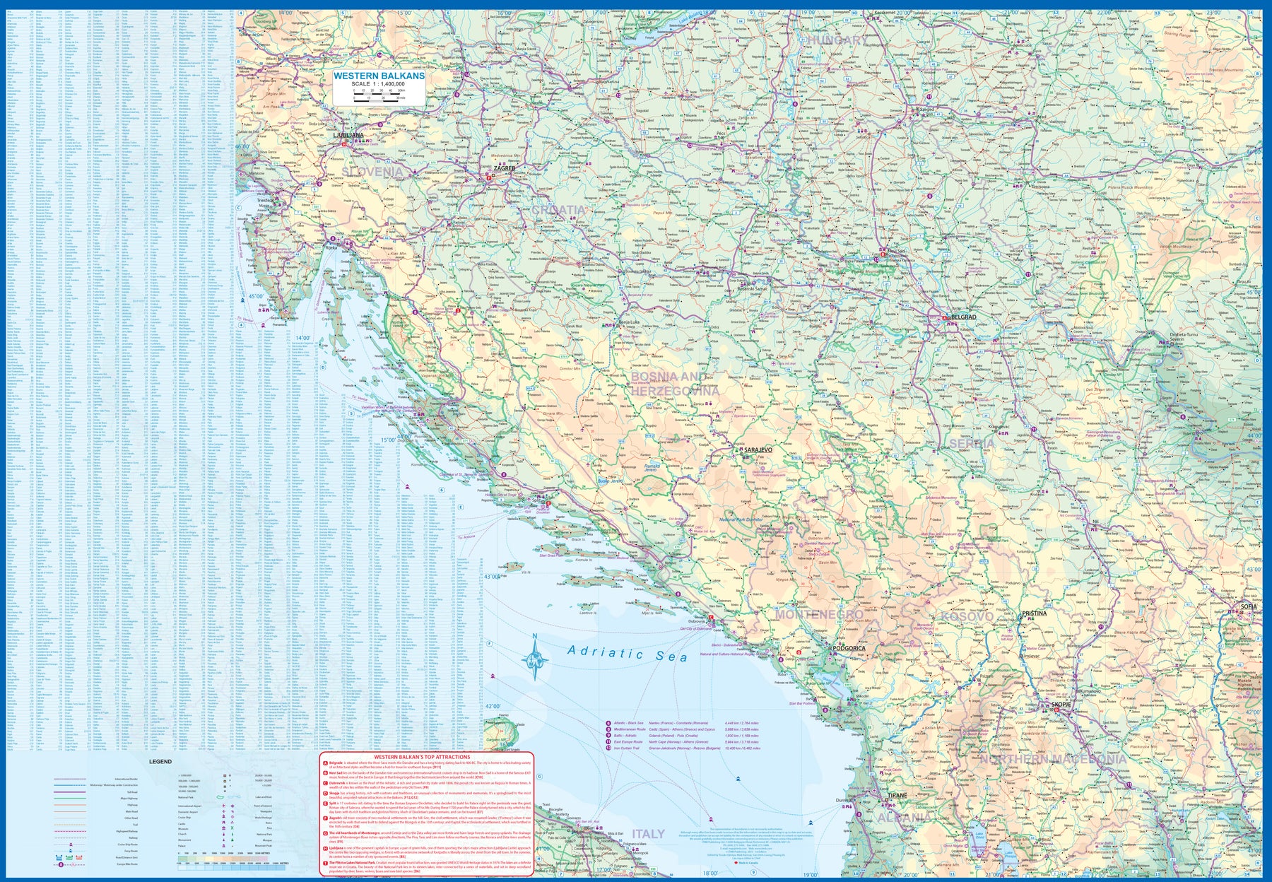
The second side of the sheet provides an excellent regional coverage for the Western Balkans, essentially Slovenia, Croatia, Montenegro, Serbia, and reasonably large tracks of land for Hungary, Albania, and North Macedonia, showing the growing number of wilderness parks being created.
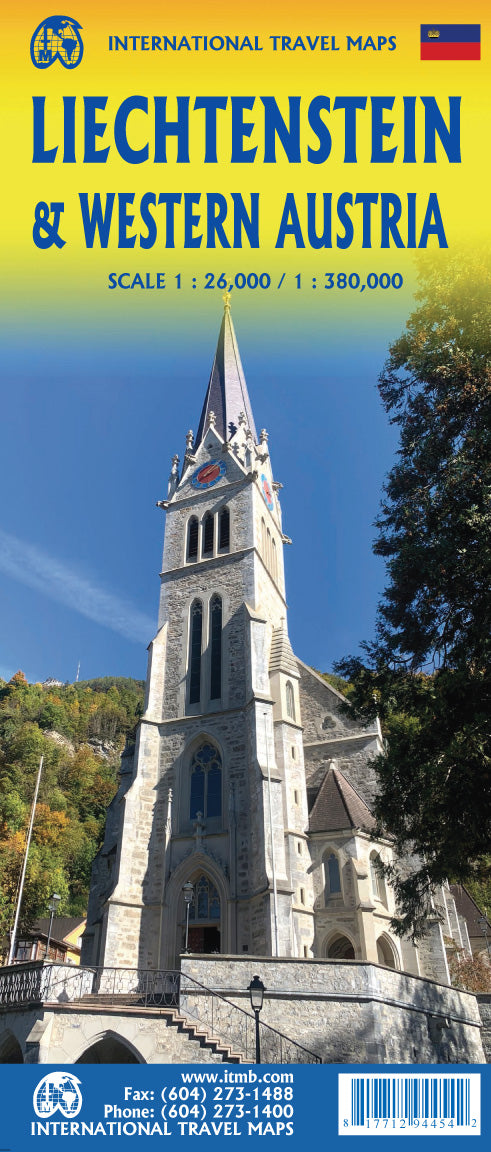
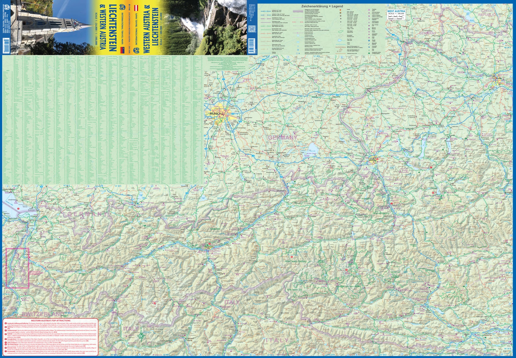
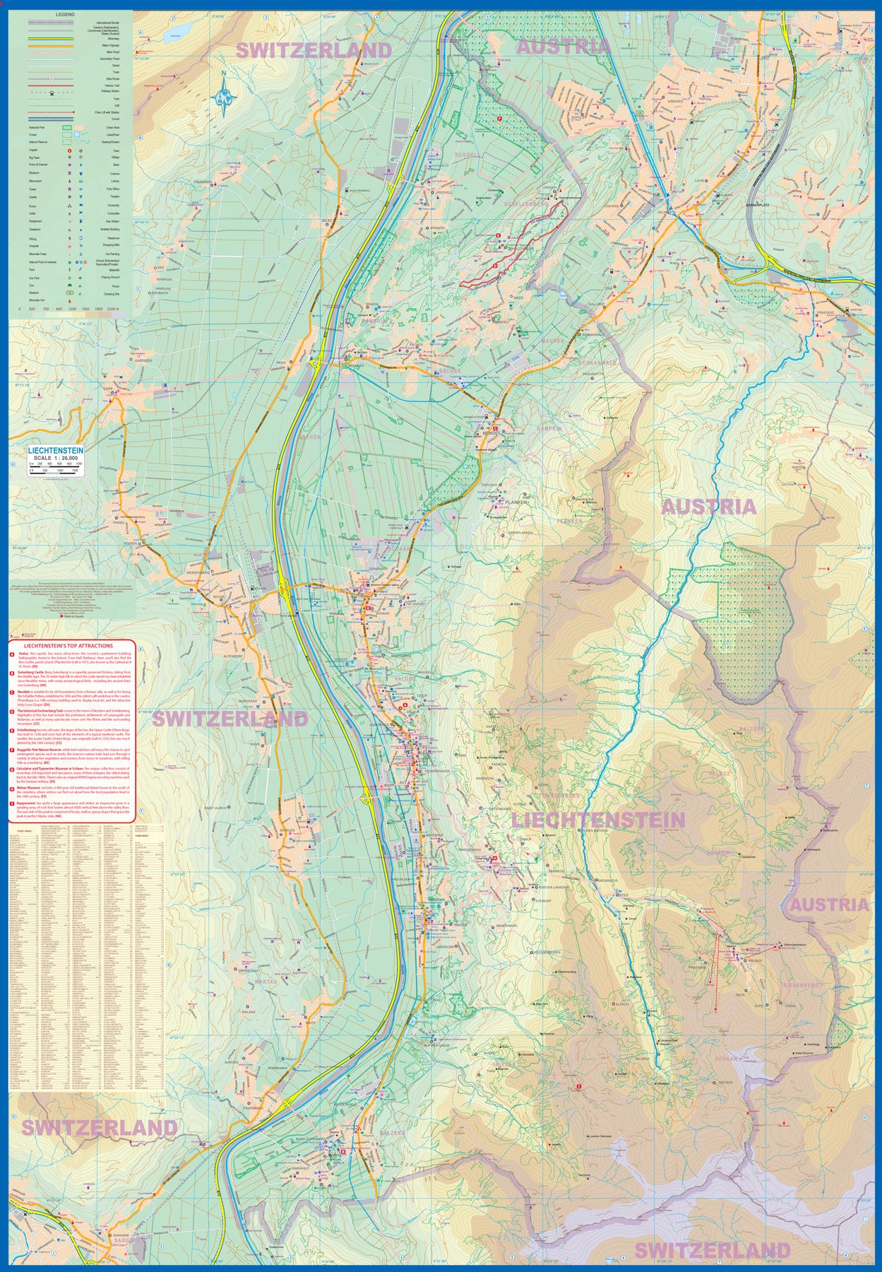
Liechtenstein & Western Austria
Ordinær pris 179,00 krEurope is dotted with mini-states that exist solely for historic reasons but are fiercely independent. Liechtenstein, surrounded by Switzerland on its west and south and Austria on its other borders, is such a state. It is larger and more diverse than many imagine and is quite a popular ski resort region. Side 1 is a detailed map of the principality, framed on the west by the Rhine River and a bit of Switzerland and on the east by Austria. Most development occurs in the Rhine Valley in a north-south direction, dominated by the capital city of Vaduz. There are five access points from Switzerland across the Rhine, one from the south, and two from Austria in the north. The ski haven of Malbun is prominently shown, and the scale of the map is detailed enough to name every major street. This also enabled us the opportunity to include schools, shopping areas, post offices, and churches, as well as a wide range of eating establishments. Walking/hiking trails have also been included.
This is the only map of Liechtenstein ever produced by a cartographic firm, and joins Andorra, Luxembourg, and Monaco as a valued part of ITMB's coverage of Europe. Side 2 concentrates on eastern Austria and southern Germany from Lake Boden (Bodensee) to Linz and from the Italian border north to Passau, in Germany. It is both a road/rail map and a physical relief map of this portion of the Alps. It includes its own Top Attractions list. Border crossings are shown merely as a formality, except for Switzerland. This would be an excellent map to use to explore the mountains south of Innsbruck or to discover small villages in the Tirol.
Croatia: Istria
Ordinær pris 199,00 krReise Know-How maps (world mapping project series) are easy-to-read, waterproof and highly durable travel maps specifically designed for everyday use on the road.
Our maps combine state-of-the-art, GPS-compatible cartography (including hypsometric tints and contour lines) with a detailed rendering of road networks and touristic information. They offer the best possible scale, level of detail and readability, be it a map of a small island or half a continent.
The maps feature a detachable paper sleeve so that the maps can be folded easily and fit in every pocket. Although printed on plastic, a special coating makes sure the maps retain a paper-like feel and can even be written on with a pencil.
4 Northern England
Ordinær pris 199,00 krThe OS Roadmaps series are single sided folded maps, the 8 maps provide GB 1: 250 000 coverage to enable the end user to navigate and plan their road journey. The maps include all motorways, primary routes and A roads plus detailed tourist information including National Parks, Country Parks and World Heritage sites and a useful town and city gazetteer.
The eight maps in the series are Northern Scotland, Orkney & Shetland, Western Scotland and the Western Isles, Southern Scotland and Northumberland, Northern England, East Midlands and East Anglia, Wales/Cymru and West Midlands, South West England and South East England.
140 Zoom - Corfu - Ionian islands
Ordinær pris 169,00 krMICHELIN Zoom Map Corfu will give you an overall picture of your journey thanks to its clear and accurate mapping scale 1/80,000. Our map will help you easily plan your safe and enjoyable journey thanks to a comprehensive key, a complete name index as well a clever time & distance chart. Michelin's driving information will help you navigate safely in all circumstances.
With MICHELIN National Maps, find more than just your way!Corfu, the northernmost of the Ionian Islands in Greece. Located off of the far northwest coast of the Greece, Corfu is in the Ionian sea, east of Italy and southwest of Albania. MICHELIN NATIONAL MAPS feature:* Up-to-date mapping* A scale adapted to the size of the country* A clear and comprehensive key* Distance and time chart* Place name index* Driving and road safety information* Tourist sights informationOur maps are regularly updated even if the ISBN does not change.
Publisert år: 2021
Innbinding: falset
Material: papir
Målestokk: 1:80000
Portugal: Azores Walking & Cycling Map Set
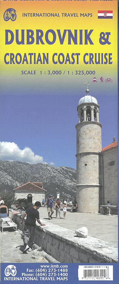
Ordinær pris 219,00 krCroatia: Dubrovnik & Croatian Coast Cruise
Ordinær pris 199,00 krThe ancient port city of Dubrovnik, on the southern Croatian coastline, has evolved into a major tourist destination. The old walled city, normally entered through the famous Pile Gate, was so crowded with tourists when we arrived, that it took some time to get to the main street of Stradun. The city has completely recovered from the Montenegrin bombing during the breakup of Yugoslavia, with a few shellholes remaining just to show to tourists. The highlights of a visit are the Rector’s Palace, the Tvrdava fortress, and the cathedral. The map covers the urban area outside of the old town as well, as this is where most of the hotels and restaurants are located.
The other side of the map shows the extensive coastline of Croatia in two parts – from the Italian border to Trogir, and from Split to the border with Montenegro. We travelled from Porec to Dubrovnik in a small cruise ship of 45 passengers, which enabled us to visit ports that larger ships could not reach. As a result, we visited islands we could not have otherwise visited. The cover picture shows grandson Johnny in one such small town.
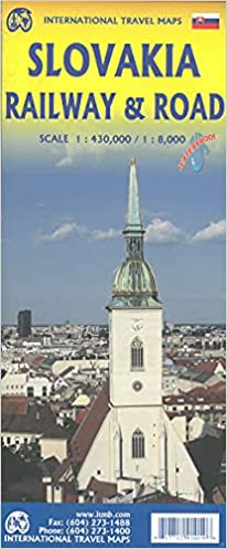
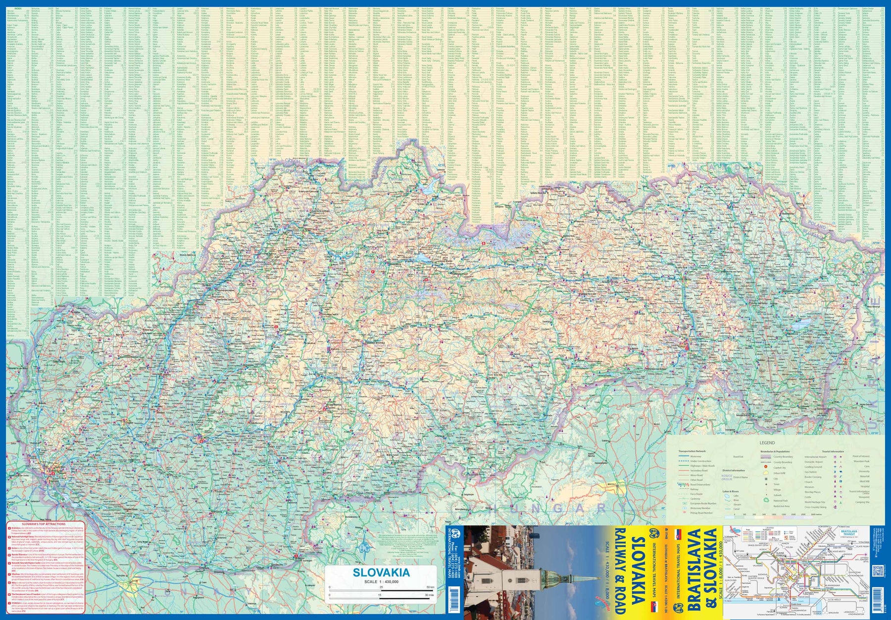
Slovakia - Railway & Road
Ordinær pris 169,00 krAs tourism to the eastern reaches of Europe becomes more popular, Slovakia is well-positioned to present an attractive opportunity for exploration. ITMB previously included this country with adjacent Hungary, but now we have expanded coverage and included a detailed map of Bratislava (1:8.000). Side 1 (1:430.000) shows the elongated country from its Austrian and Czech borders to its increasingly important border with Ukraine. As usual, we have included a listing of Top Attractions, such as the little-known towns of Kosice, Banska Stiavnica, and Sturovo, as well as the karst underground caves of Demanova and the fairy tale castle of Bojnice.
Side 2 portrays the capital city of Bratislava in excellent detail, showing the Danube River and the old town in great detail, along with the newer outlying areas of Petrzalka and Ruzinov. The map is printed on waterproof stone paper for durability. Legend Includes: Roads by classification, Rivers and Lakes, National Park, Airports, Points of Interests, Highways, Main Roads, Zoos, Fishing, and much more...
Jämtlandsfjällan
Ordinær pris 249,00 kr Salgspris 199,00 kr Spar 20%21 ARKÖSUND GRYT VÄSTERVIK
Ordinær pris 189,00 kr15 CHARLOTTENBERG ARVIKA
Ordinær pris 189,00 krElbrus
Ordinær pris 299,00 kr Salgspris 149,00 kr Spar 50%232 La Palma
Ordinær pris 189,00 krKompass sine vandrekart er av de aller beste til sitt bruk, de er lettleste, detaljerte og oppdaterte! De spesialiserer seg på sentral-europa (de tysktalende landene samt italia og spania), hvor de er de mest solgte vandrekartene i vår butikk. De har selvfølgelig gps-koordinater, samt en liten guide følger hvert kart men vær oppmerksom på at denne er på tysk!
Publisert år: 2018
Innbinding: falset
Material: papir
Målestokk: 1:50000
87 Breuil-Cervinia Zermatt
Ordinær pris 219,00 krPublisert år: 2024
Innbinding: falset
Material: plast laminert
Målestokk: 1:50000
ODENWALD SPESSART
Ordinær pris 109,00 krBulgaria
Ordinær pris 169,00 krMarco Polo er svært detaljerte kart som er praktiske og enkle i bruk. 7 klistremerker for å markere spesifikke steder gjør det enda enklere å planlegge reisen. Alle kartene inneholder en omfattende indeks for enkelt å finne frem.
Bulgaria-kartet inkluderer også bykart over de fire byene Burgas, Plovdiv, Sofia og Varna.
Publisert år: 2018
Innbinding: falset
Material: Papir
Målestokk: 1:800 000
Corsica
Ordinær pris 189,00 krLet the Marco Polo Corsica Road Map guide you around this beautiful island. Discover 1000km of glorious coastline, carved standing stones and and stunning scenery with this highly durable, detailed touring map of Corsica. It folds away easily and is always on standby to help when you're stuck.
Kosovo
Ordinær pris 199,00 krKosovo at 1:150,000 on a large map in Freytag & Berndt’s “Top 10 Tips” series with the index booklet also providing multilingual descriptions of the country’s most interesting locations. Where appropriate, place names are bilingual, with Serbian names shown in Latin alphabet only (within Serbia itself and Macedonia place names are in both Cyrillic and Latin alphabets).
The map is an enlargement of F&B’s mapping of the region at a smaller scale, so all names are in much larger print size than found on similar maps. Topography is presented by relief shading with colouring for forested areas, plus names of various mountain ranges and peaks. Road network includes small local roads and selected cart tracks. Driving distances are marked on main routes and scenic roads are highlighted. Railway lines are shown with stations. Various places of interest, including the publishers’ recommendations are highlighted. Latitude and longitude lines are drawn at 10’ intervals. Multilingual map legend includes English.
City Pocket Map: Dubrovnik
Ordinær pris 99,00 krBykart i lommestørrelse. Dette store østerriske kartforlaget er kjent for sin klare kartografi og gode papirkvalitet. De kommer i alle målestokker, og flere av landkartene inneholder bykart og turistinformasjon.
Dubrovnik in a series of handy pocket street plans from Freytag & Berndt. Each map is laminated, so waterproof and tear-resistant, and highlights the publishers’ recommendations of five best choices in five categories: shopping, restaurants and cafes, culture, nightlife and sights.
On one side is an indexed street plan annotated with colour-coded markers highlighting the publishers’ recommendations, all listed on the reverse of the map with brief notes in several languages. In larger cities the plans cover only the central districts. Also provided are a small road map of the city’s environs, if appropriate a diagram of the metro network, and a Fact Box with phone numbers for tourist offices, car hire and emergency services.
Publisert år: 2018
Innbinding: falset
Material: plast laminert
Målestokk: 1:10000
D67 Bas-Rhin
Ordinær pris 159,00 krKart med målestokk 1:100 000, og hovedfokus på utendørsaktiviteter som sykling, turgåing, klatring og golf, samt kirker, museer og tilgjengelige chateaux.
805 Western Russia - from Baltic to Black Sea
Ordinær pris 169,00 krMichelin er en av verdens beste, og best kjente, kartserier. Kartene har glimrende kartografi.
Publisert år: 2018
Innbinding: falset
Material: Papir
Målestokk: 1:2000000
328 Local: Ain Haute-Savoie
Ordinær pris 169,00 krMichelin er en av verdens beste, og best kjente, kartserier. Kartene har glimrende kartografi.
323 Local: Cher, Indre
Ordinær pris 169,00 krMichelin er en av verdens beste, og best kjente, kartserier. Kartene har glimrende kartografi.