1101 produkter
1101 produkter


1101 produkter
Spain: La Palma
Ordinær pris 169,00 krDette store østerriske kartforlaget er kjent for sin klare kartografi og gode papirkvalitet. De kommer i alle målestokker, og flere av landkartene inneholder bykart og turistinformasjon.
Clear road map of La Palma from Freytag & Berndt showing its road network with main places of interest and hiking trails, plus street plans of Santa Cruz de la Palma, Los Cancajos, Puerto Naos and Los Llanos de Ariadne.
Publisert år: 2024
Innbinding: falset
Material: papir
Målestokk: 1:40000
Spain: Lanzarote
Ordinær pris 199,00 krDette store østerriske kartforlaget er kjent for sin klare kartografi og gode papirkvalitet. De kommer i alle målestokker, og flere av landkartene inneholder bykart og turistinformasjon.
Spain: Mallorca
Ordinær pris 199,00 krMajorca at 1:50,000 on a large, double-sided, contoured map from Freytag & Berndt, with highlighting for scenic roads and tourist routes, plus a booklet with a GPS-annotated index, street plan of central Palma, and multilingual descriptions of the island’s best sights.
Spain: Mediterranean Coast
Ordinær pris 199,00 krSpain is one of the most popular travel destinations in Europe. The country is extremely diverse, reflecting its history. The coastal areas of the Mediterranean were probably first settled by Phoenicians, then Greeks, then Romans, and then Arabs before being brought into a united Spain at the time Columbus was seeking a sponsor to fund his proposed journey to discover new lands to the west. This map focuses on the coast from the French border south through Catalunya all the way to the Straits of Gibraltar and Cadiz. The offshore islands of Mallorca, Ibiza, and Menorca are included, as is the North African Spanish enclave of Ceuta and the British enclave of Gibraltar.
All road and rail lines are shown, including the new Cadiz to Madrid fast train. By the nature of mapping, a considerable amount of the interior is on the map as well, so this map is much more than just a coastal journey through Valencia and Murcia to reach Granada, although that would be a very enjoyable trip. The map is equally applicable to interior trips to Cordoba or Albacete as it is a map of the coast. However, its purpose is to show the attractions of the coast – beaches, resort areas, historic towns, forts, nature reserves, archaeological remains, and Top Attractions.
Stockholm
Ordinær pris 99,00 krKart i postkortstørrelse. Folder seg ut som en popoutbok når du åpner dem. Fargerik turistinformasjon med kart over metro og busstraseer, landemerker og lignende. Veldig enkelt å håndtere.
Stockholm
Ordinær pris 119,00 krLonely Planet City Map er slitesterkt og vanntett, med en hendig slipcase og et format som er lett å brette. Få mer ut av kartet og reisen din med bilder og informasjon om byattraksjoner, transportkart, reiseruteforslag, omfattende gate- og nettstedsindeks og praktiske reisetips. Med dette brukervennlige navigasjonsverktøyet i baklommen kan du virkelig komme til hjertet av din destinasjon!
Stockholm
Ordinær pris 149,00 krFolded street and travel map in colour. Scale 1:15,000. Legend includes sights, museums, monuments, churches, synagogues, monasteries, castles, windmills, beaches, golf courses, parking, youth hostels, car ferries, airfields, subway, commuter train, camping sites, viewpoints, hotels.
Street Map: Bruges
Ordinær pris 149,00 krDiscover Bruges by foot, car or bike using Michelin Bruges City Plan (scale 1/12,500 cm). In addition to Michelin's clear and accurate mapping, this city plan will help you explore and navigate across Bruges different districts thanks to its full index, its comprehensive key showing places of interest and tourist attractions, as well as practical information on public transport leisure facilities, service stations and shops!Discover the new range of Michelin City Maps* Write on Wipe off ,Draw your route with a felt tipped pen, Erase with a damp cloth!* Plastic Format* Durable and convenient to use* Handy Compact, folds "free" for easy handling* Clarity and legibility of Michelin mapping:* Map of the city centre with identified tourist sites* Green Guide tourist sites* Smaller Map of whole city* Underground Map, with a detailed index.
Publisert år: 2020
Innbinding: Falset
Material: Plast
Målestokk: 1:12,500
Street Map: Moscow
Ordinær pris 149,00 krDiscover Moscow by foot, car or bike using Michelin Moscow City Plan (scale 1/12,500 cm). In addition to Michelin's clear and accurate mapping, this city plan will help you explore and navigate across Moscow different districts thanks to its full index, its comprehensive key showing places of interest and tourist attractions, as well as practical information on public transport leisure facilities, service stations and shops!Discover the new range of Michelin City Maps* Write on Wipe off, Draw your route with a dry marker tipped pen, Erase with a damp cloth!* Plastic Format* Durable and convenient to use* Handy Compact, folds "free" for easy handling* Clarity and legibility of Michelin mapping:* Map of the city centre with identified tourist sites* Green Guide tourist sites* Smaller Map of whole city* Underground Map, with a detailed index.
Publisert år: 2019
Innbinding: Falset
Material: Plast
Målestokk: 1:12,500
Street Map: St. Petersburg
Ordinær pris 149,00 krDiscover Saint Petersburg by foot, car or bike using Michelin Saint Petersburg City Plan (scale 1/12,500 cm). In addition to Michelin's clear and accurate mapping, this city plan will help you explore and navigate across Saint Petersburg different districts thanks to its full index, its comprehensive key showing places of interest and tourist attractions, as well as practical information on public transport leisure facilities, service stations and shops!Discover the new range of Michelin City Maps* Write on Wipe off ,Draw your route with a felt tipped pen, Erase with a damp cloth!* Plastic Format* Durable and convenient to use* Handy Compact, folds "free" for easy handling* Clarity and legibility of Michelin mapping:* Map of the city centre with identified tourist sites* Green Guide tourist sites* Smaller Map of whole city* Underground Map, with a detailed index.
Publisert år: 2020
Innbinding: Falset
Material: Plast
Målestokk: 1:12,500
Sverige (Sweden)
Ordinær pris 199,00 krSweden
Ordinær pris 189,00 krMarco Polo er svært detaljerte kart som er praktiske og enkle i bruk. 7 klistremerker for å markere spesifikke steder gjør det enda enklere å planlegge reisen. Alle kartene inneholder en omfattende index for enkelt å finne frem.
Sweden: South
Ordinær pris 199,00 krHighly tear-resistant and 100% waterproof map "Sweden, South" from the series world mapping project.
Travel know-how maps are characterized by particularly sturdy plastic paper, which can be written on like paper, even with a pencil. The cardboard envelope is removable, making it easy to put the card in any pocket. A protective cover is not required. The cartographic representation focuses on the most important information for travelers and is particularly easy to read. Instead of shading, colored layers of elevation are used.
Switzerland
Ordinær pris 199,00 krPerfect touring map - the scale is 1 : 275 000 ideal to help you tour the region by car or campervan. Easy to use - the superbly clear mapping in strong colours and easy to read text will help you navigate the country like a local. Durable, tear-resistant map - designed to withstand the rigors of the road, the map is printed on tear-resistant, water repellent and writeable paper.
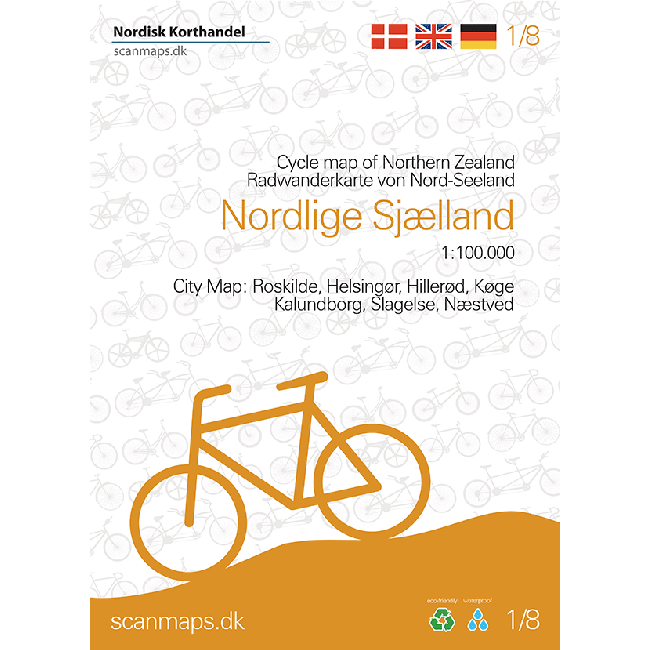
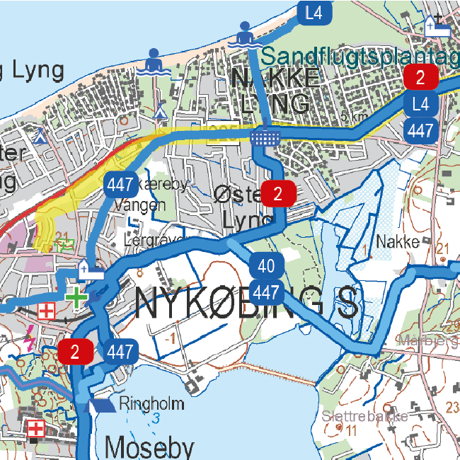
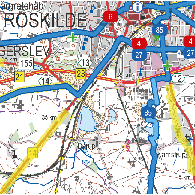
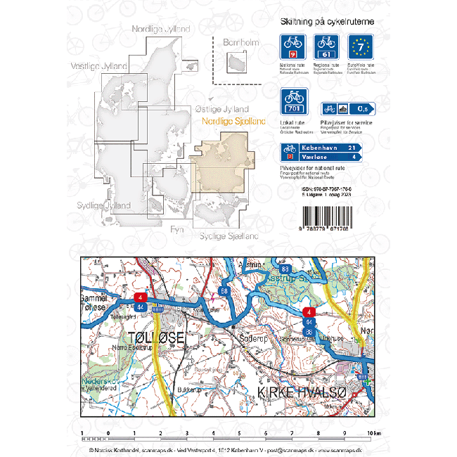
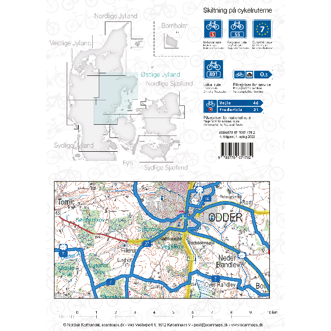
Sykkelkart 1 - Nordlige Sjælland
Ordinær pris 249,00 krThe maps contain: National cycle routes Regional cycle routes Local cycle routes, including the beautiful panorama routes. General information about accommodation, bike inclusion on trains etc. -Information icons on the map: Grocery stores outside major city, Tourist offices, National attractions, UNESCO world heritage, Bicycle friendly churches (special place for bike parking, water bottle filling etc., and a bicycle pump is available), Bike retailers, Beaches, Campsites, Hotels / Inns, Resting places, Hostels, Tent camps Ferry routes List of content is written in Danish, German and English.
Sykkelkart 2 - Sydlige Sjælland
Ordinær pris 249,00 krSykkelkart 3 - Fyn
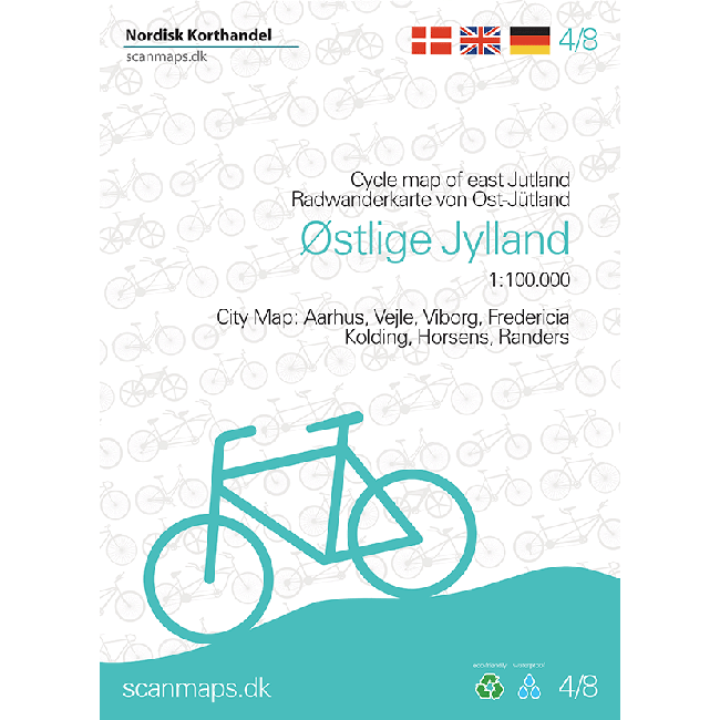
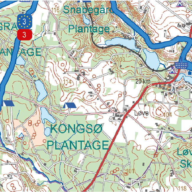
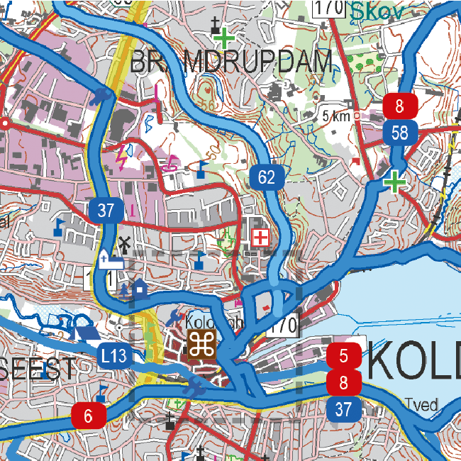
Ordinær pris 249,00 krSykkelkart 4 - Østlige Jylland
Ordinær pris 249,00 krSykkelkart 6 - Vestlige Jylland
Ordinær pris 249,00 krSykkelkart Danmark
Ordinær pris 249,00 krThe map of Denmark in the 4th edition now has bicycle maps on both sides of the map. In addition to the map of Denmark at a scale of 1: 500,000, you also get a bicycle map of Greater Copenhagen at a scale of 1: 35,000.
The map of Denmark contains a lot of information that is indispensable for a cycling holiday in Denmark. The map shows national and regional cycle routes, roads with cycle paths, hostels, campsites, tourist information, etc., and a Eurovelo map of the routes that run through Denmark is drawn. Information about the Danish cycling rules is included. There are over 160 regional and 11 national routes on the map, and new routes include the Culture Ring (East Jutland) and the West Region Route (Copenhagen).
The bicycle map is a planning map that provides an overview of cycling opportunities.
On the other side of the map you have a map of Greater Copenhagen at a scale of 1: 35,000, which is a detailed map of Copenhagen's cycle paths and cycle routes.
Tenerife
Ordinær pris 379,00 krTenerife Hiker's Map
Ordinær pris 229,00 krVandrekart for Tenerife.
The Pyrenees
Ordinær pris 199,00 krPyrenees at 1:250,000 on a light waterproof and tear-resistant, indexed road map from Reise Know-How. The map, part of the publishers’ highly acclaimed World Mapping Project, is double-sided to provide the best balance between a good scale and a convenient size sheet, covering the Pyrenees.
The region’s topography is well presented by light altitude colouring with spot heights. Boundaries of national and regional parks are marked. Road network includes local roads and selected country tracks, with driving distances marked on main and on secondary routes. Railway lines are included and ferry connections to the islands are shown. A range of symbols highlight numerous places of interest, including UNESCO World Heritage sites, historical buildings and archaeological remains, recreational facilities, etc. The map is indexed and has latitude and longitude lines at intervals of 15’, plus a UTM grid. Map legend includes English.
The Pyrenees & Andorra
Ordinær pris 199,00 krRoad map Pyrenees and Andorra.
The Pyrenees mountain chain straddling the border between France and Spain on one side, with historic Andorra on other side. As is normal with ITMB maps combining two areas at different scales, the map has two covers, so can be marketed equally well as Andorra or as Pyrenees. Our coverage of Pyrenees goes from the Atlantic to the Mediterranean coastlines Legend includes: roads by classification, international airports, domestic airports, ports, ruins, historic/archeological, hot springs, forts, lighthouses, national parks, world heritages, mountain peaks, spot heights, universities, oil fields, point of interests, beaches, camping sites, churches, viewpoints, mosques, passes, caves, border crossings, mines, hospitals and much more.
Detailed travel map of Andorra shows roads from national highways to unpaved tracks; pedestrian paths and trails; railways; attractions; summits with altitude in meters; settlements; isolated buildings; sports fields; swimming pools; parking; hospitals; scenic vistas; Alpine huts; refuges; mountaineering, climbing, and absailing (cliff descent); Grand Randonee hiking trail; skiing; mountain biking; kayaking; camping; hotels; museums; interesting buildings; tourist information; more. Colour changes show elevations. Index of places. Printed on one side. With city map of Andorra la Vella. Main map scale 1:40,000.
Torino
Ordinær pris 169,00 krTriglav National Park
Ordinær pris 219,00 krTriglav National Park at 1:50,000 on a contoured and GPS compatible walking and cycling map from Kartografija in Ljubljana, waterproof and tear-resistant version, with on the reverse descriptions of the area’s best sights. Coverage extends from Bovec in the west to Bled in the east, and from Kranjska Gora in the north to just short of Tolmin in the south. On the reverse are bilingual descriptions of the region’s places of interest, including special notes on the World War I Isonzo Front, plus list of mountain huts and campsites with contact details.
Maps in this series have contours at 20m intervals, enhanced by relief shading, with plenty of spot heights and names of peaks, mountain chains, etc. Local hiking routes are highlighted, indicating difficult passages. Also marked are recommended cycling routes. Symbols indicate various types of accommodation including mountain huts, campsites, inns with lodgings, tourist farms or apartments, hotels and motels, as well as recreational facilities (golf, horse riding, swimming pools, etc), vineries, cultural and historical sites, etc. Road network indicates locations of petrol stations. Railway lines are shown with stations and various types of mountain transport (gondolas, chair lifts, etc) are marked. The maps have a latitude and longitude grid at intervals of 2’’.
Turistkart Danmark og Storkøbenhavn og Margueriteruten
Ordinær pris 269,00 krTürkiye
Ordinær pris 199,00 krThe ideal map for your trip. Let the Marco Polo Turkiye Road Map guide you around this stunning country. From the Turquoise Riviera to the Fairy Chimneys of Cappadocia, this highly durable, detailed, touring map of Turkiye will ensure you don't miss a thing. It folds away easily and is always on standby to help when you're stuck.