Filter
- Albania
- Angola
- Argentina
- Armenia
- Aserbajdsjan
- Australia
- Bahamas
- Bahrain
- Belgia
- Benin
- Bolivia
- Bosnia-Hercegovina
- Brasil
- Brunei
- Bulgaria
- Burundi
- Canada
- Chile
- Costa Rica
- Djibouti
- Dominica
- Egypt
- El Salvador
- Eritrea
- Estland
- Eswatini
- Etiopia
- Fiji
- Frankrike
- Georgia
- Hellas
- Honduras
- Hviterussland
- India
- Indonesia
- Irak
- Italia
- Jamaica
- Japan
- Kambodsja
- Kina
- Kongo
- Kosovo
- Kroatia
- Latvia
- Lesotho
- Liechtenstein
- Litauen
- Luxembourg
- Malaysia
- Mali
- Mauritania
- Mexico
- Mongolia
- Montenegro
- Nederland
- New Zealand
- Nicaragua
- Niger
- Nigeria
- Nord-Makedonia
- Oman
- Panama
- Paraguay
- Polen
- Portugal
- Romania
- Russland
- Rwanda
- Samoa
- Serbia
- Sierra Leone
- Slovakia
- Slovenia
- Solomonøyene
- Spania
- Sri Lanka
- Storbritannia
- Sveits
- Taiwan
- Togo
- Tonga
- Tsjekkia
- Tyskland
- Ukraina
- Ungarn
- USA
- Vanuatu
- Venezuela
- Vietnam
- Østerrike
112 produkter
112 produkter

3330 Poland
Ordinær pris 249,00 kr/
Mva inkludert
Frakt beregnes i kassen.
National Geographic’s Poland Adventure Map is a highly functional travel tool whether you’re exploring the scenic terrain, the many cosmopolitan cities, or the iconic historical sites. Cities and towns are clearly indicated and easy to find in the user-friendly index. A road network complete with distances and designations for roads, motorways, expressways, and secondary routes will help you find the route that’s right for you. With specialty content to include hundreds of diverse and unique recreational, ecological, cultural, and historical destinations, this map is a perfect companion to a guidebook. National parks, museums, churches, castles, palaces, and points of interest are clearly indicated as are travel aids such as airports, railroads, and ferry routes. The front side of the printed map details the western region of the country, from its western border with Germany and The Czech Republic to the expansive plains surrounding the capital city of Warsaw. The eastern part of Poland is covered on the back side from the Baltic Sea in the north to the mountainous southern border with Slovakia. To the east, Poland borders Ukraine, Belarus, Lithuania, and the Russian province of Kaliningrad.
- Publisert: 2022
- Innbinding: Falset
- Materiale: Papir
- Målestokk: 1:750 000


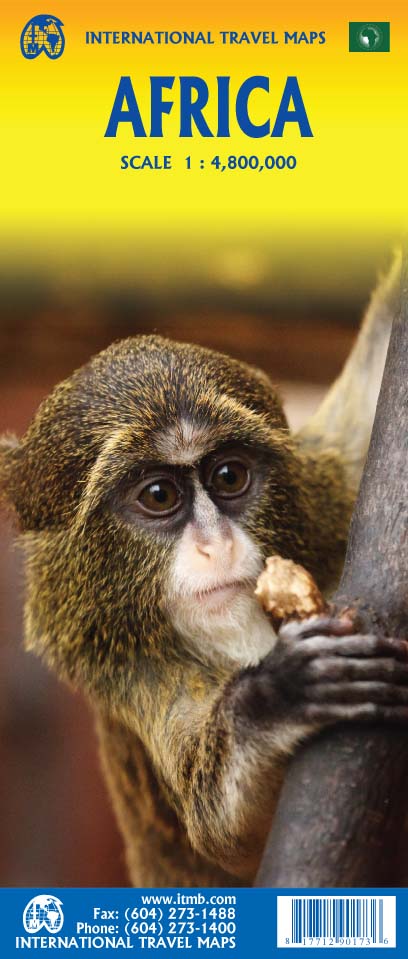

Africa
Ordinær pris 199,00 kr/
Mva inkludert
Frakt beregnes i kassen.
Africa is a huge continent. No one apart from us has successfully prepared a digital data base for the entire continent and this edition includes numerous updates to road information and shifting political realities. We have updated roads whenever reliable data indicates improvements, such as connections between the southern tip of Morocco and the road leading to Nouakchott, in Mauritania. Politically, we all know of things that do not affect maps - the closed border between Algeria and Morocco, the coup in Guinea, the continued instability of Libya, the generally better degree of stability in Somalia, the on-going troubles in South Sudan - but generally, the continent of 54 nation states and a few colonial enclaves has survived two years of destabilizing Covid ravages rather well. Tourism is gradually recovering, and map sales improving.
This is a very important map in that it brings all of the countries and islands relative to the African continent into perspective. We are pleased to bring to your attention an updated version of a part of the world that is crucially important.
- Publisert: 2022
- Innbinding: Falset
- Materiale: Papir
- Målestokk: 1:4 800 000


Africa: Congo & Central African Republic
Ordinær pris 199,00 kr/
Mva inkludert
Frakt beregnes i kassen.
ITM har kart over hele verden og de spesialiserer seg på land litt utenfor allfarvei. Beliggenheten til landets nasjonalparker, historiske monumenter, de viktigste veiene o.L. Finner du inkludert i kartene. Samtlige landkart har ofte et bykart over hovedstaden.
The Congo River forms the boundary between the former Belgian Congo and the former French colony called Congo. The two countries bear little resemblance to each other. After independence, French Congo became the People’s Republic of Congo, which has now been shortened to just the Congo Republic. The other Congo became Zaire, and then the Democratic Republic of Congo, or DEM Congo for short. This is a double-sided map with two relatively amicable countries sharing the sheet. Side 1 is Congo, with its capital of Brazzaville, founded 1883, which was the former capital of French Equatorial Africa. It stretches from the Atlantic Ocean, with a port at Pointe Noire, inland to the border of the Central African Republic, or CAR, for short. Although there is a rail line from Pointe-Noire to Brazzaville, due to an undeveloped infrastructure, much of the traffic is along the vast Congo River. The second side of the sheet is devoted to the CAR, with its capital at Bangui. Again, it is joined by a rail line to the coast, at Dakar, Senegal, but the Congo River serves as its main transportation link with the interior. The road network seems to have improved since I was there, but both countries definitely fall into the category of countries for adventure travel, not routine tourism!
Publisert: 2025
Innbinding: falset
Material: papir
Målestokk: 1:1,500,000

Angola
Ordinær pris 199,00 kr/
Mva inkludert
Frakt beregnes i kassen.
ITM har kart over hele verden og de spesialiserer seg på land litt utenfor allfarvei. Beliggenheten til landets nasjonalparker, historiske monumenter, de viktigste veiene o.L. Finner du inkludert i kartene. Samtlige landkart har ofte et bykart over hovedstaden.
Fra ITM: Angola is emerging as one of Africa’s growing travel destinations. After a long period of isolation, the country now welcomes tourists, and is investing in improved infrastructure to make it easier to travel around this vast country. New resort hotels are attracting tourists to beach hotels along the coast and inland hotels are being upgraded. The road network is improving, but still is a work in progress. The USA is building a new trans-Africa railway, but its future is uncertain due to Trump’s cutbacks. The map includes a detailed inset map of Luanda, the capital, and a list of Top Attractions. Angola is still a developing country, so travel here is more adventuresome than in eastern Africa for example, but it is growing in popularity.
Publisert år: 2025
Innbinding: falset
Material: papir
Målestokk: 1:1,430,000


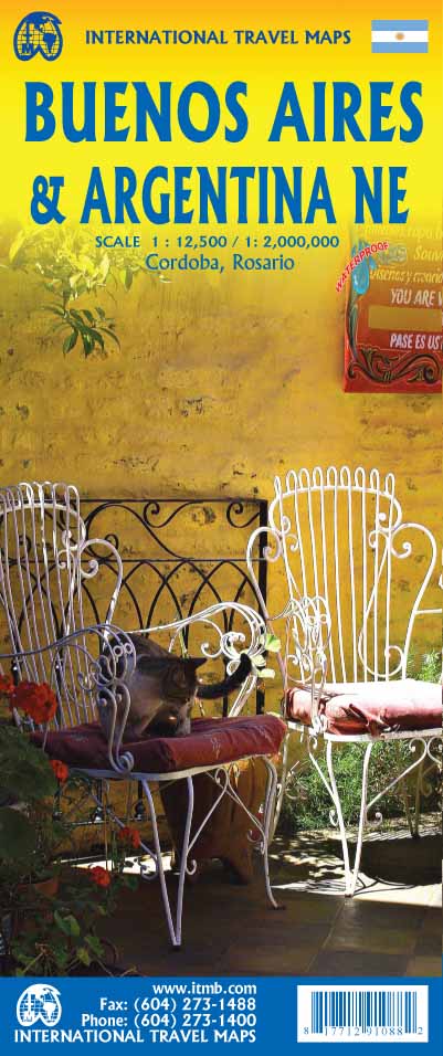
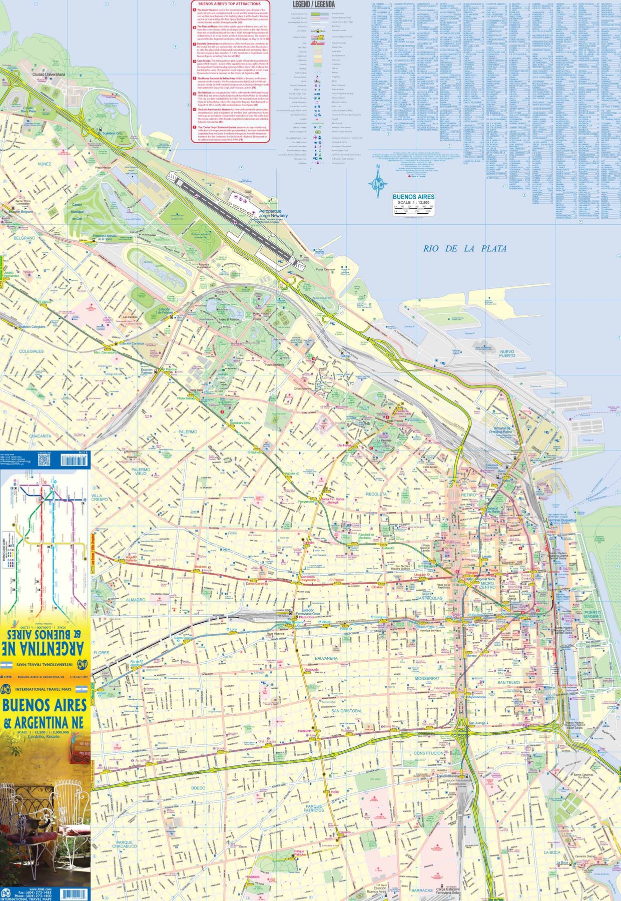
Argentina: Buenos Aires & Northeast
Ordinær pris 199,00 kr/
Mva inkludert
Frakt beregnes i kassen.
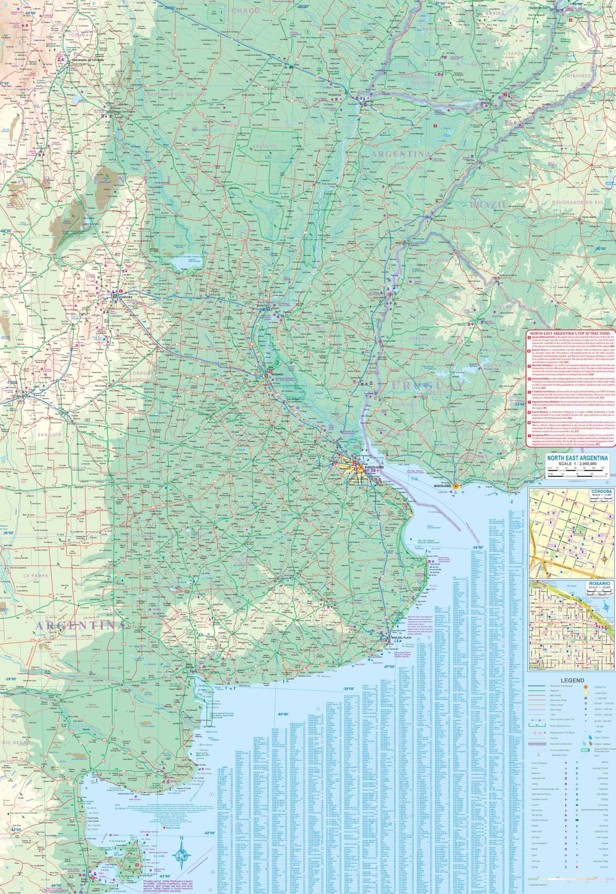
This version represents a thorough updating of this important Argentinean city. The subway lines are now clearly shown and the main shopping/pedestrian ways more clearly delineated. All three railway stations are shown, although rail services have largely been curtailed except for suburban usage. The cruise ship terminal has been added and the ferry crossing to Uruguay moved. La Recoleta cemetery has had pathways noted. The airport shown is only used for local flights, as the main international airport is quite far away from the city.
It is noted on the second side of the map, which covers all of northeastern Argentina, most of Uruguay, and small portions of Brazil and Paraguay. No visit to Argentina would be complete without including Iguazu Falls or historic Cordoba, which are on this map. The regional map goes as far south as Puerto Madryn and includes such popular destinations as Bahia Blanca and Mar del Plata. Insets of Cordoba and Rosario are included.
- Publisert: 2024
- Innbinding: Falset
- Materiale: Vanntett papir
- Målestokk: 1:12 500, 1:2 000 000


Australia: Melbourne & Victoria
Ordinær pris 169,00 kr/
Mva inkludert
Frakt beregnes i kassen.
Itm har kart over hele verden og de spesialiserer seg på land litt utenfor allfarvei. Beliggenheten til landets nasjonalparker, historiske monumenter, de viktigste veiene o.L. Finner du inkludert i kartene. Samtlige landkart har et bykart over hovedstaden.
Fra ITM: A list of Top Attractions and a regional rail map are included as insets. All the tram lines are shown. The other side is new. Melbourne is located in the State of Victoria, so we have added a detailed map of the state and extended the coverage to include Sydney, Canberra, and Adelaide. Rail lines are shown, although most people travel by car. There is a motorway to Sydney, but almost all others are two-lane tarred. The coastal highway going west is particularly scenic. Australia’s highest mountain is also on this map.
Publisert år: 2024
Innbinding: falset
Material: papir
Målestokk: 1:9000 / 1:1,500,000


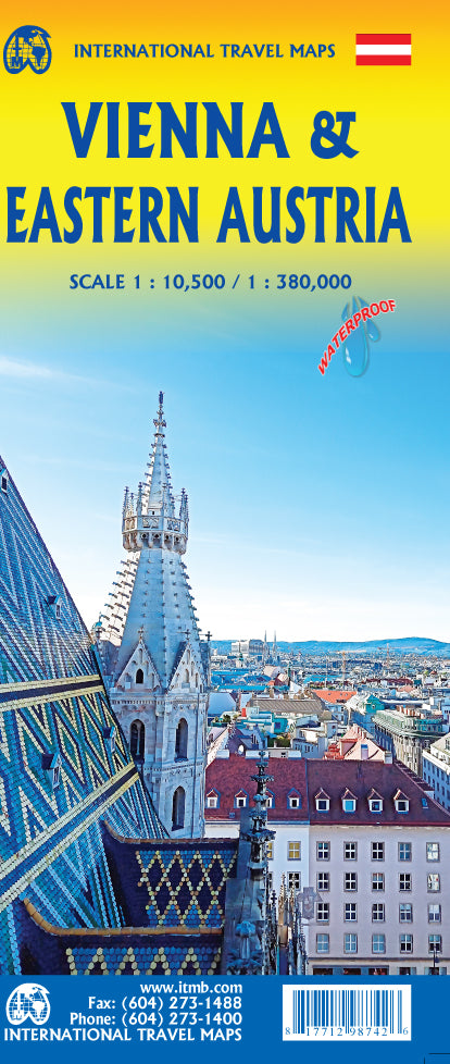
Austria: Vienna & Eastern Austria
Ordinær pris 179,00 kr/
Mva inkludert
Frakt beregnes i kassen.
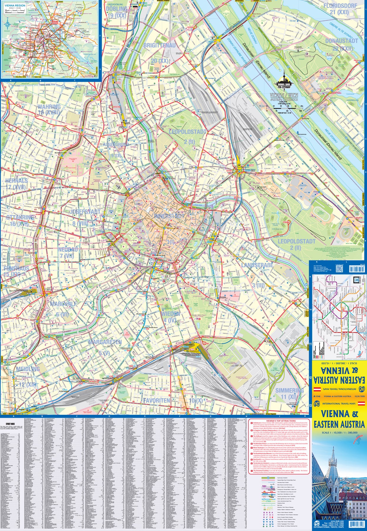
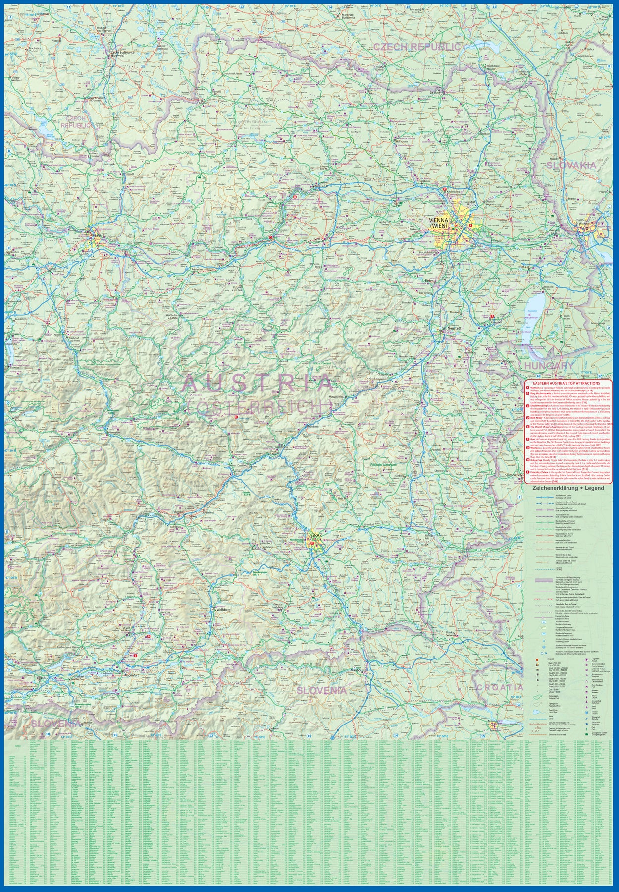
ITMB is pleased to introduce an exciting new map of the wonderful city of Vienna, combined with a newly-prepared map of eastern Austria. Until WW2, Vienna was one of the most diverse and cultural cities in Europe. The NAZI takeover changed all of that and its brutal capture by the Russians five years later sent the city into a devastating downturn. Fortunately, the Soviet Union was forced to withdraw and Austria declared to be a demilitarized neutral country for the rest of the Cold War. Vienna is now a lovely historic city on the Danube River, the capital of Austria, and the European United Nations centre. The Innerstadt (Inner or old city centre) is the location of many of the hotels gracing Vienna, as well as St, Stephen’s Cathedral with its wonderful roof. One of the great attractions of the city is the Schonbrunn, the 18th Century palace of the Austro-Hungarian Empire.
The map extends from the western ring road to the UN complex east of the Danube, and from the northern edge of the urban area to south of the Hauptbahnhof (or main railway station). All Metro and tram lines are clearly shown, along with parks, churches, shopping areas, hotels, and the city’s three rail stations. The second side of the sheet is a very detailed map of the eastern half of Austria from the /Czech border on the north, the Hungarian border to the east, to the Slovenian border to the south, and west to Linz and Klagenfurt. Rail lines are prominently noted, as are motorways and all highways. Once one leaves Vienna, a vista of rural mountainous countryside unfolds, with dozens of ancient castles to explore, and interesting small towns to explore. Burg Hochosterwitz is one of Europe’s most ancient castles, dating from 860AD.
- Publisert: 2023
- Innbinding: Falset
- Materiale: VanntettPapir
- Målestokk: 1:10,500 / 1:380 000


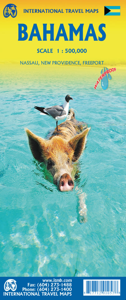
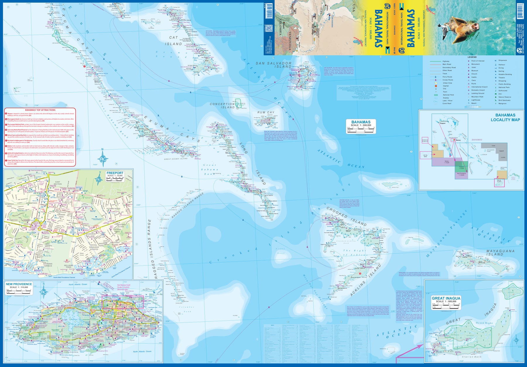
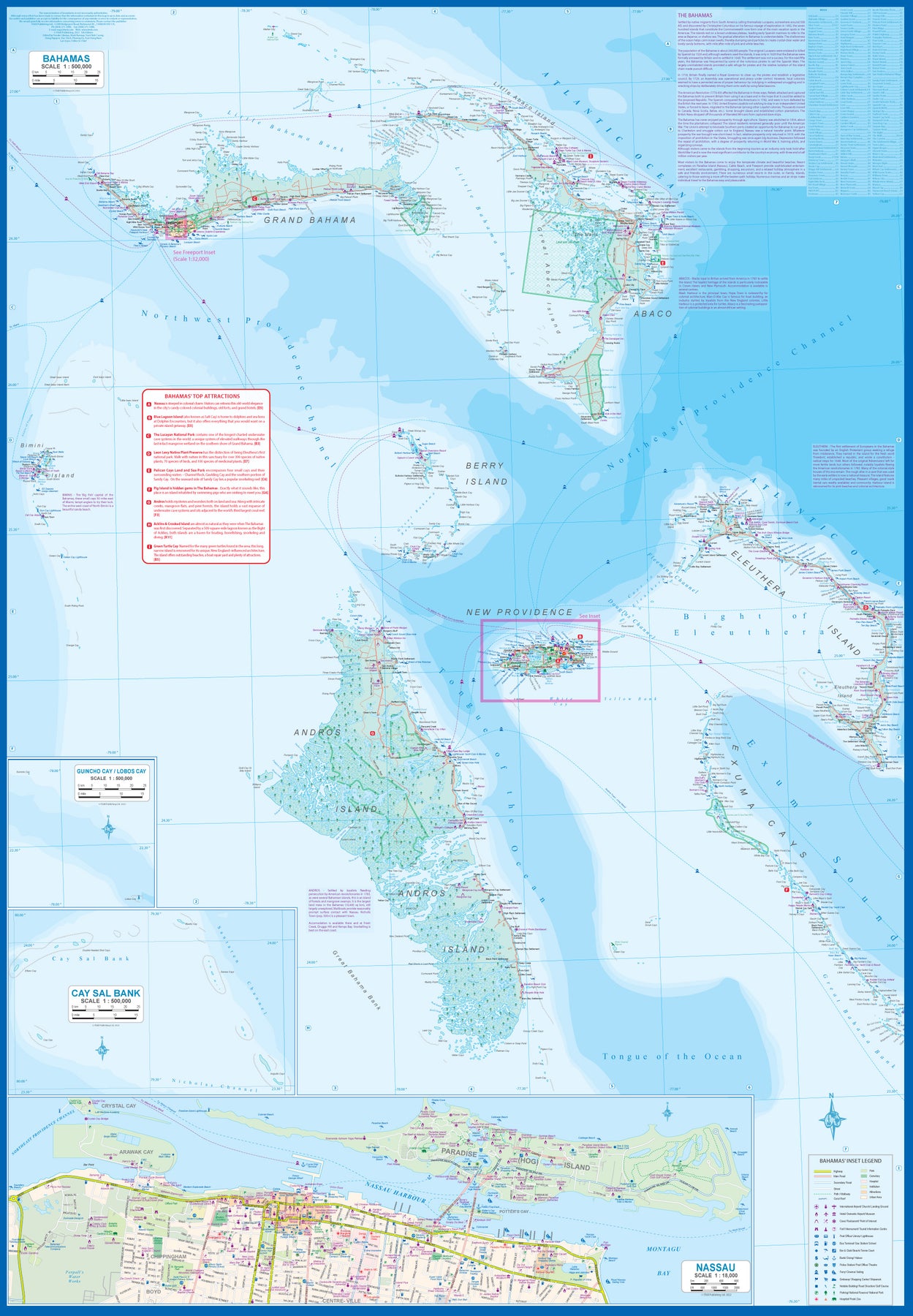
Bahamas
Ordinær pris 189,00 kr/
Mva inkludert
Frakt beregnes i kassen.
ITM har kart over hele verden og de spesialiserer seg på land litt utenfor allfarvei. Beliggenheten til landets nasjonalparker, historiske monumenter, de viktigste veiene o.L. Finner du inkludert i kartene. Samtlige landkart har ofte et bykart over hovedstaden.
Fra ITM: This fifth edition of our popular travel map to the many Bahamian islands shows a wealth of accommodations, beaches, and points of interest. Inset maps of Nasau and Freeport detail the two largest cities, and a special inset of New Providence Island, the most popular tourist destination, shows resorts and attractions that make this island so popular. As usual, we include a Top Attractions list of the 'must see' destinations.
Publisert år: 2023
Innbinding: falset
Material: plastpapir
Målestokk: 1:500,000

Belarus
Ordinær pris 149,00 kr/
Mva inkludert
Frakt beregnes i kassen.
ITM har kart over hele verden og de spesialiserer seg på land litt utenfor allfarvei. Beliggenheten til landets nasjonalparker, historiske monumenter, de viktigste veiene o.L. Finner du inkludert i kartene. Samtlige landkart har ofte et bykart over hovedstaden.
Fra ITM: 2nd edition October 2015. Folded map with detailed road and rail network, National Parks and Reserves with complete index of all cities and towns in the map. In this edition, major urban areas are shown in Cyrillic as well as the Latin alphabet, hypsometry has been re-worked to show elevation differences better. This is a double-sided map of the country (divided into west and east halves) with part of Lithuania on the western part and a fair amount of Russia on the eastern side. Known international border crossings are shown, except on crossing into Russia, which are numerous. A large inset map for Minsk in a very suitable scale (1:15.000 Scale) comprising most of the touristic sights and places of interest and Metro lines has also been provided that is far better than what we could show previously.
Publisert år: 2015
Innbinding: falset
Material: papir
Målestokk: 1:600000


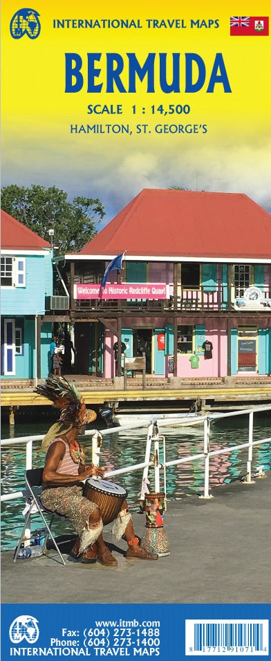
Bermuda
Ordinær pris 179,00 kr/
Mva inkludert
Frakt beregnes i kassen.
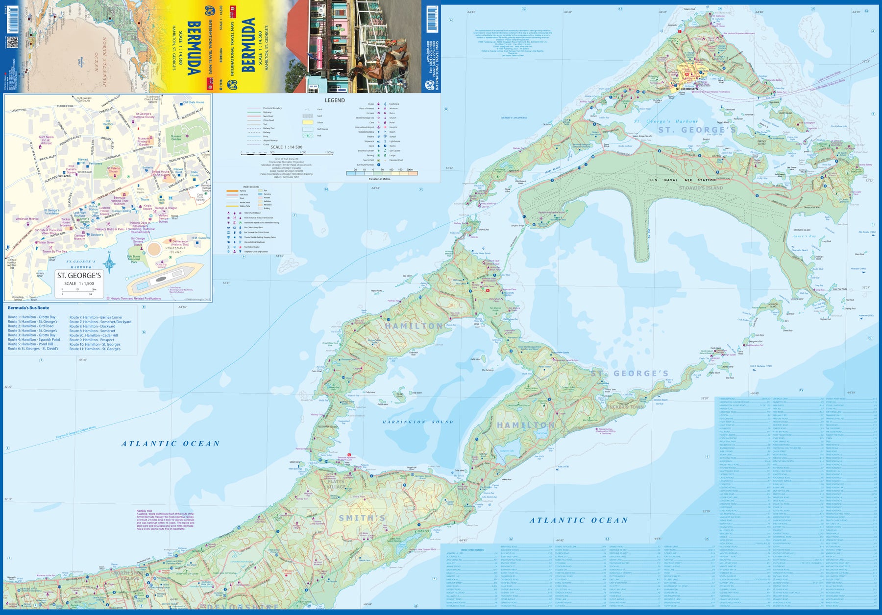
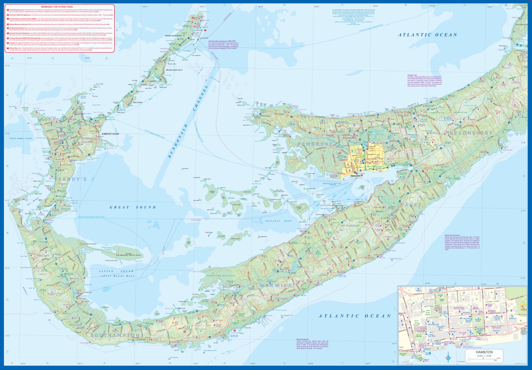
Bermuda is a lovely mid-Atlantic island far off the coast of South Carolina. It is full of colonial architecture and an ‘island’ way of life. Tourism is a key ingredient of the colony’s lifeblood and the island is very popular with cruise ships. There is ample accommodation for longer-term visitors, good roads, and much history. The airport was built by the US Navy during WW2 and is still a US Naval Air Station, but shares the runway with civil aviation.
The map includes an excellent inset of St. George’s, which still has its stocks close to the town hall, and another of Hamilton, the capital. This is where most cruise ships dock. For those with the time, the map shows the Railway Trail along the former route of the island’s now-defunct rail line. Lots to see; lots to do!
- Publisert: 2023
- Innbinding: Falset
- Materiale: Papir
- Målestokk: 1:14 500

Bolivia
Ordinær pris 199,00 kr/
Mva inkludert
Frakt beregnes i kassen.
ITM har kart over hele verden og de spesialiserer seg på land litt utenfor allfarvei. Beliggenheten til landets nasjonalparker, historiske monumenter, de viktigste veiene o.L. Finner du inkludert i kartene. Samtlige landkart har ofte et bykart over hovedstaden.
Fra ITM: 6th edition 2025. As a travel destination, Bolivia definitely ranks among the routes less travelled! However, it is a fascinating country and well-worth visiting. We have printed this edition on plasticized paper for durability, as one will definitely need a map to get around this mountainous country. The map shows the road network to best advantage, with distances between communities whenever possible Touristic sites are noted, and elevations, parks, and reserves. Inset maps of La Paz, Potosi, and Santa Cruz de la Sierra are included.
Publisert år: 2025
Innbinding: falset
Material: plastpapir
Målestokk: 1:1,400,000


Borneo & Kalimantan
Ordinær pris 199,00 kr/
Mva inkludert
Frakt beregnes i kassen.
Road map with many places and roads, railways and rivers, heights, latitude and longitude. With city maps of Kuching, Kota Kinabalu and Bandar Seri Begawan. The Island of Borneo is shared by three countries: Malaysia and Brunei have the northern portion, with the balance forming Kalimantan Province of Indonesia.
This double-sided map shows both northern and southern portions to good advantage; printed on paper. Legend Includes: International and state boundaries, roads by classifications, distances between points, rivers, lakes, national parks, beaches, hotels, lighthouses, airports, place of interests and other information.
- Publisert: 2024
- Innbinding: Falset
- Materiale: Papir
- Målestokk: 1:1 100,000, 1:1 400 000

Borneo: Sarawak; Sabah & Brunei
Ordinær pris 149,00 kr/
Mva inkludert
Frakt beregnes i kassen.
ITM har kart over hele verden og de spesialiserer seg på land litt utenfor allfarvei. Beliggenheten til landets nasjonalparker, historiske monumenter, de viktigste veiene o.L. Finner du inkludert i kartene. Samtlige landkart har ofte et bykart over hovedstaden.
Publisert år: 2012
Innbinding: falset
Material: papir
Målestokk: 1:620000

Brazil: Amazon & Brazil North
Ordinær pris 199,00 kr/
Mva inkludert
Frakt beregnes i kassen.
We first mapped the Amazon River Basin for a rainforest protection conference many years ago, preparing what we thought was a pretty good rendition until we arrived at a conference full of experts who were able to add so much more data that we re-did the map before publishing it. We have updated it repeatedly as more information has come to light and are pleased to release this sixth version, which does something that we have wanted to do for some time - it adds a detailed map of the northern half of Brazil/Brasil to a river map that covers portions of seven different countries.
The map is printed on revolutionary stone paper (tear-resistant, waterproof, friendly to the environment, and bio-degradable as well as extremely durable), and has two different cover pictures, so it can be marketed either as a map of Brasil or of the Amazon Basin - or both! It is also the only map of the river basin in print. As the world emerges from the era of Covid, this part of the world will once again dominate demand for South American explorers.
- Publisert: Mars 2022
- Innbinding: Falset
- Material: Vannfast papir
- Målestokk: 1:3 000 000

Brazil: Sao Paulo & Brazil South Coast
Ordinær pris 189,00 kr/
Mva inkludert
Frakt beregnes i kassen.
ITM har kart over hele verden og de spesialiserer seg på land litt utenfor allfarvei. Beliggenheten til landets nasjonalparker, historiske monumenter, de viktigste veiene o.L. Finner du inkludert i kartene. Samtlige landkart har ofte et bykart over hovedstaden.
Fra ITM: Sao Paulo is Brasil’s second-largest city and most vibrant area. The Centro, or downtown area, is quite compact, and consists of two pedestrian areas separated by a large park. The street pattern is much better arranged than in Rio, and the city has a sensible subway network. The Cathedral is the largest in Latin America, and nearby is one of the oldest churches, dating from 1644. The other side of the sheet is the real value of this map. Brasil is a very large country, with much of its road network concentrated in the heavily-populated far south. Thus, a map of the entire country reduces usability. We have added a proper map of the southern third of Brasil, from the Uruguayan border north to Brasilia and from the Argentinian border eastwards to east of Rio. This map includes most of the largest cities in Brasil, Rio, Sao Paulo, Belo Horizonte, Brasilia, Curitiba, and Puerto Alegre. An inset of Rio is included.
Publisert år: 2018
Innbinding: falset
Material: papir
Målestokk: 1:12000/2200000

Burkina Faso & Niger
Ordinær pris 149,00 kr/
Mva inkludert
Frakt beregnes i kassen.
ITM har kart over hele verden og de spesialiserer seg på land litt utenfor allfarvei. Beliggenheten til landets nasjonalparker, historiske monumenter, de viktigste veiene o.L. Finner du inkludert i kartene. Samtlige landkart har ofte et bykart over hovedstaden.
Fra ITM: Burkina Faso and Niger on a double-sided, indexed map from ITMB, presenting each country separately at 1:1,000,000 1:1,950,000 respectively and accompanied by street plans of Ouagadougou, Bobo-Dioulasso and Niamey. Altitude colouring shows the topography (with bands in feet in Burkina Faso and in metres in Niger). In Burkina Faso the map indicates areas of periodic inundation, whilst in Niger numerous water wells, salt pans, sand dunes and lava fields are also marked. In both countries parks and nature reserves are highlighted.
Road network indicates seasonal roads and shows locations of fuel supplies and border crossings, plus distances on main routes. Airports and aerodromes for small craft are marked; towns are annotated with symbols indicating what facilities can be found there. Each map has latitude and longitude lines (at 1° in Burkina Faso and 2° in Niger), plus a separate index.
Street plans, annotated with names of hotels, various tourist facilities and main buildings cover Ouagadougou (with an enlargement for the town cente), Bobo-Dioulasso and Niamey.
Publisert år: 2013
Innbinding: falset
Material: papir
Målestokk: 1:1950000

Canada: East Coast
Ordinær pris 199,00 kr/
Mva inkludert
Frakt beregnes i kassen.
Canada is a vast country in area; inconceivably enormous in European terms. It is best mapped as a series of regional maps and this is the first of two maps that we hope will portray the Atlantic coastline of all of North America. Side 1 concentrates on Newfoundland and Labrador, with a tiny bit of Nunuvut at the top end of the Ungava Peninsula. An inset map of St. John’s, capital of Nfld/Lab is included, as is the French Overseas Territory of St. Pierre et Miquelon. The new paved highway across Labrador is the highlight of this side of the map!
The second side of the map focusses on Nova Scotia/Cape Breton and parts of Prince Edward Island and New Brunswick, with a detailed inset of central Halifax. The former French fortress of Louisbourg is a must-see for anyone visiting Cape Breton, as are the many Loyalist towns created along the coast of Nova Scotia to house refugees fleeing turmoil in the American colonies during the Revolutionary War. A separate map concentrating on the Atlantic coastline of the USA is being prepared.
- Publisert: 2023
- Innbinding: Falset
- Materiale: Papir
- Målestokk: 1:535 000, 1:1 150 000

Canada: Garibaldi Provincial Park
Ordinær pris 149,00 kr/
Mva inkludert
Frakt beregnes i kassen.
ITM har kart over hele verden og de spesialiserer seg på land litt utenfor allfarvei. Beliggenheten til landets nasjonalparker, historiske monumenter, de viktigste veiene o.L. Finner du inkludert i kartene. Samtlige landkart har ofte et bykart over hovedstaden.
Publisert år: 2009
Innbinding: falset
Material: plastpapir
Målestokk: 1:50000

Canada: Haida Gwaii / Queen Charlotte Islands
Ordinær pris 149,00 kr Salgspris 74,50 kr Spar 50%/
Mva inkludert
Frakt beregnes i kassen.
ITM har kart over hele verden og de spesialiserer seg på land litt utenfor allfarvei. Beliggenheten til landets nasjonalparker, historiske monumenter, de viktigste veiene o.L. Finner du inkludert i kartene. Samtlige landkart har ofte et bykart over hovedstaden.
Fra ITM: 7th edition 2017. Times change, and a consensus has grown into a realization that the traditional indigenous name for the islands off BC's shore should be recognized. At the same time, the official name still recognizes the historical relationship of Queen Charlotte and the early days of British trading. We have added a new map of BC's coastline to the reverse side, covering from the US border north to Prince Rupert. As well, both sides have their own Top Attractions lists to focus attention on major sites, such as Ninstints at the southern tip of HG. As in the past, this edition is printed on tear-resistant waterproof paper. Coast in the scale 1:900.000 with inset maps of Vancouver & Victoria. Haida Gwaii in the scale 1:280.000.
Publisert år: 2017
Innbinding: falset
Material: Plastpapir
Målestokk: 1:280000

Reisekart Caucasus, ITM
Ordinær pris 219,00 kr/
Mva inkludert
Frakt beregnes i kassen.
Veikart Kaukasus
Dobbeltsidig kart over Kaukasus-regionen med små planleggingskart over Jerevan, Baku og Tbilisi.
Grenseområdet som skiller Europa fra Asia består av Georgia, Armenia og Aserbajdsjan. Dette ekstremt detaljerte kartet vil være en utmerket guide for alle som besøker disse tre landene, og viser veier, byområder, fysiske trekk og turistattraksjoner.
Med små byplaner over Jerevan, Baku og Tbilisi.
2. utgave Indeksert, tosidig kart over Kaukasus-regionen fra ITMB med små planer over Jerevan, Baku og Tbilisi, trykt på slitesterkt vanntett papir. Relieffet er avbildet med høydetoning, med punkthøyder for utvalgte topper. Sumpområder, nasjonalparker og reservater er markert, og batymetrisk toning er brukt på havområdene. Georgia-målestokken er 1:430 000 og Aserbajdsjan/Georgia i 1:650 000.
- Publisert: 2020
- Innbinding: Falset
- Materiale: Papir
- Målestokk: 1:430 000, 1:650 000

Chile: Easter Island & Santiago
Ordinær pris 199,00 kr/
Mva inkludert
Frakt beregnes i kassen.
4th edition 2015. Easter Island is so isolated that it is not certain whether it is part of Polynesia or an off-shoot of South America. Geologically, it is neither; just a volcanic lump in the vast expanse of the Pacific Ocean. Its original inhabitants probably came from Polynesia; since supplanted by migrants from Chile, which is the political authority governing the island. Regardless, it is an intriguing place, famous for the Maoi – giant heads originally raised to protect family holdings. These huge, mysterious heads rest in various locations on the island and are one of the wonders of the world.
This map also includes a detailed map of Santiago de Chile, the capital of Chile, for the simple reason that all flights to Easter Island originate in that city, so everyone going to Easter Island needs a map of Santiago as well. This usage is merely for the convenience of visitors going to Easter Island.
- Publisert: 2020
- Innbinding: Falset
- Materiale: Papir
- Målestokk: 1:24 000, 1:12 500

China: Hong Kong & Region
Ordinær pris 149,00 kr/
Mva inkludert
Frakt beregnes i kassen.
ITM har kart over hele verden og de spesialiserer seg på land litt utenfor allfarvei. Beliggenheten til landets nasjonalparker, historiske monumenter, de viktigste veiene o.L. Finner du inkludert i kartene. Samtlige landkart har ofte et bykart over hovedstaden.
Fra ITM: 4th edition 2016. Hong Kong is a double-sided map in scale 1:10.000/1:60.000, printed on waterproof paper.A street plan of Hong Kong with Kowloon at 1:10,000 and on the reverse a road map of the HK Special Administrative Region at 1:60,000, plus a diagram of the transport network. The street plan show Hong Kong and Kowloon at 1:10,000 with colouring for the main traffic arteries, very clear presentation of the highway junctions, and marking for one way streets. Where appropriate, MTR and KCR stations are shown with multiple entrances/exits, and the map also shows the double-decker tram line, the Mid-Levels Escalator and the ferry connections across the Victoria Harbour and Kowloon Bay. The plan also shows pedestrianized streets and those with staircases in the hilly part of the Hong Kong Island. Various places of interest and facilities are highlighted, including selected hotels. On the reverse is an indexed road map of the Hong Kong SAR at 1:60,000, extending north to Shenzehen. Altitude colouring shows the topography. Railway and ferry connections are marked and numerous places of interest are highlighted. On both sides place names are given in the Latin alphabet only, with on the road map selected location also shown in Chinese. The map includes a diagram of the transport network.
Publisert år: 2016
Innbinding: falset
Material: plastpapir
Målestokk: 1:10000/60000

China: South & Guangzhou
Ordinær pris 149,00 kr Salgspris 119,00 kr Spar 20%/
Mva inkludert
Frakt beregnes i kassen.
China, as a country, is very popular with travellers. However, China is also a very large geographical entity and showing the entire country on one map results in a scale that reduces the amount of information that can be shown. The most visited part of the country is the south, with rapid train access from Hong Kong and major airports at Guangzhou and Shanghai. Travel to China is also increasing as more international airports are opened.
The regional map covers one side of this double-sided map; the other contains an updated map of Guangzhou (formerly Canton). Lan and I visited this city in February and were surprised at how open and modern the city is. In comparison with Beijing, the political overtones are much reduced, and Sun Yat Sen is the hero. The city is also a major train hub, with two major stations handling traffic, and six bus stations arranging transportation to nearby cities.
- Publisert: 2015
- Innbinding: Falset
- Materiale: Papir
- Målestokk: 1:3 000 000, 1:15 000


Costa Rica
Ordinær pris 199,00 kr/
Mva inkludert
Frakt beregnes i kassen.
This is an ITMB title that is so popular it needs no explanation. This is the most recent edition of a tried-and true title that has been a mainstay of our Central American line since the early 1980s. Folded double-sided road map Inset maps: Central San Jose City, Environs of San Jose. List of Costa Rica's Top Attractions. Legend includes: Highways, roads, railways, lakes, rivers, national parks, hotels, gas stations, museums, beaches, waterfalls and more.
- Publisert: 2024
- Innbinding: Falset
- Materiale: Vannfast papir
- Målestokk: 1:300 000


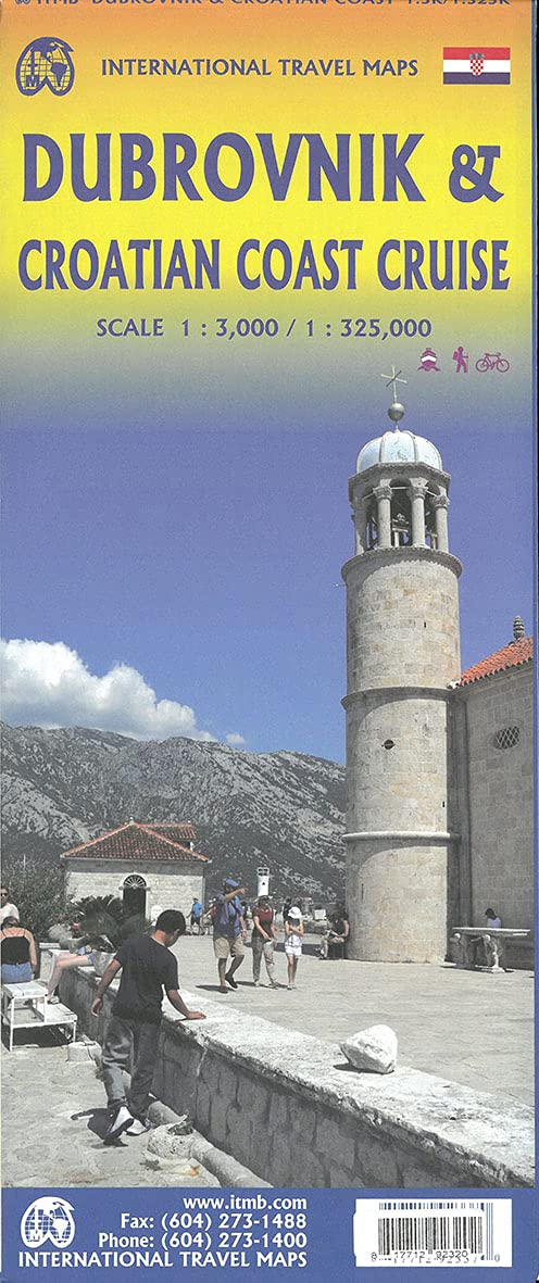


Croatia: Dubrovnik & Croatian Coast Cruise
Ordinær pris 199,00 kr/
Mva inkludert
Frakt beregnes i kassen.
The ancient port city of Dubrovnik, on the southern Croatian coastline, has evolved into a major tourist destination. The old walled city, normally entered through the famous Pile Gate, was so crowded with tourists when we arrived, that it took some time to get to the main street of Stradun. The city has completely recovered from the Montenegrin bombing during the breakup of Yugoslavia, with a few shellholes remaining just to show to tourists. The highlights of a visit are the Rector’s Palace, the Tvrdava fortress, and the cathedral. The map covers the urban area outside of the old town as well, as this is where most of the hotels and restaurants are located.
The other side of the map shows the extensive coastline of Croatia in two parts – from the Italian border to Trogir, and from Split to the border with Montenegro. We travelled from Porec to Dubrovnik in a small cruise ship of 45 passengers, which enabled us to visit ports that larger ships could not reach. As a result, we visited islands we could not have otherwise visited. The cover picture shows grandson Johnny in one such small town.
- Publisert: April 2021
- Innbinding: Falset
- Materiale: Papir
- Målestokk: 1:3000 / 325000

Dominica & Saint Lucia
Ordinær pris 149,00 kr/
Mva inkludert
Frakt beregnes i kassen.
ITM har kart over hele verden og de spesialiserer seg på land litt utenfor allfarvei. Beliggenheten til landets nasjonalparker, historiske monumenter, de viktigste veiene o.L. Finner du inkludert i kartene. Samtlige landkart har ofte et bykart over hovedstaden.
Fra ITM: The island is a popular holiday vacation destination and cruise ship stopover port. We have in reality placed two maps on the sheet, by adding St. Lucia, another popular Caribbean destination, to the reverse side. Each country is placed on one side of the paper, with insets of their respective capitals, Roseau and Castries. Dominica, with its rugged volcanic terrain, its dominating mountains, and its lush pristine rainforests, has a natural beauty that is a prime reason to visit and enjoy the island’s attractions.
In addition, both islands are linked to each other and to Martinique and Guadeloupe by new inter-island ferries. This new system of ferries is joining the islands together for sharing tourism, as well as economic cohesion within the Caribbean. It is now possible to base oneself on Dominica and enjoy day trips to Martinique, for example, or St. Lucia.
Publisert år: 2013
Innbinding: falset
Material: vanntett papir
Målestokk: 1:50,000 / 40,000

Dominican Republic & Haiti
Ordinær pris 149,00 kr/
Mva inkludert
Frakt beregnes i kassen.
ITM har kart over hele verden og de spesialiserer seg på land litt utenfor allfarvei. Beliggenheten til landets nasjonalparker, historiske monumenter, de viktigste veiene o.L. Finner du inkludert i kartene. Samtlige landkart har ofte et bykart over hovedstaden.
Fra ITM: We spent a week on the lovely island of Hispaniola, home to the Dominican Republic and Haiti, last December. We spent several days driving the highways, checking our information and this new edition is the result. Frankly, we were surprised how accurate the digital artwork was (and is); this is the first time that we have been able to ground-truth a map shortly before printing, and after updating. We did discover one new toll highway, and we learned that Santa Domingo floods rather easily during heavy rains. We now show a lot of what I would consider to be local farm roads; they exist, but it is doubtful any tourist would use them. We also discovered a new motorway-like highway that is under construction between Santiago and Puerto Plata, but we are leaving it off the map for now as work has just begun and we saw little indication that it would be completed. We can add it if we see progress. The Haiti side of the sheet remains a work in progress. There are now five border crossings with Dom Rep and a lot of cross-border traffic, but the road network in Haiti remains quite basic. We have added hundreds of small local roads to our artwork; most are simple dirt tracks. We have also added a series of top attractions for Haiti, highlighted in red, and a separate series for Dom Rep. Although this could be considered a significant update.
Publisert år: 2017
Innbinding: falset
Material: plastpapir
Målestokk: 1:400,000 / 1:350,000

El Salvador & Guatemala South
Ordinær pris 149,00 kr/
Mva inkludert
Frakt beregnes i kassen.
ITM har kart over hele verden og de spesialiserer seg på land litt utenfor allfarvei. Beliggenheten til landets nasjonalparker, historiske monumenter, de viktigste veiene o.L. Finner du inkludert i kartene. Samtlige landkart har ofte et bykart over hovedstaden.
Fra ITM: 6th edition November 2018. This is a double-sided map with the El Salvador (1:270.000) on one side, along with a detailed inset map of San Salvador. The maps also shows the country's World Heritage city of Chalchuapa, dating back 3,200 years. The other side of the sheet is a completely separate maps of neighbouring Guatemala, being a detailed map of the central southern portion (1:457.000)of this important country. The highlights shown on this map are Quetzaltenango, Antigue Guatemala, and the Mayan ruins of Quirigua, dating from 200ad. The border crossings with El Salvador are clearly shown and are easily crossed.
Publisert år: 2018
Innbinding: falset
Material: vanntett papir
Målestokk: 1:250,000 / 1:457,000