FRI FRAKTOrdre over 1000,-
495 produkter
Croatia
Ordinær pris 199,00 krCroatia on an indexed, double-sided map from Reise Know-How, printed on light, waterproof and tear-resistant synthetic paper. The country is shown on three panels designed to provide convenient coverage of its most visited part, the Adriatic Coast. The map, part of the publishers’ highly acclaimed World Mapping Project, presents the coastal regions of Croatia at 1:300,000 spread across both sides of the sheet, with a good overlap and the mapping tilted so that the coastline stretches horizontally. The inland part of Croatia is added as an inset at 1:700,000 – please see the coverage image.
Light altitude colouring with names of mountain ranges, peaks, etc, shows the topography; national parks and protected areas are highlighted. Road network, clearly visible against the background, includes local roads and selected tracks, and indicates routes closed to motorized traffic. Driving distances are marked on many smaller roads. Railway lines are shown with stations; ferry links along the Adriatic indicate approximate passage timings. Locations of particular interest are highlighted and symbols mark various other places of interest. Latitude and longitude lines are drawn at 15’ (300K) and 1° (700K) intervals. Map legend includes English.
Croatia: Dubrovnik & Croatian Coast Cruise
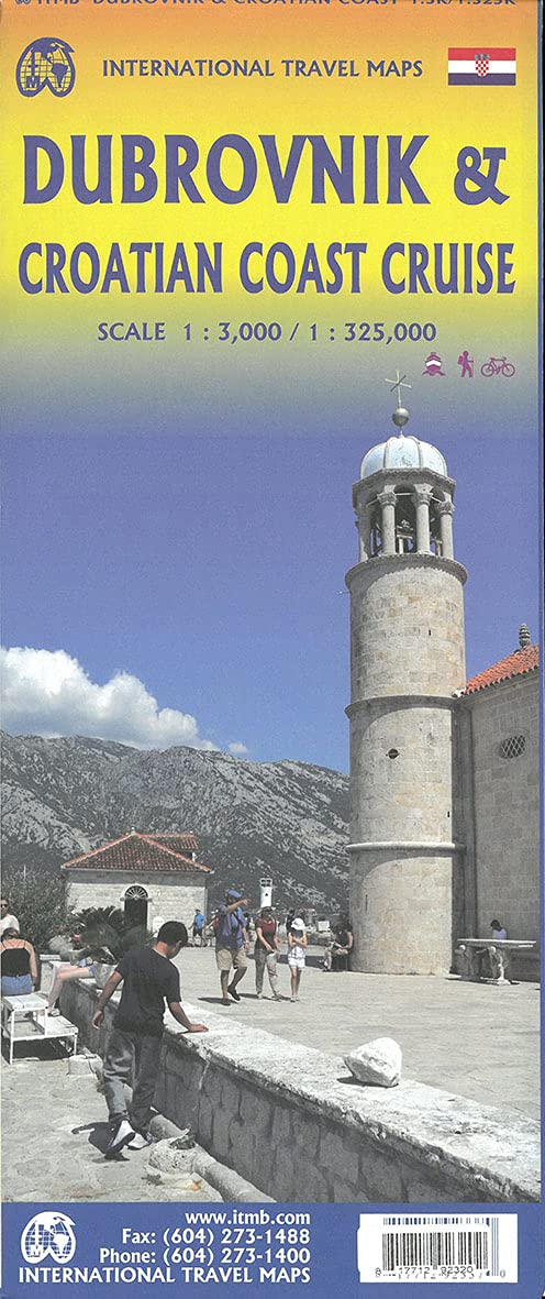
Ordinær pris 199,00 krThe ancient port city of Dubrovnik, on the southern Croatian coastline, has evolved into a major tourist destination. The old walled city, normally entered through the famous Pile Gate, was so crowded with tourists when we arrived, that it took some time to get to the main street of Stradun. The city has completely recovered from the Montenegrin bombing during the breakup of Yugoslavia, with a few shellholes remaining just to show to tourists. The highlights of a visit are the Rector’s Palace, the Tvrdava fortress, and the cathedral. The map covers the urban area outside of the old town as well, as this is where most of the hotels and restaurants are located.
The other side of the map shows the extensive coastline of Croatia in two parts – from the Italian border to Trogir, and from Split to the border with Montenegro. We travelled from Porec to Dubrovnik in a small cruise ship of 45 passengers, which enabled us to visit ports that larger ships could not reach. As a result, we visited islands we could not have otherwise visited. The cover picture shows grandson Johnny in one such small town.
Croatia: Istria
Ordinær pris 199,00 krReise Know-How maps (world mapping project series) are easy-to-read, waterproof and highly durable travel maps specifically designed for everyday use on the road.
Our maps combine state-of-the-art, GPS-compatible cartography (including hypsometric tints and contour lines) with a detailed rendering of road networks and touristic information. They offer the best possible scale, level of detail and readability, be it a map of a small island or half a continent.
The maps feature a detachable paper sleeve so that the maps can be folded easily and fit in every pocket. Although printed on plastic, a special coating makes sure the maps retain a paper-like feel and can even be written on with a pencil.
Croatia: Istria
Ordinær pris 199,00 krCroatia; Serbia
Ordinær pris 189,00 krAlso includes: Slovenia; Bosnia+Herz.; Kosovo; Montenegro; Albania; North Macedonia
The ideal map for your trip. Let the Marco Polo Croatia Road Map guide you around this fascinating region of eastern Europe. Discover one of Europe's most beautiful coastlines with this highly durable, detailed, touring map of Croatia which also covers most of the Balkans. It folds away easily and is always on standby to help when you're stuck.
Croatia; Serbia & Bosnia Herzegovena
Ordinær pris 189,00 krMarco Polo Croatia, Bosnia, Herzegovina Road Map guide you around this beautiful region of eastern Europe. Discover Croatia, Bosnia and Herzegovina with this highly durable, detailed touring map. It folds away easily and is always on standby to help when you're stuck. Perfect touring map - the scale is 1 : 650 000 ideal to help you tour the country by car or campervan. Easy to use - the superbly clear mapping in strong colours and easy to read text will help you navigate the country like a local. Durable, tear-resistant map - designed to withstand the rigors of the road, the map is printed on tear-resistant, water repellent and writeable paper. Highlights included - major sights and key points of interest are marked on the map by numbered stars.
Croatian Coast
Ordinær pris 199,00 krCycle & Walking Map - Funen / Fyn
Ordinær pris 449,00 krBicycle and walking map of Funen, Ærø, Tåsinge and Langeland (2 maps) Go on a cycling trip on Funen and the famous South Funen archipelago, and get inspired for exciting trips with the cycling map. Go on a bicycle tour – and get a fantastic nature experience! On the map there are four city maps: Odense, Svendborg, Middelfart and Nyborg. The new Herregårdsruten (Manor Route) is included in this edition, the route takes you all the way around Funen, and out to Ærø and Langeland, where it passes the many manors, estates and castles. -The maps contain: National cycle routes Regional cycle routes Local cycle routes, including the beautiful panorama routes. New: Manor Route General information about accommodation, bike inclusion on trains etc. -Information icons on the map: Grocery stores outside major city, Tourist offices, National attractions, UNESCO world heritage, Bicycle friendly churches (special place for bike parking, water bottle filling etc., and a bicycle pump is available), Bike retailers, Beaches, Campsites, Hotels / Inns, Resting places, Hostels, Tent camps, cycling-friendly roadside churches Ferry routes List of content is written in Danish, German and English.
Czechia
Ordinær pris 229,00 krReise Know-How maps (world mapping project series) are easy-to-read, waterproof and highly durable travel maps specifically designed for everyday use on the road.
The maps combine state-of-the-art, GPS-compatible cartography (including hypsometric tints and contour lines) with a detailed rendering of road networks and touristic information. They offer the best possible scale, level of detail and readability, be it a map of a small island or half a continent.
The maps feature a detachable paper sleeve so that the maps can be folded easily and fit in every pocket. Although printed on plastic, a special coating makes sure the maps retain a paper-like feel and can even be written on with a pencil.
D10 Aube
Ordinær pris 179,00 krD21 Côte d'Or
Ordinær pris 179,00 krD22 Côtes-d'Armor
Ordinær pris 159,00 krD29 Finistère
Ordinær pris 159,00 krD31 Haute-Garonne
Ordinær pris 159,00 krD38 Isère
Ordinær pris 159,00 krD67 Bas-Rhin
Ordinær pris 159,00 krKart med målestokk 1:100 000, og hovedfokus på utendørsaktiviteter som sykling, turgåing, klatring og golf, samt kirker, museer og tilgjengelige chateaux.
D68-D90 Haut-Rhin, Territtorie de Belfort
Ordinær pris 159,00 krKart med målestokk 1:100 000, og hovedfokus på utendørsaktiviteter som sykling, turgåing, klatring og golf, samt kirker, museer og tilgjengelige chateaux.
D73 Savoie
Ordinær pris 159,00 krD74 Haute-Savoie
Ordinær pris 159,00 krDalmatia, Croatian Coastline - Central and South
Ordinær pris 169,00 krMarco Polo Croatia Dalmatian Coast Map: the ideal map for your tripLet the Marco Polo Dalmatian Coast Road Map guide you around this beautiful region of Croatia. Discover one of Europe's most beautiful coastlines and explore the truly breath-taking National Parks with this highly durable, detailed, touring map of Croatia's Dalmatian Coast. It folds away easily and is always on standby to help when you're stuck.
Denmark
Ordinær pris 169,00 krMarco Polo er svært detajerte kart som er praktiske og enkle i bruk. 7 klistremerker for å markere spesifikke steder gjør det enda enklere å planlegge reisen. Alle kartene inneholder en omfattende index for enkelt å finne frem.
Denmark at 1:300,000 on a road map from Marco Polo Travel Publishing with special features to aid route planning, a street plan of central Copenhagen, plus an inset showing access to the adjoining areas of Sweden: the bridge to Malmö and the ferry connections to Helsingborg and Landskrona.
A fold-out extension of the map cover gives at-a-glance overview of the whole area covered by the map with the adjoining regions, highlighting main places of interest and making it much easier to find various localities on the main map and/or plan a route. A set of seven peel-on/peel-off stickers, removable without damaging the map, is provided to make routes or locations more prominent when navigating.
Cartography is from the renowned German publishers Mairs Dumont. Road network includes minor local roads and selected unsurfaced tracks, indicates motorway services, truck shops, toll stations, traffic or seasonal restrictions, etc, and gives driving distances on main and most secondary routes. Scenic roads, special tourist routes and viewpoints are highlighted. Railway lines, ferry routes and local airports are included.
Publisert år:2023
Innbinding: falset
Material: papir
Målestokk: 1:350000
Denmark: Faroe Islands
Ordinær pris 229,00 krThe map, published by F&B in cooperation with the locally based Henrik Solberg, shows all the islands in their proper geographical locations rather than on separate panels. Topography is vividly presented by contours with hill shading, plus numerous spot heights. Car and/or passenger only ferry connections are marked. Road network includes country tracks and gives distances on main routes.
The map also includes local footpaths and highlights several hiking trails. Symbols mark various facilities and places of interest including campsites, youth hostels and other tourist accommodation, picturesque towns, etc. Latitude and longitude lines are drawn at 5’ intervals. The index is next to the map. Map legend includes English.
The map includes a street plan of Tórshavn.
Lonely Planet Dublin
Ordinær pris 119,00 krLonely Planet Edinburgh
Ordinær pris 119,00 krLonely Planet Planning Map er slitesterkt og vanntett, med en hendig slipcase og et format som er enkelt å brette. Få mer ut av kartet og reisen din med bilder og informasjon om toppattraksjoner i landet, reiseruteforslag, en transportguide, planleggingsinformasjon, temalister og praktiske reisetips. Med dette brukervennlige navigasjonsverktøyet i baklommen kan du virkelig komme til hjertet av din destinasjon!
Elbrus
Ordinær pris 299,00 kr Salgspris 149,00 kr Spar 150,00 krEurope Eastern: Railway & Road
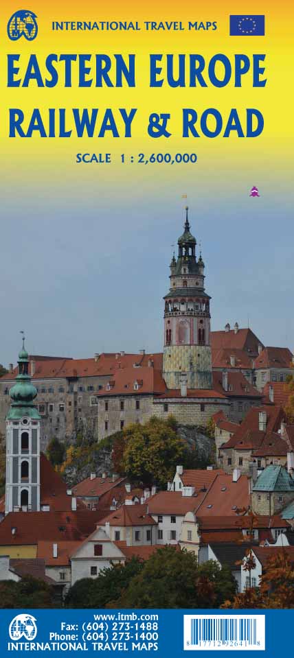
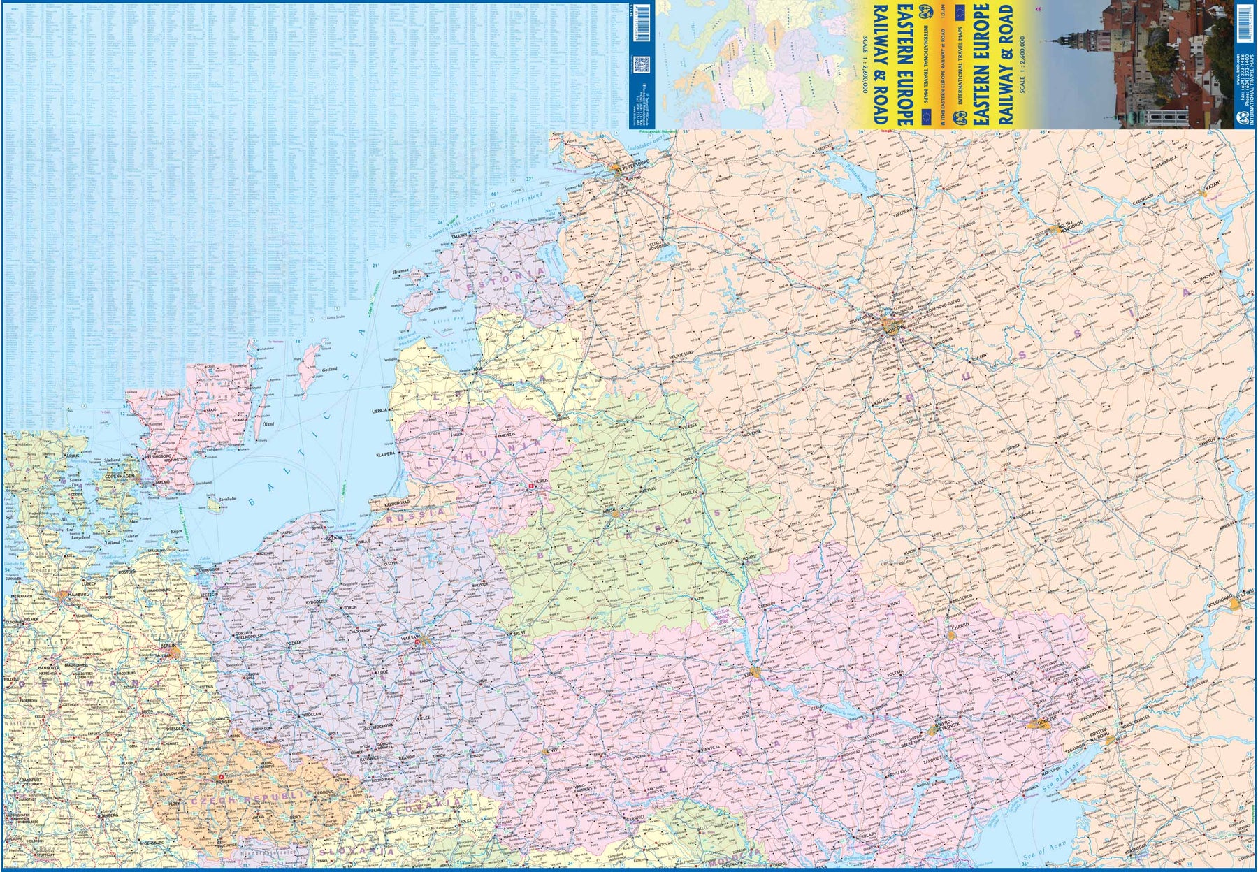
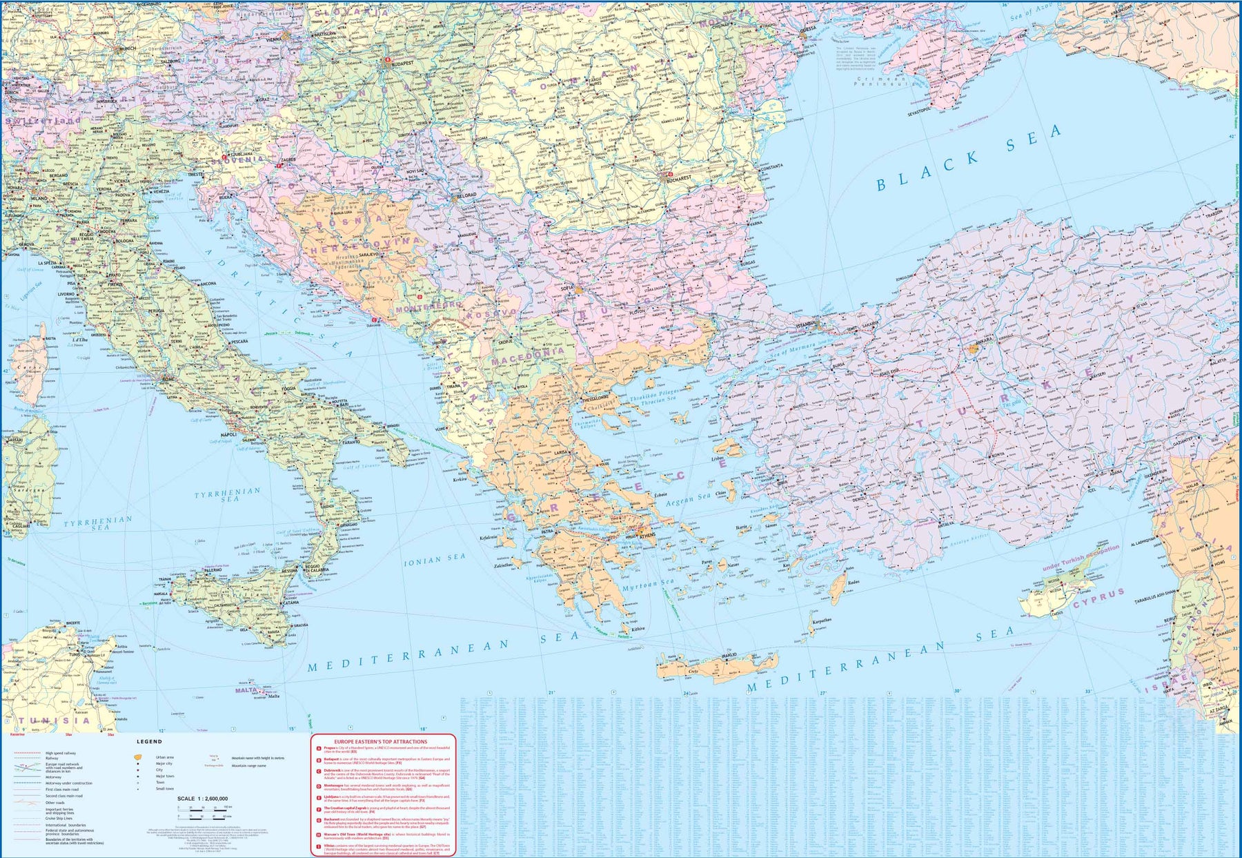
Ordinær pris 199,00 krEurope may be small in comparison to Canada, but it is densely populated and difficult to map as a continent while providing detail. Eastern Europe used to be defined as everything behind the Iron Curtain during the Cold War, but now it encompasses everything east of Germany and Switzerland, which means that this map covers Italy, Greece and the Balkan countries, the Central European countries of Romania and Hungary and most of Ukraine, Poland and the three Baltic states, and western Russia as far east as Volgograd, as well as much of Turkey. It is a combined road and rail map, showing motorways and major highways, fast-train routes in red and regular services in black. It also shows major cruise line routes, although many have been suspended due to Covid and political situations in Russia and Turkey.
Essentially, this is a map covering a very large area, as are our maps of Western and Central Europe, and our earlier map of Scandinavia. We have tried to make it politically correct, which is difficult considering the Russian occupation of Crimea and the Donetsk region of Ukraine and the on-going controversy over the ‘proper’ name for Macedonia, so we apologize for any errors. For simplicity’s sake, we have named most place names in English, so Roma is Rome and Moscva is Moscow etc. Fortunately, most English place names are the same in the local languages. However, being ITMB, Naples is Napoli, and Florence is Firenze, so don’t be too critical of us; we’re trying to reconcile differing perspectives.