Filter
- Albania
- Algerie
- Angola
- Argentina
- Australia
- Bahamas
- Bahrain
- Bangladesh
- Barbados
- Belgia
- Benin
- Bhutan
- Bolivia
- Bosnia-Hercegovina
- Botswana
- Brasil
- Brunei
- Bulgaria
- Burundi
- Canada
- Chile
- Dominica
- Frankrike
- Gabon
- Ghana
- Hviterussland
- India
- Kamerun
- Kapp Verde
- Kenya
- Komorene
- Kongo
- Kroatia
- Luxembourg
- Madagaskar
- Malaysia
- Maldivene
- Montenegro
- Mosambik
- Niger
- Rwanda
- Serbia
- Seychellene
- Sierra Leone
- Slovenia
- Somalia
- Sveits
- Sør-Afrika
- Sør-Sudan
- Tanzania
- Zimbabwe
- Østerrike
275 produkter
275 produkter
Utsolgt
USA: Honolulu & Oahu
ITM
169,00 kr
Utsolgt
USA: Pacific Coast
ITM
169,00 kr
Utsolgt
USA: Southwest
ITM
149,00 kr
Utsolgt
USA: Utah & Colorado
ITM
149,00 kr

USA: Mississippi River Basin & New Orleans
Ordinær pris 169,00 kr/
Mva inkludert
Frakt beregnes i kassen.
ITM har kart over hele verden og de spesialiserer seg på land litt utenfor allfarvei. Beliggenheten til landets nasjonalparker, historiske monumenter, de viktigste veiene o.L. Finner du inkludert i kartene. Samtlige landkart har ofte et bykart over hovedstaden.
Fra ITM: The urban area was settled by the French, and was the capital of the vast Louisiana Territory for many years. Napoleon, needing money to fight his many wars, sold the colony to the USA, in 1803, doubling the size of the new American nation overnight. The French Quarter, with buildings dating back 300 years, is the heart of the city and home to dozens of jazz emporiums. The British expulsion of the Acadians from what is now the Canadian provinces of Nova Scotia and New Brunswick, added a vibrant component to the city, creating the concept of the Cajuns. The oldest cathedral in the USA, St Louis, has dominated the city's skyline since 1794, opened just as the French Revolution was at its height. The city offers much more than just music, however, The Louisiana State Museum is where the agreement to Purchase the colony was made. The National WW2 Museum is a great repository of artifacts from the war. The residential Garden District is loaded with historic mansions - but face it, we all go to Big Ol to enjoy jazz and eat seafood, don't we? The reverse side of the sheet is one of those unique maps ITMB enjoys preparing. The Louisiana Territory was essentially the river basin of the Mississippi River. On this side, we have portrayed the heartland of America. It has many names: The Mid-West, the Great Plains, the vast interior of America. Our map goes as far north as Milwaukee, Minnesota and as far west as Omaha, Nebraska, but is essentially a map of the great Mississippi River as it moves south through Dubuque to St. Louis, to Memphis, Vicksburg, and Natchez, to flow into the Gulf of Mexico; truly a magnificent map.
Publisert år: 2022
Innbinding: falset
Material: plastpapir
Målestokk: 1:800000/15,000


USA: Montana & Idaho
Ordinær pris 169,00 kr/
Mva inkludert
Frakt beregnes i kassen.
ITM har kart over hele verden og de spesialiserer seg på land litt utenfor allfarvei. Beliggenheten til landets nasjonalparker, historiske monumenter, de viktigste veiene og lignende finner du inkludert i kartene. Samtlige landkart har ofte et bykart over hovedstaden.
Fra ITM: Montana prides itself on being the ‘blue sky’ state. Due to its high elevation, the sky does appear to be a darker shade of blue than is common in areas closer to the ocean. The state is lightly populated, so much of its attractiveness rests with natural features, such as Glacier National Park on the Canadian border, and Yellowstone National Park on the Wyoming border. The state is also perfect camping country, and our map includes dozens of authorized campsites. It also includes the national heritage site of Little Big Horn, where Lt. Colonel Custer and the US 7th Cavalry were massacred after foolishly attacking a vastly larger encampment of Sioux and Cheyenne first nations people under the leadership of Sitting Bull.
The second side of the map portrays the State of Idaho, an equally large geographic area lightly populated. The terrain is quite mountainous, but is ideal for growing potatoes. The northern portion of the state is a narrow neck used mostly to get between Washington State and Montana, but the southern half encompasses the Snake River Valley. As with Montana, outdoor recreation is the main attraction, with dozens of parks and campsites. Coeur d’Alene, the main town in the north, is actually a corruption of Coeur de Lion, named after a French Canadian fur trapper who lived in the area many years ago. The map also has two different covers, one for each state, so can be displayed in two different areas of a store. Legend Includes: Roads by classification, Rivers and Lakes, National Park, Airports, Points of Interests, Highways, Main Roads, Zoos, Fishing, and much more...
- Publisert: 2021
- Innbinding: Falset
- Materiale: Papir
- Målestokk: 1:900 000

USA: Nevada & California North
Ordinær pris 169,00 kr/
Mva inkludert
Frakt beregnes i kassen.
ITM har kart over hele verden og de spesialiserer seg på land litt utenfor allfarvei. Beliggenheten til landets nasjonalparker, historiske monumenter, de viktigste veiene og lignende finner du inkludert i kartene. Samtlige landkart har ofte et bykart over hovedstaden.
Fra ITM: The USA is one of the most challenging countries to map due to its strong identification with state boundaries. Last month, we introduced two new maps of Idaho and Montana; this month, we wish to introduce Nevada. As a state, Nevada is mostly desert-like and is lightly populated. Its two major urban areas, Las Vegas and Reno, are extremely popular travel destinations. In addition, Nevada offers the Hoover Dam, one of the seven wonders of the modern world, a national park with 5,000-year-old pine trees, America’s second deepest lake (Tahoe), the eighth highest mountain peak in the USA, and the biggest air force bombing range in the world (Nellis). The map is double-sided, and covers northern California on the other side. This includes such treasures as Death Valley, part of the Mojave Desert, Yosemite National Park, the beautiful sequoia trees in the far northeast corner, and man-made wonders such as the Golden Gate Bridge and Highway 1 along the Big Sur coastline. Nevada is a valuable addition to ITMB’s growing line of State maps; after all, it’s about the size of France!
Publisert år: 2021
Innbinding: falset
Material: vanntettpapir
Målestokk: 1:875,000


USA: Philadelphia & Pennsylvania
Ordinær pris 169,00 kr/
Mva inkludert
Frakt beregnes i kassen.
ITM har kart over hele verden og de spesialiserer seg på land litt utenfor allfarvei. Beliggenheten til landets nasjonalparker, historiske monumenter, de viktigste veiene og lignende finner du inkludert i kartene. Samtlige landkart har ofte et bykart over hovedstaden.
Fra ITM: Historic Philadelphia is one of the most significant travel destinations in the USA. Founded as a Quaker town for dissidents from England, it evolved into being the unofficial capital of the 17 American colonies by 1770. In the preamble to the American independence movement, it was a crucial ingredient in negotiations designed to address grievances. The British organized a meeting that has since become known as the Congressional Congress of 1775, in what is now known as Independence Hall. All seventeen American colonies sent representative delegations to debate the future. Phillie today is a modern city with a specially-designated historic centre, and all the important sites are noted on this map.
The other side of the sheet is a brand new map, continuing ITMB’s drive to create state maps wherever practical. This one is of Pennsylvania, a lovely and scenic part of America, stretching from the Atlantic seaboard to Lake Erie and the border with Ohio. New York City/Long Island and much of southern New York State is included, as are portions of Maryland, and Virginia. Delaware, due to its size, is completely included. All motorways and highways are noted, as well as recreational and historic locations; most notably, the tragic crash site of Flight 93 east of Pittsburgh.
The State of Pennsylvania has a long and valued history and we are pleased to add it to our range of American titles. Legend Includes: Roads by classification, Rivers and Lakes, National Park, Airports, Points of Interests, Highways, Main Roads, Zoos, Fishing, and much more.
- Publisert: 2021
- Innbinding: Falset
- Materiale: Vanntett papir
- Målestokk: 1:9000, 1: 750 000

USA: Portland & Oregon
Ordinær pris 169,00 kr/
Mva inkludert
Frakt beregnes i kassen.
ITM har kart over hele verden og de spesialiserer seg på land litt utenfor allfarvei. Beliggenheten til landets nasjonalparker, historiske monumenter, de viktigste veiene og lignende finner du inkludert i kartene. Samtlige landkart har ofte et bykart over hovedstaden.
Fra ITM: Portland is the largest city in the American state of Oregon. It is not the capital; that distinction belongs to Salem, about 50 miles to the south, but Portland is an actual sea-going port, although it is a hundred miles away from the ocean. It is situated on the majestic Columbia River, which at one time formed the border between British-controlled Canada and the emerging United States. That changed after 1842, with the Oregon Treaty, under which both governments agreed to "share" the territory. At that time, the British capital was Astoria, a lovely town at the mouth of the Columbia, but the Governor, realizing that sharing with the Americans meant capitulation to the Americans, moved the capital north to Victoria, on what was then designated a separate colony. Regardless, today both Portland and the State of Oregon present some of the nicest scenery in America. Our portrayal of the city goes from the Northwest Freemont Bridge in the north (the I-5 motorway) south to Ross Island, and from Washington Park in the west to Chavez Blvd. in the east. At this scale, this encompasses the entire core of Portland and provides room to show the rapid transit line, the convention center, the downtown, and all the bridges across the Willamette River. The reverse side of the street shows the State of Oregon in excellent detail. Most of the developed portion of the State is in the western portion, along the Pacific Ocean, or close to the I-5 motorway. Inland, the Great Sandy Desert occupies much of the southern part of the State, while majestic Mount Hood, an inactive volcano, dominates the North. The far eastern portion connects to the State of Idaho, the north to Washington State, and the south to California and Nevada. The map includes a set of "must see" destinations. My favourite is the Spruce Goos Air Museum in McMinnville.
- Publisert: 2020
- Innbinding: Falset
- Materiale: Vanntett papir
- Målestokk: 1:9000, 1:900 000

USA: South Atlantic States
Ordinær pris 149,00 kr/
Mva inkludert
Frakt beregnes i kassen.
ITM har kart over hele verden og de spesialiserer seg på land litt utenfor allfarvei. Beliggenheten til landets nasjonalparker, historiske monumenter, de viktigste veiene o.L. Finner du inkludert i kartene. Samtlige landkart har ofte et bykart over hovedstaden.
Publisert år: 2015
Innbinding: falset
Material: papir
Målestokk: 1:1000000

USA: Texas & Oklahoma
Ordinær pris 149,00 kr/
Mva inkludert
Frakt beregnes i kassen.
ITM har kart over hele verden og de spesialiserer seg på land litt utenfor allfarvei. Beliggenheten til landets nasjonalparker, historiske monumenter, de viktigste veiene o.L. Finner du inkludert i kartene. Samtlige landkart har ofte et bykart over hovedstaden.
Fra ITM: Increasingly, we are developing our artwork to cover the larger states attractively and comprehensively, but also, we hope sensibly. Texas and Oklahoma share a common heritage of having been formed out of land taken from others through the long-held policy of Manifest Destiny. Today, Texas is the second largest State in the union (after Alaska), and is the only State to have previously been an independent country. It also includes the oldest urban area in the USA, Presidio, founded by the Spaniards to guard the ford over the Rio Grande. Because of its shape, and the natural proximity of the State of Oklahoma along its northern edge, combining the two States just made sense. The map is presented double-sided (top half/bottom half) on waterproof paper that is durable and tear-resistant. There was not as much room for inset maps as we had hoped, but good-sized urban map of Amarillo, Tulsa, and Oklahoma city are included. The map has two covers, one for each State, for easier display; both States are done at the same scale.
- Publisert: 2016
- Innbinding: Falset
- Materiale: Plastpapir
- Målestokk: 1:1 300 000

Venezuela
Ordinær pris 149,00 kr/
Mva inkludert
Frakt beregnes i kassen.
ITM har kart over hele verden og de spesialiserer seg på land litt utenfor allfarvei. Beliggenheten til landets nasjonalparker, historiske monumenter, de viktigste veiene o.L. Finner du inkludert i kartene. Samtlige landkart har et bykart over hovedstaden.
Publisert år: 2010
Innbinding: falset
Material: Papir
Målestokk: 1:1750000

Vietnam
Ordinær pris 199,00 kr/
Mva inkludert
Frakt beregnes i kassen.
This map is the most detailed map of the country in print. Being developed in Vietnam, it is accurate, up to date, and informative. Vietnam is changing rapidly as it modernizes, with roads being upgraded on a regular basis and cities changing road patterns to accommodate the needs of growing populations. In our most recent visit, to Hanoi, the airport had a new terminal, there was a new bridge over the Hong Song (Red River), and a new motorway into the city was open. Scale 1:920.000.
- Publisert: 2019
- Innbinding: Falset
- Materiale: Vanntett papir
- Målestokk: 1:920 000


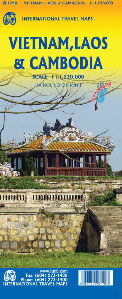
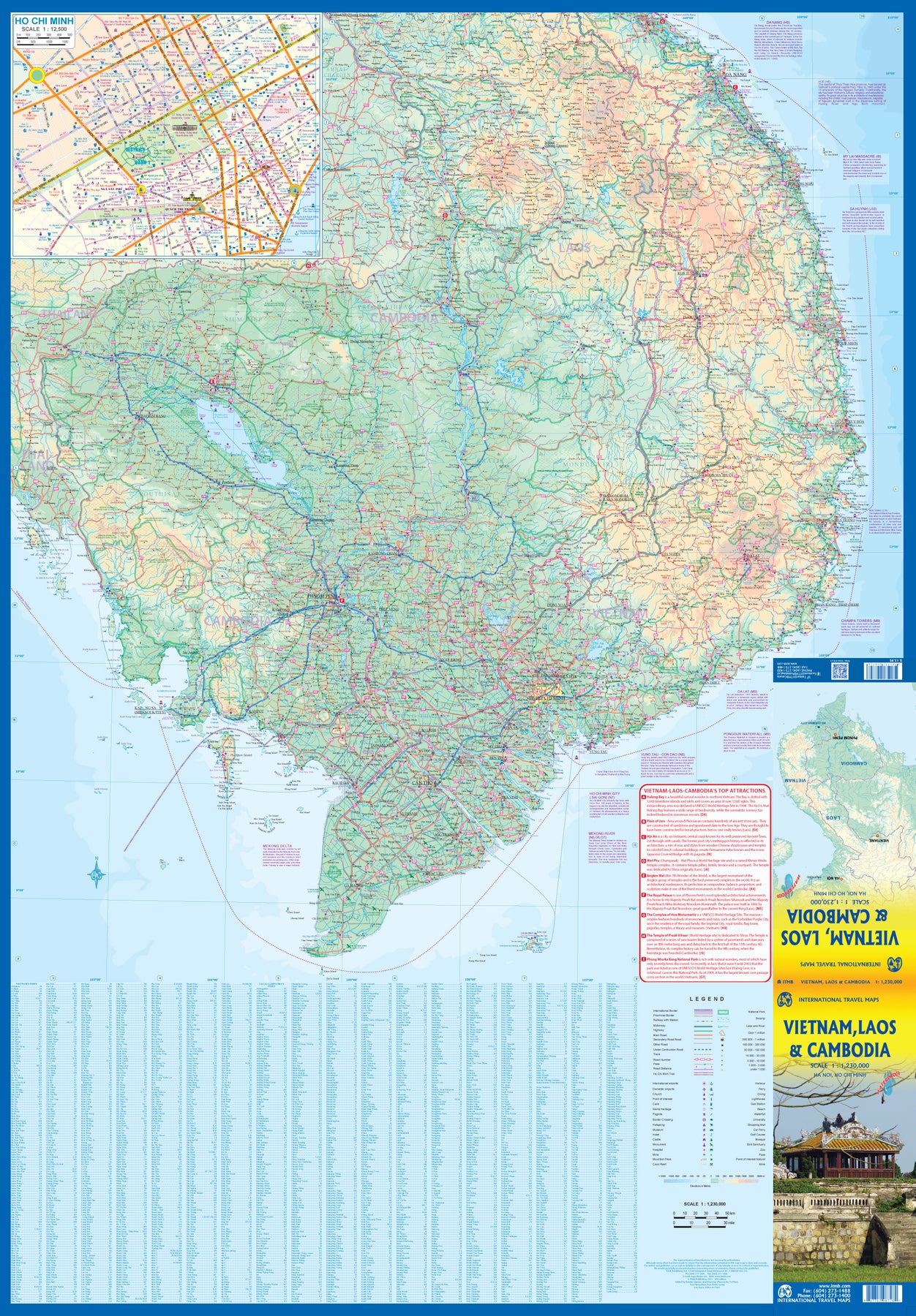
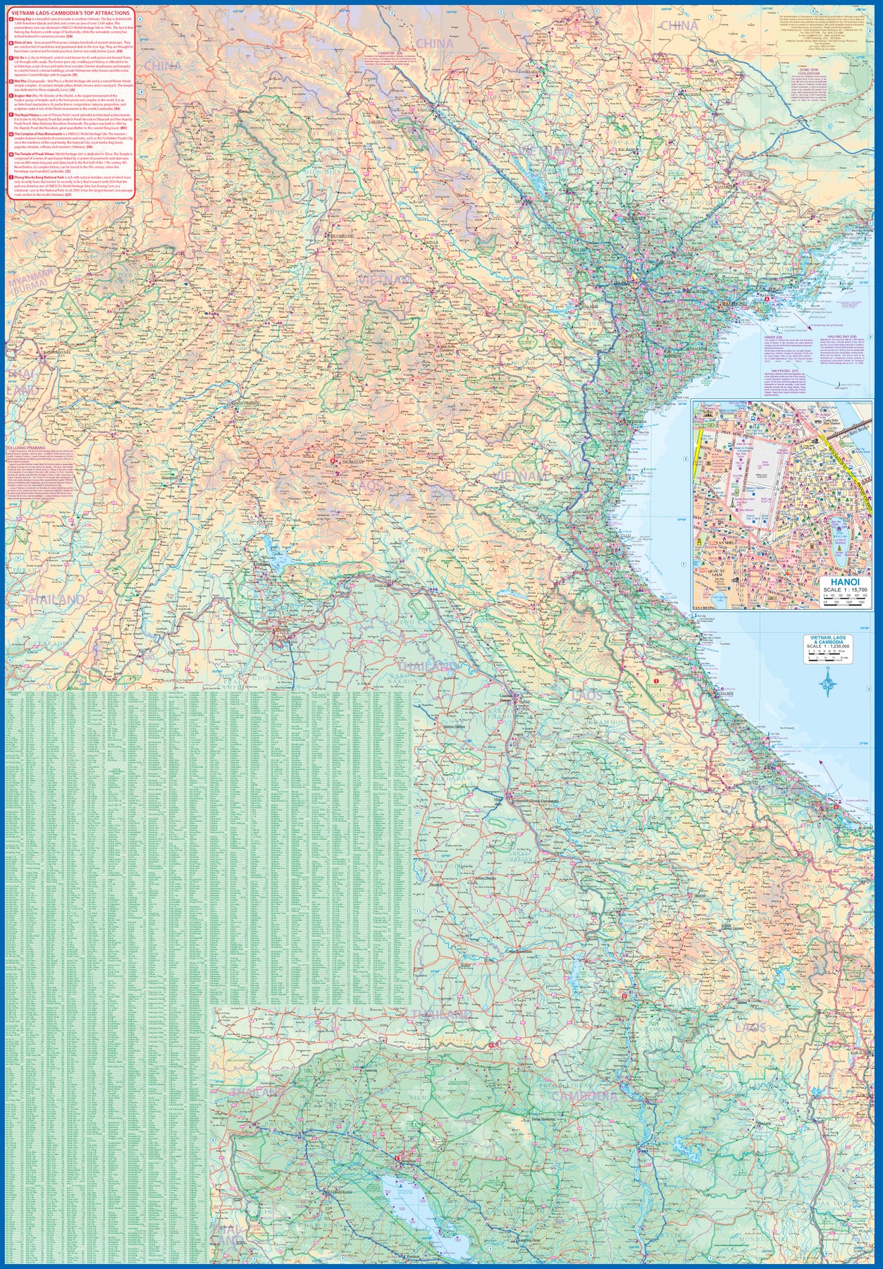
Vietnam, Laos & Cambodia
Ordinær pris 179,00 kr/
Mva inkludert
Frakt beregnes i kassen.
The former French-dominated region of Indochina evolved into three separate countries in the early 1950s. Vietnam, Laos, and Cambodia still retain strong ties and it is easy to travel from one country to another. Each has its particular charm, with a Top Attractions list highlighting the most popular attractions. Side 1 concentrates on the southern portion of the region and includes an inset map of Ho Chi Minh City; the second side covers the area from Sien Riep in Cambodia to the Chinese border areas of both Laos and Vietnam.
An inset map of Hanoi is one this side. The region is prospering after many years of civil unrest, is friendly, safe, and easy to reach since Covid restrictions were removed last year. The new Chinese-built rail line through northern Laos to Chiang Kong in Thailand, and to Vientiane, Laos, is shown for the first time. This line connects with the Chinese rail system leading to Yunnan, but is not shown as the route is still regarded as a military secret by China. At the moment, its purpose is to move freight from China to ports, but it is probable that passenger service is also possible. The map is printed on waterproof stone paper for durability and to hold up in extremely humid conditions.
- Publisert: 2023
- Innbinding: Falset
- Materiale: Vanntett papir
- Målestokk: 1:1 230 000