275 produkter
275 produkter


275 produkter
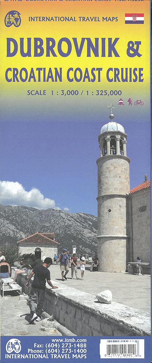
Croatia: Dubrovnik & Croatian Coast Cruise
Ordinær pris 199,00 krThe ancient port city of Dubrovnik, on the southern Croatian coastline, has evolved into a major tourist destination. The old walled city, normally entered through the famous Pile Gate, was so crowded with tourists when we arrived, that it took some time to get to the main street of Stradun. The city has completely recovered from the Montenegrin bombing during the breakup of Yugoslavia, with a few shellholes remaining just to show to tourists. The highlights of a visit are the Rector’s Palace, the Tvrdava fortress, and the cathedral. The map covers the urban area outside of the old town as well, as this is where most of the hotels and restaurants are located.
The other side of the map shows the extensive coastline of Croatia in two parts – from the Italian border to Trogir, and from Split to the border with Montenegro. We travelled from Porec to Dubrovnik in a small cruise ship of 45 passengers, which enabled us to visit ports that larger ships could not reach. As a result, we visited islands we could not have otherwise visited. The cover picture shows grandson Johnny in one such small town.
Cuba: East
Ordinær pris 149,00 krITM har kart over hele verden og de spesialiserer seg på land litt utenfor allfarvei. Beliggenheten til landets nasjonalparker, historiske monumenter, de viktigste veiene o.L. Finner du inkludert i kartene. Samtlige landkart har ofte et bykart over hovedstaden.
Fra ITM: Cuba is the fastest-growing travel destination in the world. Initially, attention has favoured Havana and the western portion of the island, but tourism is rapidly transforming the eastern portion of the country into a more rustic, natural travel experience than the over-heated Varadero resorts or hectic Havana. Until now, there has never been a map of the eastern half of Cuba; now ITMB provides one! The map covers from Varadero to the easternmost tip of Guantanamo Province on a double-sided map. Insets of Varadero, Cienfuegos, Trinidad, and Santiago are included. Naturally, the road network is shown to advantage, and there are numerous capsule comments pointing out interesting points. The American base in Guantanamo Bay is noted, but not emphasized. Cuba is a large island, safe to visit and full of friendly people. This map will prove invaluable to those wanting to go beyond the confines of the traditional resort communities.
Publisert år: 2017
Innbinding: falset
Material: vanntettpapir
Målestokk: 1:420,000
Cyprus
Ordinær pris 199,00 krCyprus is a lovely Mediterranean island; a popular tourist destination for Europeans. It is also a very historic island, with roots going back to Phoenician times and probably before. Politically, the island is divided into Turkish-controlled Northern Cyprus and EU-member Cyprus, the southern two-thirds of the island. Most travel is to the southern portion, with numerous resort hotels and beaches lining the coast. This is also the most economically-developed part of the island, as the northern portion has not been recognized by anyone except Turkey, which still maintains a significant military presence in areas they control. It is possible for tourists to pass through the ‘green zone’ in Nicosia from south to north and back safely and efficiently. T
he north portion is, in my opinion, more interesting simply because it is less travelled. When we were visiting the island to research it, we spent most of our time driving mountainous roads, discovering interesting villages (and occasionally, military outposts), but we never felt fearful or were harassed by anyone. To me, the most fascinating part of the island was the very contentious Famagusta city area right on the border that is now an abandoned city covering many blocks of high-rises. We were able to drive through quite a bit of it before being waved off by Turkish soldiers. Regardless of politics, the island is a dream resort for anyone.
We have tried to be fair to both sides of this divided island; a wonderful place to explore or enjoy on a beach – North or South! Legend Includes: Roads by classification, Rivers and Lakes, National Park, Airports, Points of Interests, Highways, Main Roads, Zoos, Fishing, and much more...
Dominica & Saint Lucia
Ordinær pris 149,00 krITM har kart over hele verden og de spesialiserer seg på land litt utenfor allfarvei. Beliggenheten til landets nasjonalparker, historiske monumenter, de viktigste veiene o.L. Finner du inkludert i kartene. Samtlige landkart har ofte et bykart over hovedstaden.
Fra ITM: The island is a popular holiday vacation destination and cruise ship stopover port. We have in reality placed two maps on the sheet, by adding St. Lucia, another popular Caribbean destination, to the reverse side. Each country is placed on one side of the paper, with insets of their respective capitals, Roseau and Castries. Dominica, with its rugged volcanic terrain, its dominating mountains, and its lush pristine rainforests, has a natural beauty that is a prime reason to visit and enjoy the island’s attractions.
In addition, both islands are linked to each other and to Martinique and Guadeloupe by new inter-island ferries. This new system of ferries is joining the islands together for sharing tourism, as well as economic cohesion within the Caribbean. It is now possible to base oneself on Dominica and enjoy day trips to Martinique, for example, or St. Lucia.
Publisert år: 2013
Innbinding: falset
Material: vanntett papir
Målestokk: 1:50,000 / 40,000
Dominican Republic & Haiti
Ordinær pris 149,00 krITM har kart over hele verden og de spesialiserer seg på land litt utenfor allfarvei. Beliggenheten til landets nasjonalparker, historiske monumenter, de viktigste veiene o.L. Finner du inkludert i kartene. Samtlige landkart har ofte et bykart over hovedstaden.
Fra ITM: We spent a week on the lovely island of Hispaniola, home to the Dominican Republic and Haiti, last December. We spent several days driving the highways, checking our information and this new edition is the result. Frankly, we were surprised how accurate the digital artwork was (and is); this is the first time that we have been able to ground-truth a map shortly before printing, and after updating. We did discover one new toll highway, and we learned that Santa Domingo floods rather easily during heavy rains. We now show a lot of what I would consider to be local farm roads; they exist, but it is doubtful any tourist would use them. We also discovered a new motorway-like highway that is under construction between Santiago and Puerto Plata, but we are leaving it off the map for now as work has just begun and we saw little indication that it would be completed. We can add it if we see progress. The Haiti side of the sheet remains a work in progress. There are now five border crossings with Dom Rep and a lot of cross-border traffic, but the road network in Haiti remains quite basic. We have added hundreds of small local roads to our artwork; most are simple dirt tracks. We have also added a series of top attractions for Haiti, highlighted in red, and a separate series for Dom Rep. Although this could be considered a significant update.
Publisert år: 2017
Innbinding: falset
Material: plastpapir
Målestokk: 1:400,000 / 1:350,000
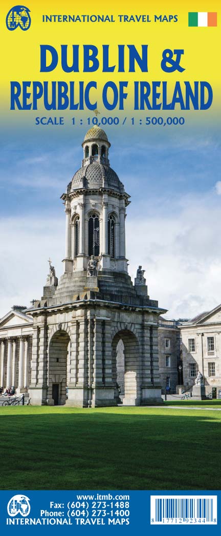
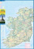
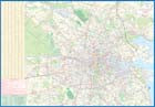
Dublin & Republic of Ireland
Ordinær pris 199,00 krWe are pleased to present our most recent edition of Dublin, combined with a map of Ireland on the reverse side. The cover notes the Republic of Ireland, which is the focus of attention, but most of Northern Ireland (Belfast area excluded) shows as well. Regardless, one side of the sheet is a detailed map of Dublin, the capital of the Republic and a very popular travel destination.
The coverage goes far beyond the norm, extending from the River Tolka in the north to south of the Grand Canal, and from Phoenix Park in the west as far east as the Dublin Bay. The River Liffey, of course, flows across the centre of the page. Dublin has two rapid-transit tram lines, both of which are prominently shown, as is the city centre, all parks, as many hotels as we could find, shopping areas and restaurants, theatres and educational institutions, embassies, the ferry terminal, and much more.
The Top Attractions are also noted. The other side of the sheet presents a very detailed travel map of the Republic, showing all motorways, highways, and secondary routes, as well as rail lines. Touristic attractions, such as Blarney Castle and the Rock of Cashel are highlighted. This would be an excellent map for those touring the Republic by road.
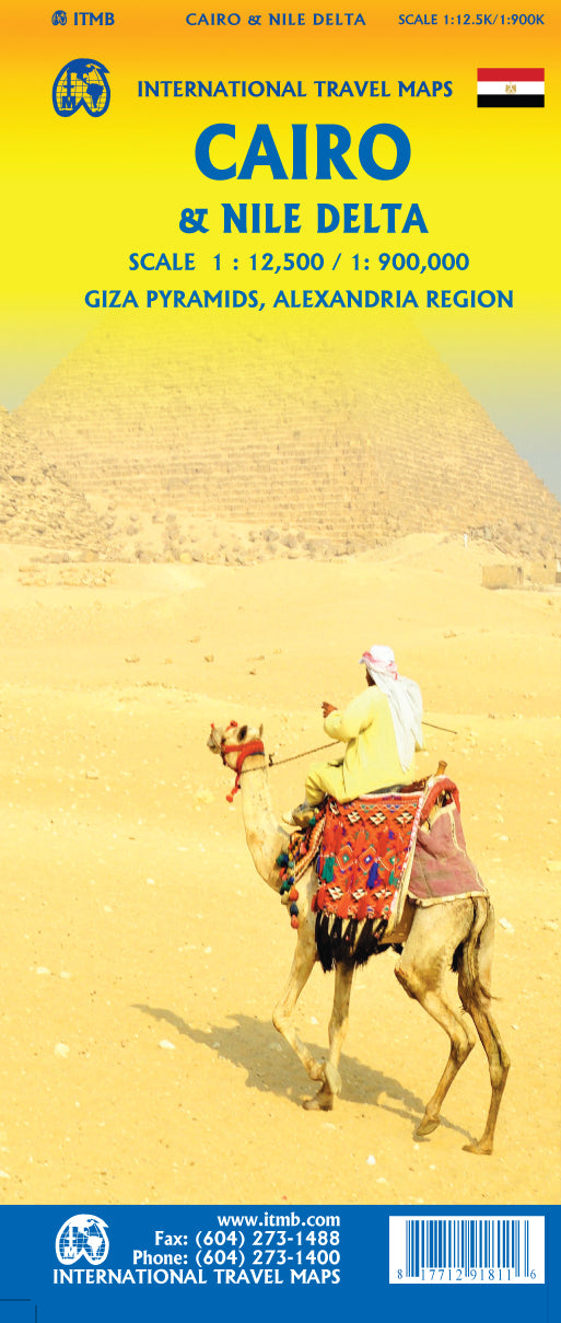
Egypt & Cairo
Ordinær pris 199,00 kr2nd Edition Following the so-called Arab spring of a few years ago, northern Africa experienced much turbulence. Egypt experienced the overthrow of the government, the installation of a radical religious-oriented replacement, and the installation of a radical religious-oriented replacement, and the installation of military governance. Tourism plummeted. Most map publishers discontinued their maps of the country. Five years later, Egypt has stabilized and tourism is growing. We feel that the time is right to re-introduce our ITMB map of Egypt.
This version focuses on the portions of the country that have been re-opened for tourism, which means from the Mediterranean coastline south to the Aswan Dam. The portion further south remains closed for the moment, as is the border crossing with Sudan. We have also unrest, as the border areas with Libya remain very unstable. However, we have provided a large inset map of Egypt, covering everything, in the area of desert. We have also added a listing of Egypt's Top tombs.
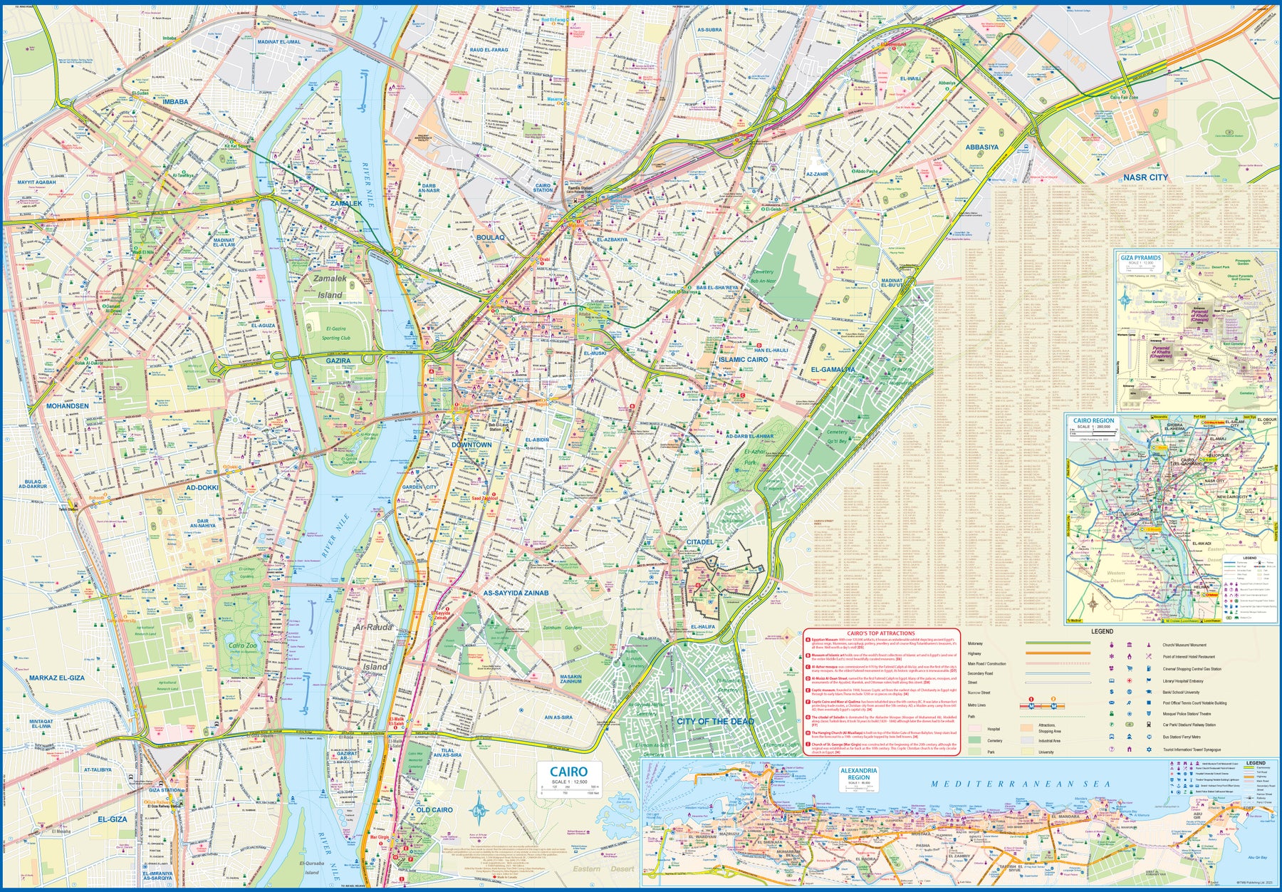
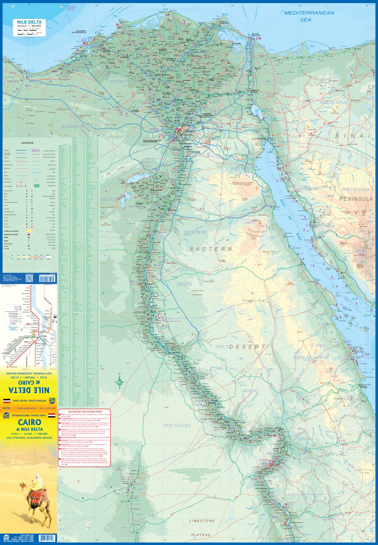
The other side of the sheet is a detailed map of Cairo, with an inset of the Giza Pyramid complex just to the west of Cairo, and another inset of the Cairo region showing all the known tombs west of the Nile River south to Helwan. The back cover is a schematic map of the rapid transit system of Cairo. There is a third inset, showing Alexandra and other associated urban areas along the coast. The maps is printed on stone paper, which is waterproof, durable, and long-lasting. It is also biodegradable.
Egypt: Cairo & Nile Delta
Ordinær pris 199,00 krCairo is one of the most vibrant and exciting cities in the world (as is Egypt as a country, which we map separately). Side 1 focuses on the city itself, with insets of Alexandria, the pyramids of Gizi, and the region immediately surrounding Cairo. The city has also expanded its rapid transit Metro system, which is shown on the back cover. An extension to the airport should open next year. The second side of the map sheet shows the delta of the Nile River, which is a gigantic flood plain, and follows the course of the river south past Cairo all the way past Luxor. Much of the Red Sea is included, as is most of the Sinai Peninsula. The famous canal is, of course, shown in detail.
This map is designed for the visitor concentrating on the most popular aspects of a trip to ancient Egypt. The map also has two Top Attraction lists, one for the city and one for the region, to make it easy for users to locate such sites as the Temple of Horus or the must-see new Museum of Egypt.
El Salvador & Guatemala South
Ordinær pris 149,00 krITM har kart over hele verden og de spesialiserer seg på land litt utenfor allfarvei. Beliggenheten til landets nasjonalparker, historiske monumenter, de viktigste veiene o.L. Finner du inkludert i kartene. Samtlige landkart har ofte et bykart over hovedstaden.
Fra ITM: 6th edition November 2018. This is a double-sided map with the El Salvador (1:270.000) on one side, along with a detailed inset map of San Salvador. The maps also shows the country's World Heritage city of Chalchuapa, dating back 3,200 years. The other side of the sheet is a completely separate maps of neighbouring Guatemala, being a detailed map of the central southern portion (1:457.000)of this important country. The highlights shown on this map are Quetzaltenango, Antigue Guatemala, and the Mayan ruins of Quirigua, dating from 200ad. The border crossings with El Salvador are clearly shown and are easily crossed.
Publisert år: 2018
Innbinding: falset
Material: vanntett papir
Målestokk: 1:250,000 / 1:457,000
Ethiopia & Eritrea
Ordinær pris 169,00 krITM har kart over hele verden og de spesialiserer seg på land litt utenfor allfarvei. Beliggenheten til landets nasjonalparker, historiske monumenter, de viktigste veiene o.L. Finner du inkludert i kartene. Samtlige landkart har ofte et bykart over hovedstaden.
Fra ITM: Double-sided map with Ethiopia at 1:1,900,000 accompanied by a street plan of Addis Ababa, with on the reverse Eritrea at 1:915,000 with a plan of Asmara. Both road maps are indexed and show the topography by altitude colouring: in Ethiopia with bands in metres and peak heights given in both metres and feet, and in Eritrea with bands in feet and peak heights either in feet and metres or in feet only.
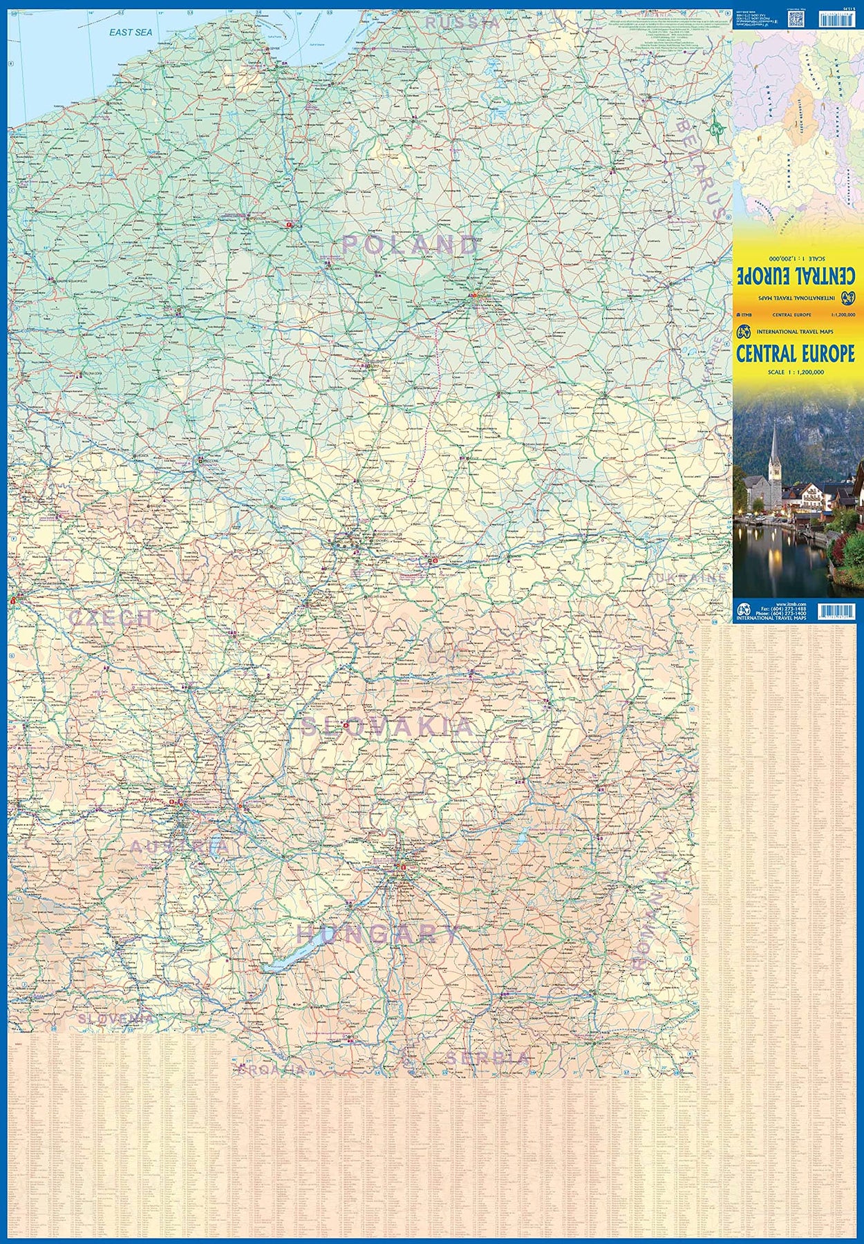
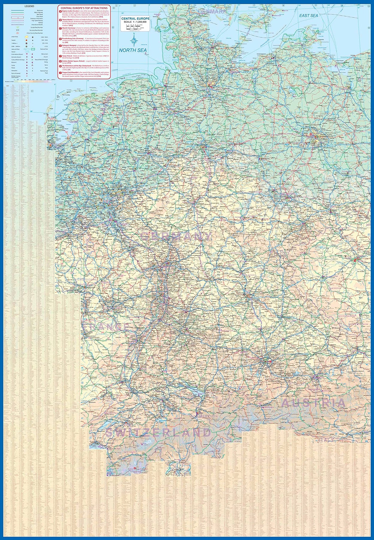
Europe Central
Ordinær pris 199,00 krEurope is fairly big, and densely populated. A map of all of Europe is useful, but at a scale that limits our ability to show information. As a result, last year we published a map of Western Europe. Now, we are pleased to extend our more detailed coverage of the continent with a map covering the Central European countries of Germany, Austria, Poland, Czech Republic, Hungary, Slovakia, and Switzerland, with portions of France, Belarus, Serbia, and Romania. A third map, covering eastern European countries, will be released soon, providing detailed regional coverage of the continent in a way that we hope is pleasing. Germany occupies most of the first side, and Poland the other, with Czech and Slovakia divided between the two sides, and Slovakia/Hungary filling the rest of side 2.
This is a regional map, showing rail lines as well and roads, airports, and major touristic attractions. A listing of the region’s top attractions is included. This map will appeal to those visiting several countries on one trip, by rail or road. Legend Includes: Roads by classification, Rivers and Lakes, National Park, Airports, Points of Interests, Highways, Main Roads, Zoos, Fishing, and much more...
Europe Eastern: Railway & Road
Ordinær pris 199,00 krEurope may be small in comparison to Canada, but it is densely populated and difficult to map as a continent while providing detail. Eastern Europe used to be defined as everything behind the Iron Curtain during the Cold War, but now it encompasses everything east of Germany and Switzerland, which means that this map covers Italy, Greece and the Balkan countries, the Central European countries of Romania and Hungary and most of Ukraine, Poland and the three Baltic states, and western Russia as far east as Volgograd, as well as much of Turkey. It is a combined road and rail map, showing motorways and major highways, fast-train routes in red and regular services in black. It also shows major cruise line routes, although many have been suspended due to Covid and political situations in Russia and Turkey.
Essentially, this is a map covering a very large area, as are our maps of Western and Central Europe, and our earlier map of Scandinavia. We have tried to make it politically correct, which is difficult considering the Russian occupation of Crimea and the Donetsk region of Ukraine and the on-going controversy over the ‘proper’ name for Macedonia, so we apologize for any errors. For simplicity’s sake, we have named most place names in English, so Roma is Rome and Moscva is Moscow etc. Fortunately, most English place names are the same in the local languages. However, being ITMB, Naples is Napoli, and Florence is Firenze, so don’t be too critical of us; we’re trying to reconcile differing perspectives.
Europe Western: Railroad & Road
Ordinær pris 179,00 krThis is a new title for ITMB. It focusses on the western half of the European land mass at a much better scale than would be possible for all of Europe. Even at this scale, showing the rail lines and the major roads results in a map with a lot of information on it, but it meets the needs of those travelling around Europe by rail, which is its primary market. It can also be used by those driving, although it would be better for vehicle users to rely on individual country maps.
Side 1 covers the British Isles, the Low Countries, Germany, Denmark, the Czech Republic, most of Poland, and southern Scandinavia. The second side covers the Iberian Peninsula, France, Italy, Slovenia, Croatia, Bosnia, Austria, Hungary, and the southern portion of Germany. Trains tend to be used by travellers in Europe for longer trips, say from Frankfurt to Rome, and for this reason our new map should find a good market. There has not been enough room on this map to show many touristically important sites, but where room exists, we have added UNESCO World Heritage sites, major churches, and most international airports.
Coverage includes major ferry routes and includes the islands of Majorca, Menorca, Ibiza, Sardinia, Elba, and Corsica, Sicily, and Malta. As the EU evolves, passenger rail service is increasingly becoming a pan-European reality, but German trains running on French lines and Italian trains going north into Austria. This is a timely map; coming out at the beginning of a truly European rail system.
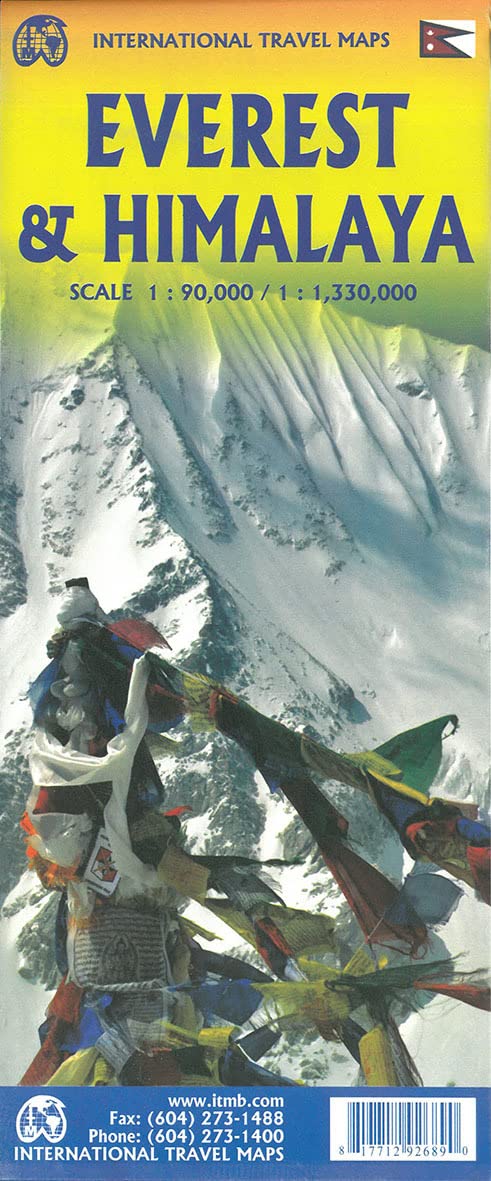
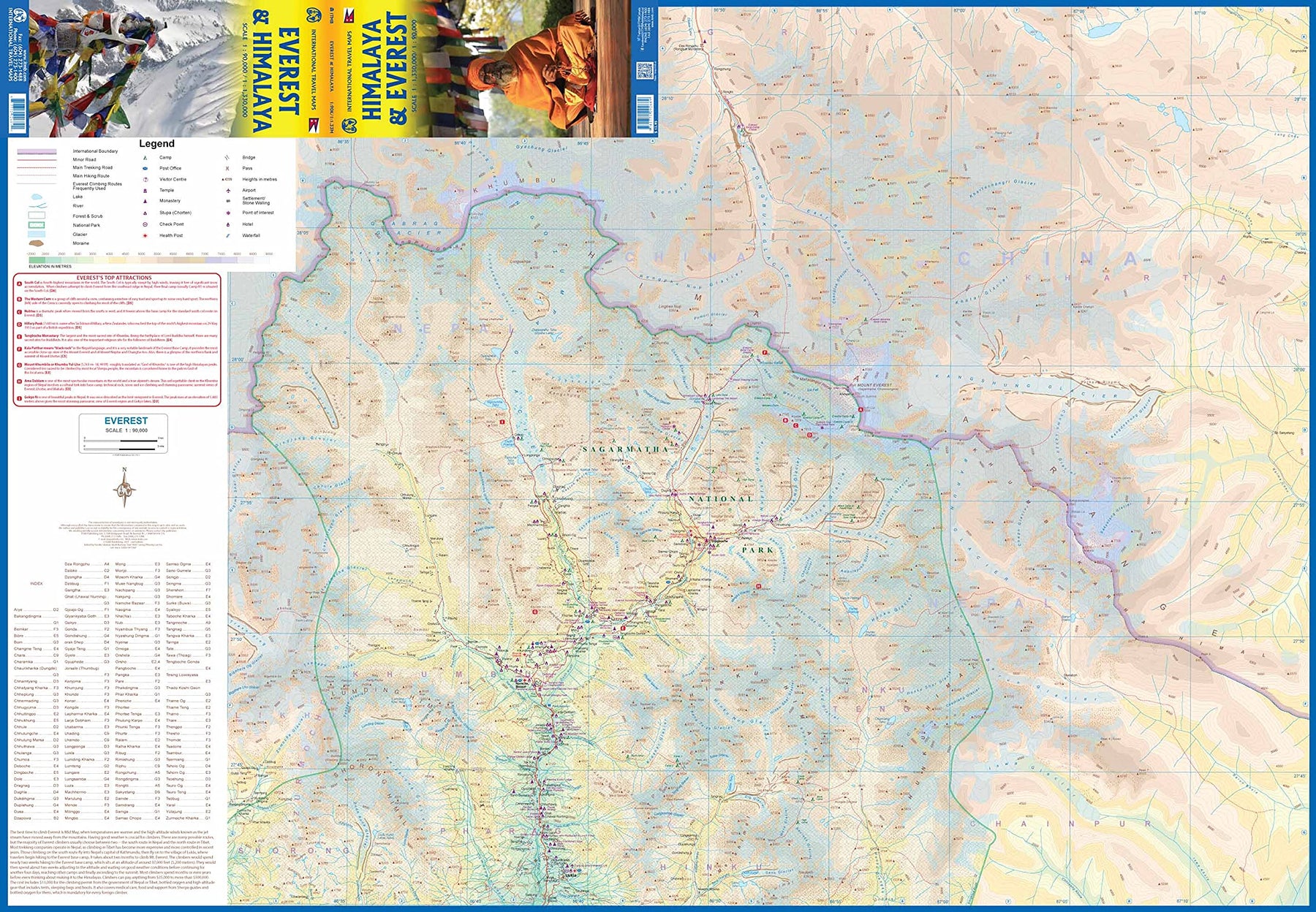
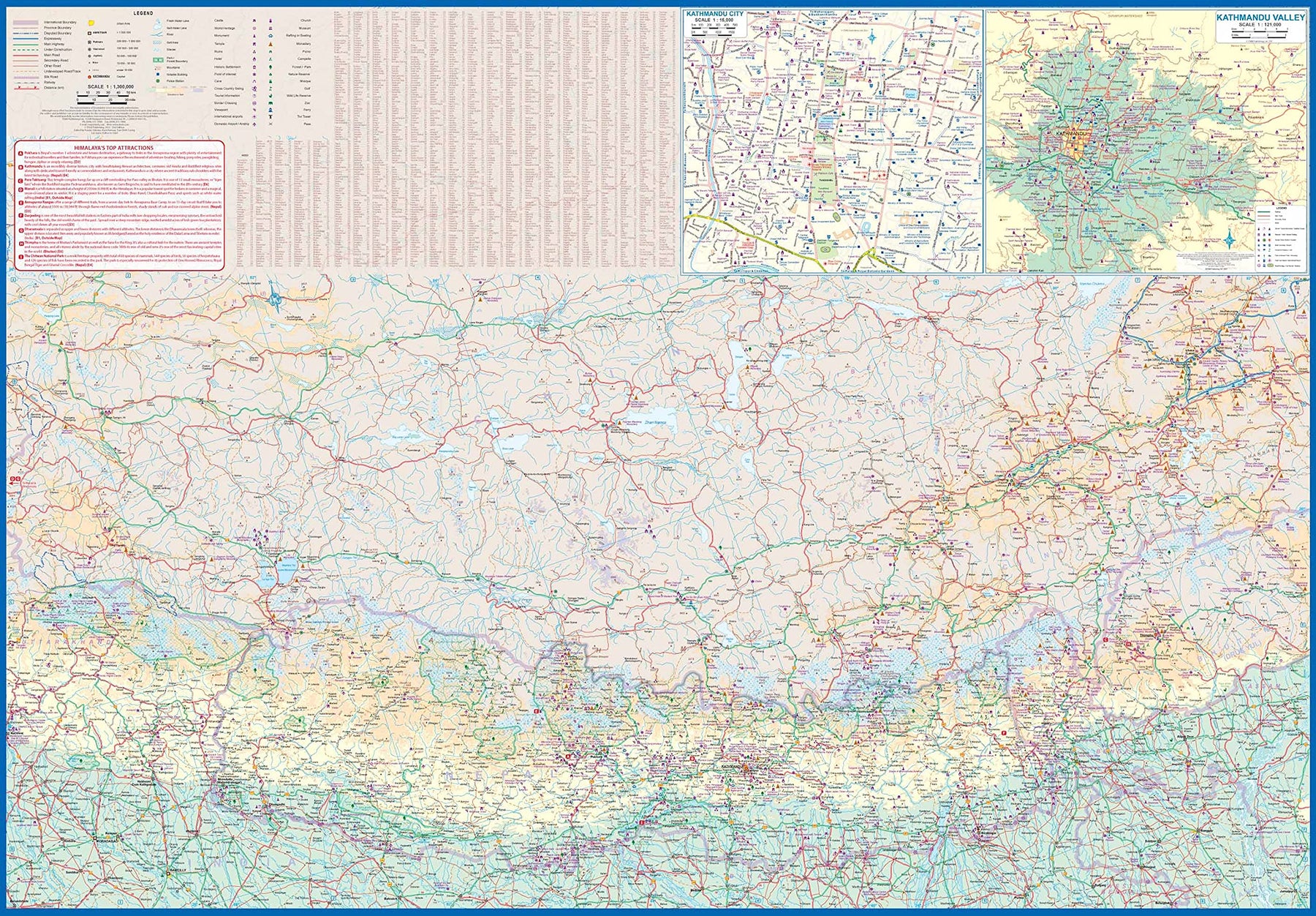
Everest & Himalaya
Ordinær pris 199,00 krThe climbing season for Everest begins in May, just about the time that vaccinations against Covid should kick into high gear. Time to start planning that little jaunt you’ve always wanted to do! Seriously, this is a lovely double-sided map with two attractive covers, so can be displayed either as Everest or Himalaya. The Everest side covers the mountain itself, with base camps and accommodations clearly shown. There are actually several interesting trails one could explore and all are shown; only one leads to the summit. The reverse side shows the entire Himalaya ‘knot’ that forms the basis for so many mountain chains.
The area of coverage includes all of Nepal and Sikkim, a significant portion of Bhutan, most of Tibet, and a bit of northern India. All roads and attractions are shown. The map includes a detailed inset map for Kathmandu and another for the valley region surrounding the city. There are now half a dozen access roads into Nepal, and all are shown. East-west travel is finally available with the completion of Hwy 1401. Legend Includes: Roads by classification, Rivers and Lakes, National Park, Airports, Points of Interests, Highways, Main Roads, Zoos, Fishing, and much more...
France: French Atlantic Coast - Rail & Bike
Ordinær pris 179,00 krFrance is a rather large country, and while it can be portrayed on a map as a country, mapping it in segments provides an opportunity to concentrate on regions at a better scale. This map, covering the coastal region of France from the Cotenin Peninsula south to the Spanish border and east as far as Paris and Montpellier in Languedoc is the first of what we hope will be a series covering the country at an improved scale. This map is double-sided, covering from Quimper and Paris at the northernmost portion of coverage, to Angouleme and Clermont at the southern extreme on one side, with the second side covering from Bordeaux and St-Etienne south to Bayonne/Pamplona and Nimes/Avignon in the south. This is a part of Europe that has been fought over for centuries, and as such is dotted with fortresses proclaiming its historic importance.
This map has been designed with the leisure traveller in mind. Although it shows all motorways and highways, rail connections by train are emphasized, as are long-distance Euro-Velo cycling routes that are being developed in many parts of Europe. At this scale, it would be impractical to record all accommodations, but we have included a new feature that is thus far peculiar to France, and that is motorway hotels at rest areas. Naturally, the map is rich with places of touristic interest.
France: North Rail & Bike
Ordinær pris 179,00 krFrance: Railway & Road
Ordinær pris 169,00 krThis edition of France continues a developing strain of European country maps for ITMB – placing an emphasis on train travel. Tourism is changing, or rather, is growing exponentially as more and more people from Asia visit France. Most of these visitors, and for that matter, most visitors from North America, prefer to travel around France by using the excellent rail network, rather than by road. Most map publishers have removed rail lines from their maps in order to concentrate on those people travelling by car.
Our map shows the road network in good detail, but our difference is that we show the rail network in excellent detail as well. As a country, France is one of the most popular destinations in Europe, and for good reason. Whether one is interested in the chateaux gracing the Loire Valley or the great cathedrals of Chartres or Reims, or the massive defensive fortresses of bygone years, France offers something for everyone.
This is a traveller’s map, whether moving around by rail or by road, its plastic paper ensures it will not tear or crack, and can even be used as an umbrella if one is caught in a sudden rainstorm! We have also included anther feature common to ITM maps, a listing of the top ten attractions in the country – hard to do for France! The map includes dozens of noteworthy attractions, World Heritage sites, and scenic back roads for those wishing to avoid motorways.
France: South Rail & Bike
Ordinær pris 199,00 krThis is a brand new title for ITMB and an attempt to portray a changing travel landscape in a mapping format. Eco-tourism is a rapidly growing activity, with enormous potential. At the same time, governments are seeking to reduce carbon pollution by encouraging train travel, so ITMB is climbing aboard the movement by publishing a map encouraging train travel while still retaining the road network and noting all the long-distance bike routes in southern France by designated number.
This is, by its scale, a generalized map of that portion of France south of Poitiers or Lyon to the Mediterranean, so is more of a regional map showing biking opportunities than a detailed trail map. Nevertheless, it is an excellent map on waterproof paper showing cycling routes and tertiary roads that are suitable for recreational exploration. Naturally, motorways and main highways are shown as well. Legend Includes: Roads by classification, Rivers and Lakes, National Park, Airports, Points of Interests, Mining, Highways, Main Roads, Zoos, Fishing, , and much more...
Germany: Frankfurt & Central
Ordinær pris 199,00 krThe historic city of Frankfurt started as a Roman city. The Romer (Roman, in English) central old town was the Roman encampment, and the current market square was the forum. We have been to Frankfurt many times, thanks to the annual book fair that is held there, and have long wanted to add the city to our range of European titles. Covid provided time to develop the artwork, and the map is now here. The reverse side is extremely important, covering central Germany in detail. This is also one of the most-travelled parts of Europe, so we have created a new map showing all the touristic destinations from the Rhine to Leipzig and from Gottingen south to Wurzburg. The map is printed on stone paper for both durability and resistance to water; a perfect umbrella in an emergency!
Great Britain: Cardiff & Wales
Ordinær pris 179,00 krITM finds the UK to be a never-ending source of maps needing to be prepared, such as this one of Cardiff and Wales. Cardiff is the capital of Wales, and is also an international access point to the UK; a map seems desirable. The city is based at the mouth of the River Taff, with most touristic points being concentrated in the harbour area, the city centre, and a concentration of eateries along Albany Road. Cardiff is shaped by two parallel motorways; the A4232 close to the waterfront, and the A48 near the northern extremities. Both are included in our map, which also shows historic sites, hotels, and tourist amenities.
The reverse side shows all of Wales as an entity, showing roads, rail lines, ferry crossing points, and access routes to England. It also shows historic sites, tourist attractions, parks, airports, ferry terminals, and all the towns and villages. By the nature of the shape of Wales, adjacent portions of England also are included – Liverpool, Shrewsbury, Ludlow, and Hereford.
Great Britain: England - North & Central Railway & Road
Ordinær pris 199,00 krCoverage is from Birmingham/Peterborough north to York on side one and from Lancaster north to the Scottish border at Berwick-upon-Tweed. As the border angles in a southwesterly angle, the map also includes much of the Scottish border region as far west as Dumfries. Being an area regularly serviced by rail (the world’s original railway line is on the map), we have emphasized rail connections for end users. However, we have also included roads for those driving or cycling. Legend Includes: England Boundary, Country Boundary, Capital, Motorway, Highway, Main Road, Railway, Theme Park, Museum, Point of Interest, Church, Cave, Hotel, River, Beach, Waterfall, Ferry, Harbour, Zoo, Golf Course, National Park, Park, etc.