11 produkter
11 produkter


11 produkter
Great Britain: Scotland - Far North & Islands
Ordinær pris 199,00 krGreat Britain, by its shape, is difficult to map. The population is dense, the road network intense, and the coastline convoluted. A map of the British Isles shows only the major features. Sectional maps of just England, or Just Wales, make little sense, due to the geographic shape of the island kingdom. Scotland also needs more than one map to show its treasures in sufficient detail. ITMB previously issued Scotland Central and South, and now extends its coverage at 1:300,000 to the sparsely-populated highlands and the isolated Western, Orkney, and Shetland island archipelagos that are usually shrunk to Invergarry to John O'Graoats in the North, and from the Western islands of Uist and Lewis to the Moray Firth and Craigellachie in the east.
The second side has to duplicate part of the first side in order to extend the artwork further eastward to include Aberdeen and northward to include the wonderful island chains known collectively as the Shetlands and Orkneys. This map instills a sense of history, of adventure, and of being 'off the beaten path'. It is the Islands and Highlands part of Scorland where Gaelic is still commonly spoken and castles abound, where one can lose oneself traversing single-land roads across barren moors, or enjoy fishing villages such as Ullapool, or re-visit momentous events in history at Culloden. This is the heart of Scotland.
Great Britain: Scotland - Central & South Rail & Road
Ordinær pris 199,00 krThis is another new ITMB title and extends our sectional coverage of the UK northwards from the southernmost border at Gretna Green through the densely-populated Glasgow/Edinburgh/Stirling conurbation to the highlands. The reason for this sectional map is to provide additional space to show 25% more detail than our map of all of Scotland can provide. The north of Scotland is my favourite part of the country, but there isn’t much there except heather and single-lane tracks across treeless moors. The South, like it or not, is where most of Scotland’s four million people live and where most of the castles, palaces, battlefields, parks, and touristic attractions are located.
The map also shows the ferry routes to the outer islands of Arran and Mull, and the most poignant battlefield I’ve ever visited, Culloden, east of Inverness. This was the spot where the clans were slaughtered in 1745, effectively ending the clan system and determining Scotland’s future as a junior partner to England. For history, Scotland is hard to beat, and this map shows the beauty and the majesty of this interesting homeland to excellent advantage. Rail lines have been emphasized.
Great Britain: London & Southeast
Ordinær pris 199,00 krITM har kart over hele verden og de spesialiserer seg på land litt utenfor allfarvei. Beliggenheten til landets nasjonalparker, historiske monumenter, de viktigste veiene o.L. Finner du inkludert i kartene. Samtlige landkart har ofte et bykart over hovedstaden.
Fra ITM: This 5th edition of our London map has undergone an extensive revision, adding more hotels, pubs, and attractions. While it is not practical to show all such buildings on a map, we are hoping to achieve a representative sample. The ‘tube’ or underground lines have also been re-drawn and emphasized. Rail lines are shown from their appropriate rail station outwards. There is one north-south rail line through London, and an east-west line under construction, but we are leaving these off our map until the second line is completed. Also, the overground lines are an increasingly important method of travel around London, and these have been shown where appropriate. The big change on this map, and the reason for its new ISBN, is the enhanced and expanded map on the second side of South East England at 1:300,000 scale. This would be ideal for day trips out of London or for those driving. The western edge of the map is Bath and the northern extreme is either Northampton or Cambridge. The main roads in and out of London are shown, with motorways in blue, A roads in green (un-widened A roads in magenta) and thousands of B roads wend their way to lovely villages and secondary towns. Both sides of the map include our Top Attractions list. The map is printed on high density plastic paper, both for durability and for inclement weather.
Publisert år: 2024
Innbinding: falset
Material: Plastpapir
Målestokk: 1:7500/250.000
Great Britain: England East Coast
Ordinær pris 199,00 krThe United Kingdom may be geographically small, but it is so packed with touristic sites that it needs to be broken down into logical units to be manageable. This is the first of several maps we will be publishing of England at 1:250,000 scale, covering Southeast England from Dover to Southampton north to Luton on Side 1 and from Colchester to Coventry north to Sheffield and Boston; essentially all of SE England from the Channel to Derbyshire and west to the Isle of Wight.
Even at this scale, there is only room to show major attractions without creating clutter. Both road and rail routes are clearly shown, with rapid-rail routes shown in red. This latter feature is not included on most other maps, an one notes with a bit of surprise that this part of England has more such routes than is generally believed to exist. We travelled on one of these trains during our recent visit to the UK (albeit from Newcastle to Edinburgh) and they are quite an improvement! Whether by train or by road, all options are shown. Whether one wishes to visit Hever Castle in Kent or Winchester cathedral, or the university cities of Cambridge or Oxford, this is an ideal map for exploring one of the most touristic corners of Europe.
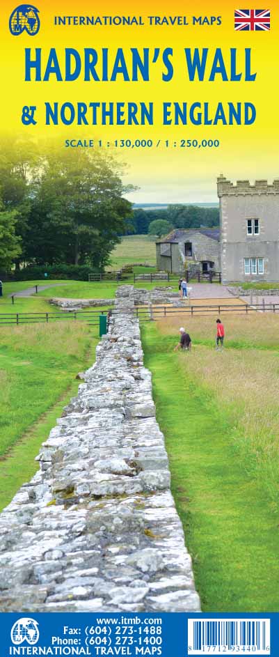
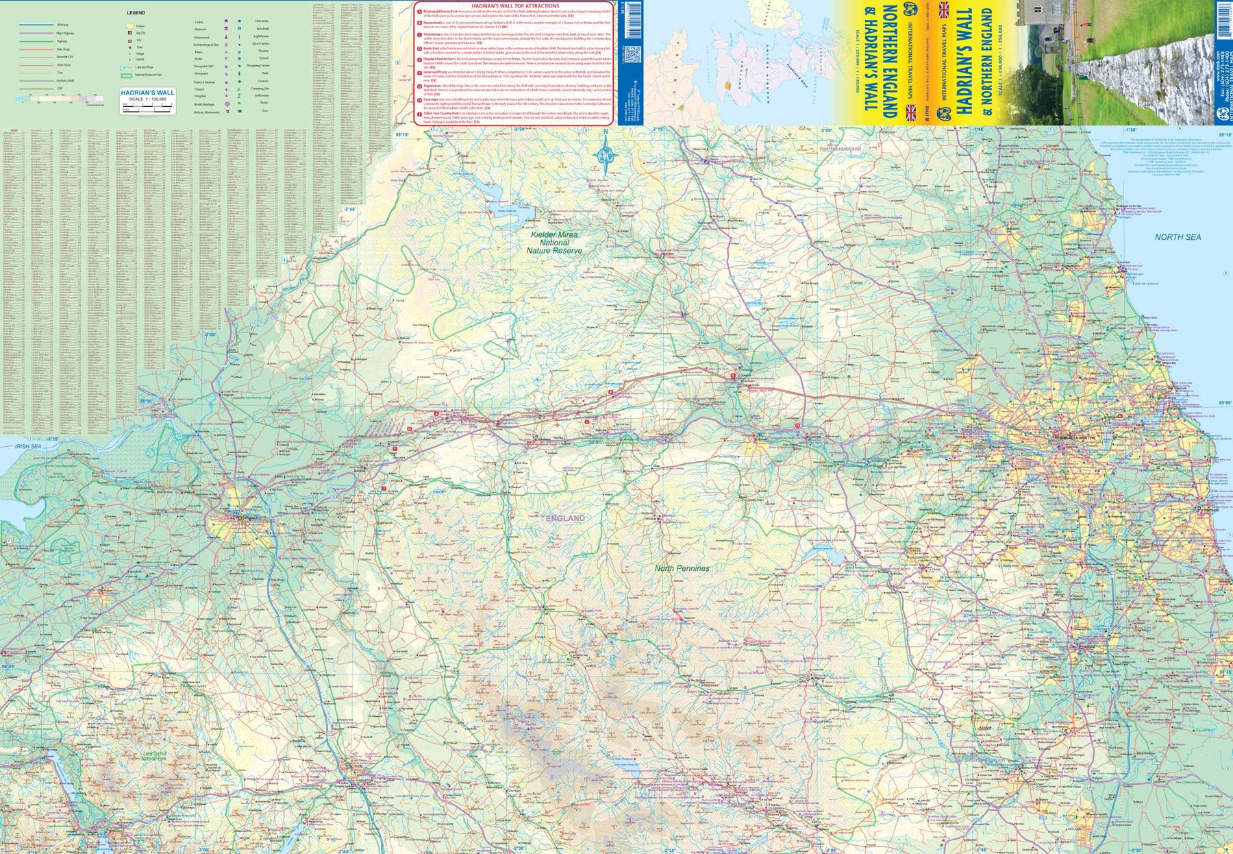
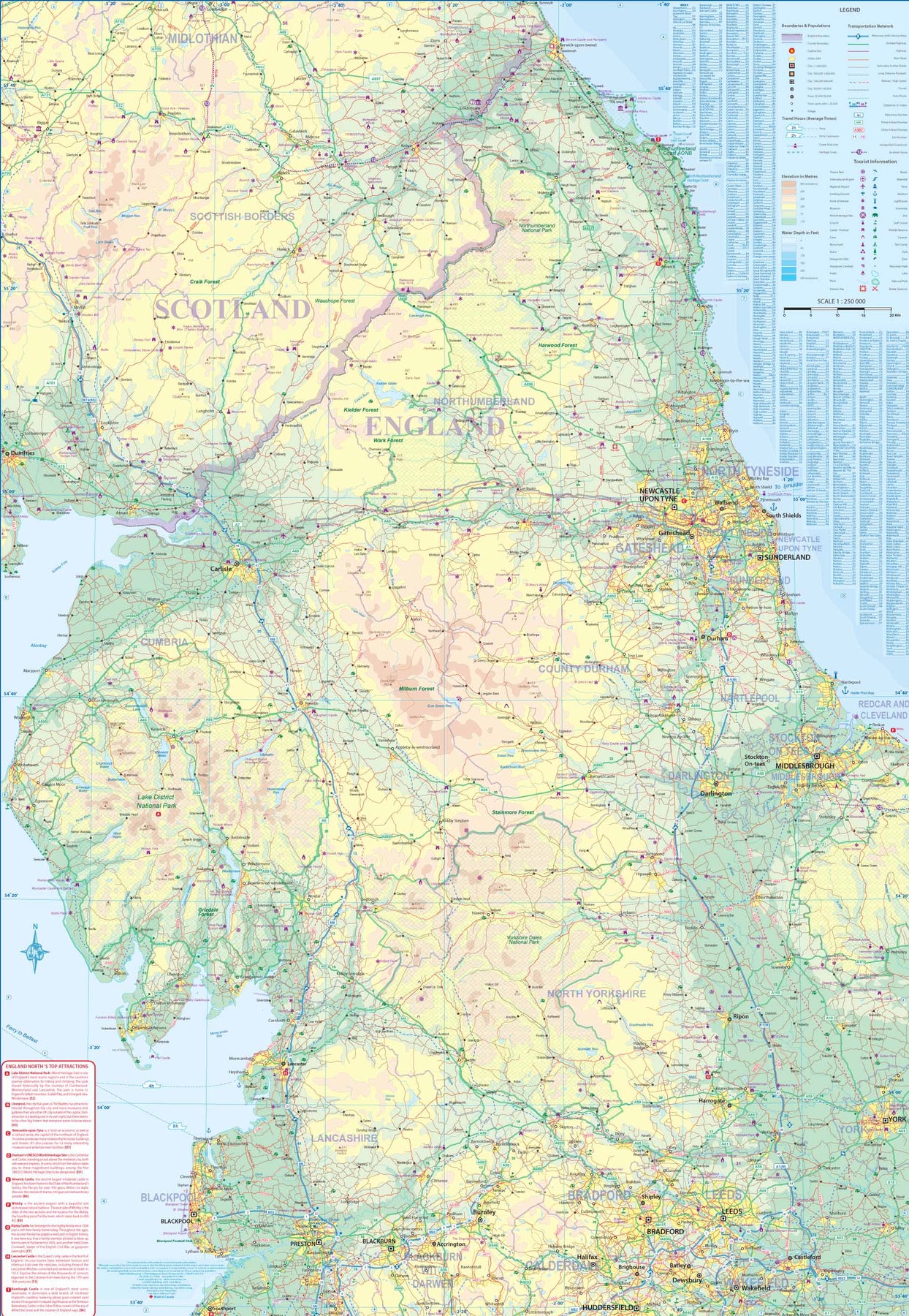
Great Britain: Hadrians Wall & Northern England
Ordinær pris 199,00 krThe Romans eventually subdued the fiercely independent Britons over time, from Julius Caesar's second invasion to the end of Roman rule in 410AD, but they never brought the extremely unruly Scots or the Welsh under their rule. In fact, raids from Scotland (known to the Romans as Caledonia) were so devastating that Emperor Hadrian ordered a wall built to keep them out. This massive wall stretches from the mouth of the River Esk, west of Carlisle, all the way across northern England to a point on the River Tyne somewhat to the east of modern-day Newcastle. The wall, like the Great Wall of China, was only moderately successful in keeping the Scottish Picts at bay and required a small army just to man the many watch towers and encampments. Nevertheless, it remained as a fortified border until the Roman legions abandoned Britain in 410.
Much of the wall was gradually demolished to create housing and fencing on both sides, but the foundations remain, as well as remnants of fortifications along the length of the wall. In today's United Kingdom, the wall is a long-distance hiking trail, a series of museums and memorials, a few temples that have been reconstructed, and some rebuilt portions of a remarkable construction that has survived the ravages of time. It is a 'must see' travel experience for everyone, a life-shaping experience for youngsters, and a massive tribute to the will of the Roman Empire. By the nature of a rectangular sheet of paper, the map shows much more than 'just' the wall, going as far south as Penrith and County Durham, and north into southern Scotland, showing all sorts of attractions that have nothing to do with the wall itself. In short, this is a marvellous travel map for all to enjoy.
Great Britain: England - Southeast & Midlands Railway & Road
Ordinær pris 199,00 krThe shape of the UK makes it difficult to map logically. The term South East, within crowded England, is generally more restrictive than is appropriate for a map. Our definition of SE is from the English Channel north to the northern tip of East Anglia and west to Portsmouth/Reading/Peterborough. This occupies side one of the sheet. Side two consists of that complex portion of England generally called ‘The Midlands’ stretching from Cambridge/Peterborough west to the Welsh border and from Luton/Gloucester north to Manchester/Grimsby. London is, of course, prominent, but only as a main roads map.
This is the most recent sectional map of the UK that ITMB has published, and was necessitated by the realization that, to see England properly, one needs a detailed enough map to show rail lines, motorways, A-type highways and B-type secondary roads, but also the tertiary level of road joining villages. The road network of England is incredibly complex and cannot be shown in proper detail without mapping at this scale or better. England also has a sophisticated rail network and this is left off most maps to avoid clutter. We have emphasized all the rail lines carrying passengers, which makes the London portion look like a spaghetti factory, but there are lines everywhere. All motorways and highways are shown, but rail lines are prominently shown, to encourage travel by train. A Top Attractions list has been included as well, but hundreds of interesting touristic sites have been included.