1101 produkter
1101 produkter


1101 produkter
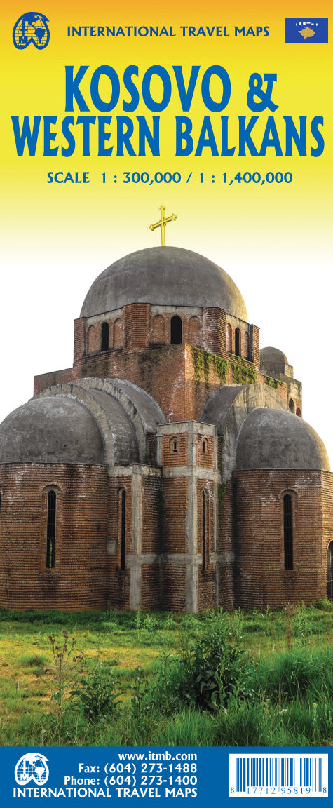
Kefalonia
Ordinær pris 229,00 krKefalonia was popularised and made famous by Captain Corelli's Mandolin. For your best adventures, use the best map. Water-proof, split-proof, tear-proof, adventure-proof.
Kefalonia and Ithaca Tour and Trail Super Durable Map is simply the toughest, most accurate, easy to read, easy to use map of the island you can buy at any price. A large 960mm by 690mm double sided map sheet has both Kefalonia and Ithaca at 1:40,000 scale with the North-West of Kefalonia on the cover side and the South-East of Kefalonia with neighbouring island Ithaca on the reverse. A generous common overlap of Kefalonia reduces the need to turn the map over when navigating.
Our special concertina map fold makes your map easy to open and easy to refold to its 230mm by 120mm pocket size. Our legendary 'Tour & Trail' level of detail ranges from major roads to secondary roads to minor roads to streets and narrow country roads, plus dirt roads, tracks and walking trails. Place names are in English and Greek to aid your navigation.
Altitude shading is designed to clearly show the altitude range when travelling across the island by car or on foot. 20 metre and 100 metre contours combined with altitude shading bring this beautiful landscape to life. There are plenty of individual height points and all of the official Trig points are on the map.
Tour and Trail attention to detail includes our useful symbol range including viewpoints, picnic areas, petrol stations, bar/restaurants and parking areas where you can pull off the road safely. You will easily identify springs, caves, sports grounds, cemeteries, monasteries, churches, chapels, lighthouses, castles, camping areas, wind turbines, hotels etc. Published walking routes are clearly highlighted on the map.
It all adds up to the most detailed and most durable map of Kefalonia and Ithaca that you can buy anywhere. Super Durable means a waterproof, tear-proof, map that can take the roughest treatment and still folds up like new after your adventures. Super Durable Maps come with a 2 year adventurous use Wear and Tear guarantee.
Digital editions of our Kefalonia and Ithaca Tour and Trail Map are available for phone apps and Garmin users from our Discovery Walking Guides website.
Publisert år: 2020
Innbinding: fal
Material: 0
Målestokk: 1:40 000
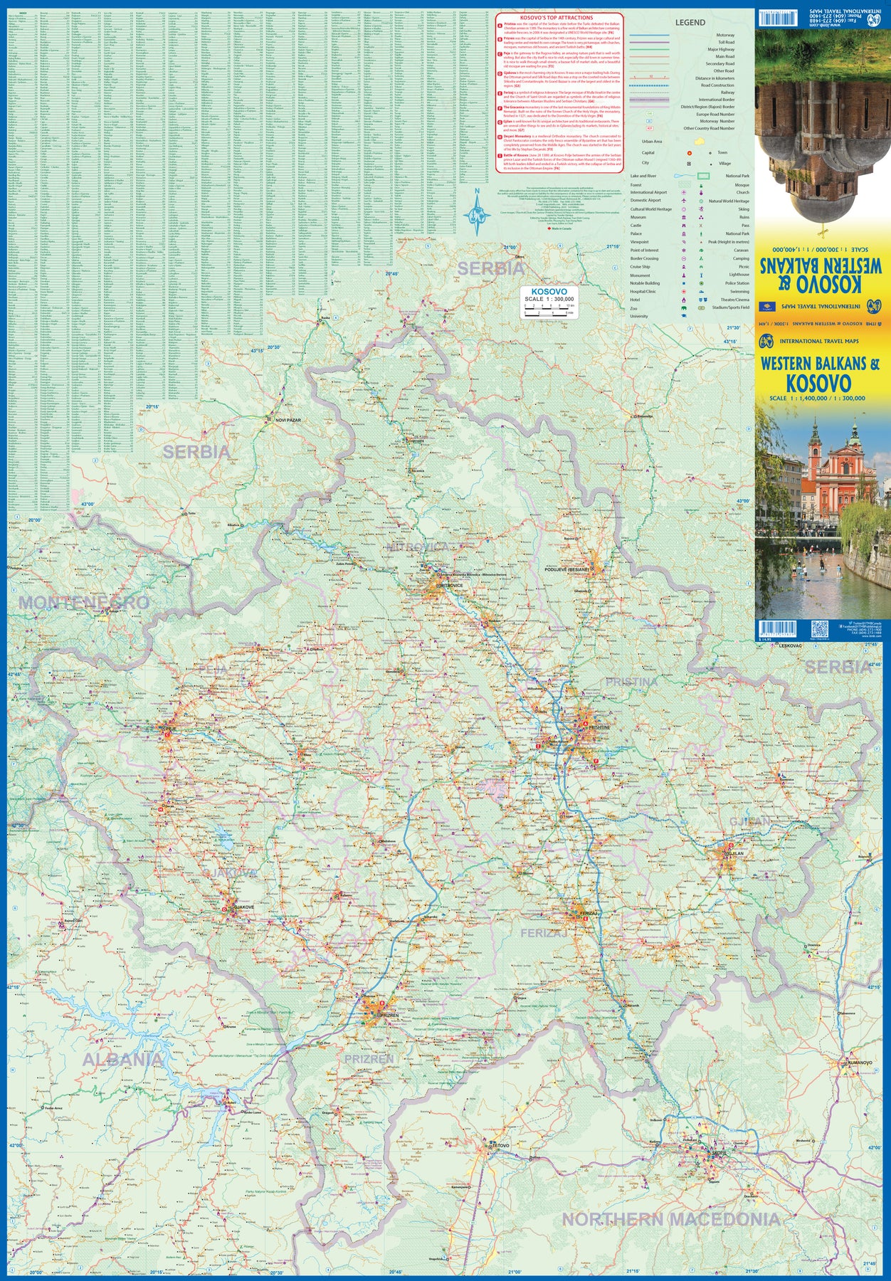
Kosovo
Ordinær pris 199,00 krKosovo at 1:150,000 on a large map in Freytag & Berndt’s “Top 10 Tips” series with the index booklet also providing multilingual descriptions of the country’s most interesting locations. Where appropriate, place names are bilingual, with Serbian names shown in Latin alphabet only (within Serbia itself and Macedonia place names are in both Cyrillic and Latin alphabets).
The map is an enlargement of F&B’s mapping of the region at a smaller scale, so all names are in much larger print size than found on similar maps. Topography is presented by relief shading with colouring for forested areas, plus names of various mountain ranges and peaks. Road network includes small local roads and selected cart tracks. Driving distances are marked on main routes and scenic roads are highlighted. Railway lines are shown with stations. Various places of interest, including the publishers’ recommendations are highlighted. Latitude and longitude lines are drawn at 10’ intervals. Multilingual map legend includes English.
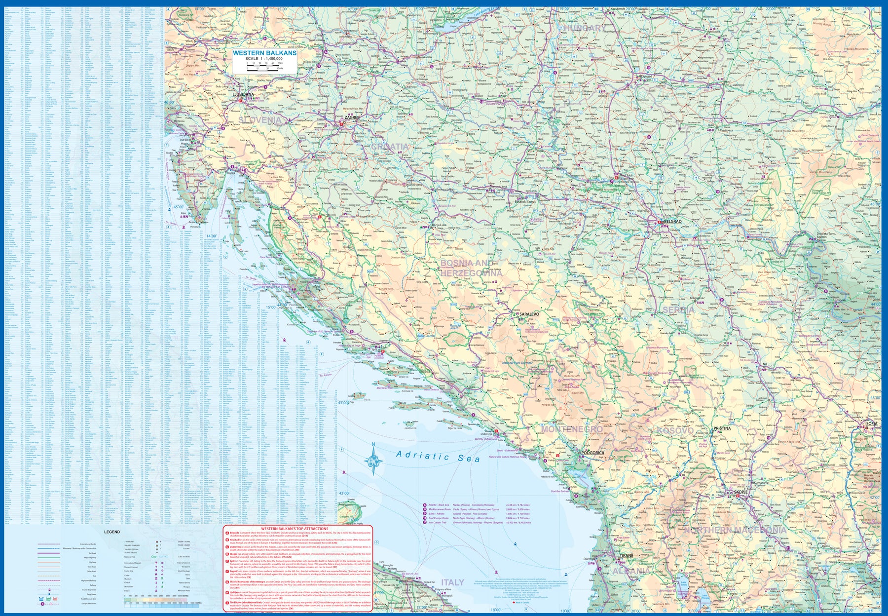
Kosovo & Western Balkans
Ordinær pris 199,00 krKosovo is the country that shouldn't exist, but does. When Yugoslavia fell to pieces after Tito died, Kosovo was lumped in with Serbia but was very unhappy with being a part of an Eastern Orthodox regime. It broke away, resulting in genocidal fighting until the Americans stepped in and stopped the fighting. The region was then placed under a European Union control in the faint hope that it would merge with Albania, or Montenegro, but it didn't. Relations with Serbia are still quite strained, but Kosovo is still surviving as a mountainous Balkan state. Fought over for centuries by Turks and Serbs, Kosovo is emerging as a small but touristic European country. This is definitely an off-the-beaten-path travel destination!
The second side of the sheet provides an excellent regional coverage for the Western Balkans, essentially Slovenia, Croatia, Montenegro, Serbia, and reasonably large tracks of land for Hungary, Albania, and North Macedonia, showing the growing number of wilderness parks being created.
La Palma Caldera de Taburiente
Ordinær pris 199,00 krLanguedoc-Roussillon
Ordinær pris 199,00 krLanzarote
Ordinær pris 119,00 krMarco Polo er svært detaljerte kart som er praktiske og enkle i bruk. 7 klistremerker for å markere spesifikke steder gjør det enda enklere å planlegge reisen. Alle kartene inneholder en omfattende index for enkelt å finne frem.
Lanzarote
Ordinær pris 229,00 krLanzarote Tour & Trail Map covers this big island at a scale of 1:40,000 resulting in the most detailed and toughest map of Lanzarote that you can buy.
We have also included a full island map of La Graciosa at 1:40,000 scale for those people adventuring or staying on the island. Getting such a large island onto one map sheet at 1:40,000 scale means that we have had to split the island into a North-East section on one side and a South-West section on the other side, with a generous overlap between the sections.
In addition to the usual high level of detail on our "Tour & Trail Maps" we have introduced special 'lava' fills to define the lava fields and a 'zocos' fill to define the famous La Geria region. The result is the definitive map of Lanzarote. Super-Durable version is produced on a special polymer substrate using 100% oxygenation inks which results in a map that is virtually tear proof, water proof, baby proof, almost dog proof and will outlast any paper map many times over.
Lefkada, Paxos & Antipaxos
Ordinær pris 229,00 krVanntett og holdbart turkart over Lefkas, Paxos og Antipaxos.
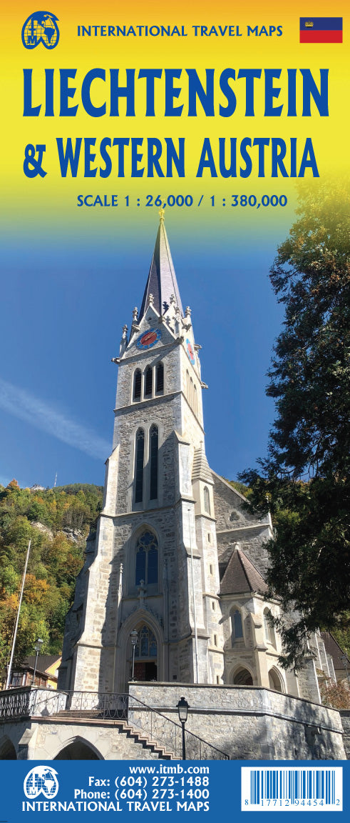
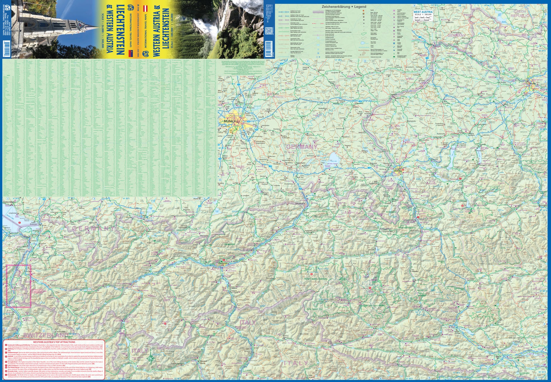
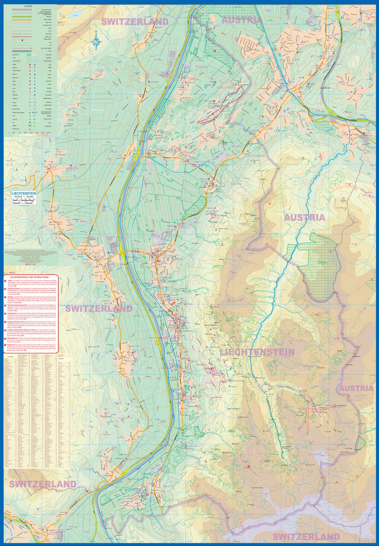
Liechtenstein & Western Austria
Ordinær pris 179,00 krEurope is dotted with mini-states that exist solely for historic reasons but are fiercely independent. Liechtenstein, surrounded by Switzerland on its west and south and Austria on its other borders, is such a state. It is larger and more diverse than many imagine and is quite a popular ski resort region. Side 1 is a detailed map of the principality, framed on the west by the Rhine River and a bit of Switzerland and on the east by Austria. Most development occurs in the Rhine Valley in a north-south direction, dominated by the capital city of Vaduz. There are five access points from Switzerland across the Rhine, one from the south, and two from Austria in the north. The ski haven of Malbun is prominently shown, and the scale of the map is detailed enough to name every major street. This also enabled us the opportunity to include schools, shopping areas, post offices, and churches, as well as a wide range of eating establishments. Walking/hiking trails have also been included.
This is the only map of Liechtenstein ever produced by a cartographic firm, and joins Andorra, Luxembourg, and Monaco as a valued part of ITMB's coverage of Europe. Side 2 concentrates on eastern Austria and southern Germany from Lake Boden (Bodensee) to Linz and from the Italian border north to Passau, in Germany. It is both a road/rail map and a physical relief map of this portion of the Alps. It includes its own Top Attractions list. Border crossings are shown merely as a formality, except for Switzerland. This would be an excellent map to use to explore the mountains south of Innsbruck or to discover small villages in the Tirol.
Lisbon
Ordinær pris 119,00 krLonely Planet City Map er slitesterkt og vanntett, med en hendig slipcase og et format som er lett å brette. Få mer ut av kartet og reisen din med bilder og informasjon om byattraksjoner, transportkart, reiseruteforslag, omfattende gate- og nettstedsindeks og praktiske reisetips. Med dette brukervennlige navigasjonsverktøyet i baklommen kan du virkelig komme til hjertet av din destinasjon!
Lombardy
Ordinær pris 189,00 krMarco Polo er svært detaljerte kart som er praktiske og enkle i bruk. 7 klistremerker for å markere spesifikke steder gjør det enda enklere å planlegge reisen. Alle kartene inneholder en omfattende index for enkelt å finne frem.
London
Ordinær pris 119,00 krLondon
Ordinær pris 119,00 krKart i postkortstørrelse. Folder seg ut som en popoutbok når du åpner dem. Fargerik turistinformasjon med kart over metro og busstraseer, landemerker og lignende. Veldig enkel å håndtere.
Lower Austria
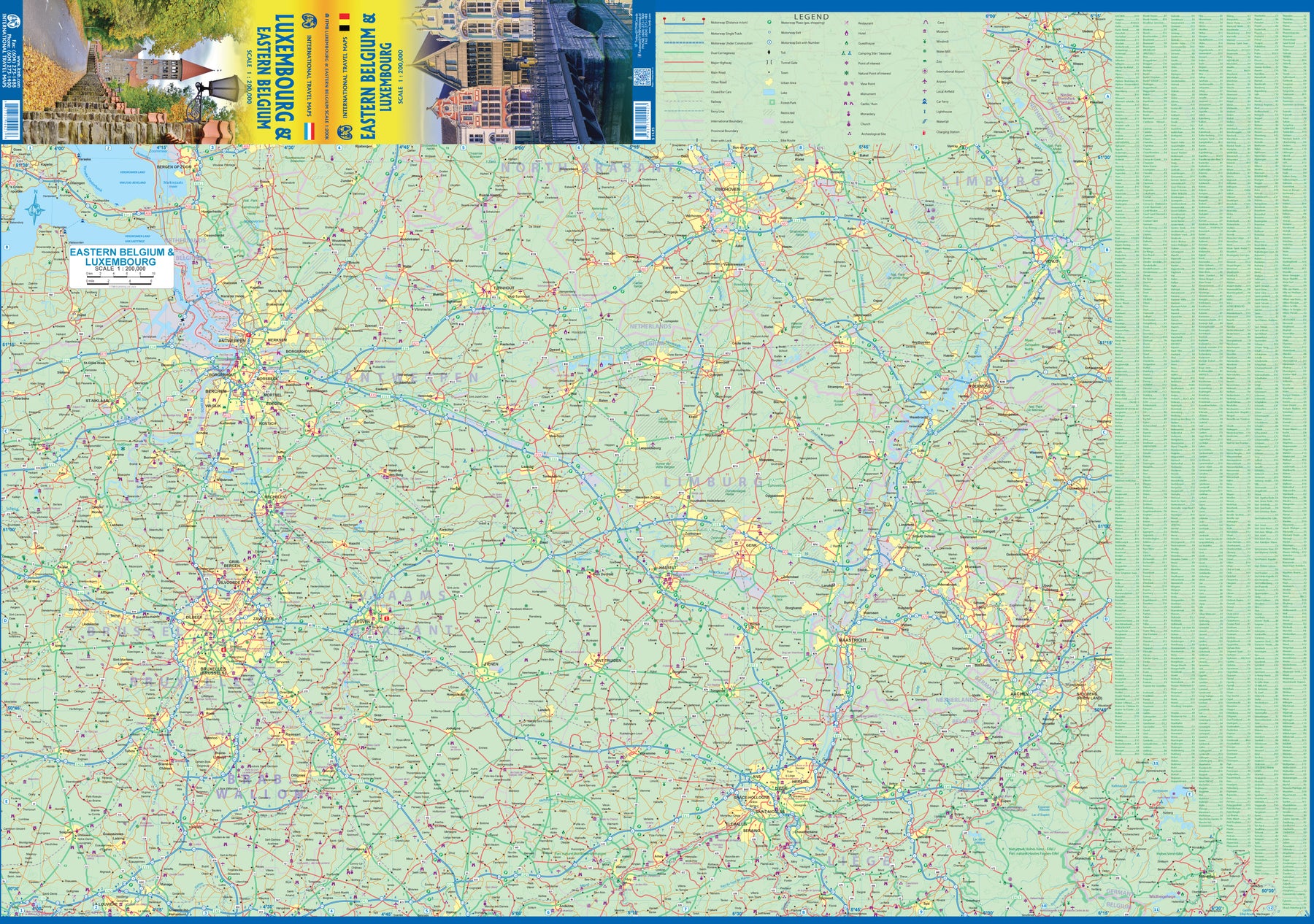
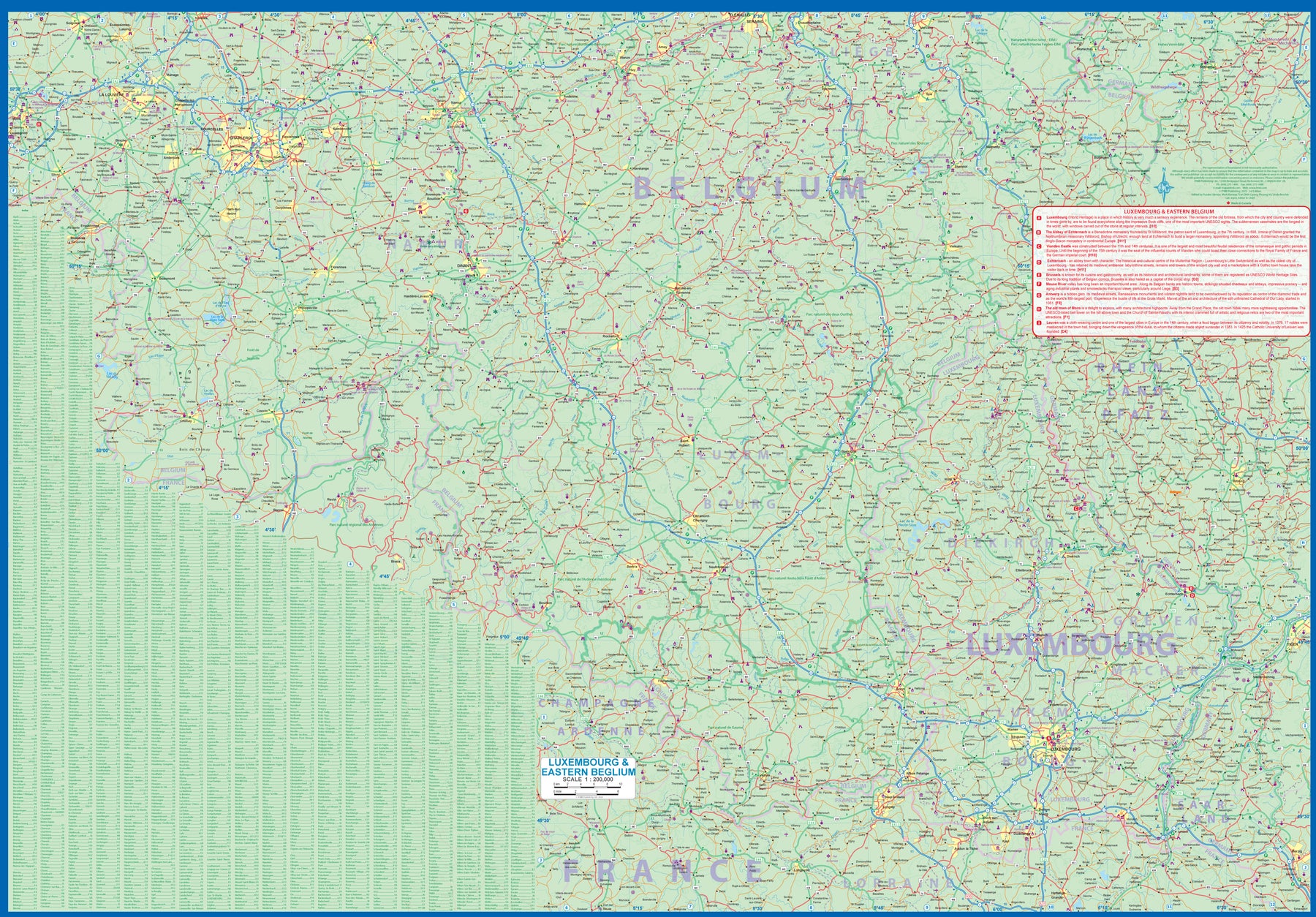
Ordinær pris 199,00 krLuxembourg & Eastern Belgium
Ordinær pris 199,00 krLuxembourg is the largest of Europe’s mini-states. We have included the principality on maps of surrounding countries, as most publishers do, but we felt it was time to concentrate on the principality itself and place it into context with its neighbours. Bounded on the west by Belgium, on its east by Germany, and its south by France, Luxembourg has survived for centuries by playing off one large power against another in order to retain its independence. Largely a French-speaking area, Luxembourg is also a strong supporter of the EU. It is a mountainous country, part of the Ardennes region, and close to Bastogne, the focal point of Hitler's last attempt to break the Allies in what is now called the Battle of the Bulge. Bastogne, site of a marvelous WW2 museum, is also on Side 1, as is a portion of Belgium going as far as Mons.
Side 2 concentrates on Belgium east of Brussels, with a small portion of Netherlands included. This includes the Brussels region, Antwerp, Leuven, Liege, and Aachen, with a tiny portion of Germany. Belgium is a larger and more diverse country than many realize. One of the great treasure of eastern Belgium is the cathedral town of Liege, which is known in Flemish as Luik and in German as Luttich, which can make finding it a bit challenging, depending upon whose map one is using, or which road signs one is following!
Madrid
Ordinær pris 119,00 kr
Lonely Planet City Map er slitesterkt og vanntett, med en hendig slipcase og et format som er lett å brette. Få mer ut av kartet og reisen din med bilder og informasjon om byattraksjoner, transportkart, reiseruteforslag, omfattende gate- og nettstedsindeks og praktiske reisetips. Med dette brukervennlige navigasjonsverktøyet i baklommen kan du virkelig komme til hjertet av din destinasjon!
Mallorca Ost (East)
Ordinær pris 129,00 krOm esterbauer estebauer er et Østerriksk forlag som spesialiserer seg på sykkelkart og sykkel- og vandreguider. Forlaget er representert med ca. 36 titler med hovedvekt på serien cycline guide/ bikeline som kombinerer sykkelguider og kart i spiralinbinding slik at du enkelt kan brette deg frem til riktig side og sykle etter kartet. Det fleste er tyskspråklige, men enkelte utgivelser finnes også på engelsk eller dansk.
Publisert måned: Jul
Publisert år: 2015
Innbinding: falset
Material: plastpapir
Målestokk: 1:60000
Mallorca: Serra de Tramuntana
Ordinær pris 399,00 krThis set of 4 maps covers the Tramuntana Mountains in northern Mallorca, at a scale of 1:25 000. The 4 maps show all the main walking and hiking trails in the Tramuntana Mountains, with a generous overlap between each map.
Also shown across all 4 maps is the whole of the GR 221 long distance walking trail.
Mallorca: Tramuntana Central
Ordinær pris 219,00 krVandre'kart i målestokk 1:25 000 over sentrale delen av fjellkjeden Serra de Tramuntana på Mallorca, med hefte (26 sider på engelsk) som beskriver områder egnet for terrengsykling, turgåing, overnattingsmuligheter.
Mallorca: Tramuntana Nord
Ordinær pris 249,00 krVandre- og turkart over den nordlige delen av fjellkjeden Serra de Tramuntana på Mallorca.
Malta & Gozo
Ordinær pris 199,00 kr3rd edition 2019. Although the country is modest in size, it is historically rich and popular with tourists. The double-sided map shows the main island of Malta on one side, and the smaller island of Gozo on the reverse, as well as inset maps of Valletta, Bugibba, Marsaskala, Mdina, and Victoria. For history buffs, Valletta can’t be beat, but the touristic city of Bugibba contains most of the resort hotels. Mdina, a walled city, is a World Heritage site. as is Victoria, a hilltop market town with a still-formidable citadel. The legacy of the Knights of St. john are everywhere. This is a very interesting and popular country to visit and a proud member of the EU.
Malta: Liesertal Maltatal
Ordinær pris 189,00 krDette store østerriske kartforlaget er kjent for sin klare kartografi og gode papirkvalitet. De kommer i alle målestokker, og flere av landkartene inneholder bykart og turistinformasjon.
Marseille
Ordinær pris 199,00 krMediterranean Cruising
Ordinær pris 199,00 krITM har kart over hele verden og de spesialiserer seg på land litt utenfor allfarvei. Beliggenheten til landets nasjonalparker, historiske monumenter, de viktigste veiene o.L. Finner du inkludert i kartene. Samtlige landkart har ofte et bykart over hovedstaden.
Fra ITM: We are very pleased to present our very first cruising map covering the Mediterranean Sea. This is a double-sided map covering the eastern portion on side 1 and the western part on side 2. We were presented with a dilemma in designing this map, in that the shape of the sea is such that to include the straits of Gibraltar and the Dardanelles on the same map, a compromise would be necessary.
As few cruise ships now go to the North African coast, we concentrated on showing only the portion from Morocco to Tunisia so we could show Spain, France, Italy, Greece, the Balkans, and the Eastern Mediterranean, including the Black Sea. Little did we know that war in Europe would impact so intensely on what should be a pleasurable touristic map. Regardless, almost all of the ports of call for cruise ships in 2022 are shown on this map, including those favoured by smaller liners in the Adriatic Sea. We have also included common ferry routes between Italy and Greece and Marseille to Algiers.