8 produkter
8 produkter
Utsolgt
Chile
ITM
169,00 kr

Chile: Easter Island & Santiago
Ordinær pris 199,00 kr/
Mva inkludert
Frakt beregnes i kassen.
ITM har kart over hele verden og de spesialiserer seg på land litt utenfor allfarvei. Beliggenheten til landets nasjonalparker, historiske monumenter, de viktigste veiene o.L. Finner du inkludert i kartene. Samtlige landkart har ofte et bykart over hovedstaden.
Fra ITM: 4th edition 2015. Easter Island is so isolated that it is not certain whether it is part of Polynesia or an off-shoot of South America. Geologically, it is neither; just a volcanic lump in the vast expanse of the Pacific Ocean. Its original inhabitants probably came from Polynesia; since supplanted by migrants from Chile, which is the political authority governing the island. Regardless, it is an intriguing place, famous for the Maoi – giant heads originally raised to protect family holdings. These huge, mysterious heads rest in various locations on the island and are one of the wonders of the world. This map also includes a detailed map of Santiago de Chile, the capital of Chile, for the simple reason that all flights to Easter Island originate in that city, so everyone going to Easter Island needs a map of Santiago as well. This usage is merely for the convenience of visitors going to Easter Island.
Publisert år: 2020
Innbinding: falset
Material: papir
Målestokk: 1:24,000 / 12,500

Chile: Santiago & Northern Chile
Ordinær pris 179,00 kr/
Mva inkludert
Frakt beregnes i kassen.
ITM har kart over hele verden og de spesialiserer seg på land litt utenfor allfarvei. Beliggenheten til landets nasjonalparker, historiske monumenter, de viktigste veiene o.L. Finner du inkludert i kartene. Samtlige landkart har ofte et bykart over hovedstaden.
Fra ITM: The capital if Chile dominates the country. As locals, tell it, Santiago IS Chile; modern, cosmopolitan, and the main entry point for most visitors to Chile. The central banking and shopping district is well-served by four separate rapid transit lines and the map includes such attractions as parks, the railway station, the funicular, and the gondola ride. The reverse side of the map is an innovation for this title. The northern half of Chile is shown in two detailed portion maps, side by side. The far north, from the Peruvian border near Arica to Vina el Mar is shown on the first map, along with all crossings into neighbouring countries. The other map continues south from Vina del Mar/ Valparaiso to well south of Puerto Mont. This map would include Santiago, Talca, Concepcion, Temuco, and the Austral Highway as far south as Cochrane, which is close to the famous Laguna San Rafael National Park and its ice fields. Truly, a useful map!
Publisert år: 2019
Innbinding: falset
Material: papir
Målestokk: 1:12,500 / 770,000

Chile: South & Patagonia
Ordinær pris 199,00 kr/
Mva inkludert
Frakt beregnes i kassen.
ITM har kart over hele verden og de spesialiserer seg på land litt utenfor allfarvei. Beliggenheten til landets nasjonalparker, historiske monumenter, de viktigste veiene o.L. Finner du inkludert i kartene. Samtlige landkart har ofte et bykart over hovedstaden.
Fra ITM: This edition is enhanced by adding a set of ‘must see’ destinations and by the addition of three inset maps: Easter Island (Chile); Ushuaia (Argentina), and the Falkland Islands (UK). The map itself is double-sided, with the entire area of coverage on one side, and a more detailed expansion of southern Chile (south of Puerto Montt) and Easter Island on the other side. I should advise that ITMB publishes more detailed separate maps of Easter Island and of Tierra del Fuego.
- Publisert: 2019
- Innbinding: Falset
- Materiale: Papir
- Målestokk: 1:1:770,000, / 2,200,000


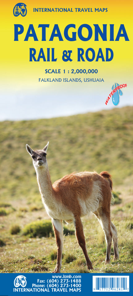
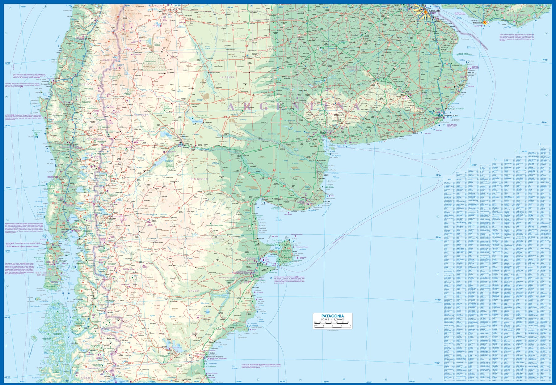
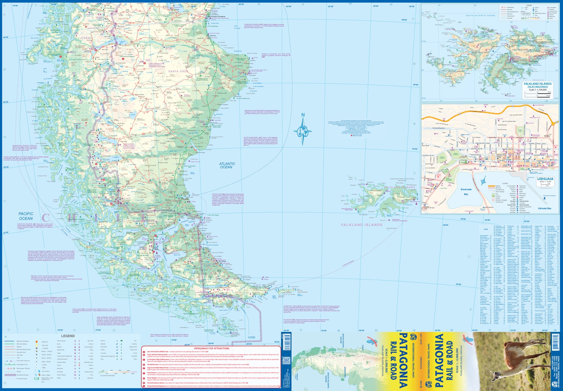
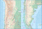
Patagonia Rail & Road
Ordinær pris 189,00 kr/
Mva inkludert
Frakt beregnes i kassen.
ITM har kart over hele verden og de spesialiserer seg på land litt utenfor allfarvei. Beliggenheten til landets nasjonalparker, historiske monumenter, de viktigste veiene og lignende finner du inkludert i kartene. Samtlige landkart har ofte et bykart over hovedstaden.
Fra ITM: Patagonia has changed dramatically in recent years. Argentina has finally invested in infrastructural improvements to make the region more accessible by paving roads, upgrading airports, building hospitals, encouraging tourism, and making exploration much more pleasant than when I first visited the region. By the shape of the southern third of South America, the map is best shown with the northern portion of Patagonia on one side and goes to the north of what is traditionally thought of as Patagonia to include the La Pampa region and Buenos Aires at the northernmost upper area of the map. As a result, all of Chile south of Conception is also shown. Highway 40, the 'spinal cord' of Patagonia, is now paved, or mostly so, making driving reasonably easy. There are rail lines in this northern region, and we have shown them, but I believe that all passenger service has been discontinued. The second side covers the Santa Cruz grasslands, the wonderful Chilean southern islands, and the very popular Tierra del Fuego portion of both countries. Most people do not realize that the Tierra region is an island, with access controlled by a Chilean ferry and border crossings into the Argentinian portion. Ushuaia, the most important city, is actually in the southern shore of the island, fronting on to the Beagle Channel. The southernmost point in South America is an island named after Hoorn, in old Holland, called Cape Horn in English. We even show the route tour boats use to get to Cape Horn from Ushuaia. The Falkland Islands are close enough to this southern tip of the continent to show on this map, and we have also included an expanded inset map to show the British colony in better detail. Just don't try to get there from Argentina! We have also included a detailed inset map of Ushuaia.
- Publisert: 2023
- Innbinding: Falset
- Materiale: Vanntett Papir
- Målestokk: 1:2 000 000

South America
Ordinær pris 249,00 kr/
Mva inkludert
Frakt beregnes i kassen.
ITM har kart over hele verden og de spesialiserer seg på land litt utenfor allfarvei. Beliggenheten til landets nasjonalparker, historiske monumenter, de viktigste veiene og lignende finner du inkludert i kartene. Samtlige landkart har ofte et bykart over hovedstaden.
Fra ITM: South America as a continent is fascinating. For many years, ITMB has provided this map, either in its original version of two single sided map or a double sided map, such as this. We spent a lot of time reviewing the artwork and updating information from more detailed maps. The resulting map is a considerable improvement on the previous edition. The print is remarkable clear and easy to read. Road categories, road numbers of highways, parks, major history and touristic information have all been updated. This is a fascinating continent, and this map is the definitive map of the continent
- Publisert: 2019
- Innbinding: Falset
- Materiale: Papir
- Målestokk: 1:4 000 000


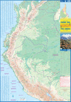
The Andes
Ordinær pris 199,00 kr/
Mva inkludert
Frakt beregnes i kassen.
We are pleased to be able to re-introduce this important title into our publishing range after a lapse caused by Covid. The Andes mountain chain is the southern extension of the Sierra Nevada chain through Mexico and Central America, which is, in turn the southern extension of the Rocky Mountain chain from Alaska to the Mexican border. The Andes is a magnificent series of high mountains that enters Colombia and spreads southwards through Ecuador and Peru all the way to southern Patagonia.
The map is double-sided, with the Northern Andes on one side and the other side divided into two side-by-side maps portraying the Central Andes and the Southern Andes. Thus, the map coverage focuses on the Andes themselves, rather than on all of South America. All of Colombia and Peru are shown, most of Bolivia, all of Chile, and the Patagonian portion of Argentina except for the southern portion of Tierra del Fuego. The importance of this map is that it focuses on the highland areas of the continent, where much of the population lives. Bogota, Medellin, Quito, Lima, Arequipa, La Paz, Santiago, Talca, and Punta Arenas are all located along the spine of the Andes. So are the Torres del Paine peaks, the Montt Glacier, and numerous volcanoes, touristic sites, and twisting mountain roads.
- Publisert: 2022
- Innbinding: Falset
- Materiael: Papir
- Målestokk: 1:3 000 000