73 produkter
73 produkter


73 produkter
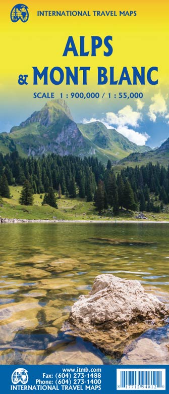
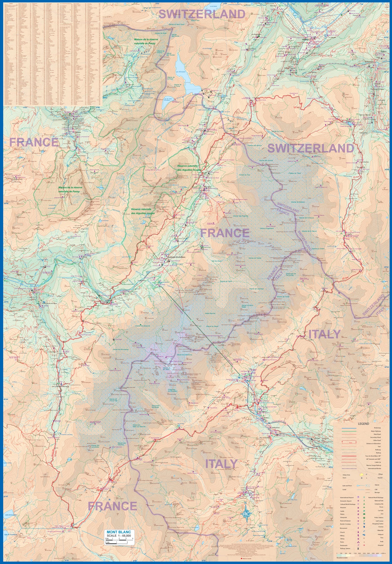
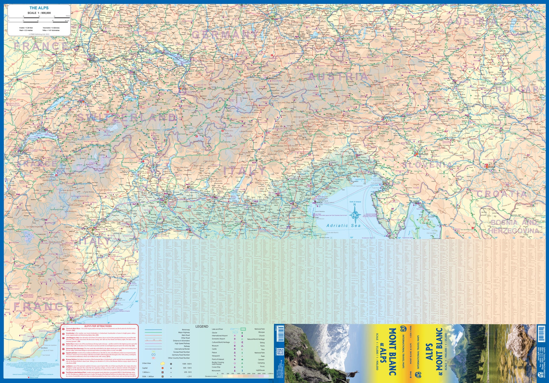
Alps & Mont Blanc
Ordinær pris 189,00 krAustria: Rail & Road
Ordinær pris 199,00 krAustria is both an ancient country and a modern country. It was a powerful empire prior to the French Revolution (Marie Antoinette was an Austrian princess prior to her marriage to the king of France), and WW1 was strongly influenced by the Austro-Hungarian empire. The aftermath of that war resulted in Austria becoming much diminished in power, but despite WW2, its borders remain much as they were in 1918. That said, today's Austria is a lovely and safe place to visit. 75 years of peaceful neutrality has restored the country to prosperity and the country is loaded with picturesque villages, lovely mountain scenes, historic castles and palaces, wonderful churches, and museums galore.
This map emphasises the rail network that is the best way to travel around the country, but also shows motorways and ordinary highways, parks, scenic attractions, and connections to surrounding countries.
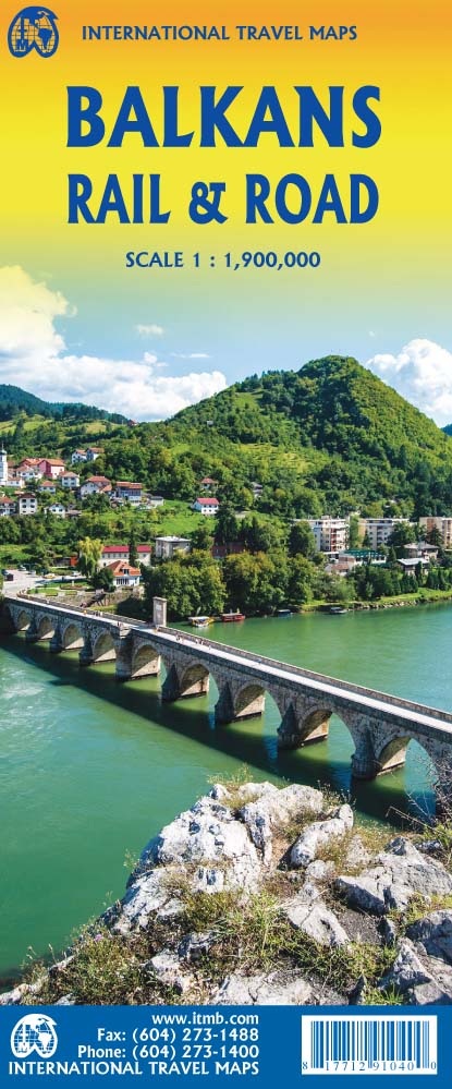
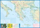
Balkans & Peaks of the Balkans
Ordinær pris 179,00 krThe portion of Europe east of the Adriatic and west of the Black Sea and south of the Alps has traditionally formed the region known as the Balkan States. This includes the former Yugoslavian states of Slovenia, Slovakia, Croatia, Montenegro, Bosnia Herzegovina, Kosovo, Serbia, and Northern Macedonia, as well as Albania, Hungary, Romania, and Bulgaria. Due to its shape, a large portion of Greece, and a bit of Turkey also are included. This is a new area of mapping for us, resulting from numerous visits to the region It is essentially a road map, as the rail network is weak, although rail lines carrying passengers are shown. Nice though the regional map is, its strength lies in the hiking map of the Peaks of the Balkans on the other side.
This detailed map is centred on eastern Montenegro, northern Albania, and western Kosovo. The ten major hiking routes are shown in pink, and there are numerous secondary routes one can explore. This is a growing touristic destination for those seeking a semi-wilderness area for enjoyment, while remaining in Europe, and is becoming quite popular. Accommodations are comprehensively shown, as well as campsites. Contouring is shown, and many peaks are noted. It should be stated that, as these paths cross international borders, hikers should keep their passports handy for inspection Legend Includes: Roads by classification, Rivers and Lakes, National Park, Airports, Points of Interests, Highways, Main Roads, Zoos, Fishing, and much more...
Balkans Rail & Road
Ordinær pris 179,00 krITM har kart over hele verden og de spesialiserer seg på land litt utenfor allfarvei. Beliggenheten til landets nasjonalparker, historiske monumenter, de viktigste veiene o.L. Finner du inkludert i kartene. Samtlige landkart har ofte et bykart over hovedstaden.
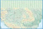
Belarus
Ordinær pris 149,00 krITM har kart over hele verden og de spesialiserer seg på land litt utenfor allfarvei. Beliggenheten til landets nasjonalparker, historiske monumenter, de viktigste veiene o.L. Finner du inkludert i kartene. Samtlige landkart har ofte et bykart over hovedstaden.
Fra ITM: 2nd edition October 2015. Folded map with detailed road and rail network, National Parks and Reserves with complete index of all cities and towns in the map. In this edition, major urban areas are shown in Cyrillic as well as the Latin alphabet, hypsometry has been re-worked to show elevation differences better. This is a double-sided map of the country (divided into west and east halves) with part of Lithuania on the western part and a fair amount of Russia on the eastern side. Known international border crossings are shown, except on crossing into Russia, which are numerous. A large inset map for Minsk in a very suitable scale (1:15.000 Scale) comprising most of the touristic sights and places of interest and Metro lines has also been provided that is far better than what we could show previously.
Publisert år: 2015
Innbinding: falset
Material: papir
Målestokk: 1:600000
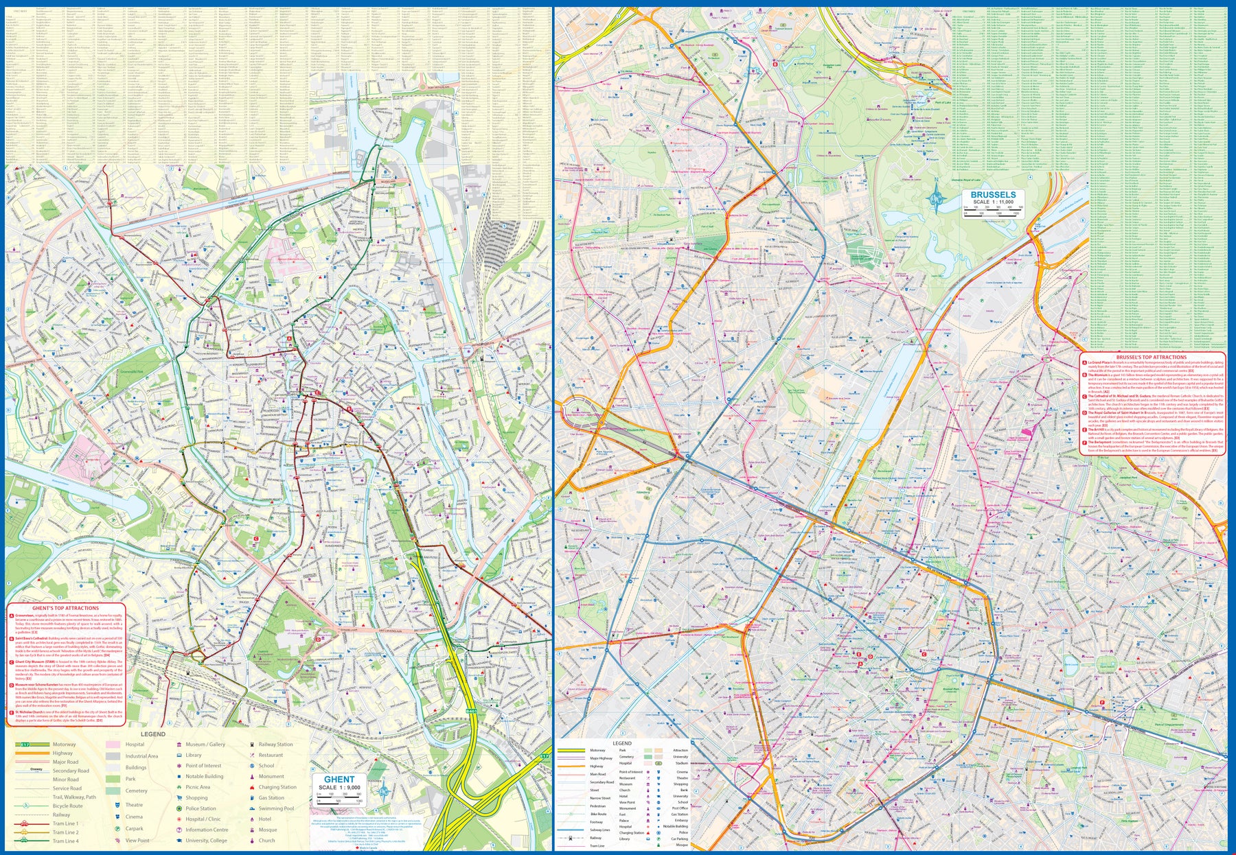
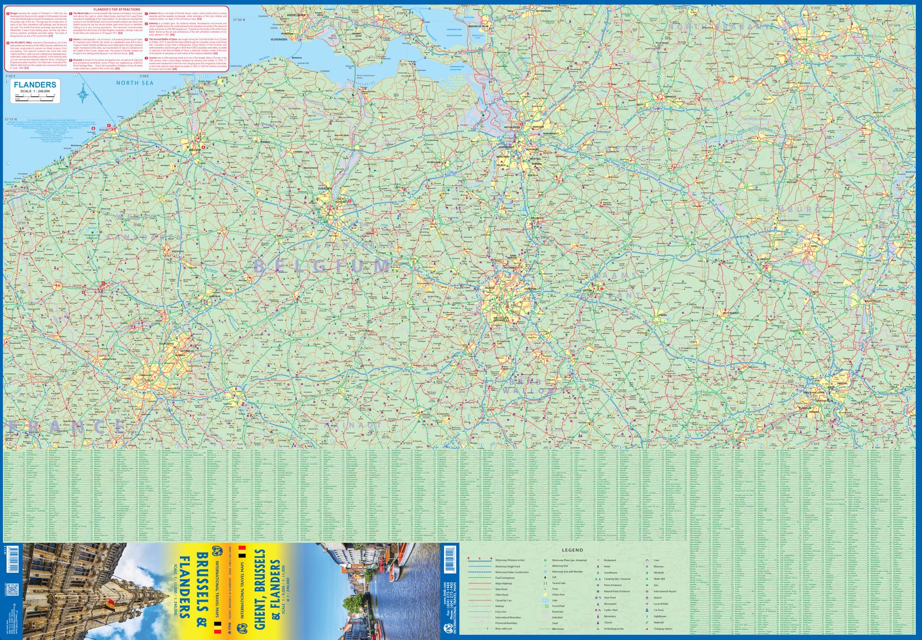
Belgium: Ghent; Brussels & Flanders
Ordinær pris 179,00 krGhent is one of the most historic cities in Europe. A city of canals, it became wealthy during the Middle Ages by controlling the production of cloth over several centuries. It is full of historic buildings and desperately needs a map or one becomes lost in the narrow streets that fill the ancient city centre. However, Ghent is not all that big so we have combined it with a detailed map of Brussels, the nominal capital of Belgium and the location of the European Union HQ. It was also the site of the famous world fair in 1968, the legacy of which is the Giant Atomium.
Side 2 of the map is also a new venture for us; a detailed map of Flanders region from Liege to Lille and from south of Brussels to north of Antwerp. This portion of both France and Belgium is full of historical importance and we hope to develop this artwork in future editions. For now, it is a detailed road map showing many fortresses/castles and monuments.
Bulgaria Railway & Road
Ordinær pris 169,00 krITM har kart over hele verden og de spesialiserer seg på land litt utenfor allfarvei. Beliggenheten til landets nasjonalparker, historiske monumenter, de viktigste veiene o.L. Finner du inkludert i kartene. Samtlige landkart har ofte et bykart over hovedstaden.
Fra ITM: We spent a week in Bulgaria in 2019, driving the roads, staying in towns around the country, and visiting attractions. The result of all this effort was to update our data for a new map of Bulgaria. This is a country that has been transformed by its entry into the European Union. Touristically, the country has benefitted by new investments in resort accommodations and by improvements to touristic attractions. The country is quite affordable to visit, the people are friendly, the weather is pleasant, the roads are generally very good, and accommodations are equal to other parts of Europe. We have changed the name somewhat to place an emphasis on rail travel. In concert with changing travel patterns, Bulgaria is renovating its passenger rail service, so we have included all lines carrying passengers. We have also updated the motorway network of the country. We have added a Top Attractions list to the artwork, and have updated the large inset map of Sofia. Provincial boundaries have not been included, as these are mostly local administrations, but the names have been included, as they are commonly used within the country.
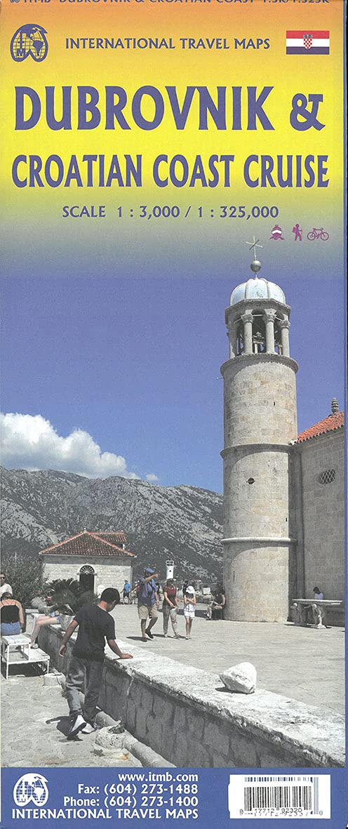
Croatia: Dubrovnik & Croatian Coast Cruise
Ordinær pris 199,00 krThe ancient port city of Dubrovnik, on the southern Croatian coastline, has evolved into a major tourist destination. The old walled city, normally entered through the famous Pile Gate, was so crowded with tourists when we arrived, that it took some time to get to the main street of Stradun. The city has completely recovered from the Montenegrin bombing during the breakup of Yugoslavia, with a few shellholes remaining just to show to tourists. The highlights of a visit are the Rector’s Palace, the Tvrdava fortress, and the cathedral. The map covers the urban area outside of the old town as well, as this is where most of the hotels and restaurants are located.
The other side of the map shows the extensive coastline of Croatia in two parts – from the Italian border to Trogir, and from Split to the border with Montenegro. We travelled from Porec to Dubrovnik in a small cruise ship of 45 passengers, which enabled us to visit ports that larger ships could not reach. As a result, we visited islands we could not have otherwise visited. The cover picture shows grandson Johnny in one such small town.
Denmark & Southern Sweden
Ordinær pris 149,00 krITM har kart over hele verden og de spesialiserer seg på land litt utenfor allfarvei. Beliggenheten til landets nasjonalparker, historiske monumenter, de viktigste veiene og lignende finner du inkludert i kartene. Samtlige landkart har ofte et bykart over hovedstaden.
Fra ITM: This is a new title for us, but it covers a logical travel destination. Denmark is, of course, a popular and interesting country to visit. So, for that matter, is Sweden. This map combines the best of both countries in a double-sided entity that shows all of Denmark on one side and the southern half of Sweden on the other side. The Danish side shows all roads that probably exist in the country as well as touristic attractions such as churches, windmills, castles, museums, and other points of interest. An interesting inset map of the island of Bornholm is included. The other side shows Sweden in great detail from the bridge joining Copenhagen to Malmo and the ferry between Helsingor and Helsingborg north to the border with Norway and east to Stockholm as well as much farther north into the interior lakes, all the way to Ostersund. A detailed map of the old town centre of Stockholm, known as Gamla Stan, is also included.
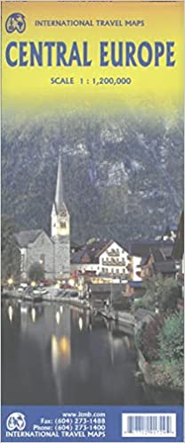
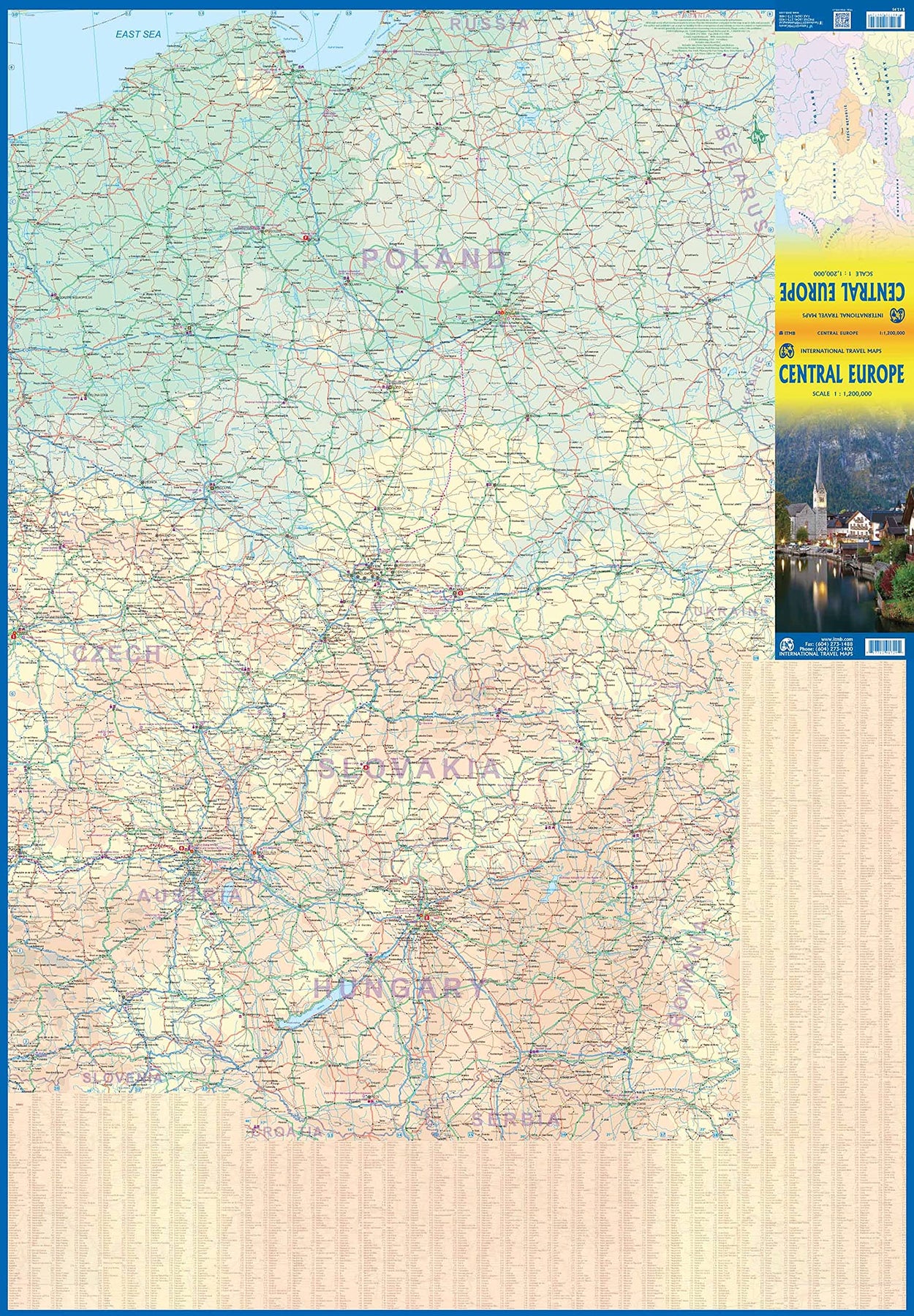
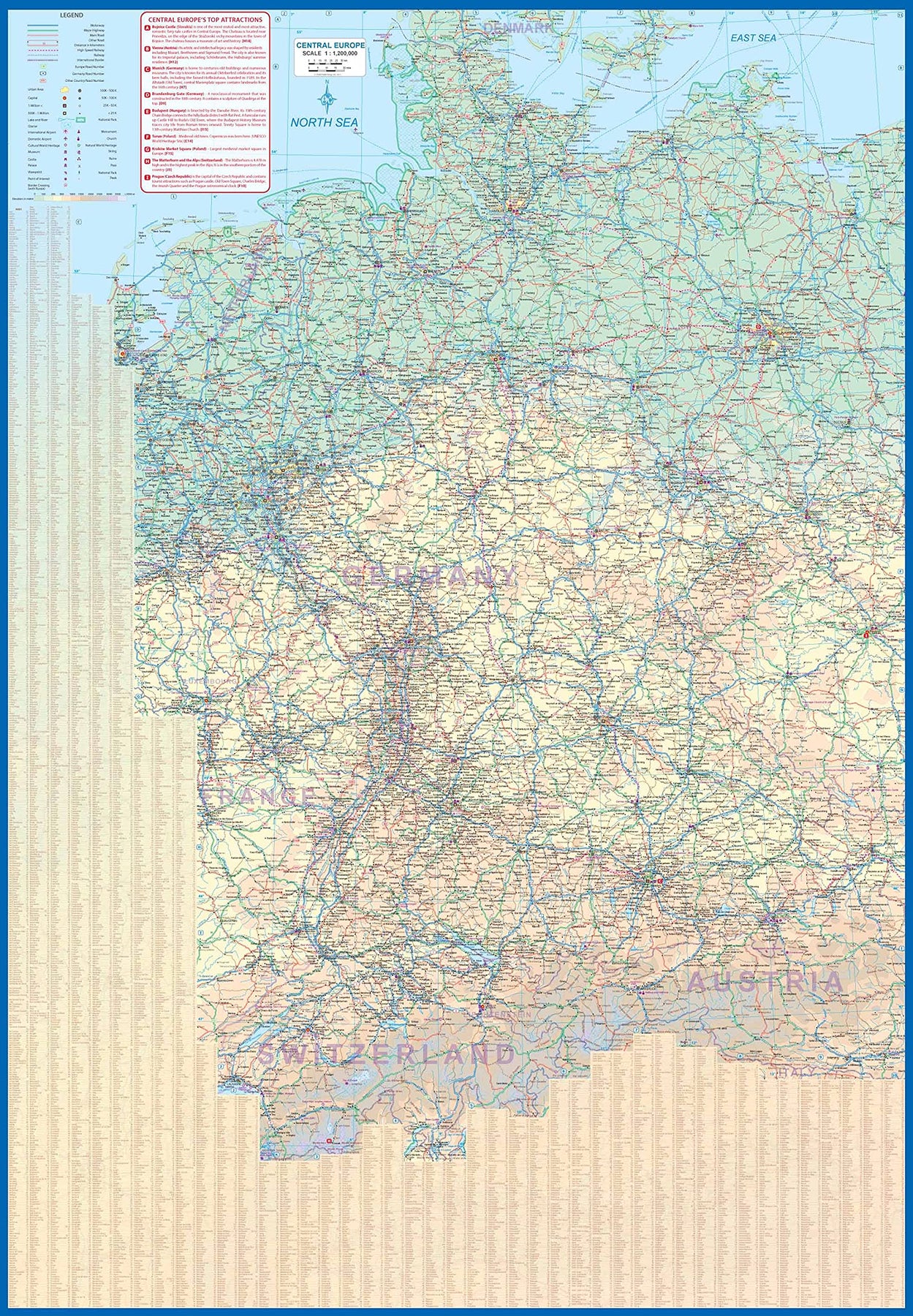
Europe Central
Ordinær pris 199,00 krEurope is fairly big, and densely populated. A map of all of Europe is useful, but at a scale that limits our ability to show information. As a result, last year we published a map of Western Europe. Now, we are pleased to extend our more detailed coverage of the continent with a map covering the Central European countries of Germany, Austria, Poland, Czech Republic, Hungary, Slovakia, and Switzerland, with portions of France, Belarus, Serbia, and Romania. A third map, covering eastern European countries, will be released soon, providing detailed regional coverage of the continent in a way that we hope is pleasing. Germany occupies most of the first side, and Poland the other, with Czech and Slovakia divided between the two sides, and Slovakia/Hungary filling the rest of side 2.
This is a regional map, showing rail lines as well and roads, airports, and major touristic attractions. A listing of the region’s top attractions is included. This map will appeal to those visiting several countries on one trip, by rail or road. Legend Includes: Roads by classification, Rivers and Lakes, National Park, Airports, Points of Interests, Highways, Main Roads, Zoos, Fishing, and much more...
Europe Eastern: Railway & Road
Ordinær pris 199,00 krEurope may be small in comparison to Canada, but it is densely populated and difficult to map as a continent while providing detail. Eastern Europe used to be defined as everything behind the Iron Curtain during the Cold War, but now it encompasses everything east of Germany and Switzerland, which means that this map covers Italy, Greece and the Balkan countries, the Central European countries of Romania and Hungary and most of Ukraine, Poland and the three Baltic states, and western Russia as far east as Volgograd, as well as much of Turkey. It is a combined road and rail map, showing motorways and major highways, fast-train routes in red and regular services in black. It also shows major cruise line routes, although many have been suspended due to Covid and political situations in Russia and Turkey.
Essentially, this is a map covering a very large area, as are our maps of Western and Central Europe, and our earlier map of Scandinavia. We have tried to make it politically correct, which is difficult considering the Russian occupation of Crimea and the Donetsk region of Ukraine and the on-going controversy over the ‘proper’ name for Macedonia, so we apologize for any errors. For simplicity’s sake, we have named most place names in English, so Roma is Rome and Moscva is Moscow etc. Fortunately, most English place names are the same in the local languages. However, being ITMB, Naples is Napoli, and Florence is Firenze, so don’t be too critical of us; we’re trying to reconcile differing perspectives.
Europe Western: Railroad & Road
Ordinær pris 179,00 krThis is a new title for ITMB. It focusses on the western half of the European land mass at a much better scale than would be possible for all of Europe. Even at this scale, showing the rail lines and the major roads results in a map with a lot of information on it, but it meets the needs of those travelling around Europe by rail, which is its primary market. It can also be used by those driving, although it would be better for vehicle users to rely on individual country maps.
Side 1 covers the British Isles, the Low Countries, Germany, Denmark, the Czech Republic, most of Poland, and southern Scandinavia. The second side covers the Iberian Peninsula, France, Italy, Slovenia, Croatia, Bosnia, Austria, Hungary, and the southern portion of Germany. Trains tend to be used by travellers in Europe for longer trips, say from Frankfurt to Rome, and for this reason our new map should find a good market. There has not been enough room on this map to show many touristically important sites, but where room exists, we have added UNESCO World Heritage sites, major churches, and most international airports.
Coverage includes major ferry routes and includes the islands of Majorca, Menorca, Ibiza, Sardinia, Elba, and Corsica, Sicily, and Malta. As the EU evolves, passenger rail service is increasingly becoming a pan-European reality, but German trains running on French lines and Italian trains going north into Austria. This is a timely map; coming out at the beginning of a truly European rail system.
France: French Atlantic Coast - Rail & Bike
Ordinær pris 179,00 krFrance is a rather large country, and while it can be portrayed on a map as a country, mapping it in segments provides an opportunity to concentrate on regions at a better scale. This map, covering the coastal region of France from the Cotenin Peninsula south to the Spanish border and east as far as Paris and Montpellier in Languedoc is the first of what we hope will be a series covering the country at an improved scale. This map is double-sided, covering from Quimper and Paris at the northernmost portion of coverage, to Angouleme and Clermont at the southern extreme on one side, with the second side covering from Bordeaux and St-Etienne south to Bayonne/Pamplona and Nimes/Avignon in the south. This is a part of Europe that has been fought over for centuries, and as such is dotted with fortresses proclaiming its historic importance.
This map has been designed with the leisure traveller in mind. Although it shows all motorways and highways, rail connections by train are emphasized, as are long-distance Euro-Velo cycling routes that are being developed in many parts of Europe. At this scale, it would be impractical to record all accommodations, but we have included a new feature that is thus far peculiar to France, and that is motorway hotels at rest areas. Naturally, the map is rich with places of touristic interest.
France: North Rail & Bike
Ordinær pris 179,00 krFrance: Railway & Road
Ordinær pris 169,00 krThis edition of France continues a developing strain of European country maps for ITMB – placing an emphasis on train travel. Tourism is changing, or rather, is growing exponentially as more and more people from Asia visit France. Most of these visitors, and for that matter, most visitors from North America, prefer to travel around France by using the excellent rail network, rather than by road. Most map publishers have removed rail lines from their maps in order to concentrate on those people travelling by car.
Our map shows the road network in good detail, but our difference is that we show the rail network in excellent detail as well. As a country, France is one of the most popular destinations in Europe, and for good reason. Whether one is interested in the chateaux gracing the Loire Valley or the great cathedrals of Chartres or Reims, or the massive defensive fortresses of bygone years, France offers something for everyone.
This is a traveller’s map, whether moving around by rail or by road, its plastic paper ensures it will not tear or crack, and can even be used as an umbrella if one is caught in a sudden rainstorm! We have also included anther feature common to ITM maps, a listing of the top ten attractions in the country – hard to do for France! The map includes dozens of noteworthy attractions, World Heritage sites, and scenic back roads for those wishing to avoid motorways.