Filter
- Albania
- Algerie
- Andorra
- Angola
- Argentina
- Armenia
- Aserbajdsjan
- Australia
- Bangladesh
- Belgia
- Benin
- Bolivia
- Botswana
- Brasil
- Brunei
- Bulgaria
- Burundi
- Canada
- Chile
- Colombia
- Costa Rica
- Cuba
- Danmark
- Djibouti
- Dominica
- Ecuador
- Ekvatorial-Guinea
- El Salvador
- Eritrea
- Estland
- Eswatini
- Etiopia
- Fiji
- Filippinene
- Finland
- Frankrike
- Gabon
- Georgia
- Guyana
- Hellas
- Honduras
- Hviterussland
- India
- Indonesia
- Irak
- Irland
- Island
- Israel
- Italia
- Jamaica
- Japan
- Jemen
- Kambodsja
- Kamerun
- Kenya
- Kina
- Kirgisistan
- Kroatia
- Latvia
- Lesotho
- Libya
- Litauen
- Luxembourg
- Madagaskar
- Malawi
- Malaysia
- Mali
- Malta
- Marokko
- Mauritania
- Mexico
- Mongolia
- Mosambik
- Nauru
- Nederland
- Nepal
- New Zealand
- Nicaragua
- Niger
- Nigeria
- Nord-Korea
- Norge
- Oman
- Pakistan
- Panama
- Papua Ny-Guinea
- Paraguay
- Peru
- Polen
- Portugal
- Romania
- Russland
- Rwanda
- Samoa
- San Marino
- Sierra Leone
- Singapore
- Slovakia
- Slovenia
- Solomonøyene
- Spania
- Sri Lanka
- Storbritannia
- Surinam
- Sveits
- Sverige
- Sør-Afrika
- Sør-Korea
- Taiwan
- Tanzania
- Thailand
- Togo
- Tonga
- Tsjekkia
- Tunisia
- Turkmenistan
- Tyrkia
- Tyskland
- Uganda
- Ungarn
- Uruguay
- USA
- Usbekistan
- Venezuela
- Vietnam
- Zimbabwe
- Østerrike
4594 produkter
4594 produkter
Utsolgt
Ireland
ITM
199,00 kr
Utsolgt
Qatar & Bahrain
ITM
179,00 kr
Utsolgt
Lithuania & Latvia
ITM
199,00 kr
Utsolgt
Cornwall
Ordnance Survey
179,00 kr
Utsolgt
The Andes
ITM
199,00 kr

03 Oberstdorf - Kleinwalsertal
Ordinær pris 249,00 kr/
Mva inkludert
Frakt beregnes i kassen.
- Publisert : 2024
- Innbinding: Falset
- Materiale: Vannfast papir
- Målestokk: 1:25 000


Croatia - Through Writers' Eyes
Ordinær pris 209,00 kr Salgspris 149,00 kr Spar 29%/
Mva inkludert
Frakt beregnes i kassen.
This volume is not a guide of where to stay and what to do, rather it is a collection of writing that aims to invest the traveller with a cultural and historical background to Croatia, which will give life and meaning into the sights, sounds and tastes that the traveller will experience.
- Publisert: 2006
- Antall sider: 250
- Innbinding: Heftet
- Språk: Engelsk
- ISBN: 9780907871897


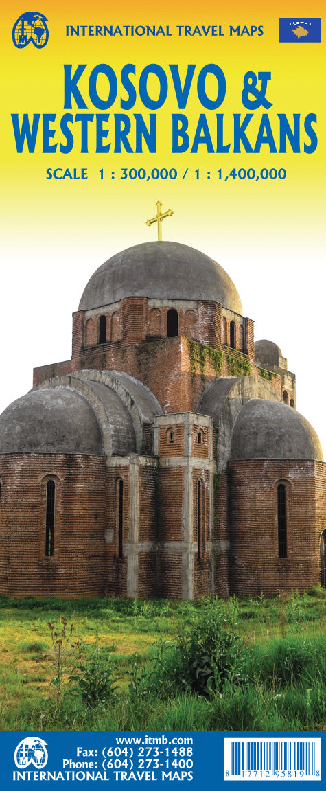
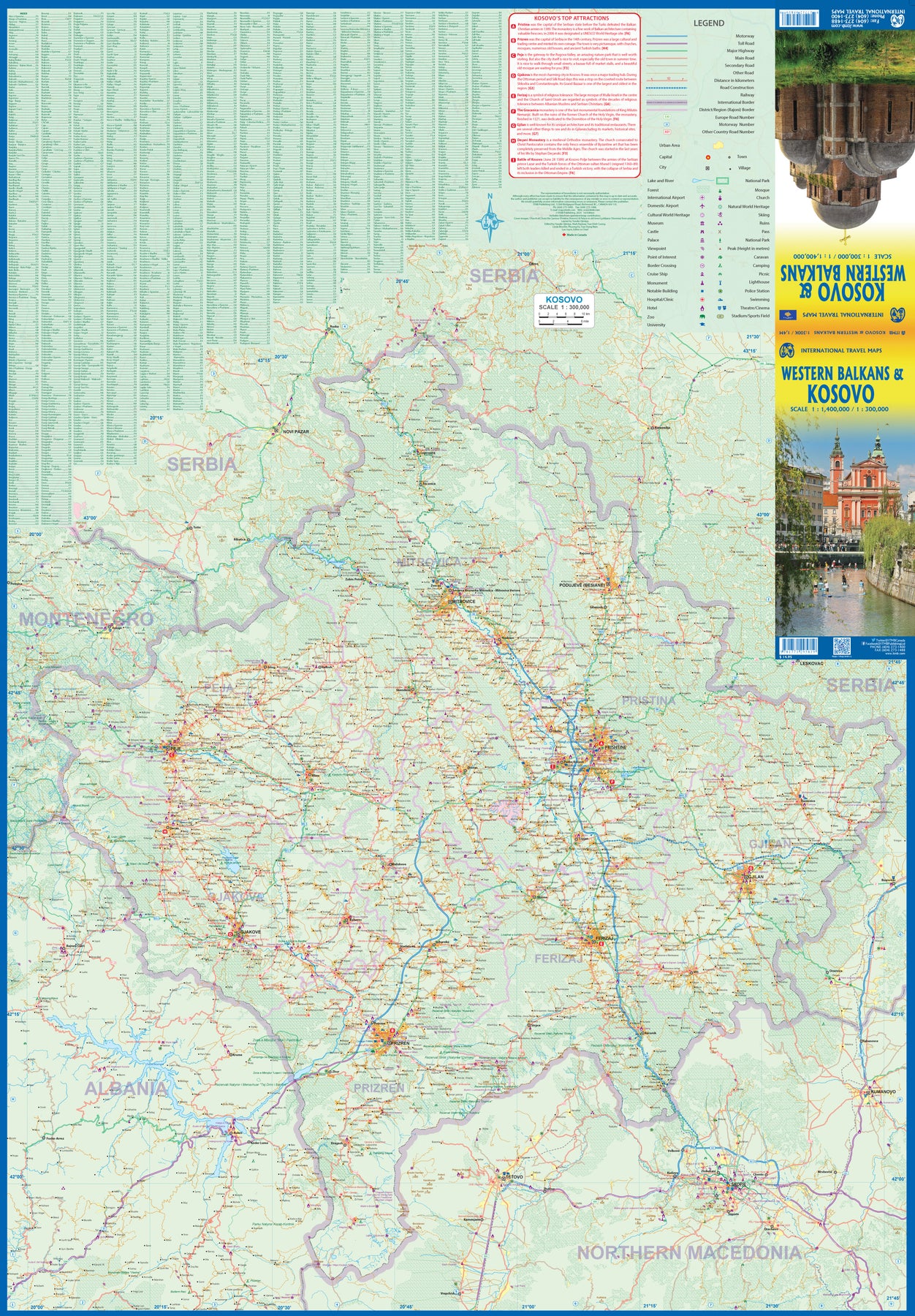
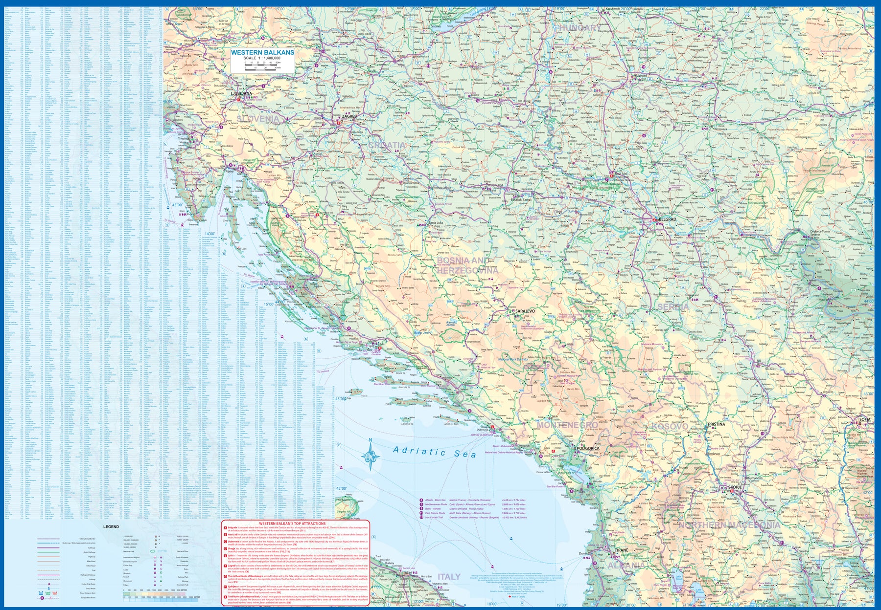
Kosovo & Western Balkans
Ordinær pris 199,00 kr/
Mva inkludert
Frakt beregnes i kassen.
Kosovo is the country that shouldn't exist, but does. When Yugoslavia fell to pieces after Tito died, Kosovo was lumped in with Serbia but was very unhappy with being a part of an Eastern Orthodox regime. It broke away, resulting in genocidal fighting until the Americans stepped in and stopped the fighting. The region was then placed under a European Union control in the faint hope that it would merge with Albania, or Montenegro, but it didn't. Relations with Serbia are still quite strained, but Kosovo is still surviving as a mountainous Balkan state. Fought over for centuries by Turks and Serbs, Kosovo is emerging as a small but touristic European country. This is definitely an off-the-beaten-path travel destination!
The second side of the sheet provides an excellent regional coverage for the Western Balkans, essentially Slovenia, Croatia, Montenegro, Serbia, and reasonably large tracks of land for Hungary, Albania, and North Macedonia, showing the growing number of wilderness parks being created.
- Publisert: 2023
- Innbinding: Falset
- Materiale: Papir
- Målestokk: Kosovo 1:300 000 - Balkans 1:1 400 000


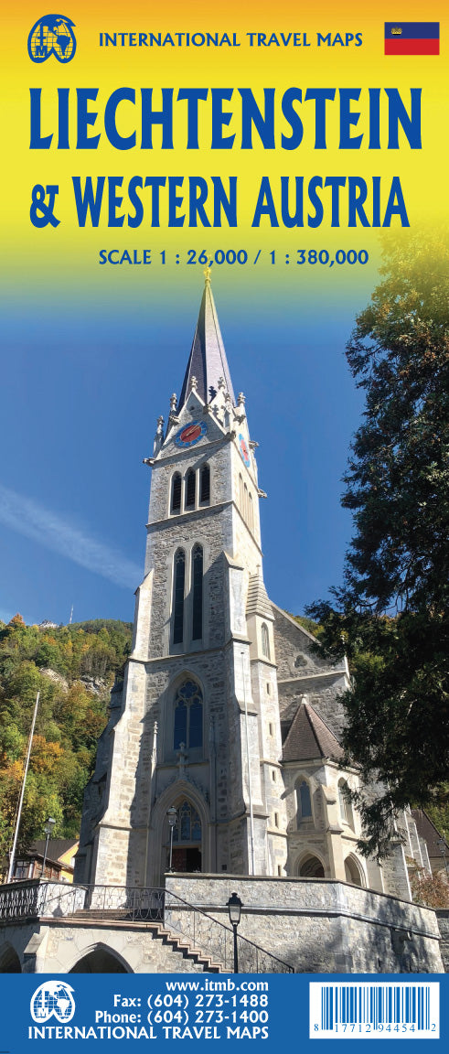
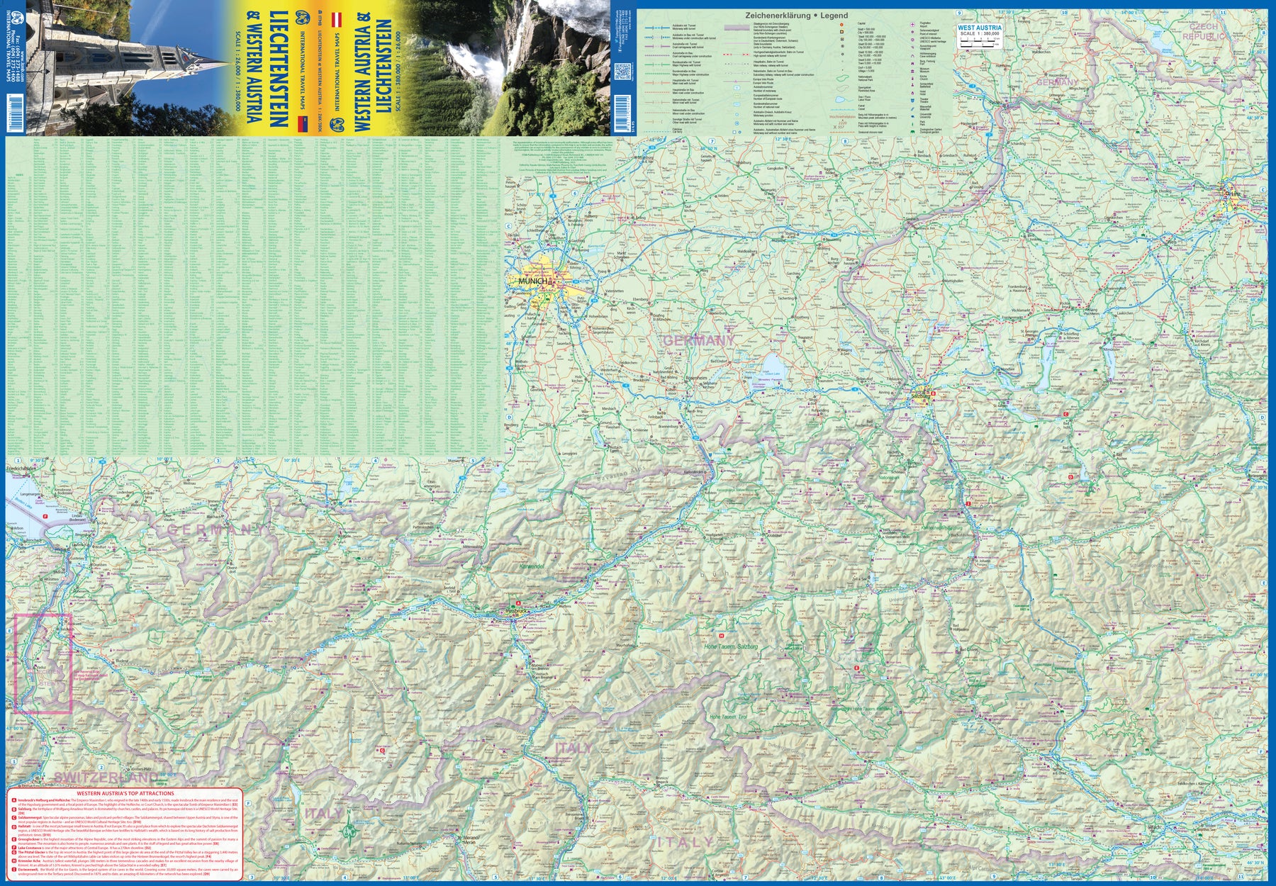
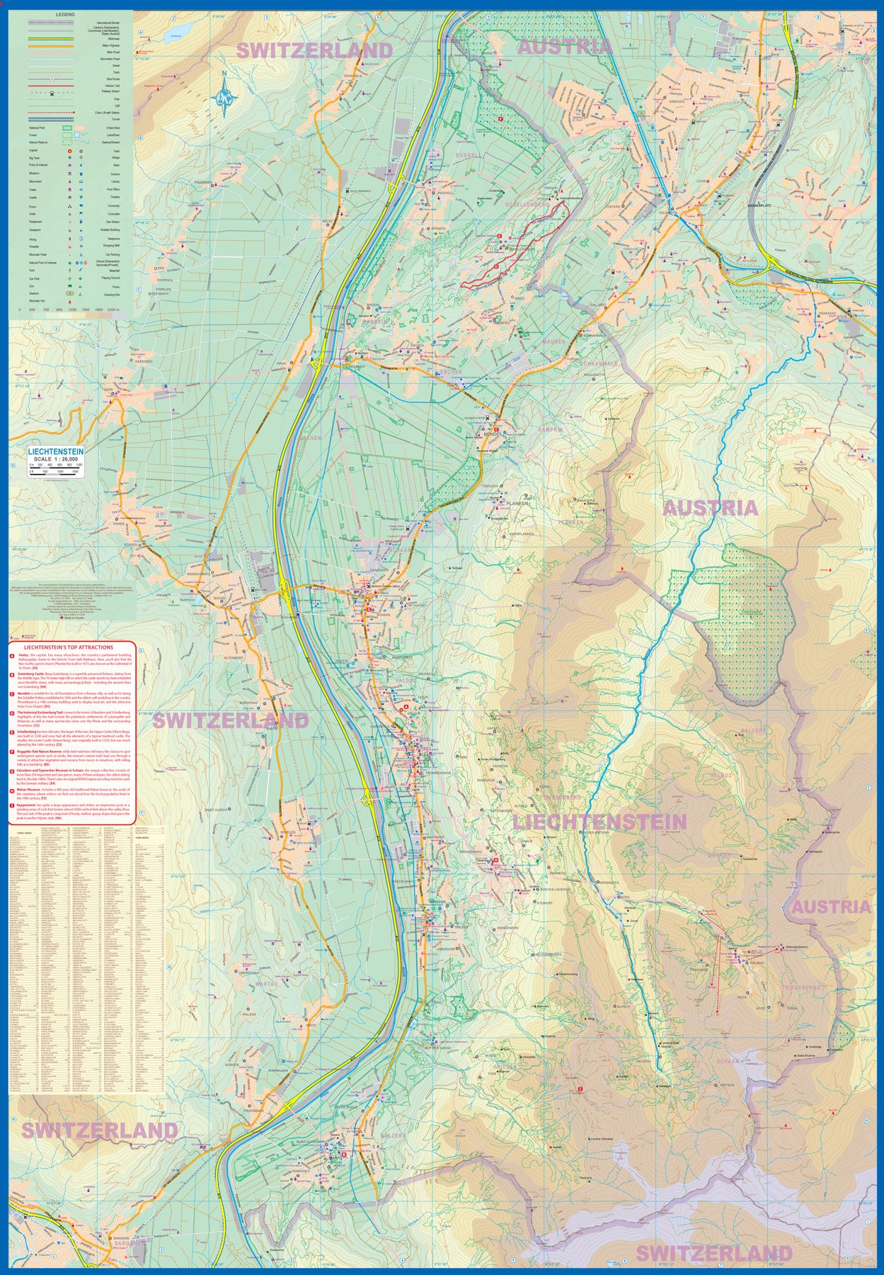
Liechtenstein & Western Austria
Ordinær pris 179,00 kr/
Mva inkludert
Frakt beregnes i kassen.
Europe is dotted with mini-states that exist solely for historic reasons but are fiercely independent. Liechtenstein, surrounded by Switzerland on its west and south and Austria on its other borders, is such a state. It is larger and more diverse than many imagine and is quite a popular ski resort region. Side 1 is a detailed map of the principality, framed on the west by the Rhine River and a bit of Switzerland and on the east by Austria. Most development occurs in the Rhine Valley in a north-south direction, dominated by the capital city of Vaduz. There are five access points from Switzerland across the Rhine, one from the south, and two from Austria in the north. The ski haven of Malbun is prominently shown, and the scale of the map is detailed enough to name every major street. This also enabled us the opportunity to include schools, shopping areas, post offices, and churches, as well as a wide range of eating establishments. Walking/hiking trails have also been included.
This is the only map of Liechtenstein ever produced by a cartographic firm, and joins Andorra, Luxembourg, and Monaco as a valued part of ITMB's coverage of Europe. Side 2 concentrates on eastern Austria and southern Germany from Lake Boden (Bodensee) to Linz and from the Italian border north to Passau, in Germany. It is both a road/rail map and a physical relief map of this portion of the Alps. It includes its own Top Attractions list. Border crossings are shown merely as a formality, except for Switzerland. This would be an excellent map to use to explore the mountains south of Innsbruck or to discover small villages in the Tirol.
- Publisert: 2023
- Innbinding: Falset
- Materiale: Papir
- Målestokk: 1:26 000, 1:380 000

Croatia: Istria
Ordinær pris 199,00 kr/
Mva inkludert
Frakt beregnes i kassen.
Reise Know-How maps (world mapping project series) are easy-to-read, waterproof and highly durable travel maps specifically designed for everyday use on the road.
Our maps combine state-of-the-art, GPS-compatible cartography (including hypsometric tints and contour lines) with a detailed rendering of road networks and touristic information. They offer the best possible scale, level of detail and readability, be it a map of a small island or half a continent.
The maps feature a detachable paper sleeve so that the maps can be folded easily and fit in every pocket. Although printed on plastic, a special coating makes sure the maps retain a paper-like feel and can even be written on with a pencil.
- Publisert: 2022
- Innbinding: Falset
- Materiale: Plastpapir
- Målestokk: 1:70 000

USA: Hawaii Volcanoes National Park & Big Island
Ordinær pris 199,00 kr/
Mva inkludert
Frakt beregnes i kassen.
We didn't suspect, when we started developing this title, that Mauna Loa Volcano would erupt as soon as our map of the national park was printed, but it did! It is on the news every night, and a marvelous touristic attraction. How many of us can ever see a massive eruption of molten lava? Now, we can! (at least, from a safe distance). The national park occupies one side of the map and is the latest in ITMB's series of national parks. By the nature of such parks, we show all the features and elevations, but in this case, we'll add the proviso that heights and lava flows are changing the landscape on a daily basis. Volcanoes are sort of like elephants-they go where they please!
The reverse side of the sheet is a map of Big Island, where the park is located. Its name comes from being the largest island in area of all the Hawaiian archipelago. The map includes an inset of Hilo, the largest city on the island, located on a calm bay of the east coast, and a separate inset of Kailua-Kona on the west coast, which is also the focal point for surfing and resorts. This pretty much completes our detailed mapping of Hawaii; in addition to this title, we have maps of the complete state and of each major island, as well as a new map of Honolulu/Waikiki. The map is printed on waterproof stone paper, which could prove very useful in tropical Hawaii!
- Publisert: 2022
- Innbinding: Falset
- Materiale: Vannfast papir
- Målestokk: 1:85 000, 1: 200 000

222 Rugby & Daventry
Ordinær pris 199,00 kr/
Mva inkludert
Frakt beregnes i kassen.
OS Explorer is the Ordnance Survey's most detailed map and is recommended for anyone enjoying outdoor activities such as walking, horse riding and off-road cycling. The series provides complete GB coverage and can now be used in all weathers thanks to OS Explorer - Active, a tough, versatile version of OS Explorer. The OS Explorer Active range now includes a digital version of the paper map, accessed through the OS smartphone app, OS Maps.
- Publisert: 2015
- Innbinding: Falset
- Materiale: Papir
- Målestokk: 1:25 000


USA: Honolulu & Oahu
Ordinær pris 199,00 kr/
Mva inkludert
Frakt beregnes i kassen.
Honolulu/Waikiki is a brand new map for ITMB, and our first new title for a part of the USA this year. Almost everyone flying to Hawaii goes to Honolulu, and the vast majority stay in hotels located close to Waikiki Beach. This is quite a comprehensive city plan map for the Honolulu urban area, stretching from east of Diamond Head to the international airport. It also includes a large inset of the Pearl Harbour area, with its many memorials to the ships sunk during the surprise Japanese attack on December 6, 1941. Ford Island is still a major US military base. Our Top Attractions list shows the highlights of touristic interest.
The second side is a newly-updated version of our map of the island of Oahu. Although the focus of this map is on Honolulu, most visitors include day trips to outlying areas of the island. There are numerous coves where one can enjoy a reasonably isolated experience, and attractions such as the Dole Pineapple Farm to enjoy. It is not possible to drive all the way along the coast. Waimea Bay offers the best "big wave" surfing. A very popular activity is to climb to the rim of Diamond Head volcano.
- Publisert: 2022
- Innbinding: Falset
- Materiale: Vannfast papir
- Målestokk: 1:18 000, 1:80 000