111 produkter
111 produkter


111 produkter
Rhine River Cruising
Ordinær pris 199,00 krThe Rhine River flows from the Gletch Glacier in the Swiss Alps north to central Germany and then on to Amsterdam and the North Sea. It has been a major transportation link in Europe for many centuries, with dozens of castles located at strategic points. Today, it is a peaceful touristic haven as well as a busy working river, with dozens of shallow-draft boats wending their way around countless turns in the river. It is probably the busiest tourist highway in Europe. This double-sided map starts in Amsterdam, where it is known as the Waal, and follows the course of the river inland past Nijmegen to the German border, where the name changes to Rhine. There are many notable interesting cities along its route, such as Essen in the Ruhr Valley, Dusseldorf, Koln, with its magnificent cathedral, Bonn, Castle Arenfels, Koblenz, and Rüdesheim, where it joins the Main River and heads east to Frankfurt-on-Main and points east. As a map is a rectangular sheet of paper and a river is a narrow portion wending its way as geography takes it. This is much more than a simple river map. It is a detailed portrayal of a very interesting part of Europe, extending far beyond the banks of the river, and is ideal for those travelling by car, by train, or by river boat. A detailed city centre map of Frankfurt is included.
Portugal
Ordinær pris 199,00 krITM har kart over hele verden og de spesialiserer seg på land litt utenfor allfarvei. Beliggenheten til landets nasjonalparker, historiske monumenter, de viktigste veiene o.L. Finner du inkludert i kartene. Samtlige landkart har ofte et bykart over hovedstaden.
Fra ITM: We are very pleased to be able to release a double-sided detailed map of Portugal. Although we have included the country in previous maps, it was always as an adjunct to another map (Spain and Portugal, Portugal and Southern Spain etc.), so it is high time that this very nice popular country had its own ITM map. Being a long, rather thin country, Side 1 concentrates on Lisbon and the southern half of Portugal with a detailed inset map of Lisbon. It also includes the Spanish provinces of Huelva and Badajoz. Side 2 covers the northern half of the country along with portions of neighbouring Spanish provinces. As a country, Portugal has a wealth of touristic attractions and we have included as many as we can on this map without cluttering it – castles, palaces, fortresses, cathedrals and churches, dozens of museums, beaches, a few hotels, mines, monuments, and just about everything a visitor would want to have. Of course, motorways, highways, secondary routes, rail lines, ferry services, and geographic heights of land are also included; altogether, a fabulous map for a wonderful country.
Publisert år: 2025
Innbinding: falset
Material: Papir
Målestokk: 1:500,000
Great Britain: England East Coast
Ordinær pris 199,00 krThe United Kingdom may be geographically small, but it is so packed with touristic sites that it needs to be broken down into logical units to be manageable. This is the first of several maps we will be publishing of England at 1:250,000 scale, covering Southeast England from Dover to Southampton north to Luton on Side 1 and from Colchester to Coventry north to Sheffield and Boston; essentially all of SE England from the Channel to Derbyshire and west to the Isle of Wight.
Even at this scale, there is only room to show major attractions without creating clutter. Both road and rail routes are clearly shown, with rapid-rail routes shown in red. This latter feature is not included on most other maps, an one notes with a bit of surprise that this part of England has more such routes than is generally believed to exist. We travelled on one of these trains during our recent visit to the UK (albeit from Newcastle to Edinburgh) and they are quite an improvement! Whether by train or by road, all options are shown. Whether one wishes to visit Hever Castle in Kent or Winchester cathedral, or the university cities of Cambridge or Oxford, this is an ideal map for exploring one of the most touristic corners of Europe.
Spain: Balearics - Mallorca; Ibiza & Menorca
Ordinær pris 199,00 krThe Balearic Islands in the western Mediterranean have been extremely popular travel destinations for centuries. Mallorca/Majorca and Ibiza have become favoured visits by cruise ships to these islands in recent years, but the warm climate has attracted visitors for a long time. Side 1 concentrates on the three major islands of Mallorca, Ibiza, and Menorca but includes the smaller islands of Formentera and Cabrera, along with an inset map showing the islands in relation to the Spanish mainland ports of Valencia and Barcelona. Side 2 focusses on cruising the entire western half of the Mediterranean, from Naples west to Gibraltar. Naturally, the Balearics end up right in the centre of the map, which also includes the islands of Corsica and Sardinia, both of which are becoming increasingly popular with those cruising. I hasten to add that cruising is the fastest growing segment of the entire travel industry, so is an important market for the mapping industry.
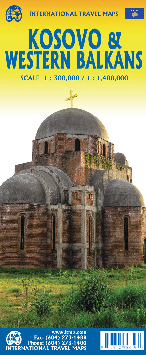
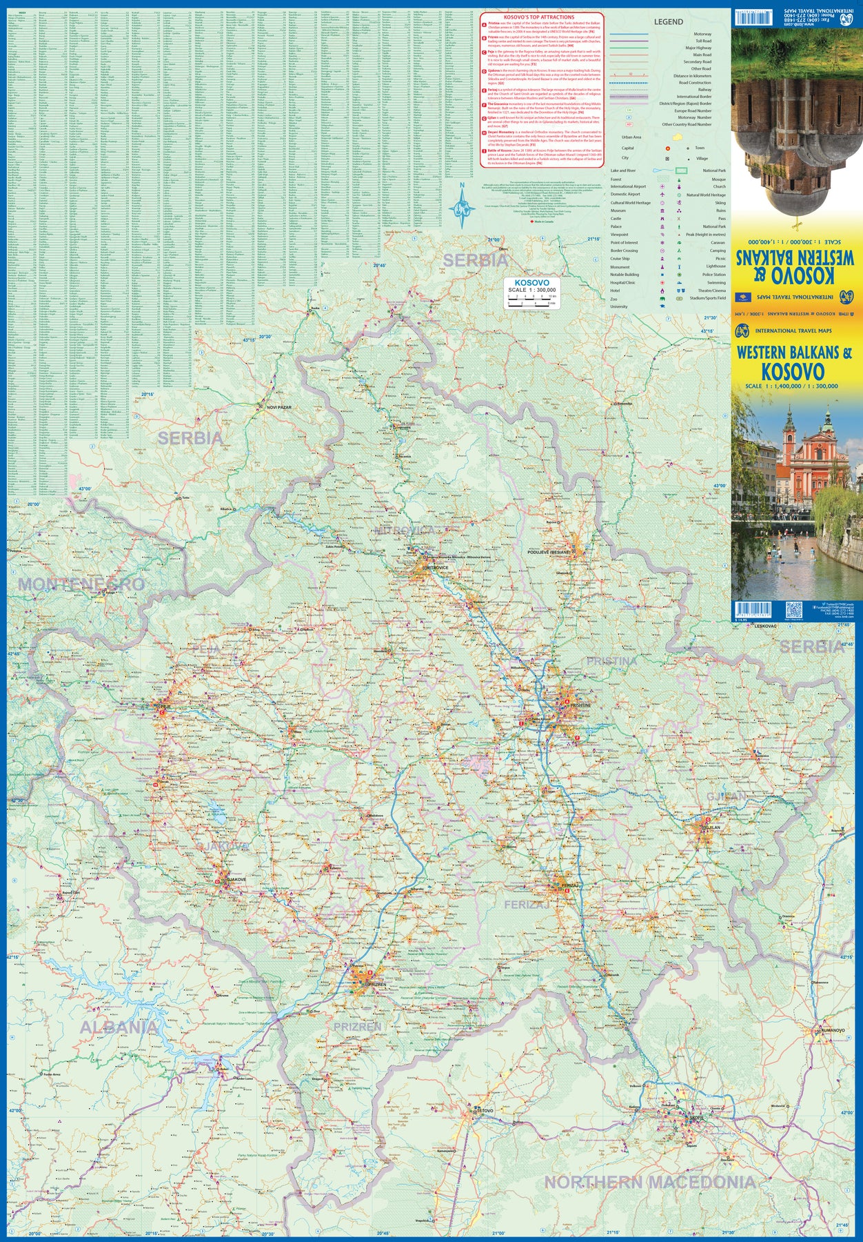
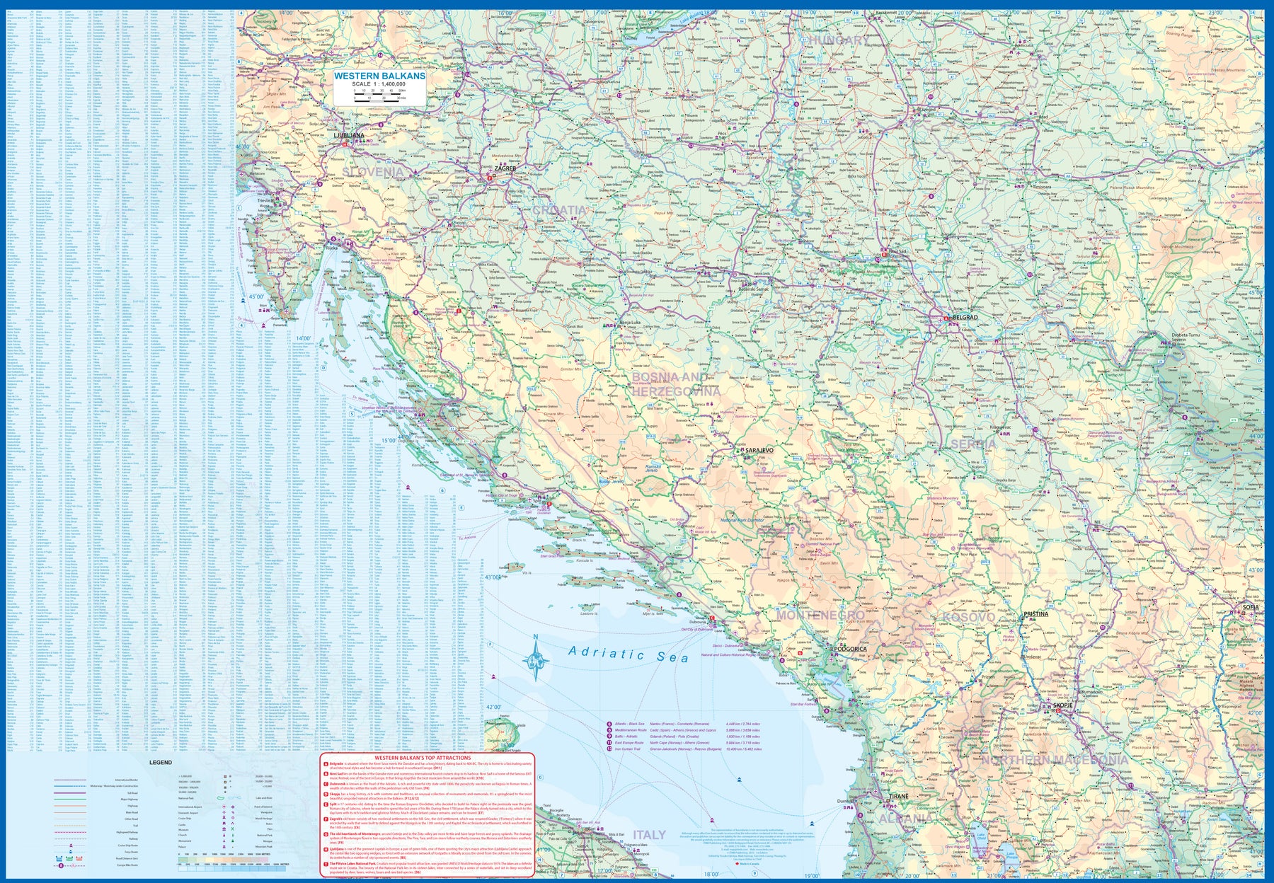
Kosovo & Western Balkans
Ordinær pris 199,00 krKosovo is the country that shouldn't exist, but does. When Yugoslavia fell to pieces after Tito died, Kosovo was lumped in with Serbia but was very unhappy with being a part of an Eastern Orthodox regime. It broke away, resulting in genocidal fighting until the Americans stepped in and stopped the fighting. The region was then placed under a European Union control in the faint hope that it would merge with Albania, or Montenegro, but it didn't. Relations with Serbia are still quite strained, but Kosovo is still surviving as a mountainous Balkan state. Fought over for centuries by Turks and Serbs, Kosovo is emerging as a small but touristic European country. This is definitely an off-the-beaten-path travel destination!
The second side of the sheet provides an excellent regional coverage for the Western Balkans, essentially Slovenia, Croatia, Montenegro, Serbia, and reasonably large tracks of land for Hungary, Albania, and North Macedonia, showing the growing number of wilderness parks being created.
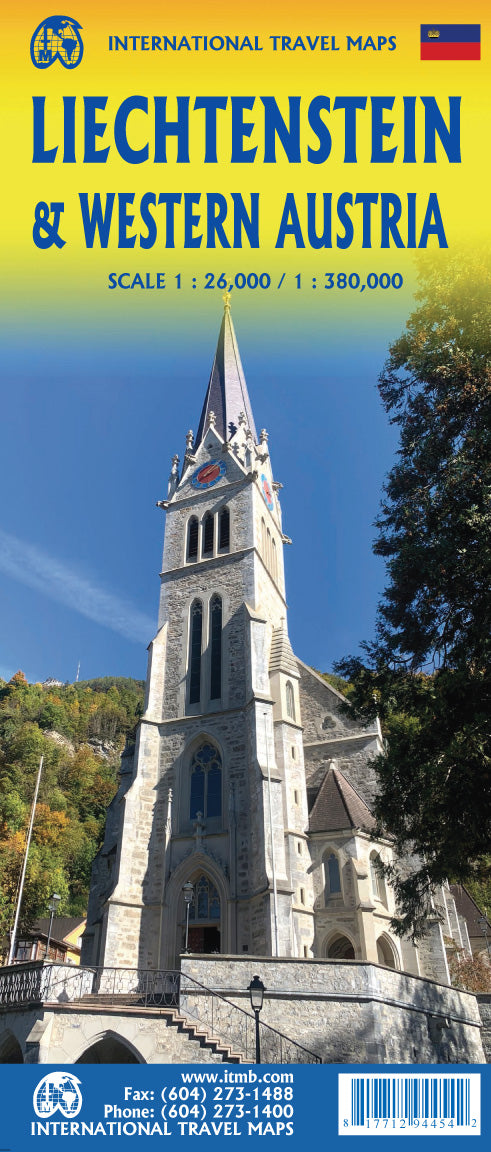
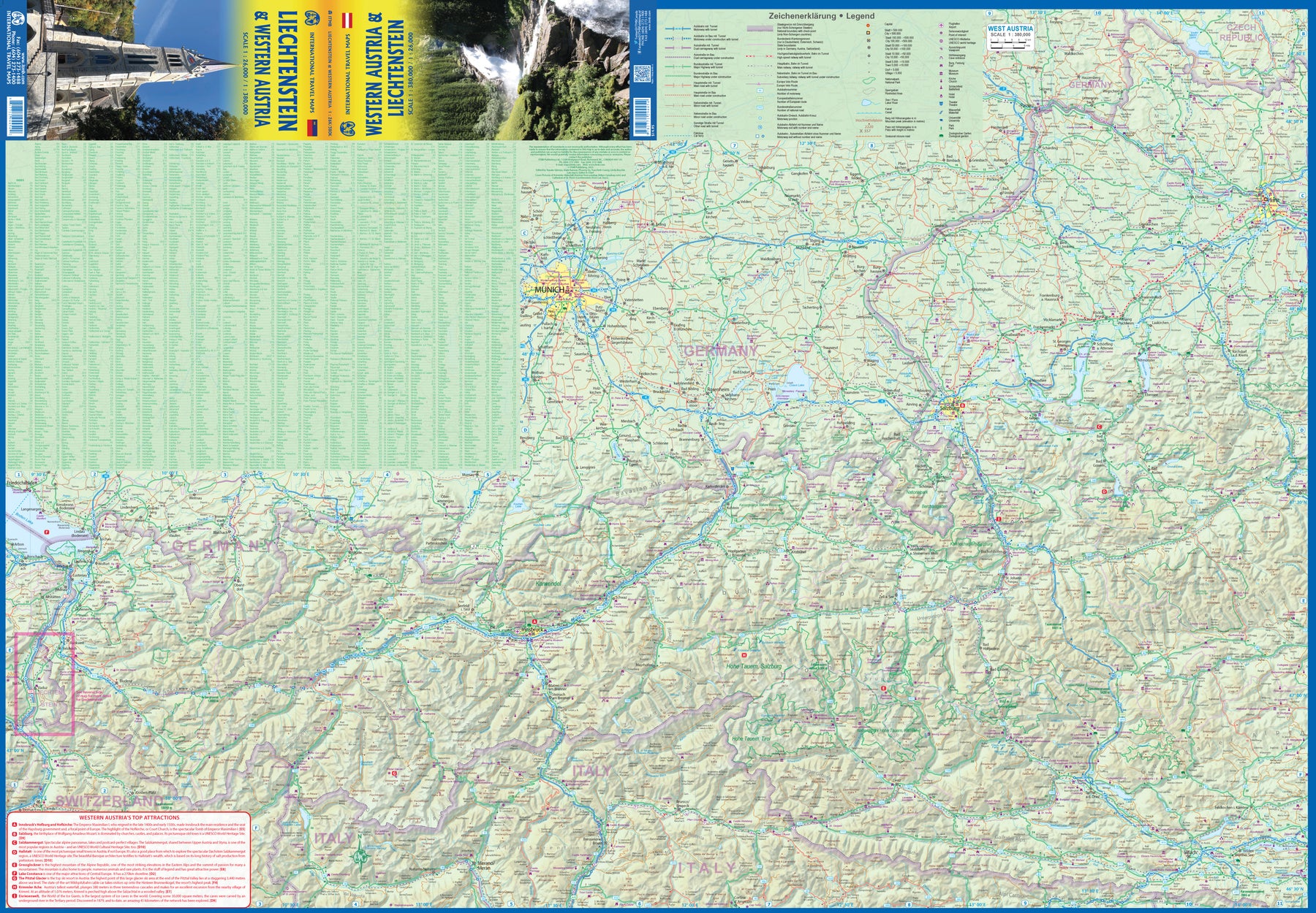
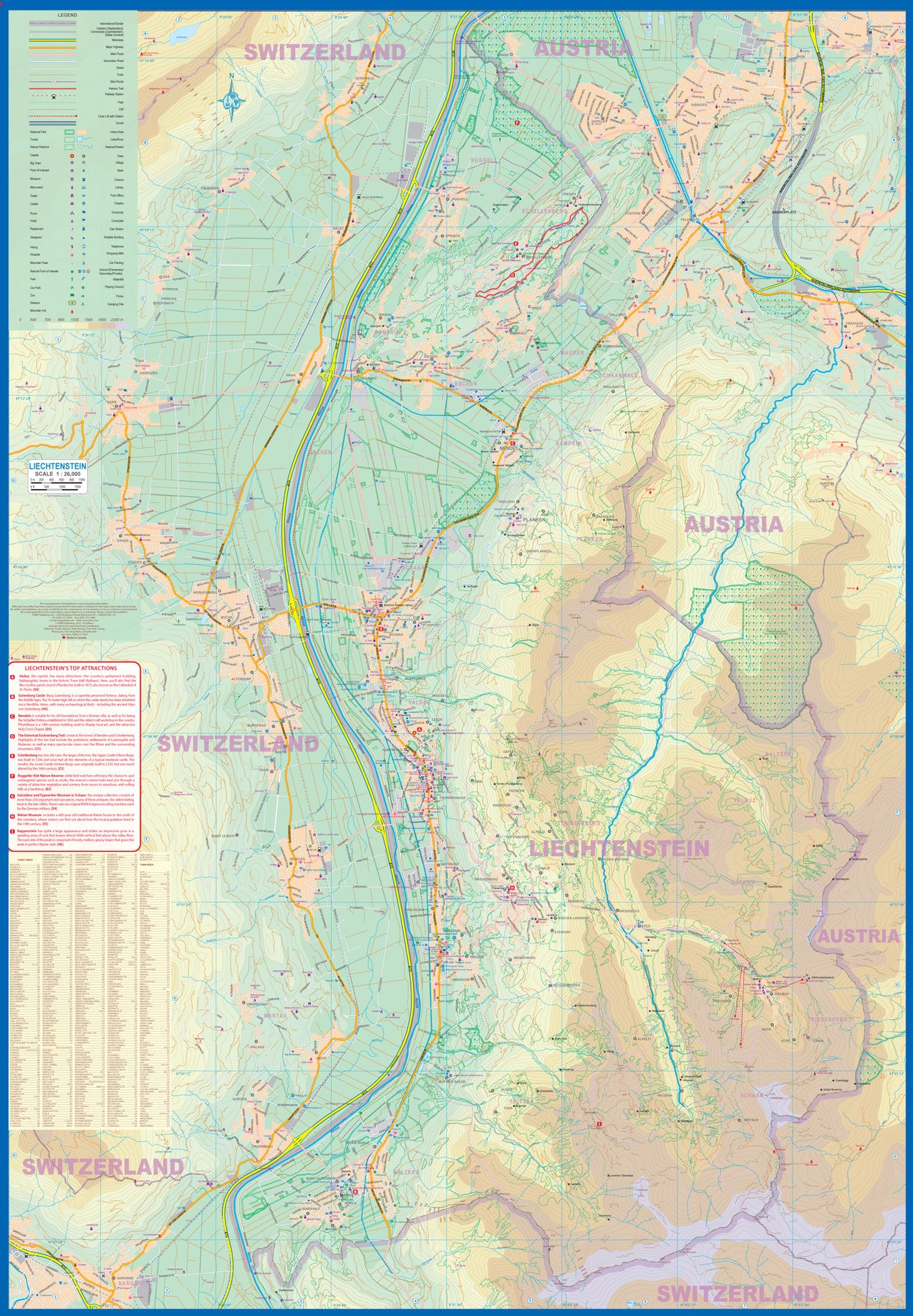
Liechtenstein & Western Austria
Ordinær pris 179,00 krEurope is dotted with mini-states that exist solely for historic reasons but are fiercely independent. Liechtenstein, surrounded by Switzerland on its west and south and Austria on its other borders, is such a state. It is larger and more diverse than many imagine and is quite a popular ski resort region. Side 1 is a detailed map of the principality, framed on the west by the Rhine River and a bit of Switzerland and on the east by Austria. Most development occurs in the Rhine Valley in a north-south direction, dominated by the capital city of Vaduz. There are five access points from Switzerland across the Rhine, one from the south, and two from Austria in the north. The ski haven of Malbun is prominently shown, and the scale of the map is detailed enough to name every major street. This also enabled us the opportunity to include schools, shopping areas, post offices, and churches, as well as a wide range of eating establishments. Walking/hiking trails have also been included.
This is the only map of Liechtenstein ever produced by a cartographic firm, and joins Andorra, Luxembourg, and Monaco as a valued part of ITMB's coverage of Europe. Side 2 concentrates on eastern Austria and southern Germany from Lake Boden (Bodensee) to Linz and from the Italian border north to Passau, in Germany. It is both a road/rail map and a physical relief map of this portion of the Alps. It includes its own Top Attractions list. Border crossings are shown merely as a formality, except for Switzerland. This would be an excellent map to use to explore the mountains south of Innsbruck or to discover small villages in the Tirol.
USA: Hawaii Volcanoes National Park & Big Island
Ordinær pris 199,00 krWe didn't suspect, when we started developing this title, that Mauna Loa Volcano would erupt as soon as our map of the national park was printed, but it did! It is on the news every night, and a marvelous touristic attraction. How many of us can ever see a massive eruption of molten lava? Now, we can! (at least, from a safe distance). The national park occupies one side of the map and is the latest in ITMB's series of national parks. By the nature of such parks, we show all the features and elevations, but in this case, we'll add the proviso that heights and lava flows are changing the landscape on a daily basis. Volcanoes are sort of like elephants-they go where they please!
The reverse side of the sheet is a map of Big Island, where the park is located. Its name comes from being the largest island in area of all the Hawaiian archipelago. The map includes an inset of Hilo, the largest city on the island, located on a calm bay of the east coast, and a separate inset of Kailua-Kona on the west coast, which is also the focal point for surfing and resorts. This pretty much completes our detailed mapping of Hawaii; in addition to this title, we have maps of the complete state and of each major island, as well as a new map of Honolulu/Waikiki. The map is printed on waterproof stone paper, which could prove very useful in tropical Hawaii!
USA: Honolulu & Oahu
Ordinær pris 199,00 krHonolulu/Waikiki is a brand new map for ITMB, and our first new title for a part of the USA this year. Almost everyone flying to Hawaii goes to Honolulu, and the vast majority stay in hotels located close to Waikiki Beach. This is quite a comprehensive city plan map for the Honolulu urban area, stretching from east of Diamond Head to the international airport. It also includes a large inset of the Pearl Harbour area, with its many memorials to the ships sunk during the surprise Japanese attack on December 6, 1941. Ford Island is still a major US military base. Our Top Attractions list shows the highlights of touristic interest.
The second side is a newly-updated version of our map of the island of Oahu. Although the focus of this map is on Honolulu, most visitors include day trips to outlying areas of the island. There are numerous coves where one can enjoy a reasonably isolated experience, and attractions such as the Dole Pineapple Farm to enjoy. It is not possible to drive all the way along the coast. Waimea Bay offers the best "big wave" surfing. A very popular activity is to climb to the rim of Diamond Head volcano.
South Pacific: Oceania Cruising & New Caledonia
Ordinær pris 199,00 krThe South Pacific island complex known as New Caledonia, or Nouvelle Caledonie in French, consists of a main island and half a dozen smaller islands (collectively called the Loyalty Islands. It is an overseas possession of France and uses the Euro as its currency. It is located about halfway between Australia and Fiji and is south of Vanuatu. The main island is one of the larger land masses in the Pacific, with a reasonably well-developed road infrastructure linking the capital city of Naomea with other urban areas. There are resort hotels at various locations along the coastline, but this is a territory that one would have to regard as being adventuresome. Most of the attractions are concentrated in the vicinity of the capital. The islands were important surveillance zones during WW2, and the territory is popular with Australians and New Zealanders.
The reverse side of the sheet portrays the South Pacific for cruising, covering from Hawaii to the Marianas, down to New Guinea, and includes the eastern half of Australia, all of New Zealand, American Samoa, Fiji, and Tonga in the centre, with Tuvalu, Kiribati, and the Marshall Islands to the north and the Cook Islands and Tahiti to the east. This is an increasingly popular part of the world for cruise ship activity, as it combines affluent population areas in Australasia and the USA with exotic, but safe, travel destinations that are expensive to reach by any means except cruise ships. This is a brand new title for ITMB and expands our coverage of both the southern portions of the Pacific with yet another first-time map.
Russia: Kamchatka Peninsula
Ordinær pris 169,00 krITM har kart over hele verden og de spesialiserer seg på land litt utenfor allfarvei. Beliggenheten til landets nasjonalparker, historiske monumenter, de viktigste veiene o.L. Finner du inkludert i kartene. Samtlige landkart har ofte et bykart over hovedstaden.
Fra ITM: This is the most recently released title of our Russia series. In this revised edition, we have expanded the area of coverage to include the portion of Russia known as the Far East Republic and the eastern portions of Siberia (in January, we released Siberia itself). Lets start with the Kamchatka peninsula itself. This is a very interesting adventure travel destination, famous for its geothermal geysers and its isolation from the rest of Russia. There is only city of any size, Petropavlovsk Kamchatsky (which I genuinely hope is colloquially known as PK), the capital and location of the peninsulas only significant airport. We have included an inset map of the city. We also include a map of the famous Valley of Geysers (South of Klyuchi). Interestingly, the peninsula has a town called Esso. The other side of the sheet portrays a vast region from the Russian occupied island of Sakhalin and the Okhotsk Sea north to that portion of what we call the Arctic Ocean but is really a series of seas (this one being the East Siberian Sea) and west to the Lena River. The Trans Siberian railway west towards Moscow is shown, as well as connections into Mongolia and China. This is not a well known region of Russia and is definitely for the adventurer (I would to hear from anyone who has stayed at the hotel in Novaya Chara, which is as close to being the middle of nowhere I can imagine. actually, this portion of Russia is loaded with hotels and camping grounds. The map also shows a fascinating road going from close to the border with China all the way to a bay on the ocean. That would be quite a trip to take!
Publisert år: 2022
Innbinding: falset
Material: papir
Målestokk: 1:700,000
Brazil: Amazon & Brazil North
Ordinær pris 199,00 krWe first mapped the Amazon River Basin for a rainforest protection conference many years ago, preparing what we thought was a pretty good rendition until we arrived at a conference full of experts who were able to add so much more data that we re-did the map before publishing it. We have updated it repeatedly as more information has come to light and are pleased to release this sixth version, which does something that we have wanted to do for some time - it adds a detailed map of the northern half of Brazil/Brasil to a river map that covers portions of seven different countries.
The map is printed on revolutionary stone paper (tear-resistant, waterproof, friendly to the environment, and bio-degradable as well as extremely durable), and has two different cover pictures, so it can be marketed either as a map of Brasil or of the Amazon Basin - or both! It is also the only map of the river basin in print. As the world emerges from the era of Covid, this part of the world will once again dominate demand for South American explorers.
Spain: South Rail & Road
Ordinær pris 179,00 krThe southern half of Spain (and of Portugal, which is also included) consists of the portion from Toledo/Castellon south to the Mediterranean. Side 1 (the cover side) focuses on the eastern portion, from Granada to the coast, including the Balearic islands of Mallorca, Menorca, and Ibiza, and the other side the portion of Spain west of Granada, including that portion of Portugal from north of Lisbon to the Algarve. Gibraltar is included, as are the Straits and the Spanish enclave of Ceuta and part of Tangier. A large inset of the seven Canary Islands is also shown. This map completes our regional mapping of Spain (the other two titles are Spain North and Cataluña/Barcelona).
Spain has invested heavily in its train network, so we note both rapid train and regular train routes, as well as the expanding motorway network. Major touristic sites are noted, as always, with special attention to world heritage sites. The scale is excellent for those wanting to explore this portion of Spain at leisure.
USA: Pacific Coast
Ordinær pris 199,00 krOur west coast map, covering from Vancouver down to Tijuana has proven to be one of the most popular maps published by ITMB. This edition closely resembles previous ones, in that it focuses on the road network from north to south, covering all of Washington State, Oregon, and California on one double-sided sheet, showing all passenger-service railway lines as well. By the shape of the area covered, the western portion of Nevada is also shown as well. Space limitations did not enable us to include insets, so travellers should be advised to obtain ITMB city maps of Seattle, Portland, San Francisco, Los Angeles, and San Diego to supplement this map with more detailed coverage. This map also includes Yosemite National Park, for which ITMB also provides a separate detailed map. Hundreds of wilderness campgrounds are also included.
USA: Hawaii - Maui; Kauai & Molokai
Ordinær pris 199,00 krThe island of Maui may not be at well-known as Oahu, which is extremely popular with Japanese honeymooners, but it is as attractive touristically. Our coverage covers most of Side 1 and includes a detailed inset map of Wailuku, the principal urban area, as well as insets of Lahaina on the west coast and Wailea resort area. This side also includes a map of the island of Lanai, with its main urban area of Lanai City as an inset.
Side 2 concentrates on the islands of Molokai, Kauai, and the lightly populated island of Ni’ihau, and includes detailed inset maps of Lihue, Kaunakakai, and Po’ipu, all of which are major resort destinations. The islands are loaded with beaches and places to stay, but also with attractions, which are shown on the map. This is a beautiful map, one of the best we have ever produced, and is a fitting companion to our maps of Big Island, and Oahu/Honolulu, as well as our state map. The Maui/Kauai map also has a double-sided cover, so can be displayed as two separate maps.
Great Britain: England - Southeast & Midlands Railway & Road
Ordinær pris 199,00 krThe shape of the UK makes it difficult to map logically. The term South East, within crowded England, is generally more restrictive than is appropriate for a map. Our definition of SE is from the English Channel north to the northern tip of East Anglia and west to Portsmouth/Reading/Peterborough. This occupies side one of the sheet. Side two consists of that complex portion of England generally called ‘The Midlands’ stretching from Cambridge/Peterborough west to the Welsh border and from Luton/Gloucester north to Manchester/Grimsby. London is, of course, prominent, but only as a main roads map.
This is the most recent sectional map of the UK that ITMB has published, and was necessitated by the realization that, to see England properly, one needs a detailed enough map to show rail lines, motorways, A-type highways and B-type secondary roads, but also the tertiary level of road joining villages. The road network of England is incredibly complex and cannot be shown in proper detail without mapping at this scale or better. England also has a sophisticated rail network and this is left off most maps to avoid clutter. We have emphasized all the rail lines carrying passengers, which makes the London portion look like a spaghetti factory, but there are lines everywhere. All motorways and highways are shown, but rail lines are prominently shown, to encourage travel by train. A Top Attractions list has been included as well, but hundreds of interesting touristic sites have been included.
United Arab Emirates & Dubai
Ordinær pris 199,00 krITM har kart over hele verden og de spesialiserer seg på land litt utenfor allfarvei. Beliggenheten til landets nasjonalparker, historiske monumenter, de viktigste veiene og lignende finner du inkludert i kartene. Samtlige landkart har ofte et bykart over hovedstaden.
Fra ITM: Dubai is truly becoming a very popular travel destination and the loose federation of sheikdoms collectively known as the United Arab Emirates is growing in popularity with each passing year. Despite the turmoil affecting both Israel and Iran, this part of the Middle East is open for business and peaceful. Side 1 concentrates on the overall region from the eastern border of the UAE to its interaction with Oman. It also has an excellent inset map of Abu Dhabi, the capital of the UAE. Side 2 concentrates on Dubai itself as the largest urban area. Dubai has an extensive and interesting old town on the east bank of the Dubai Creek, which is where most of the hotels and the huge international airport are located. The ‘new town’ is on the left bank, and this is where one finds Western-style shopping areas, high-rise towers, the rapid transit line, and the main motorway out of town. The World Trade Center and Emirates Towers are also centrally located. The man-made Coastal Projects are shown in insets.
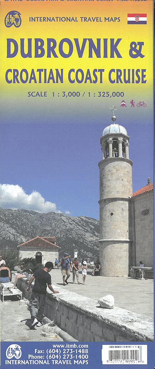
Croatia: Dubrovnik & Croatian Coast Cruise
Ordinær pris 199,00 krThe ancient port city of Dubrovnik, on the southern Croatian coastline, has evolved into a major tourist destination. The old walled city, normally entered through the famous Pile Gate, was so crowded with tourists when we arrived, that it took some time to get to the main street of Stradun. The city has completely recovered from the Montenegrin bombing during the breakup of Yugoslavia, with a few shellholes remaining just to show to tourists. The highlights of a visit are the Rector’s Palace, the Tvrdava fortress, and the cathedral. The map covers the urban area outside of the old town as well, as this is where most of the hotels and restaurants are located.
The other side of the map shows the extensive coastline of Croatia in two parts – from the Italian border to Trogir, and from Split to the border with Montenegro. We travelled from Porec to Dubrovnik in a small cruise ship of 45 passengers, which enabled us to visit ports that larger ships could not reach. As a result, we visited islands we could not have otherwise visited. The cover picture shows grandson Johnny in one such small town.
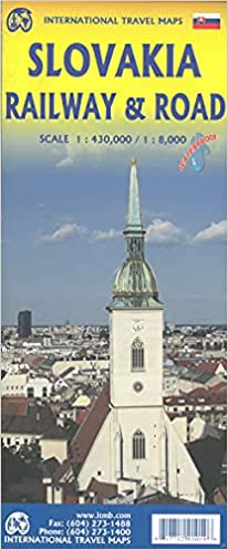
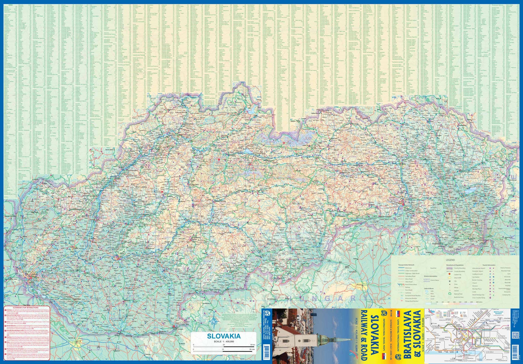
Slovakia - Railway & Road
Ordinær pris 169,00 krAs tourism to the eastern reaches of Europe becomes more popular, Slovakia is well-positioned to present an attractive opportunity for exploration. ITMB previously included this country with adjacent Hungary, but now we have expanded coverage and included a detailed map of Bratislava (1:8.000). Side 1 (1:430.000) shows the elongated country from its Austrian and Czech borders to its increasingly important border with Ukraine. As usual, we have included a listing of Top Attractions, such as the little-known towns of Kosice, Banska Stiavnica, and Sturovo, as well as the karst underground caves of Demanova and the fairy tale castle of Bojnice.
Side 2 portrays the capital city of Bratislava in excellent detail, showing the Danube River and the old town in great detail, along with the newer outlying areas of Petrzalka and Ruzinov. The map is printed on waterproof stone paper for durability. Legend Includes: Roads by classification, Rivers and Lakes, National Park, Airports, Points of Interests, Highways, Main Roads, Zoos, Fishing, and much more...
Japan: Mount Fuji / Kanto & Chubu regions
Ordinær pris 169,00 krThe volcanic cone of Mount Fuji is Japan's most popular touristic attraction. Located a shoer train ride west of Tokyo, Fuji attracts millions of visitors each year. Side 1 focuses on the mountain itself, showing rail connections, surrounding towns, roads on the lower slopes, hiking trails, and accommodations close to the summit. Side 2 shows the kata & Chubu Regions from Tokyo to Nagoya and north to Nigata. This is a brand new ITMB title.
USA: South Atlantic States
Ordinær pris 149,00 krITM har kart over hele verden og de spesialiserer seg på land litt utenfor allfarvei. Beliggenheten til landets nasjonalparker, historiske monumenter, de viktigste veiene o.L. Finner du inkludert i kartene. Samtlige landkart har ofte et bykart over hovedstaden.
Publisert år: 2015
Innbinding: falset
Material: papir
Målestokk: 1:1000000
New Zealand: Auckland & North Island
Ordinær pris 169,00 krITM har kart over hele verden og de spesialiserer seg på land litt utenfor allfarvei. Beliggenheten til landets nasjonalparker, historiske monumenter, de viktigste veiene og lignende finner du inkludert i kartene. Samtlige landkart har ofte et bykart over hovedstaden.
Fra ITM: Auckland is one of the most attractive cities to visit, and Auckland is the normal point of entry to the island nation. The City of Auckland is the largest in the country and offers a wide range of attractions. That said, one of the best is to enjoy the harbour front on a sunny day and enjoy seeing ferries bustling in and out, taking passengers to such exotic local destinations as Half Moon Bay, Great Barrier Island, or Devonport. Better still, take one of the ferries yourself! The city centre is quite compact and easily walkable, and the suburban rail line can easily take one to nearby destinations. The true value of the map is its other side, covering the north island in excellent detail. From the far north at Cape Reinga to Wellington in the far south, the northernmost major island that makes up New Zealand is a treat to discover. Good quality roads enable one to explore the island at will and enjoy such attractions as Mount Maunganuiis, Tongariro Alpine Crossing, or the Coromandel Peninsula. A newish attraction that is well-worth a visit is the Hobbiton Movie set, where the Lord of the Rings trilogy was shot. A good inset map of Wellington is also included.
USA: Philadelphia & Pennsylvania
Ordinær pris 169,00 krITM har kart over hele verden og de spesialiserer seg på land litt utenfor allfarvei. Beliggenheten til landets nasjonalparker, historiske monumenter, de viktigste veiene og lignende finner du inkludert i kartene. Samtlige landkart har ofte et bykart over hovedstaden.
Fra ITM: Historic Philadelphia is one of the most significant travel destinations in the USA. Founded as a Quaker town for dissidents from England, it evolved into being the unofficial capital of the 17 American colonies by 1770. In the preamble to the American independence movement, it was a crucial ingredient in negotiations designed to address grievances. The British organized a meeting that has since become known as the Congressional Congress of 1775, in what is now known as Independence Hall. All seventeen American colonies sent representative delegations to debate the future. Phillie today is a modern city with a specially-designated historic centre, and all the important sites are noted on this map.
The other side of the sheet is a brand new map, continuing ITMB’s drive to create state maps wherever practical. This one is of Pennsylvania, a lovely and scenic part of America, stretching from the Atlantic seaboard to Lake Erie and the border with Ohio. New York City/Long Island and much of southern New York State is included, as are portions of Maryland, and Virginia. Delaware, due to its size, is completely included. All motorways and highways are noted, as well as recreational and historic locations; most notably, the tragic crash site of Flight 93 east of Pittsburgh.
The State of Pennsylvania has a long and valued history and we are pleased to add it to our range of American titles. Legend Includes: Roads by classification, Rivers and Lakes, National Park, Airports, Points of Interests, Highways, Main Roads, Zoos, Fishing, and much more.
Vietnam: Hue; Da Nang & Central Vietnam
Ordinær pris 199,00 krCentral Vietnam in 1:800.000. Double-sided map with placenames written in Roman script with street plans of Hue 1:13.000, Da Nang 1:12.000 and Hoi An. The map shows the area’s road and rail networks and local airports. National parks, nature reserves, beaches and numerous places of interest are highlighted. Provincial boundaries are marked and names of administrative regions prominently shown. Topography is indicated by bold altitude colouring with spot heights. Latitude and longitude lines are drawn at 30’ intervals. An enlargement shows the environs of Hue in 1:90.000.
Mexico: Mexico City & Mexico Central
Ordinær pris 179,00 krITM har kart over hele verden og de spesialiserer seg på land litt utenfor allfarvei. Beliggenheten til landets nasjonalparker, historiske monumenter, de viktigste veiene og lignende finner du inkludert i kartene. Samtlige landkart har ofte et bykart over hovedstaden.
Fra ITM: Mexico City is the largest city in the Americas, with a population of about 30 million. Our map concentrates on the core of the city, which is where hotels, attractions, and touristic interest abounds, from the train station in the north to the university in the south and from the huge bus station in the east to Chapultepec Park in the west. Insets of the metropolitan area and of the rapid transit network are included. The second side contains a detailed regional map of that part of Mexico deemed to be ‘central’; essentially, from Pueblo in the east to Guadalajara in the west and from Taxco in the south to San Luis Potosi in the north. Top attractions include San Miguel de Allende, Guanajuato, the Great Pyramid of Cholula, and the colonial city of Puebla.
Puerto Rico & Virgin Islands
Ordinær pris 169,00 krITM har kart over hele verden og de spesialiserer seg på land litt utenfor allfarvei. Beliggenheten til landets nasjonalparker, historiske monumenter, de viktigste veiene o.L. Finner du inkludert i kartene. Samtlige landkart har ofte et bykart over hovedstaden.
Fra ITM: The American territories of Puerto Rico and the US Virgin Islands are anomalies in the modern world, neither fish nor fowl, as the saying goes. Although the residents are American citizens, they have no representation in Congress and are not allowed to vote in national elections. The lesser-known British Virgin Islands are included on this double-sided map. The BVI is still a British colony, consisting of about 20 islands, capitaled in Road Town (inset included). Puerto Rico (1:190.000) is a large, rectangular island, capitaled by San Juan (inset included) and is a major cruise ship point of origin as well as being home to resort communities all over the main island. Ferries connect to outlying islands. The VI portion was purchased from Denmark in 1917 and retains a colonial European charm. There are three main islands – St. Croix, St. Thomas, and St. John – and the map includes inset maps of Charlotte Amalie, Cruz Bay, Christiansted, and Frederiksted. Each side of the map sheet includes a listing of top attractions. Ferry routes to the BVI are shown, as well as water connections between the islands. Virgin islands 1:85.000.Legend Includes:Roads by classification, Rivers and Lakes, National Park, Airports, Points of Interests, Highways, Main Roads, Zoos, Fishing, and much more...
Publisert år: Aug. 2021
Innbinding: falset
Material: vanntet tpapir
Målestokk: 1:190000/1:85,000
Nigeria & Niger
Ordinær pris 149,00 krITM har kart over hele verden og de spesialiserer seg på land litt utenfor allfarvei. Beliggenheten til landets nasjonalparker, historiske monumenter, de viktigste veiene og lignende finner du inkludert i kartene. Samtlige landkart har ofte et bykart over hovedstaden.
4th edition November 2018. Nigeria in 1:1.600.000 and Niger in 1:2.000.000. Inset maps of Lagos Island, Lagos Region, Benin City, Abuja & Niamey.
Saint Lucia & Martinique
Ordinær pris 149,00 krITM har kart over hele verden og de spesialiserer seg på land litt utenfor allfarvei. Beliggenheten til landets nasjonalparker, historiske monumenter, de viktigste veiene og lignende finner du inkludert i kartene. Samtlige landkart har ofte et bykart over hovedstaden.
Fra ITM: Saint Lucia in 1:45.000 and Martinique in 1:65.000. We have included an inset map of Castries, the capital, noting, among other things, the cruise ship terminals (there are two) and the inter-island ferry terminal. That is important because St. Lucia is now linked to neighbouring Martinique by a scheduled ferry service and it is very convenient for visitors wishing to enhance their visit by adding a day trip to Martinique. For this reason, we have added a full-page map of Martinique to the reverse side of the sheet. The ferry goes to Fort-de-France, the capital, and the map includes an inset of the city, showing where the ferry docks. Martinique, with its French heritage, is more exotic than most English-speaking Caribbean countries, but is friendly and somehow different.
It is considered an extension of France and thus of the European Union, so uses the Euro. Although the common language is French (or a variety of it), English is well-understood. Cars are readily available for hire and road conditions are good. The island even boasts a motorway, going to the island’s south coast. Both islands are important Caribbean travel destinations, with resort hotels concentrated on Marigot Bay and Rodney Bay in St. Lucia and in the Pont du Bout peninsula of Martinique. The map has a double-sided cover for ease of marketing.
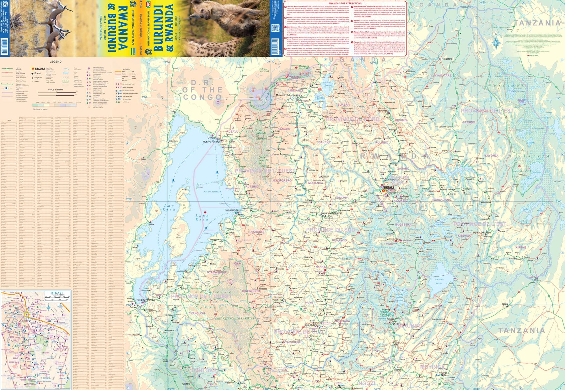
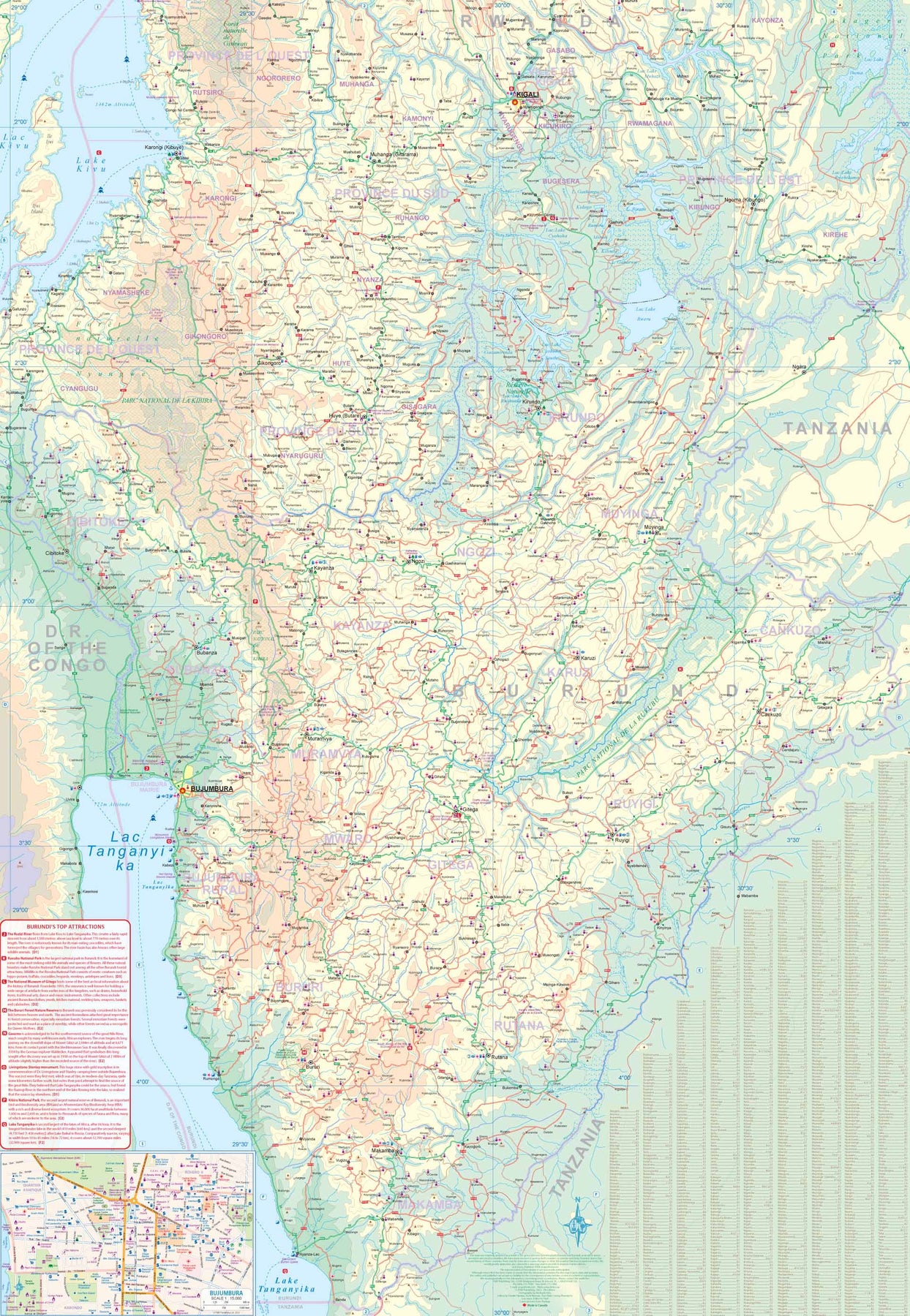
Rwanda & Burundi
Ordinær pris 199,00 krITM har kart over hele verden og de spesialiserer seg på land litt utenfor allfarvei. Beliggenheten til landets nasjonalparker, historiske monumenter, de viktigste veiene og lignende finner du inkludert i kartene. Samtlige landkart har ofte et bykart over hovedstaden.