111 produkter
Belarus
Ordinær pris 149,00 krITM har kart over hele verden og de spesialiserer seg på land litt utenfor allfarvei. Beliggenheten til landets nasjonalparker, historiske monumenter, de viktigste veiene o.L. Finner du inkludert i kartene. Samtlige landkart har ofte et bykart over hovedstaden.
Fra ITM: 2nd edition October 2015. Folded map with detailed road and rail network, National Parks and Reserves with complete index of all cities and towns in the map. In this edition, major urban areas are shown in Cyrillic as well as the Latin alphabet, hypsometry has been re-worked to show elevation differences better. This is a double-sided map of the country (divided into west and east halves) with part of Lithuania on the western part and a fair amount of Russia on the eastern side. Known international border crossings are shown, except on crossing into Russia, which are numerous. A large inset map for Minsk in a very suitable scale (1:15.000 Scale) comprising most of the touristic sights and places of interest and Metro lines has also been provided that is far better than what we could show previously.
Publisert år: 2015
Innbinding: falset
Material: papir
Målestokk: 1:600000
USA: Arizona & New Mexico
Ordinær pris 169,00 krThis version includes two separate covers, one for each state, to enhance marketing possibilities, and the addition of two Top Attractions listings, one for each state. The Arizona side has a detailed inset map of Flagstaff, showing the path of Route 66 through the city streets. The New Mexico side includes a large inset of Albuquerque, also including the Route 66 passageway through the city.
Canada: Garibaldi Provincial Park
Ordinær pris 149,00 krITM har kart over hele verden og de spesialiserer seg på land litt utenfor allfarvei. Beliggenheten til landets nasjonalparker, historiske monumenter, de viktigste veiene o.L. Finner du inkludert i kartene. Samtlige landkart har ofte et bykart over hovedstaden.
Publisert år: 2009
Innbinding: falset
Material: plastpapir
Målestokk: 1:50000
Canada: Haida Gwaii / Queen Charlotte Islands
Ordinær pris 149,00 kr Salgspris 74,50 kr Spar 50%ITM har kart over hele verden og de spesialiserer seg på land litt utenfor allfarvei. Beliggenheten til landets nasjonalparker, historiske monumenter, de viktigste veiene o.L. Finner du inkludert i kartene. Samtlige landkart har ofte et bykart over hovedstaden.
Fra ITM: 7th edition 2017. Times change, and a consensus has grown into a realization that the traditional indigenous name for the islands off BC's shore should be recognized. At the same time, the official name still recognizes the historical relationship of Queen Charlotte and the early days of British trading. We have added a new map of BC's coastline to the reverse side, covering from the US border north to Prince Rupert. As well, both sides have their own Top Attractions lists to focus attention on major sites, such as Ninstints at the southern tip of HG. As in the past, this edition is printed on tear-resistant waterproof paper. Coast in the scale 1:900.000 with inset maps of Vancouver & Victoria. Haida Gwaii in the scale 1:280.000.
Publisert år: 2017
Innbinding: falset
Material: Plastpapir
Målestokk: 1:280000
China: Hong Kong & Region
Ordinær pris 149,00 krITM har kart over hele verden og de spesialiserer seg på land litt utenfor allfarvei. Beliggenheten til landets nasjonalparker, historiske monumenter, de viktigste veiene o.L. Finner du inkludert i kartene. Samtlige landkart har ofte et bykart over hovedstaden.
Fra ITM: 4th edition 2016. Hong Kong is a double-sided map in scale 1:10.000/1:60.000, printed on waterproof paper.A street plan of Hong Kong with Kowloon at 1:10,000 and on the reverse a road map of the HK Special Administrative Region at 1:60,000, plus a diagram of the transport network. The street plan show Hong Kong and Kowloon at 1:10,000 with colouring for the main traffic arteries, very clear presentation of the highway junctions, and marking for one way streets. Where appropriate, MTR and KCR stations are shown with multiple entrances/exits, and the map also shows the double-decker tram line, the Mid-Levels Escalator and the ferry connections across the Victoria Harbour and Kowloon Bay. The plan also shows pedestrianized streets and those with staircases in the hilly part of the Hong Kong Island. Various places of interest and facilities are highlighted, including selected hotels. On the reverse is an indexed road map of the Hong Kong SAR at 1:60,000, extending north to Shenzehen. Altitude colouring shows the topography. Railway and ferry connections are marked and numerous places of interest are highlighted. On both sides place names are given in the Latin alphabet only, with on the road map selected location also shown in Chinese. The map includes a diagram of the transport network.
Publisert år: 2016
Innbinding: falset
Material: plastpapir
Målestokk: 1:10000/60000
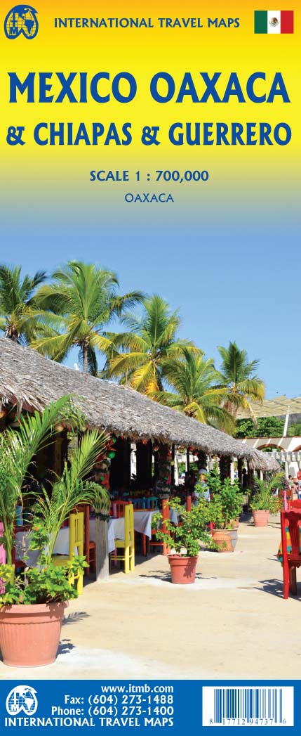
Mexico: Oaxaca & Chiapas & Guerrero
Ordinær pris 169,00 krITM har kart over hele verden og de spesialiserer seg på land litt utenfor allfarvei. Beliggenheten til landets nasjonalparker, historiske monumenter, de viktigste veiene o.L. Finner du inkludert i kartene. Samtlige landkart har ofte et bykart over hovedstaden.
Fra ITM: Travel to Mexico is exploding at the moment, as Covid restrictions lift. That portion of Mexico that forms the relatively narrow land mass between Mexico City and the Yucatan Peninsula is called the Isthmus of Mexico. It consists of three states, Oaxaca, in the west, Chiapas in the east, and Guerrero in the west. This is a double-sided map, stretching from west of Acapulco to beyond the border with Guatemala along the Pacific coast, and from Veracruz to Carmen along the Gulf of Mexico coast. It is the part of Mexico containing numerous holiday resort areas for sun-lovers, but is also rich in history and attractive colonial-era towns.
Oaxaca City is a UNESCO World Heritage site, as is the Mayan temple site of Palenque. There are numerous archeological sites in the region to explore, such as Monte Alban, which dates from the 8th Century BC. The colourful mining town of Taxco, with its narrow cobblestone streets, is a must-see, as is San Cristobal de Las Casas, in Chiapas State. This is an extremely popular part of Mexico to visit, so we are very pleased to be able to bring it back into print.
Mexico: Sonora & Sinaloa
Ordinær pris 169,00 krITM har kart over hele verden og de spesialiserer seg på land litt utenfor allfarvei. Beliggenheten til landets nasjonalparker, historiske monumenter, de viktigste veiene og lignende finner du inkludert i kartene. Samtlige landkart har ofte et bykart over hovedstaden.
Fra ITM: The northern Pacific coastline of Mexico borders on California and Arizona and is a popular travel destination. Sonora is the more northerly state of Mexico, bordering on Baja California on its west (much of which is included on this map) Nogales is probably the best-known city, although Hermosillo is the capital. Sinaloa is more southerly, and is probably best known for Mazatlán, the popular ocean resort community and cruise ship port of call. Sinaloa is also the starting point for the famous train excursion known as the Copper Canyon, originating in Los Mochis. The rail route is shown on the map. The canyon is actually in Chihuahua State, which is included on this map, and goes through a portion of Mexico that is pretty much devoid of roads. The trip ends in Cuauhtémoc, but users are advised to stay on the train to the capital city, also called Chihuahua. We have included the top ten attractions of the region, including the Pinacate Volcanic Field, the Nacapule Canyon, and Las Labradas World Heritage site. This is a part of Mexico easy to reach from the USA, and has many attractive cities
Ethiopia & Eritrea
Ordinær pris 199,00 krITM har kart over hele verden og de spesialiserer seg på land litt utenfor allfarvei. Beliggenheten til landets nasjonalparker, historiske monumenter, de viktigste veiene o.L. Finner du inkludert i kartene. Samtlige landkart har ofte et bykart over hovedstaden.
Fra ITM: Double-sided map with Ethiopia at 1:1,900,000 accompanied by a street plan of Addis Ababa, with on the reverse Eritrea at 1:915,000 with a plan of Asmara. Both road maps are indexed and show the topography by altitude colouring: in Ethiopia with bands in metres and peak heights given in both metres and feet, and in Eritrea with bands in feet and peak heights either in feet and metres or in feet only.
Venezuela
Ordinær pris 149,00 krITM har kart over hele verden og de spesialiserer seg på land litt utenfor allfarvei. Beliggenheten til landets nasjonalparker, historiske monumenter, de viktigste veiene o.L. Finner du inkludert i kartene. Samtlige landkart har et bykart over hovedstaden.
Publisert år: 2010
Innbinding: falset
Material: Papir
Målestokk: 1:1750000
Togo & Benin
Ordinær pris 169,00 krITM har kart over hele verden og de spesialiserer seg på land litt utenfor allfarvei. Beliggenheten til landets nasjonalparker, historiske monumenter, de viktigste veiene og lignende finner du inkludert i kartene. Samtlige landkart har ofte et bykart over hovedstaden.
Fra ITM: The two small countries squeezed between Ghana on the west and Nigeria on the east developed out of the European colonialization of most of Africa Germany, under Kaiser Bill, was determined to create an empire to rival that of Britain, and seized a portion of the coastline close to the British-held area of Ghana and held on to it until WW1 ended Germany’s colonial aspirations. Britain and France jointly governed Togo briefly, but the territory was ceded to France until independence was granted in the 1960s. Neighbouring Benin (formerly the French colony of Dahomey) was all that the French colonial office could obtain of the rich coastal plain until the German defeat in WW1, which gained it Togo and German Cameroun, further to the east. Both countries have their points of interest, but to this day have little to do with each other. There is one border crossing on the coast, and a couple of others much farther inland, but each country operates on a north-south basis, not an east-west one. The map includes inset maps of Lome, the capital of Togo, and Porto Novo, in Benin, which is now the capital. Togo’s best sites are noted in a red inset box, with a separate box for Benin.
Somalia & Horn of Africa
Ordinær pris 169,00 krITM har kart over hele verden og de spesialiserer seg på land litt utenfor allfarvei. Beliggenheten til landets nasjonalparker, historiske monumenter, de viktigste veiene og lignende finner du inkludert i kartene. Samtlige landkart har ofte et bykart over hovedstaden.
Fra ITM: 3rd Edition Somalia is one of the more itneresting off-the-beaten-path countries. The area around Mogadishu prefers to call itself Somalia, but controls only a portion of the overall country area. Then there is Jubaland, on the Kenyan border, aligned very closely to the former Italian colony boundaries of the same name. Truuly, an amazing juxtaposition of countries within countries! the reverse side of the sheet presents a vey interesting regional perspective of the area between the northern border of Ethiopia, a small portion of Sudan and a reasonable portion of South Sudan, all of Uganda, most of Kenya, all of Djibouti and a fair portion of Eritrea, as well as the former Aden portion of war-torn Yemen. The strategic island of Socotra is in the upper right corner. This is a fascinating regional map, never before published to my knowledge, of an extremely significant part of the world. Think of the following: Socotra guards and controls access to the Gulf of Aden and the Red Sea, leading to the Suez Canal. What an interesting part of the world! How can anyone not be captivated by such wonderfully exotic names as Hargeysa, Boosaaso, or Kismayyo? Somalia and the region of the Horn remain crucially important to world peace, so this map is important.
Publisert år: 2020
Innbinding: falset
Material: plastpapir
Målestokk: 1:1,700,000 / 1:2,400,000
Surinam & French Guiana
Ordinær pris 149,00 krITM har kart over hele verden og de spesialiserer seg på land litt utenfor allfarvei. Beliggenheten til landets nasjonalparker, historiske monumenter, de viktigste veiene o.L. Finner du inkludert i kartene. Samtlige landkart har ofte et bykart over hovedstaden.
Publisert år: 2009
Innbinding: falset
Material: papir
Målestokk: 1:750000
Nicaragua & El Salvador
Ordinær pris 149,00 krITM har kart over hele verden og de spesialiserer seg på land litt utenfor allfarvei. Beliggenheten til landets nasjonalparker, historiske monumenter, de viktigste veiene o.L. Finner du inkludert i kartene. Samtlige landkart har ofte et bykart over hovedstaden.
Publisert år: 2015
Innbinding: falset
Material: plastpapir
Målestokk: 1:700000
Mexico
Ordinær pris 189,00 krITM har kart over hele verden og de spesialiserer seg på land litt utenfor allfarvei. Beliggenheten til landets nasjonalparker, historiske monumenter, de viktigste veiene og lignende finner du inkludert i kartene. Samtlige landkart har ofte et bykart over hovedstaden.
Fra ITM: Mexico is a fascinating country, and as travel re-opens, is proving to be very popular. This most recent edition was recently printed, and is now the current edition. Double sided detailed travel map, with comprehensive place name index. Distinguishes roads ranging from expressways (free/toll) to rural roads. Legend includes railways, tracks, trails, international airports, domestic airports, bridges, border crossing points, points of interest, archaeological sites, beaches, active volcanos, filling stations, national parks, deserts, places of touristic interest. Printed on durable, water-resistant plastic paper, suitable for travelling in areas with extreme humidity. This is another chestnut in the ITMB line, and sells well. The cover picture is new, as is the ISBN. Mexico is a very large and diverse country, and very popular with Americans. Again, there is little one can say that is news about such a tried-and-true map, except to say that it is extremely popular.
Nicaragua & Honduras
Ordinær pris 169,00 krITM har kart over hele verden og de spesialiserer seg på land litt utenfor allfarvei. Beliggenheten til landets nasjonalparker, historiske monumenter, de viktigste veiene o.L. Finner du inkludert i kartene. Samtlige landkart har ofte et bykart over hovedstaden.
Fra ITM: Central America generally remians poplar with visitors. Both Honduras and Nicaragua, which occupy different sides of this sheet, have a lot of attractions to offer. Honduras offers beaches, the wonderful Mayan complex of Copan, lake Yojoa, the colonial heritage of Belen Gualcho, the Valley of Angels, and a city of charm named Gracias A large inset map of Tegucigalpa, the capital, is included. Nicaragua has one of the oldes urban areas in the Western Hemisphere, Granada (1534), the mountains of Matagalpa, quiet fishing villages, pottery works at San Juan, the largest lake in Central America, and touristic islands off the coast. An excellent inset map of Managua, the capital, is included.
Publisert år: 2019
Innbinding: falset
Material: papir
Målestokk: 1:700000
Dominican Republic & Haiti
Ordinær pris 149,00 krITM har kart over hele verden og de spesialiserer seg på land litt utenfor allfarvei. Beliggenheten til landets nasjonalparker, historiske monumenter, de viktigste veiene o.L. Finner du inkludert i kartene. Samtlige landkart har ofte et bykart over hovedstaden.
Fra ITM: We spent a week on the lovely island of Hispaniola, home to the Dominican Republic and Haiti, last December. We spent several days driving the highways, checking our information and this new edition is the result. Frankly, we were surprised how accurate the digital artwork was (and is); this is the first time that we have been able to ground-truth a map shortly before printing, and after updating. We did discover one new toll highway, and we learned that Santa Domingo floods rather easily during heavy rains. We now show a lot of what I would consider to be local farm roads; they exist, but it is doubtful any tourist would use them. We also discovered a new motorway-like highway that is under construction between Santiago and Puerto Plata, but we are leaving it off the map for now as work has just begun and we saw little indication that it would be completed. We can add it if we see progress. The Haiti side of the sheet remains a work in progress. There are now five border crossings with Dom Rep and a lot of cross-border traffic, but the road network in Haiti remains quite basic. We have added hundreds of small local roads to our artwork; most are simple dirt tracks. We have also added a series of top attractions for Haiti, highlighted in red, and a separate series for Dom Rep. Although this could be considered a significant update.
Publisert år: 2017
Innbinding: falset
Material: plastpapir
Målestokk: 1:400,000 / 1:350,000
Jamaica & Cayman Islands
Ordinær pris 149,00 krITM har kart over hele verden og de spesialiserer seg på land litt utenfor allfarvei. Beliggenheten til landets nasjonalparker, historiske monumenter, de viktigste veiene o.L. Finner du inkludert i kartene. Samtlige landkart har ofte et bykart over hovedstaden.
Fra ITM: This map was called Cayman Islands and Jamaica in its previous edition, which was a well-intentioned attempt to promote the smaller islands adjacent to big brother. Now, we are reverting to what we think is a more logical title arrangement for listing purposes, but the map has two covers, so one can market it as either Jamaica or the Caymans, or best of all, market both! We visited the Caymans a few months ago and drove every road on the main island, including a few that turned out to be driveways! The map is very current as a result. The other side of the map is the very popular touristic island of Jamaica, now into its sixth edition. This island is large enough to justify renting a car and exploring. It is a great way to discover hidden coves and find historic plantations, especially along the touristic north shore. 6th/3rd Ed. 1:250,000/1:37,500
Publisert år: 2017
Innbinding: falset
Material: papir
Målestokk: 1:250000/37,500
Borneo: Sarawak; Sabah & Brunei
Ordinær pris 149,00 krITM har kart over hele verden og de spesialiserer seg på land litt utenfor allfarvei. Beliggenheten til landets nasjonalparker, historiske monumenter, de viktigste veiene o.L. Finner du inkludert i kartene. Samtlige landkart har ofte et bykart over hovedstaden.
Publisert år: 2012
Innbinding: falset
Material: papir
Målestokk: 1:620000
Norway: North & Central
Ordinær pris 169,00 krNorway is one of the more interesting countries in Europe for travellers, in that it has wide open spaces and unusual Arctic scenery, particularly in the north. Because it is a rather long and narrow country, trying to portray it adequately on a single sheet results in a lack of scale adequate for showing touristic attractions. This map covers the northern portion of the country, from Trondheim to Nordkapp and from the North Atlantic to the Russian border. It also shows a portion of northern Sweden and a bit of Finland and Russia, but its focus is on roads, rail connections, airports, distance markers, parks, and touristic attractions in the region. Most noticeably, the rail lines leading to Trondheim and north to Bodo are clearly shown. Communities, sometimes fairly small, are included, as are ferries to outlying islands close to the coast.
The reverse side shows the rail line to Narvik coming in from Sweden, and all roads and towns north to the Arctic Ocean and east to the Russian border. Border crossing to Sweden/Finland are not shown, as both countries are part of the EU, but crossings to Russia are shown, albeit closed at the moment.
Burkina Faso & Niger
Ordinær pris 149,00 krITM har kart over hele verden og de spesialiserer seg på land litt utenfor allfarvei. Beliggenheten til landets nasjonalparker, historiske monumenter, de viktigste veiene o.L. Finner du inkludert i kartene. Samtlige landkart har ofte et bykart over hovedstaden.
Fra ITM: Burkina Faso and Niger on a double-sided, indexed map from ITMB, presenting each country separately at 1:1,000,000 1:1,950,000 respectively and accompanied by street plans of Ouagadougou, Bobo-Dioulasso and Niamey. Altitude colouring shows the topography (with bands in feet in Burkina Faso and in metres in Niger). In Burkina Faso the map indicates areas of periodic inundation, whilst in Niger numerous water wells, salt pans, sand dunes and lava fields are also marked. In both countries parks and nature reserves are highlighted.
Road network indicates seasonal roads and shows locations of fuel supplies and border crossings, plus distances on main routes. Airports and aerodromes for small craft are marked; towns are annotated with symbols indicating what facilities can be found there. Each map has latitude and longitude lines (at 1° in Burkina Faso and 2° in Niger), plus a separate index.
Street plans, annotated with names of hotels, various tourist facilities and main buildings cover Ouagadougou (with an enlargement for the town cente), Bobo-Dioulasso and Niamey.
Publisert år: 2013
Innbinding: falset
Material: papir
Målestokk: 1:1950000
Australia: Melbourne & Victoria
Ordinær pris 169,00 krItm har kart over hele verden og de spesialiserer seg på land litt utenfor allfarvei. Beliggenheten til landets nasjonalparker, historiske monumenter, de viktigste veiene o.L. Finner du inkludert i kartene. Samtlige landkart har et bykart over hovedstaden.
Fra ITM: A list of Top Attractions and a regional rail map are included as insets. All the tram lines are shown. The other side is new. Melbourne is located in the State of Victoria, so we have added a detailed map of the state and extended the coverage to include Sydney, Canberra, and Adelaide. Rail lines are shown, although most people travel by car. There is a motorway to Sydney, but almost all others are two-lane tarred. The coastal highway going west is particularly scenic. Australia’s highest mountain is also on this map.
Publisert år: 2024
Innbinding: falset
Material: papir
Målestokk: 1:9000 / 1:1,500,000
USA: Orlando & Southern Florida
Ordinær pris 189,00 krITM har kart over hele verden og de spesialiserer seg på land litt utenfor allfarvei. Beliggenheten til landets nasjonalparker, historiske monumenter, de viktigste veiene o.L. Finner du inkludert i kartene. Samtlige landkart har ofte et bykart over hovedstaden.
Fra ITM: Florida is one of the most travelled-to parts of the world, and with Orlando in its centre, a map is necessary as well as inevitable. The big attraction, of course, is the Walt Disney World resort area, which is yet another must-see destination. The resort is so large that it requires its own inset map and has eighteen hotels at last count, its own monorail, and too many attractions to note here. Disneyland is for everyone young and old, so enjoy it.
Publisert år: 2024
Innbinding: falset
Material: papir
Målestokk: 1:10,000/1: 600,000
USA: Las Vegas & Region
Ordinær pris 199,00 krStreet plan of Las Vegas with a map of the Las Vegas region at on the reverse. Street names are clearly marked, with rail and monorail lines and stations displayed. Places of interest are shown, with the names of casinos, wedding chapels, shows such as Spamalot all displayed prominently. Local facilities such as petrol stations, hotels, swimming pools are marked.
Indonesia: Sumatra
Ordinær pris 199,00 krITM har kart over hele verden og de spesialiserer seg på land litt utenfor allfarvei. Beliggenheten til landets nasjonalparker, historiske monumenter, de viktigste veiene o.L. Finner du inkludert i kartene. Samtlige landkart har ofte et bykart over hovedstaden.
Fra ITM: The Indonesian island of Sumatra is not only the largest portion of this nation of islands, it is also very close to Singapore and Malaysia, so has easy connections to both countries as well as to other parts of Indonesia. Side 1 shows the northern portion of Sumatra, with an excellent inset map of Medan, its major city. Several offshore islands are included, as well as a significant Top Attractions list. Side 2 shows the bulk of the island as well as a portion of southern Malaysia, Singapore, and various islands in the vicinity. Ferry routes to Java, Malacca (part of Malaysia), the Lingga and Riau Archipelagoes and Singapore are included, as well as inset maps of Padang and Palembang, the two major cities in the south. Sumatra has a well-developed road network along its western side, but not along its eastern portion, except in the far north. Thus, the island remains a place for adventure travel waiting to be discovered.
Publisert år: 2024
Innbinding: falset
Material: papir
Målestokk: 1:1100.000
Great Britain
Ordinær pris 199,00 krITM har kart over hele verden og de spesialiserer seg på land litt utenfor allfarvei. Beliggenheten til landets nasjonalparker, historiske monumenter, de viktigste veiene o.L. Finner du inkludert i kartene. Samtlige landkart har ofte et bykart over hovedstaden.
Fra ITM: This is the third set of artwork for Great Britain that we have published and the first that is completely our own artwork (the previous versions were joint ventures). In mapping, as in life, one has to differentiate between the political entity known as the United Kingdom and the geo-political reality of Greater Britain, which includes the Channel Islands, the Isle of Man, and various assorted entities that are loosely attached to the UK by history. We have tried, in this edition, to combine a detailed road map with a touristic sites map. Given that Britain is both densely covered by thousands of narrow laneway passing themselves off as sub-B level roads and by having the greatest treasure trove in the world of castles, manor houses, gardens, museums, and interesting places worth visiting, and the task of portraying all this information becomes formidable. To keep the map from becoming too cluttered, we had to compromise, so if you don’t find the little laneway leading to your favourite pub in Devon, sorry. We've done our best to portray Britain as positively as possible, so if you're hankering to visit Foula Island, it's on the map!
Publisert år: 2025
Innbinding: falset
Material: plastpapir
Målestokk: 1:720,000
Borneo & Kalimantan
Ordinær pris 199,00 krRoad map with many places and roads, railways and rivers, heights, latitude and longitude. With city maps of Kuching, Kota Kinabalu and Bandar Seri Begawan. The Island of Borneo is shared by three countries: Malaysia and Brunei have the northern portion, with the balance forming Kalimantan Province of Indonesia.
This double-sided map shows both northern and southern portions to good advantage; printed on paper. Legend Includes: International and state boundaries, roads by classifications, distances between points, rivers, lakes, national parks, beaches, hotels, lighthouses, airports, place of interests and other information.
Zurich & Northern Switzerland
Ordinær pris 199,00 krCity map Zurich and Road map Northern Switzerland.
Switzerland is a lovely country to visit, albeit rather expensive, and is conveniently located in the heart of western Europe. Zurich, as a city, is not only commercially important but is a lovely city to visit and enjoy. The Old Town is a walking paradise, with stores intermingled with squares and churches, and the hilly nature of the city brings photographic images to the forefront with each turn of a corner. ITMB publishes a separate map of Geneva on one side and all of Switzerland on the other side.
For this title, we have expanded the scale and filled the reverse side with and easy-to-use regional map of North-western Switzerland, combining the city with its hinterland. Being a rather small country, this results in a map covering most of the country, from Lausanne in the southwest and Basle on the north to Chur on the east and Montreux in the south, so the far east and south of the country are excluded.