315 produkter
315 produkter


315 produkter
USA: Northeast
Ordinær pris 199,00 krITM har kart over hele verden og de spesialiserer seg på land litt utenfor allfarvei. Beliggenheten til landets nasjonalparker, historiske monumenter, de viktigste veiene o.l. finner du inkludert i kartene. Samtlige landkart har ofte et bykart over hovedstaden.
Fra ITM: The original British colonies that prospered were the ones closest to England. Makes sense! Rhode Island, Massachusetts, Connecticut, and New York were relatively closer to London than Virginia and the Carolinas, so they got the benefits of the Industrial Revolution first. This part of the USA is riddled with historic sites, as well as large urban areas, such as Boston and NYC. Its charm as a regional map is that it combines like-minded areas together on one sheet at a scale that is manageable and easy to read. There are countless parks to explore, such as Campobello, which is actually in Canada, but most easily accessed from Maine. The Cape Cod peninsula is one of the most visited sites in the USA, with colonial-era Provincetown at its tip. There are many motorways and highways that allow easy travel, as well as rapid train services along the coast to NYC and Washington. Side 2 concentrates on the rest of New York State and shows a fair portion of Pennsylvania. Although the Canadian border areas are shown, along with crossings, relatively little of the countryside north of the USA is shown in order to concentrate one’s efforts on exploring the historic heart of America.
USA: Chicago & Illinois
Ordinær pris 199,00 krITM har kart over hele verden og de spesialiserer seg på land litt utenfor allfarvei. Beliggenheten til landets nasjonalparker, historiske monumenter, de viktigste veiene og lignende finner du inkludert i kartene. Samtlige landkart har ofte et bykart over hovedstaden.
Fra ITM: Chicago is one of the largest cities in the USA and has long been famous for its rail hub joining lines from the east coast to those serving the western regions. It is also the start (or the finish) of famed Route 66, the first paved highway to the Pacific. Side 1 covers the city from the convention centre north to Wrigleyville and from the lakefront west to Western Avenue, with a large inset of Greater Chicago and another of Oak Park (famous for being the home of Frank Lloyd Wright). Side 2 is a brand new map for ITMB, being of the great state of Illinois, of which Chicago is a small part. This side traces Route 66 southwest from its origins in downtown Chicago to somewhat beyond St. Louis, where the national highway continues into Missouri. This map starts on Wisconsin in the north, at Minneapolis, and continues south to western Kentucky, ending at Nashville, Tennessee and is loaded with touristic attractions that are sure to delight visitors.
Publisert: 2025
Innbinding: falset
Material: vanntettpapir
Målestokk: 1:12,000/1:1,000,000
Rhine River Cruising
Ordinær pris 199,00 krThe Rhine River flows from the Gletch Glacier in the Swiss Alps north to central Germany and then on to Amsterdam and the North Sea. It has been a major transportation link in Europe for many centuries, with dozens of castles located at strategic points. Today, it is a peaceful touristic haven as well as a busy working river, with dozens of shallow-draft boats wending their way around countless turns in the river. It is probably the busiest tourist highway in Europe. This double-sided map starts in Amsterdam, where it is known as the Waal, and follows the course of the river inland past Nijmegen to the German border, where the name changes to Rhine. There are many notable interesting cities along its route, such as Essen in the Ruhr Valley, Dusseldorf, Koln, with its magnificent cathedral, Bonn, Castle Arenfels, Koblenz, and Rüdesheim, where it joins the Main River and heads east to Frankfurt-on-Main and points east. As a map is a rectangular sheet of paper and a river is a narrow portion wending its way as geography takes it. This is much more than a simple river map. It is a detailed portrayal of a very interesting part of Europe, extending far beyond the banks of the river, and is ideal for those travelling by car, by train, or by river boat. A detailed city centre map of Frankfurt is included.
Portugal
Ordinær pris 199,00 krITM har kart over hele verden og de spesialiserer seg på land litt utenfor allfarvei. Beliggenheten til landets nasjonalparker, historiske monumenter, de viktigste veiene o.L. Finner du inkludert i kartene. Samtlige landkart har ofte et bykart over hovedstaden.
Fra ITM: We are very pleased to be able to release a double-sided detailed map of Portugal. Although we have included the country in previous maps, it was always as an adjunct to another map (Spain and Portugal, Portugal and Southern Spain etc.), so it is high time that this very nice popular country had its own ITM map. Being a long, rather thin country, Side 1 concentrates on Lisbon and the southern half of Portugal with a detailed inset map of Lisbon. It also includes the Spanish provinces of Huelva and Badajoz. Side 2 covers the northern half of the country along with portions of neighbouring Spanish provinces. As a country, Portugal has a wealth of touristic attractions and we have included as many as we can on this map without cluttering it – castles, palaces, fortresses, cathedrals and churches, dozens of museums, beaches, a few hotels, mines, monuments, and just about everything a visitor would want to have. Of course, motorways, highways, secondary routes, rail lines, ferry services, and geographic heights of land are also included; altogether, a fabulous map for a wonderful country.
Publisert år: 2025
Innbinding: falset
Material: Papir
Målestokk: 1:500,000
USA: Appalachian Trail
Ordinær pris 199,00 krThis is a new venture for ITMB, although we have published several recreational hiking maps over the years. The Appalachian mountain range was the original western boundary of the American colonies while under British rule. Everything west of there was technically the French possession of Louisiana Territory, called by American settlers ‘Indian country’. Nowadays, it is a massive recreational hinterland for east coast residents wanting to escape overcrowded cities. The National Parks Service maintains the trail and a series of overnight huts.
Most people only hike a portion of the trail, but for the dedicated hiker, the trail is a great adventure. We have divided the length of the trail into four natural regions: Maine into New York State, Connecticut south to Maryland, Maryland to Virginia, and Virginia to Georgia, to its traditional end at Springer Mountain. This is a demanding trail hike, but one of the most popular in the world.
Mexico: Mexico Central
Ordinær pris 199,00 krMexico is an exceptionally interesting country to visit. The country itself is larger than most people realize, making sectional maps essential. We started mapping Mexico in the late 1980s and have gradually added regional maps as time and money enabled. Naturally, touristy popular areas like the Yucatan, Baja, and the Pacific Coast really need specialized maps, but so does the central region of the country. This map covers from Mexico City south to Acapulco and east almost as far as the Guatemalan border on side 1, and from Puebla west to Guadalajara on side 2.
Highlights include the colonial mining town of Taxco, the ruins of the Aztec capital of Teotihuacan, the untouched historical city of Oaxaca, and the mountain centre of Tuxtla Gutierrez. This is a map for driving and exploring and coming to understand one of the most important countries in the Americas.
Poland: Krakow & South Poland
Ordinær pris 199,00 krThe Polish city of Krakow is medieval in its city centre, with its walled fortress, the Wawel (a world heritage site) and its old town, which is now largely a pedestrian precinct. The Rynek Glowny, or central square, is the largest in Europe and features the 16th century Cloth Hall and the 14th century cathedral. Nearby is the Wieliczke Salt Mine, another World heritage site, and a wonder to explore. Also nearby is Tyniec Abbey, dating back to the 11th century.
The reverse side covers southern Poland, from Warsaw in the north to the Carpathian Mountains. Poland is one of Europes hidden treasures, with small villages and ancient towns, such as Zamosc (another world heritage site), national parks, chalk tunnels (in Chelm) a martyrs clock (in Lublin), and a bishops palace (in Kielce). Put them all together, and a marvellous travel experience unfolds!
Canada: East Coast
Ordinær pris 199,00 krCanada is a vast country in area; inconceivably enormous in European terms. It is best mapped as a series of regional maps and this is the first of two maps that we hope will portray the Atlantic coastline of all of North America. Side 1 concentrates on Newfoundland and Labrador, with a tiny bit of Nunuvut at the top end of the Ungava Peninsula. An inset map of St. John’s, capital of Nfld/Lab is included, as is the French Overseas Territory of St. Pierre et Miquelon. The new paved highway across Labrador is the highlight of this side of the map!
The second side of the map focusses on Nova Scotia/Cape Breton and parts of Prince Edward Island and New Brunswick, with a detailed inset of central Halifax. The former French fortress of Louisbourg is a must-see for anyone visiting Cape Breton, as are the many Loyalist towns created along the coast of Nova Scotia to house refugees fleeing turmoil in the American colonies during the Revolutionary War. A separate map concentrating on the Atlantic coastline of the USA is being prepared.
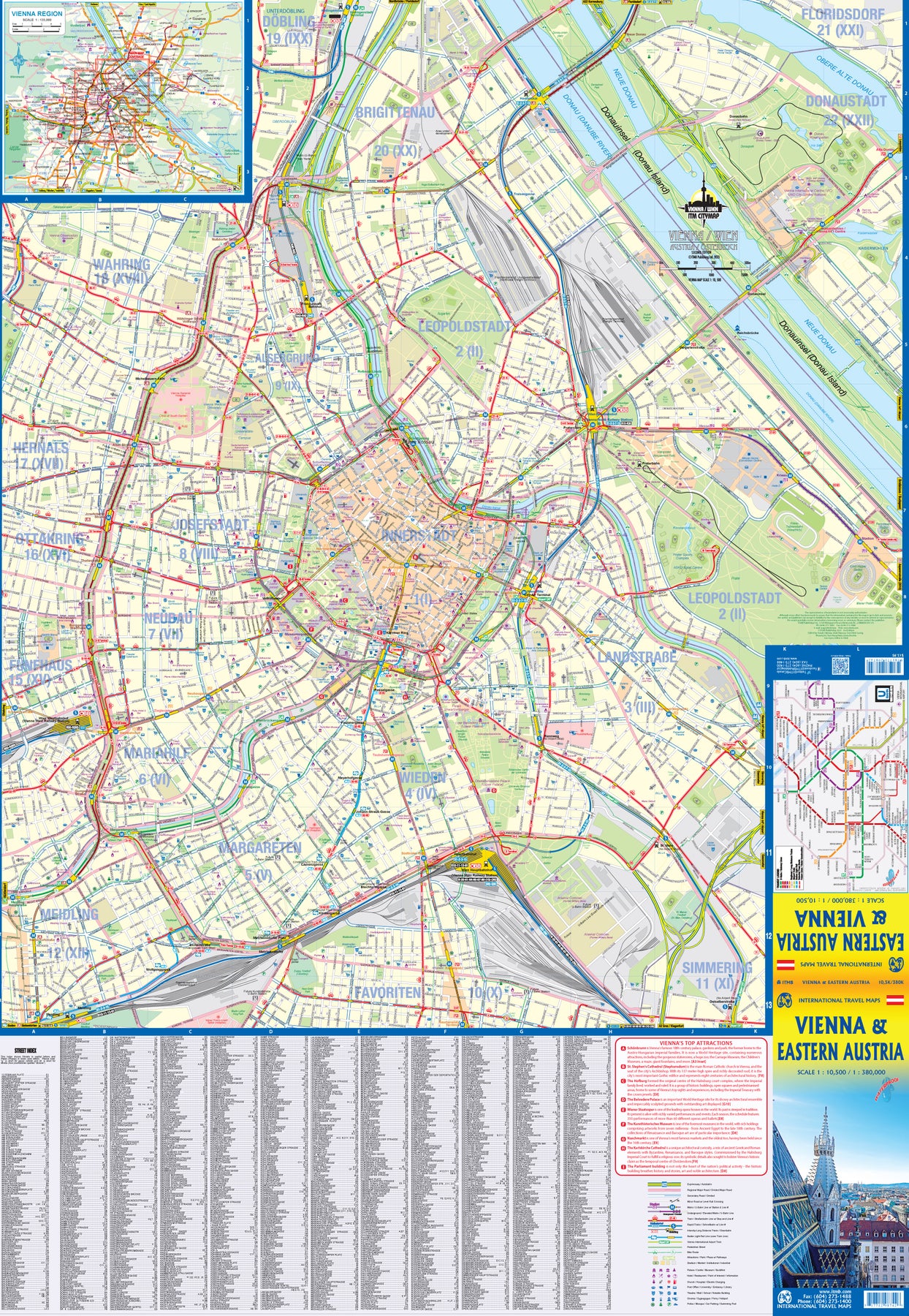
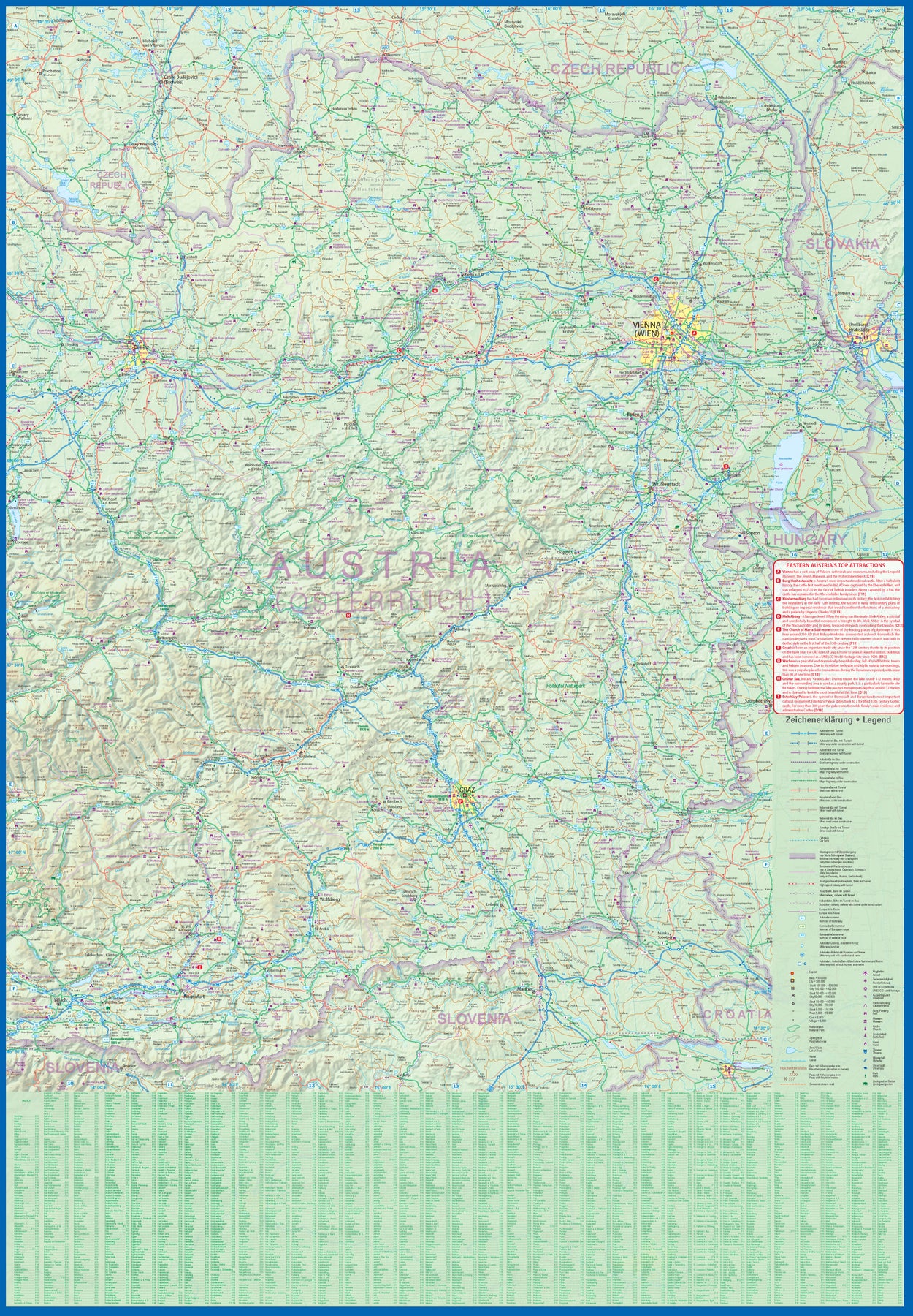
Austria: Vienna & Eastern Austria
Ordinær pris 179,00 krITMB is pleased to introduce an exciting new map of the wonderful city of Vienna, combined with a newly-prepared map of eastern Austria. Until WW2, Vienna was one of the most diverse and cultural cities in Europe. The NAZI takeover changed all of that and its brutal capture by the Russians five years later sent the city into a devastating downturn. Fortunately, the Soviet Union was forced to withdraw and Austria declared to be a demilitarized neutral country for the rest of the Cold War. Vienna is now a lovely historic city on the Danube River, the capital of Austria, and the European United Nations centre. The Innerstadt (Inner or old city centre) is the location of many of the hotels gracing Vienna, as well as St, Stephen’s Cathedral with its wonderful roof. One of the great attractions of the city is the Schonbrunn, the 18th Century palace of the Austro-Hungarian Empire.
The map extends from the western ring road to the UN complex east of the Danube, and from the northern edge of the urban area to south of the Hauptbahnhof (or main railway station). All Metro and tram lines are clearly shown, along with parks, churches, shopping areas, hotels, and the city’s three rail stations. The second side of the sheet is a very detailed map of the eastern half of Austria from the /Czech border on the north, the Hungarian border to the east, to the Slovenian border to the south, and west to Linz and Klagenfurt. Rail lines are prominently noted, as are motorways and all highways. Once one leaves Vienna, a vista of rural mountainous countryside unfolds, with dozens of ancient castles to explore, and interesting small towns to explore. Burg Hochosterwitz is one of Europe’s most ancient castles, dating from 860AD.
Greece: Crete; Mykonos & Santorini
Ordinær pris 169,00 krThe many islands off the coast of Greece can only be mapped properly a few at a time. Side 1 of this map shows the large island of Crete in good detail, with the relatively nearby island of Mykonos and its adjacent island of Rinia and the island of Santorini, with its adjacent islands of Thirasia and Nea Kameni being shown in great detail. A locality map showing the islands in relation to the rest of Greece is included as an inset. It is our intention to map more islands as time passes, but this depends upon future research trips (we lead a hard life!).
Side 2 of the map is a general map of Greece in relation to its neighbours to the north and east. The Mediterranean is divided into smaller seas, such as the Adriatic along the coast of Croatia, the Ionian to the west of Greece, the Myrtoan to its south and the Aegean to its east. All this area is replete with islands and geopolitical conflicts. As such, this map is useful for showing the region as an entity that links the Balkan states to the eastern Mediterranean.
Italy: Sicily; Sardinia & The South
Ordinær pris 169,00 krITM har kart over hele verden og de spesialiserer seg på land litt utenfor allfarvei. Beliggenheten til landets nasjonalparker, historiske monumenter, de viktigste veiene og lignende finner du inkludert i kartene. Samtlige landkart har ofte et bykart over hovedstaden.
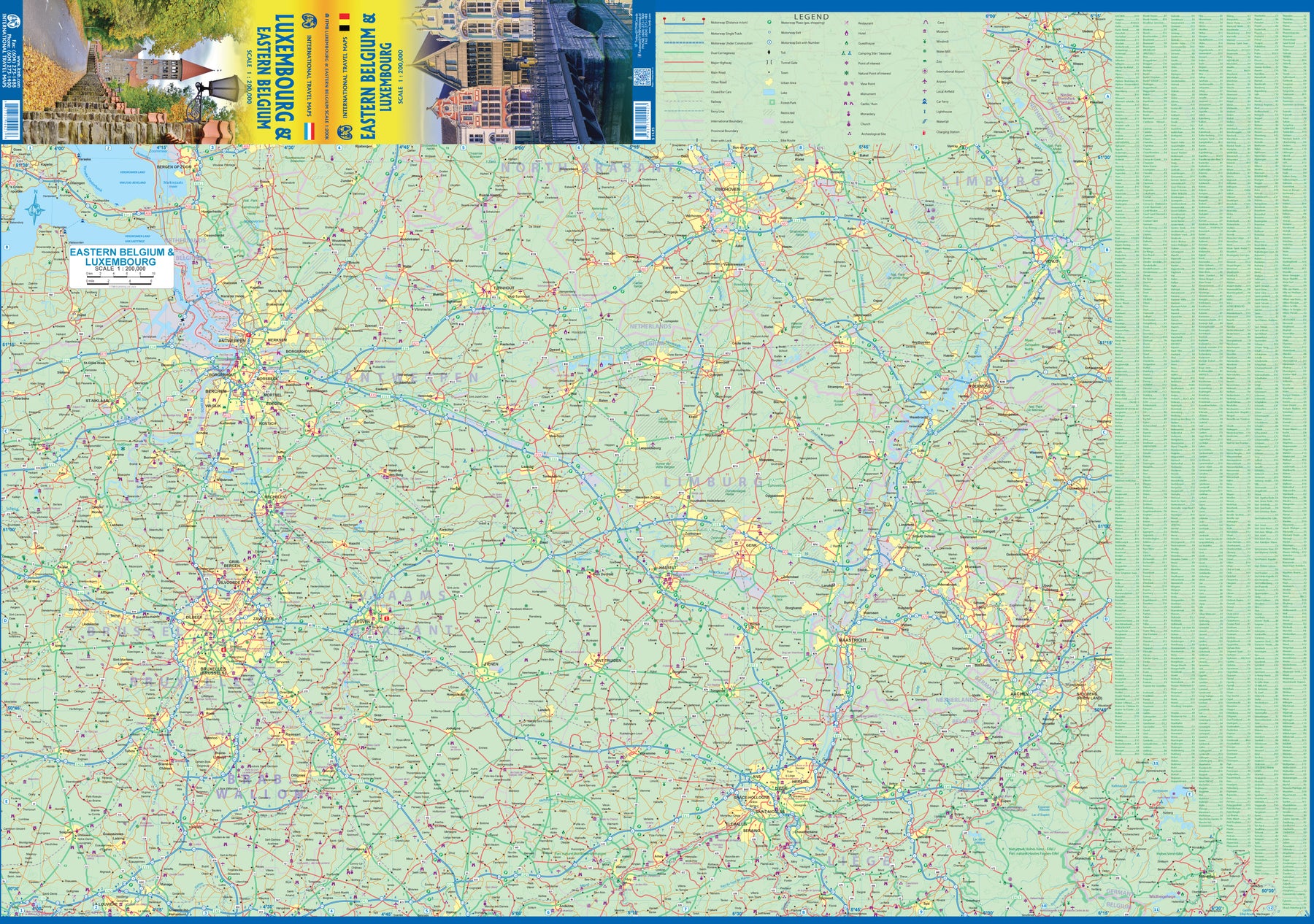
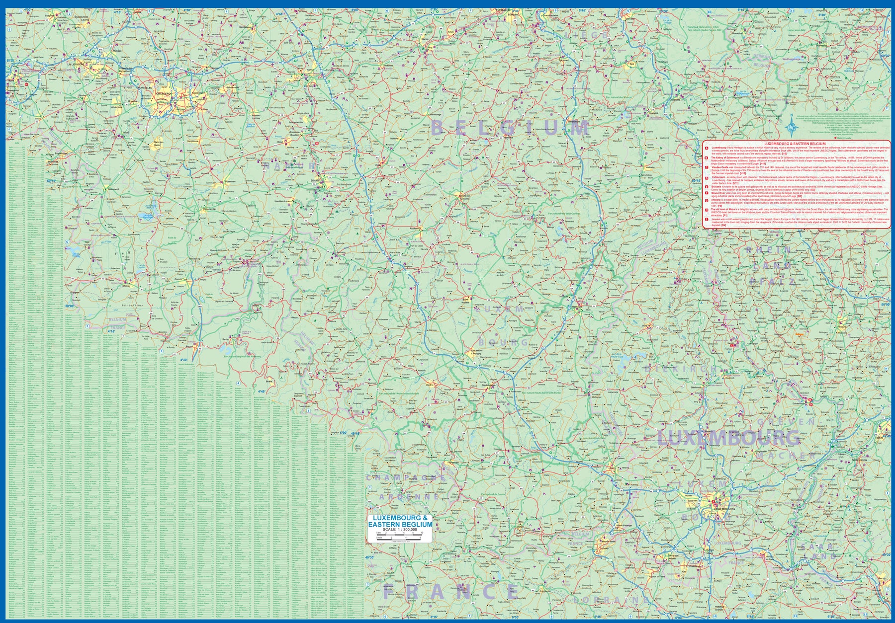
Luxembourg & Eastern Belgium
Ordinær pris 199,00 krLuxembourg is the largest of Europe’s mini-states. We have included the principality on maps of surrounding countries, as most publishers do, but we felt it was time to concentrate on the principality itself and place it into context with its neighbours. Bounded on the west by Belgium, on its east by Germany, and its south by France, Luxembourg has survived for centuries by playing off one large power against another in order to retain its independence. Largely a French-speaking area, Luxembourg is also a strong supporter of the EU. It is a mountainous country, part of the Ardennes region, and close to Bastogne, the focal point of Hitler's last attempt to break the Allies in what is now called the Battle of the Bulge. Bastogne, site of a marvelous WW2 museum, is also on Side 1, as is a portion of Belgium going as far as Mons.
Side 2 concentrates on Belgium east of Brussels, with a small portion of Netherlands included. This includes the Brussels region, Antwerp, Leuven, Liege, and Aachen, with a tiny portion of Germany. Belgium is a larger and more diverse country than many realize. One of the great treasure of eastern Belgium is the cathedral town of Liege, which is known in Flemish as Luik and in German as Luttich, which can make finding it a bit challenging, depending upon whose map one is using, or which road signs one is following!
USA: San Diego & California South
Ordinær pris 169,00 krITM har kart over hele verden og de spesialiserer seg på land litt utenfor allfarvei. Beliggenheten til landets nasjonalparker, historiske monumenter, de viktigste veiene o.L. Finner du inkludert i kartene. Samtlige landkart har ofte et bykart over hovedstaden.
Fra ITM: In the southwest corner of the American mainland is the port city of San Diego, one of the major hubs of the US Navy. The city itself is very interesting, with a city centre dominated by colonial-styled buildings. Balboa Park is home to one of the best zoos in North America, and the historic 'old town' area north of the city centre has become a popular 'Old Mexico' theme attraction. As well, there is the Tijuana Trolley, which is, in fact, a modern surface-rail tram line that goes from the city centre to close to the walk-across border with Mexico into colourful downtown Tijuana. A day visit to Mexico is one of the highlights of a visit to San Diego! Enjoy!
Publisert år: 2023
Innbinding: falset
Material: papir
Målestokk: 1:15,000 / 1:900,000
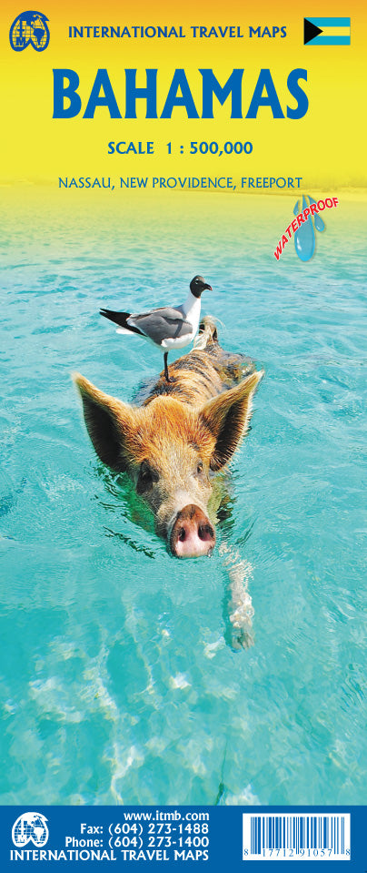
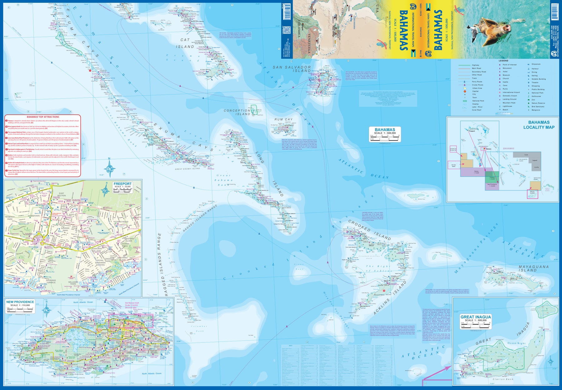
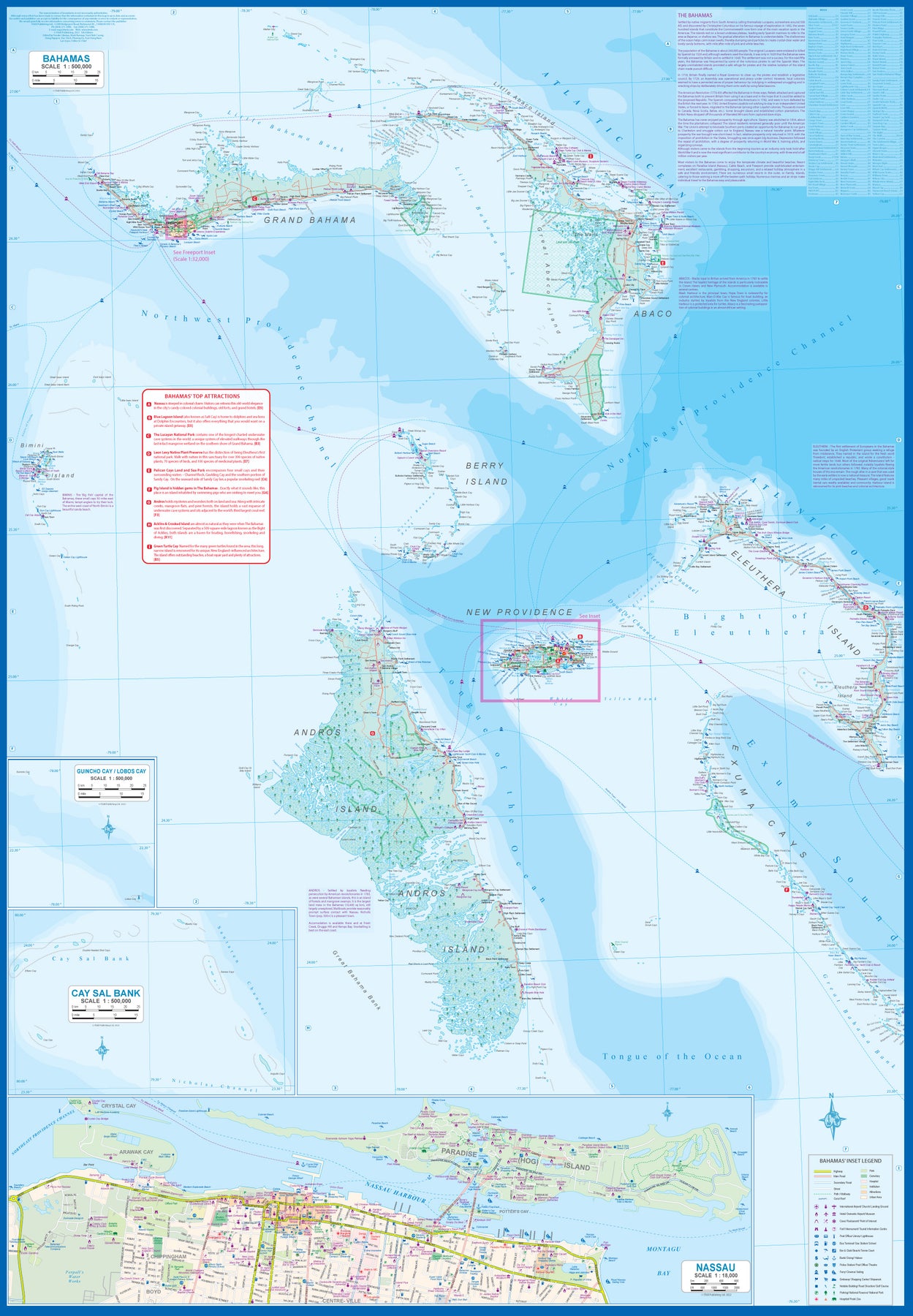
Bahamas
Ordinær pris 189,00 krITM har kart over hele verden og de spesialiserer seg på land litt utenfor allfarvei. Beliggenheten til landets nasjonalparker, historiske monumenter, de viktigste veiene o.L. Finner du inkludert i kartene. Samtlige landkart har ofte et bykart over hovedstaden.
Fra ITM: This fifth edition of our popular travel map to the many Bahamian islands shows a wealth of accommodations, beaches, and points of interest. Inset maps of Nasau and Freeport detail the two largest cities, and a special inset of New Providence Island, the most popular tourist destination, shows resorts and attractions that make this island so popular. As usual, we include a Top Attractions list of the 'must see' destinations.
Publisert år: 2023
Innbinding: falset
Material: plastpapir
Målestokk: 1:500,000
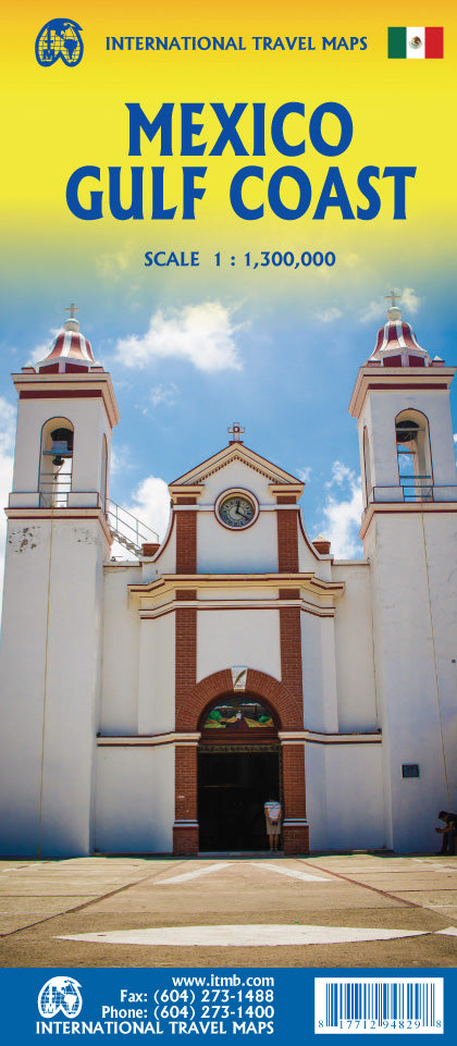
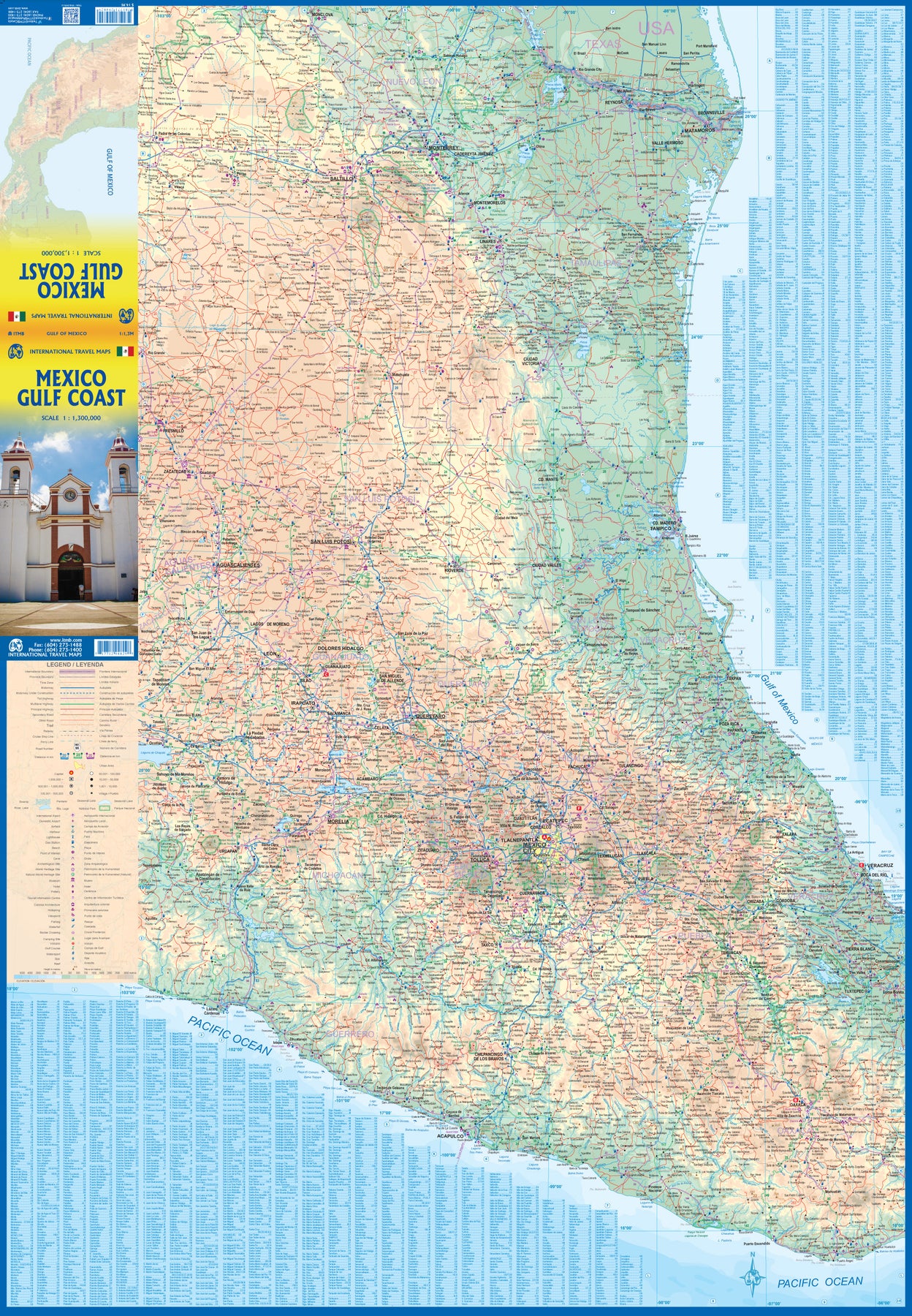
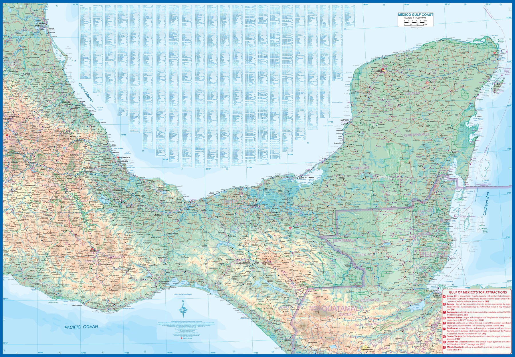
Mexico: Gulf Coast
Ordinær pris 169,00 krMexico is an ever-popular travel destination. The country is so large that we started mapping it as a series of regional maps years ago. The Gulf Cost extends from Brownsville, Texas through Vera Cruz to the Yucatan Peninsula. Due to the shape of the region, all of Belize and about half of Guatemala is included, but the focus is on the many attractions of the eastern Gulf coast of Mexico. Side 1 cover the northern coastal regions, going inland as far as Monterrey, Zacatecas, Morelia, and Mexico City.
Side 2 shows the Gulf Coast from Tampico to Carmen, then on to Merida, Cancun, and the southern tip of Belize. By the shape of this part of Mexico, the Pacific Coast, from the Guatemalan border westwards past Acapulco is also shown. All major roads are shown, but as passenger rail service was discontinued several years ago, we have opted to not show most rail lines. This is a map for explorers and adventurers to discover by driving. It covers all of historic Mexico and complements other ITMB maps detailing regions of a fascinating country, where the first word you learn is 'Hola!'
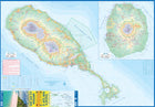
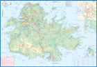
Antigua; St. Kitts; Nevis
Ordinær pris 179,00 krOur latest version of Antigua is also a new title for ITMB, in that we are combining the Caribbean island nation with nearby St. Kitts and Nevis, with a small inset map for the lovely island of Barbuda. Side 1 is a very expansive and detailed map of Antigua, with a good inset map of St. John’s, the capital. At the southern end of the island is Nelson’s Dockyard, a historical remnant that serviced British naval ships for centuries, and is well-worth a visit.
Spain: Mediterranean Coast
Ordinær pris 199,00 krSpain is one of the most popular travel destinations in Europe. The country is extremely diverse, reflecting its history. The coastal areas of the Mediterranean were probably first settled by Phoenicians, then Greeks, then Romans, and then Arabs before being brought into a united Spain at the time Columbus was seeking a sponsor to fund his proposed journey to discover new lands to the west. This map focuses on the coast from the French border south through Catalunya all the way to the Straits of Gibraltar and Cadiz. The offshore islands of Mallorca, Ibiza, and Menorca are included, as is the North African Spanish enclave of Ceuta and the British enclave of Gibraltar.
All road and rail lines are shown, including the new Cadiz to Madrid fast train. By the nature of mapping, a considerable amount of the interior is on the map as well, so this map is much more than just a coastal journey through Valencia and Murcia to reach Granada, although that would be a very enjoyable trip. The map is equally applicable to interior trips to Cordoba or Albacete as it is a map of the coast. However, its purpose is to show the attractions of the coast – beaches, resort areas, historic towns, forts, nature reserves, archaeological remains, and Top Attractions.
Canada: West Coast Trail & Carmanah Valley
Ordinær pris 169,00 krITM har kart over hele verden og de spesialiserer seg på land litt utenfor allfarvei. Beliggenheten til landets nasjonalparker, historiske monumenter, de viktigste veiene o.L. Finner du inkludert i kartene. Samtlige landkart har ofte et bykart over hovedstaden.
Fra ITM: This map is a specialized hiking map of one of the toughest trails in North America. It takes a week to hoof it from Bamfield to Port Renfrew along the western coastline of British Columbia’s West Coast Trail. Hiking the trail is so popular that it is necessary to reserve a start time well in advance of arriving! The trail is contained within a national park, so camping sites are controlled and must be adhered to.
The map has a secondary purpose; it is a recreational map at a detailed scale for anyone wanting to explore the old-growth forests of this part of Vancouver Island. This includes the Broken Islands group, which is also part of the national park, and the Carmanah Valley Provincial Park, home of some of the tallest and oldest trees in the world. By the nature of a rectangular sheet of paper, the map also includes a wealth of logging roads, shorter hikes, whitewater kayaking areas, wilderness campsites, and the canoeing routes of Nitinat Lake. This is truly an amazing adventure map. The artwork is that of the Canada Map Office, with recreational information added by ITMB.
United Arab Emirates & Abu Dhabi
Ordinær pris 169,00 krITM har kart over hele verden og de spesialiserer seg på land litt utenfor allfarvei. Beliggenheten til landets nasjonalparker, historiske monumenter, de viktigste veiene og lignende finner du inkludert i kartene. Samtlige landkart har ofte et bykart over hovedstaden.
We are pleased to release this brand new ITMB title. Abu Dhabi is one of the leading Emirates that are rapidly becoming vacation heavens for Europeans who don't want the long flights to Asian destinations. The city is so modern it almost squeaks. The palace is a world-class wonder, the seafront Corniche is a marvelous beach, and the central shopping area offers everything from hamburgers to Gucci bags. Motorways now connect the city state to nearby Dubai and to Oman, with a recently-completed one along the coastline to the Saudi border.
The reverse side of the map is an updated edition of the entire United Arab Emirates and most of Oman, with new motorways seemingly everywhere. A large inset map of central Dubai is included, along with a good one of Muscat. We docked at Abu Dhabi's cruise ship terminal during our visit and were impressed by the extent of urbanization of the city.
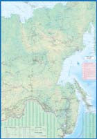
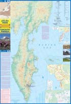
Russia: Kamchatka Peninsula
Ordinær pris 169,00 krITM har kart over hele verden og de spesialiserer seg på land litt utenfor allfarvei. Beliggenheten til landets nasjonalparker, historiske monumenter, de viktigste veiene o.L. Finner du inkludert i kartene. Samtlige landkart har ofte et bykart over hovedstaden.
Fra ITM: This is the most recently released title of our Russia series. In this revised edition, we have expanded the area of coverage to include the portion of Russia known as the Far East Republic and the eastern portions of Siberia (in January, we released Siberia itself). Lets start with the Kamchatka peninsula itself. This is a very interesting adventure travel destination, famous for its geothermal geysers and its isolation from the rest of Russia. There is only city of any size, Petropavlovsk Kamchatsky (which I genuinely hope is colloquially known as PK), the capital and location of the peninsulas only significant airport. We have included an inset map of the city. We also include a map of the famous Valley of Geysers (South of Klyuchi). Interestingly, the peninsula has a town called Esso. The other side of the sheet portrays a vast region from the Russian occupied island of Sakhalin and the Okhotsk Sea north to that portion of what we call the Arctic Ocean but is really a series of seas (this one being the East Siberian Sea) and west to the Lena River. The Trans Siberian railway west towards Moscow is shown, as well as connections into Mongolia and China. This is not a well known region of Russia and is definitely for the adventurer (I would to hear from anyone who has stayed at the hotel in Novaya Chara, which is as close to being the middle of nowhere I can imagine. actually, this portion of Russia is loaded with hotels and camping grounds. The map also shows a fascinating road going from close to the border with China all the way to a bay on the ocean. That would be quite a trip to take!
Publisert år: 2022
Innbinding: falset
Material: papir
Målestokk: 1:700,000