2208 produkter
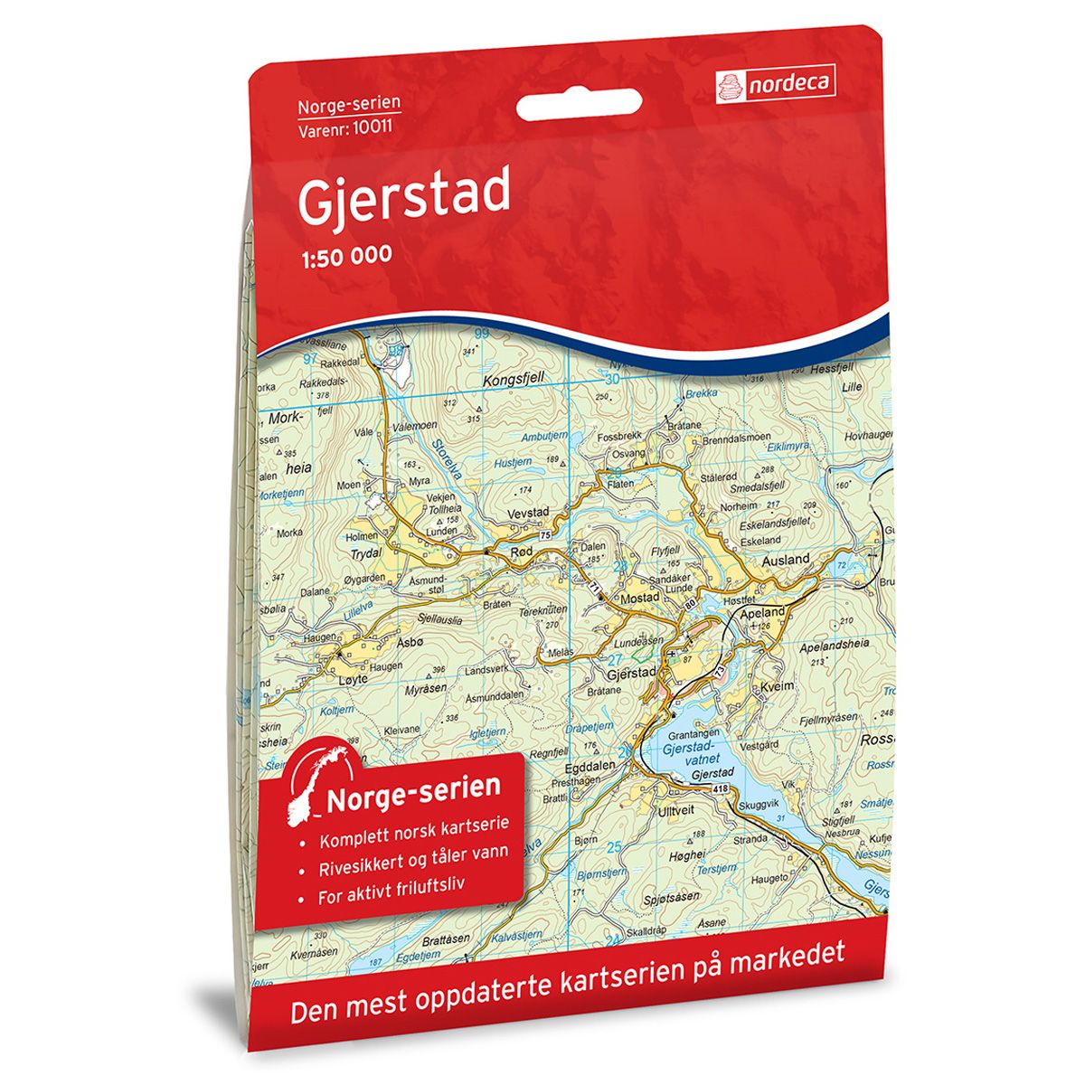
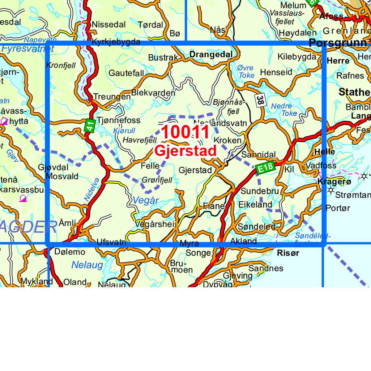
10011 Gjerstad
Ordinær pris 259,00 krNorge-serie kartet Gjerstad i målestokk 1:50 000 er trykket på et slitesterkt resirkulerbart plastfibermaterial som tåler vann. Kartet egner seg for turgåere, jegere, fiskere og brukes blant annet av redningskorpsene. Norge-serien er en landsdekkende kartserie og er derfor også populær for de som går lengre turer.
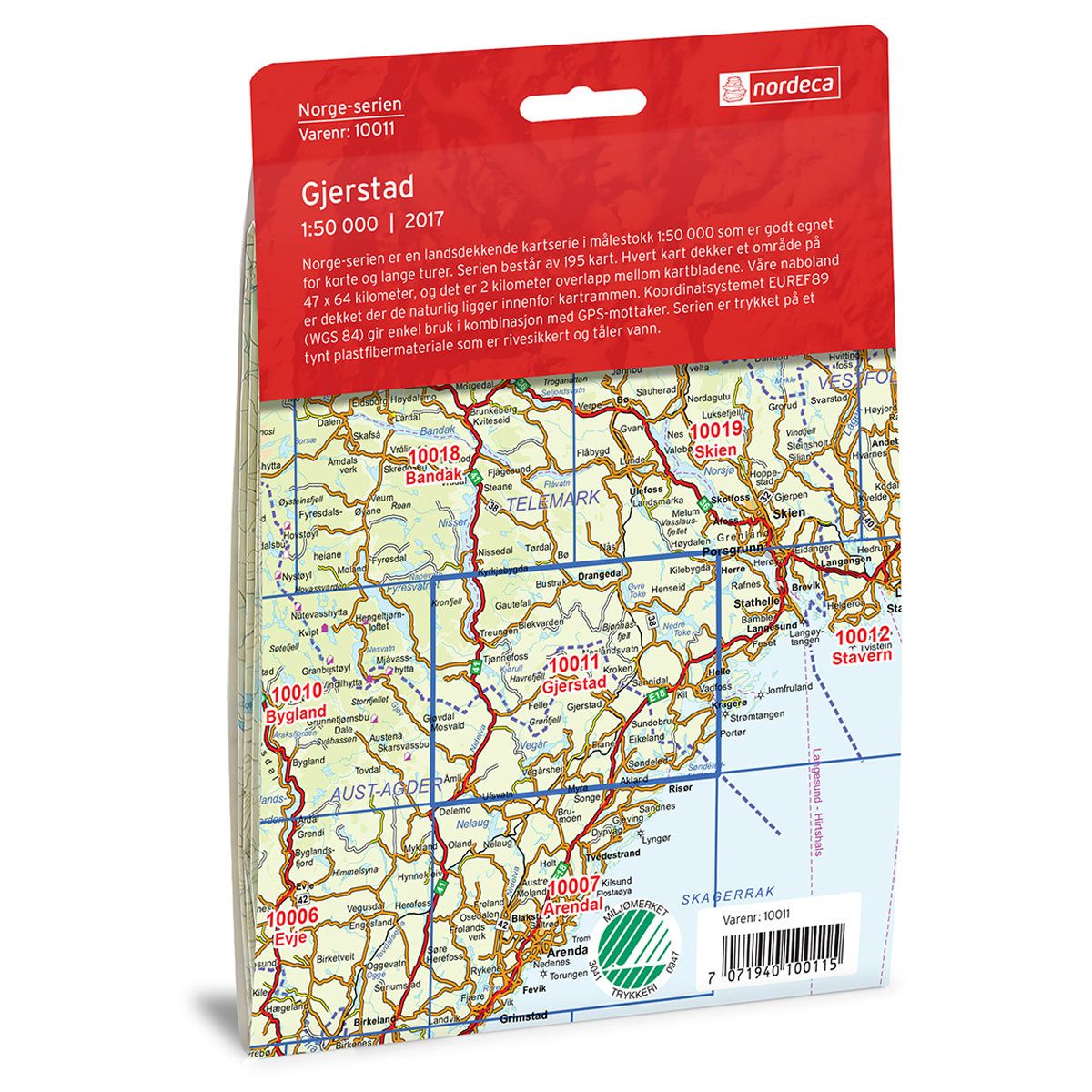
Overlapp på alle kart gjør det enkelt å navigere mellom kartene.
10005 Sirdal
Ordinær pris 259,00 krNorge-serie kartet Gjerstad i målestokk 1:50 000 er trykket på et slitesterkt resirkulerbart plastfibermaterial som tåler vann. Kartet egner seg for turgåere, jegere, fiskere og brukes blant annet av redningskorpsene. Norge-serien er en landsdekkende kartserie og er derfor også populær for de som går lengre turer.
Overlapp på alle kart gjør det enkelt å navigere mellom kartene.
CK38 Drammensmarka - Sommer
Ordinær pris 239,00 krKart over Drammensmarka. Kartet dekker hele Finnemarka og Konnerudmarka. Kartet viser blant annet merkede stier, badeplasser, servering, overnatting og kollektivtrafikk. Kartet har fjellskygge og er trykket på værbestandig papir.
Norway: North Cape
Ordinær pris 199,00 krVeikart over nordlige deler av Norge. Inkluderer blant annet Nordkapp, Hammerfest, Alta, Kautokeino og Kirkenes.
6008 Hardangervidda
Ordinær pris 249,00 krOpplevelsesguide Hardangervidda tar for seg rundturen fra Oslo via Hallingdal til Sørfjorden og tilbake via Haukeli og Kongsberg, med avstikkere til Rjukan, Numedal og Eggedal. Kartet har 98 attraksjoner/severdigheter/aktiviteter, noen eksempler er: Munchs hus, Tropicana badeland, Rallarvegen, Trolltunga, Vigelandsparken, Holmenkollen og Vøringsfossen og Henie Onstad kunstsenter.
6001 Tromsø
Ordinær pris 249,00 krOpplevelsesguide Tromsø tar for seg strekningen fra Bardufoss via Senja, Kvaløya, Tromsø og Lyngen til Stor-slett med avstikkere langs veien.
Kartet har 67 attraksjoner/severdigheter/aktiviteter, noen eksempler er: Hvalsafari, Bergsbotn utsiktsplass, Senjatrollet, Tromsø Domkirke, Tungeneset, Bleikstranda og Gamslett fiskerbondegård
3046 Hovden Sør
Ordinær pris 259,00 kr Salgspris 159,00 kr Spar 39%3021 Sør Valdres
Ordinær pris 259,00 kr3005 Folgefjell Nasonalpark
Ordinær pris 259,00 krtopo 3000 folgefonna nasjonalpark er et detaljert kart, tåler vann og hard bruk. Turstiene er tydelig avmerkede, og du kan lese om hvor det finnes overnattingsteder. Kartet dekker 3000km2 og har en målestokk på 1:50 000. Kartet er midt i blinken for deg som ønsker godt markerte turstier, de er tydlig merket enten de går over fjellet, gjennom skogen eller følger veien.
3003 Lysefjorden
Ordinær pris 259,00 krTopo 3000 er et detaljert kart som dekker over 3000 km2. Lysefjorden er den sørligste av de store fjordene i Norge og er en populær og mye omtalt attraksjon. Fjorden strekker seg nesten 40 km. Langs de bratte fjellsidene er det mange kjente steder som Preikestolen, Lysebotn og Kjerag. Her finner du turer som: Lysefjorden rundt, fra Forsand til Preikestolen 116,1 km, Helgetur langs Lysefjorden, mellom Flørli-Langavatn-Kjerag 30,1 km og Sokkaknuten 4,2 km. Eksempel på hytter: Preikestolen fjellstue (betjent), Skåpet og Langavatn (selvbetjente).
2756 Romsdalseggen - Trolltindene
Ordinær pris 259,00 kr Salgspris 159,00 kr Spar 39%2744 Rallarvegen (Haugastøl; Finse; Myrdal; Flåm)
Ordinær pris 259,00 krDette kartet dekker Rallarvegen i hele sin lengde, fra Haugastøl i sørøst til Flåm i nordvest, i tillegg til store deler av det omgivende fjellet, fra Hallingskarvet og Hardangerjøkulen i sør til Undredalen i nord.
Den nasjonale turkartserien dekker de mest populære turområdene i Norge. Serien utgis i samarbeid med Den Norske Turistforening (DNT) og inneholder blant annet deres løyper og hytter i tillegg til mye annen lokal turinformasjon. Turkartene er hovedsaklig i 1:50 000 som er en velegnet målestokk for turbruk. I tillegg finnes titler i 1:25 000 for enda tydeligere lesbarhet i spesielt utvalgte og populære turområder, samt 1:100 000 som egner seg godt for planlegging.
Steder i kartet: Aurlandsdalen, Aurlandsvangen, Blåskavlen, Djupsvatnet, Finse, Flåm, Folarskardnuten, Hallingskarvet, Hallingskarvet nasjonalpark, Hardangerjøkulen, Mjølfjellet, Myrdal, Nærøydalen, Såteggi og Ustevatnet.
Publisert år: 2017
Innbinding: falset
Material: papir
Målestokk: 1:50000
2681 Lysefjorden
Ordinær pris 259,00 krNordeca Lyngenhalvøya Nord 1:50 000 er utviklet i samarbeid med DNT. Det er benyttet avansert kartteknologi og kartet innehar viktig turinformasjon i tillegg til det man får i fra de offisielle databasene til Kartverket. Informasjon som sommerløyper, hytter, bruer og merkede stier er gjennomgått og kvalitetssikret av DNT. Kartet er trykket på resirkulerbart materiale som er slitesterkt og værbestandig. Kartet kan derfor benyttes i all slags vær.
Publisert år: 2019
Innbinding: falset
Material: papir
Målestokk: 1:50000
2673 Vestvågøy
Ordinær pris 259,00 krVestvågøy er som Lofoten for øvrig et yndet turistmål som byr på midnattssol, fantastiske naturopplevelser og et bredt spekter av friluftsaktiviteter. Øya byr på høye fjell, sjarmerende fiskevær som Ballstad og Stamsund, og hvite sandstrender som på Hauklandsstranden, Viksanden, Unstad, Utakleiv og Eggum.
Den nasjonale turkartserien dekker de mest populære turområdene i Norge. Serien utgis i samarbeid med Den Norske Turistforening (DNT) og inneholder blant annet deres løyper og hytter i tillegg til mye annen lokal turinformasjon. Turkartene er hovedsaklig i 1:50 000 som er en velegnet målestokk for turbruk. I tillegg finnes titler i 1:25 000 for enda tydeligere lesbarhet i spesielt utvalgte og populære turområder, samt 1:100 000 som egner seg godt for planlegging.
Steder i kartet: Ballstad, Eggum, Gimsøya, Gravdal, Henningsvær, Leknes, Stamsund og Vestvågøya.
Publisert år: 2016
Innbinding: falset
Material: Plastfiber
Målestokk: 1:50000
2671 Vågan
Ordinær pris 259,00 krVågan er begynnelsen på Lofoten. Her reiser fjellene seg, stiger opp av hav, damp og glitter. Fjellene i Lofoten er av de eldste i verden. Fra vestsiden av Vågan har man et fantastisk skue mot midnattssol og storhav. Det er merket flere turløyper langs fjellryggene og for fjellklatrere er Vågan et eldorado. Kajakk er et meget naturvennlig fremkomstmiddel og gir en fantastisk mulighet for å utforske Lofotens mange små og store øyer, holmer og skjær.
2655 Galdhøpiggen
Ordinær pris 259,00 krNordeca Galdhøpiggen 1:25 000 er utviklet i samarbeid med DNT. Det er benyttet avansert kartteknologi og kartet innehar viktig turinformasjon i tillegg til det man får i fra de offisielle databasene til Kartverket. Informasjon som sommerløyper, hytter, bruer og merkede stier er gjennomgått og kvalitetssikret av DNT. Kartet er trykket på resirkulerbart materiale som er slitesterkt og værbestandig. Kartet kan derfor benyttes i all slags vær.
Rough Guides Mini: Budapest
Ordinær pris 149,00 krThis pocket-sized travel guide to Budapest is a convenient, quick-reference companion to discovering what to do, what to see and how to get around the destination. It covers top attractions like Buda's Castle Hill, the Danube River, Opera House, as well as hidden gems, including the Great Synagogue. Our Budapest guide book will save you time and enhance your exploration of this fascinating city.
This Budapest travel guide has been fully updated post-COVID-19. This Mini Rough Guide to Budapest covers: Buda's Castle Hill and Old Town; Buda riverside; Obuda; Crossing the Danube; Pest; City outskirts and excursions. In this guide book to Budapest you will find: RECOMMENDATIONS FOR EVERY TYPE OF TRAVELLER Experiences selected for every kind of trip to Budapest, from cultural explorations in Buda's Old Town, to family activities in child-friendly places, like City Park or chilled-out breaks in popular tourist areas, like the Hungarian Parliament Building.
TOP TEN ATTRACTIONS This Budapest travel guide covers the destination's top ten attractions not to miss, including Szechenyi Baths, the House of Terror, St. Stephen's Basilica, Margaret Island and a Perfect Day itinerary suggestion. COMPACT FORMAT. Compact, concise, and packed with essential information, with a sharp design and colour-coded sections, this guide book to Budapest is the perfect on-the-move companion when you're exploring Budapest.
Rough Guides USA: Texas & The Southwest
Ordinær pris 219,00 kr Salgspris 109,50 kr Spar 50%Denne praktiske reiseguiden til Texas inneholder detaljerte reisetips og oversikt over de mest ikoniske severdigheter, samt noen skatter utenfor allfarvei. Med forslagene til reiseruter og forfatterens ekspertise utvalg av ting å se og gjøre blir denne boken til en perfekt følgesvenn både i forkant og underveis på turen. Denne Texas-guideboken er fullpakket med detaljer om hvordan du kommer deg dit og rundt, informasjon før avreise og topp tidsbesparende tips, inkludert en visuell liste over ting du ikke bør gå glipp av. De fargekodede kart gjør det enklere å navigere mens oppdager Texas.
Dette er en av de mest populære guidebokseriene, beregnet for folk som reiser på egenhånd. Fyldige, men ikke avskrekkende, verken i pris eller størrelse. Her finner du informasjon av praktisk og kuriøs karakter, skrevet av engasjerte og kunnskapsrike forfattere.Walking in Ticino - Switzerland (South)
Ordinær pris 329,00 krThis guidebook describes 38 walking routes in Ticino, the Swiss canton with a Mediterranean twist. Towering snowcapped mountains and lush, narrow valleys overlook stylish lakeside resorts with palm-fringed promenades and handsome Italianate architecture. It's not just the Italian language that sets Ticino apart: the food, sunny weather and stunning landscapes attract millions of visitors to this part of the southern Alps every year.
As for the walks, it's the variety - as much as the fabulous scenery - that provides the draw. In this book you'll find everything from level walks along the shores of Lakes Lugano and Maggiore, to more challenging trails through craggy, forested valleys with gushing waterfalls and ancient stone-built villages, to isolated mountain huts right at the permanent snowline. If you think you already know Switzerland, but haven't walked in Ticino, a stunning experience awaits you - and all of the routes are easily accessible through a network of buses, trains, funiculars, cable cars and chairlifts.
Lonely Planet Experience: Spain
Ordinær pris 299,00 krLonely Planet's Experience Spain is your guide to unforgettable experiences and local surprises. Trek beautiful national parks, sample tapas and wine from around the country and explore Roman and Moorish sites in the south - all guided by local experts with fresh perspectives. Uncover Spain's best experiences and get away from the everyday!
2385 Reineskarvet
Ordinær pris 259,00 krTurkartserien til Nordeca er laget i samarbeid med Den Norske Turistforeningen (DNT) og inneholder DNTs stier, hytter og annen nyttig turinformasjon. Enkelte av kartene har også skiløyper.
Enten du vil ferdes over de åpne viddene på Reineskarvet, fiske i de mange vannene eller oppleve kulturlandskapet nede i dalførene så viser dette kartet deg veien. Her finner du sommerstier og skiløyper, og informasjon om servicetilbud og aktiviteter.
Kartet dekker Djupsvatnet, Hallingdal, Hemsedal, Hemsil, Hol og Ål.
Karakalpakstan
Ordinær pris 319,00 krBradt's Karakalpakstan is the longest, most detailed and most up-to-date travel guidebook to this autonomous republic - Central Asia's best-kept secret. With detailed information on what to see and do, listings for accommodation and restaurants, and guidance on getting around, this guide provides all the practical advice adventurous tourists need to visit or explore this exciting destination. Roughly the size of Sweden, Karakalpakstan borders Kazakhstan, Turkmenistan and Uzbekistan, and was, until recently, dominated by the Aral Sea.
As the sea water has retreated, the Aralkum - the world's newest desert - and numerous lakes have formed in its place. Ecotourism is developing rapidly here, as local people recognise the need to protect and restore fragile ecosystems while creating meaningful employment opportunities. Amid Karakalpakstan's remote wildernesses, the intrepid traveller will find unique geology (such as the Ustyurt Plateau), rare wildlife (including a substantial population of the critically endangered saiga antelope, whose peculiarly bulbous nose helps filter desert dust and regulate the animal's temperature), and fabulous star gazing.
The region also boasts a long history and rich culture. Scattered through the Kyzylkum, the ruins of the 50-plus desert fortresses of Ancient Khorezm (some proposed as UNESCO World Heritage Sites) attest to region's former strategic importance. You can explore ancient settlements (such as the necropolis of Mizdarkhan, said to include the grave of Adam), and see caravanserais, mausolea and even Chilpik Dakhma, a Zoroastrian 'tower of silence'.
Alternatively, celebrate Russian avant garde art alongside the superb archaeological and ethnographic collections of Savitsky Museum in Nukus, justifiably known as the 'Louvre of the Steppe'. For something entirely different, why not explore Muynak's ship graveyard on the remains of the Aral Sea, visit the notorious Soviet bioweapons lab Aralsk 7 on Vozrozdeniye (Resurrection Island), raise your binoculars at the Important Bird and Biodiversity Area of Sudochye Lake (where 230 types of birds have been recorded) or dance the night away at the annual Stihia festival of electronic music. Written by two Central Asian experts, Bradt's Karakalpakstan is an indispensable practical companion to visiting this excitingly varied republic.
Lonely Planet Experience: Tuscany
Ordinær pris 299,00 krLonely Planet's Experience Tuscany travel guide reveals exciting new ways to explore this iconic destination with one-of-a-kind adventures at every turn. See world famous art at the Uffizi Gallery, taste delicious wines in Chianti, find the perfect sunset in Val d'Orcia - using our local experts and planning tools to create your own unique trip.
Lonely Planet Experience: Hawaii
Ordinær pris 279,00 krUnique experiences to string together an unforgettable trip! Inspiring full-colour travel photography and maps throughout. Highlights and trip builders to help tailor a trip to your personal needs and interests. Fresh perspectives to surprise you with things you hadn't thought of, as well as fresh takes on the well-known sights. Insider tips help you discover hidden gems and get around like a local. Expert insights take you to the heart of the place - surfing, traditional crafts, island cuisine, stargazing, wildlife, hiking. Practical info and tips on money, getting around, unique and local ways to stay, and responsible travel. Covers Honolulu, O'ahu, Maui, the Big Island, Kaua'i.
The Perfect Choice: Lonely Planet's Experience Hawaii, our inspiring guide, filled with local tips and fresh perspectives focuses on Hawaii's best experiences to string together for an unforgettable trip.
Like a Local: Lisbon
Ordinær pris 219,00 krExperience Lisbon the local way with this insider's guide Lisbon is picture-perfect, with its mosaicked tiles, bright yellow trams and plates of pasteis de nata (and, boy, are there a lot to try). But what's beyond the well-trodden sights? Vintage kiosks creating latte art, old factories hosting dance classes and storytelling sessions, secret viewpoints offering a different perspective on the city - the list goes on. There's so much more to Lisbon than the Castelo de Sao Jorge and Mosteiro dos Jeronimos, and who better to show you around than the locals? This insider's guide is packed with recommendations from Lisboetas in the know, helping you to discover all their favourite hangouts and hidden haunts.
Of course, with a city as storied as Lisbon we could fill the pages of this book tenfold. Rather, Lisbon Like a Local offers a snapshot of local life, and it's yours for the taking. Whether you're a Lisboeta looking to uncover your city's secrets or a traveller seeking an authentic experience beyond the tourist track, this stylish guide makes sure you experience the real side of Lisbon.
Rough Guides USA: The South
Ordinær pris 169,00 krDenne praktiske reiseguiden til USA: The South inneholder detaljerte reisetips og oversikt over de mest ikoniske severdigheter, samt noen skatter utenfor allfarvei. Med forslagene til reiseruter og ekspertforfatterens utvalg av ting å se og gjøre blir denne boken til en perfekt følgesvenn både i forkant og underveis på turen. Denne USA: The South-guideboken er fullpakket med detaljer om hvordan du kommer deg dit og rundt, informasjon før avreise og topp tidsbesparende tips, inkludert en visuell liste over ting du ikke bør gå glipp av. Våre fargekodede kart gjør Sørlige USA enklere å navigere mens du er der.