Filter
- Andorra
- Angola
- Argentina
- Aserbajdsjan
- Australia
- Bangladesh
- Belgia
- Belize
- Benin
- Bolivia
- Bosnia-Hercegovina
- Brasil
- Brunei
- Bulgaria
- Burundi
- Canada
- Chile
- Costa Rica
- Cuba
- Danmark
- Djibouti
- Ecuador
- El Salvador
- Eritrea
- Estland
- Eswatini
- Etiopia
- Finland
- Frankrike
- Ghana
- Guyana
- Hellas
- Honduras
- Hviterussland
- India
- Indonesia
- Irak
- Iran
- Irland
- Island
- Israel
- Italia
- Jamaica
- Jordan
- Kambodsja
- Kasakhstan
- Kenya
- Kina
- Kirgisistan
- Kongo
- Kosovo
- Kroatia
- Kypros
- Laos
- Latvia
- Lesotho
- Libanon
- Libya
- Litauen
- Luxembourg
- Malawi
- Malaysia
- Mali
- Marokko
- Mauritania
- Mexico
- Montenegro
- Mosambik
- Namibia
- Nederland
- Nepal
- New Zealand
- Nicaragua
- Niger
- Nigeria
- Norge
- Pakistan
- Panama
- Paraguay
- Peru
- Polen
- Portugal
- Romania
- Russland
- Rwanda
- Samoa
- Serbia
- Sierra Leone
- Singapore
- Slovakia
- Slovenia
- Somalia
- Spania
- Sri Lanka
- Storbritannia
- Surinam
- Sveits
- Sverige
- Sør-Korea
- Taiwan
- Thailand
- Togo
- Tsjekkia
- Tunisia
- Turkmenistan
- Tyskland
- Uganda
- Ungarn
- USA
- Usbekistan
- Venezuela
- Vietnam
- Zimbabwe
- Østerrike
2208 produkter
2208 produkter

10182 Børselv
Ordinær pris 259,00 kr/
Mva inkludert
Frakt beregnes i kassen.
Norge-serien er en landsdekkende kartserie i målestokk 1:50 000 som er godt egnet for korte og lange turer. Kartene er velegnet til tur- og fritidsbruk på fjellet, i skogen, langs kysten og til jakt og fiske. For profesjonelle virksomheter gir kartene nødvendig kunnskap om terreng og geografi for planlegging og utøvelse.
Hvert kart dekker et område på 47x64 kilometer, og det er 2 kilometer overlapp mellom kartbladene.
Kartene i Norge-serien er trykket på et tynt plastfibermateriale som tåler vann og er vanskelig å rive i stykker. Kartene tåler store fysiske påkjenninger og vil være et perfekt kart for tur i all slags vær.
Publisert år: 2017
Innbinding: falset
Material: plastfiber
Målestokk: 1:50000

10172 Neiden
Ordinær pris 259,00 kr/
Mva inkludert
Frakt beregnes i kassen.
Norge-serien er en landsdekkende kartserie i målestokk 1:50 000 som er godt egnet for korte og lange turer. Kartene er velegnet til tur- og fritidsbruk på fjellet, i skogen, langs kysten og til jakt og fiske. For profesjonelle virksomheter gir kartene nødvendig kunnskap om terreng og geografi for planlegging og utøvelse.
Hvert kart dekker et område på 47x64 kilometer, og det er 2 kilometer overlapp mellom kartbladene.
Kartene i Norge-serien er trykket på et tynt plastfibermateriale som tåler vann og er vanskelig å rive i stykker. Kartene tåler store fysiske påkjenninger og vil være et perfekt kart for tur i all slags vær.
Publisert år: 2018
Innbinding: falset
Material: papir
Målestokk: 1:50000

10157 Nordreisa
Ordinær pris 259,00 kr/
Mva inkludert
Frakt beregnes i kassen.
Norge-serien er en landsdekkende kartserie i målestokk 1:50 000 som er godt egnet for korte og lange turer. Kartene er velegnet til tur- og fritidsbruk på fjellet, i skogen, langs kysten og til jakt og fiske. For profesjonelle virksomheter gir kartene nødvendig kunnskap om terreng og geografi for planlegging og utøvelse.
Hvert kart dekker et område på 47x64 kilometer, og det er 2 kilometer overlapp mellom kartbladene.
Kartene i Norge-serien er trykket på et tynt plastfibermateriale som tåler vann og er vanskelig å rive i stykker. Kartene tåler store fysiske påkjenninger og vil være et perfekt kart for tur i all slags vær.
Publisert år: 2018
Innbinding: falset
Material: plastfiber
Målestokk: 1:50000

10141 Sortland
Ordinær pris 259,00 kr/
Mva inkludert
Frakt beregnes i kassen.
Norge-serien er en landsdekkende kartserie i målestokk 1:50 000 som er godt egnet for korte og lange turer. Kartene er velegnet til tur- og fritidsbruk på fjellet, i skogen, langs kysten og til jakt og fiske. For profesjonelle virksomheter gir kartene nødvendig kunnskap om terreng og geografi for planlegging og utøvelse.
Hvert kart dekker et område på 47x64 kilometer, og det er 2 kilometer overlapp mellom kartbladene.
Kartene i Norge-serien er trykket på et tynt plastfibermateriale som tåler vann og er vanskelig å rive i stykker. Kartene tåler store fysiske påkjenninger og vil være et perfekt kart for tur i all slags vær.
Publisert år: 2018
Innbinding: falset
Material: plastfiber
Målestokk: 1:50000

10138 Lødingen
Ordinær pris 259,00 kr/
Mva inkludert
Frakt beregnes i kassen.
Norge-serien er en landsdekkende kartserie i målestokk 1:50 000 som er godt egnet for korte og lange turer. Kartene er velegnet til tur- og fritidsbruk på fjellet, i skogen, langs kysten og til jakt og fiske. For profesjonelle virksomheter gir kartene nødvendig kunnskap om terreng og geografi for planlegging og utøvelse.
Hvert kart dekker et område på 47x64 kilometer, og det er 2 kilometer overlapp mellom kartbladene.
Kartene i Norge-serien er trykket på et tynt plastfibermateriale som tåler vann og er vanskelig å rive i stykker. Kartene tåler store fysiske påkjenninger og vil være et perfekt kart for tur i all slags vær.
Publisert år: 2017
Innbinding: falset
Material: plastfiber
Målestokk: 1:50000


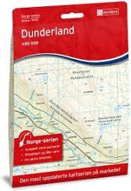
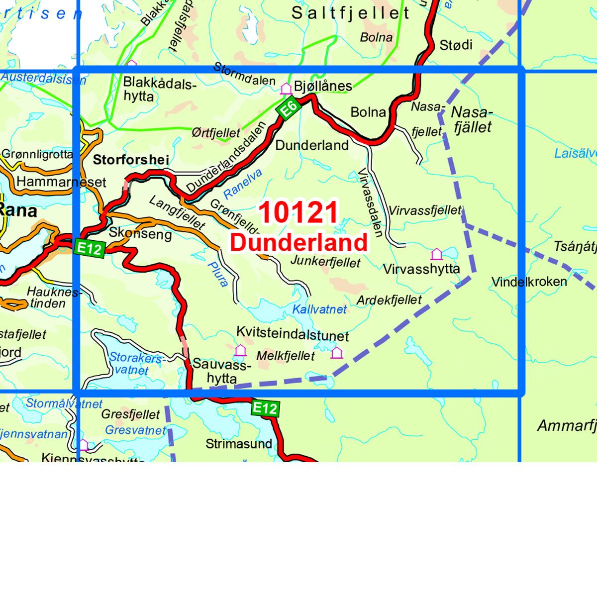
10121 Dunderland
Ordinær pris 259,00 kr/
Mva inkludert
Frakt beregnes i kassen.
Norge-serien er en landsdekkende kartserie i målestokk 1:50 000 som er godt egnet for korte og lange turer. Kartene er velegnet til tur- og fritidsbruk på fjellet, i skogen, langs kysten og til jakt og fiske. For profesjonelle virksomheter gir kartene nødvendig kunnskap om terreng og geografi for planlegging og utøvelse.
Hvert kart dekker et område på 47x64 kilometer, og det er 2 kilometer overlapp mellom kartbladene.
Kartene i norge-serien er trykket på et tynt plastfibermateriale som tåler vann og er vanskelig å rive i stykker. Kartene tåler store fysiske påkjenninger og vil være et perfekt kart for tur i all slags vær.
- Publisert år: 2017
- Innbinding: falset
- Material: plastfiber
- Målestokk: 1:50000

10108 Røyrvik
Ordinær pris 259,00 kr/
Mva inkludert
Frakt beregnes i kassen.
Norge-serien er en landsdekkende kartserie i målestokk 1:50 000 som er godt egnet for korte og lange turer. Kartene er velegnet til tur- og fritidsbruk på fjellet, i skogen, langs kysten og til jakt og fiske. For profesjonelle virksomheter gir kartene nødvendig kunnskap om terreng og geografi for planlegging og utøvelse.
hvert kart dekker et område på 47x64 kilometer, og det er 2 kilometer overlapp mellom kartbladene.
kartene i norge-serien er trykket på et tynt plastfibermateriale som tåler vann og er vanskelig å rive i stykker. Kartene tåler store fysiske påkjenninger og vil være et perfekt kart for tur i all slags vær.
Publisert år: 2016
Innbinding: falset
Material: plastfiber
Målestokk: 1:50000

10100 Sørli
Ordinær pris 259,00 kr/
Mva inkludert
Frakt beregnes i kassen.
Norge-serien er en landsdekkende kartserie i målestokk 1:50 000 som er godt egnet for korte og lange turer. Kartene er velegnet til tur- og fritidsbruk på fjellet, i skogen, langs kysten og til jakt og fiske. For profesjonelle virksomheter gir kartene nødvendig kunnskap om terreng og geografi for planlegging og utøvelse.
hvert kart dekker et område på 47x64 kilometer, og det er 2 kilometer overlapp mellom kartbladene.
kartene i norge-serien er trykket på et tynt plastfibermateriale som tåler vann og er vanskelig å rive i stykker. Kartene tåler store fysiske påkjenninger og vil være et perfekt kart for tur i all slags vær.
Publisert år: 2017
Innbinding: falset
Material: plastfiber
Målestokk: 1:50000


10094 Fosen
Ordinær pris 259,00 kr/
Mva inkludert
Frakt beregnes i kassen.
Norge-serie kartet Fosen i målestokk 1:50 000 er trykket på et slitesterkt resirkulerbart plastfibermaterial som tåler vann. Kartet egner seg for turgåere, jegere, fiskere og brukes blant annet av redningskorpsene. Norge-serien er en landsdekkende kartserie og er derfor også populær for de som går lengre turer.
Overlapp på alle kart gjør det enkelt å navigere mellom kartene.
- Publisert: 2017
- Innbinding: Falset
- Materiale: Plastfiber
- Målestokk: 1:50 000

10077 Romsdalsfjorden
Ordinær pris 259,00 kr/
Mva inkludert
Frakt beregnes i kassen.
Norge-serien er en landsdekkende kartserie i målestokk 1:50 000 som er godt egnet for korte og lange turer. Kartene er velegnet til tur- og fritidsbruk på fjellet, i skogen, langs kysten og til jakt og fiske. For profesjonelle virksomheter gir kartene nødvendig kunnskap om terreng og geografi for planlegging og utøvelse.
hvert kart dekker et område på 47x64 kilometer, og det er 2 kilometer overlapp mellom kartbladene.
kartene i norge-serien er trykket på et tynt plastfibermateriale som tåler vann og er vanskelig å rive i stykker. Kartene tåler store fysiske påkjenninger og vil være et perfekt kart for tur i all slags vær.
Publisert år: 2017
Innbinding: falset
Material: plastfiber
Målestokk: 1:50000


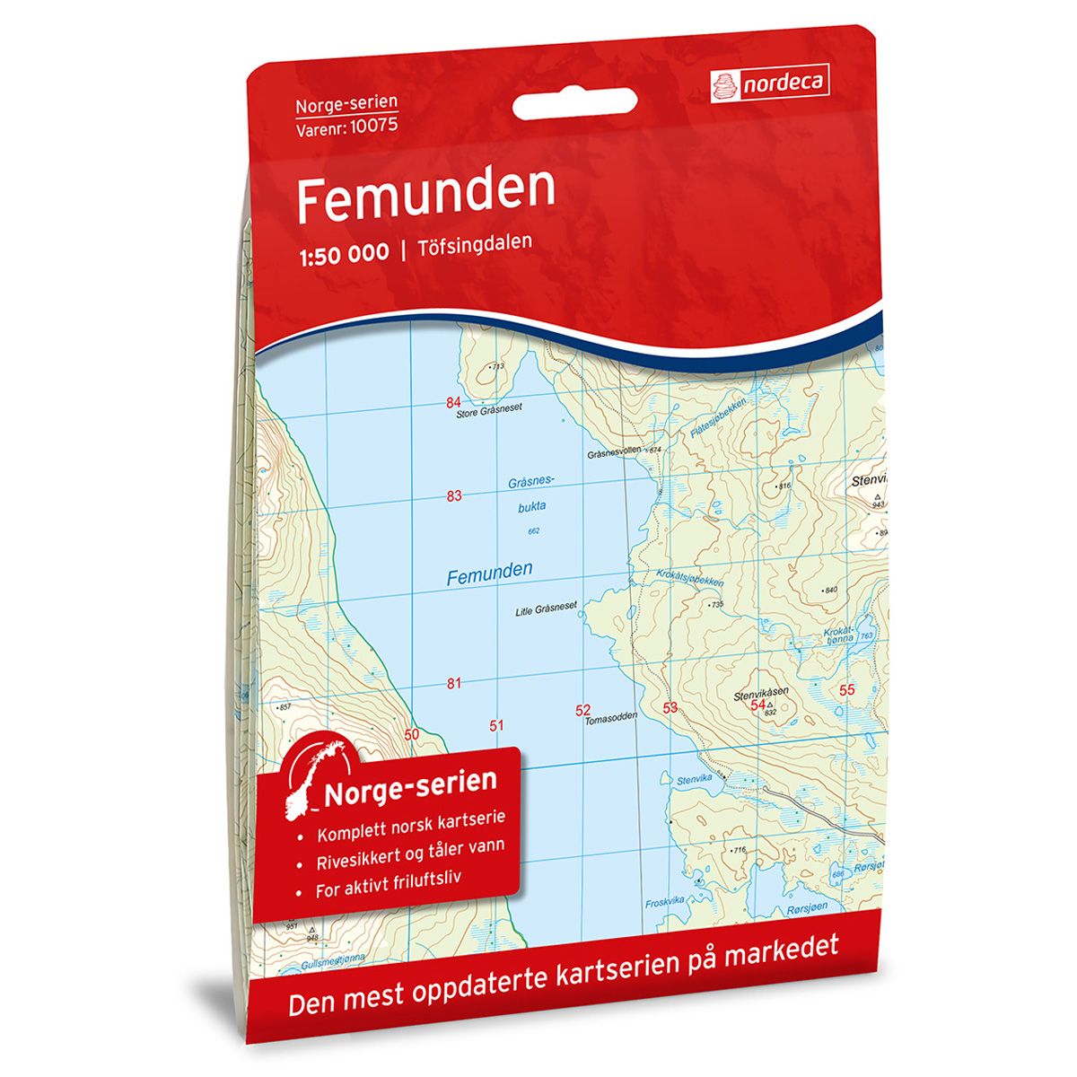
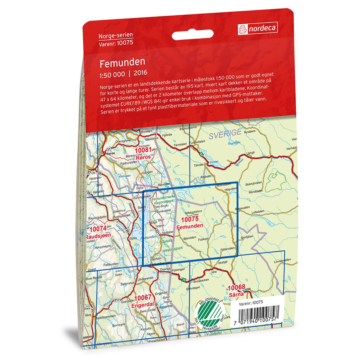
10075 Femunden
Ordinær pris 259,00 kr/
Mva inkludert
Frakt beregnes i kassen.
Norge-serie kartet Femunden i målestokk 1:50 000 er trykket på et slitesterkt resirkulerbart plastfibermaterial som tåler vann. Kartet egner seg for turgåere, jegere, fiskere og brukes blant annet av redningskorpsene. Norge-serien er en landsdekkende kartserie og er derfor også populær for de som går lengre turer. Overlapp på alle kart gjør det enkelt å navigere mellom kartene.
- Publisert: 2016
- Innbinding: Falset
- Materiale: Plastfiber
- Målestokk: 1:50 000

10058 Øyer
Ordinær pris 259,00 kr/
Mva inkludert
Frakt beregnes i kassen.
Norge-serien er en landsdekkende kartserie i målestokk 1:50 000 som er godt egnet for korte og lange turer. Kartene er velegnet til tur- og fritidsbruk på fjellet, i skogen, langs kysten og til jakt og fiske. For profesjonelle virksomheter gir kartene nødvendig kunnskap om terreng og geografi for planlegging og utøvelse.
hvert kart dekker et område på 47x64 kilometer, og det er 2 kilometer overlapp mellom kartbladene.
kartene i norge-serien er trykket på et tynt plastfibermateriale som tåler vann og er vanskelig å rive i stykker. Kartene tåler store fysiske påkjenninger og vil være et perfekt kart for tur i all slags vær.
Publisert år: 2017
Innbinding: falset
Material: plastfiber
Målestokk: 1:50000


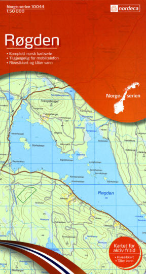
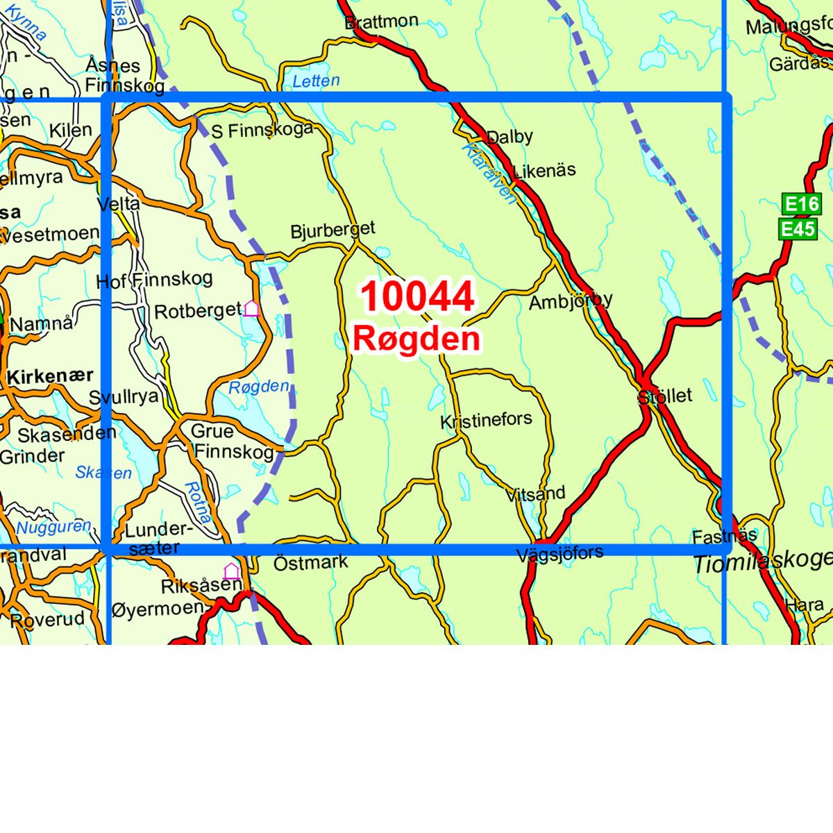
10044 Røgden
Ordinær pris 259,00 kr/
Mva inkludert
Frakt beregnes i kassen.
Norge-serie kartet Røgden i målestokk 1:50 000 er trykket på et slitesterkt resirkulerbart plastfibermaterial som tåler vann. Kartet egner seg for turgåere, jegere, fiskere og brukes blant annet av redningskorpsene. Norge-serien er en landsdekkende kartserie og er derfor også populær for de som går lengre turer.
Overlapp på alle kart gjør det enkelt å navigere mellom kartene.
- Publisert: 2020
- Innbinding: Falset
- Materiale: Plastfiber
- Målestokk: 1:50 000

10024 Haukeli
Ordinær pris 259,00 kr/
Mva inkludert
Frakt beregnes i kassen.
Norge-serien er en landsdekkende kartserie i målestokk 1:50 000 som er godt egnet for korte og lange turer. Kartene er velegnet til tur- og fritidsbruk på fjellet, i skogen, langs kysten og til jakt og fiske. For profesjonelle virksomheter gir kartene nødvendig kunnskap om terreng og geografi for planlegging og utøvelse.
hvert kart dekker et område på 47x64 kilometer, og det er 2 kilometer overlapp mellom kartbladene.
kartene i norge-serien er trykket på et tynt plastfibermateriale som tåler vann og er vanskelig å rive i stykker. Kartene tåler store fysiske påkjenninger og vil være et perfekt kart for tur i all slags vær.
Publisert år: 2017
Innbinding: falset
Material: plastfiber
Målestokk: 1:50000

CK48 Setesdalsheiene
Ordinær pris 229,00 kr/
Mva inkludert
Frakt beregnes i kassen.
Kartene er enkle å lese, praktiske og oppdaterte. Gode på veikart over norge. Serien dekker hovedsaklig nord-europa.
Publisert år: 2010
Innbinding: falset
Material: papir
Målestokk: 1:100.000


6005 The Mountains - Gudbrandsdalen
Ordinær pris 249,00 kr/
Mva inkludert
Frakt beregnes i kassen.
Opplevelsesguiden tar for seg E6-strekningen fra Hamar til Dombås, strekningen i østerdalen fra Elverum til Alvdal og veiene over Sogne-fjellet og Filefjell, med avstikkere langs veien.
Kartet har 122 attraksjoner/severdigheter/aktiviteter, noen eksempler er:Borgund stavkirke, Galdhøpiggen, Domkirkeodden, Folldal gruver, Besseggen, Hunderfossen familiepark, Gamle Lærdalsøyri.
- Publisert: 2018
- Innbinding: Falset
- Materiale: Papir
- Målestokk: 1:250 000


3043 Trysil Nord
Ordinær pris 259,00 kr/
Mva inkludert
Frakt beregnes i kassen.
- Publisert år: 2020
- Innbinding: falset
- Material: plastfiber
- Målestokk: 1:50000


3042 Trysil Sør
Ordinær pris 259,00 kr/
Mva inkludert
Frakt beregnes i kassen.
Topo 3000 er et detaljert og lettlest turkart som tåler vann og hard bruk. Dekker flere populære turmål i ett kart.
Turkartet er laget i et plastmateriale som gjør at de tåler fuktighet og hardt bruk bedre enn vanlig papirkart.
Du finner tydelig merkede turstier, enten de går i fjellet, i skogen eller langs veien.
DNT-hytter og andre overnattingssteder er fremhevet for å forenkle planleggingen.
Topo 3000 dekker et område på 64 x 47 km (over 3000km²).
- Publisert år: 2020
- Innbinding: falset
- Material: plastfiber
- Målestokk: 1:50000

3023 Indre Etnefjell
Ordinær pris 259,00 kr Salgspris 159,00 kr Spar 39%/
Mva inkludert
Frakt beregnes i kassen.
Publisert år: 2019
Innbinding: falset
Material: plastfiber
Målestokk: 1:50000
Innbinding: falset
Material: plastfiber
Målestokk: 1:50000

2781 Lyngenhalvøya Sør
Ordinær pris 259,00 kr/
Mva inkludert
Frakt beregnes i kassen.
Nordeca Lyngenhalvøya Nord 1:50 000 er utviklet i samarbeid med DNT. Det er benyttet avansert kartteknologi og kartet innehar viktig turinformasjon i tillegg til det man får i fra de offisielle databasene til Kartverket. Informasjon som sommerløyper, hytter, bruer og merkede stier er gjennomgått og kvalitetssikret av DNT. Kartet er trykket på resirkulerbart materiale som er slitesterkt og værbestandig. Kartet kan derfor benyttes i all slags vær.
Publisert år: 2017
Innbinding: falset
Material: papir
Målestokk: 1:50000

2777 Sylan Nord
Ordinær pris 259,00 kr/
Mva inkludert
Frakt beregnes i kassen.
Den nasjonale turkartserien dekker de mest populære turområdene i Norge. Serien utgis i samarbeid med Den Norske Turistforening (DNT) og inneholder blant annet deres løyper og hytter i tillegg til mye annen lokal turinformasjon. Turkartene er hovedsaklig i 1:50 000 som er en velegnet målestokk for turbruk. I tillegg finnes titler i 1:25 000 for enda tydeligere lesbarhet i spesielt utvalgte og populære tur områder, samt 1:100 000 som egner seg godt for planlegging.
Publisert år: 2011
Innbinding: falset
Material: Plastfiber
Målestokk: 1:100000


2661 Skarvheimen - Aurlandsdalen
Ordinær pris 259,00 kr/
Mva inkludert
Frakt beregnes i kassen.
Skarvheimen er området mellom Jotunheimen og Hardangervidda, som ligger i Buskerud og strekker seg innover i Sogn og Fjordane. Dette turkartet gir informasjon om skiløyper, stier, alpinanlegg og turisthytter.
- Publisert: 2018
- Innbinding: Falset
- Materiale: Plastfiber
- Målestokk: 1:50 000

Trekking Austria's Adlerweg
Ordinær pris 339,00 kr/
Mva inkludert
Frakt beregnes i kassen.
The Eagle's Way across the Austrian Alps in Tyrol.
A guidebook to Austria's Adlerweg (the Eagle's way) a long-distance trail from St Johann in Tirol in the east, passing through the historic town of Innsbruck at its mid-point before continuing to St Anton am Arlberg in the west. This waymarked 324km trek is presented in 24 stages ranging between 7 and 32km in length, with easier alternate routes provided for the most difficult stages. This guide features 1:50,000 mapping, accommodation details for the start and end points of each stage, which serve hearty meals and refreshments, and details on local transport, planning and local history.
Traversing the North Kakalpen Alps the route passes through the Wilderkaiser, Bradenberger Alpen, Rofangebirge, Karwendelgebirge, Wettersteinebirge and the Lechtaler Alpen ranges, enjoying views as far as Munich and the Swiss Alps. It is the perfect adventure for those looking for an alpine challenge.
- Forfatter: Mike Wells
- Publisert: 2023
- Språk: Engelsk
- Innbinding: Heftet
- ISBN: 9781786310903

Boston
Ordinær pris 319,00 kr/
Mva inkludert
Frakt beregnes i kassen.
With so much to see and do, Boston is a must-visit. Whatever your dream trip involves, this DK travel guide is the perfect companion. Our updated guide brings Boston to life, transporting you there like no other travel guide does with expert-led insights, trusted travel advice, detailed breakdowns of all the must-see sights, photographs on practically every page, and our hand-drawn illustrations, which take you inside the city’s buildings and neighbourhoods.
You'll discover:- our pick of Boston’s must-sees and top experiences- beautiful photography and detailed illustrations, taking you to the heart of Boston- the best spots to eat, drink, shop and stay - detailed maps and walks which make navigating the region easy- easy-to-follow itineraries- expert advice: get ready, get around and stay safe- colour-coded chapters to each part of Boston.
- Publisert: Mai 2025
- Antall sider: 208
- Innbinding: Heftet
- Språk: Engelsk

UK: North East Scotland
Ordinær pris 269,00 kr/
Mva inkludert
Frakt beregnes i kassen.
Smitten by Scotland since childhood, travel writer Rebecca Gibson moved to Moray and started exploring her new home region on foot to produce this new title in Bradt's award-winning series of Slow travel guides to UK regions. Walkers, cyclists, wildlife lovers, families, history and folklore enthusiasts, and foodies are all catered for, with coverage of a wide range of attractions. As the only comprehensive guidebook to North East Scotland in print, it also contains all the practical information you could need to plan and enjoy time in this thrillingly diverse yet largely under-explored part of Britain.
This region of mountains and coasts, ancient Caledonian pine forests and salmon-rich rivers harbours much to enthral and surprise. Long famous among hillwalkers, mountaineers and nature lovers, the Cairngorms is the UK's largest National Park and holds five of its six tallest summits - but also abounds in fairy folklore. Balmoral Estate has been a royal residence since Queen Victoria's reign, while Aberdeenshire - with its unique language, Doric - has Scotland's highest density of castles and numerous Pictish stone circles among an astounding 30,000 sites of historical and archaeological interest.
- Forfattere: Rebecca Gibson
- Publisert: Mai 2023
- Utgave: 1. utgave
- Antall sider: 328
- Innbinding: Heftet
- Språk: Engelsk
- ISBN: 9781784779016

Utah
Ordinær pris 299,00 kr/
Mva inkludert
Frakt beregnes i kassen.
This Insight Guide is a lavishly illustrated inspirational travel guide to Utah and a beautiful souvenir of your trip. Perfect for travellers looking for a deeper dive into the destination's history and culture, it's ideal to inspire and help you plan your travels. With its great selection of places to see and colourful magazine-style layout, this Utah guidebook is just the tool you need to accompany you before or during your trip.
Whether it's deciding when to go, choosing what to see or creating a travel plan to cover key places like Canyonlands National Park, Zion National Park, it will answer all the questions you might have along the way. It will also help guide you when you'll be exploring Bryce Canyon National Park or discovering Grand Staircase-Escalante National Monument on the ground. Our Utah travel guide was fully-updated post-COVID-19.
The Insight Guide UTAH covers: Ogden; Salt Lake City; Provo; Park City; Dinosaur; Flaming Gorge; High Uintas; Castle Country; Sanpete and Sevier Valleys; Great Basin; Zion National Park; St. George and Cedar City; Bryce Canyon National Park; Grand Staircase-Escalante National Monument and Glen Canyon National Recreation Area; Capitol Reef National Park; Arches National Park; Canyonlands National Park; Moab and San Juan County. In this guide book to Utah you will find: IN-DEPTH CULTURAL AND HISTORICAL FEATURES Created to provide a deeper dive into the culture and the history of Utah to get a greater understanding of its modern-day life, people and politics.
- Publisert: 2023
- Utgave: 1. utgave
- Antall sider: 288
- Innbinding: Heftet
- Språk: Engelsk
- ISBN: 9781839053252


Lonely Planet Friuli; Venezia & Giulia
Ordinær pris 229,00 kr/
Mva inkludert
Frakt beregnes i kassen.
Lonely Planet's Friuli Venezia Giulia is our most comprehensive guide that extensively covers all the region has to offer, with recommendations for both popular and lesser-known experiences. Indulge in coffee and cuisine of Trieste, hit the slopes of Giulie Alps or laze away on the beaches of the southern coast ; all with your trusted travel companion. Inside Lonely Planet's Friuli Venezia Giulia Travel Guide: What's NEW in this edition? NEW top experiences feature - a visually inspiring collection of Friuli Venezia Giulia's best experiences and where to have them What's NEW feature taps into cultural trends and helps you find fresh ideas and cool new areas - NEW Accommodation feature gathers all the information you need to plan your over-night stays. Highlights and itineraries help you tailor your trip to your personal needs and interests. Eating & drinking in Friuli, Venezia and Giulia - we reveal the dishes and drinks you have to try. Colour maps and images throughout. Insider tips to save time and money and get around like a local, avoiding crowds and trouble spots. Honest reviews for all budgets - eating, sleeping, sightseeing, going out, shopping, hidden gems that most guidebooks miss. Cultural insights give you a richer, more rewarding travel experience - history, people, music, landscapes, wildlife, politics. Over 30 maps Covers Trieste, Carso, Friuli coast, Gorizia and the Collio, Udine, Pordenone and Western Friuli, and the mountains: the Friulian Dolomites, Carnia and the Julian Alps.
- Publisert: Mai 2023
- Utgave: 1. utgave
- Antall sider: 304
- Innbinding: Heftet
- Språk: Engelsk
- ISBN: 9781838696184