
Filter
- Albania
- Algerie
- Andorra
- Angola
- Argentina
- Armenia
- Aserbajdsjan
- Australia
- Bahamas
- Bangladesh
- Barbados
- Belgia
- Belize
- Benin
- Bhutan
- Bolivia
- Bosnia-Hercegovina
- Botswana
- Brasil
- Brunei
- Bulgaria
- Burundi
- Canada
- Chile
- Colombia
- Costa Rica
- Cuba
- Danmark
- Djibouti
- Ecuador
- Egypt
- El Salvador
- Elfenbenskysten
- Eritrea
- Estland
- Eswatini
- Etiopia
- Fiji
- Finland
- Frankrike
- Gabon
- Gambia
- Georgia
- Ghana
- Guatemala
- Guyana
- Hellas
- Honduras
- Hviterussland
- India
- Indonesia
- Irak
- Iran
- Irland
- Island
- Israel
- Italia
- Jamaica
- Japan
- Jordan
- Kambodsja
- Kamerun
- Kapp Verde
- Kasakhstan
- Kenya
- Kina
- Kirgisistan
- Komorene
- Kongo
- Kosovo
- Kroatia
- Kypros
- Laos
- Latvia
- Lesotho
- Libanon
- Liberia
- Libya
- Litauen
- Luxembourg
- Madagaskar
- Malawi
- Malaysia
- Mali
- Malta
- Marokko
- Mauritania
- Mauritius
- Mexico
- Monaco
- Mongolia
- Montenegro
- Mosambik
- Namibia
- Nederland
- Nepal
- New Zealand
- Nicaragua
- Niger
- Nigeria
- Norge
- Pakistan
- Palestina
- Panama
- Paraguay
- Peru
- Polen
- Portugal
- Romania
- Russland
- Rwanda
- Samoa
- Senegal
- Serbia
- Seychellene
- Sierra Leone
- Singapore
- Slovakia
- Slovenia
- Somalia
- Spania
- Sri Lanka
- Storbritannia
- Sudan
- Surinam
- Sveits
- Sverige
- Syria
- Sør-Afrika
- Sør-Korea
- Sør-Sudan
- Taiwan
- Tanzania
- Thailand
- Togo
- Trinidad og Tobago
- Tsjekkia
- Tunisia
- Turkmenistan
- Tyrkia
- Tyskland
- Uganda
- Ungarn
- Uruguay
- USA
- Usbekistan
- Venezuela
- Vietnam
- Zambia
- Zimbabwe
- Øst-Timor
- Østerrike
- Albania
- Algerie
- Andorra
- Angola
- Argentina
- Armenia
- Aserbajdsjan
- Australia
- Bahamas
- Bangladesh
- Barbados
- Belgia
- Belize
- Benin
- Bhutan
- Bolivia
- Bosnia-Hercegovina
- Botswana
- Brasil
- Brunei
- Bulgaria
- Burundi
- Canada
- Chile
- Colombia
- Costa Rica
- Cuba
- Danmark
- Djibouti
- Ecuador
- Egypt
- El Salvador
- Elfenbenskysten
- Eritrea
- Estland
- Eswatini
- Etiopia
- Fiji
- Finland
- Frankrike
- Gabon
- Gambia
- Georgia
- Ghana
- Guatemala
- Guyana
- Hellas
- Honduras
- Hviterussland
- India
- Indonesia
- Irak
- Iran
- Irland
- Island
- Israel
- Italia
- Jamaica
- Japan
- Jordan
- Kambodsja
- Kamerun
- Kapp Verde
- Kasakhstan
- Kenya
- Kina
- Kirgisistan
- Komorene
- Kongo
- Kosovo
- Kroatia
- Kypros
- Laos
- Latvia
- Lesotho
- Libanon
- Liberia
- Libya
- Litauen
- Luxembourg
- Madagaskar
- Malawi
- Malaysia
- Mali
- Malta
- Marokko
- Mauritania
- Mauritius
- Mexico
- Monaco
- Mongolia
- Montenegro
- Mosambik
- Namibia
- Nederland
- Nepal
- New Zealand
- Nicaragua
- Niger
- Nigeria
- Norge
- Pakistan
- Palestina
- Panama
- Paraguay
- Peru
- Polen
- Portugal
- Romania
- Russland
- Rwanda
- Samoa
- Senegal
- Serbia
- Seychellene
- Sierra Leone
- Singapore
- Slovakia
- Slovenia
- Somalia
- Spania
- Sri Lanka
- Storbritannia
- Sudan
- Surinam
- Sveits
- Sverige
- Syria
- Sør-Afrika
- Sør-Korea
- Sør-Sudan
- Taiwan
- Tanzania
- Thailand
- Togo
- Trinidad og Tobago
- Tsjekkia
- Tunisia
- Turkmenistan
- Tyrkia
- Tyskland
- Uganda
- Ungarn
- Uruguay
- USA
- Usbekistan
- Venezuela
- Vietnam
- Zambia
- Zimbabwe
- Øst-Timor
- Østerrike
2016 produkter
2016 produkter

New Zealand: Auckland & North Island
Ordinær pris 169,00 kr/
Mva inkludert
Frakt beregnes i kassen.
ITM har kart over hele verden og de spesialiserer seg på land litt utenfor allfarvei. Beliggenheten til landets nasjonalparker, historiske monumenter, de viktigste veiene og lignende finner du inkludert i kartene. Samtlige landkart har ofte et bykart over hovedstaden.
Fra ITM: Auckland is one of the most attractive cities to visit, and Auckland is the normal point of entry to the island nation. The City of Auckland is the largest in the country and offers a wide range of attractions. That said, one of the best is to enjoy the harbour front on a sunny day and enjoy seeing ferries bustling in and out, taking passengers to such exotic local destinations as Half Moon Bay, Great Barrier Island, or Devonport. Better still, take one of the ferries yourself! The city centre is quite compact and easily walkable, and the suburban rail line can easily take one to nearby destinations. The true value of the map is its other side, covering the north island in excellent detail. From the far north at Cape Reinga to Wellington in the far south, the northernmost major island that makes up New Zealand is a treat to discover. Good quality roads enable one to explore the island at will and enjoy such attractions as Mount Maunganuiis, Tongariro Alpine Crossing, or the Coromandel Peninsula. A newish attraction that is well-worth a visit is the Hobbiton Movie set, where the Lord of the Rings trilogy was shot. A good inset map of Wellington is also included.
- Publisert: 2019
- Innbinding: Falset
- Material:r Papir
- Målestokk: 1:12 500 / 1:650 000


USA: Philadelphia & Pennsylvania
Ordinær pris 169,00 kr/
Mva inkludert
Frakt beregnes i kassen.
ITM har kart over hele verden og de spesialiserer seg på land litt utenfor allfarvei. Beliggenheten til landets nasjonalparker, historiske monumenter, de viktigste veiene og lignende finner du inkludert i kartene. Samtlige landkart har ofte et bykart over hovedstaden.
Fra ITM: Historic Philadelphia is one of the most significant travel destinations in the USA. Founded as a Quaker town for dissidents from England, it evolved into being the unofficial capital of the 17 American colonies by 1770. In the preamble to the American independence movement, it was a crucial ingredient in negotiations designed to address grievances. The British organized a meeting that has since become known as the Congressional Congress of 1775, in what is now known as Independence Hall. All seventeen American colonies sent representative delegations to debate the future. Phillie today is a modern city with a specially-designated historic centre, and all the important sites are noted on this map.
The other side of the sheet is a brand new map, continuing ITMB’s drive to create state maps wherever practical. This one is of Pennsylvania, a lovely and scenic part of America, stretching from the Atlantic seaboard to Lake Erie and the border with Ohio. New York City/Long Island and much of southern New York State is included, as are portions of Maryland, and Virginia. Delaware, due to its size, is completely included. All motorways and highways are noted, as well as recreational and historic locations; most notably, the tragic crash site of Flight 93 east of Pittsburgh.
The State of Pennsylvania has a long and valued history and we are pleased to add it to our range of American titles. Legend Includes: Roads by classification, Rivers and Lakes, National Park, Airports, Points of Interests, Highways, Main Roads, Zoos, Fishing, and much more.
- Publisert: 2021
- Innbinding: Falset
- Materiale: Vanntett papir
- Målestokk: 1:9000, 1: 750 000

Vietnam: Hue; Da Nang & Central Vietnam
Ordinær pris 199,00 kr/
Mva inkludert
Frakt beregnes i kassen.
Central Vietnam in 1:800.000. Double-sided map with placenames written in Roman script with street plans of Hue 1:13.000, Da Nang 1:12.000 and Hoi An. The map shows the area’s road and rail networks and local airports. National parks, nature reserves, beaches and numerous places of interest are highlighted. Provincial boundaries are marked and names of administrative regions prominently shown. Topography is indicated by bold altitude colouring with spot heights. Latitude and longitude lines are drawn at 30’ intervals. An enlargement shows the environs of Hue in 1:90.000.
- Publisert: 2020
- Innbinding: Falset
- Materiale: Papir
- Målestokk: 1:13 000, 1:12 000, 1:800 000


Mexico: Mexico City & Mexico Central
Ordinær pris 179,00 kr/
Mva inkludert
Frakt beregnes i kassen.
ITM har kart over hele verden og de spesialiserer seg på land litt utenfor allfarvei. Beliggenheten til landets nasjonalparker, historiske monumenter, de viktigste veiene og lignende finner du inkludert i kartene. Samtlige landkart har ofte et bykart over hovedstaden.
Fra ITM: Mexico City is the largest city in the Americas, with a population of about 30 million. Our map concentrates on the core of the city, which is where hotels, attractions, and touristic interest abounds, from the train station in the north to the university in the south and from the huge bus station in the east to Chapultepec Park in the west. Insets of the metropolitan area and of the rapid transit network are included. The second side contains a detailed regional map of that part of Mexico deemed to be ‘central’; essentially, from Pueblo in the east to Guadalajara in the west and from Taxco in the south to San Luis Potosi in the north. Top attractions include San Miguel de Allende, Guanajuato, the Great Pyramid of Cholula, and the colonial city of Puebla.
- Publisert: 2024
- Innbinding: Falset
- Materiale: Papir
- Målestokk: 1:900 000, 1:12 000

Puerto Rico & Virgin Islands
Ordinær pris 169,00 kr/
Mva inkludert
Frakt beregnes i kassen.
ITM har kart over hele verden og de spesialiserer seg på land litt utenfor allfarvei. Beliggenheten til landets nasjonalparker, historiske monumenter, de viktigste veiene o.L. Finner du inkludert i kartene. Samtlige landkart har ofte et bykart over hovedstaden.
Fra ITM: The American territories of Puerto Rico and the US Virgin Islands are anomalies in the modern world, neither fish nor fowl, as the saying goes. Although the residents are American citizens, they have no representation in Congress and are not allowed to vote in national elections. The lesser-known British Virgin Islands are included on this double-sided map. The BVI is still a British colony, consisting of about 20 islands, capitaled in Road Town (inset included). Puerto Rico (1:190.000) is a large, rectangular island, capitaled by San Juan (inset included) and is a major cruise ship point of origin as well as being home to resort communities all over the main island. Ferries connect to outlying islands. The VI portion was purchased from Denmark in 1917 and retains a colonial European charm. There are three main islands – St. Croix, St. Thomas, and St. John – and the map includes inset maps of Charlotte Amalie, Cruz Bay, Christiansted, and Frederiksted. Each side of the map sheet includes a listing of top attractions. Ferry routes to the BVI are shown, as well as water connections between the islands. Virgin islands 1:85.000.Legend Includes:Roads by classification, Rivers and Lakes, National Park, Airports, Points of Interests, Highways, Main Roads, Zoos, Fishing, and much more...
Publisert år: Aug. 2021
Innbinding: falset
Material: vanntet tpapir
Målestokk: 1:190000/1:85,000

Nigeria & Niger
Ordinær pris 149,00 kr/
Mva inkludert
Frakt beregnes i kassen.
ITM har kart over hele verden og de spesialiserer seg på land litt utenfor allfarvei. Beliggenheten til landets nasjonalparker, historiske monumenter, de viktigste veiene og lignende finner du inkludert i kartene. Samtlige landkart har ofte et bykart over hovedstaden.
4th edition November 2018. Nigeria in 1:1.600.000 and Niger in 1:2.000.000. Inset maps of Lagos Island, Lagos Region, Benin City, Abuja & Niamey.
- Publisert: 2018
- Innbinding: Falset
- Materiale: Papir
- Målestokk: 1:2 000 000, 1:1 600 000

Saint Lucia & Martinique
Ordinær pris 149,00 kr/
Mva inkludert
Frakt beregnes i kassen.
ITM har kart over hele verden og de spesialiserer seg på land litt utenfor allfarvei. Beliggenheten til landets nasjonalparker, historiske monumenter, de viktigste veiene og lignende finner du inkludert i kartene. Samtlige landkart har ofte et bykart over hovedstaden.
Fra ITM: Saint Lucia in 1:45.000 and Martinique in 1:65.000. We have included an inset map of Castries, the capital, noting, among other things, the cruise ship terminals (there are two) and the inter-island ferry terminal. That is important because St. Lucia is now linked to neighbouring Martinique by a scheduled ferry service and it is very convenient for visitors wishing to enhance their visit by adding a day trip to Martinique. For this reason, we have added a full-page map of Martinique to the reverse side of the sheet. The ferry goes to Fort-de-France, the capital, and the map includes an inset of the city, showing where the ferry docks. Martinique, with its French heritage, is more exotic than most English-speaking Caribbean countries, but is friendly and somehow different.
It is considered an extension of France and thus of the European Union, so uses the Euro. Although the common language is French (or a variety of it), English is well-understood. Cars are readily available for hire and road conditions are good. The island even boasts a motorway, going to the island’s south coast. Both islands are important Caribbean travel destinations, with resort hotels concentrated on Marigot Bay and Rodney Bay in St. Lucia and in the Pont du Bout peninsula of Martinique. The map has a double-sided cover for ease of marketing.
- Publisert: 2018
- Innbinding: Falset
- Materiale: Papir
- Målestokk: 1:45 000, 1:65 000

Lesotho & Swaziland (Eswatini)
Ordinær pris 169,00 kr Salgspris 84,50 kr Spar 84,50 kr/
Mva inkludert
Frakt beregnes i kassen.
ITM har kart over hele verden og de spesialiserer seg på land litt utenfor allfarvei. Beliggenheten til landets nasjonalparker, historiske monumenter, de viktigste veiene o.L. Finner du inkludert i kartene. Samtlige landkart har ofte et bykart over hovedstaden.
Fra ITM: ITM is pleased to re-introduce their coverage of two countries of africa that are fairly unique. Both were well-established entities when settlers arrived, and both were able to maintain their identities throughout the colonial era, as protectorates. Lesotho is quite mountainous, with a poorly developed road network, so is a travel adventure destination. It occupies side 1, along with an inset of maseru, the capital. Swaziland, which has recently changed its name for local purposes to eswatini, occupies side 2, with an inset of mbabane, its capital. Both countries are easy to access from south africa, and are well worth visiting. We have also added two lists showing the top attractions of both countries. Both are land-locked countries either adjacent to or surrounded by south africa; both are essentially agricultural countries, although lesotho s mountainous terrain offers considerable touristic appeal, particularly the sani pass. Legend includes: Highway, main road, secondary road, street, pathway, railway, park, lake, international airport, gas station, church, hotel, museum, library, restaurant, shopping, police station, bank, school, stadium, bus terminal, golfing, etc. 2nd edition 2019. Scales: Lesotho 1:350.000, swailand 1:200.000.
Publisert år: 2019
Innbinding: falset
Material: papir
Målestokk: 1:350000


Iraq & Baghdad
Ordinær pris 199,00 kr/
Mva inkludert
Frakt beregnes i kassen.
ITM har kart over hele verden og de spesialiserer seg på land litt utenfor allfarvei. Beliggenheten til landets nasjonalparker, historiske monumenter, de viktigste veiene o.L. Finner du inkludert i kartene. Samtlige landkart har ofte et bykart over hovedstaden.
Fra ITM: Iraq is one of those countries that should be on everyone’s bucket list to visit at least once. It has had an extremely unpleasant modern history, from which it is recovering, and finding a degree of stability that is encouraging. The north of the country, which is in Kurdish hands, is the most stable, and hence, most touristic part of the country. The south is divided between Sunni and Shite religious factions and, although interesting to visit, is a tad less stable. The most interesting part of this map is the detailed street map of Baghdad on Side 2. This is the only known paper map of the city and became famous during the siege of Baghdad in 2003 as it was the ONLY map available to the Allied forces approaching the city. Nine million copies were printed by National Geographic Society for their excellent article on the city and was used by countless soldiers trying to find their way safely around a very complex urban area. Fortunately, it is reasonably safe to visit it now. Definitely a country for adventure tourism!
Publisert: 2025
Innbinding: falset
Material: papir
Målestokk: 1:1,200,000 / 1:22,000

El Salvador & Guatemala South
Ordinær pris 149,00 kr/
Mva inkludert
Frakt beregnes i kassen.
ITM har kart over hele verden og de spesialiserer seg på land litt utenfor allfarvei. Beliggenheten til landets nasjonalparker, historiske monumenter, de viktigste veiene o.L. Finner du inkludert i kartene. Samtlige landkart har ofte et bykart over hovedstaden.
Fra ITM: 6th edition November 2018. This is a double-sided map with the El Salvador (1:270.000) on one side, along with a detailed inset map of San Salvador. The maps also shows the country's World Heritage city of Chalchuapa, dating back 3,200 years. The other side of the sheet is a completely separate maps of neighbouring Guatemala, being a detailed map of the central southern portion (1:457.000)of this important country. The highlights shown on this map are Quetzaltenango, Antigue Guatemala, and the Mayan ruins of Quirigua, dating from 200ad. The border crossings with El Salvador are clearly shown and are easily crossed.
Publisert år: 2018
Innbinding: falset
Material: vanntett papir
Målestokk: 1:250,000 / 1:457,000

Angola
Ordinær pris 129,00 kr Salgspris 64,50 kr Spar 64,50 kr/
Mva inkludert
Frakt beregnes i kassen.
Infomap™ er kongen av road-trip kart i den sørlige delen av afrika. Godt detaljerte og oppdaterte veikart i papir. Kartene inneholder også skogs - og landeveier for deg som vil utenfor allfarvei. Perfekt kompanjong på safari eller andre eventyr. Har gps-koordinater.
Publisert år: 2014
Innbinding: falset
Material: papir
Målestokk: 1:1 600 000

392 Ben Nevis & Fort William
Ordinær pris 279,00 kr/
Mva inkludert
Frakt beregnes i kassen.
OS Explorer is the Ordnance Survey's most detailed map and is recommended for anyone enjoying outdoor activities such as walking, horse riding and off-road cycling. The series provides complete GB coverage and can now be used in all weathers thanks to OS Explorer - Active, a tough, versatile version of OS Explorer. The OS Explorer Active range now includes a digital version of the paper map, accessed through the OS smartphone app, OS Maps.
Publisert: 2015
Innbinding: falset
Material: plast laminert
Målestokk: 1:25000

3 Southern Scotland & Northumberland
Ordinær pris 199,00 kr/
Mva inkludert
Frakt beregnes i kassen.
The OS Roadmaps series are single sided folded maps, the 8 maps provide GB 1: 250 000 coverage to enable the end user to navigate and plan their road journey. The maps include all motorways, primary routes and A roads plus detailed tourist information including National Parks, Country Parks and World Heritage sites and a useful town and city gazetteer.
The eight maps in the series are Northern Scotland, Orkney & Shetland, Western Scotland and the Western Isles, Southern Scotland and Northumberland, Northern England, East Midlands and East Anglia, Wales/Cymru and West Midlands, South West England and South East England.
- Publisert: 2020
- Innbinding: Falset
- Materiale: Papir
- Målestokk: 1:250 000

Spain: Fuerteventura
Ordinær pris 199,00 kr/
Mva inkludert
Frakt beregnes i kassen.
This detailed recto/verso road map of Fuerteventura is very suitable for planning and traveling around the country. The road network is well represented, both the main roads, provincial and local roads. Road numbers are also clearly stated. Distances between places are marked on the map in kilometers, and gas stations are also marked in important places.
Shadow shows the relief and sometimes some points with the actual height. Province borders, national parks and reserves are easy to find. Symbols indicate the location of tourist sites, monuments, historically important places and viewpoints. In certain places you can find hotels and campsites, airports, train connections and ports.
- Publisert: 2024
- Innbinding: Falset
- Materiale: Papir
- Målestokk: 1:100 000


Indigenous Peoples Trail
Ordinær pris 249,00 kr/
Mva inkludert
Frakt beregnes i kassen.
The Indigenous People Trail map at 1:75,000 highlighting a trekking circuit in the less visited part of Nepal directly east of Kathmandu. The map is part of the Nepa Maps series which provides extensive coverage of trekking areas of Nepal on detailed contoured maps with trekking routes and hiking trails, huts and camp sites, local places of interest and other tourist information.
The map covers an area directly east of Kathmandu, with Dhulikhel and Khopasi at its western edge and Charikot in the north-eastern corner. Numerous trails are marked, with the main highlighted route crossing the area east of the Sunkashi River. Contours are at 80m intervals, with additional vegetation colouring. Margin ticks show latitude and longitude at intervals of 5'. The map is indexed and includes additional information on various stages of the main trek and other activities in this area.
Titles in this series have cartography is based on the country’s topographic survey, with contours usually at 40m or 50m intervals, enhanced by relief shading, colouring and graphics to show various features of the terrain, including glaciers, forested or cultivated areas, etc. Numerous peaks, with additional spot heights, plus names of glaciers and mountain ranges are prominently shown. The network of rivers, streams and lakes is shown in great detail, with many smaller rivers and lakes named.
- Publisert: 2011
- Innbinding: Falset
- Materiale: Papir
- Målestokk: 1:75 000

102 - Valsavarenche, Val di Rhemes
Ordinær pris 249,00 kr Salgspris 179,00 kr Spar 70,00 kr/
Mva inkludert
Frakt beregnes i kassen.
Teknisk og svært detaljert topografisk kart egnet for fotturer. Kartet inneholder også skiruter (alpint). Enkle å lese med tydelig detaljering av turstier, klatrelokasjoner, militærruter, jernbane og fjellhytter for husly. Passer for vandring, sykkel (landevei og terreng) og hesteridning i Italia.
- Publisert: 2016
- Innbinding: Falset
- Materiale: Papir
- Målestokk: 1:25 000


6005 The Mountains - Gudbrandsdalen
Ordinær pris 249,00 kr/
Mva inkludert
Frakt beregnes i kassen.
Opplevelsesguiden tar for seg E6-strekningen fra Hamar til Dombås, strekningen i østerdalen fra Elverum til Alvdal og veiene over Sogne-fjellet og Filefjell, med avstikkere langs veien.
Kartet har 122 attraksjoner/severdigheter/aktiviteter, noen eksempler er:Borgund stavkirke, Galdhøpiggen, Domkirkeodden, Folldal gruver, Besseggen, Hunderfossen familiepark, Gamle Lærdalsøyri.
- Publisert: 2018
- Innbinding: Falset
- Materiale: Papir
- Målestokk: 1:250 000

Explore: Iceland
Ordinær pris 169,00 kr Salgspris 84,50 kr Spar 84,50 kr/
Mva inkludert
Frakt beregnes i kassen.
Insight Guides Explore is an illustrated, practical pocket-sized travel guide to Iceland with ready-made cycling, walking and driving itineraries for different interests and themes, backed up by maps and all the practical information you will need for your trip. The easy-to-follow routes will save you time, and help you plan and enhance your visit. This Iceland guide book has been fully updated post-COVID-19.
- Publisert: Okt. 2023
- Antall sider: 144
- Innbinding: Heftet
- Språk: Engelsk
- ISBN: 9781839053498

Trekking Austria's Adlerweg
Ordinær pris 339,00 kr/
Mva inkludert
Frakt beregnes i kassen.
The Eagle's Way across the Austrian Alps in Tyrol.
A guidebook to Austria's Adlerweg (the Eagle's way) a long-distance trail from St Johann in Tirol in the east, passing through the historic town of Innsbruck at its mid-point before continuing to St Anton am Arlberg in the west. This waymarked 324km trek is presented in 24 stages ranging between 7 and 32km in length, with easier alternate routes provided for the most difficult stages. This guide features 1:50,000 mapping, accommodation details for the start and end points of each stage, which serve hearty meals and refreshments, and details on local transport, planning and local history.
Traversing the North Kakalpen Alps the route passes through the Wilderkaiser, Bradenberger Alpen, Rofangebirge, Karwendelgebirge, Wettersteinebirge and the Lechtaler Alpen ranges, enjoying views as far as Munich and the Swiss Alps. It is the perfect adventure for those looking for an alpine challenge.
- Forfatter: Mike Wells
- Publisert: 2023
- Språk: Engelsk
- Innbinding: Heftet
- ISBN: 9781786310903

Boston
Ordinær pris 319,00 kr/
Mva inkludert
Frakt beregnes i kassen.
With so much to see and do, Boston is a must-visit. Whatever your dream trip involves, this DK travel guide is the perfect companion. Our updated guide brings Boston to life, transporting you there like no other travel guide does with expert-led insights, trusted travel advice, detailed breakdowns of all the must-see sights, photographs on practically every page, and our hand-drawn illustrations, which take you inside the city’s buildings and neighbourhoods.
You'll discover:- our pick of Boston’s must-sees and top experiences- beautiful photography and detailed illustrations, taking you to the heart of Boston- the best spots to eat, drink, shop and stay - detailed maps and walks which make navigating the region easy- easy-to-follow itineraries- expert advice: get ready, get around and stay safe- colour-coded chapters to each part of Boston.
- Publisert: Mai 2025
- Antall sider: 208
- Innbinding: Heftet
- Språk: Engelsk

UK: North East Scotland
Ordinær pris 269,00 kr/
Mva inkludert
Frakt beregnes i kassen.
Smitten by Scotland since childhood, travel writer Rebecca Gibson moved to Moray and started exploring her new home region on foot to produce this new title in Bradt's award-winning series of Slow travel guides to UK regions. Walkers, cyclists, wildlife lovers, families, history and folklore enthusiasts, and foodies are all catered for, with coverage of a wide range of attractions. As the only comprehensive guidebook to North East Scotland in print, it also contains all the practical information you could need to plan and enjoy time in this thrillingly diverse yet largely under-explored part of Britain.
This region of mountains and coasts, ancient Caledonian pine forests and salmon-rich rivers harbours much to enthral and surprise. Long famous among hillwalkers, mountaineers and nature lovers, the Cairngorms is the UK's largest National Park and holds five of its six tallest summits - but also abounds in fairy folklore. Balmoral Estate has been a royal residence since Queen Victoria's reign, while Aberdeenshire - with its unique language, Doric - has Scotland's highest density of castles and numerous Pictish stone circles among an astounding 30,000 sites of historical and archaeological interest.
- Forfattere: Rebecca Gibson
- Publisert: Mai 2023
- Utgave: 1. utgave
- Antall sider: 328
- Innbinding: Heftet
- Språk: Engelsk
- ISBN: 9781784779016

Utah
Ordinær pris 299,00 kr/
Mva inkludert
Frakt beregnes i kassen.
This Insight Guide is a lavishly illustrated inspirational travel guide to Utah and a beautiful souvenir of your trip. Perfect for travellers looking for a deeper dive into the destination's history and culture, it's ideal to inspire and help you plan your travels. With its great selection of places to see and colourful magazine-style layout, this Utah guidebook is just the tool you need to accompany you before or during your trip.
Whether it's deciding when to go, choosing what to see or creating a travel plan to cover key places like Canyonlands National Park, Zion National Park, it will answer all the questions you might have along the way. It will also help guide you when you'll be exploring Bryce Canyon National Park or discovering Grand Staircase-Escalante National Monument on the ground. Our Utah travel guide was fully-updated post-COVID-19.
The Insight Guide UTAH covers: Ogden; Salt Lake City; Provo; Park City; Dinosaur; Flaming Gorge; High Uintas; Castle Country; Sanpete and Sevier Valleys; Great Basin; Zion National Park; St. George and Cedar City; Bryce Canyon National Park; Grand Staircase-Escalante National Monument and Glen Canyon National Recreation Area; Capitol Reef National Park; Arches National Park; Canyonlands National Park; Moab and San Juan County. In this guide book to Utah you will find: IN-DEPTH CULTURAL AND HISTORICAL FEATURES Created to provide a deeper dive into the culture and the history of Utah to get a greater understanding of its modern-day life, people and politics.
- Publisert: 2023
- Utgave: 1. utgave
- Antall sider: 288
- Innbinding: Heftet
- Språk: Engelsk
- ISBN: 9781839053252


Lonely Planet Friuli; Venezia & Giulia
Ordinær pris 229,00 kr/
Mva inkludert
Frakt beregnes i kassen.
Lonely Planet's Friuli Venezia Giulia is our most comprehensive guide that extensively covers all the region has to offer, with recommendations for both popular and lesser-known experiences. Indulge in coffee and cuisine of Trieste, hit the slopes of Giulie Alps or laze away on the beaches of the southern coast ; all with your trusted travel companion. Inside Lonely Planet's Friuli Venezia Giulia Travel Guide: What's NEW in this edition? NEW top experiences feature - a visually inspiring collection of Friuli Venezia Giulia's best experiences and where to have them What's NEW feature taps into cultural trends and helps you find fresh ideas and cool new areas - NEW Accommodation feature gathers all the information you need to plan your over-night stays. Highlights and itineraries help you tailor your trip to your personal needs and interests. Eating & drinking in Friuli, Venezia and Giulia - we reveal the dishes and drinks you have to try. Colour maps and images throughout. Insider tips to save time and money and get around like a local, avoiding crowds and trouble spots. Honest reviews for all budgets - eating, sleeping, sightseeing, going out, shopping, hidden gems that most guidebooks miss. Cultural insights give you a richer, more rewarding travel experience - history, people, music, landscapes, wildlife, politics. Over 30 maps Covers Trieste, Carso, Friuli coast, Gorizia and the Collio, Udine, Pordenone and Western Friuli, and the mountains: the Friulian Dolomites, Carnia and the Julian Alps.
- Publisert: Mai 2023
- Utgave: 1. utgave
- Antall sider: 304
- Innbinding: Heftet
- Språk: Engelsk
- ISBN: 9781838696184

Rough Guides Mini: Zakynthos
Ordinær pris 149,00 kr/
Mva inkludert
Frakt beregnes i kassen.
This pocket-sized travel guide to Zakynthos is a convenient, quick-reference companion to discovering what to do, what to see and how to get around the destination. It covers top attractions like Blue Caves of Zakynthos, Assos, Sami, Drogarati as well as hidden gems, including Sea Turtle Rescue and Shipwreck Bay. Our Zakynthos guide book will save you time and enhance your exploration of this fascinating region.
- Publisert: Mai 2023
- Utgave: 1. utgave
- Antall sider: 144
- Innbinding: Heftet
- Språk: Engelsk
- ISBN: 9781839058349


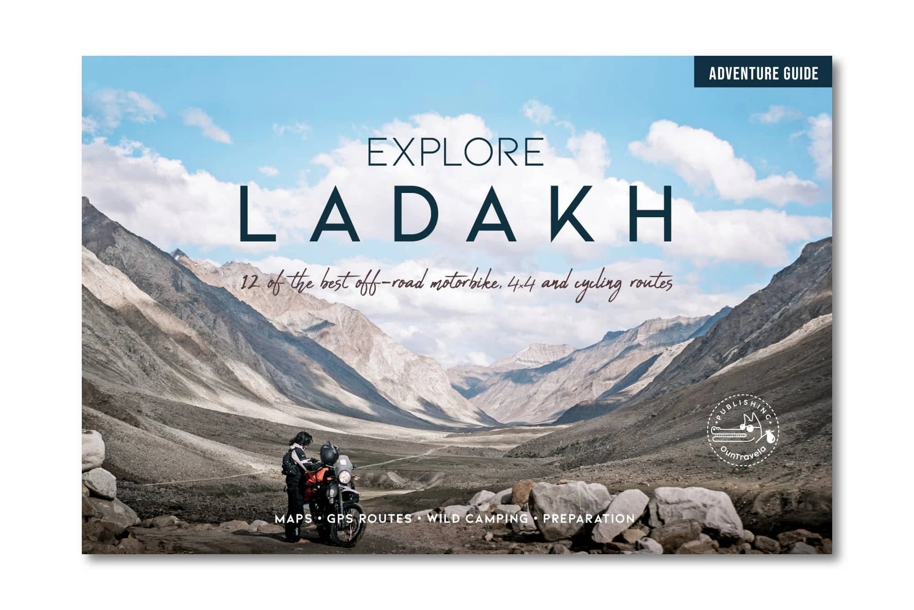


Explore Ladakh
Ordinær pris 199,50 kr/
Mva inkludert
Frakt beregnes i kassen.
Guiden Explore Ladakh inviterer til å utforske de villeste hjørnene av det indiske Himalaya med motorsykkel, 4×4 eller sykkel. Ladakh er en region med fler tusen år gammel tibetisk budistisk kultur. Det er også hjemsted for vakkert og godt bevarte naturlandskap. Du vil oppdage en annen side av India og krysse de høyeste passene i verden, og ta deg fra billedskjønne daler til store platåer.
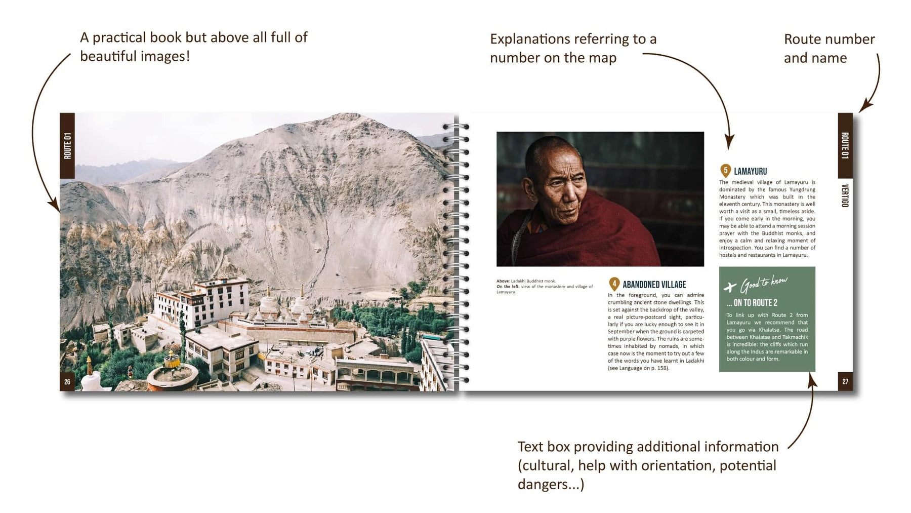
Bli inspirert til å foreta en tidløs reise ved å bruke vårt utvalg av tolv offroad 4×4, motorsykkel- og sykkelruter som er kartlagt på satellittbilder sammen med hovedpunktene av interesse: innsjøer, isbreer, utsiktspunkter, ville campingplasser, servicestasjoner, herberger osv. Du finner all nødvendig praktisk informasjon du trenger for å komme i gang på en selvstendig reise (bilutleie, helse, utstyr, indre linjetillatelse) og all informasjon du trenger å vite om dyrelivet, floraen og kulturen av denne unike regionen i India!
- Publisert: 2020
- Innbinding: Spiral
- Språk: Engelsk
- Antall Sider: 160
- ISBN: 9782491618018

Fotturguide Toscana
Ordinær pris 99,00 kr Salgspris 49,50 kr Spar 49,50 kr/
Mva inkludert
Frakt beregnes i kassen.
Finn din fredelige plett i Toscanas vakre tidløse landskap. Opplev områdets unike kultur, vin og mattradisjoner vekk fra de hektiske turiststedene. Utforsk sjarmerende avkroker som er ukjente for det fleste bare et fåtall kilometer fra Firenze.
Boken tar deg med på oppdagelsesferd til hemmelige steder og flotte opplevelser i Carmignano kommune, i åsene vest for Firenze. De fleste turister som haster avgårde mellom Pisa, Lucca og Firenze finner aldri veien hit. Siden to av forfatterne er fra Carmignano kan du utforske området med ekte innsideinformasjon i lommen.
Bokens fokus er tolv korte og lengre vandringer, og de mulighetene disse gir av opplevelser. Ingen turer er lange eller tøffe, de lengste rundt 4 timers varighet. Noen kan også gjennomføres med barn, eller på sykkel.
I tillegg til turene presenteres en rekke tips, råd og fakta. Kapitlet om barer og restauranter er en nyttig introduksjon til italienske vaner, skikk og bruk. Matmarkeder og lokale fester er behørig omtalt sammen med andre lokale tradisjoner. Det gis også en kort introduksjon til områdets historie og geografiske plassering. Stedets to viktigste landbruksprodukter, olivenolje og vin, er funnet verdig et eget kapittel.
Å komme seg til og rundt i området med bil og kollektivtransport er nøye omtalt, og det gis en oversikt over mulige overnattingssteder. En oversikt over nyttige ord og vendinger er tatt med, spesielt også med tanke på bestilling på restauranter.
- Frofattere: Tormod Næs, Sara Spinelli, Turid Indrebø og Erminio Monteleone
- Publisert: 2017
- Utgave: 1. utgave
- Språk: Norsk Bokmål
- Antall sider: 134
- ISBN: 9788292421239