Filter
- Albania
- Andorra
- Angola
- Argentina
- Aserbajdsjan
- Australia
- Bahamas
- Bahrain
- Bangladesh
- Belgia
- Belize
- Benin
- Bolivia
- Bosnia-Hercegovina
- Brasil
- Brunei
- Bulgaria
- Burundi
- Canada
- Chile
- Costa Rica
- Cuba
- Danmark
- Djibouti
- Dominica
- Ecuador
- El Salvador
- Eritrea
- Estland
- Eswatini
- Etiopia
- Fiji
- Finland
- Frankrike
- Guyana
- Hellas
- Honduras
- Hviterussland
- India
- Indonesia
- Irak
- Iran
- Irland
- Island
- Italia
- Jamaica
- Japan
- Kambodsja
- Kasakhstan
- Kenya
- Kina
- Kirgisistan
- Kongo
- Kosovo
- Kroatia
- Kuwait
- Laos
- Latvia
- Lesotho
- Libanon
- Libya
- Liechtenstein
- Litauen
- Luxembourg
- Malawi
- Malaysia
- Mali
- Malta
- Marokko
- Mauritania
- Mauritius
- Mexico
- Mongolia
- Montenegro
- Mosambik
- Nederland
- Nepal
- New Zealand
- Nicaragua
- Niger
- Nigeria
- Nord-Makedonia
- Norge
- Oman
- Pakistan
- Panama
- Paraguay
- Peru
- Polen
- Portugal
- Romania
- Russland
- Rwanda
- Samoa
- San Marino
- Serbia
- Sierra Leone
- Singapore
- Slovakia
- Slovenia
- Solomonøyene
- Somalia
- Spania
- Sri Lanka
- Storbritannia
- Surinam
- Sveits
- Sverige
- Sør-Korea
- Taiwan
- Thailand
- Togo
- Tonga
- Tsjekkia
- Tunisia
- Turkmenistan
- Tyskland
- Uganda
- Ukraina
- Ungarn
- Uruguay
- USA
- Usbekistan
- Vanuatu
- Venezuela
- Vietnam
- Østerrike
753 produkter
753 produkter

China: South & Guangzhou
Ordinær pris 149,00 kr Salgspris 119,00 kr Spar 20%/
Mva inkludert
Frakt beregnes i kassen.
China, as a country, is very popular with travellers. However, China is also a very large geographical entity and showing the entire country on one map results in a scale that reduces the amount of information that can be shown. The most visited part of the country is the south, with rapid train access from Hong Kong and major airports at Guangzhou and Shanghai. Travel to China is also increasing as more international airports are opened.
The regional map covers one side of this double-sided map; the other contains an updated map of Guangzhou (formerly Canton). Lan and I visited this city in February and were surprised at how open and modern the city is. In comparison with Beijing, the political overtones are much reduced, and Sun Yat Sen is the hero. The city is also a major train hub, with two major stations handling traffic, and six bus stations arranging transportation to nearby cities.
- Publisert: 2015
- Innbinding: Falset
- Materiale: Papir
- Målestokk: 1:3 000 000, 1:15 000

Chios
Ordinær pris 159,00 kr Salgspris 79,50 kr Spar 50%/
Mva inkludert
Frakt beregnes i kassen.
Publisert år: 2014
Innbinding: falset
Material: plastpapir
Målestokk: 1:60000
Innbinding: falset
Material: plastpapir
Målestokk: 1:60000

City Pocket Map: Dubrovnik
Ordinær pris 99,00 kr/
Mva inkludert
Frakt beregnes i kassen.
Bykart i lommestørrelse. Dette store østerriske kartforlaget er kjent for sin klare kartografi og gode papirkvalitet. De kommer i alle målestokker, og flere av landkartene inneholder bykart og turistinformasjon.
Dubrovnik in a series of handy pocket street plans from Freytag & Berndt. Each map is laminated, so waterproof and tear-resistant, and highlights the publishers’ recommendations of five best choices in five categories: shopping, restaurants and cafes, culture, nightlife and sights.
On one side is an indexed street plan annotated with colour-coded markers highlighting the publishers’ recommendations, all listed on the reverse of the map with brief notes in several languages. In larger cities the plans cover only the central districts. Also provided are a small road map of the city’s environs, if appropriate a diagram of the metro network, and a Fact Box with phone numbers for tourist offices, car hire and emergency services.
Publisert år: 2018
Innbinding: falset
Material: plast laminert
Målestokk: 1:10000

CK22 Danmark
Ordinær pris 299,00 kr/
Mva inkludert
Frakt beregnes i kassen.
Nyrevidert, detaljert veikart med kilometeravstander og nummererte motorveikryss. Naturskjønne veier er uthevet. Bornholm, Læsø og Anholt er innfelt som egne kartutsnitt. Eget kartutsnitt Stor-København. Registerhefte innlimt i omslaget.
- Publisert: 2023
- Innbinding: Falset
- Materiale: Papir
- Målestokk: 1:300 000

Congo - Republic & Democratic Republic
Ordinær pris 249,00 kr/
Mva inkludert
Frakt beregnes i kassen.
Tysk kartserie med flotte kart på slitesterkt plastpapir.
- Publisert: 2023
- Innbinding: Falset
- Materiale: Plastpapir
- Målestokk: 1:2 000 000

Corfu
Ordinær pris 199,00 kr/
Mva inkludert
Frakt beregnes i kassen.
Vanntett og holdbart turkart over Korfu.
- Publisert: April 2019
- Innbinding: Falset
- Materiale: Plastpapir
- Målestokk: 1:40 000

Corfu (Central) - Othoni; Erikousa; Mathraki
Ordinær pris 169,00 kr Salgspris 84,50 kr Spar 50%/
Mva inkludert
Frakt beregnes i kassen.
Gåkart/Turkart/Hiking Map
Publisert år: 2022
Innbinding: falset
Material: plastpapir
Målestokk: 1:20000

Corsica
Ordinær pris 189,00 kr/
Mva inkludert
Frakt beregnes i kassen.
Let the Marco Polo Corsica Road Map guide you around this beautiful island. Discover 1000km of glorious coastline, carved standing stones and and stunning scenery with this highly durable, detailed touring map of Corsica. It folds away easily and is always on standby to help when you're stuck.
- Publisert: 2024
- Innbinding: Falset
- Materiale: Papir
- Målestokk: 1:150 000

Costa de Lisboa
Ordinær pris 169,00 kr/
Mva inkludert
Frakt beregnes i kassen.
The regional map show the combination of geographical information and GPS references. The map include an index of places and street plans of main cities in the region. The maps show the road and rail networks on a base with altitude coloring and highlight various places of interest and facilities.
- Publisert: 2020
- Innbinding: Falset
- Materiale: Plastpapir
- Målestokk: 1:160 000

Costa del Sol (Axarquia)
Ordinær pris 229,00 kr/
Mva inkludert
Frakt beregnes i kassen.
- Publisert: Mai 2017
- Innbinding: Falset
- Materiale: Plastpapir
- Målestokk: 1:40 000


Costa Rica
Ordinær pris 199,00 kr/
Mva inkludert
Frakt beregnes i kassen.
This is an ITMB title that is so popular it needs no explanation. This is the most recent edition of a tried-and true title that has been a mainstay of our Central American line since the early 1980s. Folded double-sided road map Inset maps: Central San Jose City, Environs of San Jose. List of Costa Rica's Top Attractions. Legend includes: Highways, roads, railways, lakes, rivers, national parks, hotels, gas stations, museums, beaches, waterfalls and more.
- Publisert: 2024
- Innbinding: Falset
- Materiale: Vannfast papir
- Målestokk: 1:300 000

Costa Rica & Panama
Ordinær pris 199,00 kr/
Mva inkludert
Frakt beregnes i kassen.
Highly tear-resistant and 100% waterproof map "Costa Rica, Panama" from the series world mapping project.
Travel know-how maps are characterized by particularly sturdy plastic paper, which can be written on like paper, even with a pencil. The cardboard envelope is removable, making it easy to put the card in any pocket. A protective cover is not required. The cartographic representation focuses on the most important information for travelers and is particularly easy to read. Instead of shading, colored layers of elevation are used.
- Contour lines with elevation information
- Colored elevation layers
- Classified road network with distance information
- Sights
- Detailed location index
- GPS-accurate
- Longitude and latitude
- Five-language legend (german, English, French, Spanish, Russian)
- Overview map on the cover
- Publisert: 2023
- Innbinding: Falset
- Materiale: Plastpapir
- Målestokk: 1:550 000

Cotopaxi
Ordinær pris 299,00 kr Salgspris 149,00 kr Spar 50%/
Mva inkludert
Frakt beregnes i kassen.
- Publisert: 2009
- Innbinding: Falset
- Materiale: Papir
- Målestokk: 1:250 000, 1:40 000

Crete
Ordinær pris 199,00 kr/
Mva inkludert
Frakt beregnes i kassen.
Crete at 1:150,000 on a double-sided, indexed map from Marco Polo Travel Publishing with four street plans, plus special features to make route planning and navigating easier: a fold-out flap in the jacket shows the whole island highlighting popular locations, with the grid reference system in the margins making it easier to find various places on the main map. A set of seven peel-on/peel-off stickers, removable without damaging the map, is provided for making routes or locations more prominent when navigating.
Cartography is from the renowned German publishers MairDumont. Road network shows main and secondary roads with driving distances and highlights scenic routes. Smaller country roads or tracks, presented in white on a background with relief shading, are perhaps less clear to see than on maps with altitude colouring. In addition to the shading, topography is presented by numerous peaks and names of mountain ranges.
E4 long-distance hiking route is marked, both the section across the central mountains and the variant along the south coast. Picturesque towns, places of interest and landscapes are given star rating, and other tourist information includes campsites and youth hostels, archaeological sites, churches, viewpoints, etc. All place names are given in both Greek and Latin alphabets. Latitude and longitude grid is drawn at intervals of 10'. Multilingual map legend includes English.
The index is in a separate booklet attached to the map cover and also includes street plans of central Iraklion, Rethymnon, Hania, and Aghios Nikolaos, as well as a table with distances and traveling times and main traffic and speed regulations.
- Publisert: 2025-27
- Innbinding: Falset
- Materiale: Papir
- Målestokk: 1:175 000

Croatia
Ordinær pris 199,00 kr/
Mva inkludert
Frakt beregnes i kassen.
Dette store østerrikske kartforlaget er kjent for sin klare kartografi og gode papirkvalitet. De kommer i alle målestokker, og flere av landkartene inneholder bykart og turistinformasjon.
- Publisert: 2025
- Innbinding: Falset
- Materiale: Papir
- Målestokk: 1:500 000

Croatia
Ordinær pris 199,00 kr/
Mva inkludert
Frakt beregnes i kassen.
Croatia on an indexed, double-sided map from Reise Know-How, printed on light, waterproof and tear-resistant synthetic paper. The country is shown on three panels designed to provide convenient coverage of its most visited part, the Adriatic Coast. The map, part of the publishers’ highly acclaimed World Mapping Project, presents the coastal regions of Croatia at 1:300,000 spread across both sides of the sheet, with a good overlap and the mapping tilted so that the coastline stretches horizontally. The inland part of Croatia is added as an inset at 1:700,000 – please see the coverage image.
Light altitude colouring with names of mountain ranges, peaks, etc, shows the topography; national parks and protected areas are highlighted. Road network, clearly visible against the background, includes local roads and selected tracks, and indicates routes closed to motorized traffic. Driving distances are marked on many smaller roads. Railway lines are shown with stations; ferry links along the Adriatic indicate approximate passage timings. Locations of particular interest are highlighted and symbols mark various other places of interest. Latitude and longitude lines are drawn at 15’ (300K) and 1° (700K) intervals. Map legend includes English.
- Publisert: 2023
- Innbinding: Falset
- Materiale: Vannfast papir
- Målestokk: 1:700 000


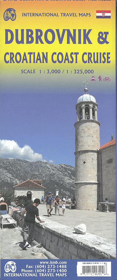


Croatia: Dubrovnik & Croatian Coast Cruise
Ordinær pris 199,00 kr/
Mva inkludert
Frakt beregnes i kassen.
The ancient port city of Dubrovnik, on the southern Croatian coastline, has evolved into a major tourist destination. The old walled city, normally entered through the famous Pile Gate, was so crowded with tourists when we arrived, that it took some time to get to the main street of Stradun. The city has completely recovered from the Montenegrin bombing during the breakup of Yugoslavia, with a few shellholes remaining just to show to tourists. The highlights of a visit are the Rector’s Palace, the Tvrdava fortress, and the cathedral. The map covers the urban area outside of the old town as well, as this is where most of the hotels and restaurants are located.
The other side of the map shows the extensive coastline of Croatia in two parts – from the Italian border to Trogir, and from Split to the border with Montenegro. We travelled from Porec to Dubrovnik in a small cruise ship of 45 passengers, which enabled us to visit ports that larger ships could not reach. As a result, we visited islands we could not have otherwise visited. The cover picture shows grandson Johnny in one such small town.
- Publisert: April 2021
- Innbinding: Falset
- Materiale: Papir
- Målestokk: 1:3000 / 325000

Croatia: Istria
Ordinær pris 199,00 kr/
Mva inkludert
Frakt beregnes i kassen.
Reise Know-How maps (world mapping project series) are easy-to-read, waterproof and highly durable travel maps specifically designed for everyday use on the road.
Our maps combine state-of-the-art, GPS-compatible cartography (including hypsometric tints and contour lines) with a detailed rendering of road networks and touristic information. They offer the best possible scale, level of detail and readability, be it a map of a small island or half a continent.
The maps feature a detachable paper sleeve so that the maps can be folded easily and fit in every pocket. Although printed on plastic, a special coating makes sure the maps retain a paper-like feel and can even be written on with a pencil.
- Publisert: 2022
- Innbinding: Falset
- Materiale: Plastpapir
- Målestokk: 1:70 000

Croatia: Istria
Ordinær pris 199,00 kr/
Mva inkludert
Frakt beregnes i kassen.
- Publisert: 2024
- Innbinding: Falset
- Materiale: Papir
- Målestokk: 1:100 000

Croatia; Serbia
Ordinær pris 189,00 kr/
Mva inkludert
Frakt beregnes i kassen.
Also includes: Slovenia; Bosnia+Herz.; Kosovo; Montenegro; Albania; North Macedonia
The ideal map for your trip. Let the Marco Polo Croatia Road Map guide you around this fascinating region of eastern Europe. Discover one of Europe's most beautiful coastlines with this highly durable, detailed, touring map of Croatia which also covers most of the Balkans. It folds away easily and is always on standby to help when you're stuck.
- Publisert: 2019-2023
- Innbinding: Falset
- Materiale: Papir
- Målestokk: 1:800 000

Croatia; Serbia & Bosnia Herzegovena
Ordinær pris 189,00 kr/
Mva inkludert
Frakt beregnes i kassen.
Marco Polo Croatia, Bosnia, Herzegovina Road Map guide you around this beautiful region of eastern Europe. Discover Croatia, Bosnia and Herzegovina with this highly durable, detailed touring map. It folds away easily and is always on standby to help when you're stuck. Perfect touring map - the scale is 1 : 650 000 ideal to help you tour the country by car or campervan. Easy to use - the superbly clear mapping in strong colours and easy to read text will help you navigate the country like a local. Durable, tear-resistant map - designed to withstand the rigors of the road, the map is printed on tear-resistant, water repellent and writeable paper. Highlights included - major sights and key points of interest are marked on the map by numbered stars.
- Publisert: 2024
- Innbinding: Falset
- Materiale: Papir
- Målestokk: 1:650 000

Croatian Coast
Ordinær pris 199,00 kr/
Mva inkludert
Frakt beregnes i kassen.
- Publisert: 2023
- Innbinding: Falset
- Materiale: Papir
- Målestokk: 1:200 000

Cuba
Ordinær pris 189,00 kr Salgspris 129,00 kr Spar 32%/
Mva inkludert
Frakt beregnes i kassen.
Dette store østerriske kartforlaget er kjent for sin klare kartografi og gode papirkvalitet. De kommer i alle målestokker, og flere av landkartene inneholder bykart og turistinformasjon.
- Publisert: 2016
- Innbinding: Falset
- Materiale: Papir
- Målestokk: 1:900 000

Cuba
Ordinær pris 199,00 kr/
Mva inkludert
Frakt beregnes i kassen.
A series specially designed for lovers of large journeys and mountain walks.
A detailed scale and complete tourist information to help you plan your trekking. Thanks to the laminated surface and flex-folding, the Trekking maps of TerraQuest will guide you anywhere, even in the most extreme conditions. You can make your own notes on the maps and erase them without damaging the maps.
- Lots of tourist information (trekking routes, touristic infrastructure, natural attractions and other interesting sites)
- Shaded relief gives a good image of the mountains
- GPS compatible, using the WGS84 system
- Legend in 6 languages: English, French, German, Spanish, Italian, Polish
- Publisert: 2024
- Innbinding: Falset
- Materiale: Vannfast papir
- Målestokk: 1:650 000


Cycle & Walking Map - Funen / Fyn
Ordinær pris 449,00 kr/
Mva inkludert
Frakt beregnes i kassen.
Bicycle and walking map of Funen, Ærø, Tåsinge and Langeland (2 maps) Go on a cycling trip on Funen and the famous South Funen archipelago, and get inspired for exciting trips with the cycling map. Go on a bicycle tour – and get a fantastic nature experience! On the map there are four city maps: Odense, Svendborg, Middelfart and Nyborg. The new Herregårdsruten (Manor Route) is included in this edition, the route takes you all the way around Funen, and out to Ærø and Langeland, where it passes the many manors, estates and castles. -The maps contain: National cycle routes Regional cycle routes Local cycle routes, including the beautiful panorama routes. New: Manor Route General information about accommodation, bike inclusion on trains etc. -Information icons on the map: Grocery stores outside major city, Tourist offices, National attractions, UNESCO world heritage, Bicycle friendly churches (special place for bike parking, water bottle filling etc., and a bicycle pump is available), Bike retailers, Beaches, Campsites, Hotels / Inns, Resting places, Hostels, Tent camps, cycling-friendly roadside churches Ferry routes List of content is written in Danish, German and English.
- Publisert: 2025
- Innbinding: Falset
- Materiale: Plastpapir
- Målestokk: 1:50 000

Czechia
Ordinær pris 229,00 kr/
Mva inkludert
Frakt beregnes i kassen.
Reise Know-How maps (world mapping project series) are easy-to-read, waterproof and highly durable travel maps specifically designed for everyday use on the road.
The maps combine state-of-the-art, GPS-compatible cartography (including hypsometric tints and contour lines) with a detailed rendering of road networks and touristic information. They offer the best possible scale, level of detail and readability, be it a map of a small island or half a continent.
The maps feature a detachable paper sleeve so that the maps can be folded easily and fit in every pocket. Although printed on plastic, a special coating makes sure the maps retain a paper-like feel and can even be written on with a pencil.
- Publisert: 2024
- Innbinding: Falset
- Materiale: Plastpapir
- Målestokk: 1:350 000

D09 Ariege: Foix; Saint Girons
Ordinær pris 179,00 kr/
Mva inkludert
Frakt beregnes i kassen.
Publisert år: 2024
Innbinding: falset
Material: papir
Målestokk: 1:100.000


D10 Aube
Ordinær pris 179,00 kr/
Mva inkludert
Frakt beregnes i kassen.
- Publisert: 2025
- Innbinding: Falset
- Materiale: Papir
- Målestokk: 1:100 000