753 produkter
6 Tamba Kosi-Likhu Khola
Ordinær pris 159,00 kr Salgspris 79,50 kr Spar 50%Publisert år: 1992 - (still the current map for this region as of May 2023)
Tamba Kosi - Likhu Khola region at 1:50,000 in a series of detailed topographic maps of selected trekking areas of Nepal originally prepared by E. Schneider and now edited by the German Scientific Association of Comparative High-Mountain Research (Arbeitsgemeinschaft für vergleichende Hochgebirgsforschung). The map covers the area south of the Rolwaling Himal and Lapchi Kang massifs, with the Tamba, Khimti and Likhu Rivers and the town of Jiri.
Traditionally referred to as “the Schneider maps”, titles in this series cover Nepal’s most popular trekking regions at 1:50,000 or 1:100,000. The maps were originally prepared by the Austrian climber and cartographer Erwin Schneider and for nearly five decades provided the best and often the only coverage of these areas. Now sponsored by the German Scientific Association of Comparative High-Mountain Research (Arbeitsgemeinschaft für vergleichende Hochgebirgsforschung), the maps are still quoted in most trekking guides to Nepal. Most maps have contours at 40-m intervals and, with bold relief shading and colouring for the glaciers, provide a vivid representation of the terrain. Margin ticks and crosshairs give UTM coordinates plus latitude and longitude. Map legend is in English.
Innbinding: falset
Material: Papir
Målestokk: 1:50000
650 Val di Fassa, Marmolada, Dolomiti Fassane
Ordinær pris 199,00 krKompass sine vandrekart er av de aller beste til sitt bruk, de er lettleste, detaljerte og oppdaterte! De spesialiserer seg på Sentral-Europa (de tysktalende landene samt Italia og Spania), hvor de er de mest solgte vandrekartene i vår butikk. De har selvfølgelig GPS-koordinater, samt en liten guide følger hvert kart, men vær oppmerksom på at denne er på tysk!
680 Isole d'Ischia e Procida
Ordinær pris 239,00 kr682 Penisola; Sorrentina; Costiera Amalfitana
Ordinær pris 249,00 krKompass sine vandrekart er av de aller beste til sitt bruk, de er lettleste, detaljerte og oppdaterte! De spesialiserer seg på Sentral-Europa (de tysktalende landene samt Italia og Spania), hvor de er de mest solgte vandrekartene hos Nomaden. De har selvfølgelig GPS-koordinater, samt en liten guide følger hvert kart, men vær oppmerksom på at denne er på tysk!
683 Trentino
Ordinær pris 349,00 kr7 - Valli Maira Grana Stura
Ordinær pris 199,00 krTurkart/Hiking Map
Publisert måned: 2utg
Publisert år: 2011
Innbinding: falset
Material: papir
Målestokk: 1:50000
7 Dudh Kosi
Ordinær pris 159,00 kr Salgspris 79,50 kr Spar 50%Dudh Kosi region at 1:50,000 in a series of detailed topographic maps of selected trekking areas of Nepal originally prepared by E. Schneider and now edited by the German Scientific Association of Comparative High-Mountain Research (Arbeitsgemeinschaft für vergleichende Hochgebirgsforschung). The map covers the lower Dudh Kosi River, the downstream end of the Hinku River, and the Rawa River.
Traditionally referred to as “the Schneider maps”, titles in this series cover Nepal’s most popular trekking regions at 1:50,000 or 1:100,000. The maps were originally prepared by the Austrian climber and cartographer Erwin Schneider and for nearly five decades provided the best and often the only coverage of these areas. Now sponsored by the German Scientific Association of Comparative High-Mountain Research (Arbeitsgemeinschaft für vergleichende Hochgebirgsforschung), the maps are still quoted in most trekking guides to Nepal. Most maps have contours at 40-m intervals and, with bold relief shading and colouring for the glaciers, provide a vivid representation of the terrain. Margin ticks and crosshairs give UTM coordinates plus latitude and longitude. Map legend is in English.
Publisert år: 2012 - Still current map as of May 2023
Innbinding: falset
Material: Papir
Målestokk: 1:50000
7 Garhwal (Uttaranchal)
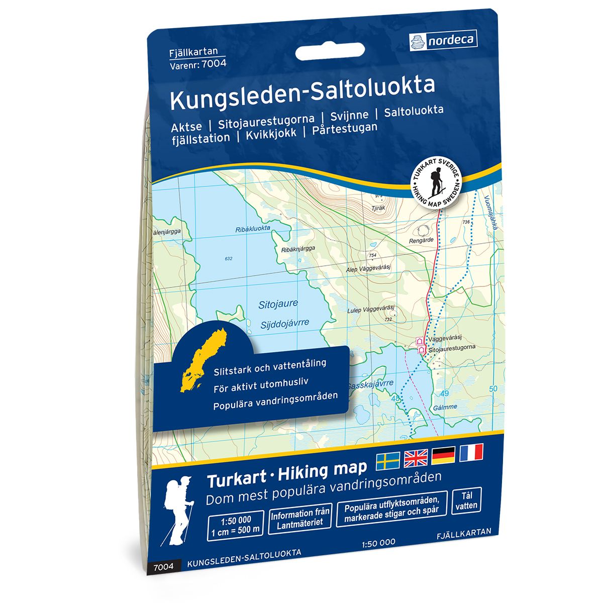
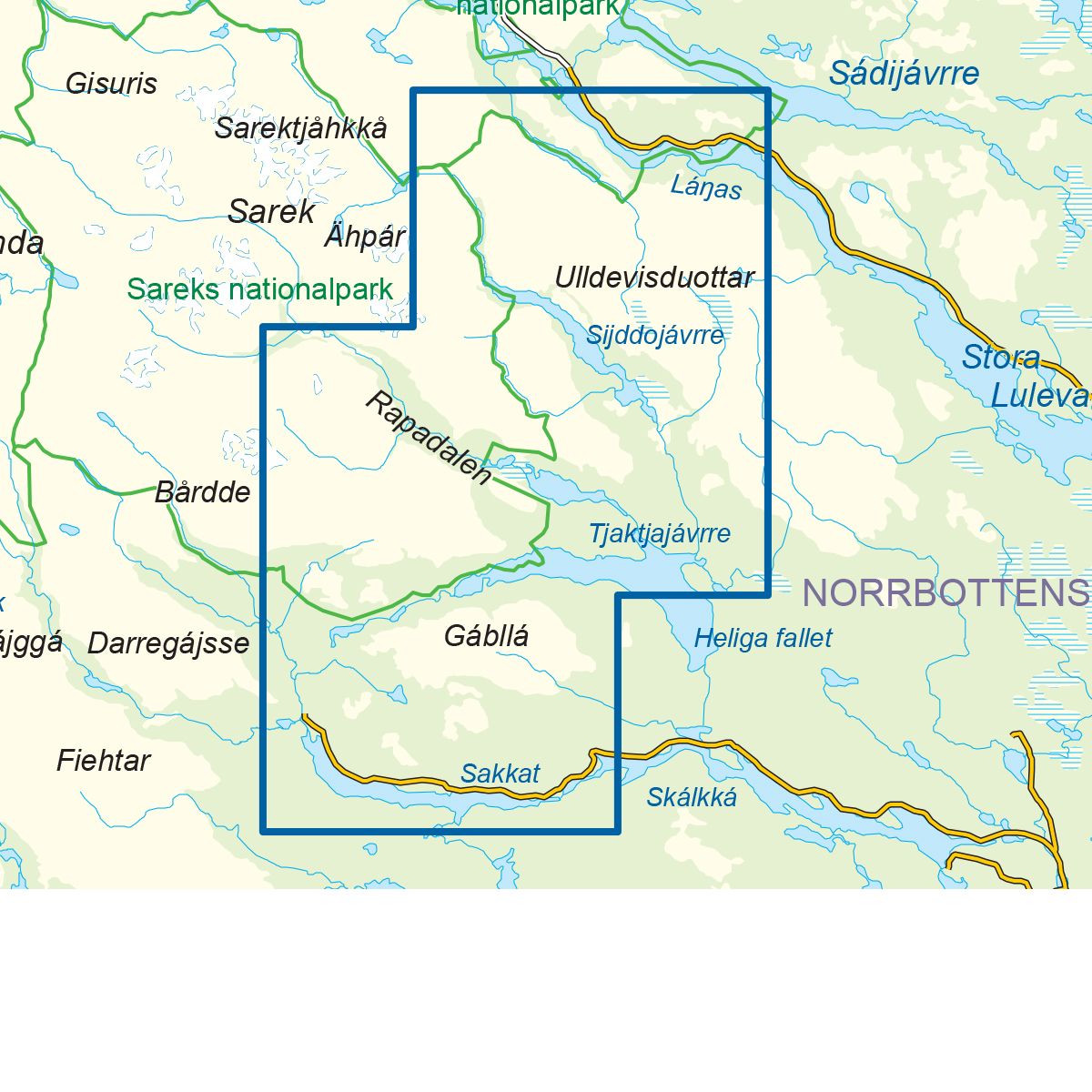
Ordinær pris 179,00 kr Salgspris 89,50 kr Spar 50%7004 Kungsleden-Saltoluokta
Ordinær pris 249,00 krFjellkart Kungsleden – Saltoluokta er et detaljert kart som dekker over 3000km2. Her finner du både turstier og fjellstuer i området som er tydelig merket i kartet. Kartet dekker Kungsledens strekning mellom Saltoluokta fjällstation og Kvikkjokk, videre sørover via rasteplassen ved Mallenjarka og gjennom deler av Pärlälvens fjällurskogs naturreservat. I dette området finnes urørte urskoger, fjelltopper og småtjern. Langs Kungsleden finnes flere fjellstuer hvor man kan komme for å nyte fjellene i området.
Eksempel på fjellstuer i kartet: Årrenjarka, Kvikkjokk fjällstation, Pårtestugan, Aktse, Sitojaurestugorna og Saltoluokta fjällstation.
7005 Kungsleden-Kvikkjokk
Ordinær pris 249,00 krFjellkart Kungsleden – Kvikkjokk er et detaljert kart som dekker over 3000km2. Her finner du både turstier og fjellstuer i området som er tydelig merket i kartet. Kartet dekker Kungsledens strekning som passerer ved Kvikkjokk fjällstation. Videre dekkes området fra Kvikkjok i øst, via Tarradalen til riksgrensen i vest. I tillegg til Kungsleden dekker kartet også Padjelantaleden og Nordkalottleden med sine mange fjellstuer langs stiene. Det finnes også flere høye fjelltopper og isbreer i området som gir en unik naturopplevelse.
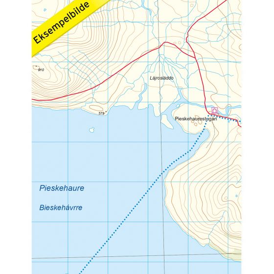
Kvikkjokk fjällstation er et perfekt utgangspunkt for turer, enten du vil gå Kungsleden eller Nordkalottleden. Kungsleden passerer gjennom Kvikkjokk og stedet er også et av start eller endepunktene for Nordkalottleden. Eksempel på fjellstuer i området: Stáddájåhkå, Sårjåsjaurestugan, Duottar, Pieskehaurestugan, Vaimokstugan, Darreluoppal, Såmmarlappastugan, Kvikkjokk fjällstation, Njunjesstugan. Muorkihytta finnes på norsk side av grensen.
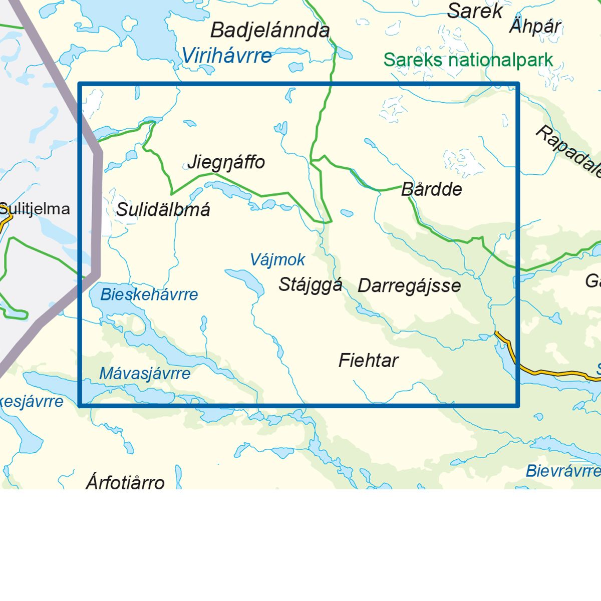
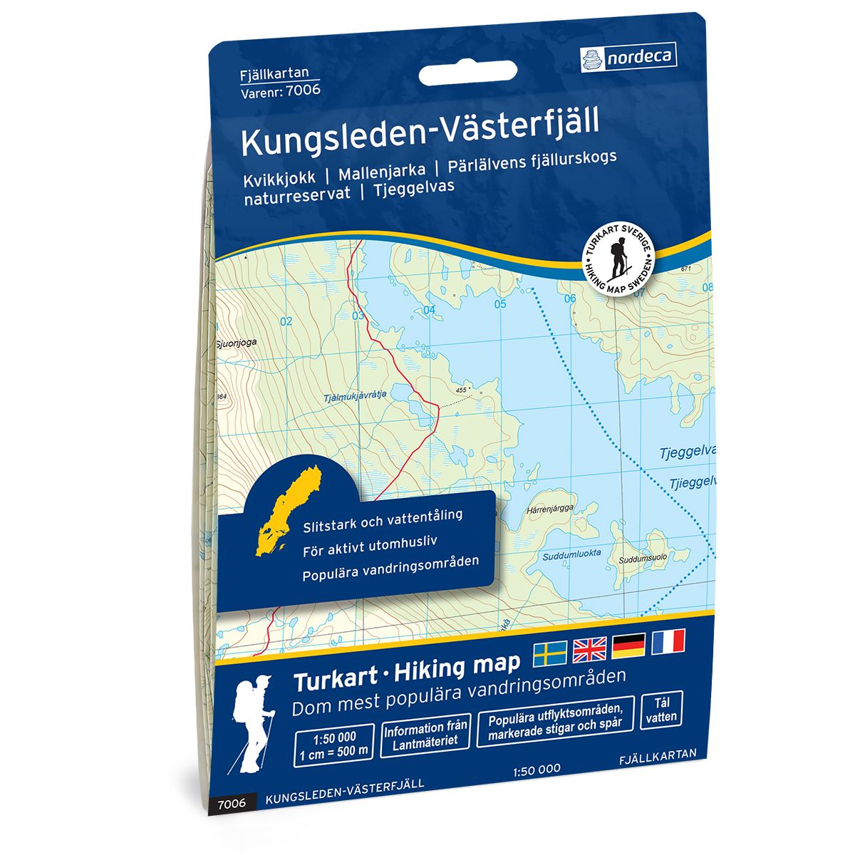
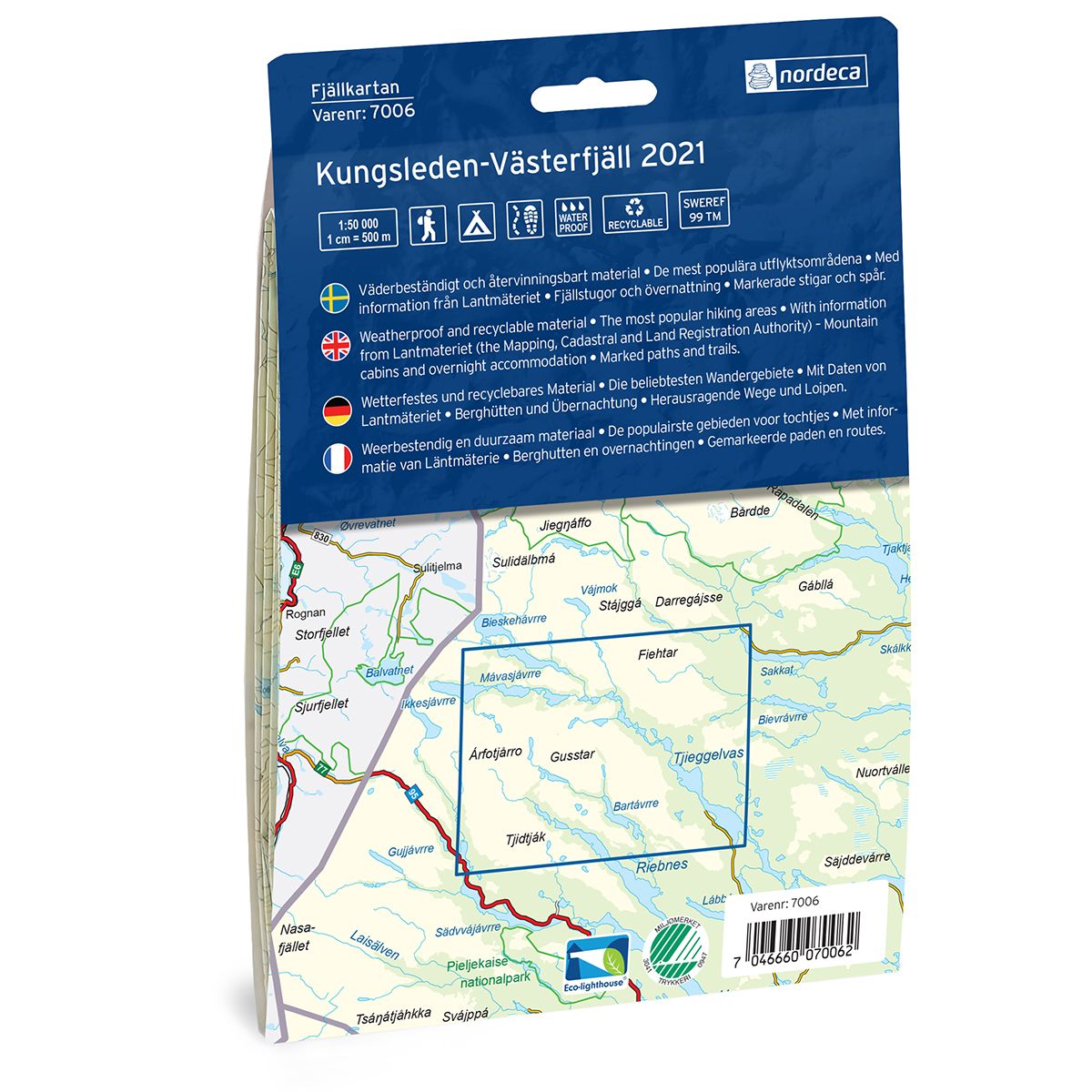
7006 Kungsleden-Västerfjäll
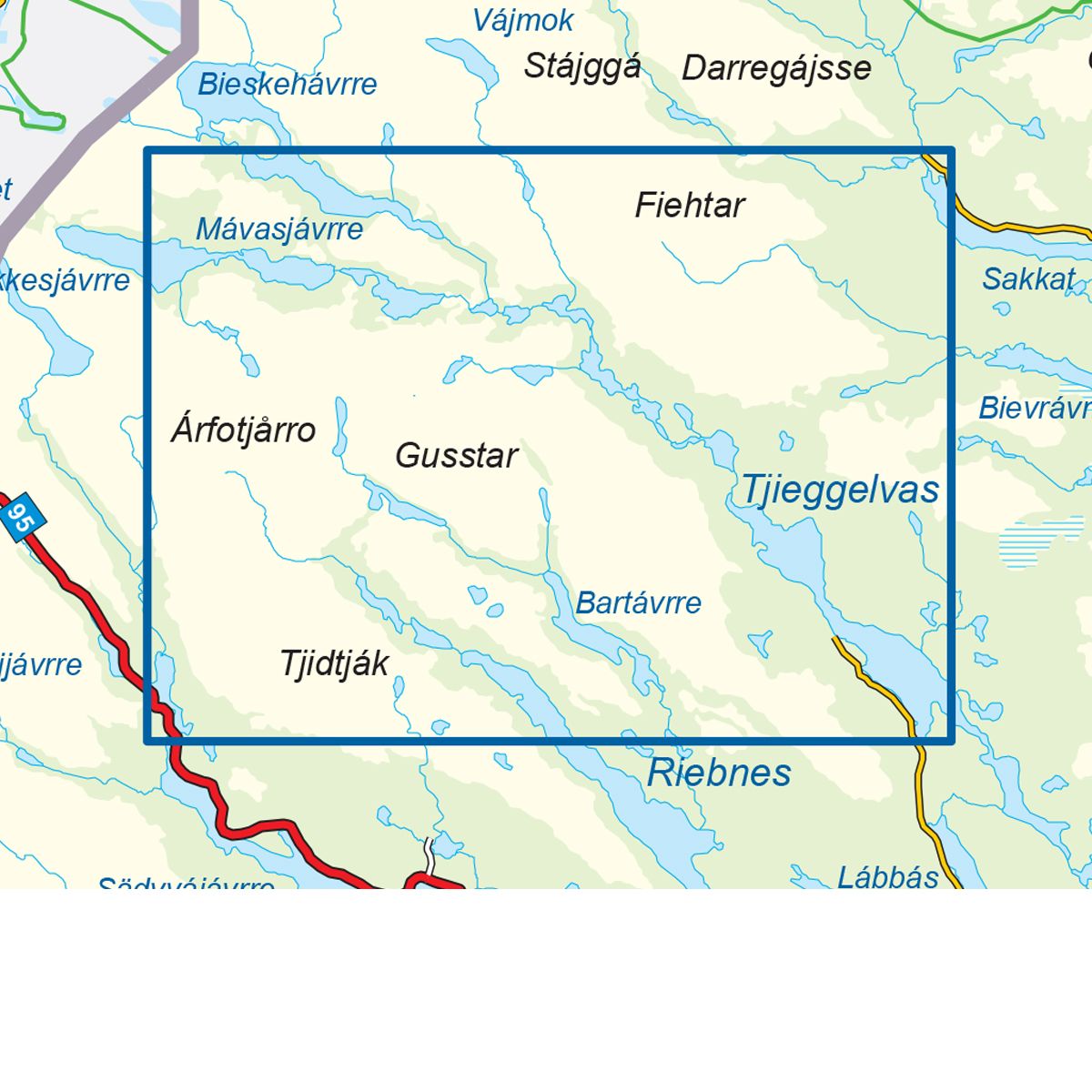
Ordinær pris 249,00 krFjellkart Kungsleden – Västerfjäll er et detaljert kart som dekker over 3000km2. Her finner du både turstier og fjellstuer i området som er tydelig merket i kartet. Kartet dekker området fra Vuoggatjålme til Kvikkjokk, og den delen av Kungsleden som går via Västerfjäll og videre opp mot Kvikkjokk fjällstation. Västerfjäll er et flott utgangspunkt til mange flotte fjelltopper, fantastisk natur og vakre sjøer og er verdt et besøk både sommer og vinter. Innsjøen Tjeggelvas er også verdt å utforske for jakt og fisketurister. Eksempel på fjellstuer i kartet: Kvikkjokk fjällstation.
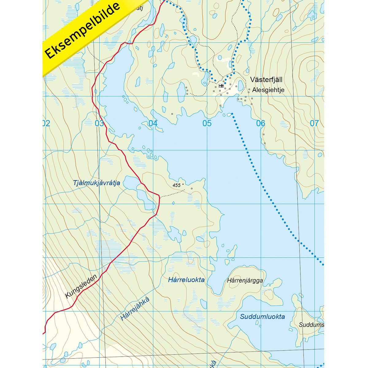
7007 Kungsleden-Jäkkvik
Ordinær pris 249,00 krFjellkart Kungsleden – Jäkkvik er et detaljert kart som dekker over 3000km2. Her finner du både turstier og fjellstuer i området som er tydelig merket i kartet. Kartet dekker Kungsledens strekning fra Adolfsström i sør via Pieljekaisestugan til fjellbygden Jäkkvik lenger øst. Vandringen passerer gjennom nasjonalparken Pieljekaise. Videre dekkes området nord for Jäkkvik ved innsjøen Riebnes. Her krysser Kungsleden ved den lille bygden Vuonatjviken. Eksempel på fjellstuer i området: Pieljekaisestugan.
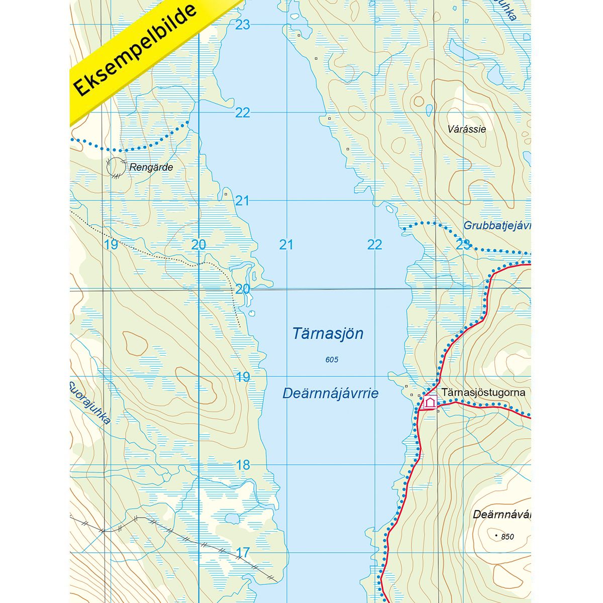
7008 Kungsleden-Hemavan
Ordinær pris 249,00 krFjellkart Kungsleden – Hemavan er et detaljert kart som dekker over 3000km2. Her finner du både turstier og fjellstuer i området som er tydelig merket i kartet. Kartet dekker den sørligste delen av Kungsleden mellom Hemavan over Tärnasjön og til Ammarnäs, med sine mange fjellstuer på veien. I tillegg dekkes Kungsledens videre trase nord fra Ammarnäs ved Björkfjället videre mot Adolfsström. Den mer enn 400 km lange Kungsleden, en av verdens mest kjente vandringsturer, har sitt startpunkt i Hemavan og strekker seg hele veien til Abisko i nord. Denne vandringen tar deg gjennom et variert landskap i Lapplands fjellverden med sjøer, fjelltopper, idylliske fjellandsbyer og fire nasjonalparker. Vandringen er varierende og passer for både nye og erfarne vandrere.
Eksempel på fjellstuer i kartet: Vatjosjöstugan, Servestugan, Aigertstugan, Rävfallsstugan, Östra Vitnjul, Västra Vitnjul, Mankeforsstugan, Hemavan fjällstation, Viterskalsstugan, Syterskalet, Syterstugan, Tärnasjöstugorna, Jirestugan, Glimmerstugan, Skidbäcksstugan og Dalavardo. På norsk side av grensen finnes hytten Kvitsteindalstunet.
701 Sylt
Ordinær pris 199,00 krSykkel og turkart fra Kompass.
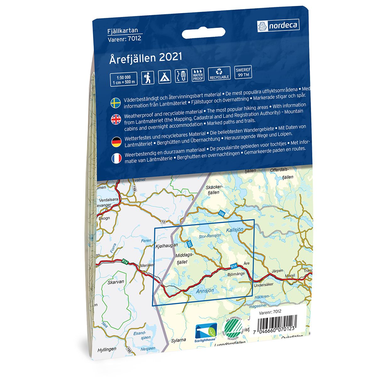
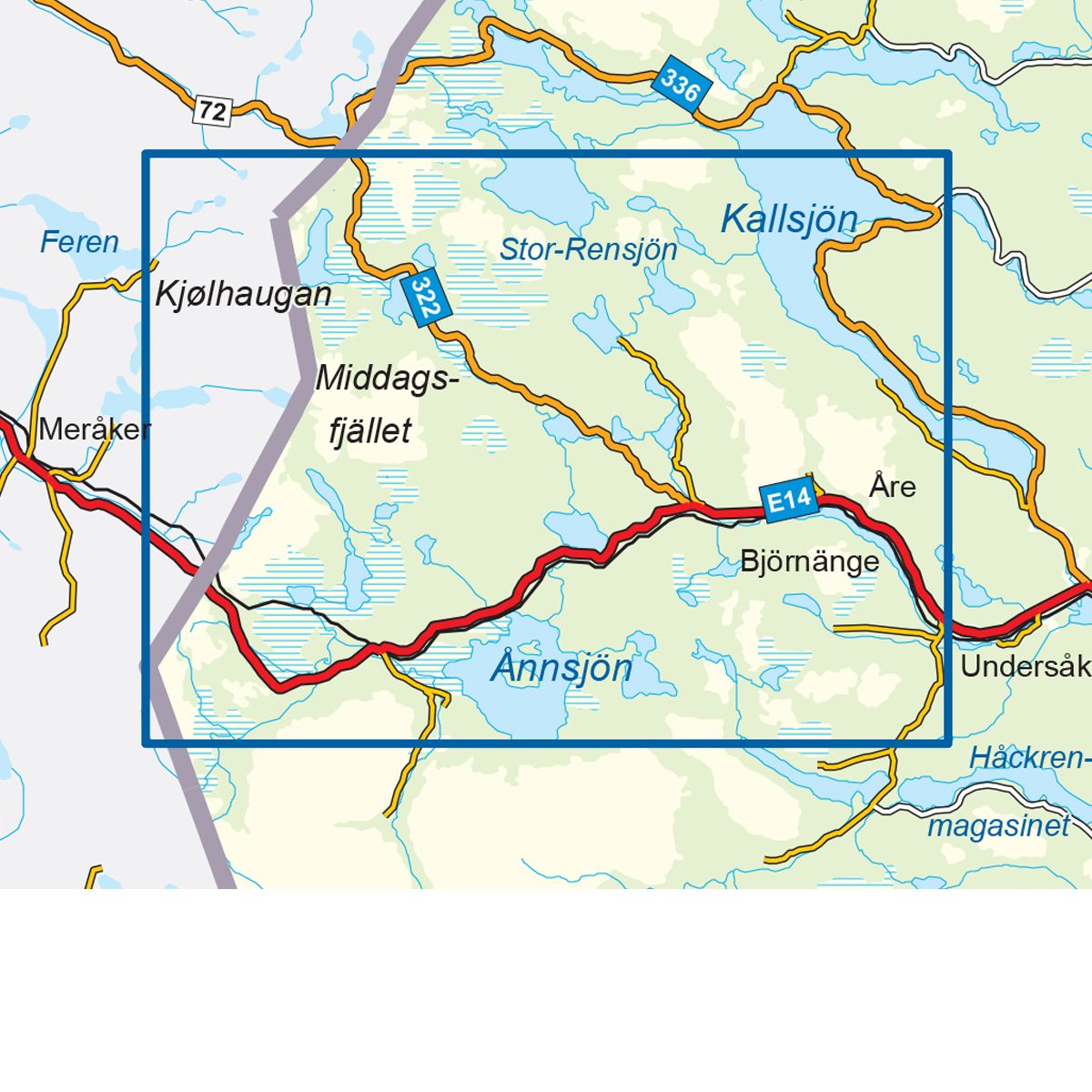
7012 Årefjällen
Ordinær pris 249,00 krFjellkart Årefjällen er et detaljert kart som dekker over 3000km2. Her finner du både turstier og fjellstuer i området som er tydelig merket i kartet. Kartet dekker den norske siden av riksgrensen i vest ved Teveldalen og videre inn i Sverige og Storlien til den populære vinterdestinasjonen Åre i øst. Åre skisenter er et perfekt sted for skientusiaster. Årefjällen byr på enkle turer, men også litt tøffere utfordringer. Åreskutan, Mörvikshummeln og Totthummeln er eksempler på flotte fjellturer som er vel verdt et besøk i områdene rundt Åre.
Kartet dekker også Trillevallen, som er et høyfjellsområde hvor du kan oppleve fantastiske skimuligheter og vakre turstier. Enafors og Storlien er fine utgangspunkt for å utforske alt Årefjällen har å by på. Eksempler på fjellstuer i kartet: Storlien, Enafors, Trillevallen, Hållfjället og Edsåsen. Ferslia og Angeltjønnhytta ligger på den norske siden av grensen.
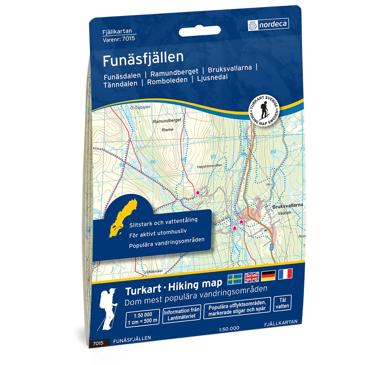
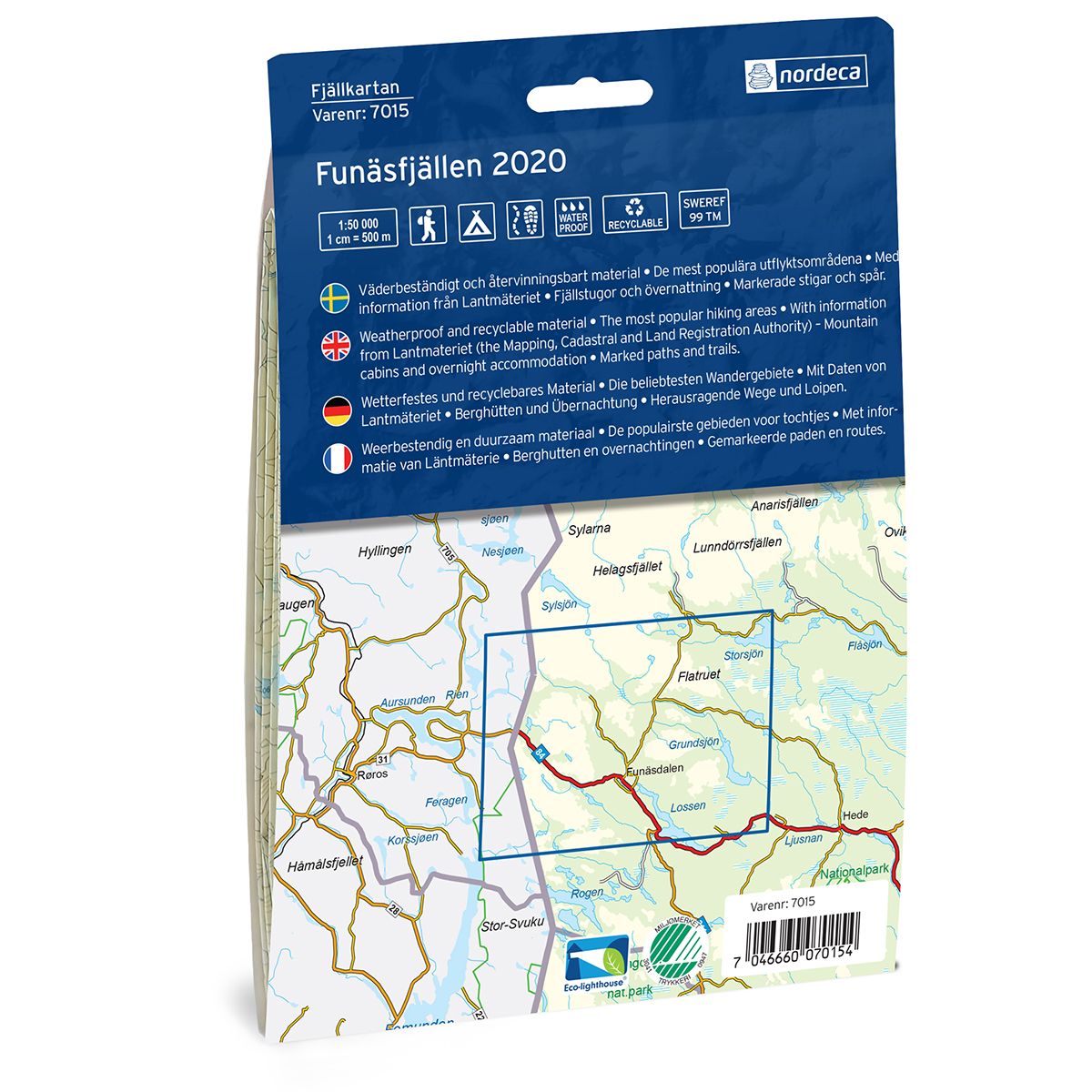
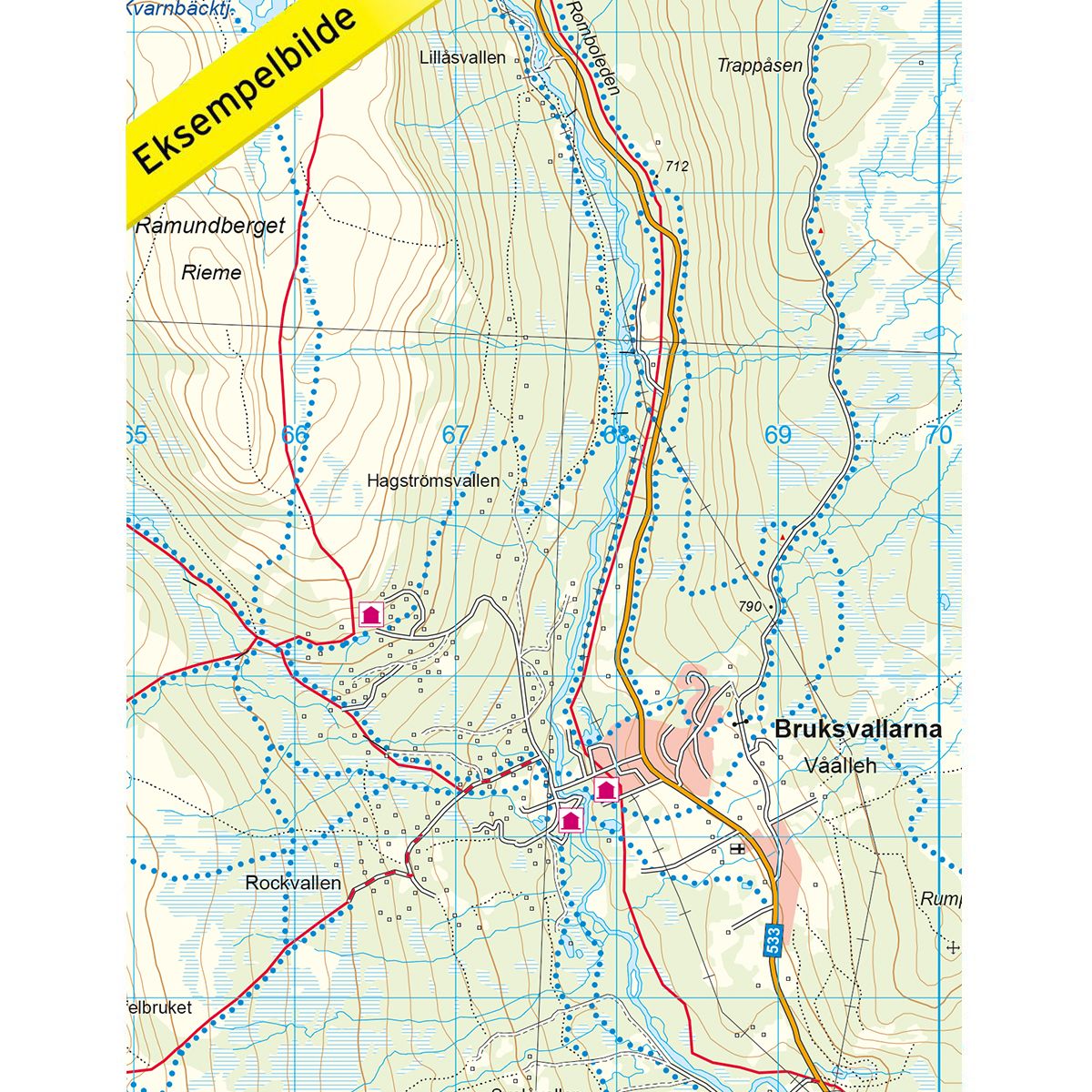
7015 Funäsfjällen
Ordinær pris 249,00 krFjellkart Funäsfjällen er et detaljert kart som dekker over 3000km2. Her finner du både turstier og fjellstuer i området som er tydelig merket i kartet. Kartet dekker området fra riksgrensen i vest til Storsjön i øst. Funäsfjällen er en typisk skidestinasjon, med de beste forutsetningene for alpint med sine mange skitrekk og skiheiser i området. Kartet dekker dessuten skiområdene Tänndalen, Ramundberget og Funäsdalsberget i tillegg til byene Funäsdalen, Bruksvallarna og Fjällnäs. Området byr dessuten på fantastisk natur også utenom skisesongen som kan oppleves enten til fots eller på sykkel. Eksempel på fjellstuer i kartet: Röstavallen, Fältjägarstugan og Baggården.
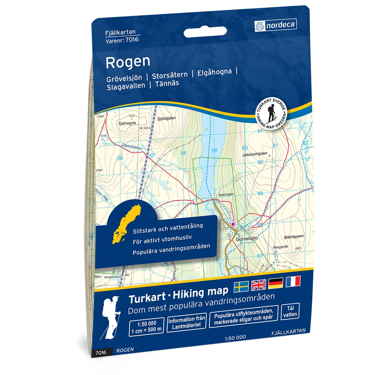
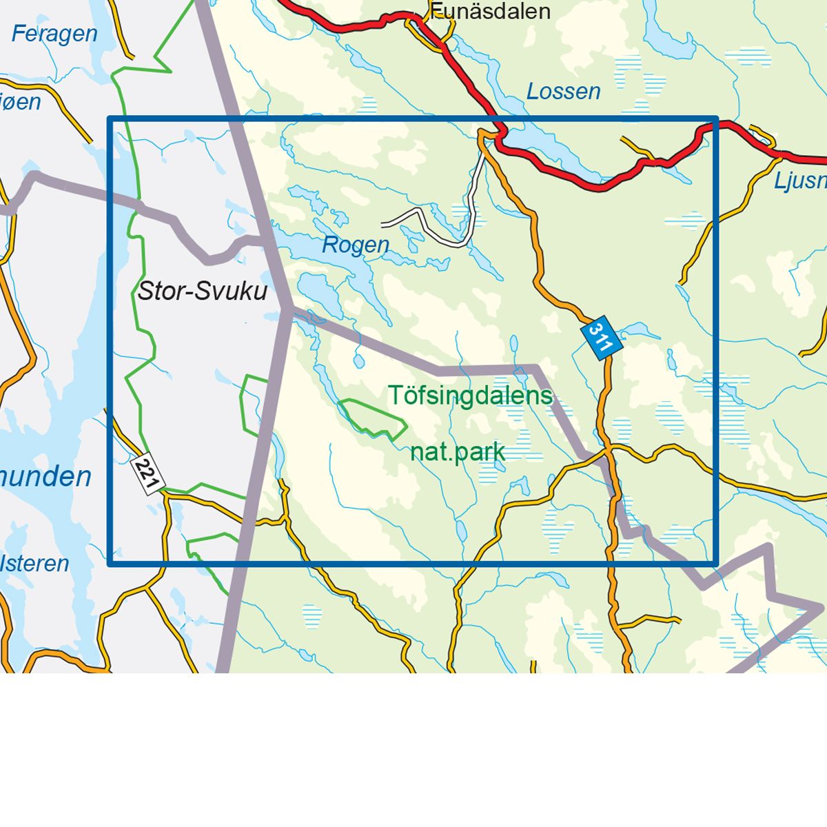
7016 Rogen
Ordinær pris 249,00 krFjellkart Rogen er et detaljert kart som dekker over 3000km2. Her finner du både turstier og fjellstuer i området som er tydelig merket i kartet. Kartet dekker det populære fjellområdet rundt Rogen i tillegg til to nasjonalparker, Femundsmarka i Norge og Töfsingdalen i Sverige. Rogenstugan som ligger ved den store innsjøen Rogen er et godt utgangspunkt for flotte turer i et vakkert turområde. Her kan du blant annet leie kano til å utforske den store innsjøen som ligger på grensen mellom Norge og Sverige. Landskapet rundt gir et særpreget inntrykk med enorme steinblokker, skog, fjell og labyrinter av små vann. Lenger sør finner du Grövelsjön, et fjellområde med en naturopplevelse helt utenom det vanlige. Eksempler på fjellstuer i kartet: Røvollen, Svukuriset, Skredbrostugan og Rogenstugan.
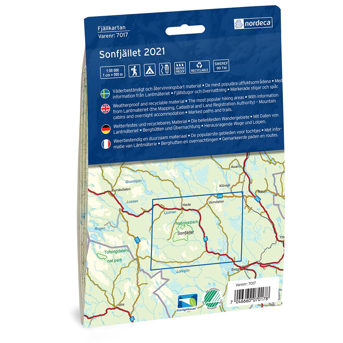
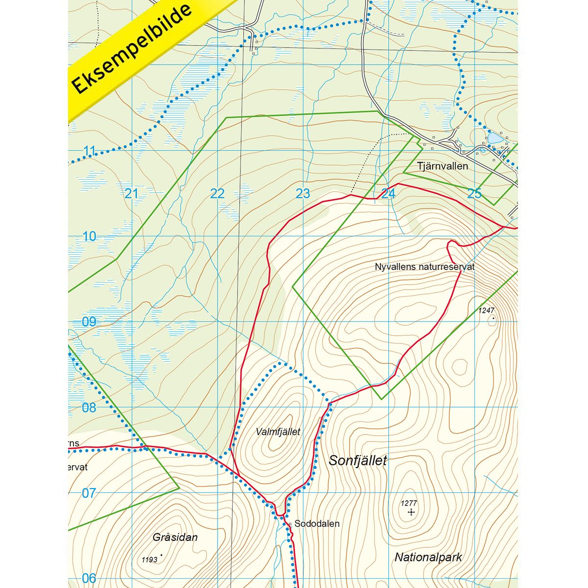
7017 Sonfjället
Ordinær pris 249,00 krFjellkart Sonfjället er et detaljert kart som dekker over 3000km2. Her finner du både turstier og fjellstuer i området som er tydelig merket i kartet. Sonfjället er et majestetisk fjell i Härjedalen. Området inkluderer Sonfjällets nasjonalpark, en av Europas aller første, og kan by på høye fjelltopper, mange turstier og et rikt dyreliv. Kartet dekker områdene Nyvallen og Nysätern som utgjør små naturreservat innenfor nasjonalparkområdet. Dette er fine utgangspunkt for turer i området.
Kartet dekker dessuten skidestinasjonene Vemdalsskalet og Lofsdalen, med Lofsens fjällby som et perfekt utgangspunkt med gode overnattingsmuligheter. I Vemdalen finner man også gode muligheter for aktiviteter på sommeren og området er godt tilrettelagt for at det skal være enkelt å dra på turer med barn. Eksempel på fjellstuer i kartet: Lofsens fjällby.
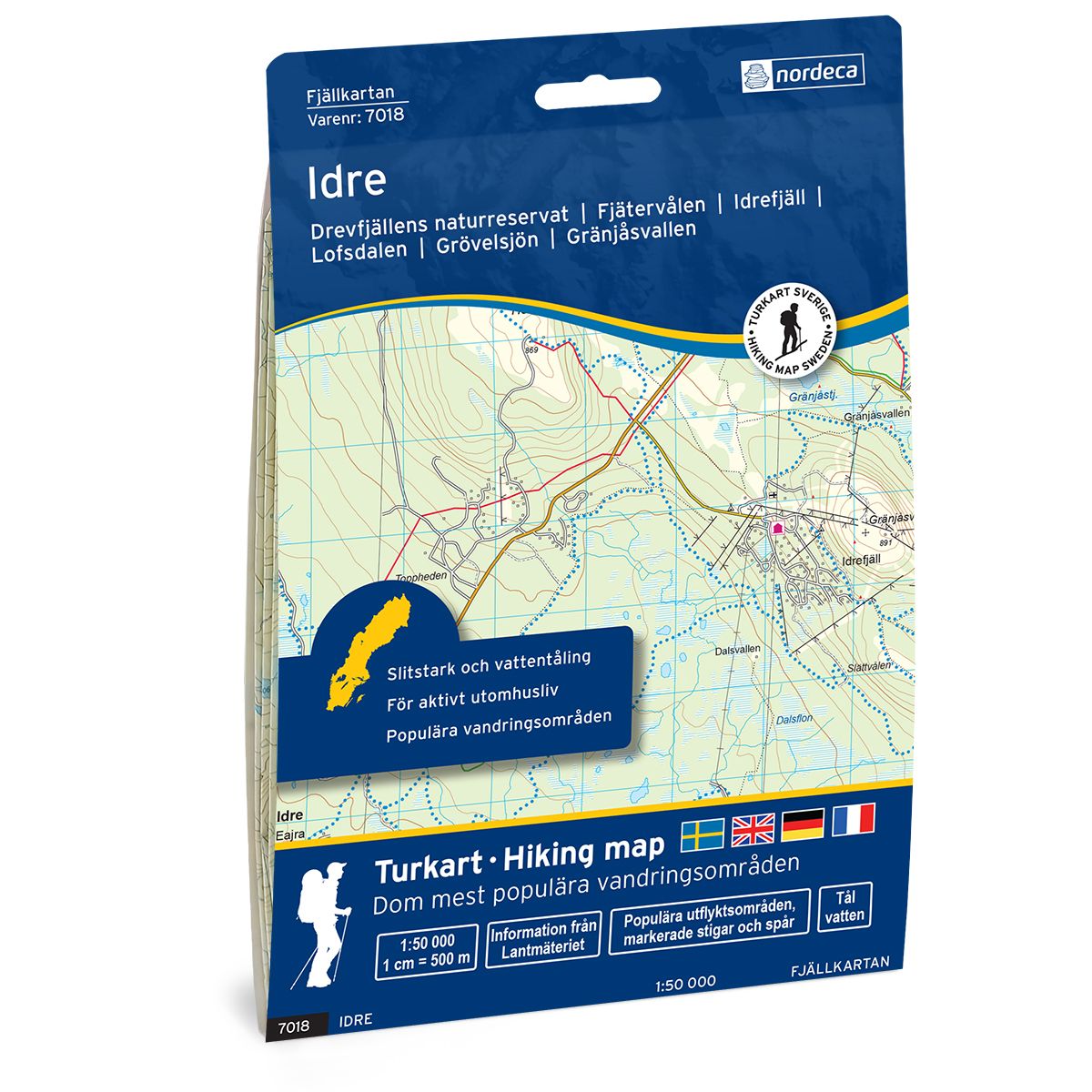
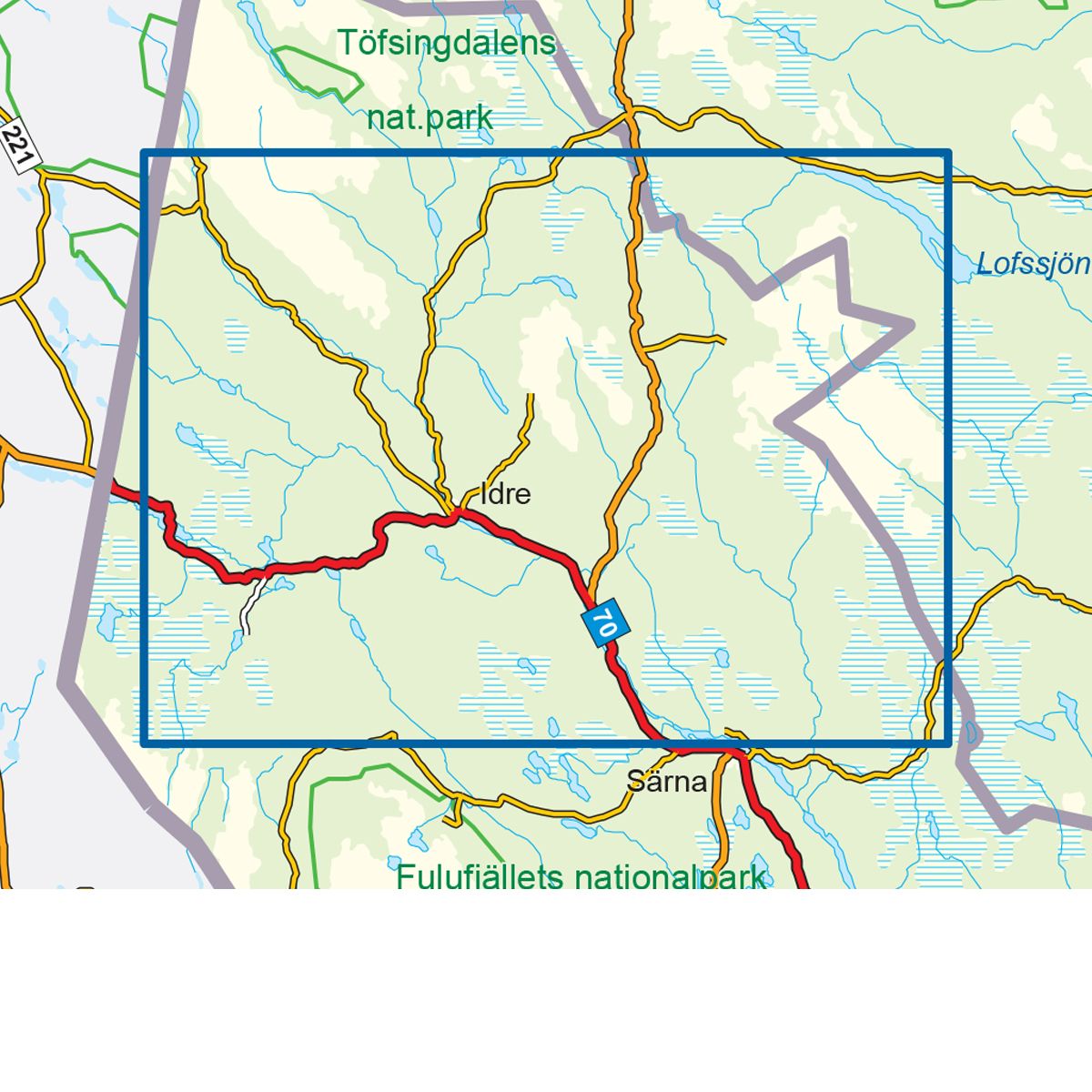
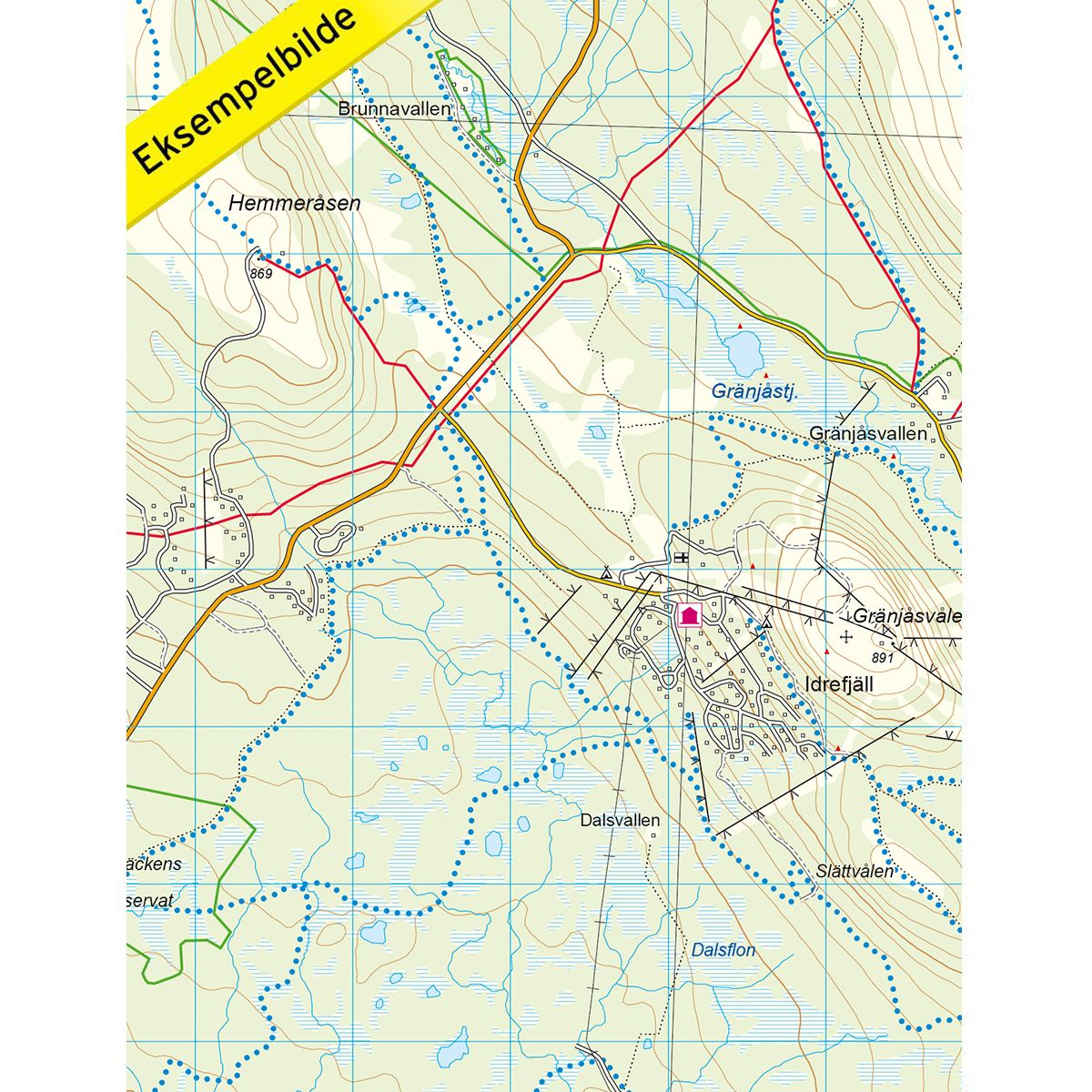
7018 Idre
Ordinær pris 249,00 krFjellkart Idre er et detaljert kart som dekker over 3000km2. Her finner du både turstier og fjellstuer i området som er tydelig merket i kartet. Kartet dekker området fra Grövelsjön og Storsätern i nordvest til Lofsdalen og Lofsjön i øst. Kartet er sentrert rundt Idre, et kjent vintersportssted med flotte skianlegg. Idre er dessuten et fint sted for fotturer, spesielt i områdene rundt Grövelsjön og tettstedet Idre. Idrefjäll byr på herlige fjellopplevelser og morsomme aktiviteter for hele familien, som for eksempel rafting, vandring, golf og klatrepark. Eksempel på fjellstuer i kartet: Lofsens fjällby.
706 France: North-West
Ordinær pris 169,00 krMichelin er en av verdens beste, og best kjente, kartserier. Kartene har glimrende kartografi.
708 France: South-West
Ordinær pris 169,00 krMichelin er en av verdens beste, og best kjente, kartserier. Kartene har glimrende kartografi.
709 France: South-East
Ordinær pris 169,00 krMichelin er en av verdens beste, og best kjente, kartserier. Kartene har glimrende kartografi.
716 Belgium & Luxembourg
Ordinær pris 169,00 krMichelin er en av verdens beste, og best kjente, kartserier. Kartene har glimrende kartografi.
719 Germany; BENELUX; Austria; Czech Republic
Ordinær pris 169,00 krMichelin er en av verdens beste, og best kjente, kartserier. Kartene har glimrende kartografi.
720 Poland
Ordinær pris 169,00 krMichelin er en av verdens beste, og best kjente, kartserier. Kartene har glimrende kartografi. Rød serie, kalt “national”. Dekker et enkelt land eller en gruppe land primært med hovedferdselsårer.
723 Nordseeküste
Ordinær pris 249,00 kr