Filter
- Andorra
- Angola
- Argentina
- Aserbajdsjan
- Australia
- Bangladesh
- Belgia
- Belize
- Benin
- Bolivia
- Bosnia-Hercegovina
- Brasil
- Brunei
- Bulgaria
- Burundi
- Canada
- Chile
- Costa Rica
- Cuba
- Danmark
- Djibouti
- Ecuador
- El Salvador
- Eritrea
- Estland
- Eswatini
- Etiopia
- Finland
- Frankrike
- Ghana
- Guyana
- Hellas
- Honduras
- Hviterussland
- India
- Indonesia
- Irak
- Iran
- Irland
- Island
- Israel
- Italia
- Jamaica
- Jordan
- Kambodsja
- Kasakhstan
- Kenya
- Kina
- Kirgisistan
- Kongo
- Kosovo
- Kroatia
- Kypros
- Laos
- Latvia
- Lesotho
- Libanon
- Libya
- Litauen
- Luxembourg
- Malawi
- Malaysia
- Mali
- Marokko
- Mauritania
- Mexico
- Montenegro
- Mosambik
- Namibia
- Nederland
- Nepal
- New Zealand
- Nicaragua
- Niger
- Nigeria
- Norge
- Pakistan
- Panama
- Paraguay
- Peru
- Polen
- Portugal
- Romania
- Russland
- Rwanda
- Samoa
- Serbia
- Sierra Leone
- Singapore
- Slovakia
- Slovenia
- Somalia
- Spania
- Sri Lanka
- Storbritannia
- Surinam
- Sveits
- Sverige
- Sør-Korea
- Taiwan
- Thailand
- Togo
- Tsjekkia
- Tunisia
- Turkmenistan
- Tyskland
- Uganda
- Ungarn
- USA
- Usbekistan
- Venezuela
- Vietnam
- Zimbabwe
- Østerrike
2208 produkter
2208 produkter

Vernon Subutex 2
Ordinær pris 149,00 kr Salgspris 75,00 kr Spar 50%/
Mva inkludert
Frakt beregnes i kassen.
Rock star Alexandre Bleach might be dead, but he has a secret. It's a secret that concerns several people, but the only person who can unlock it is Vernon Subutex, former record shop proprietor turned homeless messiah and guru, last seen hallucinating and feverish on a bench in the parc des Buttes Chaumont. Aïcha wants to know the truth behind the death of her mother, Vodka Satana. And if she finds the bastards responsible, she wants to make them pay, whatever Céleste thinks of her plan.
Céleste wants Aïcha to get a grip and stop hanging around with Subutex's gang of disciples. The Hyena wants to find the Bleach tapes. She wants to untangle her complicated feelings about Anaïs, her boss' assistant. And speaking of her boss, she does not want Laurent Dopalet to discover how badly she has double-crossed him. Laurent Dopalet wants the Hyena to find and destroy the Bleach tapes. He wants to forget he ever knew Vodka Satana. He wants people to stop graffitiing his apartment with ludicrous allegations. Above all, he wants people to understand: none of this is his fault.
- Forfatter: Virginie Despentes
- Publisert: 2019
- Antall sider: 320
- Innbinding: Heftet
- Språk: Engelsk
- ISBN: 9780857055835

Tail of the Blue Bird
Ordinær pris 149,00 kr Salgspris 74,50 kr Spar 50%/
Mva inkludert
Frakt beregnes i kassen.
Sonokrom, a village in the Ghanaian hinterland, has not changed for thousands of years. Kayo is a forensic pathologist convinced that scientific logic can shatter even the most inexplicable of mysteries. But as events in the village become incomprehensible, Kayo finds that Western logic and political bureaucracy are no longer equal to the task.
- Forfatter: Nii Ayikwei Parkes
- Publisert: 2010
- Språk: Engelsk
- ISBN: 9780099526124

Map of the Invisible World
Ordinær pris 149,00 kr Salgspris 74,50 kr Spar 50%/
Mva inkludert
Frakt beregnes i kassen.
From the author of the internationally acclaimed, Whitbread Award-winning 'The Harmony Silk Factory' comes an enthralling new novel that evokes an exotic yet turbulent and often frightening world. Sixteen-year-old Adam is an orphan three times over. He and his older brother, Johan, were abandoned by their mother as children; he watched as Johan was adopted and taken away by a wealthy couple; and he had to hide when Karl, the Dutch man who raised him, was arrested by soldiers during Sukarno's drive to purge 1960s Indonesia of its colonial past.
Adam sets out on a quest to find Karl, but all he has to guide him are some old photos and letters, which send him to the colourful, dangerous capital, Jakarta. Johan, meanwhile, is living a seemingly carefree, privileged life in Malaysia, but is careening out of control, unable to forget the long-ago betrayal of his helpless, trusting brother. 'Map of the Invisible World' is a masterful novel, and confirms Tash Aw as one of the most exciting young writers at work today.
- Forfatter: Tash Aw
- Publisert: April 2010
- Innbinding: Heftet
- ISBN: 9780007349982

The Kon-Tiki Expedition
Ordinær pris 179,00 kr Salgspris 89,50 kr Spar 50%/
Mva inkludert
Frakt beregnes i kassen.
This is the story of how Thor Heyderdahl and five other men crossed the Pacific Ocean on a balsa-wood raft in an extraordinary bid to prove Heyderdahl's theory that the Polynesians undertook the same feat on such a craft over 1000 years ago.
- Forfatter: Thor Heyerdahl
- Publisert: Juli 1996
- Innbinding: Heftet
- Språk: Engelsk
- ISBN: 9780006550334

Himmelblomsttreet
Ordinær pris 199,00 kr Salgspris 99,50 kr Spar 50%/
Mva inkludert
Frakt beregnes i kassen.
«Vi er to menn. Du er knapt førti, jeg litt yngre. Vi sitter i det grønneste av alt grønt. Hør alle lydene. Det er ingen gråt. Jungelen gråt heller ikke da min landsby ble brent og alle mine døde. Jungelen kan ikke gråte. Jungelen føder stadig nytt liv. Milliarder på milliarder av nye liv. Dette må vi passe på, Yenso, du og jeg, kanskje er det derfor vi sitter her nå, nettopp fordi du og jeg skal passe på denne jungelen som det aller viktigste på hele denne kloden.»
Hoverpersonen i Himmelblomsttreet Jens Oder Flirum - alias Yenso - sitter sammen med kameraten Mino i Amazonas-jungelen. Hensynsløs kapitalistisk utnytting har ødelagt jungelen. Dette skal de bekjempe.
Jens Oder Flirum vender tilbake til Europa for å iverksette Den Store Planen.
- Forfatter: Gert Nygårdshaug
- Publisert: 2018
- Innbinding: Heftet
-
Språk: Norsk Bokmål
- Antall sider: 398
- ISBN: 9788202599904

SISTE TUR
Ordinær pris 349,00 kr Salgspris 174,50 kr Spar 50%/
Mva inkludert
Frakt beregnes i kassen.
I en årrekke har journalist og forfatter Alexander Urrang Hauge portrettert skimiljøet fra innsiden i sin faste spalte i skimagasinet Fri Flyt. Siste Tur handler om feilskjæret, hvileskjæret og undervannsskjæret som graver ut nådeløse sår i en altfor dyr skisåle - finansiert av ukelønn, månedslønn, sparepenger, konfirmasjonspenger og hundrelappen du fikk av mormor fordi du klippet gresset.
I boka møter du Motbakke-Maria, Bumse-Bård, Aksel Lund Svindal og andre snøtyper - som deg selv. Du som drømmer om pudder, men innser at det helst er skare og gjennomslagsføre. Du som går på trynet så det synger og som teller til ti og reiser deg opp. Igjen. Og igjen.
Siste Tur handler om å være full av faen og om å vinne til slutt.
ALEXANDER URRANG HAUGE
har bidratt i skimagasinet Fri Flyt nesten siden starten i 1998, først som leserbrevskribent, senere som reporter, portrettør og fast spaltist. I Siste Tur finner du det beste fra spalten med samme navn og flere helt nye tekster.

Nedenunder og hjem
Ordinær pris 349,00 kr Salgspris 175,00 kr Spar 50%/
Mva inkludert
Frakt beregnes i kassen.
Om nordmenn i Australia fra 1600-tallet til i dag Fortellingen om norsk utvandring dreier seg om mer enn de som søkte lykken i Amerika. Der emigranter flest seilte mot vest, valgte en modig minoritet å legge ruten sørover til den moderne verdens fjerneste utpost. Dette er historien om våre glemte utvandrere til Australia. Få visste hva de dro til. Andre kom ufrivillig i lenker. Men allerede før kontinentet ble etablert som straffekoloni, fikk trolig norske sjømenn landkjenning. Med tiden fortsatte nordmenn med utferdstrang å sette spor etter seg Down Under - som oppdagere, nybyggere, gullgravere og i tjeneste under fremmed flagg, senere som entreprenører, skipionerer og studenter.
I denne boka går Fredrik Larsen Lund i fotsporene til både eventyrere og samfunnsstøtter, kjeltringer og ulykkesfugler. Hva reiste de fra? Hvordan ble de mottatt? Og hvordan taklet de en hverdag uendelig langt hjemmefra? På kryss og tvers over det røde kontinent oppsøker forfatteren steder som skjuler fascinerende beretninger om fargerike nordmenn og norsk innflytelse - fra Queenslands Eidsvold i øst til Norseman i vest. Underveis trekker han linjer frem til våre dager og undersøker nordmenns møter med det fremmede, da og nå. Nedenunder og hjem er dels utvandringshistorie, dels reiseskildring - en original og kunnskapsrik jakt på det norske Australia.
- Forfatter: Fredrik Larsen Lund
- Publisert: 2014
- Antall sider: 345
- ISBN: 9788282114097

Skolopenderen danser
Ordinær pris 249,00 kr Salgspris 124,50 kr Spar 50%/
Mva inkludert
Frakt beregnes i kassen.
I «Skolopenderen danser» reiser vi med Wolf til Roma, Paris og Asmara. Øysteins assosiative og vilt kreative språk løper i alle retninger - samtidig. Her er humor, kåtskap og alvor - sinne, galskap og latter. Boken består av to korte og eventyrlige romaner: «Skolopenderen danser» og «Hestetimen». Alle hovedpersonene er unge kvinner. Vi følger disse gjennom hverdag og drøm; på reiser du aldri vil glemme.
Øystein Wingaard Wolf (f. 1958) er i en kategori for seg selv på litteratur- og kulturfeltet. Vi har å gjøre med en av de store språkkunstnerne i landet. Ikke bare som lyriker og romanforfatter har han gjort seg bemerket, han er også en begavet låtmaker og sanger. Dessuten har han oppfunnet elefantdansen.
Øystein Wingaard Wolf (f. 1958) er i en kategori for seg selv på litteratur- og kulturfeltet. Vi har å gjøre med en av de store språkkunstnerne i landet. Ikke bare som lyriker og romanforfatter har han gjort seg bemerket, han er også en begavet låtmaker og sanger. Dessuten har han oppfunnet elefantdansen.

From Mumbai to Mecca
Ordinær pris 159,00 kr Salgspris 79,50 kr Spar 50%/
Mva inkludert
Frakt beregnes i kassen.
Ilija trojanow's journey from mumbai to mecca is told in the tradition of the rihla, one of the oldest genres of classical arabic literature and describes the hajj, the pilgrimage to the holy sites of islam. 'from the very first moment they realise that the hajj - the pilgrimage to mecca - is among the duties of each and every muslim, the faithful long to go.' trojanov, with the help of his friends, donned the ihram, the traditional garb of the pilgrim. He joined hundreds of thousands of muslims who each year go on the hajj, the greatest demonstration of the muslim faith.
in three short weeks he experienced a tradition dating back over one thousand years this is his account, personal yet enlightening, for the interested non-muslims who remain barred from the holy sites of islam.
forfattere: I. Trojanow
Publisert måned: Aug
Publisert år: 2017
Utgave: 1.utg
Sider nr: 150

I AM JUSTICE A JOURNEY OUT OF AFRICA
Ordinær pris 159,00 kr Salgspris 79,50 kr Spar 50%/
Mva inkludert
Frakt beregnes i kassen.
Forfattere: Paul kenyon
Publisert måned: Aug
Publisert år: 2010
Utgave: 2utg
Sider nr:250
Publisert måned: Aug
Publisert år: 2010
Utgave: 2utg
Sider nr:250

The Leopard´s Tale
Ordinær pris 179,00 kr Salgspris 89,50 kr Spar 50%/
Mva inkludert
Frakt beregnes i kassen.
Almost everyone on safari hopes for a glimpse of the charismatic and elusive leopard. Chui was the first of a new generation of leopards Jonathan Scott watched and photographed in Kenya's Masai Mara Game Reserve in the 1970s and 1980s. He spent every available moment watching and photographing Chui and her cubs, Light and Dark, aware that he was only privileged to do so for as long as they chose to remain visible.
His classic account tells the story of the mother leopard as a solitary hunter providing for herself and her offspring. He records encounters with baboon, hyaena and man, hazards facing the cubs as they learn to fend for themselves and periods of play and relaxation. Some years after Chui disappeared, a young female appeared, Half-Tail.
Jonathan and Angela have followed her and her daughter Zawadi, stars of the BBC's Big Cat Diary, for the past twenty years, bringing the story up to date. Nobody has studied leopards more closely or known them more intimatelyJonathan says: 'The update is based on our work with Half-Tail and Zawadi from both the pictures and text perspective - Angie worked with us on Big Cat Diary as the stills photographer from 1996 and before that we both worked with Half-Tail from the time she first appeared around Leopard Gorge and Fig Tree Ridge - our kids grew up on safari with Half-Tail and Zawadi as stars of their own Mara adventures.'
Forfattere: J.Angela scott
Publisert måned: Aug
Publisert år: 2013
Utgave: 2utg
Sider nr:228

Canada: East Coast
Ordinær pris 199,00 kr/
Mva inkludert
Frakt beregnes i kassen.
Canada is a vast country in area; inconceivably enormous in European terms. It is best mapped as a series of regional maps and this is the first of two maps that we hope will portray the Atlantic coastline of all of North America. Side 1 concentrates on Newfoundland and Labrador, with a tiny bit of Nunuvut at the top end of the Ungava Peninsula. An inset map of St. John’s, capital of Nfld/Lab is included, as is the French Overseas Territory of St. Pierre et Miquelon. The new paved highway across Labrador is the highlight of this side of the map!
The second side of the map focusses on Nova Scotia/Cape Breton and parts of Prince Edward Island and New Brunswick, with a detailed inset of central Halifax. The former French fortress of Louisbourg is a must-see for anyone visiting Cape Breton, as are the many Loyalist towns created along the coast of Nova Scotia to house refugees fleeing turmoil in the American colonies during the Revolutionary War. A separate map concentrating on the Atlantic coastline of the USA is being prepared.
- Publisert: 2023
- Innbinding: Falset
- Materiale: Papir
- Målestokk: 1:535 000, 1:1 150 000


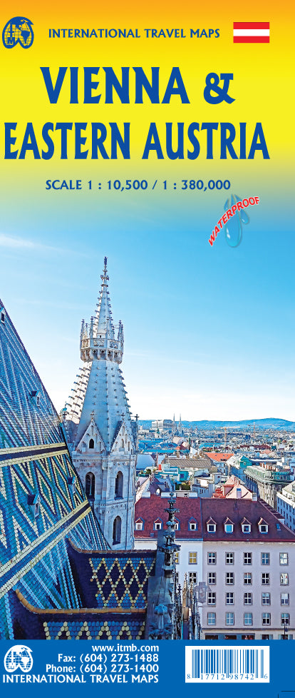
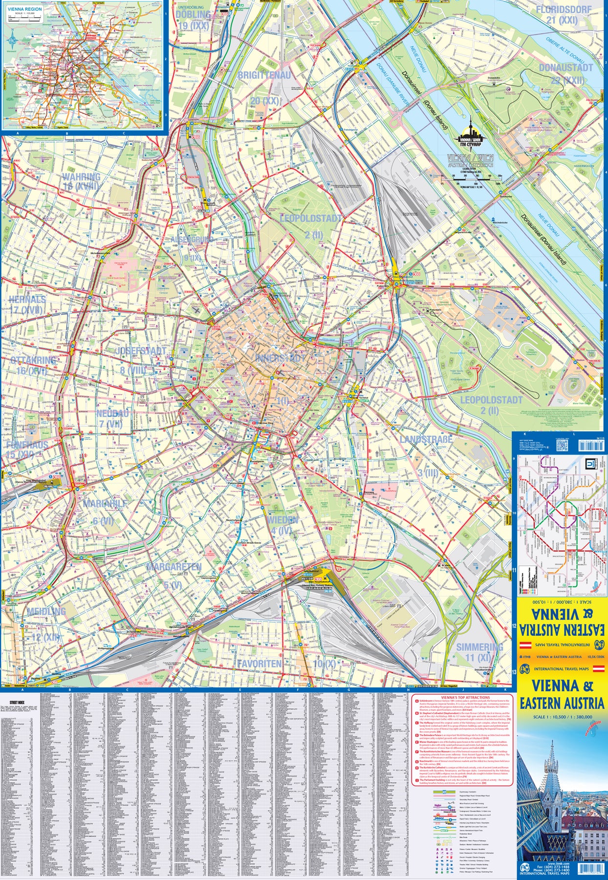
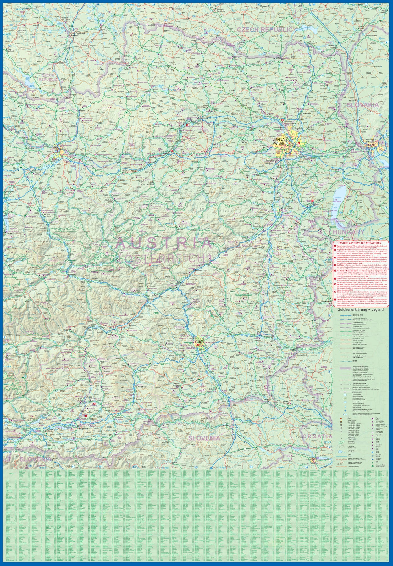
Austria: Vienna & Eastern Austria
Ordinær pris 179,00 kr/
Mva inkludert
Frakt beregnes i kassen.
ITMB is pleased to introduce an exciting new map of the wonderful city of Vienna, combined with a newly-prepared map of eastern Austria. Until WW2, Vienna was one of the most diverse and cultural cities in Europe. The NAZI takeover changed all of that and its brutal capture by the Russians five years later sent the city into a devastating downturn. Fortunately, the Soviet Union was forced to withdraw and Austria declared to be a demilitarized neutral country for the rest of the Cold War. Vienna is now a lovely historic city on the Danube River, the capital of Austria, and the European United Nations centre. The Innerstadt (Inner or old city centre) is the location of many of the hotels gracing Vienna, as well as St, Stephen’s Cathedral with its wonderful roof. One of the great attractions of the city is the Schonbrunn, the 18th Century palace of the Austro-Hungarian Empire.
The map extends from the western ring road to the UN complex east of the Danube, and from the northern edge of the urban area to south of the Hauptbahnhof (or main railway station). All Metro and tram lines are clearly shown, along with parks, churches, shopping areas, hotels, and the city’s three rail stations. The second side of the sheet is a very detailed map of the eastern half of Austria from the /Czech border on the north, the Hungarian border to the east, to the Slovenian border to the south, and west to Linz and Klagenfurt. Rail lines are prominently noted, as are motorways and all highways. Once one leaves Vienna, a vista of rural mountainous countryside unfolds, with dozens of ancient castles to explore, and interesting small towns to explore. Burg Hochosterwitz is one of Europe’s most ancient castles, dating from 860AD.
- Publisert: 2023
- Innbinding: Falset
- Materiale: VanntettPapir
- Målestokk: 1:10,500 / 1:380 000

Greece: Crete; Mykonos & Santorini
Ordinær pris 169,00 kr/
Mva inkludert
Frakt beregnes i kassen.
The many islands off the coast of Greece can only be mapped properly a few at a time. Side 1 of this map shows the large island of Crete in good detail, with the relatively nearby island of Mykonos and its adjacent island of Rinia and the island of Santorini, with its adjacent islands of Thirasia and Nea Kameni being shown in great detail. A locality map showing the islands in relation to the rest of Greece is included as an inset. It is our intention to map more islands as time passes, but this depends upon future research trips (we lead a hard life!).
Side 2 of the map is a general map of Greece in relation to its neighbours to the north and east. The Mediterranean is divided into smaller seas, such as the Adriatic along the coast of Croatia, the Ionian to the west of Greece, the Myrtoan to its south and the Aegean to its east. All this area is replete with islands and geopolitical conflicts. As such, this map is useful for showing the region as an entity that links the Balkan states to the eastern Mediterranean.
- Publisert: 2023
- Innbinding: Falset
- Materiale: VanntettPapir
- Målestokk: 1:265,000 / 1:70,000


Italy: Sicily; Sardinia & The South
Ordinær pris 169,00 kr/
Mva inkludert
Frakt beregnes i kassen.
ITM har kart over hele verden og de spesialiserer seg på land litt utenfor allfarvei. Beliggenheten til landets nasjonalparker, historiske monumenter, de viktigste veiene og lignende finner du inkludert i kartene. Samtlige landkart har ofte et bykart over hovedstaden.
- Publisert: 2023
- Innbinding: Falset
- Materiale: Plastpapir
- Målestokk: 1:600.000

197 Chichester & The South Downs
Ordinær pris 209,00 kr/
Mva inkludert
Frakt beregnes i kassen.
- Publisert: 2017
- Innbinding: Falset
- Materiale: Papir
- Målestokk: 1:50 000

350 Edinburgh
Ordinær pris 209,00 kr/
Mva inkludert
Frakt beregnes i kassen.
OS Explorer is the Ordnance Survey's most detailed map and is recommended for anyone enjoying outdoor activities like walking, horse riding and off-road cycling. The OS Explorer range now includes a digital version of the paper map, accessed through the OS smartphone app, OS Maps. Providing complete GB coverage the series details essential information such as youth hostels, pubs and visitor information as well as rights of way, permissive paths and bridleways.
- Publisert: 2017
- Innbinding: Falset
- Materiale: Papir
- Målestokk: 1:25 000

145 Pragser Dolomiten
Ordinær pris 199,00 kr/
Mva inkludert
Frakt beregnes i kassen.
- Publisert: 2023
- Innbinding: Falset
- Materiale: Plastlaminert
- Målestokk: 1:25 000

96 Bormio; Livigno - Alta Valtellina
Ordinær pris 199,00 kr/
Mva inkludert
Frakt beregnes i kassen.
- Publisert: 2023
- Innbinding: Falset
- Materiale: Plastlaminert
- Målestokk: 1:50 000

344 Pentland Hills Penicuik & West Linton
Ordinær pris 209,00 kr/
Mva inkludert
Frakt beregnes i kassen.
OS Explorer is the Ordnance Survey's most detailed map and is recommended for anyone enjoying outdoor activities such as walking, horse riding and off-road cycling. The series provides complete GB coverage and can now be used in all weathers thanks to OS Explorer - Active, a tough, versatile version of OS Explorer. The OS Explorer Active range now includes a digital version of the paper map, accessed through the OS smartphone app, OS Maps.
- Publisert: 2015
- Innbinding: Falset
- Materiale: Papir
- Målestokk: 1:25 000

A Boy of China
Ordinær pris 159,00 kr Salgspris 79,50 kr Spar 50%/
Mva inkludert
Frakt beregnes i kassen.
Forlagets omtale:
forfattere: R.Loseby
Publisert år: 2016
Sider nr:303
the incredible story of the search for one of mao's lost children, set against the extraordinary backdrop of modern china. 'a son is very important in chinese society,' he had said. 'to lose one is careless. The ancestors would be angry.' intrigued by stories of a son given away by mao and his then-wife during the long march, and mystified by the ‘official' explanation of the boy's fate (whereabouts unknown - no further information available), richard loseby sets out alone across china in search of answers. Tracing mao's own revolutionary journey, the author encounters the extraordinary realities of a new revolution, one that is transforming an ancient culture into a modern economic powerhouse. At the heart of the journey is the hunt for an elusive truth about a brutal and traumatic time in the nation's still raw history. Who was that abandoned boy? Might he still be alive? Would he even want to be found? The result is an amazing traveller's tale – revealing, poignant, funny, sad and unexpected at every turn. A boy of china takes the reader on an unforgettable journey that is at once intimate and epic
forfattere: R.Loseby
Publisert år: 2016
Sider nr:303

INTO THE WILD
Ordinær pris 169,00 kr/
Mva inkludert
Frakt beregnes i kassen.
- Forfattere: Jon Krakauer
- Publisert: September 2011
- Utgave: 2. utgave
- Antall sider: 206

HOUSE OF STONE
Ordinær pris 169,00 kr Salgspris 84,50 kr Spar 50%/
Mva inkludert
Frakt beregnes i kassen.
A powerful and intensely human insight into the civil war in Zimbabwe, focusing on a white farmer and his maid who find themselves on opposing sides. One bright morning Nigel Hough, one of the few remaining white farmers in Mugabe's Zimbabwe, received the news he was dreading - a crowd were at the gate demanding he surrender his home and land. To his horror, his family's much-loved nanny Aqui was at the head of the violent mob that then stole his homestead and imprisoned him in an outhouse By tracing the intertwined lives of Nigel and Aqui - rich and poor, white and black, master and maid - through intimate and moving interviews, Christina Lamb captures not just the source of a terrible conflict, but also her own conviction that there is still hope for one of Africa's most beautiful countries.
ISBN: 9780007219391
Forfattere: Christina Lamb
Publisert måned: Des
Publisert år: 2007
Utgave: 1.utg
Sider nr: 290

461 Orkney - East mainland
Ordinær pris 279,00 kr/
Mva inkludert
Frakt beregnes i kassen.
OS Explorer is the Ordnance Survey's most detailed map and is recommended for anyone enjoying outdoor activities such as walking, horse riding and off-road cycling. The series provides complete GB coverage and can now be used in all weathers thanks to OS Explorer - Active, a tough, versatile version of OS Explorer. The OS Explorer Active range now includes a digital version of the paper map, accessed through the OS smartphone app, OS Maps.
Publisert: 2015
Innbinding: falset
Material: laminert
Målestokk: 1:25000

Sintra Cascais Nature Park
Ordinær pris 299,00 kr/
Mva inkludert
Frakt beregnes i kassen.
Topographic map on the scale 1/25 000, subtitled in Portuguese, English, Spanish, French and German. Waterproof, with functional compass.
Includes the whole network of paths in the Nature Park, tourist attractions such as monuments, beaches, camping sites, picnic areas, tourist offices, surf spots, climbing, diving and free flight, among others.
- Publisert: 2023
- Innbinding: Falset
- Materiale: Papir
- Målestokk: 1:25 000


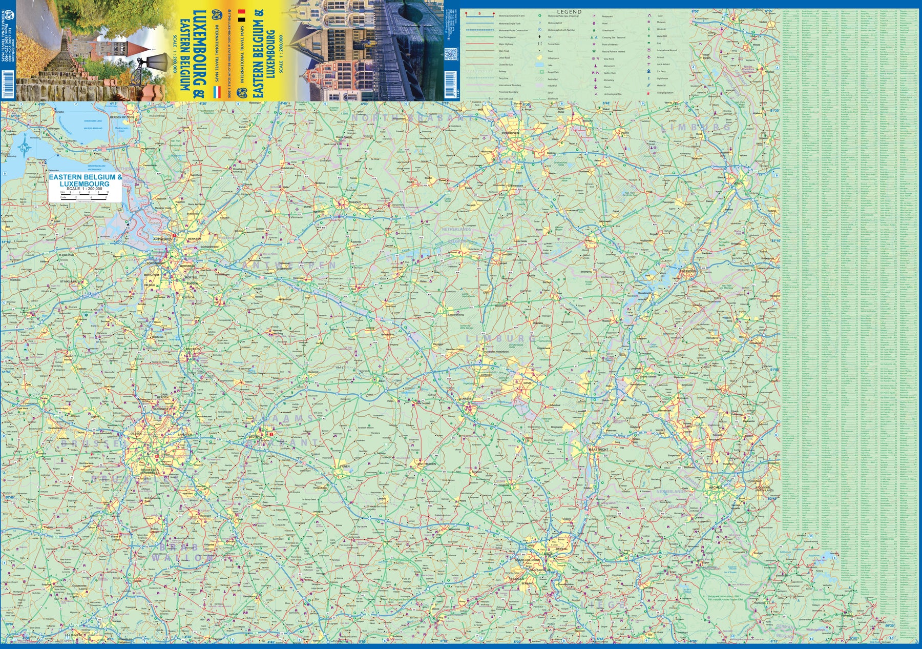
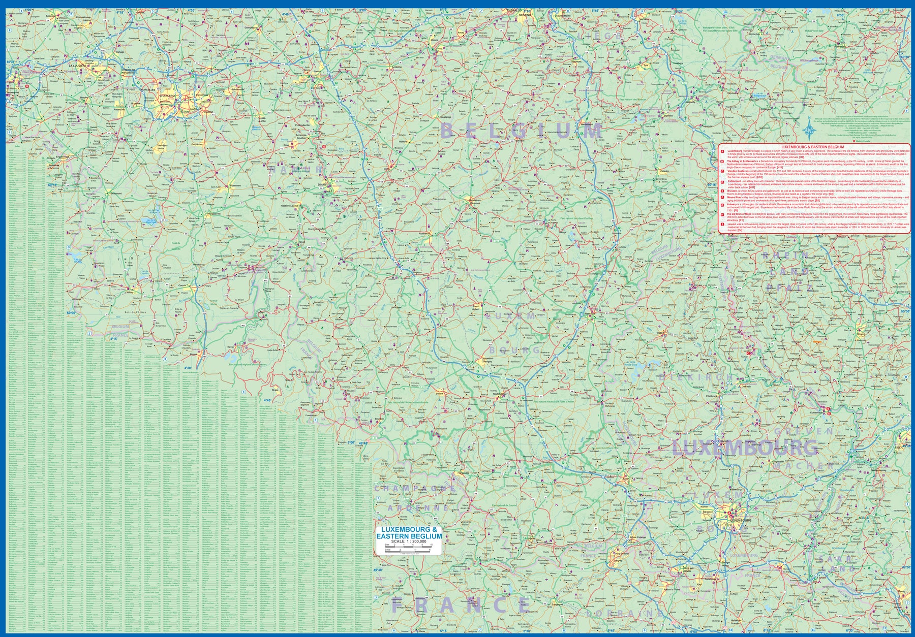
Luxembourg & Eastern Belgium
Ordinær pris 199,00 kr/
Mva inkludert
Frakt beregnes i kassen.
Luxembourg is the largest of Europe’s mini-states. We have included the principality on maps of surrounding countries, as most publishers do, but we felt it was time to concentrate on the principality itself and place it into context with its neighbours. Bounded on the west by Belgium, on its east by Germany, and its south by France, Luxembourg has survived for centuries by playing off one large power against another in order to retain its independence. Largely a French-speaking area, Luxembourg is also a strong supporter of the EU. It is a mountainous country, part of the Ardennes region, and close to Bastogne, the focal point of Hitler's last attempt to break the Allies in what is now called the Battle of the Bulge. Bastogne, site of a marvelous WW2 museum, is also on Side 1, as is a portion of Belgium going as far as Mons.
Side 2 concentrates on Belgium east of Brussels, with a small portion of Netherlands included. This includes the Brussels region, Antwerp, Leuven, Liege, and Aachen, with a tiny portion of Germany. Belgium is a larger and more diverse country than many realize. One of the great treasure of eastern Belgium is the cathedral town of Liege, which is known in Flemish as Luik and in German as Luttich, which can make finding it a bit challenging, depending upon whose map one is using, or which road signs one is following!
- Publisert: 2023
- Innbinding: Falset
- Materiale: Papir
- Målestokk: 1:200 000

Kathmandu Valley
Ordinær pris 159,00 kr Salgspris 79,50 kr Spar 50%/
Mva inkludert
Frakt beregnes i kassen.
- Publisert: 1998
- Innbinding: Falset
- Materiale: Papir
- Målestokk: 1:50 000


USA: San Diego & California South
Ordinær pris 169,00 kr/
Mva inkludert
Frakt beregnes i kassen.
ITM har kart over hele verden og de spesialiserer seg på land litt utenfor allfarvei. Beliggenheten til landets nasjonalparker, historiske monumenter, de viktigste veiene o.L. Finner du inkludert i kartene. Samtlige landkart har ofte et bykart over hovedstaden.
Fra ITM: In the southwest corner of the American mainland is the port city of San Diego, one of the major hubs of the US Navy. The city itself is very interesting, with a city centre dominated by colonial-styled buildings. Balboa Park is home to one of the best zoos in North America, and the historic 'old town' area north of the city centre has become a popular 'Old Mexico' theme attraction. As well, there is the Tijuana Trolley, which is, in fact, a modern surface-rail tram line that goes from the city centre to close to the walk-across border with Mexico into colourful downtown Tijuana. A day visit to Mexico is one of the highlights of a visit to San Diego! Enjoy!
Publisert år: 2023
Innbinding: falset
Material: papir
Målestokk: 1:15,000 / 1:900,000