1151 produkter
1151 produkter
Salg
Quick view
Salg
Quick view
Salg
Quick view
Salg
Quick view
Salg
Quick view
Salg
Quick view
Salg
Quick view
Salg
Quick view


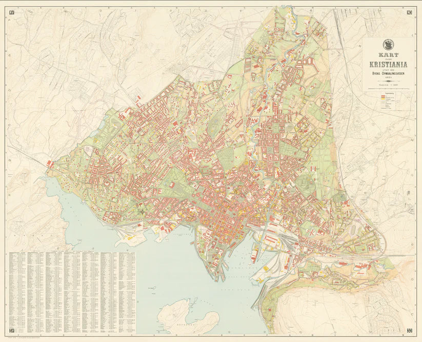
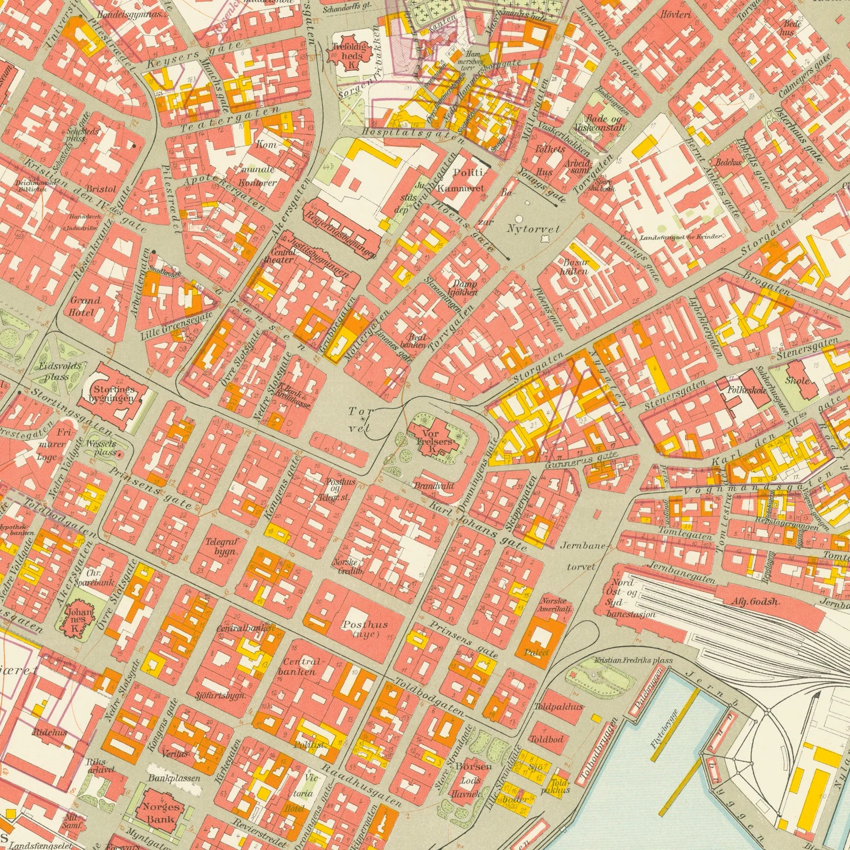
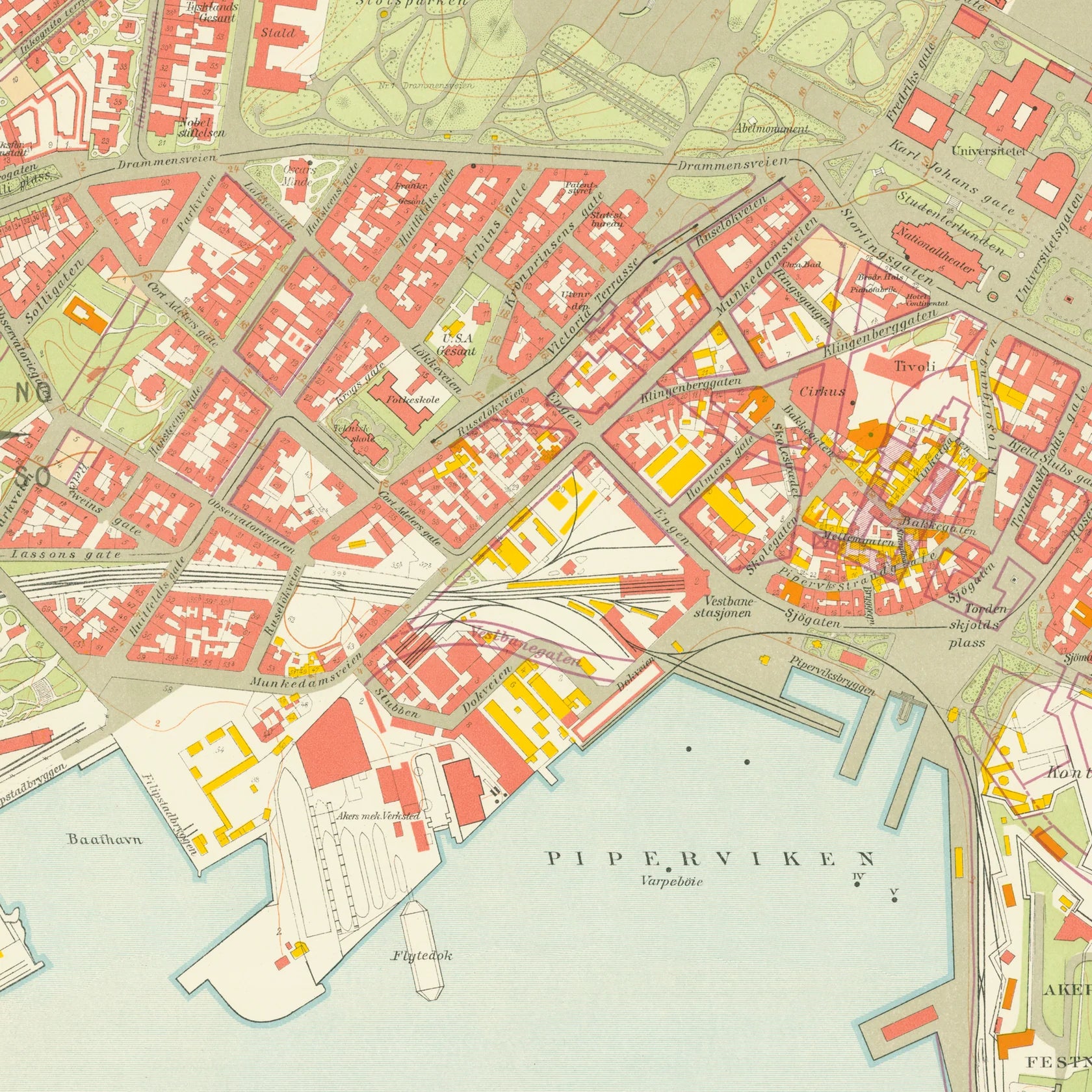
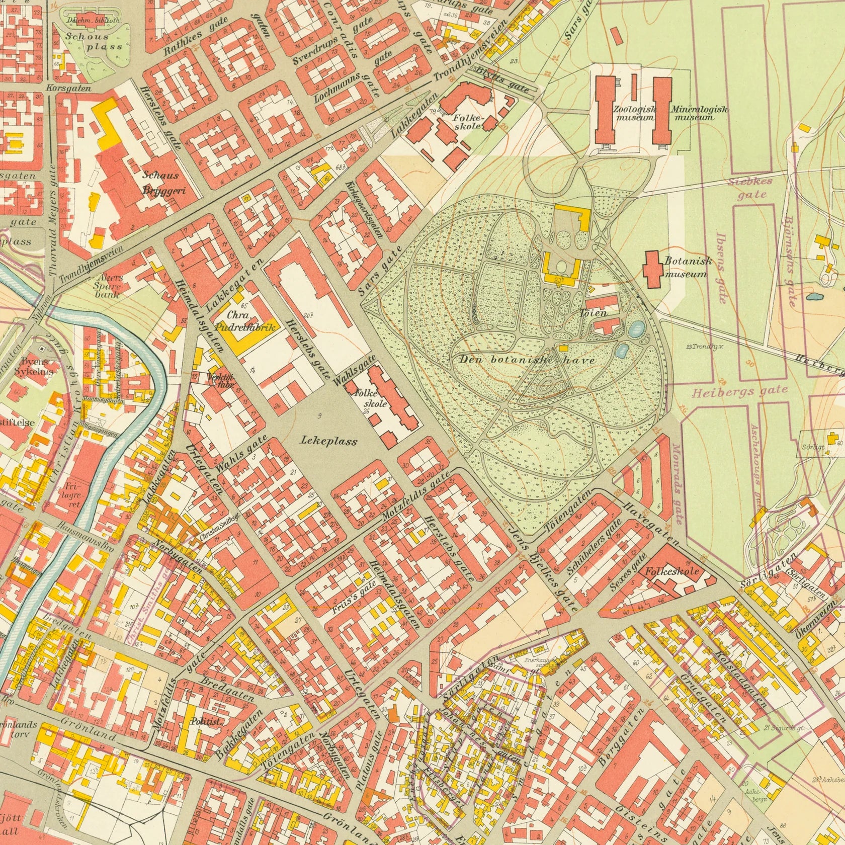
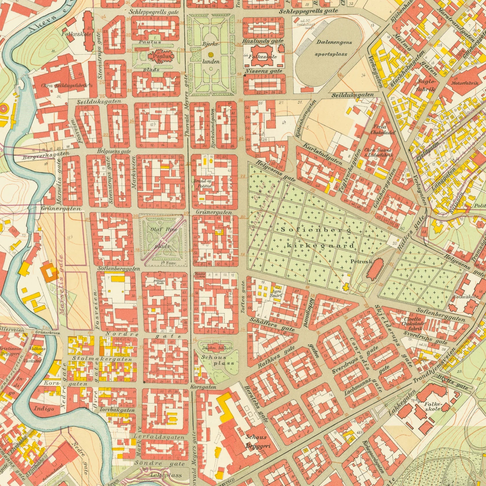
Kristiania 1921
Ordinær pris 2.800,00 kr
Mva inkludert
Frakt beregnes i kassen.
Dette er Dapa Maps' versjon av kartet Kristiania 1921.
Oslos peneste kart? Ja det mener vi. I flere år har Dapa Maps sett på dette kartet og tenkt at de må gjøre med det. Vinteren 2023/2024 har de gjort en digital restaurering av kartet og kan nå vise det frem for allmenheten.
Kartet er opprinnelig tegnet av Byens Oppmaalingsvesen (forløper til Plan- og bygningsetaten) i 1921. Kartet ble da tegnet på 6 ulike kartblad som finnes arkivert hos Byarkivet.
Det Dapa Maps har gjort er å sette kartet sammen til et kart og redigert bort rutenettet slik at lesbarheten blir bedre. De har ikke endret noe på fargene eller på noen andre detaljer.
Dapa Maps
Kartet er laget av Daniel og Pavel fra Dapa Maps. De er to kartografer som tror at livet er best ute, derfor er de opptatt av å lage de peneste kartene de kan for at du kan bli kjent med områdene du liker best. Om du ønsker kan du lese mer om de her.
For hvert kart som selges planter de et tre slik at verden blir litt grønnere 🌳


