Filter
- Albania
- Algerie
- Andorra
- Angola
- Argentina
- Armenia
- Aserbajdsjan
- Australia
- Bahamas
- Bangladesh
- Belgia
- Benin
- Bolivia
- Botswana
- Brasil
- Brunei
- Bulgaria
- Burundi
- Canada
- Chile
- Colombia
- Costa Rica
- Cuba
- Danmark
- Djibouti
- Dominica
- Ecuador
- Ekvatorial-Guinea
- El Salvador
- Elfenbenskysten
- Eritrea
- Estland
- Eswatini
- Etiopia
- Fiji
- Filippinene
- Finland
- Frankrike
- Gabon
- Georgia
- Guyana
- Hellas
- Honduras
- Hviterussland
- India
- Indonesia
- Irak
- Irland
- Island
- Israel
- Italia
- Jamaica
- Japan
- Jemen
- Kambodsja
- Kamerun
- Kasakhstan
- Kenya
- Kina
- Kirgisistan
- Kroatia
- Latvia
- Lesotho
- Libya
- Litauen
- Luxembourg
- Madagaskar
- Malawi
- Malaysia
- Mali
- Malta
- Marokko
- Mauritania
- Mexico
- Mongolia
- Mosambik
- Nauru
- Nederland
- Nepal
- New Zealand
- Nicaragua
- Niger
- Nigeria
- Nord-Korea
- Norge
- Oman
- Pakistan
- Panama
- Papua Ny-Guinea
- Paraguay
- Peru
- Polen
- Portugal
- Romania
- Russland
- Rwanda
- Samoa
- San Marino
- Sierra Leone
- Singapore
- Slovakia
- Slovenia
- Solomonøyene
- Spania
- Sri Lanka
- Storbritannia
- Surinam
- Sveits
- Sverige
- Sør-Afrika
- Sør-Korea
- Taiwan
- Tanzania
- Thailand
- Togo
- Tonga
- Tsjekkia
- Tunisia
- Tyrkia
- Tyskland
- Uganda
- Ungarn
- Uruguay
- USA
- Usbekistan
- Venezuela
- Vietnam
- Zimbabwe
- Østerrike
2558 produkter
2558 produkter

Europe Rail Map
Ordinær pris 229,00 kr/
Mva inkludert
Frakt beregnes i kassen.
- Publisert: -> 2028
- Innbinding: Falset
- Materiale: Papir
- Målestokk: 1:5 000 000

Europe Rail Map
Ordinær pris 279,00 kr/
Mva inkludert
Frakt beregnes i kassen.
The definitive rail map for today's independent traveller This is the 3rd edition of the map which includes the latest high speed routes and updates (as of December 2021) This map seeks to show all passenger rail routes in Europe (other than those of the suburban networks of major cities) and is the ideal companion to the European Rail Timetable. Important Tourist Railways are also shown, many of which operate only during the tourist season.
- Features every mainline railway route across Europe
- Colour coding for all high-speed routes
- Highlighting for scenic lines
- Also includes some principal tourist and heritage lines (services on these lines may not run all year or on every day of the week)
- Publisert: 2024
- Utgave: 3. utgave, 3. revisjon
- Målestokk: 1:4 000 000

Europe: Southeast & Balkans
Ordinær pris 199,00 kr/
Mva inkludert
Frakt beregnes i kassen.
The Balkans and South-Eastern Europe on a road map from Freytag and Berndt, covering a large chunk of the Continent from southern Poland and Kiev to the Mediterranean, and from Naples to Ankara. The map shows the area’s road network, indicating diving distances on principal routes and main border crossings. Railways and ferry routes are marked. In most countries internal administrative boundaries are also shown.
In Greece, Bulgaria and Ukraine (but not Serbia) names of main cities are shown both in Latin alphabet and in Greek or Cyrillic. The map has a latitude and longitude grid at intervals of 1º. Multilingual map legend includes English.
A booklet attached to the map cover contains an index, arranged by country, plus street plan of central Athens, Belgrade, Bratislava, Budapest, Bucharest, Chisinau, Istanbul, Kiev, Ljubljana, Podgorica, Prague, Pristina, Sarajevo, Skopje, Tirana, Vienna and Zagreb.
- Publisert: 2024
- Innbinding: Falset
- Materiale: Papir
- Målestokk: 1:2 000 000

European Long-Distance Hiking Trails
Ordinær pris 199,00 kr/
Mva inkludert
Frakt beregnes i kassen.
All 12 E-paths on one map. The one-sided printed map with a scale of 1:4,000,000 enables clear planning and, as a Europe poster, is the perfect tour overview.
The map is published in cooperation with the European Hiking Association and EUFED (European Youth Hostels). The tour guide is there with a description of all the paths and a list of the youth hostels that are located along the respective path.
Break out of everyday life and face new challenges, gain experience and go to your limits - KOMPASS long-distance maps are for everyone who has big plans.
- Publisert : 2024-2028
- Innbinding: Falset
- Materiale: Vannfast papir
- Målestokk: 1:4,000,000

Eurovelo 6: Budapest to the Black Sea
Ordinær pris 399,00 kr/
Mva inkludert
Frakt beregnes i kassen.
The classic cycle routes along the Danube river from Budapest to the Black Sea. Cycling trail, accommodations, attractions, bicycle repair shops and restaurants are shown on the map. 8 individual maps in a wallet.
The set contains:
- Map 1: Budapest - Mohács
- Map 2: Mohács – Novi Sad
- Map 3: Novi Sad - Golubac
- Map 4: Golubac - Vidin
- Map 5: Lom - Belene
- Map 6: Belene – Oltenita
- Map 7: Calaras – Brãila
- Map 8: Brãila - Constanta
Ideal for long cycle tours - light weight, easy folding, weather and tear proof - map section always aligned with the main route - with accommodation details - downloadable GPS track of the routes.
- Publisert: Aug. 2022
- Innbinding: Falset
- Materiale: Papir
- Målestokk: 1:100 000

Everest & Gokyo
Ordinær pris 299,00 kr/
Mva inkludert
Frakt beregnes i kassen.
A detailed 1:60,000 scale map showing the area around the Everest Region and Gokyo, including the Cho La and Renjo passes.
Showing routes from Lulka to Everest Base Camp, Thame, the Renjo Pass, Pheriche and Gokyo. It has a grid lines with reference numbers and a detailed English key sheet.
Time taken and height gained from place to place are also shown on a table on the cover. Two 1:4000 scale maps are included, one of Namche Bazar and one of Lukla, showing roads and local amenities.
- Publisert: 2016
- Innbinding: Falset
- Materiale: Papir
- Målestokk: 1:60 000


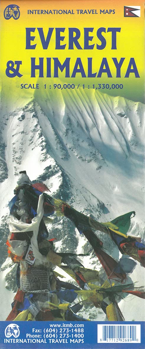
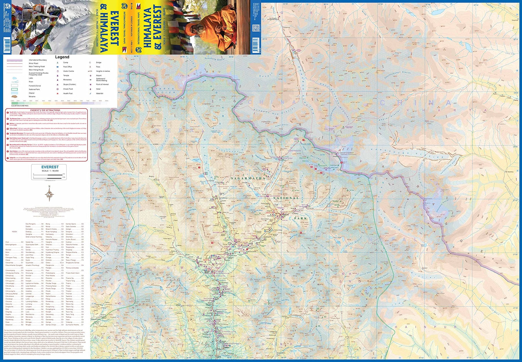
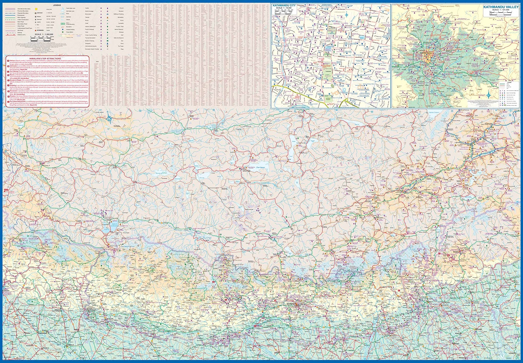
Everest & Himalaya
Ordinær pris 199,00 kr/
Mva inkludert
Frakt beregnes i kassen.
The climbing season for Everest begins in May, just about the time that vaccinations against Covid should kick into high gear. Time to start planning that little jaunt you’ve always wanted to do! Seriously, this is a lovely double-sided map with two attractive covers, so can be displayed either as Everest or Himalaya. The Everest side covers the mountain itself, with base camps and accommodations clearly shown. There are actually several interesting trails one could explore and all are shown; only one leads to the summit. The reverse side shows the entire Himalaya ‘knot’ that forms the basis for so many mountain chains.
The area of coverage includes all of Nepal and Sikkim, a significant portion of Bhutan, most of Tibet, and a bit of northern India. All roads and attractions are shown. The map includes a detailed inset map for Kathmandu and another for the valley region surrounding the city. There are now half a dozen access roads into Nepal, and all are shown. East-west travel is finally available with the completion of Hwy 1401. Legend Includes: Roads by classification, Rivers and Lakes, National Park, Airports, Points of Interests, Highways, Main Roads, Zoos, Fishing, and much more...
- Publisert: 2021
- Innbinding: Falset
- Materiale: Papir
- Målestokk: 1:90 000, 1:1 330 000


Finland
Ordinær pris 199,00 kr/
Mva inkludert
Frakt beregnes i kassen.
ITM har kart over hele verden og de spesialiserer seg på land litt utenfor allfarvei. Beliggenheten til landets nasjonalparker, historiske monumenter, de viktigste veiene og lignende finner du inkludert i kartene. Samtlige landkart har ofte et bykart over hovedstaden.
Fra ITM: NATO’s newest member shares a very long border with Russia, but the border is closed at the moment. The country faces west and welcomes visitors. It is also a very large country, so the map is divided into a north/south configuration. Side 1 shows the southern portion fronting on to the Sea of Bothnia and the strait facing Estonia. The capital, Helsinki, and the western port city of Tartu are shown, as well as ferry routes connecting the country to port cities along the Baltic Sea. This is a country of lakes, which are clearly shown, as are the rail routes joining communities and the highly-developed road network. Side 2 concentrates on the more northerly portions, all the way to Lapland in the far north. Border crossings to Russia are shown, but they are closed due to Russia’s invasion of Ukraine. A Top Attractions list is included.
- Publisert: 2025
- Innbinding: Falset
- Materiale: Vanntett papir
- Målestokk: 1:750 000

Finland
Ordinær pris 189,00 kr/
Mva inkludert
Frakt beregnes i kassen.
Marco Polo er svært detaljerte kart som er praktiske og enkle i bruk. 7 klistremerker for å markere spesifikke steder gjør det enda enklere å planlegge reisen. Alle kartene inneholder en omfattende index for enkelt å finne frem.
- Publisert: 2023
- Innbinding: Falset
- Materiale: Papir
- Målestokk: 1:800 000

Finland & Northern Scandinavia
Ordinær pris 199,00 kr/
Mva inkludert
Frakt beregnes i kassen.
Highly tear-resistant and 100% waterproof map "Finland, Northern Scandinavia" from the series world mapping project.
Travel know-how maps are characterized by particularly sturdy plastic paper, which can be written on like paper, even with a pencil. The cardboard envelope is removable, making it easy to put the card in any pocket. A protective cover is not required. The cartographic representation focuses on the most important information for travelers and is particularly easy to read. Instead of shading, colored layers of elevation are used.
- Contour lines with elevation information
- Colored elevation layers
- Classified road network with distance information
- Sights
- Detailed location index
- GPS-accurate
- Longitude and latitude
- Five-language legend (german, English, French, Spanish, Russian)
- This map, together with the map 'Southern Sweden, Southern Norway', covers the entire territory of Norway, Sweden and Finland.
- Publisert: 2023
- Innbinding: Falset
- Materiale: Plastpapir
- Målestokk: 1:875 000

Finland East
Ordinær pris 269,00 kr/
Mva inkludert
Frakt beregnes i kassen.
- Publisert: 2020
- Innbinding: Falset
- Materiale: Papir
- Målestokk: 1:250 000

Finland Southern
Ordinær pris 269,00 kr/
Mva inkludert
Frakt beregnes i kassen.
- Publisert: 2023
- Innbinding: Falset
- Materiale: Papir
- Målestokk: 1:250 000

Finland West
Ordinær pris 269,00 kr/
Mva inkludert
Frakt beregnes i kassen.
- Publisert: 2023
- Innbinding: Falset
- Materiale: Papir
- Målestokk: 1:250 000

Florence
Ordinær pris 119,00 kr/
Mva inkludert
Frakt beregnes i kassen.
Lonely Planet City Map er slitesterkt og vanntett, med en hendig slipcase og et format som er lett å brette. Få mer ut av kartet og reisen din med bilder og informasjon om byattraksjoner, transportkart, reiseruteforslag, omfattende gate- og nettstedsindeks og praktiske reisetips. Med dette brukervennlige navigasjonsverktøyet i baklommen kan du virkelig komme til hjertet av din destinasjon!
- Publisert: 2023
- Utgave: 2.utg
- Innbinding: Falset
- Material: Plast papir

Florida
Ordinær pris 199,00 kr/
Mva inkludert
Frakt beregnes i kassen.
Marco polo er svært detajerte kart som er praktiske og enkle i bruk. 7 klistremerker for å markere spesifikke steder gjør det enda enklere å planlegge reisen. Alle kartene inneholder en omfattende index for enkelt å finne frem.
Florida at 1:800,000 from on a map Marco Polo Travel Publishing with street plans or area enlargements for 10 main cities, a plan of the Disney World complex, plus an extensive index which also lists geographical features.
A fold-out extension of the map cover gives at-a-glance overview of the whole area covered by the map with the adjoining regions, highlighting main places of interest and making it much easier to find various localities on the main map and/or plan a route. A set of seven peel-on/peel-off stickers, removable without damaging the map, is provided to make routes or locations more prominent when navigating.
Publisert: 2025
Innbinding: falset
Material: papir
Målestokk: 1:800,000

Florida & The South
Ordinær pris 119,00 kr/
Mva inkludert
Frakt beregnes i kassen.
Lonely Planet City Map er slitesterkt og vanntett, med en hendig slipcase og et format som er lett å brette. Få mer ut av kartet og reisen din med bilder og informasjon om byattraksjoner, transportkart, reiseruteforslag, omfattende gate- og nettstedsindeks og praktiske reisetips. Med dette brukervennlige navigasjonsverktøyet i baklommen kan du virkelig komme til hjertet av din destinasjon!
- Publisert: Aug 2025
- Utgave: 1 utgave
- Innbinding: Falset
- Materiale: Vannfast papir

France
Ordinær pris 119,00 kr/
Mva inkludert
Frakt beregnes i kassen.
Lonely Planet Planning Map er slitesterkt og vanntett, med en hendig slipcase og et format som er enkelt å brette. Få mer ut av kartet og reisen din med bilder og informasjon om toppattraksjoner i landet, reiseruteforslag, en transportguide, planleggingsinformasjon, temalister og praktiske reisetips. Med dette brukervennlige navigasjonsverktøyet i baklommen kan du virkelig komme til hjertet av din destinasjon!
- Publisert: April 2024
- Utgave: 2. utgave
- Innbinding: Falset
- Materiale: Vannfast papir

France
Ordinær pris 189,00 kr/
Mva inkludert
Frakt beregnes i kassen.
- Publisert: 2023-2025
- Innbinding: Falset
- Materiale: Papir
- Målestokk: 1:950 000

France
Ordinær pris 199,00 kr/
Mva inkludert
Frakt beregnes i kassen.
Tysk kartserie med flotte kart på slitesterkt plastpapir.
- Publisert: 2022
- Innbinding: Falset
- Materiale: Plastpapir
- Målestokk: 1:1 100 000

France
Ordinær pris 199,00 kr/
Mva inkludert
Frakt beregnes i kassen.
Publisert: 2025
Innbinding: falset
Material: papir
Målestokk: 1:600 000

France North
Ordinær pris 199,00 kr/
Mva inkludert
Frakt beregnes i kassen.
Dette store østerriske kartforlaget er kjent for sin klare kartografi og gode papirkvalitet. De kommer i alle målestokker, og flere av landkartene inneholder bykart og turistinformasjon.
- Publisert: 2025
- Innbinding: Falset
- Materiale: Papir
- Målestokk: 1:500 000

France South
Ordinær pris 199,00 kr/
Mva inkludert
Frakt beregnes i kassen.
Dette store østerriske kartforlaget er kjent for sin klare kartografi og gode papirkvalitet. De kommer i alle målestokker, og flere av landkartene inneholder bykart og turistinformasjon.
- Publisert: 2025
- Innbinding: Falset
- Materiale: Papir
- Målestokk: 1:500 000

France: Brittany
Ordinær pris 199,00 kr/
Mva inkludert
Frakt beregnes i kassen.
Reise Know-How maps (world mapping project series) are easy-to-read, waterproof and highly durable travel maps specifically designed for everyday use on the road.
The maps combine state-of-the-art, GPS-compatible cartography (including hypsometric tints and contour lines) with a detailed rendering of road networks and touristic information. They offer the best possible scale, level of detail and readability, be it a map of a small island or half a continent.
The maps feature a detachable paper sleeve so that the maps can be folded easily and fit in every pocket. Although printed on plastic, a special coating makes sure the maps retain a paper-like feel and can even be written on with a pencil.
- Publisert: 2024
- Innbinding: Falset
- Materiale: Plastpapir
- Målestokk: 1:200 000

France: Corsica
Ordinær pris 199,00 kr/
Mva inkludert
Frakt beregnes i kassen.
Corsica at 1:135,000 on an indexed road map with topographic and tourist information printed on light, waterproof and tear-resistant synthetic paper. The map, published by Reise Know-How as part of their highly acclaimed World Mapping Project, is double-sided to provide the best balance between a good scale and a convenient size sheet, and shows the island with a generous overlap between the two sides.
Topography is indicated by altitude colouring plus spot heights and plenty of names mountain groups, peaks and other geographical features. Boundary of the Parc Naturel Régional de Corse and other protected areas are highlighted. Road network includes small local roads and selected 4WD tracks, gives driving distances on main routes, and prominently indicates scenic routes. The map also shows the course of the island’s famous long-distance trail, the GR20. Also included are railway lines and ferry connections. Symbols highlight numerous places of interest, including campsites and mountain huts, UNESCO world heritage and archaeological sites, recreational facilities and areas, beaches, etc. The map has a UTM grid plus latitude and longitude lines at intervals of 5’, is indexed, and its map legend includes English.
- Publisert: 2022
- Innbinding: Falset
- Materiale: Plastpapir
- Målestokk: 1:135 000

France: Corsica
Ordinær pris 199,00 kr/
Mva inkludert
Frakt beregnes i kassen.
Dette store østerriske kartforlaget er kjent for sin klare kartografi og gode papirkvalitet. De kommer i alle målestokker, og flere av landkartene inneholder bykart og turistinformasjon.
- Publisert: 2025
- Innbinding: Falset
- Materiale: Papir
- Målestokk: 1:150 000


France: French Atlantic Coast - Rail & Bike
Ordinær pris 179,00 kr/
Mva inkludert
Frakt beregnes i kassen.
France is a rather large country, and while it can be portrayed on a map as a country, mapping it in segments provides an opportunity to concentrate on regions at a better scale. This map, covering the coastal region of France from the Cotenin Peninsula south to the Spanish border and east as far as Paris and Montpellier in Languedoc is the first of what we hope will be a series covering the country at an improved scale. This map is double-sided, covering from Quimper and Paris at the northernmost portion of coverage, to Angouleme and Clermont at the southern extreme on one side, with the second side covering from Bordeaux and St-Etienne south to Bayonne/Pamplona and Nimes/Avignon in the south. This is a part of Europe that has been fought over for centuries, and as such is dotted with fortresses proclaiming its historic importance.
This map has been designed with the leisure traveller in mind. Although it shows all motorways and highways, rail connections by train are emphasized, as are long-distance Euro-Velo cycling routes that are being developed in many parts of Europe. At this scale, it would be impractical to record all accommodations, but we have included a new feature that is thus far peculiar to France, and that is motorway hotels at rest areas. Naturally, the map is rich with places of touristic interest.
- Publisert: 2022
- Utgave: 1. utgave
- Vanntett materiale
- Målestokk: 1:600 000
- ISBN: 9781771292887

France: North Rail & Bike
Ordinær pris 199,00 kr/
Mva inkludert
Frakt beregnes i kassen.
The northern half of France is fairly flat, making it an ideal area for biking. However, it is also a rather large area, covering several provinces of France, so we have combine rail access with biking. All the motorways and main highways are also shown, so this map is ideal for someone wanting to drive to, say , Brittany, and bike during their stay in the Breton peninsula. Side 1 covers Normandy, Brittany, the Loire, and the Poitou region west of Paris. Side 2 covers all of northern France from Calais to Strasbourg and south to Lyon. Small adjacent portions of Switzerland and Italy are included. A Top 9 Attractions list is included. France South was published a little while ago, so the entire country is now available in detail. The map is printed on waterproof stone paper for durability.
- Publisert: 2021
- Innbinding: Falset
- Materiale: Vanntett papir
- Målestokk: 1:700 000

France: South Rail & Bike
Ordinær pris 199,00 kr/
Mva inkludert
Frakt beregnes i kassen.
This is a brand new title for ITMB and an attempt to portray a changing travel landscape in a mapping format. Eco-tourism is a rapidly growing activity, with enormous potential. At the same time, governments are seeking to reduce carbon pollution by encouraging train travel, so ITMB is climbing aboard the movement by publishing a map encouraging train travel while still retaining the road network and noting all the long-distance bike routes in southern France by designated number.
This is, by its scale, a generalized map of that portion of France south of Poitiers or Lyon to the Mediterranean, so is more of a regional map showing biking opportunities than a detailed trail map. Nevertheless, it is an excellent map on waterproof paper showing cycling routes and tertiary roads that are suitable for recreational exploration. Naturally, motorways and main highways are shown as well. Legend Includes: Roads by classification, Rivers and Lakes, National Park, Airports, Points of Interests, Mining, Highways, Main Roads, Zoos, Fishing, , and much more...
- Publisert: 2020
- Vanntett materiale
- Målestokk: 1:600 000
- ISBN: 9781771292849